Cairn: OS Reference Number – NO 32021 52100
Also Known As:
- Battle Cairn
- Canmore 32360
- Cantsmill
- St. Madden’s Knowe
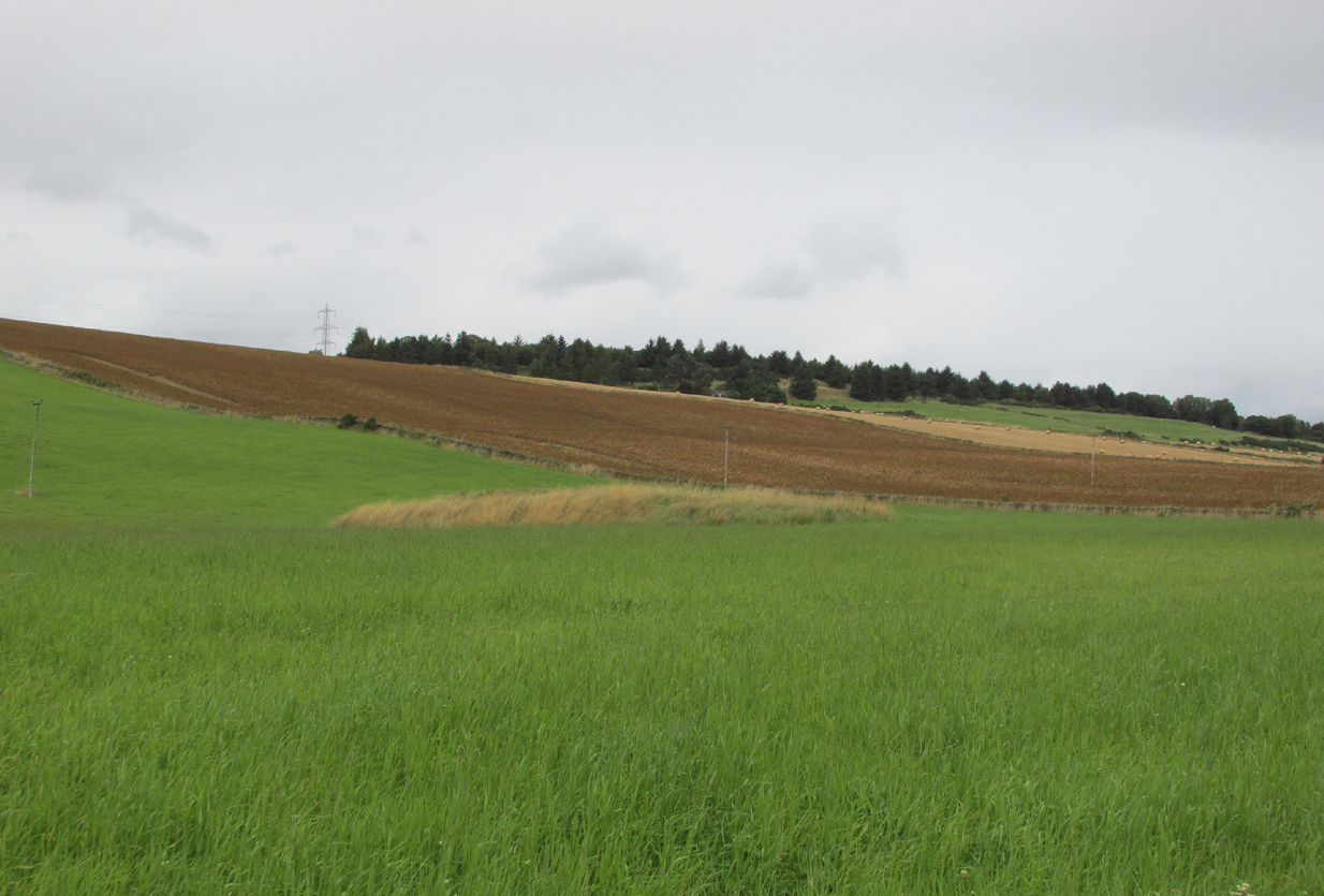
At Kirkton of Airlie, park next to the church and walk north eastwards along the track, past the houses Crabra and Cleikheim, and cross the burn by the small bridge and the mound will be seen ahead of you in the field.
Archaeology & History
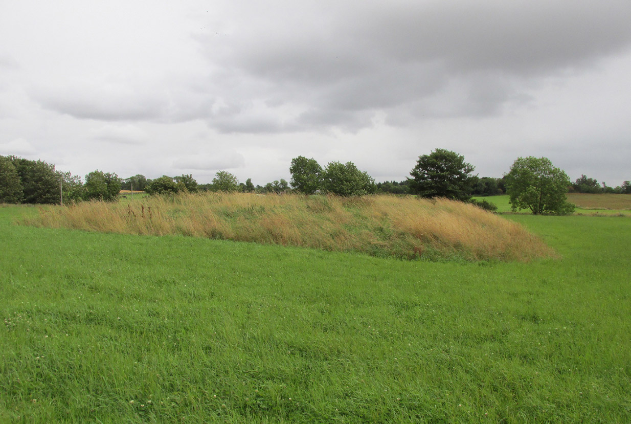
A largely flat topped, rectangular mound, measuring, according to Canmore, 28 metres by 22 metres, 2.2 metres high on the west side and about ½ metre high on the east side. There is a quantity of rubble strewn on the top among which are two stone slabs, described in 1958 as being possible cist cover stones. The site has clearly suffered considerable disturbance.

Andrew Jervise, writing of the site in 1864 described it as having been 300′ in circumference and 6-7′ high before the owner started to remove it for agricultural ‘improvements’ around 1859. He described it as being sometimes known as the ‘Battle Cairn’. As part of the demolition of the mound, agricultural workers in October 1859 unearthed a large cinerary urn half filled with human bones and protected by a large sandstone flag. Jervise writes:
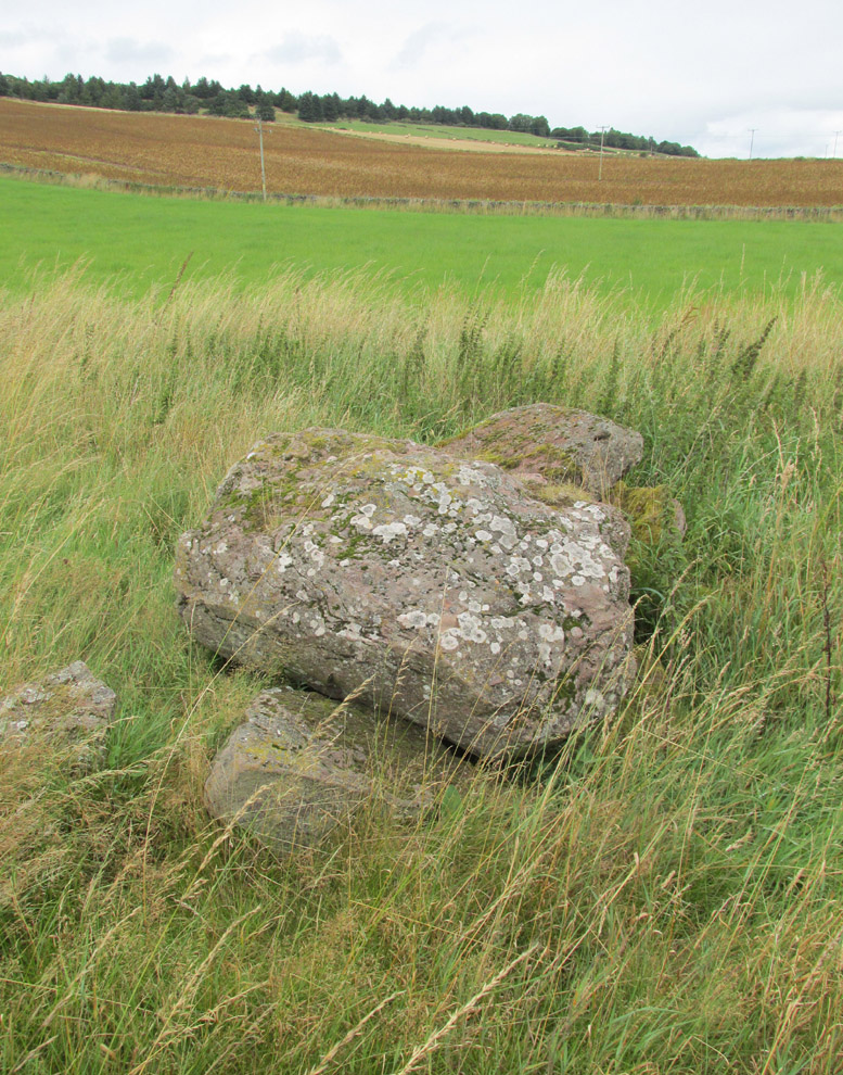
“After the urn was found, care was taken removing other parts of the hillock; and on further reducing the surface, the top of a large boulder was exposed, upon and around which the mass of loose stones and earth appear to have been raised which composed the mound. The boulder, as far as ascertained, measures about 6 by 7½ feet; and the urn was found about four feet to the north east of the stone. At the distance of about four yards from the spot where the urn was found, there appeared to be a separate circle, rudely constructed of stones and earth – stones predominating. In this circle, at pretty regular distances, deposits of human and animal bones were found; and each of these deposits appeared to have been protected by two flat stones set up in a triangular form, resembling (an inverted letter V)…none of the deposits was more than 8″ below the surface”. In February 1861, “..a stone cist was found a little to the south east of the boulder….it was 5 feet long by 2 in breadth. The lid, a single slab, was upwards of 6 feet in length…the depth of the cist was 2 feet….It was nearly empty, but one could see, from the soft, black, unctuous earth that was taken out of it, that it had contained a body.”
Jervise continues:
“The name of St. Medan’s Knowe is certainly significant, but, whether it would imply that the place had been that of his burial, or one of those of his ministry, and so been the original place of worship at Airlie – are interesting particulars upon which history and tradition are silent”.
The Ordnance Survey Name Books, and the 25-inch OS map of 1865 record the finding, 20 yards to the west of the knowe, of a bronze spear head, which was at that time in the possession of a Mr Dixon, a merchant of Kirriemuir, which may go some way to explaining the alternative name of the site as ‘Battle Cairn’. The Name Books further record the testimony of a William Duncan that, ‘there have been 7 or 8 stone coffins and an urn found in the knowe, and that he believes a number more might be found if sought for, as the half of it is not yet excavated‘.
From the surviving evidence, it is very likely that Kirkton of Airlie was the centre of a cult of St. Madden (also known as ‘Medan’ and ‘Madan’), with the adjacent Holy Well, the (now destroyed) hamlet of St. Madden’s, and a Dewar’s land occupied by the hereditary custodians of St. Madden’s Bell. This site has no connection with St Medan’s Well at nearby Kirkton of Kingoldrum, that St Medan probably being a St Medana.
References:
- Andrew Jervise, Notice of Antiquities in the Parish of Airlie, Forfarshire, Proceedings of the Society of Antiquaries of Scotland, June 1864.
- Royal Commission on the Ancient and Historical Monuments of Scotland, The Archaeological Sites & Monuments of Central Angus, Angus District, Tayside Region, HMSO: Edinburgh 1983.
- Scotland’s Place Names
© Paul T. Hornby 2016 The Northern Antiquarian