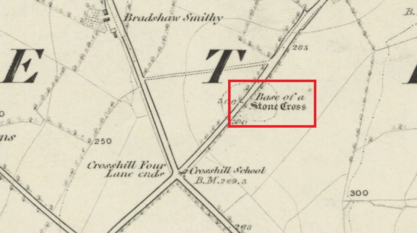
Follow Long Lane northwards from Scorton, over the crossroads at Crosshill Four Lane Ends, and the cross base will be found at the road edge immediately to the right of the driveway of ‘Sandalwood’ on the left hand side of the road.
Archaeology & History
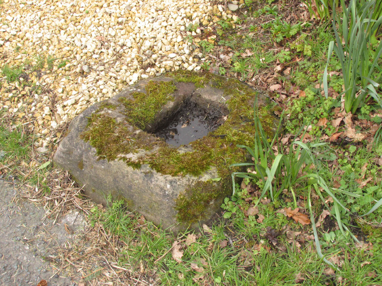
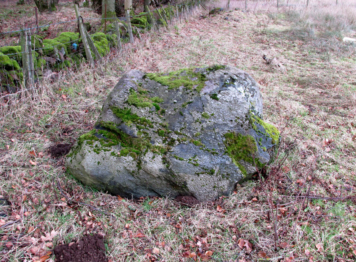
Described in the Historic Buildings listing citation as:
“Cross base, probably mediaeval. A sandstone boulder, roughly rectangular, with rectangular socket.”
Cross base at the roadside‘A sandstone boulder, roughly rectangular’
The base of one of the numerous mediaeval wayside crosses that once adorned this part of Lancashire. So what happened to the cross? It’s possible that it was wilfully destroyed in the early nineteenth century as we have a likely culprit in the person of the Reverend Richard ‘Cross Smasher’ Wilkinson (c.1791 – 1823), Curate of Whitechapel, who took it upon himself to destroy the symbol of his religion wheresoever he could find it.
Immediately to the north west of the Cross is Cross Hill. The cross itself was probably a waymarker on the road over Harrisend Fell from Oakenclough, and Bradshaw may be the name of the locality, there being a Bradshaw Bridge just outside Street to the north west, while the 1846 6-inch OS map records a ‘Bradshaw Smithy’ on the same road.
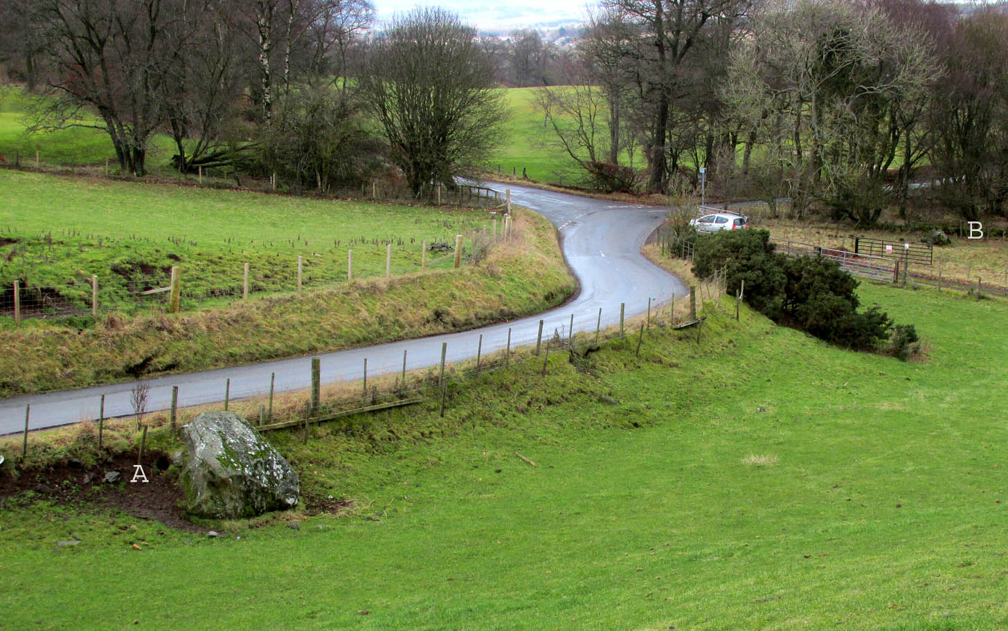
Travelling north from Perth on the A94, take the right turning for Murrayshall just before entering Scone, then take the first right and continue up to the road junction, and park up at the trackway opposite. You’ll see the big stone in the field to the right, up against the road embankment; and the small stone is in the paddock to the left of the trackway at the edge of the trees.
Archaeology & History
Two large glacial erratics which have acquired mythic status and picked up a Christian triumphalist message on the way.
Folklore
In Lawrence Melville’s (1939) excellent local history work, he thankfully put to pen an all-but-forgotten tale of oral tradition:
“Where the road from the Muir of Durdie leaves Kilspindie parish, a grass grown road leads north to Boglebee….. A few yards from the highway lie two large stones, said to have been flung from the Giant’s Hill in Collace parish – the flat topped eminence lying due north from the stones, about two or three miles away, better known as “Macbeth’s Hill”, or “Dunsinane Hill”.
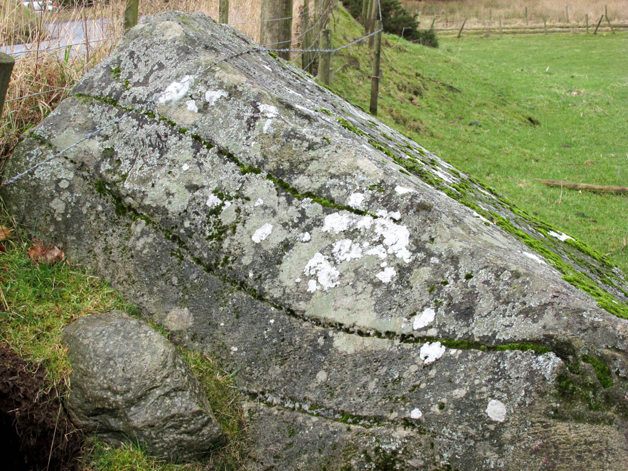
The ‘string’ marks of legendThe smaller stone with its ‘string’ marks
“When the church dedicated to St John in Perth was being built and its tower began to appear, a witch living in Collace was enraged to see this proof of the approach of Christianity and determined to destroy it. She had a son, a giant (after whom the hill receives one of its names), whom she sent to the top of the hill, giving him two huge stones with which to destroy the rising church.
“By her incantations she had supernatural power and knew that when Christianity came her power would be destroyed. She gave him her mutch from her head to be used as sling and in it the giant put the two huge stones. Whirling it around his head, he aimed them in a line with the tower, but, just as he let them fly, the string of his mother’s cap broke and the stones only went the length of Boglebee. The marks on the stones are said to be the marks of the witch’s mutch strings.”
Another view of the larger stone
A familiar folkloric message is remembered the length of Britain: a giant, a devil or other supernatural being throwing stones that either spill out of an apron or otherwise miss their mark. And in this case an unsubtle message to anyone trying to take on the might of the church. But what was the original story of these stones as told by the old time oral storytellers before Christian missionaries stalked the land?
If the string hadn’t broken and the stones had followed their original trajectory they would have fallen south of St John’s Kirk, but it was the thought that counted….
Reference:
Melville, Lawrence, The Fair Land of Gowrie, William Culross: Coupar Angus, 1939.
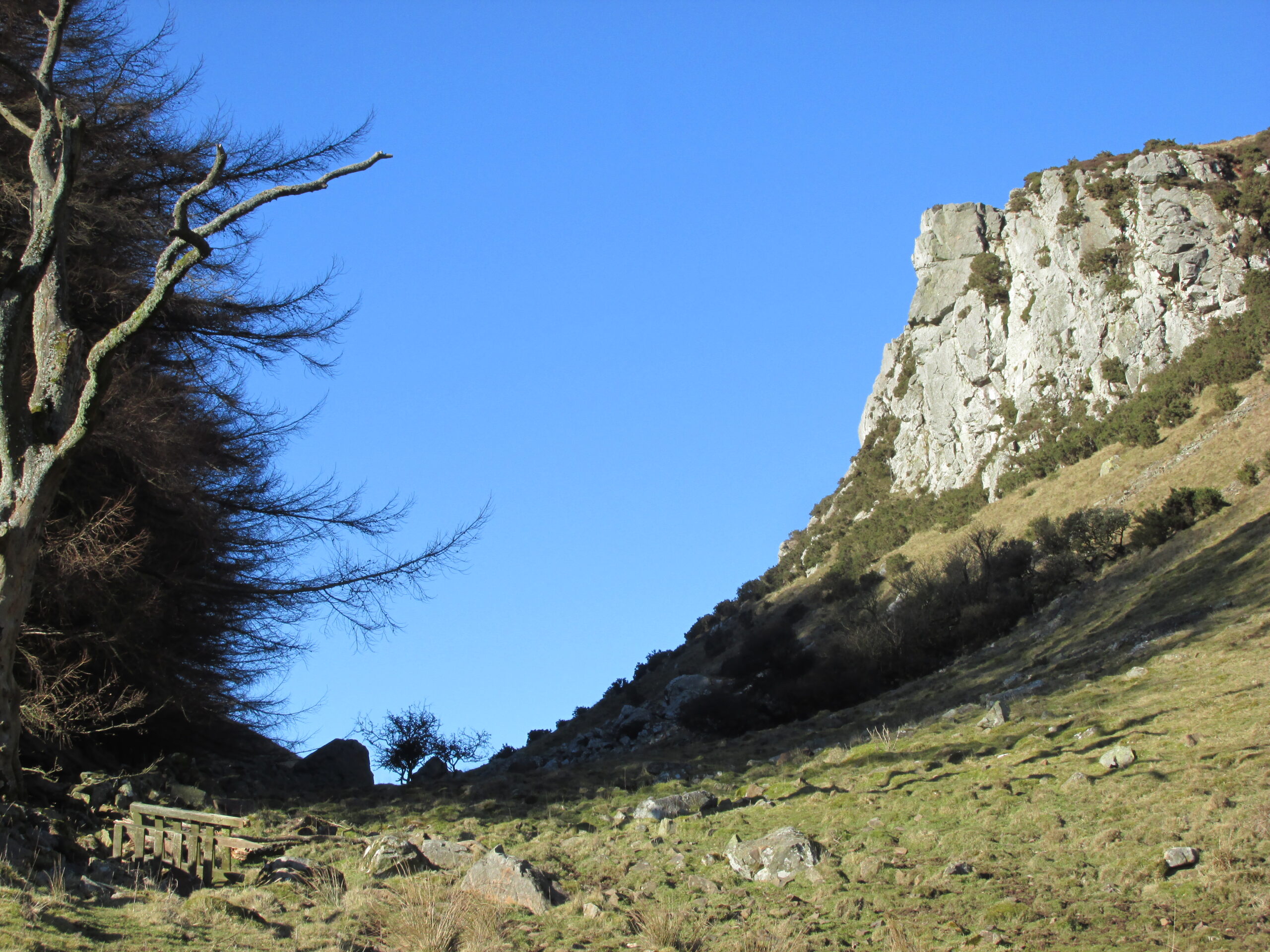
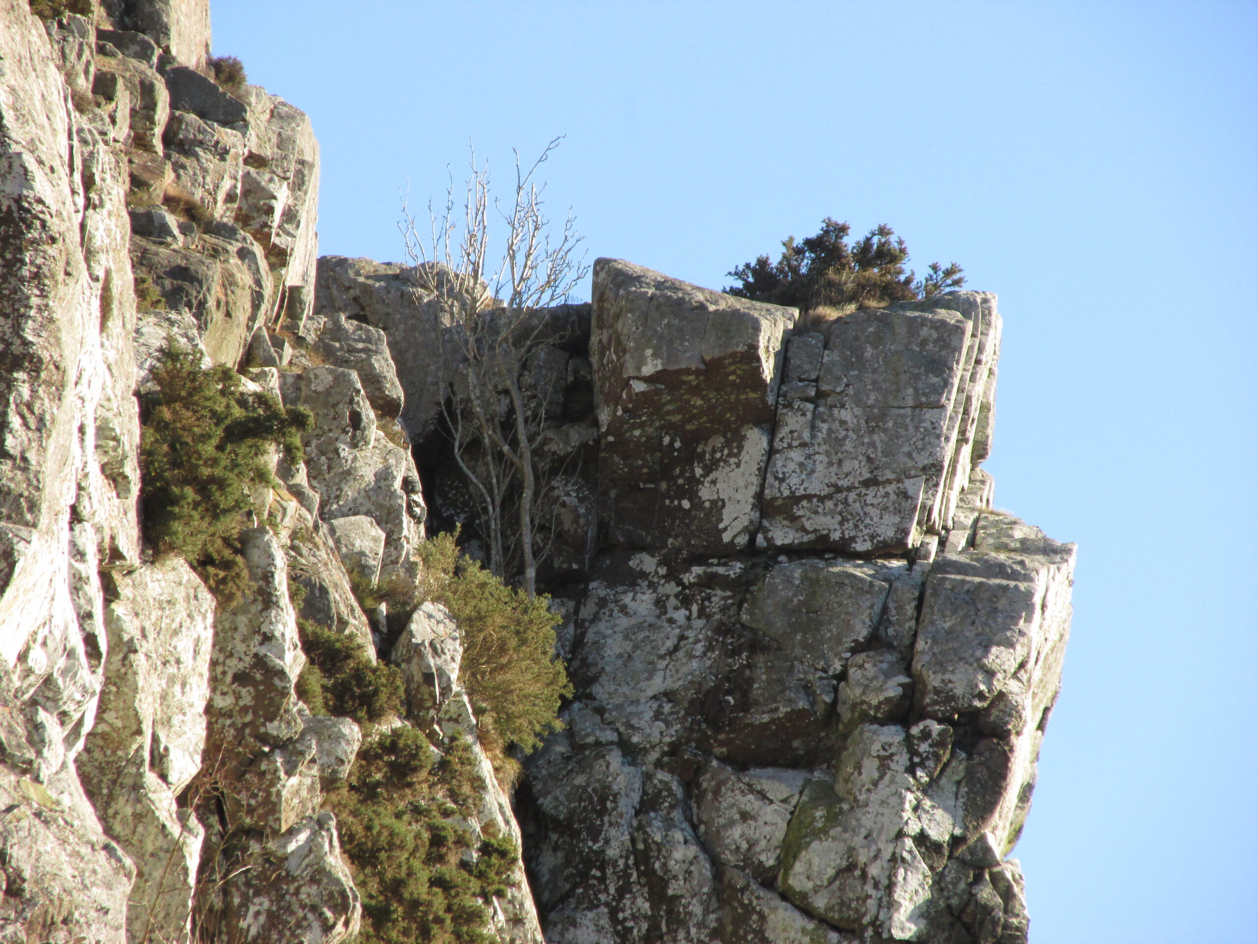
The Rock and Leap may be seen from the B953 Bandirran to Abernyte road. Approach across the fields.
Archaeology & History
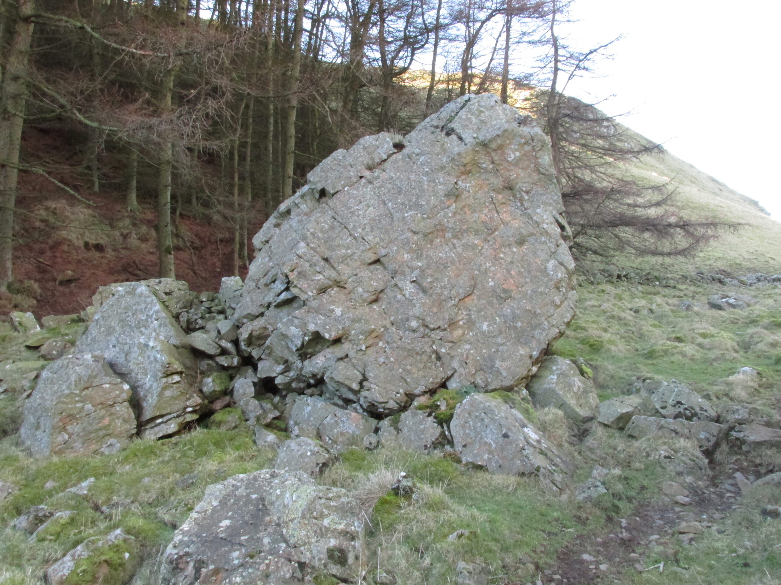
A large boulder perhaps 40 tons in weight lies in a ravine between Dunsinane and Black Hill. The ‘Leap’ is a flat topped ledge jutting out from the west side of Black Hill facing Dunsinane.
Folklore
Melville (1939) in his The Fair Land of Gowrie writes of the simple pleasures of the giant:
“From the farther side of the ravine [between Dunsinane and Black Hill], a precipitous rock juts out, which is called the “Giant’s Leap”. According to the lore of the Sidlaws, a giant, who once lived in these parts, leaped from this rock right on to the top of Dunsinane Hill. The giant also amused himself by tossing about a huge boulder which can be seen lying at the bottom of the ravine.”
And adds:
The Big Fellow’s toyGiant’s Leap from the north
“Fairies haunted the hills here and on summer nights they descended to the meadows, where they danced at a spot called “Fairygreen”. The Black Hill gets its name from the dark heath which covers it. Weird and bleak looking for most of the year, the lower slopes are brightened by glowing patches of purple flowers in late summer.”
Fairygreen Farm lies a mile almost due north of Dunsinane.
Reference:
Melville, Lawrence, The Fair Land of Gowrie, William Culross & Son, Coupar Angus, 1939.
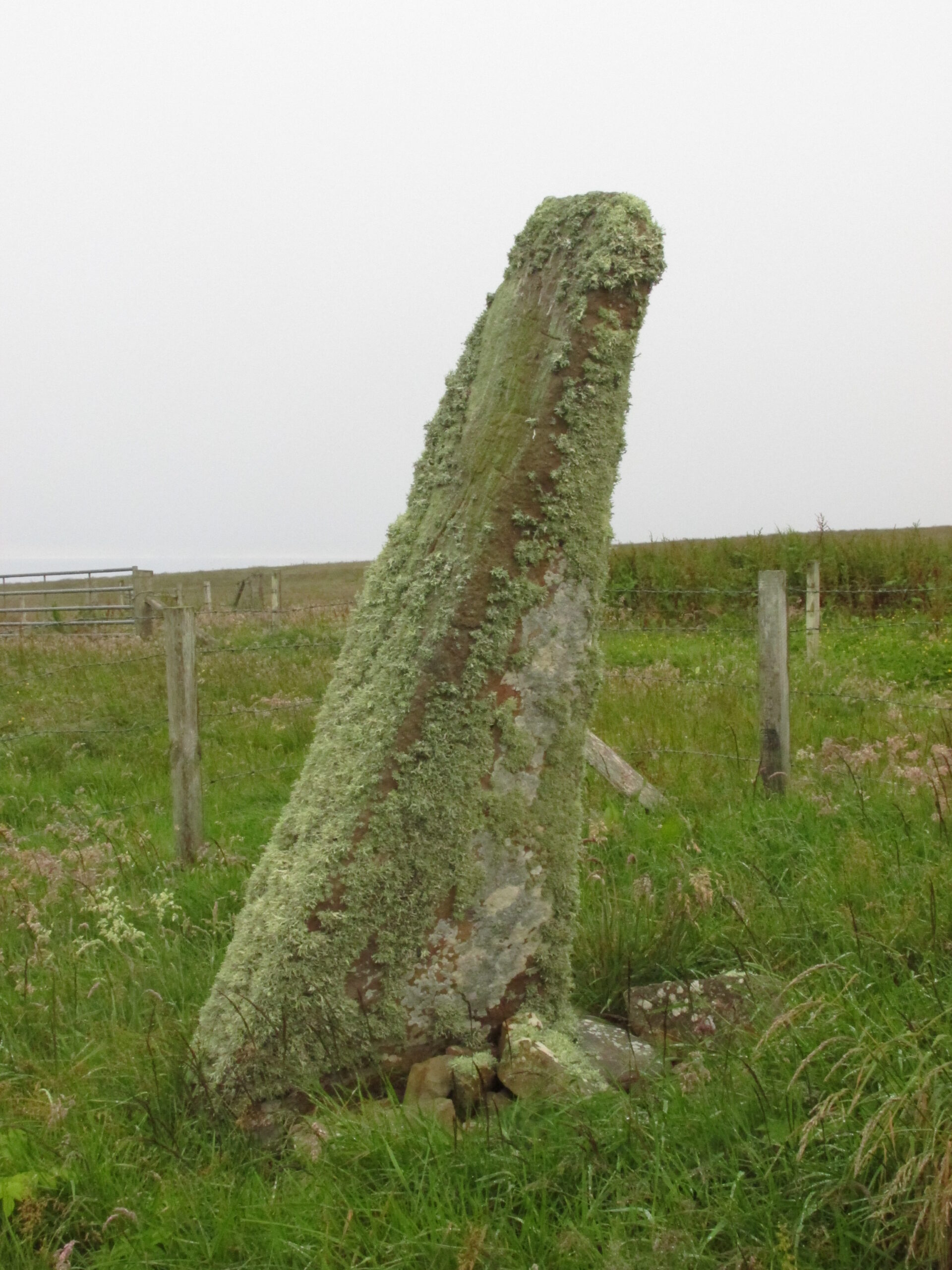
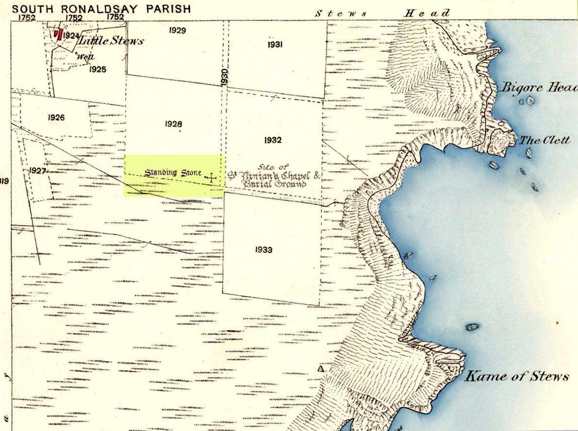
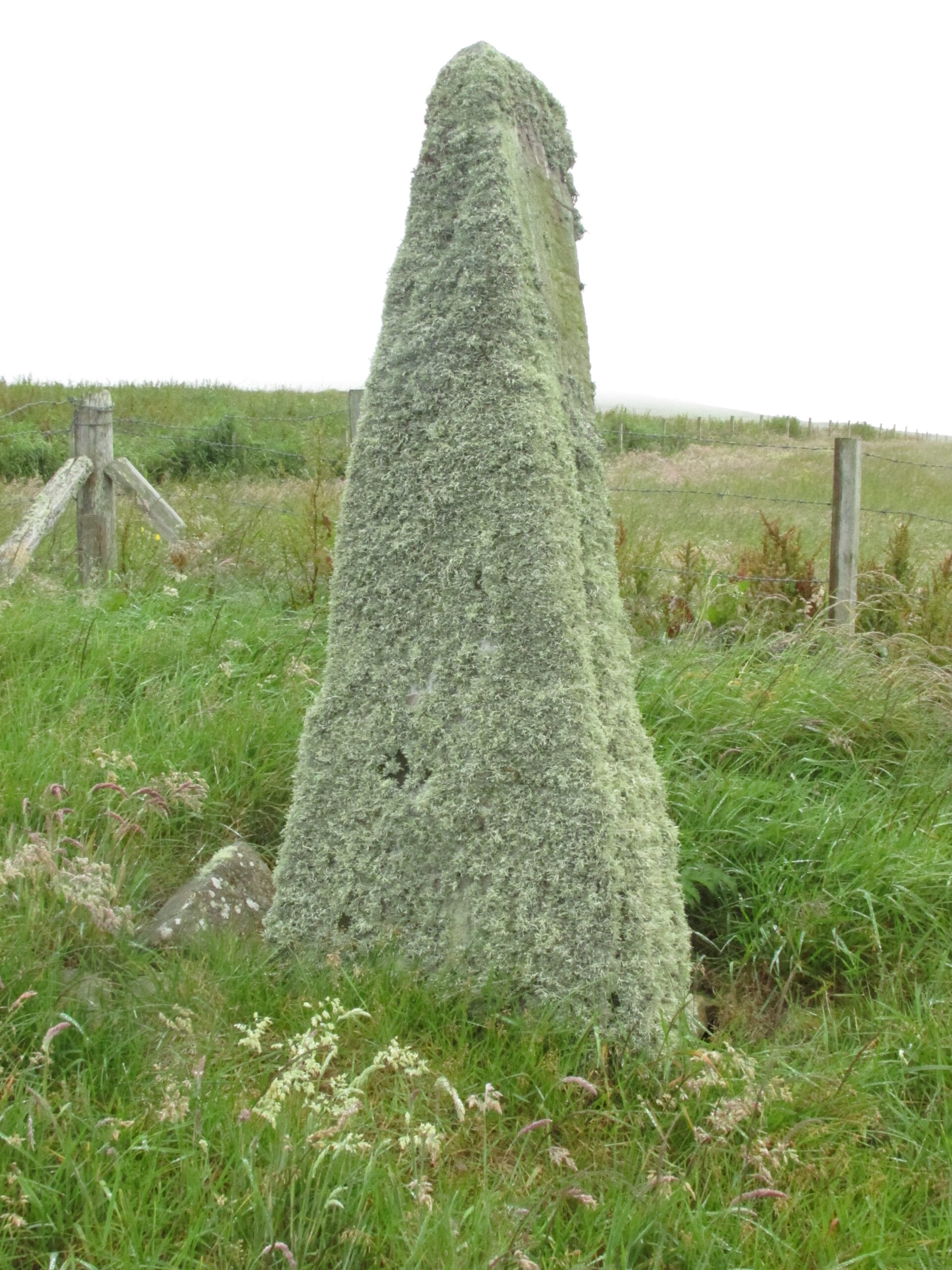
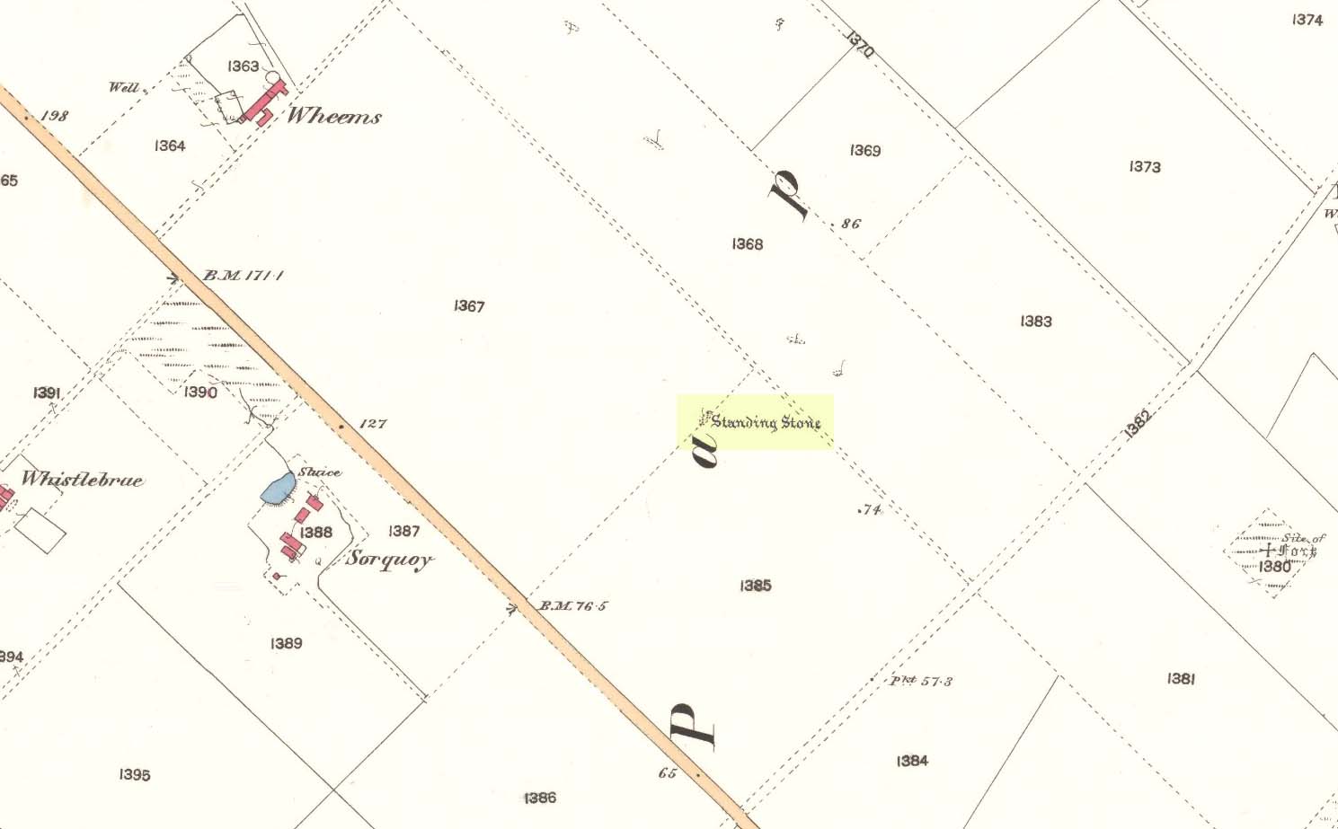
Take the third left road off the A961 past St Mary’s Hope, travelling south, taking the right fork at Lythes, and continue down to the end of the metalled road. From there, walk up the slope to your right (south) and follow the fence on your left into the next field and the stone will be seen in a fenced enclosure.
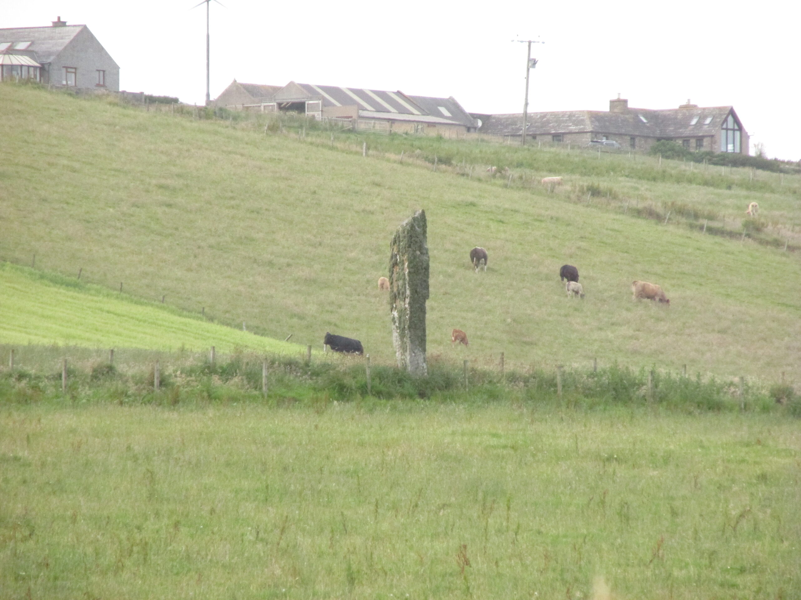
Archaeology & History
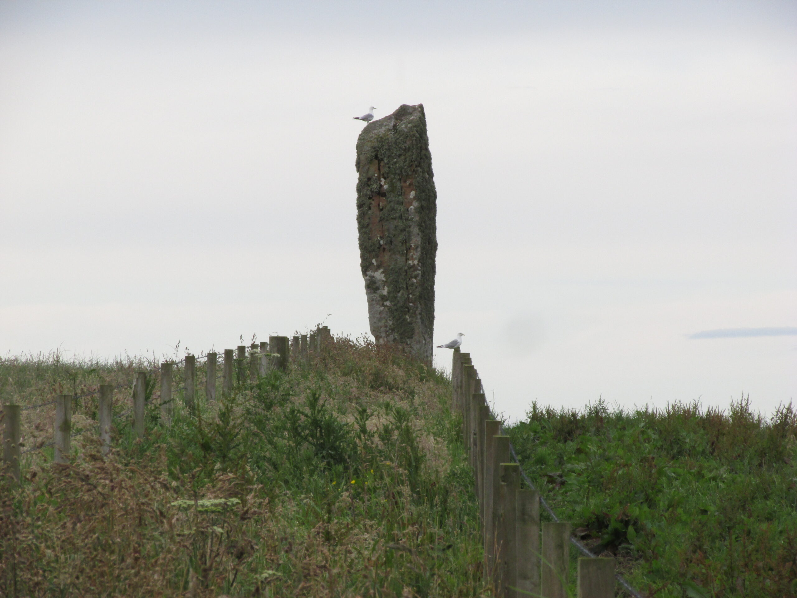
Two things strike you when you first see this stone, the triangular shape of the east facing side, and the lichen which covers this face and much of the rest of the stone giving it the distinct illusion of having a green velvet coat! From another angle it has a distinct lean and there are quite a few packing stones around its base. The Royal Commission inventory (1946) describes it thus:
Stone on 1881 map
“On a ridge barely a quarter of a mile S of the farmhouse of Stews is a triangular block of red sandstone nearly 6 ft high, set with a packing of small stones at the base and with its axis N-S. At the bottom where it is widest it measures 2 ft. 6 in. across and is from 12-13 in. thick. As it rises it tapers gradually to a pointed top, which is slightly inclined towards the W.”
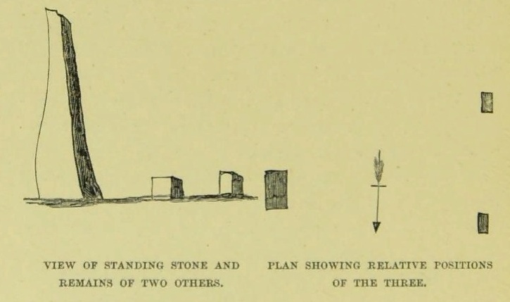
George Low on his 1774 tour wrote:
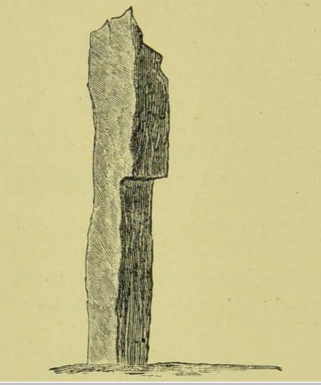
“Left this spot, and May 12th, proceeded southward by Stowse head; observed on the hill the remains of a tri-angular monument, but very much defaced, and two of the stones broke to the stumps. Tradition is there none as to the reason &c. of its erection. The figure with a plan follows…”
George Low’s 1774 sketchA coat of lichen
There is now no trace on the surface of the other two stones of this group so we are fortunate to have Mr Low on the spot sketch to record them. The stones would have been visible to the seafarers of times past who may have used them as navigation landmarks in pre-literate times, this being one of a number of surviving coastal stones on the Orkneys but whether they were erected for this purpose cannot be known. If you’ve been to see the Sorquoy stone up the coast, the surviving Stews stone is worth the journey if only for its ‘velvet’ coat.
References:
RCAHMS, Twelfth report with an inventory of the ancient monuments of Orkney and Shetland, 3v. Edinburgh. 1946
Low, George, A Tour Through the Islands of Orkney and Schetland…collected in 1774, William Peace & Son: Kirkwall 1879.
Acknowledgements: Big thanks for use of the 1st edition OS-map for this site profile, Reproduced with the kind permission of the National Library of Scotland.
Travelling south on the A961, take the first road left past St Margaret’s Hope, and follow it over the cross roads, and down the hill towards the sea, and it’s visible on the left hand side. You can’t miss it! It’s accessed by a narrow pathway which has been partly ditched – be careful!
Archaeology & History
View from the SEView from the track – SW
One of the less well known but most impressive of the Orkney standing stones, and seemingly one of the least visited. On my visit in July 2019, it was clear no one had walked the path for several months. The Royal Commission Inventory describes it as being, “14′ – 14′ 6″ high with some packing at the base. At 3′ above ground level, it is 2′ 6″ wide and 18″ thick, thickening to 21-22″ as it rises.”
It has a distinctly top-heavy look, and although invisible from the west above the brow of the hill, it can be clearly seen from the sea.
George Low visited the stone on May 11th 1774, saying:
‘In this beautiful hollow, in a cornfield, saw a large erected stone about 16 feet above ground, probably monumental, tho’ tradition is silent about it, and by digging nothing was found that could certainly prove this’.
Described by local historian George Barry (1748 – 1805):
George Low’s 1774 drawing
‘To the north (of South Ronaldsay), – at no great distance, is a most beautiful vale, with the ocean on one side, and gently declining hills on the other; which, for the production of every sort of beneficial crop, is far superior to any other part of the island. In the middle of this pleasant spot, on the brow of a hill, is a monumental stone, sixteen feet high, which, like many others through the country, bears no marks of human art, in carving, figures, or inscription. The whole delightful dale is known by the name of Paplay’ .
If you’re in the islands, this impressive stone is certainly worth a detour!
References:
Barry, Dr George, History of the Orkney Islands, Longman,Hurst,Bell & Orme: London 1808.
Low, George, A Tour Through the Islands of Orkney and Schetland…collected in 1774, William Peace & Son: Kirkwall 1874.
Royal Commission Ancient & Historical Monuments, Scotland, Inventory of the Ancient Monuments of Orkney and Shetland, HMSO 1946.
Acknowledgements: Big thanks for use of the 1st edition OS-map for this site profile, Reproduced with the kind permission of the National Library of Scotland.
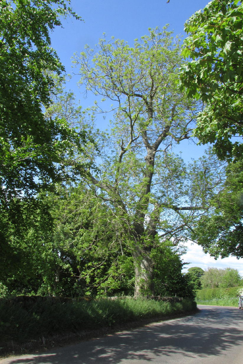
The tree is at Templeton on the west hand side of the Newtyle to Balkeerie Road travelling north, just before the bend in the road at Templeton Farm.
Archaeology & History
The only written record of the tree is in Strathmore Past and Present by the Reverend J.G. M’Pherson (1885):
Standing Proud
“After driving two miles eastward from the village of Newtyle along a most excellent level road, we enter the united parishes of Eassie and Nevay. The time-honoured boundary-mark is a conspicuous old ash, which popularly goes by the name of the Temple-tree. Tradition cannot guess its age. It is of considerable diameter, but quite hollow from the ground upwards for twenty feet. The bark is stripped off in several parts, and the thin shell of wood exposed is quite worm eaten; here and there being quite worn through, forming a rude door and rugged windows for the weird like interior.
“Large branches spread out, half dead-and-alive, with some foliage, scantily furnished with the life-giving root-sap. Could it speak it would tell of many a strange incident in its vicinity or underneath its arms. Its appearance might almost take one back to the time when the Templars left the neighbourhood; thus fixing its curious appellation”.
Sadly the tree described in the above quotation from 1885 has perished, but, just as it was not growing at the time of the Knights Templars’ local involvement, it is not unreasonable to speculate that it was a daughter of an ash tree that had formed a parish boundary marker of the original estate at the time of the Templars or even before. And now a daughter tree of that venerable 1885 tree grows in its place, the Temple-tree of the present day.
Various writers have attested to the Templar presence in Meigle, indeed M’Pherson writes:
“When the Knight Templars were in pomp…they had considerable interest in Meigle, several lands in the parish still being known as the Temple Lands. We prefer this derivation to the common one of templum, any religious house”.
In describing the now famous Meigle Pictish stones in the New Statistical Account, the Reverend William Ramsay (1845) writes;
“…A more satisfactory account of them has been suggested by Captain T.P. Mitchell, …He considers them as neither more nor less than the monuments of the Knights Templars, who unquestionably had a burying-ground at Meigle”.
While Mitchell was wrong in his attribution of the carved stones, he was clearly aware of the continuing memory of the Templars.
Modern research has shown that many of the Templar estates and lands in Scotland remained as separate fiscal entities within the Hospitaller lands up until at least the Reformation, which may explain the enduring Templar nomination of our tree.
Note: The tree formed the 19th century boundary of the parishes of Eassie and Nevay to the north, and Newtyle, both in Angus. We must assume the Templar lands boundary has been incorporated into the later parish system.
Note: This is not a clooty tree – please treat her with respect.
References:
Rev William Ramsay, Parish of Alyth, The New Statistical Account of Scotland, 1845.
Rev J.G. M’Pherson, Strathmore Past and Present, S. Cowan & Co: Perth, 1885.
Robert Ferguson, The Knights Templar And Scotland, The History Press: Stroud 2010
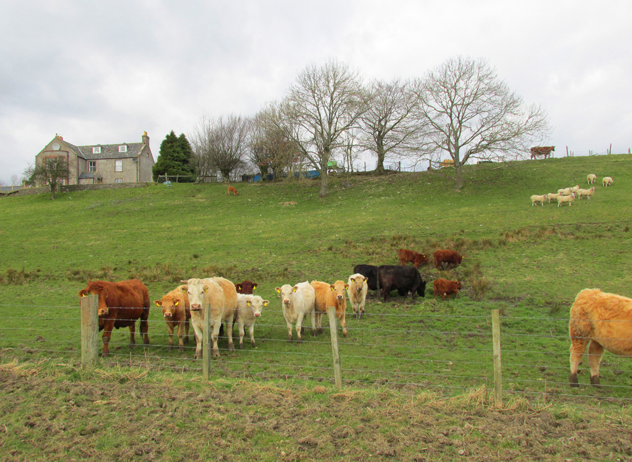
Turn left in Kirkton of Menmuir towards Bridgend past the giant hillfort and rock art of White Caterthun, cross the Bridge of Lethnot, and continue to the holiday caravan park at Drumcairn, where you can park up. Walk along the farm track on the south side of the caravan park and enter the field through the steel gate, and keep walking along the edge of the field until you come to the spring below the old manse.
Archaeology and History
In the Ordnance Survey’s Name Book of 1857, the well is described as:
‘…a spring emitting from the foot of a natural bank. There is no built-up well about it.’
Andrew Jervise (1882) writes in his History and Traditions of the Land of the Lindsays,
“…the Blessed Virgin was patron of Lethnot, and, during the incumbency of the late Mr Symers, several votive offerings, consisting of pieces of silver money, were found in the fountain near the church, which still bears the name of St.Mary’s Well…”
W.J Watson in his classic The Celtic Place Names of Scotland:
“..in Forfarshire is Navar, now Lethnot and Navar (the parish in which the Well stands)..the first part is doubtless nemed…”
Watson defines ‘nemed‘ as a derivative of nemeton – “a sacred place”, or “an institution originally pagan, taken over by the Church.”
C.P. Will, writes of the parish of Lethnot and Navar, in which the well stands:
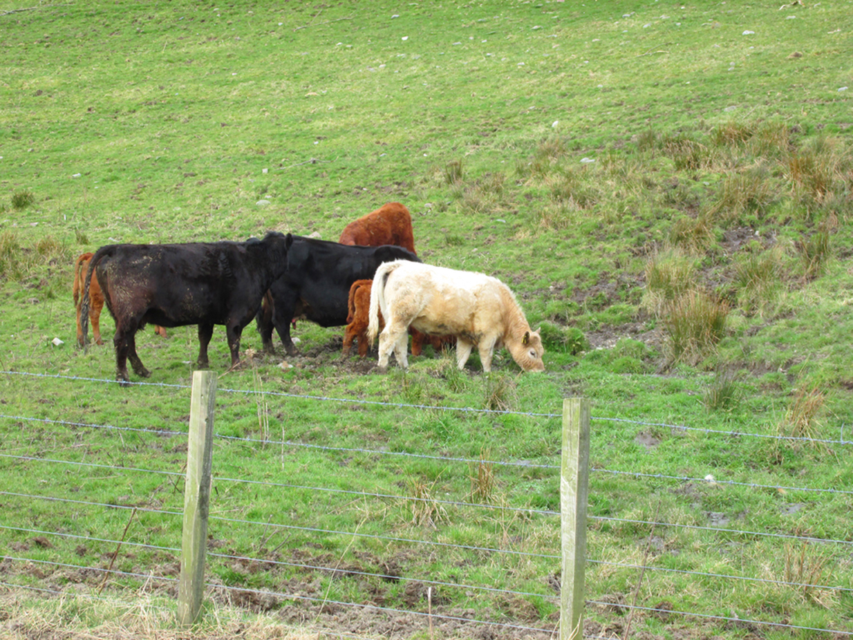
Heifers drinking the holy waters
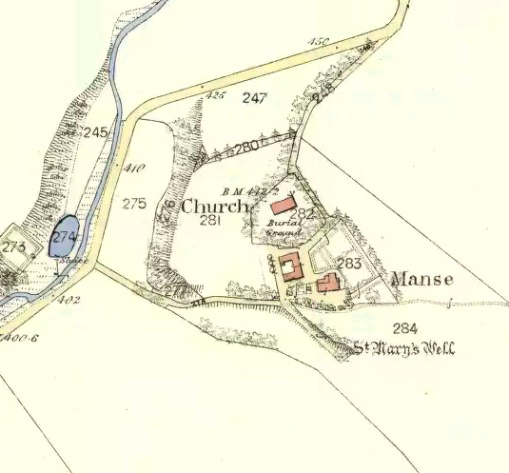
Site on the 1865 map
“..they record the existence here of an early settlement of the Celtic Christian church…Lethnot means Half-churchland, one portion of it, or as we might now say, one of two glebes…while Navar is Churchland-head, the top or extreme part of it, or Glebe-land. The two are complementary as to situation… Ultimately each had its parish church, the buildings being less than a mile apart and in full view one from the other, The “nemet” appearing in both names was a pagan shrine and, as such spots were commonly taken over by the Church on the advent of Christianity, the subsequent Gaelic neimheadh and neimhead came to mean a church site with the lands belonging to the church, latterly accepted as equivalent to glebe.”
On the day of my field visit, the field in which the spring flows was occupied by skittish cattle who spent their time drinking, so I didn’t get close up to it, but it appears that any housing to the spring has been removed.
Visible to the south are the hillforts of White and Brown Caterthun; and 1¾ miles south east of St Mary’s Well, on the southern slope of the Brown Caterthun is the site of the Hermitage Notre Domine Maria de Kilgery, while its sub chapel and adjoining Lady Well of Chapelton in Menmuir are 2¾ miles away to the south-east, which may suggest a pre-Christian ritual landscape dedicated to one of the Earth goddesses.
References:
Jervise, Andrew, The History and Traditions of the Land of The Lindsays in Angus andMearns, David Douglas: Edinburgh 1882
Jervise, Andrew, “Notices of the Localities of the Sculptured Stone Monuments at St Vigeans, Inchbrayoch, Pitmuies, and Menmuir, in Angus and of Fordoun in the Mearns – part IV,” in Proceedings Society of Antiquaries of Scotland, volume 2, 1855-56.
Watson, William J., The History of the Celtic Place Names of Scotland, Birlinn: Edinburgh 2004.
Will, C.P., Place Names of Northeast Angus, privately printed: Edzell 1963.