Westport Well, Old Town, Edinburgh, Midlothian

Healing Well (destroyed):  OS Grid Reference – NT 2511 7322

Archaeology & History

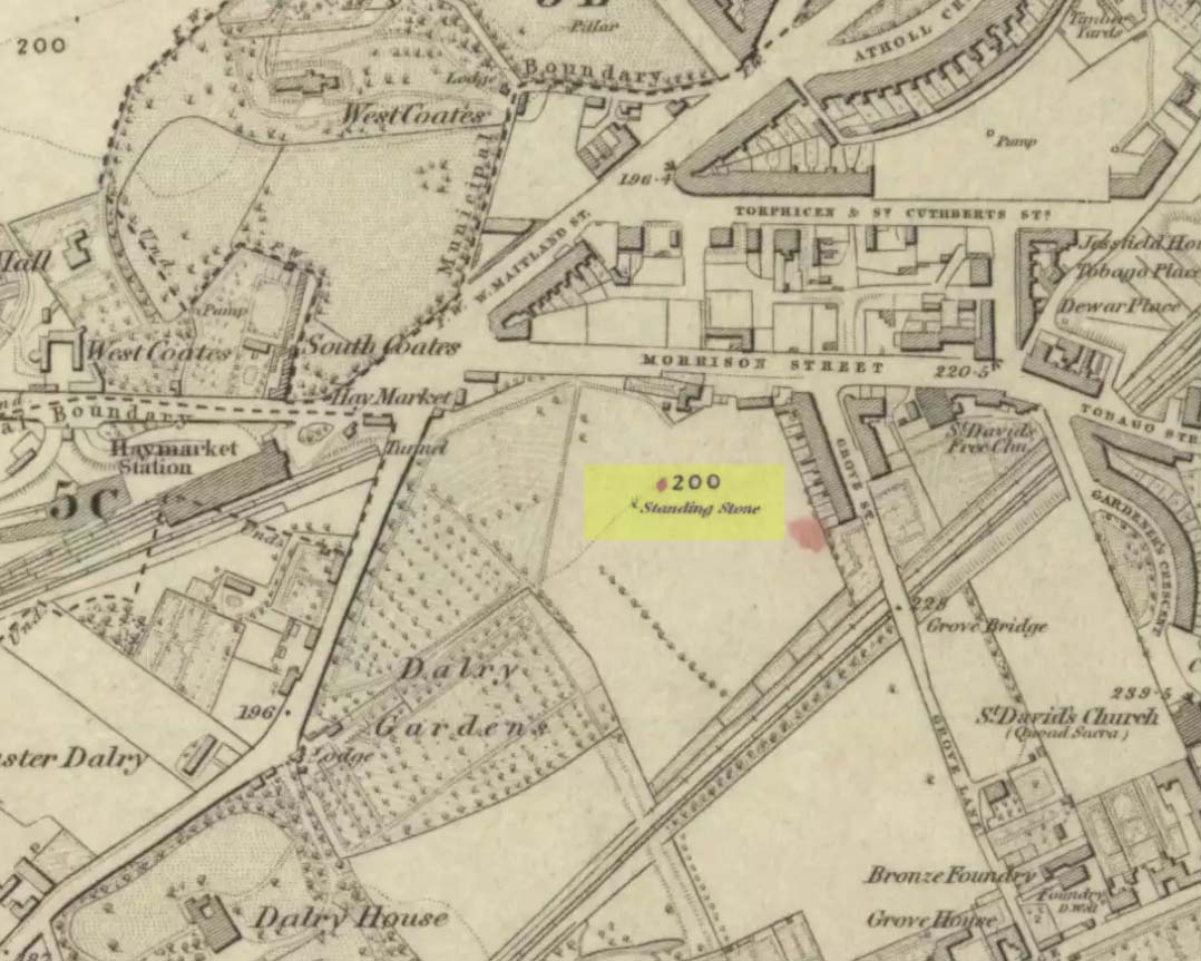
Like many others in the city centre, this old well has long since passed into history.  Said by Stuart Harris (1996) to have been “about twenty-five yards east of the eastern corner of Lady Lawson Street”, the Victorian writer Alison Dunlop (1890) told it to be by “a narrow close and an outside stair gave (which) entrance to the Court-house.”  It was the focus of much social activity in ages past; and although a number of public wells could be found in this part of the city, south of the Castle, the Westport Well was the most renowned.  Miss Dunlop told that,

“…its waters (were) of excellent repute (and) had to satisfy the necessities of all the inhabitants of the district.  The early morning never failed to see a long line of water-stoups stretching from it in either direction like the queue at a French theatre door.  Not so quiet, however, for tongues, mostly feminine, wagged freely, and the ‘Waal’ news and gossip were then the equivalent for a racy morning newspaper.”

According to her account, the patience of the people collecting the water was exemplary:

“All crowding-in was fiercely resented; gentle and simple had to stand their turn; only the water-caddies had the abiding right of precedence, and satisfied their customers at the moderate rate of two stoupful for a penny. We have already mentioned these ancient aquarian vessels peculiar to Scotland. In the event of a marriage taking place—in which case the bride was responsible for an amount of house plenishing not considered incumbent or even fashionable now-a-days—the ‘stoups’ were invariably purchased by the intending husband.  Indeed, the Weetin’ o’ the Stoups was the synonym for the last bachelor supper prior to matrimony.  Such festivities are understood to be hilarious, happy, hopeful; and the weetin’ o’ the stoups in Old Portsburgh, as in Old Edinburgh, was sometimes very wet indeed.”

References:

  1. Bennett, Paul, Ancient and Holy Wells of Edinburgh, TNA 2017.
  2. Dunlop, Alison Hay, Anent Old Edinburgh and some of the Worthies Who Walked its Streets, Somerville: Edinburgh 1890.
  3. Harris, Stuart, The Place-Names of Edinburgh: Their Origins and History, Gordon Wright: Edinburgh 1996.

© Paul Bennett, The Northern Antiquarian 

Mineral Well, Dollar, Clackmannanshire

Healing Well:  OS Grid Reference – NS 9855 9804

Also Known as:

  1. Dollar Chalybeate Spring
  2. Dollar Spa
  3. Vicar’s Bridge Spa

Archaeology & History

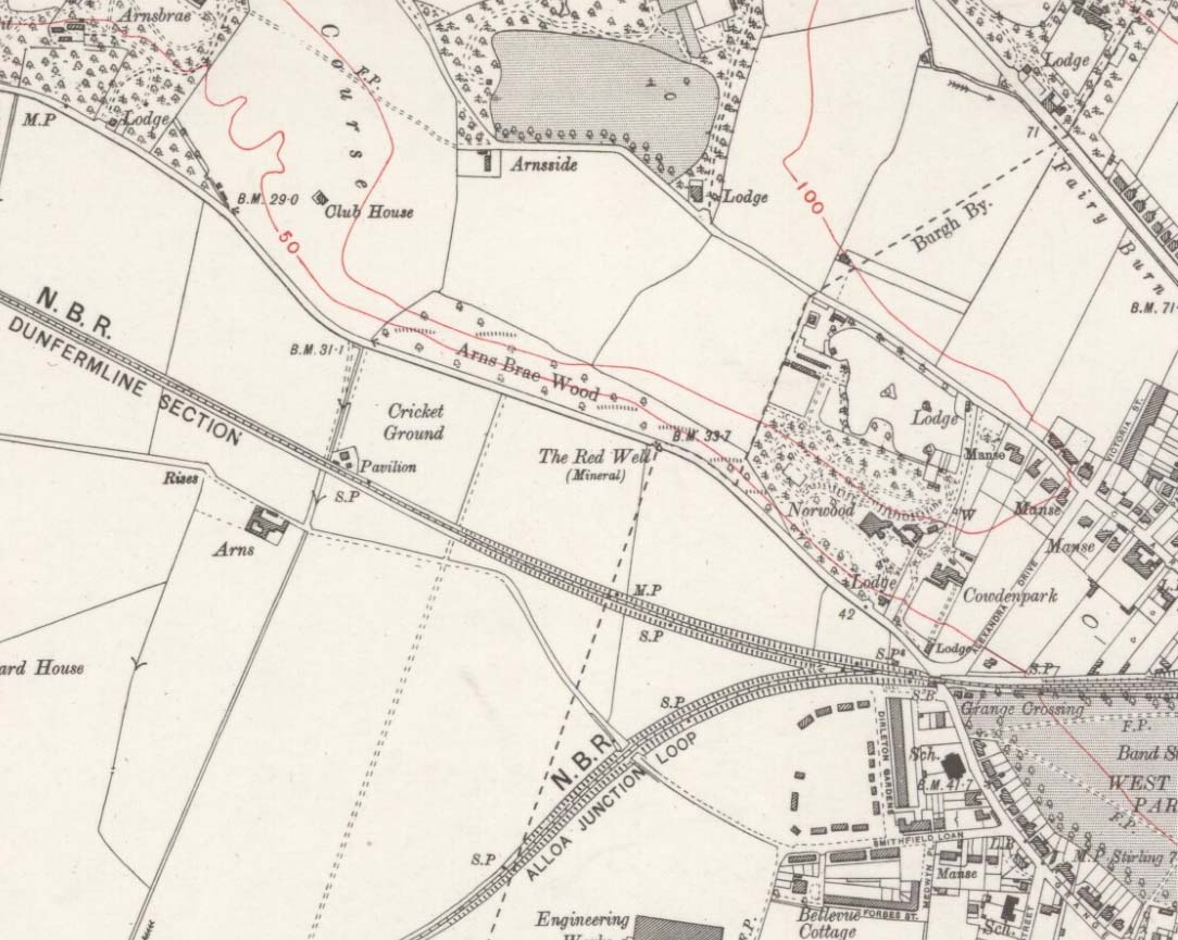
Vicars Bridge spring on 1900 map

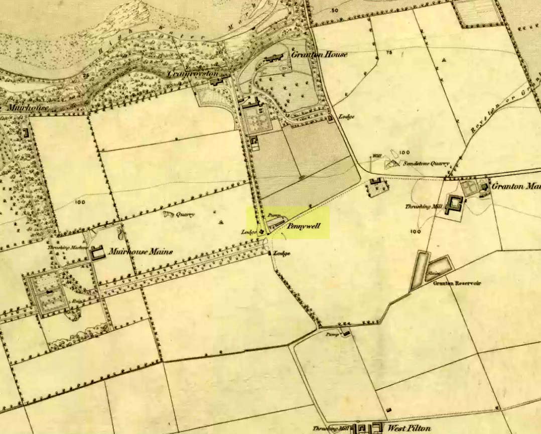
Somewhere hiding away above the north-side of the River Devon, just above the Vicar’s Bridge, a little-known healing well came into being following industrial workings in the glen in 1831 by a local iron-working company.  The waters were strongly chalybeate, or iron-bearing—and as the fad amongst the wealthy was, at the time, a love of Spa Wells, this mineral spring was broadcast as a competitor of the Harrogate and Bath Spas.  But it failed pretty fast, sadly.

Bottles of the water were marketed and sold as ‘Dollar Mineral Water’ in many of the large cities, but sales weren’t too good.  Johnston & Tullis (2003) pointed out how the waters would have been coloured like brandy; and despite it being good for anaemia, a good tonic, and favourable in treating cuts and bruises, the mineral spring was no longer of any value as a business, dying a quick death.  Local people still kept using the waters, but in recent years the spring appears to have died too.

References:

  1. Johnston, Tom & Tullis, Ramsay (eds.), Muckhart, Clackmannanshire: An Illustrated History of the Parish, MGAS 2003.
  2. Morris, Ruth & Frank, Scottish Healing Wells, Alethea: Sandy 1982.

© Paul Bennett, The Northern Antiquarian

Borgie, Tongue, Sutherland

Chambered Cairn:  OS Grid Reference – NC 6737 5940

Also Known as:

  1. Canmore ID 5743

Getting Here

Borgie Cairn under gorse, right

Very difficult to find under the herbage, but – along the A836 road between Tongue and Bettyhill, turn down at Borgie Bridge towards Skerray.  A few hundred yards along, past the third house on y’ right, a path through the gate on the left takes you up the slope. Once you meet the deep-cut dike, follow it north-ish for 200 yards, over the fence; then walk 150 yards towards the eastern edges where the mass of gorse meets with the rocky escarpment.  You’re damn close!

Archaeology & History

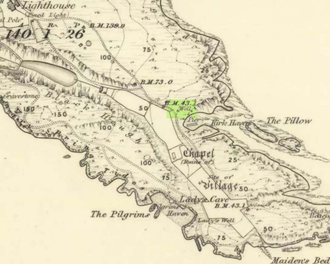
These days, much of the remains of this neolithic chambered cairn are inaccessible, as it is covered with the spindly-killer-bushes that are the yellow gorse (Ulex eurapæus).  A pity.  …Just like its fellow chambered tomb of Dun Riaskidh precisely 1½ miles NW, this was also built upon the edge of a natural rocky escarpment with some of the rocks making up the tomb falling to the edges (I nearly fell in and spined misself meandering around its edges!).

Little has been written about it in archaeo-tomes, despite it being first listed in 1947. Presumably neolithic in age, it was first classed as a ’round cairn’ and has subsequently been described by Canmore as,

“a severely robbed, chambered cairn. It is about 15.0m in diameter, with a maximum height of 0.6m in the centre; elsewhere the cairn is reduced to a stony rim and scattered stones. In the centre a chamber is indicated by two opposing earthfast boulders 1.1m apart and protruding up to 0.6m through the cairn material.”

References:

  1. Gourley, Robert, Sutherland: An Archaeological Guide, Birlinn: Edinburgh 1996.

Acknowledgments:  Huge thanks to Donna Murray, for putting me up in this part of Paradise.  Cheers Donna.

© Paul Bennett, The Northern Antiquarian
Cock Lakes, Blubberhouses Moor, North Yorkshire

Cup-Marked Stone:  OS Grid Reference – SE 1524 5469

Getting Here

Faint cups highlighted by water

Follow the same directions as if you’re visiting the James Stone monolith.  From here, walk about 60 yards southeast and zigzag about in the heather until you find a small squarish-shaped earthfast rock, barely 6 inches above ground-level (might be hard to find when the heather’s fully grown).  If you’ve got a petroglyphic nose, you’ll find it!

Archaeology & History

A simple faded cup-marked stone, roughly 2½ feet by 2 feet across, can be found about 65 feet southeast of the James Stone and 40 yards west of the Benty Gate prehistoric enclosure.  Sadly when we visited the place a few days ago, the sky was grey and the conditions for good photos were poor.

Line of faint cups from centre
Extra faint cup near centre left

At least five cup-marks have been etched onto the stone, with the main element being a row a three cups in a straight line from the centre of the stone to its SE edge.  The central cup-mark has been carved where a natural crack in the rock, running from the edge of the stone, terminates.  There also seemed to be a carved faded line running along the bottom edge of the stone—but it was unclear and another visit is needed in better light to see if there’s more on the stone.

© Paul Bennett, The Northern Antiquarian

James Stone, Blubberhouses Moor, North Yorkshire

Standing Stone: OS Grid reference – SE 15196 54722

Getting Here

James Stone, looking SW

From Blubberhouses church by the crossroads, walk up the slope (south) as if you’re going to Askwith, for 100 yards or so, taking the track and footpath past the Manor House and onto the moor.  Once you hit the moorland proper, take the footpath that bears left going down into heather and keep going till you hit the dead straight Roman Road path running west onto Blubberhouses Moor. Carry along the Roman Road for about 200 yards as though you are going towards the Eagle Stone, and looking right (if you squint) you can just make out a small pimple on the top of the moors about a quarter of a mile away. That is where you are heading (be warned – it is boggy getting there).

Archaeology and History

James Stone, looking NE

Discovered (or rather ‘noticed’) by James Turner and James Elkington in July 2016 (hence the name James Stone), this standing stone is of an indeterminable age – although it does look ancient.  Standing more than 5 feet tall, and in the middle of nowhere, it is fairly difficult to get to unless you want to get wet feet.  It is situated very close to a small and unexcavated prehistoric settlement and we could find no physical evidence of any tracks nearby (although Google Earth does show what looks like one or two very short, faint tracks near the stone, which is the old ‘Benty Gate’ track).

It could be a boundary stone, although doubtful – it has a feel to it that says it is prehistoric, although this is just guesswork on our part.  I can find no reference to it in Cowlings Rombalds Way (1946) and there seems nothing about it in either of William Grainge’s (1871; 1895) detailed history works of the region.

Mr Turner gazing at the stone

At first we thought it unlikely to be a new find, however the stone is difficult to see from the Roman Road (I had been up here dozens of times before I noticed it) and seeing that people rarely go up here anyway, and it is relatively difficult terrain getting to it, it is not surprising that no one has bothered visiting it. It would take someone who is quite keen on megaliths to want to examine it and it is well off any tracks.

Having said that, it is a nice find and it could be linked in some way with the small unexcavated settlement nearby, or possibly the large Green Plain settlement nearly a mile away.  Well worth a visit…bring your wellies!

References:

  1. Cowling, Eric T., Rombald’s Way, William Walker: Otley 1946.
  2. Grainge, William, The History and Topography of Harrogate and the Forest of Knaresborough, John Russell Smith: London 1871.
  3. Grainge, William, The History and Topography of the Townships of Little Timble, Great Timble and the Hamlet of Snowden, William Walker: Otley 1895.

© James Elkington, The Northern Antiquarian


Ing Well, Allerton, Bradford, West Yorkshire

Healing Well (destroyed): OS Grid Reference – SE 1174 3443

Archaeology & History

Ing Well on 1852 map

This ‘Well of the Meadow”, or Ing Well, is one of countless springs in and around the Bradford metropolis that have been destroyed by that thing they call ‘development’.  It was one of the main water sources for the villagers of Allerton village in the 19th century and earlier.  Highlighted on the 1852 OS-map of the region, a singular footpath once led to the waters and no further.  There appear to be no antiquarian or historical references detailing its traditions or medicinal qualities—unless of course, you know different.

The name Ing Wells is one of the most common of all titles given to water supplies in England, meaning having the same meaning and general history just about everywhere it occurs.  The place-name itself was given extensive attention in two separate studies by Eilert Ekwall (1962) and Sigurd Karlstrom (1927).

References:

  1. Ekwall, Eilert, English Place-Names in -Ing, Lund: Uppsala 1962.
  2. Karlstrom, Sigurd, Old English Compound Place-Names in -Ing, Lund: Uppsala 1927.

© Paul Bennett, The Northern Antiquarian


Cross Well, Musselburgh, East Lothian

Holy Well:  OS Grid Reference – NT 34629 72739

Archaeology & History

John Small’s 1900 sketch of the Cross

Musselburgh has had an ancient fair—held upon St. James’ Day (July 25)—for many centuries.  It was held along the old High Street by a more ancient Market Cross than the one seen there today.  R.M. Stirling (1894) told us that, “The cross is erected over a draw-well, and in local parlance is known as the Cross Well.”

On the 1853 township map, a water ‘pump’ is shown at the very spot, with the ‘cross’ and water trough shown on subsequent maps.  The Well isn’t mentioned in John Small’s (1900) description of the cross and its authenticity as a ‘holy’ well is questionable.

References:

  1. Bennett, Paul, Ancient and Holy Wells of Edinburgh, TNA 2018.
  2. Small, John W., Scottish Market Crosses, Eneas Mackay: Stirling 1900.
  3. Stirling, R.M., Inveresk Parish Lore from Pagan Times, T.C. Blair: Musselburgh 1894.

© Paul Bennett, The Northern Antiquarian 

Achnaburin, Bettyhill, Farr, Sutherland

‘Hut Circle’:  OS Grid Reference – NC 7082 5891

Also Known as:

  1. Achnabourin
  2. Canmore ID 6210

Getting Here

Site as ‘Picts House’, 1873 map

From Bettyhill village, take the A836 road as if you’re going to visit Tongue, crossing the metal bridge across the River Naver a mile south of Bettyhill.  Keep going past here for nearly a mile, beyond the houses and then into the small trees, making sure that you keep your eyes peeled to the right where a small but notable bracken-covered mound rises 10-20 yards in the rough field. Go through the gate and you’re there!

Archaeology & History

Low stone wall along S side

A site which, from the nearby roadside, has all the hallmarks of being yet another Sutherland broch (there are tons of them up here!)—but apparently it isn’t!  Despite being shown on the earliest OS-map of the region as a ‘Pict’s House’ (which are usually brochs), the site has subsequently been designated by modern archaeologists as a simple ‘hut circle’.  I have my doubts over this, as it’s a most unusual one with little logic over its positioning—unless it was either a look-out point, or an odd ritual spot.

South side of the mound

As you can see from the poor photos I got of the place, a large angled tumulus-like hillock (it’s akin to a mini-Silbury Hill at first sight) rises up from the ground with a reasonably uniform angle around much of it, to a height of between 16-20 feet.  Scattered rocks and stones adorn the mound as you walk up its embankments and onto the top where, around the edges, a notable man-made ring of walling shows it to have been artificially created.  Unfortunately most of the top of the mound was completely covered in thick decayed bracken when I visited, so it was difficult to get any good photos of this topmost walling.

The SE side of the mound

From the top of the mound, the walling is between 1-3 feet high, in a roughly circular setting, measuring 36-40 feet across.  The most distinct section of it was visible on the west-to-south-to-east section; with the lowest and depleted section occurring on its northern edges.  The entrance to the ‘hut circle’ is apparently on its eastern side.  Although it is assumed to be Iron Age in nature, its real age is unknown.

References:

  1. Mercer, R.J. & Howell, J.M., Archaeological Field Survey in Northern Scotland – volume 2, University of Edinburgh 1976-1983.

© Paul Bennett, The Northern Antiquarian
Vicar’s Well, Musselburgh, East Lothian

Holy Well (destroyed):  OS Grid-Reference – NT 3452 7264

Archaeology & History

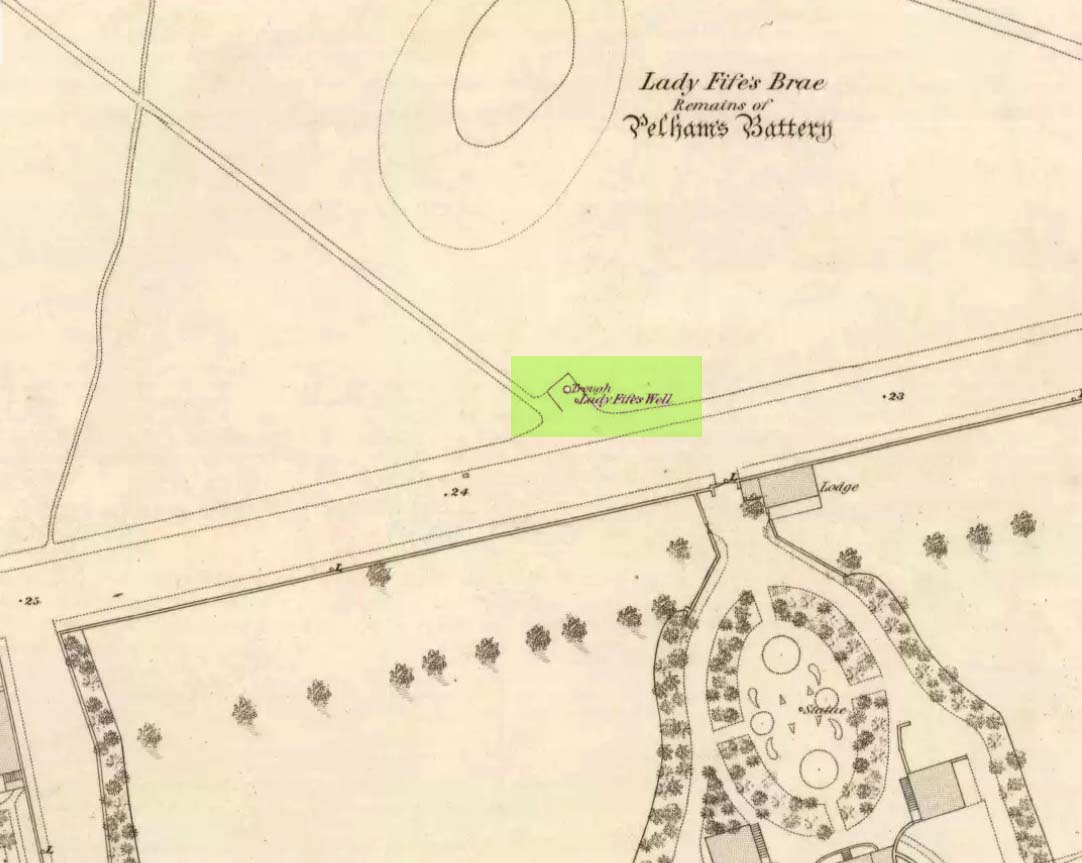
Vicars Well on 1853 map

First mentioned in the Scottish Statistical Account of 1845, its name originates from being attached to the vicarage of nearby St. Michael’s church.  Highlighted on the 1853 township map of Musselburgh, this forgotten holy well was described in the middle of the 19th century by local historian James Paterson (1857).  It was located near the middle of town, along a back-street south of the High Street.  Mr Paterson told us that:

“At the Dam Brae there is still a well, celebrated for the excellence of its water, called ‘the vicar’s well’, from which it is believed the present manse occupies the site of the ancient vicarage.  It lies to the southeast of the Brae, and the wall of the ground approaches pretty close to the mill lead, or damn, as it is called.  It is well surrounded with old trees.”

When it was described by Mr Beveridge in the 1845 Statistical Account, the spring had been covered by a pump.  Local lore told how the waters of this ancient Well was said by housewives to be excellent in the infusion of tea; and although its name was spoke in local dialect as the ‘Bickers Well’, Beveridge told it to mean the “Vicars Well.”  There is the obvious possibility that the ‘bickers’—as in chit-chat and gossip—related to it being where local folk simply met and chatted.

When Mr Stirling (1894) wrote his account of the adjacent Inveresk parish, he told how water from the Vicar’s Well,

“was in much request till a few years ago, when its use was forbidden and its site enclosed (for) sanitary considerations.”

References:

  1. Bennett, Paul, Ancient and Holy Wells of Edinburgh, TNA 2018.
  2. Paterson, James, History of the Regality of Musselburgh, James Gordon: Musselburgh 1857.
  3. Stirling, R.M., Inveresk Parish Lore from Pagan Times, T.C. Blair: Musselburgh 1894.

© Paul Bennett, The Northern Antiquarian 

Ringstone, Torrisdale Bay, Farr, Sutherland

Legendary Rock:  OS Grid Reference – NC 69128 61741

Getting Here

The Ringstone, Torrisdale Bay

Along the A836 road between Tongue and Bettyhill, turn down towards Skerray at Borgie Bridge for 1.8 miles (2.87km) until you reach the little information sign at the roadside. Walk downhill and cross the little bridge and wander onto the west side of the beach.  You’re likely to end up daydreaming… so once you’ve re-focussed, head into the middle of the beach and walk up the steep-ish sand-banks to your right (south).  Once at the top, you’ll see a gigantic rock—the Ringstone—nearly as big as a house.

Folklore

This gigantic boulder is part of one of Sutherland’s archaic Creation Myths as they’re known: ancient stories recounted by archaic societies about the nature and origins of the world.  Such tales tend to be peopled by giants, gods, huge supernatural creatures, borne of chaos, eggs, darkness and primal oceans.  Thankfully we still find some examples of these tales in the northern and northwestern mountainous regions of Britain, as the Church and Industrialism never quite destroyed the hardcore communities—despite what they might like to tell you…

The face of the Ringstone
The Ringstone, gazing east

The following folktale was written by the local headmaster, Alan Temperley (1977), who wrote down many of the oral traditions in Scotland’s far north before they disappeared forever from the tongues of local people (as is sadly happening in these mountains) as they’re slowly, sadly, being erased by the influx of incomers with no connection nor sincere love of old tales and ways.  It is typical of stories found other large geological formations from aboriginal Australia, to Skye, to everywhere on Earth where people have settled.  Mr Temperley wrote:

“Many years ago there were two giants, the Naver giant from the river at Bettyhill, and the Aird giant from the hill above Skerray.  Normally they got on quite well, but one afternoon they became involved in a heated argument about some sheep and cattle, and both grew very angry.  The Aird giant was standing on top of the hill above Torrisdale bay with the animals grazing around him, and the Naver giant stormed across the river to the beach below.

“Those are my sheep,” he roared up the hill.

“No they’re not,” the Aird giant said. “At least not all of them.”

“You stole them. You’re a thief!”

“No I didn’t. They came up here themselves. Anyway, you owe me fifty sheep from last year.”

“You’re not only as thief, you’re a liar!” shouted the Naver giant.  If you don’t send them down this minute, I’ll come up and see to it myself.”

At this the Aird giant gave a disparaging laugh and made a rude face, and picking up a great boulder flung it down the hill at his friend.

The Naver giant was speechless with fury, and picking the stone up himself, hurled it back up the hillside, making a great hole in the ground.

The Aird giant saw things had gone far enough.

“I’ll send them back if you give me that silver ring you’re always wearing,” he said.

“Never!” roared his friend, his face all red and angry.

“Suit yourself then,” said the Aird giant, and picking the stone up again he tossed it back down the hill.

For long enough the rock kept flying between them, and in time the giant from Naver grew tired, because he was throwing it uphill all the time.

“Will you give me the ring now?” said the Aird giant.

For answer the Naver giant tried one more time to throw the stone up the hill, but it only got halfway, and rolled back down to the shore.

“Come on,” said the giant from Aird, for he wanted to be friends again. “Give me the ring, and I’ll let you have it back later.”

“No!” said the Naver giant from the bottom of the hill.  “I’ll never give it to you!” His eyes began to fill with tears.

“Oh, come on, please!” coaxed the Aird giant. “Just for a week.”

“Never, never, never!” shouted the giant from Naver, and pulling the ring from his finger he threw it on the ground and jammed the great boulder down on top of it.  Then he sat down on top of the stone and stared out to sea.  Every so often he sniffed, and his friend, looking down at his broad back, saw him lift the back of a hand to his eyes.

They never made friends again, and after a long time they both died.

The ring is still buried under the stone, and so far nobody has ever been able to shift it.”

The giant’s face, in profile

When I got back from visiting this immense rock a few weeks ago, a local lady Donna Murray asked me if I’d seen the face of the giant in the rock.  I hadn’t—as I was looking to see if the name ‘Ringstone’ related to any possible cup-and-rings on its surface, which it didn’t (although I didn’t clamber onto the top).  But in the many photos I took from all angles, Donna pointed out the blatant simulacra of the giant’s face when looking at it from the east.

However, on top of the slope above the Ringstone (not the Aird side), I did find a faint but distinct ‘Ringstone’ carving (without a central cupmark).  Whether this ever had any mythic relationship to the tale or the stone, we might never know.  The rocky terrain above Aird now needs to be looked at…

References:

  1. Eliade, Mircea, Patterns in Comparative Religion, Sheed & Ward: London 1958.
  2. Long, Charles H., “Cosmogony,” in Eliade, M., Encyclopedia of Religion – volume 4, MacMillan: New York 1987.
  3. MacLagan, David, Creation Myths: Man’s Introduction to the World, Thames & Hudson: London 1977.
  4. Temperley, Alan, Tales of the North Coast, Research Publishing Company: London 1977.

Acknowledgments:  Massive thanks again to Donna Murray, for her help and for putting up with me amidst my wanderings up in Torrisdale and district.

© Paul BennettThe Northern Antiquarian 2017