Tumulus (destroyed): OS Grid Reference – TL 6116 6352
Archaeology & History
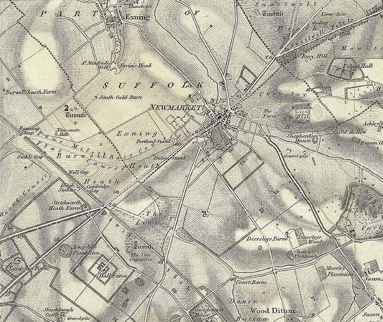
Tumulus 2, centre-left
This is one of at least five prehistoric tombs that were known to have existed in and around the Newmarket race-course. Found some 600 yards NNE of the Ninescore Hill tumulus, and some 40 yards from its nearest companion, it was shown as one in a group of ‘Tumuli’ on the 1834 OS-map (right) but, along with the rest, was subsequently destroyed sometime around 1883. A landscape scar of the monument was seen from the air in the 1940s by J.K.S. St Joseph as a ploughed-out ring ditch some 75 feet across. This was reported as still visible by the Royal Commission doods in the 1970s, but no ground trace whatsoever exists.
Royal Commission Ancient Historical Monuments, Inventory of Historical Monuments in the County of Cambridgeshire – Volume 2: North-East Cambridgeshire, HMSO: London 1972.
This is one of many long lost prehistoric tombs that were known to have existed in and around the Newmarket race-course, but unlike the Newmarket tumuli 1 – 4 which were all on the first OS-map of the area, this one had been destroyed before the Ordnance Survey lads came here. As a result we don’t know its exact whereabouts.
Described in both the Cambridge Chronicle and Gentleman’s Magazine in 1827, the accounts even then were talking about it in the past tense, albeit pretty recently. The race-course at Newmarket was being modified, leading to the destruction of our ancient landscape—and with it, this tumulus. In those days however, such destruction was deemed as an ‘improvement’, as Sylvanus Urban (1827) tells at the start of his account:
“The improvements making in the exercise ground at Newmarket, Cambridgeshire, have led to some discoveries which may, perhaps, tend to the elucidation of the hitherto obscure origin of the entrenchment commonly called “The Devil’s Ditch.” In removing one of the monumental remains denominated barrows, or tumuli, which are numerous in this neighbourhood, the skeleton of a person was found deposited near the surface, whose remains were too recent to be associated with the area of its place of interment; but, upon clearing away the earth to the centre of the mound, a discovery was made of an urn, of rude construction and materials, containing ashes, together with some beads, which, it is presumed, formed the ornaments of the person to whose honour the barrow was dedicated. There were also found two coins, supposed to be Roman, and a fragment of a cup, of far superior manufacture to the urn, lying promiscuously at the depth of about two feet.”
A summary of this was included in Babbington’s (1883) archaeological survey. But in Cyril Fox’s (1932) list of barrows near Cambridge he seemed to confuse this “tumulus on Exercise Ground” (no.16) with what he thought was another tumulus (no.17), which he described as, “Exact site unknown. Contained a cremation interment. Burnt bones and sherds of Bronze Age type, also Roman sherds.” The two are the same thing.
Royal Commission Ancient Historical Monuments, Inventory of Historical Monuments in the County of Cambridgeshire – Volume 2: North-East Cambridgeshire, HMSO: London 1972.
Urban, Sylvanus, “Domestic Occurrences,” in Gentleman’s Magazine, September 1827.
Tumulus (destroyed): OS Grid Reference – TL 613 633
Archaeology & History
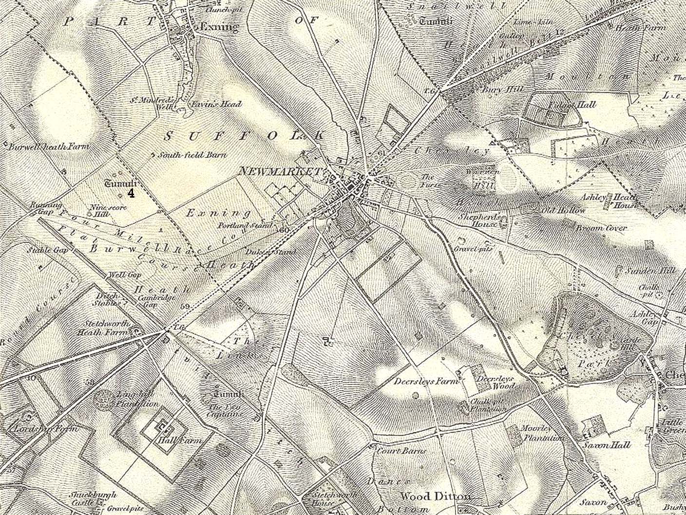
Tumulus 4, centre-left
This is one of at least five prehistoric tombs that were known to have existed in and around the Newmarket race-course. It could be seen five-hundred-and-odd yards northeast of the Ninescore Hill tumulus and about 280 yards southeast of its Newmarket Heath 2 companion. The site was shown as one of the “tumuli” on the 1834 OS-map (right) but, along with its friends, was destroyed sometime around 1883. Unlike its companions, no scar of its remains are visible from the air so we don’t know how big it was, but I’d assume the olde fella to be of a similar size and style to its close neighbours.
Royal Commission Ancient Historical Monuments, Inventory of Historical Monuments in the County of Cambridgeshire – Volume 2: North-East Cambridgeshire, HMSO: London 1972.
Tumulus (destroyed): OS Grid Reference – TL 6091 6304
Also Known as:
Newmarket Heath 1
Ninescore Hill Barrow
Archaeology & History
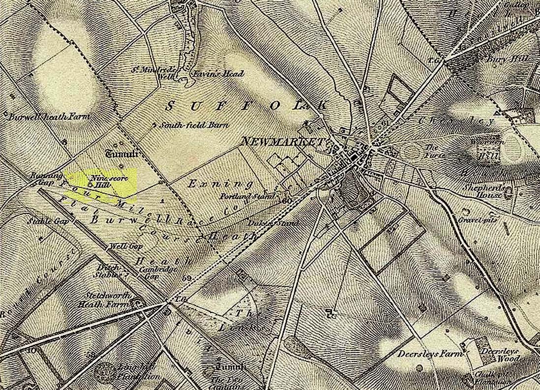
Ninescore Hill on 1834 map
Upon the small and curiously-named Ninescore Hill on the edge of Newmarket’s race-course, the old-school archaeologist Cyril Fox (1923) told that “800 yards due east of Running Gap”, was a prehistoric burial mound that was destroyed in 1885. Highlighted on the 1834 OS-map, a 19th century excavation found that the tomb “contained two inhumation interments associated with beakers,” along with some “flint arrowheads, and a secondary interment, probably Saxon.” In more recent times, the doods from the Royal Commission (1972) added the site to their inventory and noted that a faint outline—known as as ring ditch—is visible from the air when conditions are just right. But there’s bugger all left of it at ground level.
References:
Fox, Cyril, The Archaeology of the Cambridge Region, Cambridge University Press 1923.
Royal Commission Ancient Historical Monuments, Inventory of Historical Monuments in the County of Cambridgeshire – Volume 2: North-East Cambridgeshire, HMSO: London 1972.
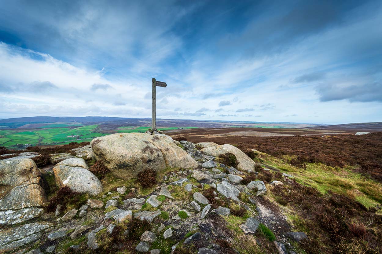
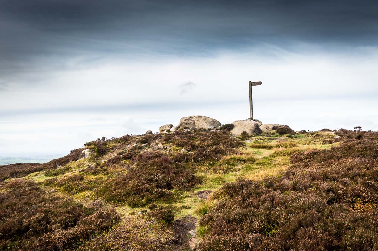
I prefer the much longer walk to this site, from Askwith Moor carpark some 5 miles to the west, but this wouldn’t be most folks cuppa tea. So for the lazy buggers amongst you: whether you’re coming via Ilkley (cross the bridge to Middleton and turn left, following the long winding road for several miles) or Bolton Bridge (hit Beamsley village and turn left up Lanshaw Bank), you need to get up to Langbar village. On the north side of the village is a distinct small rough carpark. From here, cross the road where the footpath sign is and walk straight up the steep hill to Beamsley Beacon at the top. Keep walking for exactly ¼-mile where you’ll find a large heap with boulders round its edge. You’re there.
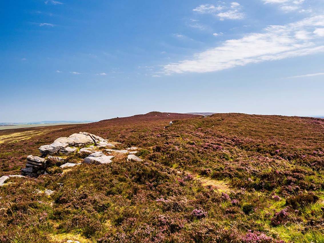
At the highest point of these hills where the moorlands of Langbar and Beamsley meet, is this prominent rocky pile on the same skyline as Beamsley Beacon. The two are ancient cairns, both robbed of most of their stones, but still a good site to sit and behold the vast landscape which reaches out for miles in all directions. And, from this highest point, looking south to the highest point across the Wharfe valley on Ilkley Moor, the remnants of another giant prehistoric cairn is visible: looking across at each other, eye to eye.
Of the two great cairns on Beamsley moor, The Old Pike is the more peculiar of the two because—unlike its partner along the ridge—several large boulders near its top give the impression of being Nature’s handiwork. This may be the case, but Nature isn’t the lass who laid down the mass of smaller rounded stones that are mainly visible on the west and southern sides. These have been placed there by people. But it’s not until you step back 40 or 50 yards that you get a more distinct impression of the place. The Old Pike rises up like a rocky nipple out of the heath, showing a very embedded overgrown man-made heap, typical of the overgrown prehistoric cairns that scatter our northern uplands.
The site is included on the archaeologist’s Pastscape website, albeit citing it as a ‘possible’ cairn. But the more we look at it, the greater the impression becomes that this old heap is man-made – certainly on its eastern and southern sides. The rise of boulders on its west may be natural, and then ancient man placed the cairn material up and around them. Only an excavation would tell us for sure. But its old name of Howber Pike tells a tale before we even visit the place. When the great Yorkshire historian Harry Speight (1900) came here he picked up on this element, telling us,
“Howber literally is the ‘Hill of Tombs’, from the Teutonic haugr and Anglian how, a burial mound, and berg also her, a hill, often fortified.”
The great place-name authority A.H. Smith (1956) not only echoes this but goes into greater etymological detail, noting that as well as haugr or how being “an artificial mound, a burial mound,” it’s a word that is particularly used in the northern counties. He does note however, that this may not always be the case and can sometime just relate to a “a hill or hilltop resembling an artificial mound.” However, we also find in Smith’s tome on place-name elements that the latter part of ‘Howber’ deriving from beorg, can also mean a tumulus or burial mound. But there are cases where this has been corrupted and means, as Speight states, a fortified hill. So at Howber Pike we seem to have the ancient name of some probable burial site. As for its neighbour a quarter-mile west, the giant cairn of Beamsley Beacon is also known as the Howber Hill….
References:
Smith, A.H., English Place-Name Elements – volume 1, Cambridge University Press 1956.
Smith, A.H., The Place-Names of the West Riding of Yorkshire – volume 5, Cambridge University Press 1963.
Speight, Harry, Upper Wharfedale, Elliott Stock: London 1900.
Acknowledgements: Huge thanks to James Elkington for use of his fine photos on this site.
Cist (destroyed): OS Grid Reference – SE 1192 4759
Archaeology & History
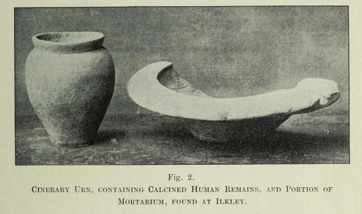
Urn found below Cowpasture Rd in 1874
In a lecture given by Frank Hall at the Ilkley Library in February, 1910, he described a number of prehistoric remains found in the area—including the remnants of a “cinerary urn, containing calcined human remains” and more, as illustrated in the old photo here. He contextualized the findings as being typical of the remains found “under a large heap of earth and stones which we now call a ‘barrow’, ‘cairn’ or ‘tumulus'” and believed that one must have existed here in bygone times. The urn, he told us,
“was found within a few yards of these premises, for it was dug up when the excavations were being carried out for the erection of Messrs Robinson and Sons’ buildings on the opposite side of Cowpasture Road, in March 1874.”
Although we list this site as a cist, we don’t know for sure; but due to the lack of descriptive and historical data about a mound of any form in this area, it is most likely to have been a cist burial and not a tumulus or barrow which Mr Hall inferred. Its location near the valley bottom is unusual when we consider the huge number of cairns on the moors above here; but a cist was found in a similar low-lying geographical position on the south side of the moors near Bingley, 5.8 miles due south, when construction of local sewage works were being done.
References:
Hall, Frank, The Contents of Ilkley Museum, William Walker: Otley 1910.
Tumulus (destroyed): OS Grid Reference – SE 1676 1504
Archaeology & History
The only thing we know of this long lost site comes from a tradition narrated by the Canon Hulbert (1882) in his definitive history of Almondbury parish. High up the hill near the very top of the village where All Saints Church was built, he told how tradition said,
“that a tumulus or mound existed at the west end where now the Clerk’s house stands; which may have been an ancient British site and led to the erection of the church.”
Sadly, there seems to be no further information about the site.
References:
Hulbert, Charles A., Annals of the Church and Parish of Almondbury, Longmans: London 1882.
Tumulus (destroyed): OS Grid Reference – SE 3222 5211
Archaeology & History
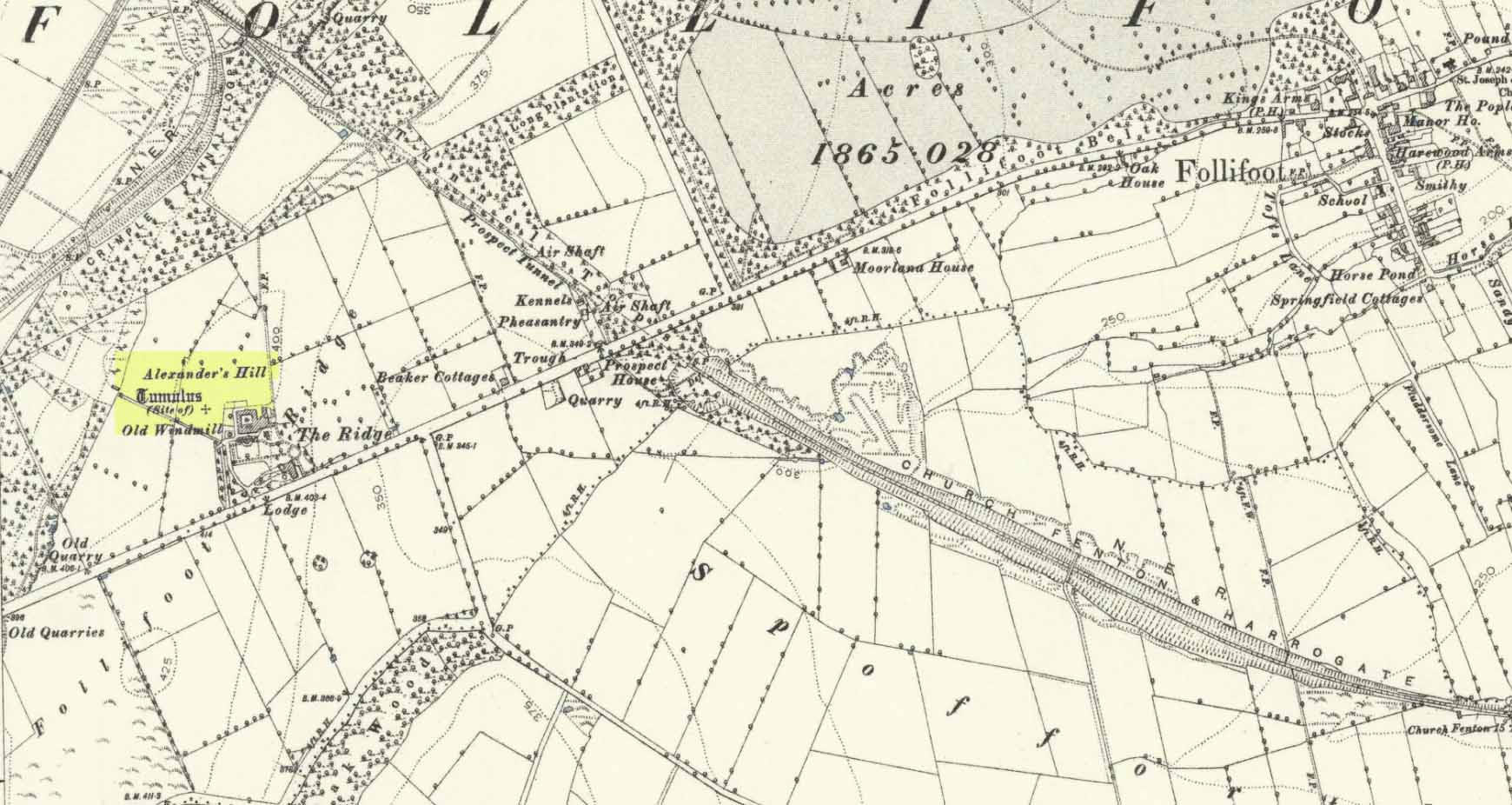
Site of tomb on 1894 map
We are thankful that the antiquarian James Wardell (1881) gave us some details of this long lost site in his survey of prehistoric remains, otherwise information about it would certainly have been lost. Prehistoric burial mounds are rare in this part of Yorkshire, but on the rise of land behind Follifoot Ridge house could once be seen “a large barrow measuring 50 feet in diameter.” Believed by Challis and Harding (1975) to have been a late Bronze Age structure, the story of its demise was told by Wardell as follows:
“This monument of a former age…exists no longer, owing to the ignorance and cupidity of the surveyors of the highways of the township in which it was situate; by whose orders the stones, of which it was partially composed, were carted away at intervals, during a period of some five or six years, to keep in repair a neighbouring road. At the base were several very large stones, probably a kistvaen, and at the same time were found fragments of urns, bones and ‘pieces of brass’, which immediately became dispersed. Some of the latter articles came into the possession of the village smith, from whom this information was obtained, and were disposed of by him to a brass-founder as old metal, and in due time, doubtless, found their way to the foundry. From the description given of them by this person, there seems to have been amongst them some spear-heads and a palstave, but after a most diligent inquiry, there could not, as might be expected, anything whatever be recovered. I should say that from weapons of bronze being found in this huge sepulchral mound, it was not one of the most ancient kind, but has perhaps covered the remains of British warriors slain in conflict with the Roman invaders… I am indebted to Mr John Dixon of Leeds for the information relating to the demolition of this barrow, which was only obtained by him after a lengthy enquiry; and he states that on his visit to the site, it could distinctly be traced by the grass there being of a darker hue than in other parts of the field.”
A mile to the northwest, one would have been able to see the Stone Rings of Pannal, also destroyed, and the two sites may have served some geomantic relationship with each other.
References:
Challis, A.J. & Harding, D.W., Later Prehistory from the Trent to the Tyne, BAR: Oxford 1975.
Wardell, James, Historical Notes of Ilkley, Rombald’s Moor, Baildon Common, and other Matters of the British and Roman Periods, Joseph Dodgson: Leeds 1869. (2nd edition 1881).
Acknowledgements: Big thanks for being able to use the 1st edition OS-map for this site profile, Reproduced with the kind permission of the National Library of Scotland.
This was an impressive site by the sound of things. Sadly destroyed, its exact whereabouts isn’t clear but should—if the description of the site is anything to go by—be on one of the highest points of land around Langside Farm. In Irving & Murray’s description (1864), they tell the cairn to have been one amidst a cluster of tombs that could once be seen “a mile to the south of his residence”, but this seems to be contested by the definitive pen of the Lesmahagow historian, John Greenshields. (1864) He told us:
“The late Lord Corehouse had an excavation scientifically made of a karn or cairn on his farm at Longside. It is to be regretted that information cannot now be obtained of so accurate a nature as the subject merits; but there were stones so arranged in the centre as to have been evidently intended for sepulchral purposes. Two rude urns of baked clay, one very large, the other smaller, were found inside a stone coffin. The small urn contained bones partially calcined and broken or pounded, some of them perfectly fresh. It has been erroneously stated in Swan’s “Views of the Clyde,” that there were eighteen small urns around the large chest, in the form of a circle, which gave rise to the idea that the remains of the chief had been surrounded by those of his family or warriors. One of the urns has been lost sight of: the smaller one, about 6 inches in diameter at the top, and 4 in height, is now in the possession of Miss Edmondstoun Cranstoun, as well as a still smaller funerary urn, recently restored by kiln-burning it with some fresh clay.”
Royal Commission on the Ancient and Historical Monuments of Scotland, Lanarkshire: An Inventory of the Prehistoric and Roman Monuments, HMSO: Edinburgh 1978.
Swan, Joseph, Views on the Clyde – Historical and Descriptive, Joseph Swan: Glasgow 1830.
When the local historian John Greenshields (1864) wrote his definitive history of Lesmahagow parish, the book was just going to press when the remains of an ancient tomb was unearthed. We are fortunate that he held publication of the book before adding the brief information about the findings. He told us:
“When these pages were passing through the press, a stone cist was discovered on the farm of Eastwood, by the hollow sound emitted when the ploughshare struck its lid. It was of the usual dimensions (about three feet by two), and contained fragments of bones, and a cinerary urn. There were no indications that a cairn had ever been heaped on its top, but the stones may have long since been removed, as the field was in a high state of cultivation. The bones were much decayed, and the urn was shivered to fragments by the finder, in his anxiety to discover hidden treasures of gold or silver.”
No further information is known to exist about this site. In all probability the cist was Bronze Age in nature, possibly earlier. We surmise this from the rapid rate of decay of artefacts upon it being unearthed.
References:
Greenshields, John B., Annals of the parish of Lesmahagow, Caledonian: Edinburgh 1864.
Royal Commission on the Ancient and Historical Monuments of Scotland, Lanarkshire: An Inventory of the Prehistoric and Roman Monuments, HMSO: Edinburgh 1978.