Fairy Oak, Killin, Perthshire

Legendary Tree:  OS Grid Reference – NN 57 33

  1. Coin Tree

Folklore

The Fairy Oak of Killin

Nothing has previously been written of this site.  Its existence came to light during one of umpteen enquiries I’d made with a well-known and very respected local lady, born and bred in Killin (sadly, a dying breed), who is known as a fount of knowledge regarding the history of the area.  We were talking about the ancient sites and folklore of the neighbourhood and, amidst being her usual helpful self she asked, “have you been to the Coin Tree?  The place where we leave offerings to the spirit of the place?”

I hadn’t.

“No, I’ve never heard of the place.”

“We keep it quiet, ” she said, “for obvious reasons.”

I knew what she meant.  The Fairy Tree at Aberfoyle is a case in point: littered with plastic pentagrams, children’s toys and so-called “offerings” of all kinds that have made it little more than a dumping ground for pseudo-pagans and new-age nuts that needs to be cleaned regularly by local folk.

Anyhow, our informant proceeded to give us directions to find the place, going out of the village, but asked that if we were to write about it, to keep its location quiet, “as the place is still used by us”—i.e., old locals.  After a slow trek along one of the roads out of the village we saw nothing that stood out.  Eventually we came across a fella relaxing in his garden and asked him if he knew anything about an old tree where offerings were made.  He gave us that look that olde locals do, to work out whether you’re a tourist or not and, after telling him what we’d been told and who had told us —that seemed to do the trick!

“You’d mean the Fairy Oak I s’ppose?  Aye,” he said, “gerrin the car and I’ll drive y’ down to it.”

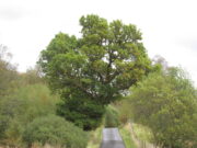
So we did.  A short distance back along the road that we’d come down he stopped and walked along a to large oak tree beside the road.  We’d walked straight past it—but in truth it’s not a conspicuous tree and unless you were shown where it was, you’d miss it as easily as we did (and I’m usually damn good at finding such things!).  We thanked the fella for taking us to see it and he drove back home to leave us with out thoughts.
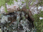
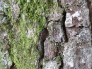
More coins as offerings
Coins for the little people

Embedded into the tree—some of them barely visible where the bark had grown over them—were clusters of old coins all around its trunk; some of them very old.  These had been inserted into the tree as offerings in the hope that the little people, or the genius loci would bring aid to that which was asked of it.

In a field across the road there’s a large “fairy-mound” hillock: one of Nature’s creations, but just the sort of place where many little people are said to live in many an old folk-tale.  Some such mounds are old tumuli, but this aint one of them.  It’s possible that it had some relationship with the tree where the fairy folk are said to reside but, if it did, our informants didn’t seem to know.

The important thing to recognise here is that in some of the small villages and hamlet in our mountains, practices and beliefs of a world long lost in suburbia are still alive here and there… But even these are dying out fast, as most incomers have no real attachment to the landscape that surrounds them.  Simply put: they see themselves as apart from the landscape as opposed to being a part of it.

© Paul BennettThe Northern Antiquarian 

Denny Bridge, Denny, Stirlingshire

Cist (destroyed):  OS Grid Reference – NS 808 830

Archaeology & History

A small and seemingly prehistoric grave, or cist, destroyed sometime around 1840, once existed on the top of a large hillock close to the River Carron where the bridge leads from Dunipace to Denny.  Thankfully, memory of its existence was preserved by Robert Watson (1845) in his short description of Dunipace parish.  He first began by talking of some large natural mounds on the eastern side of the township which, folklore told, gave rise to the place-name Dunipace; but from those mounds,

“About two miles to the westward of these hills, there was a very beautiful one about forty feet in height, and covering nearly three roods of ground, said also to be artificial.  This hill was mutilated, from time to time, for the purpose of repairing roads and other purposes.  It was entirely removed about six years ago, to form an embankment on the turnpike road near Denny bridge. The strata of which this hill was composed, were carefully observed during its removal. These were so regular, and as if rising out of, and gradually returning again to similar strata in the circumjacent level ground, as to afford conclusive evidence that the hill was not the work of man.  On the top of this hill, and about three feet below the surface, was found a coffin or tomb, composed of five large un wrought stones, in which were the bones of a human body, scull and teeth not much decayed.  Along with these, was a vase of coarse unglazed earthenware, containing a small quantity of material resembling the lining of a wasp’s nest, probably decayed paper or parchment, which in the lapse of ages had assumed that appearance.  No conjecture could be formed about the individual here interred, tradition being entirely silent on the subject ; but this circumstance corroborates the opinion of some writers, that the hills of Dunipace might have been used as burying-places for ancient chiefs.”

The site was included in the Royal Commission’s (1963:1) Inventory, but they found no additional data about it.

References:

  1. Royal Commission on the Ancient & Historical Monuments Scotland, Stirling – volume 1, HMSO: Edinburgh 1963.
  2. Royal Commission on the Ancient & Historical Monuments of Scotland, Archaeological Sites and Monuments of Stirling District, Central Region, Society of Antiquaries of Scotland 1979.
  3. Watson, Robert, “Parish of Dunipace,” in New Statistical Account of Scotland – volume 8, William Blackwood: Edinburgh 1845.

© Paul BennettThe Northern Antiquarian 

Gerchew Well, Balfron, Stirlingshire

Healing Well (lost):  OS Rid Reference – NS 579 884

Archaeology & History

One-and-a-half miles east of Balfron, this curiously-named well could once be seen – and indeed may still be there.  Mentioned just once in D.S. Buchanan’s (1903) Guide as a well-known place, I’ve been unable to locate it and can find no other accounts of the place. He wrote:

“A little beyond Dailfoil there is a road to the right, down which, about 200 yards, there is a stile over the fence, only a few feet from the famous Gerchew Well, on the banks of the Endrick.  Here the visitor can repose for a time under the shade of the trees, and quench his thirst in its pure, cool, and bubbling waters.”

His directions seem to indicate it as being just off the small road that runs to the ruins of Easter Gerchew, but there is nothing of note hereby.  A half-mile away was Wester Gerchew house, which seems contrary to his directions —and there’s nothing in evidence there either.  And so I enter it here in the hope that someone might be able to relocate this healing well. (the grid reference is an approximation based on Buchanan’s description)

References:

  1. Buchanan, D.S., Buchanan’s Popular Illustrated Guide to Strathendrick, Aberfoyle and District, J. & C. Buchanan: Balfron 1903.

© Paul BennettThe Northern Antiquarian

Balgair Moor, Fintry, Stirlingshire

Standing Stone:  OS Grid Reference – NS 60774 90383

Getting Here

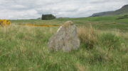
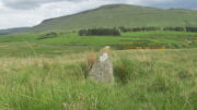
Balgair Moor stone

Go up the B822 road from Fintry for literally 2.5 miles (about 500 yards below the small copse of trees that almost hide Balafark Farm above you) and at a very small ‘parking’ spot are 2 farm-gates.  Go through the lower of the two and head downhill, crossing the small burn and up the other side for just over 100 yards where you’ll meet a very low, old and very overgrown wall.  Keep your eyes peeled for it!  Walk left along this wall, uphill, for another 100 yards till you meet a a dried-up dyke that runs downhill.  10-15 yards down this, a small stone greets you…

Archaeology & History

It’s difficult to call this a ‘standing stone’ and, as far as I’m concerned, is even more troublesome to cite it as a legitimate prehistoric monument.  Nevertheless it is shown on the modern OS-maps as such and was listed by the Royal Commission (1963:1) lads in their standing stones inventory.  But it’s really pushing it to be honest!  They told us:

“This stone stands about 180 yds NW of a gate which opens off the Fintry-Kippen road, 340 yds N of its crossing of the Lernock Burn.  It is triangular in profile and wedge-shaped in section, measuring 3’3″ both in height and breadth along its base, by 1’7″ in greatest thickness.  It may well have been a boundary stone as it is near the corner of some ground which is enclosed by a turf dyke and has been cultivated.”

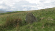
Looking southwest
Looking up to the ancient cairn of Stronend

In truth, if we call this a standing stone, then there are hundreds of others that I’ve come across over the years—frobbling off-path across huge swathes of moorland—that must also be added to our prehistoric inventories, as the height of this isolated rock is echoed in countless others which are off the archaeological listings.   One such stone ‘stands’ 100 yards northeast of here—although there are many others with  much greater potential.  …I think the only thing that may sway this as being a possible prehistoric upright is the fact that the top of the stone appears to have been broken off, albeit a few hundred years ago if the weathering is owt to go by.   But a cursory look for any broken top-piece found nothing.

References:

  1. Royal Commission on the Ancient & Historical Monuments Scotland, Stirling – volume 1, HMSO: Edinburgh 1963.

© Paul BennettThe Northern Antiquarian

St. Serf’s Water, Crieff, Perthshire

Cist:  OS Grid Reference – NN 8488 2344

Also Known as:

  1. Canmore ID 25503

Archaeology & History

Were it not for the valuable records in the Scottish Statistical Accounts, we’d have lost all knowledge of this site.  It was described in notes by by Colin Baxter (1793), where he told us:

“About 200 yards west from the church of Monivaird, a barrow was opened some years ago, in which two urns were found, each containing a stone of a bluish colour, very hard about four inches long, and of a triangular shape, somewhat resembling the head of an axe.”

The site was subsequently mentioned in the Ordnance Survey Name Book of the parish, with some additional bits of information:

“In the year 17–, there was found, about one hundred yards to the westward of the old church of Monzievaird, a barrow containing a stone-coffin, in which were inclosed two coarse earthen urns, the one filled with burnt bones, the other containing the bones of the head.  Of these, the under jawbone and the teeth were very entire.  In the stone coffin was also found a stone hatchet, bluish-coloured, very hard, about four inches long, and of a triangular shape, a remain which proves the barrow of very remote antiquity – prior to the use of iron. The stone hatchet is preserved at Ochtertyre.”

No traces remain of the site; and although the stone axes came to be in the possession of Sir William Murray of Ochtertyre, the urns and other remains have long since been lost.

Folklore

The name of ‘St Serf’s Water’ derives from it this area being dedicated to St Servanus in early times; the holy well of St Serf could be found a short distance south from where this tomb was built.

References:

  1. Baxter, Colin, “United Parishes of Monivaird and Strowan,” in Statistical Account of Scotland – volume 8, William Creech: Edinburgh 1793.
  2. Porteous, A., “Extracts from a History of the Parishes of Monivaird and Strowan“, in Archaeologia Scotica, volume 2, 1822.

© Paul BennettThe Northern Antiquarian

St. Serf’s Well, Crieff, Perthshire

Holy Well (lost):  OS Grid Reference – NN 8457 2323

Archaeology & History

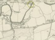
St Serfs Well on 1866 map

A mile to the west side of Crieff, in the grounds of the 18th century mansion known as Ochtertyre House, could once be seen the little-known sacred well of St Serf.  Sadly its waters seem to have disappeared beneath the rising waters of the loch known as St Serf’s Waters—which is a pity, as the place was of importance in the annual traditions of the local people, who left offerings to the spirit of the place, as was common in days of olde.  It was described in Mr Porteous’ (1822) account of Monzievaird parish, in which he told that,

“Nigh to this place is St Serf’s Well, and the moor whereon St Serf’s market is held.  He was the tutelary saint of the parish of Monivaird.  This well is a plentiful spring of water.  About sixty years ago, our people were wont, on Lammas day, to go and drink it, leaving white stones, spoons, or rags, which they brought with them; but nothing except the white stones now appear, this superstitious practice being quite in oblivion.  It has been useful in a strangury, as any other very cold water would be; for a patient, taking a tub full of it immediately from the well, plunging his arms into it, which were bare to the elbows, was cured.

“St Serf’s fair is still kept on the 11th of July, where Highland horses, linen cloth, etc., both from the south and north, are sold.”

Although the well is deemed to be ‘lost’, it is possible that its waters might be seen after a good drought.  Please let us know if that happens.

Folklore

St. Serf was said to have been a hermit and tutor of the more renowned St. Mungo.

References:

  1. Morris, Ruth & Frank, Scottish Healing Wells, Alethea: Sandy 1982.
  2. Porteous, A., “Extracts from a History of the Parishes of Monivaird and Strowan“, in Archaeologia Scotica, volume 2, 1822.

Acknowledgements:  Big thanks for use of the 1st edition OS-map in this site profile, Reproduced with the kind permission of the National Library of Scotland

© Paul BennettThe Northern Antiquarian


St Fillan’s Chair, Killin, Perthshire

Sacred Stone: OS Grid Reference – NN 56432 32010

Getting Here

Take the road to Auchlyne from Killin which follows the north side of the River Dochart, and on the edge of the village the stone will be seen on the left hand side behind a hedge, opposite the entrance to ‘Springburn’.

Archaeology & History 

The chair is mentioned in Rev. Gillies’ exemplary work, In Famed Breadalbane (1938):

St. Fillan would appear to have had a great liking for stone seats.  Besides the one already mentioned…there is..a..flat stone on the top of a knoll about a mile to the west of the village, and on the north side of the river, on which he is said to have sat and taught

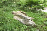
St Fillan’s Chair, ‘twixt road and river
The ‘seat’, facing the River Dochart

Two local ladies told us that the Chair had recently been uncovered from the vegetation. It is a flattish earth-fast slab of rock, which has on the right hand side a seat indentation, which faces the river bank about 12 feet away. Its proximity to the river bank would seem to limit its use as a preaching pulpit, and yet, well over a millennium after the death of Fillan, his ‘Chair’ is still remembered. Did the Chair serve another purpose, a purpose that long preceded Fillan and Christianity?

Here at Killin we are in an area of Scotland where Christianity was for long a veil worn very lightly over long-held ancient animistic beliefs and customs. Indeed in the early nineteenth century, missionaries were sent in the face of considerable local opposition by the Haldanes into Gaelic speaking Breadalbane to try to convert the locals to Christianity.

St Fillan and other saints had it seems become the named facilitators for healing at ancient places on behalf of the incoming religion from the Middle East.  To the west of Killin, there are the St Fillan’s Pools at Auchtertyre near Tyndrum, where he is reputed to have cured madness but which continued to be used for that purpose until the late eighteenth century at least.  There are stones for preventing measles and whooping cough near Killin that are still known and pointed out.  So what of our chair?

There is a nineteenth century story of a chair of St Fiacre (Irish born like Fillan) at the village church of St Fiacre near Monceaux in France being used to ‘confer fecundity upon women who sit upon it ‘.  The shape and proximity to the river may otherwise suggest St Fillan’s Chair was a birthing Chair?  Maybe some very old locals still know the true story of this Chair, but would they tell it?

References:

  1. Anon., Phallic Worship – a Description of the Mysteries of the Sex Worship of the Ancients, privately Printed: London 1880.
  2. Calder, Walter, Lawers, Lochtayside: A Historical Sketch, Macduff, Cunning & Watson, c.1930.
  3. Gillies, William, In Famed Breadalbane, Munro: Perth 1938.

© Paul T Hornby 2020

Tammy Mill’s Well, Laurieston, Falkirk, Stirlingshire

Healing Well (lost):  OS Grid Reference – NS 910 790

Also Known as:

  1. Tammy Milns Well

Archaeology & History

This all-but-forgotten site situated somewhere on the north side of Lauriston was mentioned in Falkirk’s Notes & Queries (1906) journal, but its whereabouts is somewhat of a mystery (to me at least!).   In a series of question and answers about the site, the editor of the journal, James Love, told us:

“Mr Charles Brown, factor to the Marquis of Zetland, kindly informs us that on a late occasion there passed through his hands a copy of a feu contract by the Right Honorable Francis Lord Napier in favour of Alexander Cowie, brewer, at New Merchiston (now Laurieston), of a piece of ground lying to the north of Mary Street.  This is dated 7 August, 1762 and contains the following clause:  ‘Providing also that the said Alexr Cowie and his foresaid have the Liberty of the water of Tammy Milns Well in common with the said Lord Napier’s other vassals ay New Merchiston.'”

The well was mentioned again in 1781 with similar historical information.  As to the name of the well, Mr Love wrote,

“it would appear, from the circumstance, that an old infirm man belonging to the village, called Thomas Mills or Milns, used to sit with his wooden cup at the spring which flowed from the face of the hill, over which the present structure now stands, and served out to the weary passers-by the cooling and refreshing draught for any small pittance they in their generosity might think proper to give him.  After the lands of Lauriston passed into the hands of Sir Laurence Dundas, he took the advantage of such a copious supply of what then was pure water, and built the present reservoir over the spring, and had it conveyed to Kerse House by means of leaden pipes.”

But he fails to tell us what “the present structure” was that covered the well, nor the whereabouts of the “reservoir over the spring”; and as there’s no such feature on any of the Ordnance Survey maps at the time he wrote his article, nor beforehand, I remain puzzled as to its exact position.  This situation isn’t helped by the earlier description, which said it was found on “a piece of ground lying to the north of Mary Street”.  There are two wells literlly on the other side of Mary Street, but Kerse House meanwhile—whose water supply came from the well—is about 1½ miles to the north!  All in all there are more questions than answers here.  Added to this, in John Reid’s (2009) magnum opus on local place-names, the site is mentioned, albeit in passing, where he gives us the vague grid-reference of just NS 91 79, but this may just be educated guesswork on his part.  It would be good to know exactly where it was…

References:

  1. Love, James (ed.), “Tammy Mills (or Milns) Well, Laurieston”, in Local Antiquarian Notes & Queries, Falkirk – volume 1, 1906.
  2. Reid, John, The Place-Names of Falkirk and East Stirlingshire, Falkirk Local History Society 2009.

© Paul BennettThe Northern Antiquarian


Castleton (7c), Airth, Stirlingshire

Cup-Marked Stone:  OS Grid Reference – NS  8551 8819

Archaeology & History

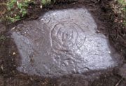
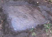
Looking down on C-7c

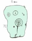
Near the northwestern end of the small geological ridge that runs to the west of Castleton farmhouse, close to an awesome nine-ringed carving, we find this more simplified triple-ringed petroglyph.  And although the carving is easy enough to describe, its labelling (as ‘Castleton 7c’) is rather troublesome.  As with other carvings in this locale, the name of the stone is based on a survey done by Maarten van Hoek in the mid-1990s.  But van Hoek’s sketch of Castleton 7c and the one shown in our photos, whilst very similar, possess attributes that aren’t on van Hoek’s drawing.  Now this isn’t too odd, as many petroglyphs look different when lighting conditions change; to the point where some features you can see one day are almost invisible the next.  But this carving has attributes that are very difficult to miss – and van Hoek’s detailing tended to be good.  But, all this aside: until we can verify with certainty one way or the other and despite my suspicions that this isn’t what van Hoek described, I’m still entering this carving as Castleton 7c. So – now that bit’s out of the way…!

When we visited the site two years ago the day was dark and overcast, so we didn’t really have good conditions for seeing any faint carvings.  But this wasn’t faint, thankfully.  It was completely buried beneath soil and gorse bushes, but thankfully Paul Hornby managed to unearth the one you can see in the photos.  If it is the Castleton 7c petroglyph, it was rediscovered by van Hoek on one of his ventures here in 1985.

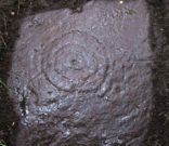
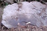
Carving showing wavy lines on right
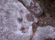
…and from another angle

When we visited the site we only managed to uncover a small section of the stone, as the roots of the surrounding gorse prevented us from seeing more. (it’s tough stuff unless you’ve got the right gardening equipment!)  The section we uncovered consisted of a cup-and-triple-ring.  This is consistent with van Hoek’s sketch and description; but we also found there were two very notable ‘arcs’ on the outer edge of the rings—nearly opposite each other—as if another, fourth ring had been started.  You can’t really miss these elements – and even in the poor lighting conditions we had, these outer arcs are very evident on a number of photos – especially when they are expanded to full-scale.  However, as I mentioned, we were unable to uncover all the rock; but when van Hoek was here there was far less herbage.  What he saw on this carving was as follows:

“Deturfing part of this ridge revealed a fine cup with three rings with a broadly pecked tail; one solo cup; one large oval ring with small central cup; and a faint cup with two rings, the outer one incomplete.  The rock slopes 12º ENE.”

Crap drawing done in crap lighting
van Hoek’s 1996 sketch

The “broadly pecked tail” he mentions is also not really clear in any of the 60 photos we took.  There is a faint line that runs through the three rings, into the central cup and out the other side: a single curving line no less.  It’s certainly visible, but it’s far from broad.  But there are a number of other lines coming out of the rings.  These maybe just natural scratch marks, or even scratches acquired from farming activity.  It’s difficult to say.  In the poor light that we had, there as looked to be a single cupmark a few inches away from the rings, but this isn’t consistent with the position of the cupmark on van Hoek’s sketch.

There’s a simple solution to all this: we need to revisit the site and expose more of the rock.  At least that will tell us once and for all whether this is the same as van Hoek’s stone, or whether we’ve found yet another new carving. Watch this space, as they say! 😉

References:

  1. van Hoek, Martin A.M., “Prehistoric Rock Art around Castleton Farm, Airth, Central Scotland,” in Forth Naturalist & Historian, volume 19, 1996.

© Paul BennettThe Northern Antiquarian


Castleton (5f), Airth, Stirlingshire

Cup-Marked Stone:  OS Grid Reference – NS 85584 88087

Archaeology & History

As with other carvings in this locale, the name of the stone is based on a survey done by Maarten van Hoek. (1996)  It’s a pretty simplistic design within the impressive Castleton complex, found at the southeastern end of the gorse-covered rocky ridge, about 70-80 yards west of the farmhouse.  It was uncovered on a visit here by Nina Harris, Paul Hornby, Frank Mercer and Lisa Samson on Sunday 19 November, 2018.

The cup-marked stone
Large cup & arc of 3

Unlike the others in the Castleton complex, this carving is probably of interest only to the hardcore petroglyph hunters.  The design consists of at least ten cup-marks on the uncovered section of the rock, one of which appears to have a broken circle with two ‘entrances’ either side of it, so to speak.  The most notable element in the design is close to the edge, where an arc of three cups almost corners a larger cup right at the edge.   There may be more carved elements to be found on the westerly side of the stone, which was covered in deep vegetation when we came here.

References:

  1. van Hoek, Martin A.M., “Prehistoric Rock Art around Castleton Farm, Airth, Central Scotland,” in Forth Naturalist & Historian, volume 19, 1996.

© Paul BennettThe Northern Antiquarian