Cup-and-Ring Stone (lost): OS Grid Reference – NO 0654 2296
Archaeology & History
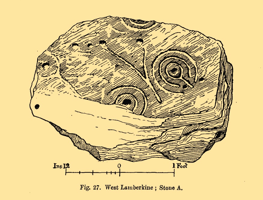
All trace of this carving seems to have gone. It was first recorded by the great Fred Coles (1903) who found it within a small group of stones, but no one has seen it since. Unless it’s been shifted into one of the nearby walls, it may have been destroyed. Coles told us it could be found,
Cole’s 1903 sketch of the carvingStone ‘A’ is the culprit
“at a point 333 yards east of the farm-steadings, where two hedges meet at right angles. Four stones…lie close together. They appear to be all of bastard whinstone. The middle stone, B, has its longer axis ESE and WNW. It is only 3in inches thick. The stones D and C are each 6 inches thick. No marks are to be seen on any of these. But on A is the very distinct sculpturing shown in the illustration…unfortunately not complete, owing to the flaking off of large strips of the weathered lower portion of the slab. There is a strong suggestion of a cist-cover in the shape and size of this stone, which the close proximity of the two other squarer and thinner stones helps to enforce. Though these stones have been known to the tenant for over thirty years, this is, I believe, the first record made of their position and features.”
The records at Canmore have suggested that this lost carving and the missing petroglyph of West Lamberkine (1) nearby are one and the same. This is unlikely. West Lamberkine (1) was described simply as a cup-marked stone, whereas this stone possessed clear identifiable cups and rings. It would be difficult to make such an elementary mistake.
Stone Circle (destroyed): OS Grid Reference – NO 220 416
Archaeology & History
In the first volume of the Royal Society’s Committee on Boulders (yes, there was such a thing!) that was read in April 1872, a megalithic ring was described that stood on the north side of the River Isla, above Coupar Angus. It was told that the minister of Bendochy, Dr Barty, reported to the committee, that
“on the rising ground behind his manse, there was a circle of large stones, boulders, standing on their ends (Druidical); but some years ago they were removed. The place is yet called ‘The Nine Stanes.'”
Despite its destruction, in recent times aerial photography has identified a number of features in the field above the manse, including what seems to be an enclosure and some disc-shaped cropmarks. One of these may be the shadow marks of the circle.
References:
Home, David Milne, First Report by the Committee on Boulders, Royal Society Edinburgh 1872.
Holy Well (destroyed): OS Grid Reference – NS 4631 7307
Also Known as:
Trees’ Well
Archaeology & History
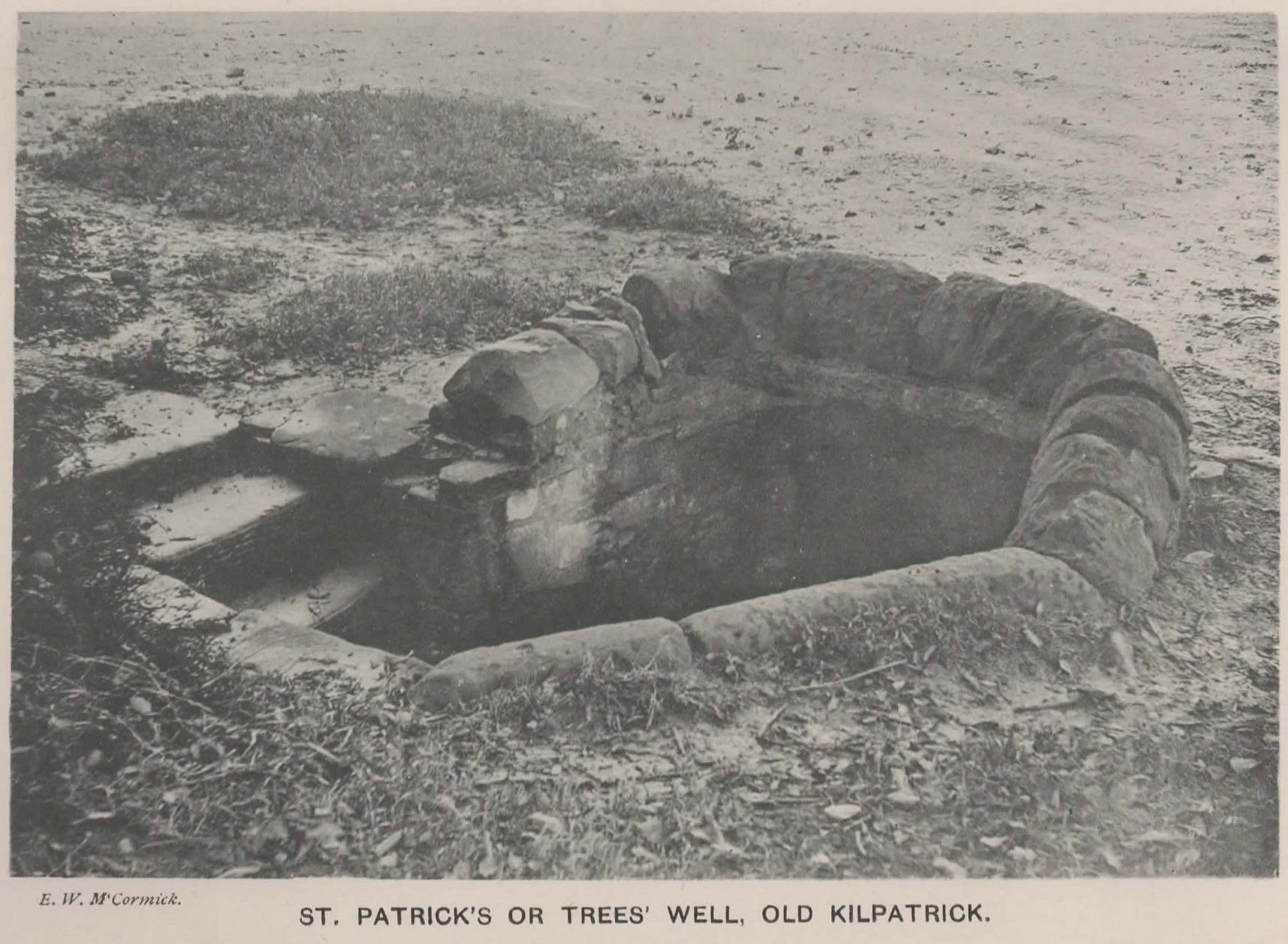
Photo of the Well in 1893
Sadly there are no longer any remains of this holy well which was found, “beside the church dedicated to St Patrick — which was said to be built on soil brought from Ireland in honor of its patron,” wrote John Bruce in 1893. He told that its waters had “been used until lately from time immemorial by the villagers, but now has been found unfit for use and consequently ordered to be closed up.” Although its waters were used for baptisms, he made no mention of any medicinal repute, which it surely would have possessed.
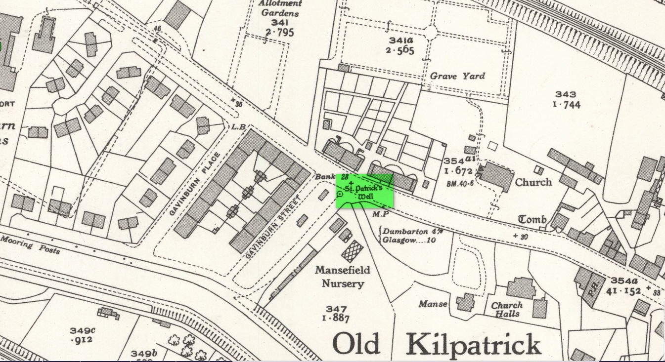
Site of well on 1939 map
The original position of the well, according to Mr Bruce, was “adjoining the church” but, according to the Ordnance Survey lads, when they came here in 1963 they located a drinking fountain on the other side of the road about 80 yards to the west and designated that as being St Patrick’s Well. The place had earlier been given a wooden sign saying “St Partrick’s Well.” Local tradition attributes St. Patrick as originally coming from this village, whose saint’s day is March 17.
The place was also known as Trees’Well, suggestive, perhaps, of a local person, although I can find no reference as to who or what that might have been.
References:
Bruce, John, The History of the Parish of West or Old Kilpatrick, John Smith: Glasgow 1893.
Acknowledgements:Huge thanks for use of the Ordnance Survey map in this site profile, reproduced with the kind permission of the National Library of Scotland.
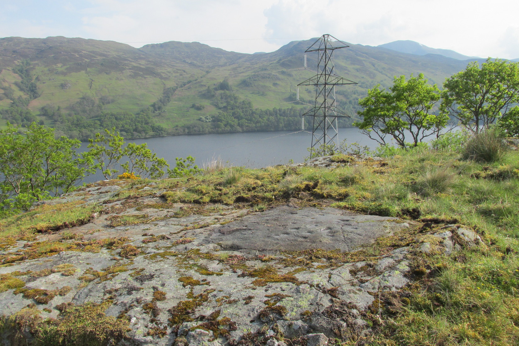
1½ miles out of St Fillans on the A85 road towards Lochearnhead you reach the boating marina by the lochside. 100 yards or so past this, park up. Cross the road and walk 50 yards to your right then follow the dirt-track up into the trees. After ⅓-Mile (0.5km) turn left to the old house on your left and follow the green path around it, then around the right-side of the rocky knoll to the Wester Glentarken (1) and (2) carvings. From here walk straight uphill, direct north, past the pylon and onto the rocky outcrop behind the gorse shrubs. You’re here!
Archaeology & History
Away from the edge of this relatively flat rock surface, hemmed in between three geological scars, this decent petroglyph shows its memory to prying eyes. It was first described by George Currie (2005) as being just “17 cups (and) one pair of cups are linked”, but there are, as usual, more elements to it than that.
Faint cup-&-rings visible
As we can see quite clearly in the photos here, two of the cups possess rings around them. One of the cup-and-rings near the middle of the mass of cups is complete, with a short line running out of it and into the longest of the natural cracks that frame the design and that runs all the way across the surface of the stone. This cup-and-ring plays a part in a rough circle of cup-marks surrounding a central cup, with one of the outer cups possessing a companion just outside the ring. Two cups in this circle are elongated. There is a possibility that the cup-and-ring I’ve mentioned has another line running from it into the cupmark at the centre of the circle.
On the same side of the long natural crack, outside the circle of cups, is another cup with a faint ring around it. Tis difficult to say whether or not this was originally complete, but when we zoom in it’s pretty damn close!
Framed secondary clusterThe carving when dry
On the other side of the long natural crack is a haphazard spread of nine more cup-marks, with at least one of them seeming to possess a very faint incomplete ring around it. You can just make it out in one of the attached photos. From some angles it seems that two other cups may possess fragments of carved rings around them, but more visits are needed in better light before we can say this with any certainty. One of the cups in this cluster is elongated, whilst two other cups in this bunch are conjoined. Another crack to the side of this secondary cluster has one or two more cups cut into it. Altogether we have between 19 and 21 cups on this petroglyph, with rings around several of them. Worth checking out when you visit this neck o’ the woods. And, of course, if you’re a serious rock art researcher, scan the slopes hereby as other carvings yet remain hidden. You can almost feel them breathing…..
References:
Currie, George, “Wester Glentarken, Perth and Kinross (Comrie parish), Cup-marked Rocks,” in Discovery & Excavation Scotland, volume 6, 2005.
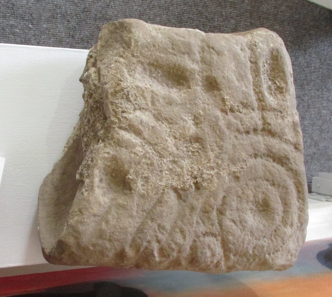
One of two petroglyphs housed in the Gala House Museum, whose background is somewhat of a mystery. When the northern antiquarian Paul Hornby visited the museum, his enquiries regarding its history and place of origin drew a blank. This small squared block of stone has obviously been broken from a larger piece, but the whereabouts of its adjoining fragments are unknown. The section that remains that we see here is somewhat more complex than it’s companion petroglyph, comprising as it does (in the photo on the right) a concentric cup-and-two-rings,with another arc above it that has a carved line running vertically into it. An elongated cup-mark sits to the side of this line. On the lower-left side we can see where a fragment of the stone has been broken off and here is a cup marking with a double arc above it, that may originally have been another cup-and-two rings. The curious angular lines at the bottom of the stone look like more recent scratches, perhaps from an industrial machine (tractor?) created when the stone was moved from its place of origin. If anyone knows anything about this carving, please let us know.
Acknowledgments: Big thanks to Prof Hornby for use of his photo.
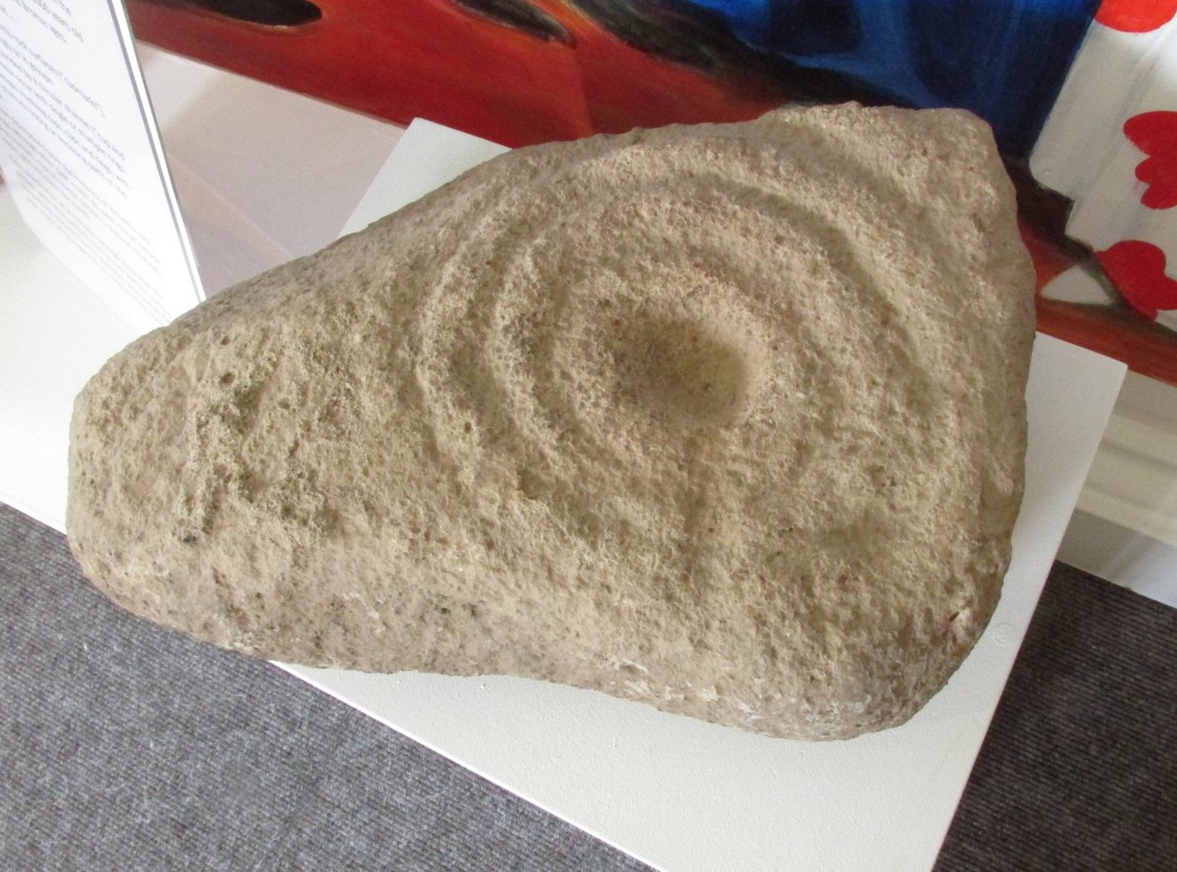
Cup-and-Ring Stone: OS Grid Reference – NT 4917 3590
Archaeology & History
Gala House Museum stone
A curious stone, inasmuch as nothing seems to be known about it! When the northern antiquarian Paul Hornby visited the Gala House Museum he was pleasantly surprised to find this multiple-ringed petroglyph on display. Upon enquiring as to its history and original location, he was informed that it had been donated locally but nothing was known about it. Incredible! One of two carvings in the museum (the origin of the other carving is equally mysterious), this portable petroglyph has three rings surrounding the central cup, which has a short line running out of it and to the edge of the third ring. The petroglyph may have come out of a nearby prehistoric tomb. If anyone knows anything about this carving, please let us know.
Acknowledgments: Big thanks to Prof Hornby for use of his photo. 🙂
Standing Stone (destroyed): OS Grid Reference – NO 483 603(approximation)
Archaeology & History
In an area once teeming with megaliths, this is but one that lost its life in the 19th century. It would seem that the only reference of its existence—and demise—comes from the pen of the great regional historian Andrew Jervise (1853) who, in a description of the nearby holy well of St Ninian, in a field near Wellford,
“within the last half century there were two or three large rude boulders nearby, which were called Druidical stones.”
References:
Jervise, Andrew, The History and Traditions of the Land of the Lindsays in Angus and Mearns, Sutherland & Knox: Edinburgh 1853.
Cup-Marked Stone (lost): OS Grid Reference – NO 003 650
Archaeology & History
When you’ve visited the impressive cup-marked stone at Dalnavaid, this long lost carving might be worth seeking out by the real explorers among you. It’s not been seen for a hundred years and was only reported in brief by the reputable local historian Hugh Mitchell (1923). It’s located a mile north of the Dalnavaid carving, up in the hills on the other side of the road, “on the East side of Clunskea Burn, and on the West shoulder of Ben Skievie.” He described the carving as “having some 16 or 18 cups, and at present it forms part of a grouse butt.”
So if we locate the grouse-butt (they’re usually not too difficult to find), the carving will obviously follow. Mitchell gave us an extra piece of info regarding its location. He described the existence of several other seemingly prehistoric remains within a few yards of the grouse-butt, curious “pit dwellings”, three of them:
“they are of circular shape, about 9 feet in diameter and nearly 5 feet below the surface of the ground, and had evidently been roofed over at one time. The entrance to each is at the lowest level and acts as a drain, to keep the house dry. They are almost the only examples in the district of neolithic dwellings.”
Let us know if you find it!
References:
Mitchell, Hugh, Pitlochry District: Its Topography, Archaeology and History, L. Mackay: Pitlochry 1923.
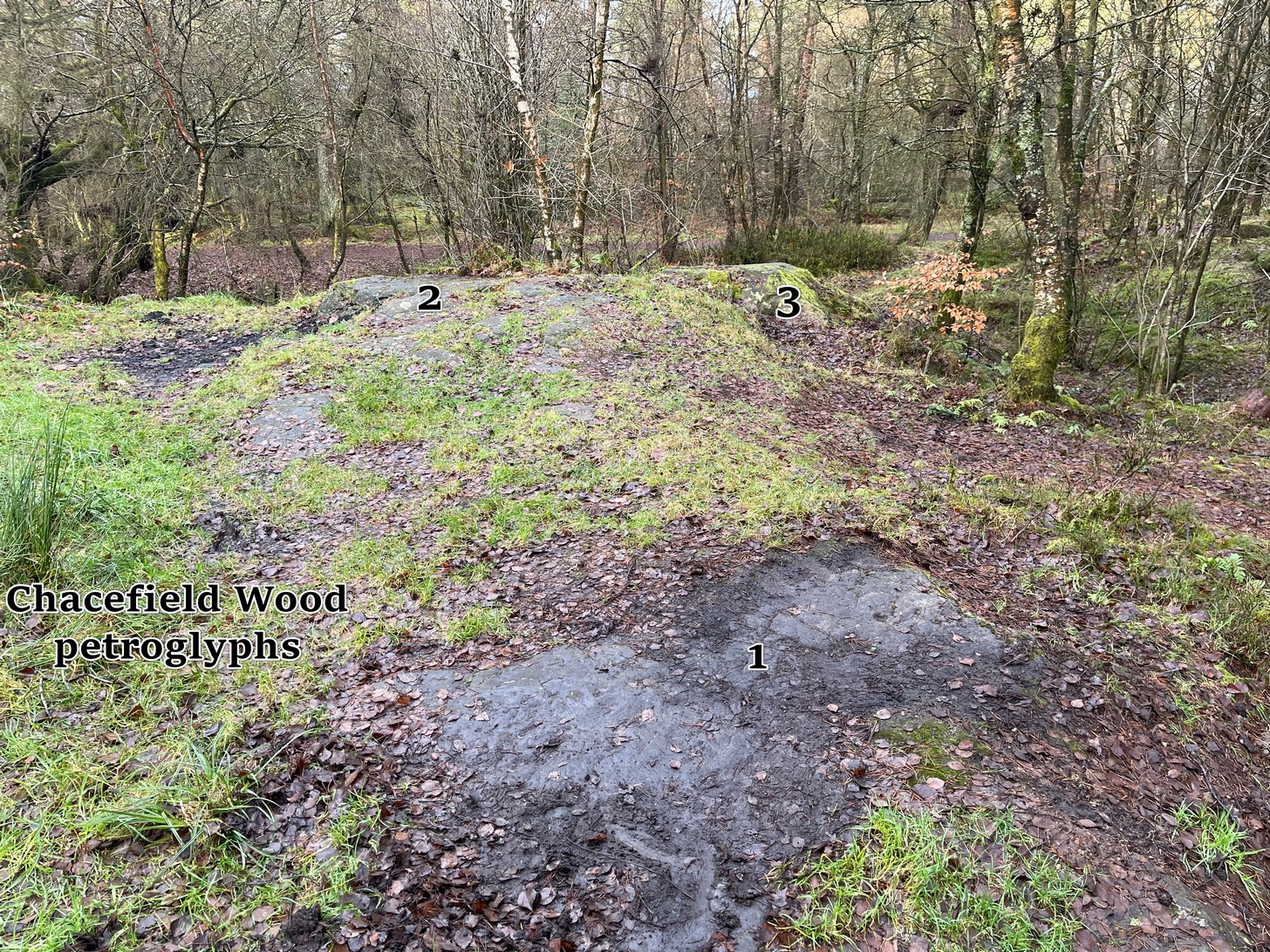
We took the A872 road on the south-side of Denny to Dennyloadhead and Longcroft, but a few hundred yards before you go under the M876, keep your eyes peeled for Drove Loan on your left. Go down here for literally ¼-mile (0.4km) where there’s a footpath into the woods on your left. Walk on the path into the trees and you’ll reach a track that heads to your right (east). Less than 200 yards on, you’ll see a pond on your right and above here is a small quarried rock outcrop. This carving’s up top, on the gently sloping rock behind carvings no.2 and no.3.
Archaeology & History
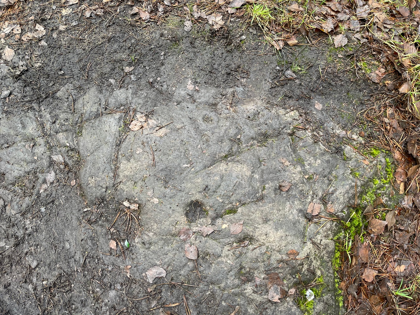
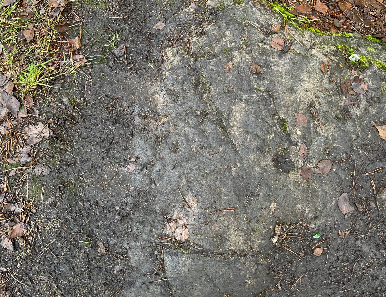
Half-covered in mud and vegetation, the first thing you’ll notice on this sloping smooth surface is what looks to be a standard cup-marking, all on its own. But it has company—albeit quiet and faint. A single incomplete cup-and-ring can be seen about 18 inch above (north-ish) this single cup-mark, which may itself be natural. You can make out the cup-and-ring pretty clearly in the photos.
When we found this, we began to clear the rest of the stone but stopped pretty quickly as a scatter of broken glass was mixed into the mud and I was lucky not to cut my hand open. Some kids have evidently been getting pissed here and have left their mess on the rock. But there may well be more symbols beneath the mulch, so if any local folk want to clean it, please make sure to wear some good gardening gloves to protect your hands! And if you find any other hidden elements, please let us know! 🙂
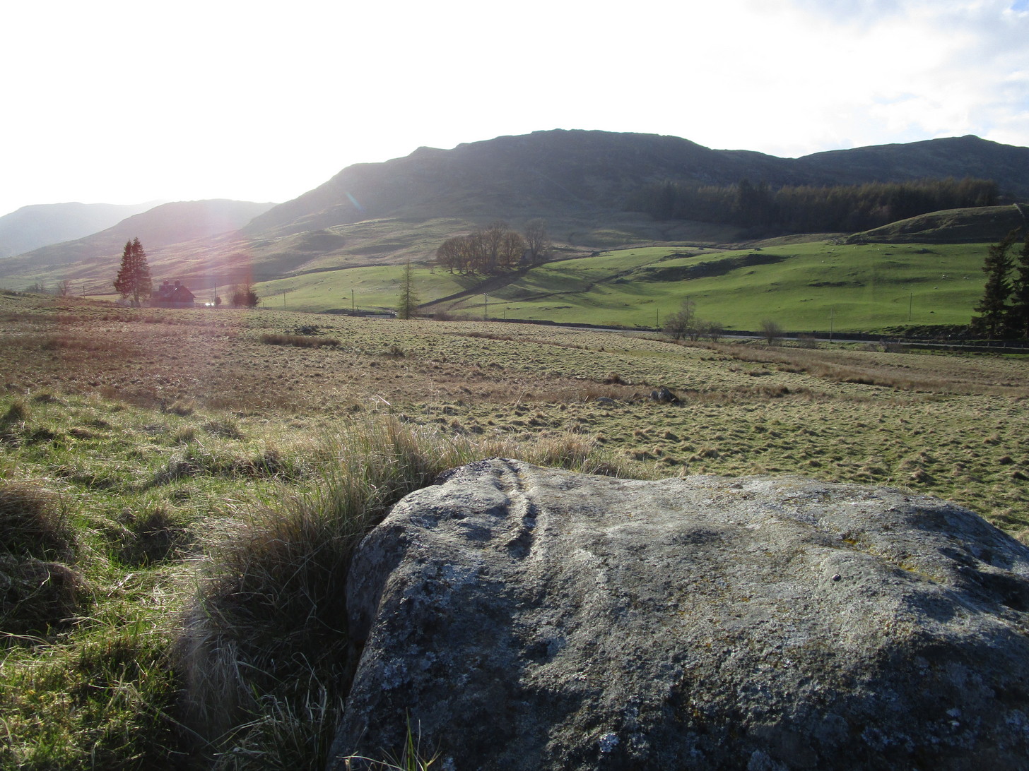
The quickest and easiest route is to take the A924 road from Pitlochry to Kirkmichael. It’s a gorgeous route in itself! Anyhoo… Once you’re out past the houses of Pitlochry and Moulin, you begin to make the real ascent up the winding road, past the hairpin bend and, 5 miles up where the road has levelled out and the craggy moorlands surround you, green fields begin to appear on your left. The first farm on your left is Dalnacarn and less than a half-mile past here, on your right, a small track takes you to Dalnavaid house. Walk along here, past the house and into the field, then the next field where a section rises up towards the fencing. On top of this are several rocks. You can’t really miss it!
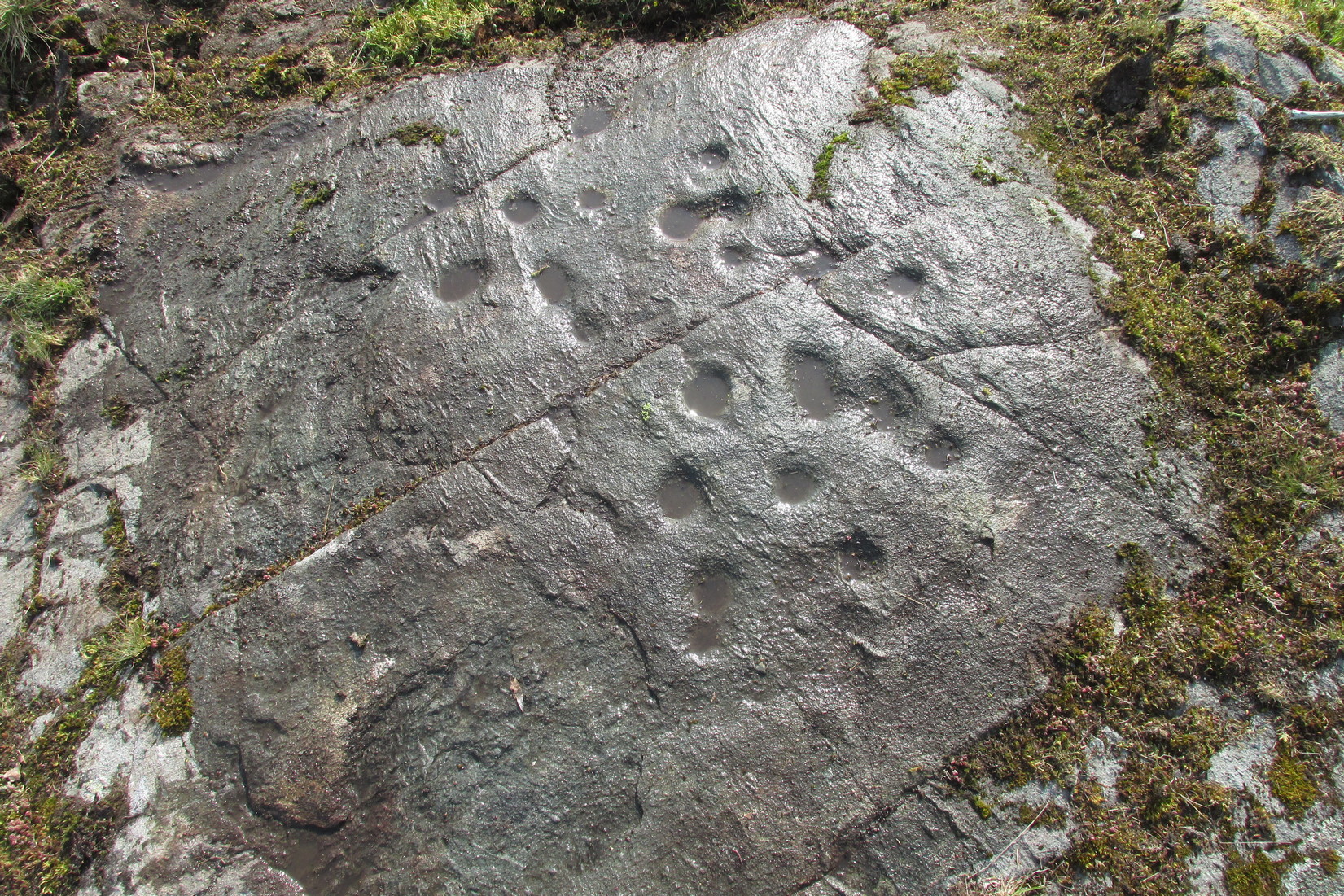
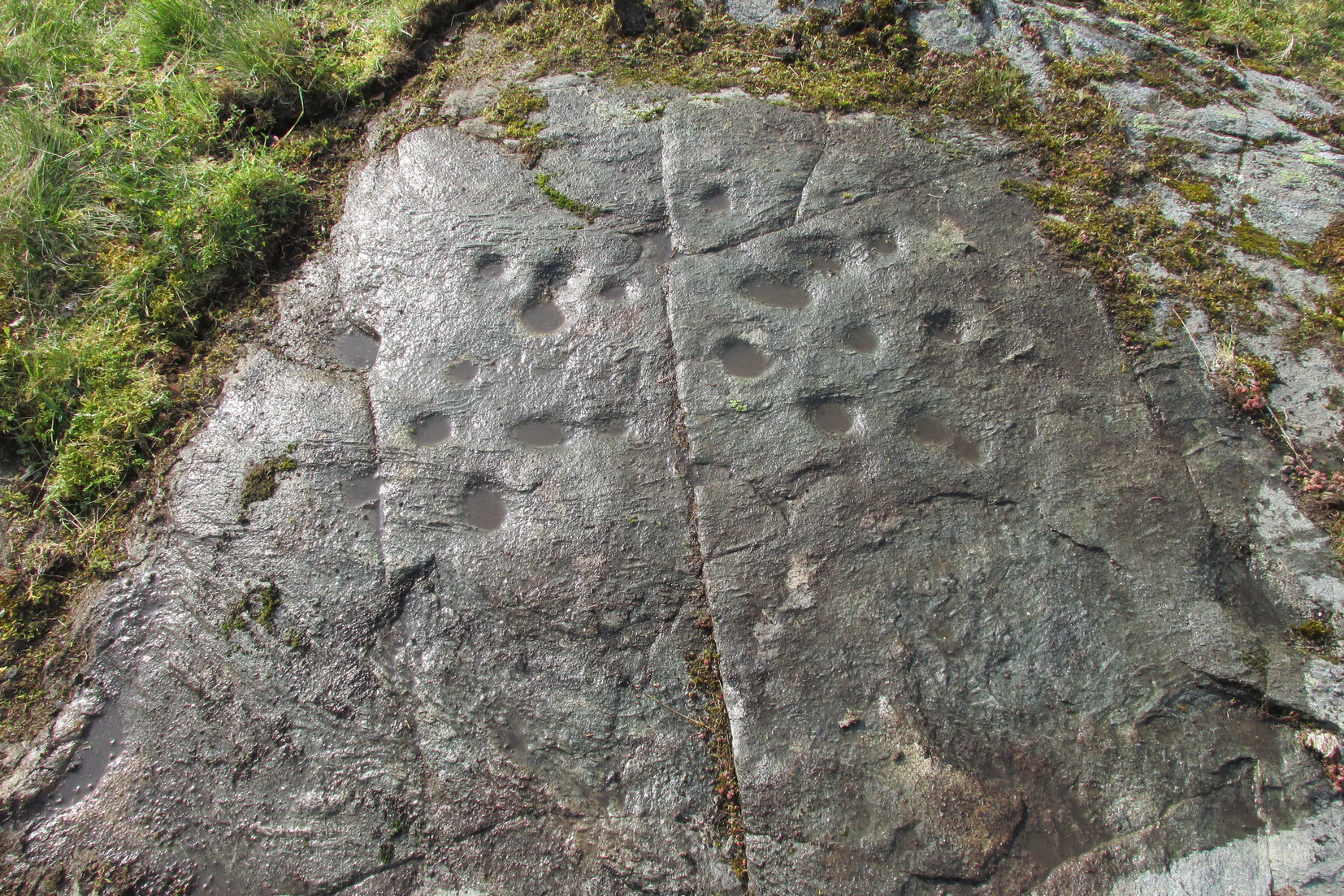
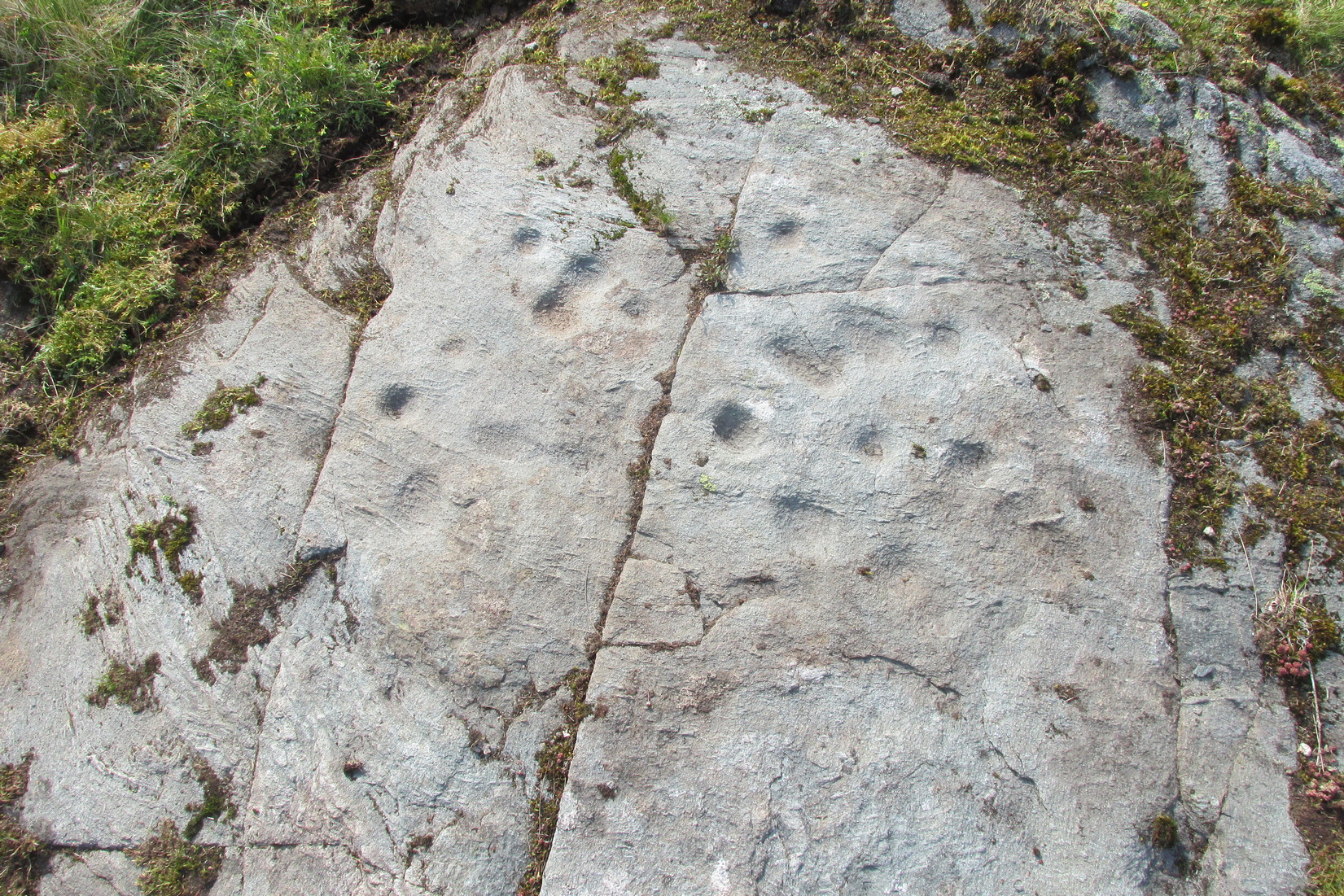
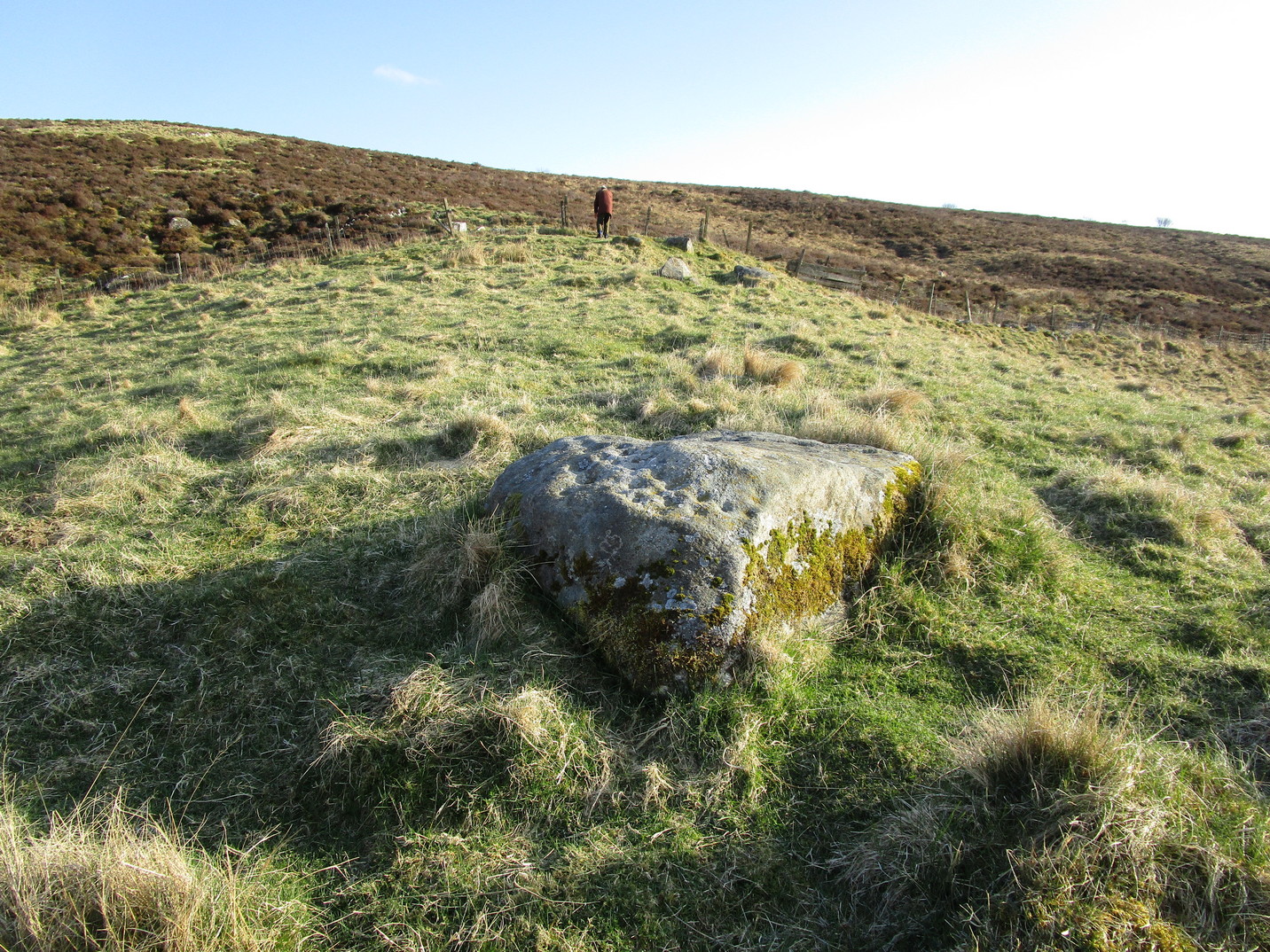
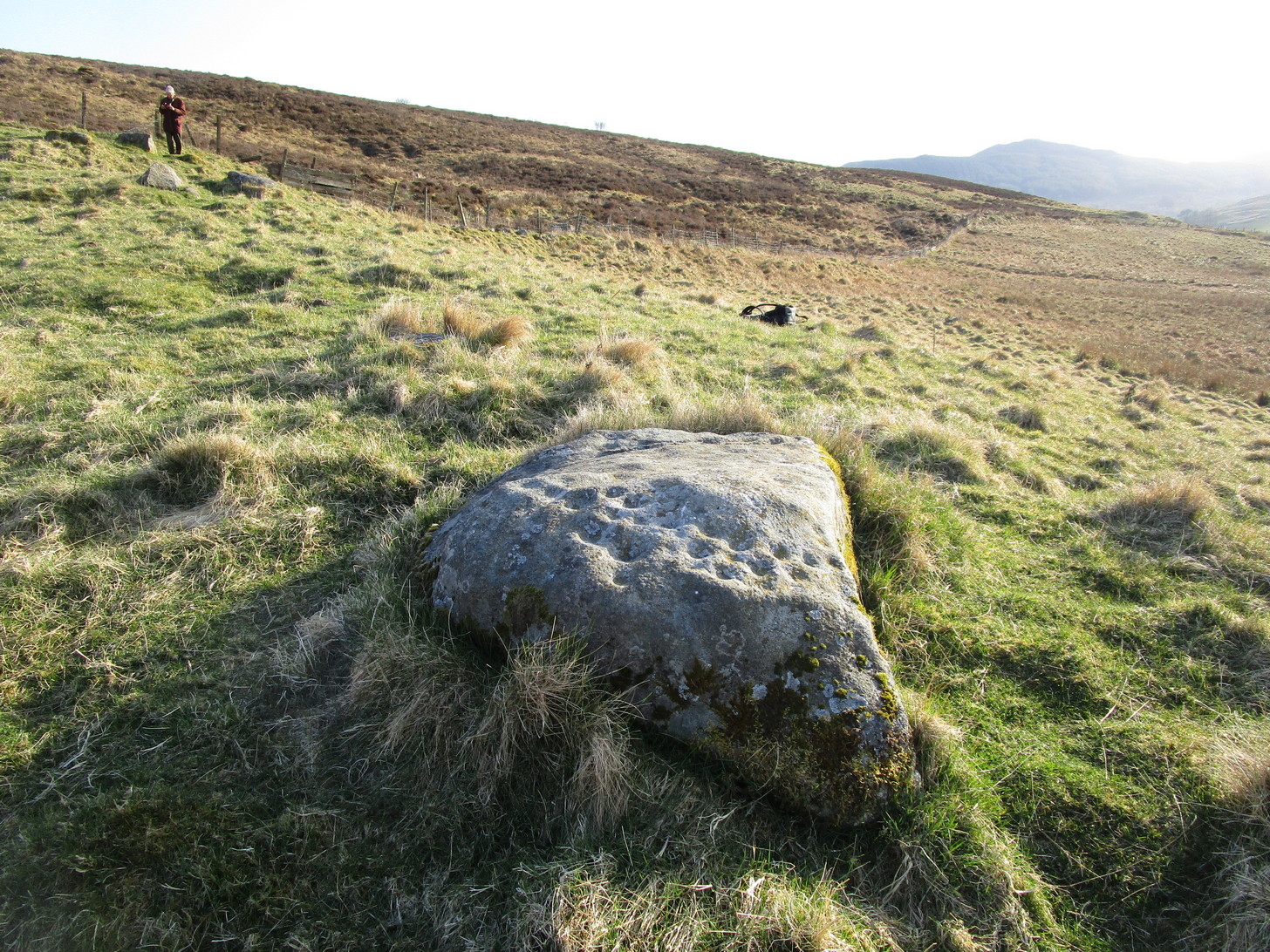
Archaeology & History
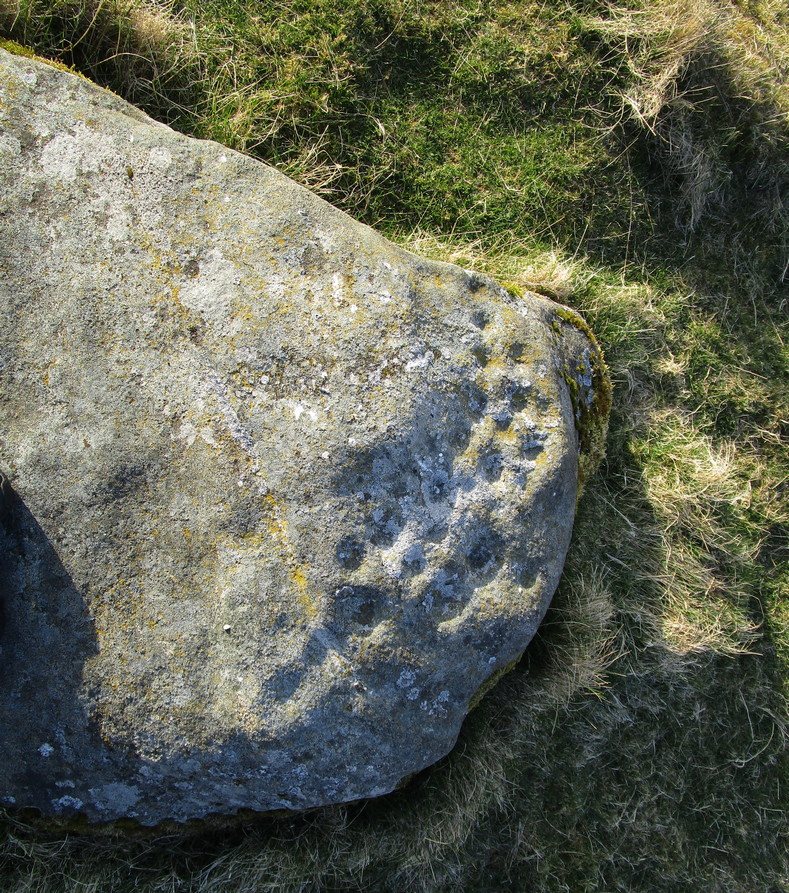
This typically female rounded rock has, unusually, a series of cups in almost three rows along its easternmost slope, with one or two single cups on its top and southern side. It was first described by Fred Cole (1908) merely as “a small boulder, with a remarkable triple row of cup-marks, resting on a cairn-like mound”; but it wasn’t until John Dixon (1921) came here that a full description appeared. He told us,
Primary rows of cupsLong worked (?) line
“About 200 yards due east of (Dalnavaid) house a ridge or spit of land juts out from the adjoining hillside on to an almost level field. The ridge has sloping sides, and the nearly flat top is 10 or 12 feet above the general surface of the field. Near the end of the ridge stands the cup-marked stone… The dimensions of the stone are: length 4 feet 8 inches; width 3 feet; height from 1 foot 11 inches to 2 feet 4 inches. The cups are all near the north-east side of the upper surface of the stone, and are more or less in rows. Some are large, with a diameter of 3 inches and a depth of nearly 1 inch; others are much weathered, and vary from small, scarcely measurable, hollows, to cups 2 inches in diameter and ½ inch deep. The hollows are no doubt cups almost obliterated by ages of weathering. Reckoning them so, there are in all thirty or thirty-one cups. All are of the plain type, without rings or connecting grooves.”
Looking (roughly) west
A few years later Mitchell (1923) counted 26 cups on it. Along the western side of the stone are two natural cracks that run across it roughly north-south. It wasn’t until I crouched down to look at what seemed to be another cup on its vertical face that I noticed how these lines appeared to have been enhanced by human hands.
For petroglyph enthusiasts, this is a decent carving well worth the visit. What looks to be a cup-and-ring design is found on a stone due south of here and, in all probability, others are hiding away nearby—the “lost” cup-marked stone of the Clunskea Burn, a mile north of here, being one such place. Let us know if y’ find it!