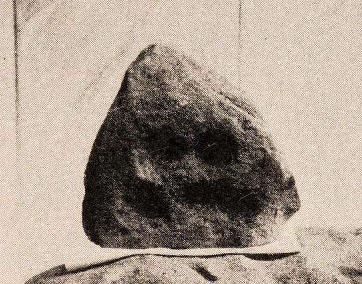
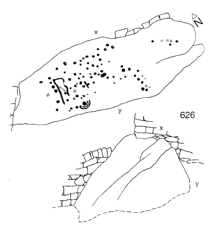
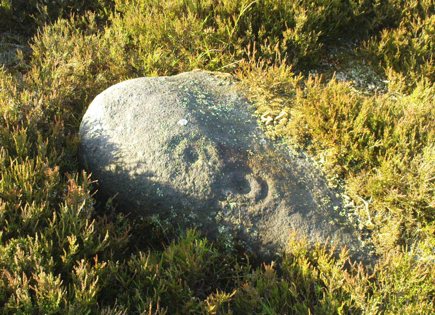
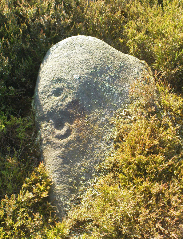
Inside the once prominent prehistoric tomb on the Cow Keeper’s Field, the northern antiquarians William Hornsby and John Laverick (1920) came across two small petroglyphs in association with a cremation burial, several feet south of the central cist: the Cow Keeper’s Field 2 carving, plus this small, triangular-shaped stone, 8in by 6in, consisting of five standard cup-marks, with two of the cups (as the photo shows) connected to each other. It is akin to the numerous ‘portable’ cup-marked stones which, in other cultures, were deposited onto cairns in remembrance of the ancestral spirits of the tomb. Such widespread practices may also have occurred here. Petroglyph researcher and writer Graeme Chappell (2017) informed us that the carving “is in storage in the Dorman museum in Middlesborough.”
References:
Brown, Paul & Chappell, Graeme, Prehistoric Rock Art in the North York Moors, Tempus: Stroud 2005.
Chappell, Graeme, Personal communication, October 4, 2017.
Crawford, G.M., Bronze Age Burial Mounds in Cleveland, Cleveland County Council 1990.
Elgee, Frank, Early Man in North-East Yorkshire, John Bellows: Gloucester 1930.
Hornsby, William & Laverick, John D., “British Barrows round Boulby,” in Yorkshire Archaeological Journal, volume 25, 1920.
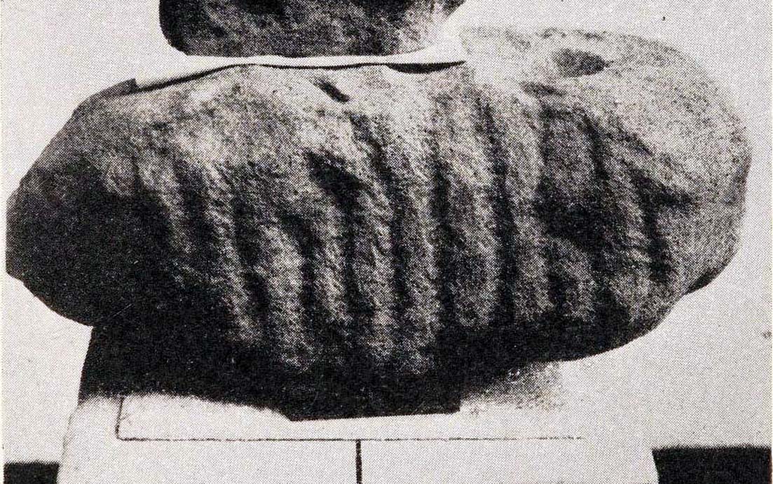
Inside the once prominent prehistoric tumulus on the Cow Keeper’s Field (now destroyed), the northern antiquarians William Hornsby and John Laverick (1920) came across two small portable petroglyphs: the Cow Keeper’s Field 1 carving, plus this “peculiarly marked stone” as they put it, some “5ft south of the centre” where a cist, or stone-lined burial existed. Measuring 18in by 7in, the rock carving consists of at least one large cup-marking which is clearly evident on top of the stone, plus what seems to be another one next to it, half-covered. Along the side of the stone, a series of twelve roughly parallel lines have been carved out, running down to the bottom of the stone. Rock art researcher and writer Graeme Chappell (2017) tells us the carving is supposed to be “in storage in the Dorman museum in Middlesborough,” although no one has seen it in years. It would be worthwhile if fellow research students could visit the said museum to recover this and other portable cup-marked stones that were found in the area.
References:
Brown, Paul & Chappell, Graeme, Prehistoric Rock Art in the North York Moors, Tempus: Stroud 2005.
Chappell, Graeme, Personal communication, October 4, 2017.
Crawford, G.M., Bronze Age Burial Mounds in Cleveland, Cleveland County Council 1990.
Elgee, Frank, Early Man in North-East Yorkshire, John Bellows: Gloucester 1930.
Hornsby, William & Laverick, John D., “British Barrows round Boulby,” in Yorkshire Archaeological Journal, volume 25, 1920.
This prehistoric tomb was one in a cluster of tumuli in the Boulby district, uncovered by the northern antiquarians, William Hornsby and John Laverick in 1918. Most of them have subsequently been destroyed – this one included. When they visited the site, they described it as “a barrow…with a diameter of 36 feet.” Once they began digging into it,
“at the centre we found a cist, the top of which was 2ft 7in below the present surface. The cist lay north 64° west, and south 64° east. It had no cover and the slab at the north-west end was wanting. The cist measured: side 3ft 6in, end 3ft 2in. Its depth was 2ft 2in. In it we found nothing except sandstone chips. With these there was no admixture of soil. Above the cist and covering a space of 5 ft by 5 ft there was a layer of burnt earth and black ashes (of furze bushes). At a distance of 5 ft south of the centre, and 1ft 10in below the present surface, there was a burnt burial, 20in in diameter. With this we found many flint chips, a shale pendant, and the peculiarly marked stone” we’ve called, simply the Cow Keeper’s Field 2 carving.
A second cup-marked stone was also found inside the tomb, a few feet south of the cist. When G.M. Crawford went to survey the burial mound in the late 1970s, he reported “there is no trace of it” and “has probably been destroyed by ploughing.”
References:
Brown, Paul & Chappell, Graeme, Prehistoric Rock Art in the North York Moors, Tempus: Stroud 2005.
Crawford, G.M., Bronze Age Burial Mounds in Cleveland, Cleveland County Council 1990.
Elgee, Frank, Early Man in North-East Yorkshire, John Bellows: Gloucester 1930.
Hornsby, William & Laverick, John D., “British Barrows round Boulby,” in Yorkshire Archaeological Journal, volume 25, 1920.
From Otley, take the road north across the River Wharfe up and up, heading towards Askwith Moor. As the moorland opens up ahead of you, at the crossroads turn right along Snowden Carr Road and literally ¾-mile along (1.25km) where a track on your right goes to Carr Farm, on the left-side of the road is a gate. Go through here to the Naked Jogger Stone and walk up the rocky ridge ahead of you, alongside the walling (as if you’re going to the Sunrise Stone), and about 20-30 yards up you’ll reach this carving.
Archaeology & History
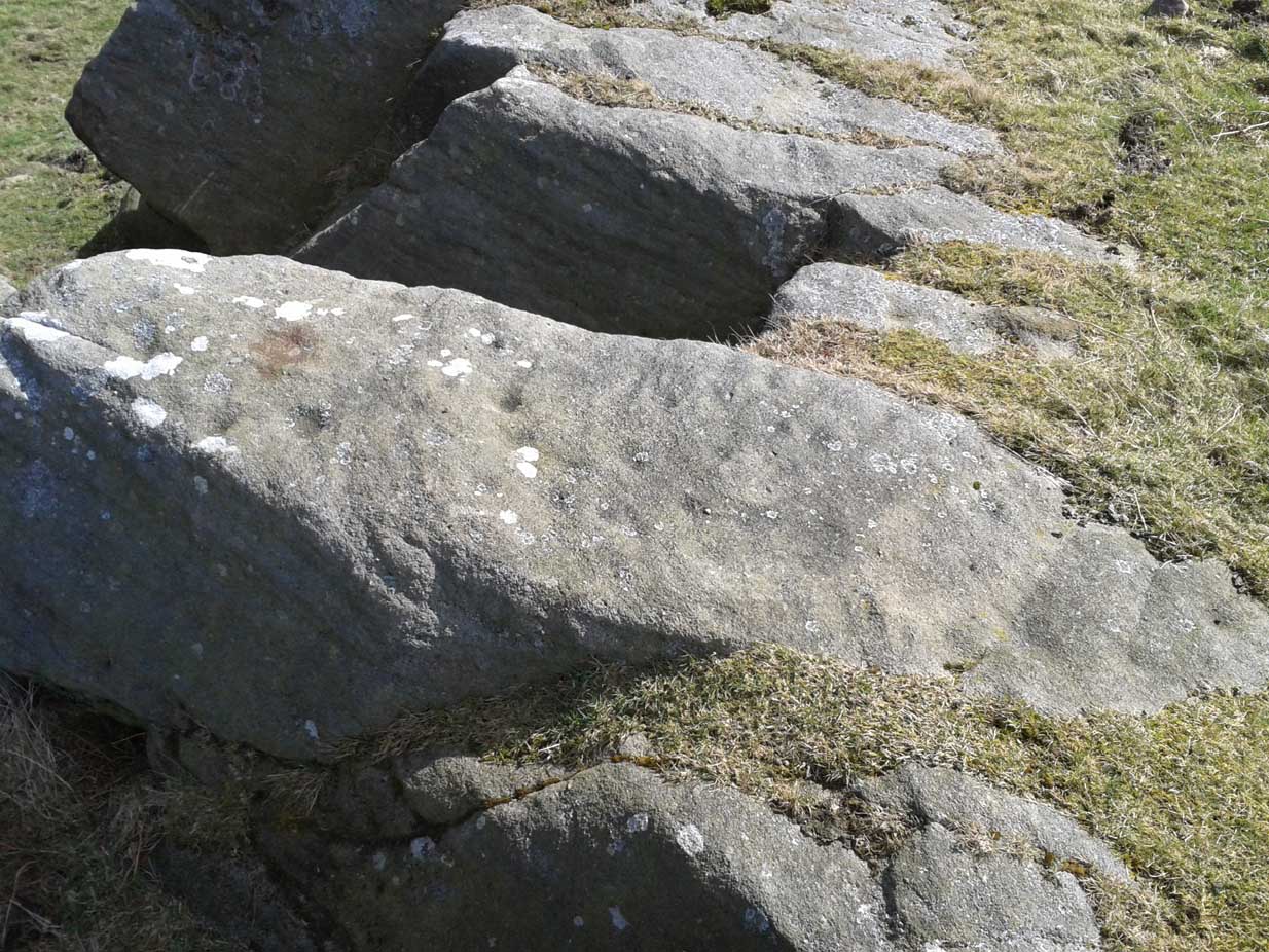
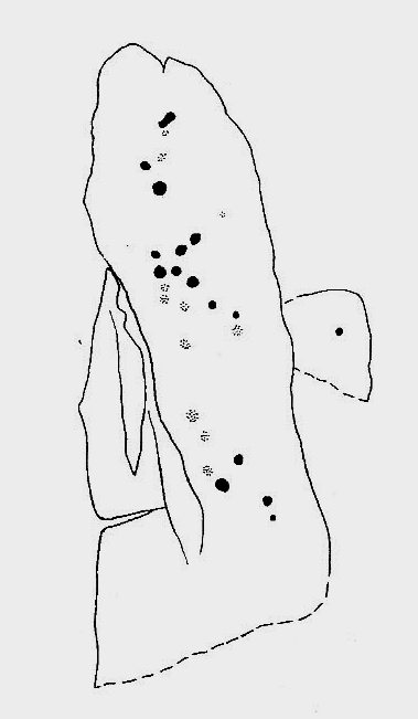
Best visited on a clear day, this is one carving amidst a small cluster of cup-marked petroglyphs found along the small geological ridge between the Sunrise Stone and Naked Jogger carving (none of which are as impressive as those two!). This particular design consists of a number of faint cup-marks— between 17 and 25 of them—reaching along the horizontal surface, with no distinct formal pattern, as usual. The carving continues beneath the encroaching soil.
Looking down at the carvingArchaeo-sketch
It seems to have been described for the first time by Stuart Feather (1973); then subsequently in Boughey & Vickerman’s (2003) survey, in which they attach a single cup-marking on an adjacent rock into the matrix of this design—but the two rock surfaces are distinctly separate. This apart, their description tells, briefly as always: “Large long rock which may be outcrop, with hill falling away steeply below. Seventeen worn cups.”
References:
Boughey, Keith & Vickerman, E.A., Prehistoric Rock Art of the West Riding, WYAS: Leeds 2003.
Take the A836 road between Tongue and Bettyhill, turning down at Borgie Bridge for 1.8 miles (2.87km) until you reach the little information sign at the roadside. Walk downhill and cross the little bridge and wander onto the west side of the beach. You’re likely to end up daydreaming… so once you’ve re-focused, head into the middle of the beach and walk up the steep-ish sand-banks to your right (south). Once at the top, you’ll see a gigantic rock—the Ringstone—bigger than a house. Walk up the hill above this until your reach the rocky plateau where things roughly level out. Look around!
Archaeology & History
This previously unrecognised carving on the edge of the rocky promontory that drops down to the stunning Torrisdale Bay—above the gigantic and legendary Ringstone boulder—is very much like the curious ‘C’-shaped motif on the Fyfield Down petroglyph, a couple of miles east of Avebury, literally 499 miles (803km) to the south. Indeed, that’s all I kept thinking about when I found it!
Ringstone carving, looking S
The carving’s nowt special—apart from the fact that it’s seemingly isolated and has no apparent companions nearby. It’s an incomplete circle, perhaps more like a bell-shape than a circle, about six inches across and seems to have no inner cup-mark. Its general appearance on the rock surface seems to indicate it was carved by a metal tool, instead of being ‘pecked’—but it’s still very old. Initially, I wondered whether it was an ichnological fossil or stromatolite—but it isn’t.
(Note that the OS-grid-ref is just a 6-figure one. I was ambling about and didn’t make an exact note of the place, but it won’t take much finding on the rocky levels above the giant Ringstone if you zigzag about. Apologies for the poor photos too, but She was cloudy most of the day.)
Acknowledgments: Huge thanks to Donna Murray, for putting me up in this part of Paradise. Cheers Donna.
Cup-and-Ring Stone (destroyed): OS Grid Reference – NO 379 204
Archaeology & History
J.R. Allen’s 1882 sketch
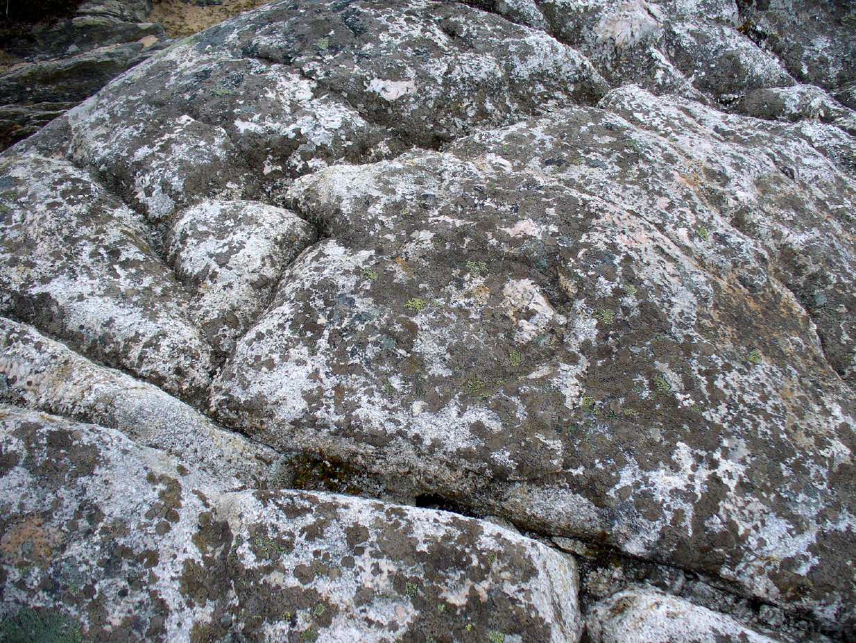
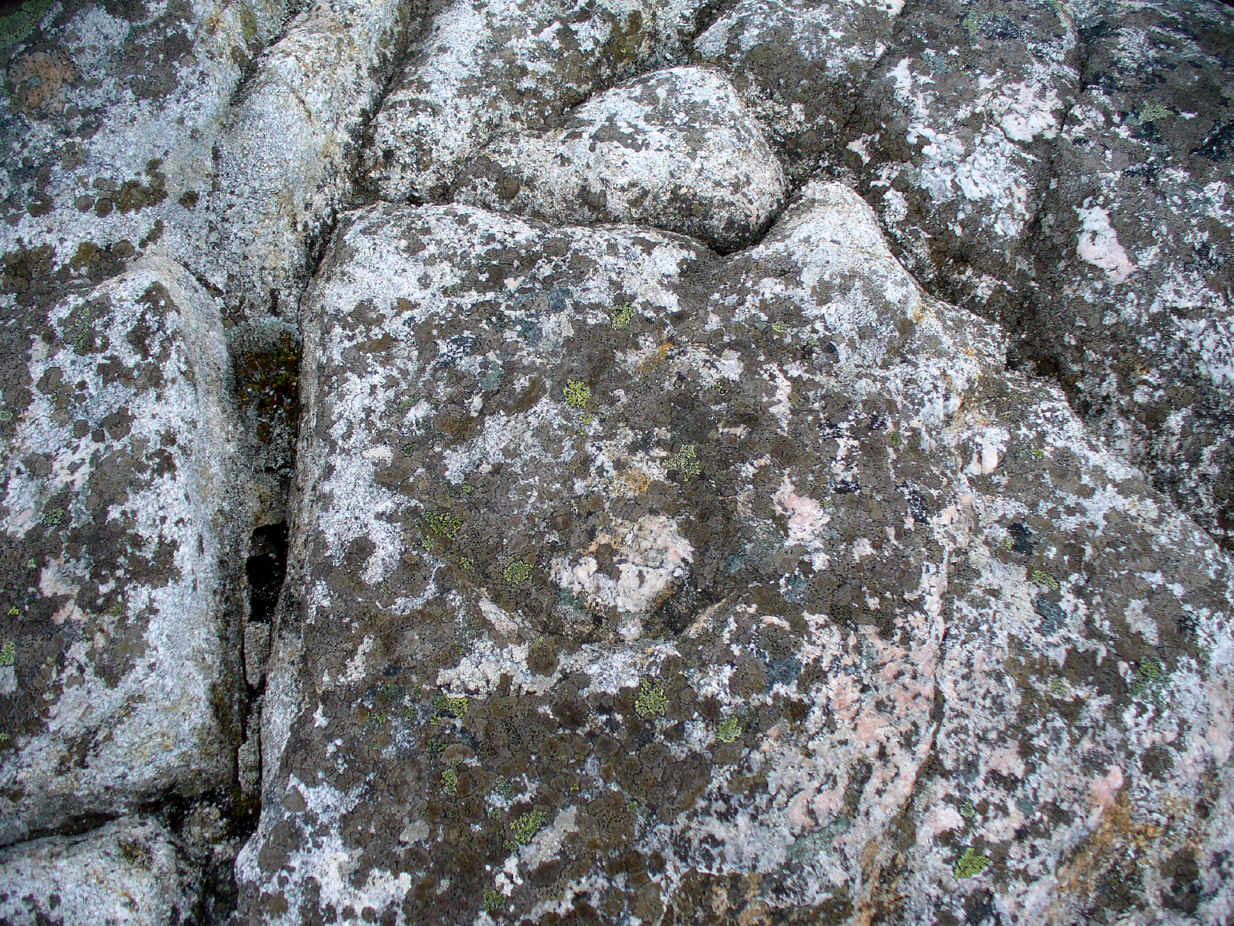
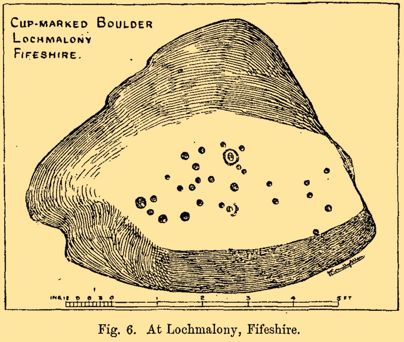
Here’s another old carving that has succumbed to the lack of animistic respect endemic in modern culture. Ronald Morris (1981) reported that this carved rounded boulder was “dynamited by the farmer and (is) now no longer extant.” First described in 1882 and later included in the Fife Inventory (1935), the large smooth rock used to lay within a nice copse of dense gorse, measuring 2½m x 1¾m across and about 1m high from ground level.
It was uncovered in 1872 and mentioned briefly for the first time in Arthur Mitchell’s (1874) fine essay on the antiquities of Cromar, where he told that “Dr. Batty Tuke tells me there is a cup stone on a moor forming part of Lochmalonie farm, in the parish of Logie, Fifeshire.” His notes were followed up by the great Romilly Allen (1882), whose sketch is all that remains of this ancient site. The carving was subsequently included in one of Ron Morris’s (1981) survey of Scottish petroglyphs, describing it simply as,
“2 cups-and-one-complete ring (one mostly weathered off), diameters 10cm (4in) and 27 cups (carving depth and angle of slope not now known.”
Its isolation from any other known petroglyphs is a little odd and there is every possibility is accompanied a prehistoric burial of some sort; although from the attitude of the farmer, all trace of that would have gone too. On a more positive note, when Batty Tuke spoke with Romilly Allen about this carving, he told that he has “frequently noticed well-marked cups on dry stone dykes in the Glenduckie area.” Petroglyph explorers amongst you might want to spend some time meandering in this neck o’ the woods….
Morris, Ronald W.B., “Fife: Loch Maloney – Cup Marks,” in Discovery & Excavation, Scotland, 1967.
Morris, Ronald W.B., The Prehistoric Rock Art of Southern Scotland, BAR: Oxford 1981.
Royal Commission on Ancient & Historical Monuments, Scotland, Eleventh Report with Inventory of Monuments and Constructions in the Counties of Fife, Kinross and Clackmannan, HMSO: Edinburgh 1935.
Takes a bitta finding this one – especially a this time of year when the bracken’s high – but it’s worth the walk. You’re probably best finding your way to the open-air carving on the slopes above Westcliff Farm, the Guisecliff Wood 626 carving (it’s pretty easy to find). From here, walk eastwards across the top of the two fields until you hit the old gate that take you back into the woods. Now it gets difficult! Walk less than 100 yards in the same direction, if you’re lucky, along the small footpath that runs pretty level through the trees, keeping your eyes peeled for a large sloping rock above you. I’d say that it’s probably best to start checking the relevant rocks (large ones) after 50 yards in the trees, just to be on the safe side. If you aint been here before it’s probably best to check it out at the end of Winter or during Spring time. Good luck!
Archaeology & History
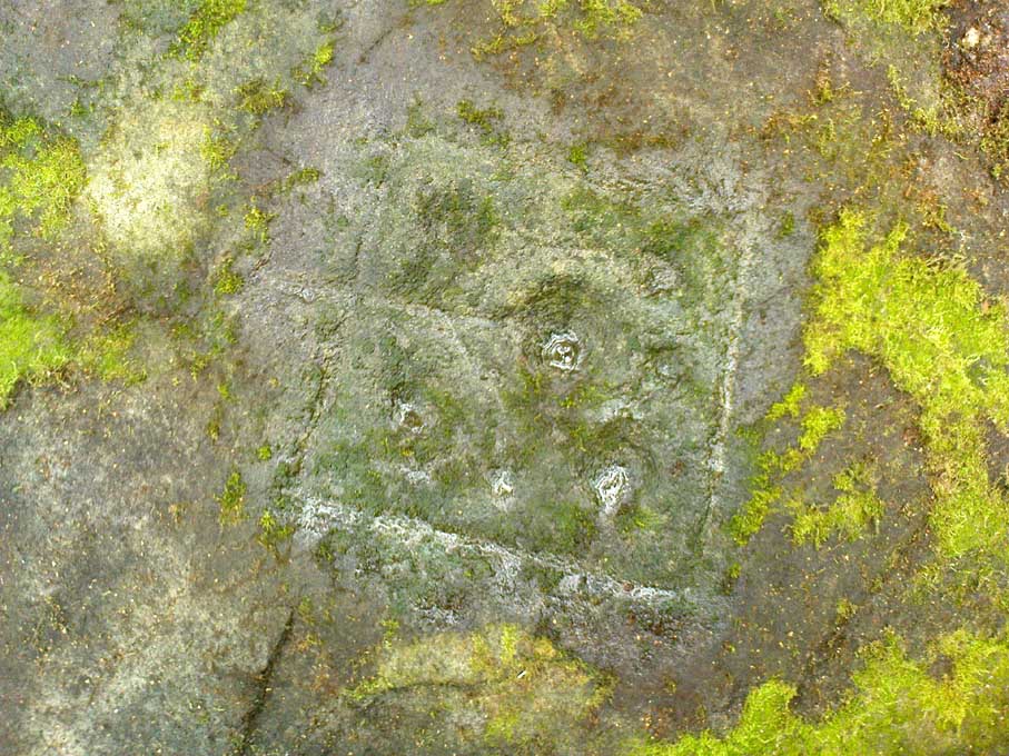
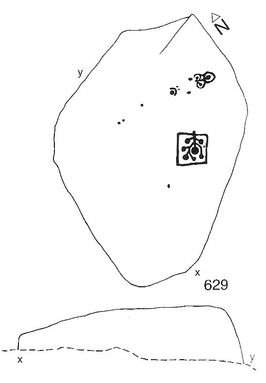
As noted by several people in our visit here the other day, some aspects of this carving are similar in design to the Tree of Life Stone on the eastern edge of Askwith Moor, 10 miles south of here. But the features on this large carved rock have intriguing elements of their own here: not least of which is the large square ‘box’ into which a cluster of otherwise normal cup-and-rings are enclosed. It’s a unique feature in prehistoric carvings in this part of the world — although such ‘box’ motifs can be seen further north at Dod Law in Northumberland.
The fainter cup-and-ringsBoughey & Vickerman’s 2003 drawing
There are two distinct sections of carvings on the stone, both of which have a similar tree-motif patterns, but the boxed one grabs your attention more once you’ve sat with the stone for a while. The other small cluster of cups are a little more difficult to notice, but once you see them they almost grow into life! You can just make out the surrounding rings and lines around some of these fainter cups, which I tried to capture in the photos (but without much success).
Our visit here didn’t pass without some voicing the thought that ‘box’ section could have been added at a much later date — perhaps a Victorian addition? But we could be way off the mark with that one!
There’s every likelihood of other carvings being found in and above the woodlands here, though any further exploratory excursions here can wait till winter time, as the Nature’s summer growth here is considerable and covers most of the rocks in green. The carving was first described in Boughey & Vickerman’s (2003) text as a
“Very large rock with extensive flat surface on which there seems to be two separate designs. Seven cups are joined in a branch-like pattern, the whole within a square groove from which the ‘stem’ of the branch just protrudes; away from this is an approximately linear feature with three cups enclosed by linked rings at one end and then six more cups with a partial ring.”
If you’re a rock art enthusiast, or a real healthy heathen, this site is well worth checking out!
References:
Boughey, Keith & Vickerman, E.A., Prehistoric Rock Art of the West Riding, WYAS 2003.
From Pateley Bridge take the B6265 road towards Grassington, turning left just a coupla hundred yards over the river bridge, towards Bewerley. Go through the hamlet and take the second on the right, up the steep zigzagging lane. A half-mile up the hill, watch out for the track onto Westcliff Farm. Go along here and onto the footpath, then as you walk through the field, look uphill where the long wall runs into the trees, and you’ll see a rock in the walling near the top. That’s it!
Archaeology & History
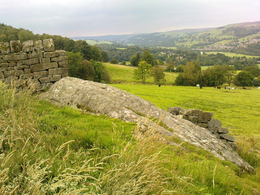
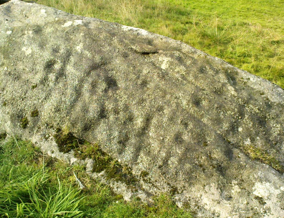
Just over the edge of the northern section of The Intakes at the western end of Guisecliff Wood, on a large rock in the walling near the very top of the field above Westcliff Farm, we find this little-known but very impressive cup-and-ring stone.
Close-up of some cupsBoughey & Vickerman’s sketch
Upon first sight the rock was aptly described by Danny Tierney as being like a Viking Hogback Stone with cup-markings along the sloping side of the long rock as it grew into the drystone walling. He had a point! It’s a curious carving (how many times do I say that!?), with the majority of the cup-marks and lines etched into the south-sloping face of the rock. Other cups found further down the stone stretch along the eastern side towards ground level; and we have a small line of cups etched onto the normal horizontal face halfway along the stone.
The carving was rediscovered by Stuart Feather in the ‘Sixties and was all-but-forgotten until Boughey & Vickerman (2003) rejuvenated it in their catalogue. They told it to be:
“Large rock of coarse grit lying with long uneven surface E to W, at ground level to S and E, but with high N and W faces. Up to eighty cups but some may be due to pebbles or other natural causes; one cup has two half-rings which, like some grooves visible, suggest a now incomplete design.”
The fascinating ‘boxed’ cup-and-ring stone of Guisecliff Woods 629 can be found less than 200 yards east of here, in the trees, and is certainly worth seeking out!
References:
Boughey, Keith & Vickerman, E.A., Prehistoric Rock Art of the West Riding, WYAS 2003.
Feather, Stuart & Hartley, C.E., “The Yorkshire Archaeological Register, 1964: Bewerley. W.R.”, in Yorkshire Archaeological Journal, volume 41, 1965.
Same directions as the Slade 01 carving. But once you reach the upstanding stone cairn on the rocky hill, walk 220 yards (less than 200m) WSW and look around. You’re damn close! If you find the large cup-marked Slade 03 carving, walk back east about 10-20 yards and you can’t really miss it!
Archaeology & History
This is just one of at least seven previously undiscovered carvings on this section of moorland – and it’s worth looking for! The two other names we gave it — ‘owl’ and ‘sunset’ — come from the very notable design: owl thanks to it having the appearance of large owl-like eyes, and sunset as the two cup-and-rings are etched on the western edge of the rock and, when we found it yesterday, the sun was setting (albeit to the NW) and the image prompted talks of setting suns, the land of the Dead and other such worldwide indigenous religious myths (Harvey 2000) — for without recourse to such ingredients, these carvings are vacuous archaeocentric museum pieces and nothing more. And this carving at least deserves much more than mere cataloguing! The internationally renowned archaeologist, O.G.S. Crawford (1957) would have entered this carving into his ‘eye’ and ‘owl’ motif, representative of goddesses or spirit-forms, as would Gimbutas. (1989)
…and from above
But this carving is archetypal, as we can see, though would appear to have no other etched features on the stone’s surface. It is very close (if not within) the prehistoric graveyard that is plainly evident 30-40 yards south in the burnt heather and would very likely have had some mythic relationship with the dead (a symbiosis we have found in many cup-and-rings). We plan further ventures here in the coming weeks in the hope that we can unearth other prehistoric remains.
References:
Crawford, O.G.S., The Eye Goddess, Phoenix House: London 1957.
Gimbutas, Marija, The Language of the Goddess, Harper Collins: New York 1989.
Harvey, Graham (ed.), Indigenous Religions, Cassell: London 2000.
Cup-and-Ring Stone: OS Grid Reference – NM 027 487
Also Known as:
Kettle Stone
Ringing Stone
Singing Stone
Archaeology & History
This is a fascinating large coastal boulder with around 53 cup-markings on it — but whether these are all man-made is a matter of debate. Some of them may be natural. However some of the cups have lines and faint rings around them, showing that at least they’re man-made; and also in one of the large cups are placed small pebbles, similar in form to the well-known Butter Rolls, or bullaun stone at Feaghna, Ireland.
Folklore
This large boulder (suggested to have been dragged and dropped here from the Isle of Rhum in an earlier Ice Age) is known in the modern tongue as the ‘Ringing Stone’ because, allegedly, if you knock the surface hard with another stone it supposedly chimes with a metallic noise. As one of the links below shows, however, it doesn’t necessarily do the trick! Local folklore tells that if the stone is ever destroyed, or falls off its present platform of smaller stones, Tiree itself will sink beneath the waves. Other lore tells that this great rock is hollow; and another that it contains a great treasure. According to Otta Swire (1964),
“Some believe this to be a treasure of gold, others claim it to be the resting place of the Feinn who there await the call to rescue Scotland.”
References:
Royal Commission on the Ancient & Historical Monuments of Scotland, Argyll – volume 3: Mull, Tiree, Coll and Northern Argyll, HMSO: Edinburgh 1980.
Swire, Otta F., Inner Hebrides and their Legends, Collins: London 1964.