Best way to find this is to get up to the Dobrudden caravan site on the edge of Baildon Hill, near the cinder-dump, then follow the same directions as for the Baildon Moor carving no.171. It’s on the same plain amidst the grasses – but you’re gonna have to zigzag about for a while before you find it!
Archaeology & History
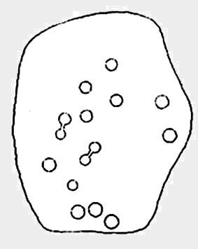
A simple plain cup-marked stone which Boughey & Vickerman (2003) reckoned to have 14 of the little babies etched on its surface. Ninety years earlier, the reliable Mr W.P. Baildon (1913) — who seems to have been the first person to describe this carving — showed there to be 15 cups when he came here.
This was one of the many carved rocks that astronomer Gordon Holmes (1997) looked at in his attempt to give a celestial explanation for the designs. I’m not too sure misself…
References:
Boughey, Keith & Vickerman, E.A., Prehistoric Rock Art of the West Riding, WYAS 2003.
Hedges, John (ed.), The Carved Rocks on Rombalds Moor, WYMCC: Wakefield 1986.
Holmes, Gordon T., 2000 BC – A Neolithic Solstice Odyssey, SASRG Press 1997.
If you wanna find this carving, you’ll find it near several others on the Low Plain, 40 yards east of the footpath north of Dobrudden Farm. Look around in the tribbly grass!
Archaeology & History
This was first described and illustrated in a short article by William Glossop in the Bradford Antiquary in 1888, and reproduced by W. Paley Baildon (1913) – who drew his own impression of the carving. Tis one of my favourites from this moor. Dunno why – I just like it.
W.P. Baildon’s accurate 1913 drawingCowling’s 1946 drawing
Local astronomer and writer Gordon Holmes (1997) posited the theory that a part of this carving represented the constellation of Cassiopeia — hence its title! He told of finding the same pattern of cups at four other carvings on the moors and assigned astronomical meanings to them. He may be right, though I doubt it to be honest. Having looked and looked at the many carvings here, and many other places, the star-reflection hypothesis doesn’t tend to work (as the heavenly bodies have moved somewhat since the days when the cups were first carved). Along with this, when I was young I used to think cup-and-rings did have an astronomical basis — only to find, after constant analysis, that the theory didn’t work.
There are perhaps 20 cup-markings here, with various linking-lines and curves between and around the cups. Perhaps the most accurate of the early drawings was Mr Paley Baildon’s 1913 image, where he highlighted the faint surrounding ring enclosing the 4 or 5 cups near the bottom of the stone.
References:
Boughey, Keith & Vickerman, E.A., Prehistoric Rock Art of the West Riding, WYAS 2003.
Cowling, Eric T., Rombald’s Way, William Walker: Otley 1946.
Glossop, William, “Ancient British Remains on Baildon Moor,” in Bradford Antiquary, 1888.
Hedges, John (ed.), The Carved Rocks on Rombalds Moor, WYMCC: Wakefield 1986.
Holmes, Gordon T., 2000 BC – A Neolithic Odyssey, SASRG Press 1997.
From East Morton village, take the moorland road, east, and up the steep hill. Where the road levels out there’s a left turn where a trackway leads onto the moor. Go up here & keep walking till you hit a moorland ‘footpath’ signpost. Stop here and walk due west (your left) onto the gently sloping rise and into the mass of the Stanbury Hill enclosure system. Keep walking for 200 yards or so, where the land begins to slope down to the end of the spur; and just 50 yards before it drops down to the stream below you’ll find a cluster of carved rocks like the Lunar Stone, the Teaspoon Rock, Spotted Stone, etc, all scattered about. Near these, you’ll find this one!
Archaeology & History
Not to be confused with the carving of the same name on the northern side of these moors (near the Green Crag Slack enclosure), this carved rock gets its name specifically from looking like a lay-out plan of some settlement or enclosure. It’s unlikely that this title or description has anything to do with the carving, but its the impression it gave me when I first saw it! But then once you look at the carving from another angle it takes on a different impression.
Enclosure Carving from above
First thought to have been found by Stuart Feather in 1978, it is one of many carvings that occur in what seems to be an extensive prehistoric enclosure or settlement. There’s a complete cup-and-ring near the western end of the rock, with another distinct cup-marking by its side, and what looks to be a natural cup at the top-end of the stone. But it was the other section of the carving on the central and eastern side which intrigued me: a curious ‘enclosure’ of lines, with a cup-marking in each section. Cutting between the cup-and-ring and the enclosure lines is a natural long crack or fissure running roughly north-south through the rock. It seemed to me (though I could be wrong) that a line had been pecked running along this natural crack — although in Boughey & Vickerman’s (2003) drawing they don’t highlight this. It also seemed that the carved lines from ‘enclosure’ linked up to the pecked line that was carved along the natural fissure in the rock (as illustrated in my crap drawing!).
Shit drawing of CR99
As with the Lunar Stone nearby: it appears that either this stone was carved at different periods; or else for a long period of time much of the stone was exposed to the elements, whilst a section of it remained covered. For the distinct cup-and-ring on the western-end is more worn, with more eroded evidence of pecking, than the extended lines on the eastern end of the rock. I need to go back here and get some better images — and certainly do a much better drawing!
References:
Boughey, Keith & Vickerman, E.A., Prehistoric Rock Art of the West Riding, WYAS 2003.
Hedges, John (ed.), The Carved Rocks on Rombalds Moor, WYMCC: Wakefield 1986.
Dead easy! Avoiding Keighley (as common sense dictates), but going to its outskirts, get to the huge Cliffe Castle (tis free) on the northern outskirts of the town. Go inside and look around!
Archaeology & History
Carving in Cliffe Castle MuseumClose-up of cups & rings
Initially located in the ground a few yards south of Dobrudden caravan park amidst a large gathering of other carved rocks, this grand-looking cup-and-ring stone is no longer in situ. As with a several other carvings, this has been on a bittova wander in the last century! It was first uprooted from the Earth and archaeologically transferred to Bradford’s Cartwright Hall Museum sometime after World War 2, where it lived peacefully for a number of years, before being moved to Cliff Castle Museum, where it still lives, quietly (along with another prehistoric carved rock, the Comet Stone, that was nabbed from the uplands near the Roms Law circle).
Baildon’s 1913 drawing
As we can see from the photos (taken in poor lighting in the museum – sorry…) there are five cup-and-rings with one cup-and-2-rings standing out (plus about another 10-12 cups scattered here and there); though when W. Paley Baildon drew a picture of the stone around 1913, he could clearly see another cup-and-ring etched onto the stone, but this has faded somewhat in the last century. Messrs Boughey & Vickerman (2003) were unable to see it.
References:
Baildon, W. Paley, Baildon and the Baildons – parts 1-15, Adelphi: London 1913-1926.
Boughey, Keith & Vickerman, E.A., Prehistoric Rock Art of the West Riding, WYAS: Leeds 2003.
Hedges, John, The Carved Rocks on Rombald’s Moor, WYMCC: Wakefield 1986.
Jackson, Sidney, ‘Cup and Ring Boulders of Baildon Moor,’ in Bradford’s Cartwright Hall Archaeology Group Bulletin, 1, 1955.
This is a lovely-looking stone in the pictures and diagrams, and is quite easy to find close to the meeting of the footpaths along Foldshaw Ridge and the Parks Lane track, near the gate. It lays at an angle in the short grass just by the path…but to me, all is not what it seems…
Archaeology & History
This was a carving I saw pictures of in the 1970s, and always thought it would be something to behold – but my first impression here wasn’t just disappointment, but the most distinct thought that the carving’s modern! It’s a real oddity. For a start, the cups in this carving are very small – much smaller than the countless authentic carvings on the moors here and at Ilkley to the south. And after seeing thousands of these things, this one didn’t seem at all right.
The lack of erosion on the cups may be due to it once accompanying a prehistoric tomb some time in the past, though no such remains have been noted here. However, at carved stones Middleton Moor 001 and Middleton Moor 2 — less than 100 yards to the east — cairns are in evidence next to the petroglyphs, indicating that this relationship occurs at some cup-and-ring stones in this small geographical region and, perhaps, explaining the ideosyncratic nature of this design.
But such speculation aside – the brief literary history of this stone is: first described by Stuart Feather in 1965 and illustrated by Sidney Jackson the same year. The rock art students Boughey & Vickerman’s (2003) described around sixty ‘cups’ etched onto the stone here, but they made no comment about either the odd nature of the cups or the possibility of it being modern. Perhaps it’s just me…
References:
Boughey, Keith & Vickerman, E.A., Prehistoric Rock Art of the West Riding, West Yorkshire Archaeology Service 2003.
Taking the roughly north-south road betwixt the village of Elton and the town of Youlgrave, rising up to see the great rock outcrop of Robin Hood’s Stride, park-up by the roadside and walk down the path across the fields to the Nine Stone Close stone circle. Once at the circle, the walling closest to the stones runs along a bit (north), then downhill. Follow it. About 25 yards before hitting more walling that crosses your path, there’s a break in the wall to a field immediately left. Just below this gate opening, in the same wall, a few yards down, look for the stone!
Archaeology & History
This small carved stone, typical of the size you get in drystone walls all over the country, was discovered for the first time on November 29, 2009, by Geoff Watson, during an ambling foray exploring the megalithic sites in and around the Birchover district. Not quite sure how his nose picked this little fella out, but once seen (and eyes adjusted!) it was obviously a portable cup-marked stone. Though what, we first wondered, was it doing in the walling here?
Similar in size and form to the Bent Head cup-marked stone found in drystone walling near Todmorden, West Yorkshire, the proximity of the Nine Stone Close megalithic ring further up the slope from this example illustrated that prehistoric man found this location of some importance; but as the cup-markings — two definites, perhaps a third — had been etched onto a small portable rock, typical of those found in prehistoric tombs, we wondered whether or not a prehistoric grave had once stood close by. Thankfully, a persual of Barry Marsden’s (1977) catalogue later proved fruitful. For in the adjacent field below where this carved stone sits in its wall, at SK 2255 6286, there’s a scattered mass of loose rocks and smaller stones (akin to the one here with its cup-markings), which Marsden listed as a prehistoric tomb. It seems probable that this cup-marked ‘portable’ originally came from this much denuded burial spot.
Likelihood is — there’ll be more of ’em hiding in walling and elsewhere hereby…
NB – Please note – the images we took of the stone aint too good as the sky was grey, cloudy and overcast all day. We await a better visit on a finer day, when conditions allow for better images. As we all know, gerrin’ decent photos of cup-markings and their ilk can be a pain in the arse even on the best of days!
References:
Heathcote, J. Percy, Birchover – Its Prehistoric and Druidical Remains, Wilfrid Edwards: Chesterfield 1947. (see MegaDread’s comment, below)
Marsden, Barry, The Burial Mounds of Derbyshire, privately printed: Bingley 1977.
Follow the directions to reach the Devil’s Den, a half-mile north of Clatford up the footpath towards the Fyfield Down cup-marked rock. You can’t miss it! The cup-markings are on the top of the capstone.
Archaeology & History
First described and illustrated by local historian and photographer, Pete Glastonbury, as far as I’m aware these cup-markings have not previously been included in any of Wiltshire’s archaeological surveys (that can’t be, surely?). The only reference I’ve found — not untypically — is from one of the early editions of the english Folklore Journal.
…and again!Devil’s Den cup-markings
At least two well-defined cups stand out on the top of the capstone. Each of them have ‘cracks’ running out of them, with the easternmost one of them (closer to the edge) turning into a channel which runs upwards on the stone, before then leading down off the edge of the rock. Each cup-mark is very clear, about two inches across and about a half-inch deep.
Archaeologists can check these cups out and work out for themselves whether they’re natural or not. They’re far more qualified than I on such matters and may be able ascertain other faint remarks on the stone. The proximity of the nearby Fyfield Down cup-marked rock, several hundred yards to the north, shows that such petroglyphs can be found in this region. Although we cannot expect many examples of rock art in this area (the rock’s damn tough and takes some burrowing into), it is likely that more carvings await discovery.
Folklore
The capstone on which these cup-markings are seen was told to be immovable and had lore said of it akin to that found at the great Whispering Knights, near the Rollright Stones. But the main piece of lore describes the cups quite specifically. In an article by Alice Gomme (1909), she told that:
“if anyone pours water into any of the natural cup-shaped cavities on the top stone at midnight, it will always be found in the morning to be gone, drunk by a thirst-tormented fiend.”
The tale is later repeated in Kathleen Wiltshire’s (1975) survey, where she too mentions the cup-marking (though only one), saying that,
“if a person pours water into the natural cup-shaped cavity on the top stone at midnight it will always be found to be gone in the morning — drunk by the devil.”
This folklore motif — repeated in Grinsell’s (1976) text — is found at rock-art sites in a number of the northern counties, where milk has been poured into the cup-markings (some of which were known as ‘cat stones’) and left overnight for the spirits to drink. In the case we have recorded at Devil’s Den, the spirit of the place seems to have been demonized, as is common.
Miss Gomme (1909) also reported the curious ingredient that the spirit of a white rabbit with glowing eyes would appear on the capstone at midnight and help the devil demolish the site with the aid of eight oxen! On this latter matter, I am duly informed by one-in-the-know that, to “those of us that know the locals and their humour, we just know this tale was made up for a visiting townie!”
References:
Gomme, Alice B., ‘Folklore Scraps from Several Localities’, in Folklore Journal, 20:1, 1909.
Grinsell, Leslie V., Folklore of Prehistoric Sites in Britain, David & Charles: London 1976.
Head up to Rivock’s Wondjina Stone carving, then keep going east to the Long Rock. Wander 100 or more further east till you see the fence, and about 50 yards before this check out the large rocks which you’ll notice near to each other. One of them is this Split Rock!
Archaeology & History
First described in Hedges’ (1986) survey, this is a large flattish boulder, split across one side, with two distinct cup-marks on its eastern side and a number of other ‘possibles’ scattering the surface. The most intriguing bit to this rock is on its lower eastern side. Here’s what Boughey & Vickerman (2003) described as,
Deep cup-and-half-ring
“one clear cup (doubtful) discovered under turf…at extreme lower SE corner, with possible attempt at pecked partial ring.”
This cup they describe as “doubtful” is quite deep, but the half-ring on its northern side has definite artificial peck-marks. I’m more of the opinion that this cup-and-half-ring is man-made — though whether it was done in more recent years is the more debatable aspect here. I’ll try getting some better images (and a drawing) of this stone when we’re next up here.
References:
Boughey, Keith & Vickerman, E.A., Prehistoric Rock Art of the West Riding, West Yorkshire Archaeology Service 2003.
Hedges, John, The Carved Rocks on Rombalds Moor, WYMCC: Wakefield 1986.
Head up to the lovely Wondjina Stone carving, then walk east towards the triangulation pillar. Keep going, over the wall – and keep going straight on, over the next wall (no footpaths up here at all). You’re now into rough heathland, but if you’re a real cup-and-ring freak, keep heading another 150 yards east, zigzagging slightly. You’ll eventually find it!
Archaeology & History
Long Rock carving, Rivock
A quite large, smooth earthfast rock, but nowt much to look at unless you’re one of the crazy bunch! This is just another one of our basic cup-marked rocks with very little modern archaeo-history attached. There are perhaps as many as four cup-markings etched onto the stone: two at the northern end, one a little further down (not mentioned in Boughey & Vickerman’s survey) and another one cited towards the south end of the stone. Gotta be honest though: a couple of them are slightly dubious and may be natural — but hopefully not! (soz about the crap photo of this poor carving; but the light was shit & our camera packed-up!)
References:
Boughey, Keith & Vickerman, E.A., Prehistoric Rock Art of the West Riding, West Yorkshire Archaeology Service 2003.
Follow the same directions to reach the Pancake Stone, but about 100 yards west, following the footpath that runs along the edge of the ridge (towards the large Haystack Rock a few hundred yards west), watch out for these large seemingly split rocks, with one elongated length of stone by the pathside. You can’t really miss it!
Archaeology & History
Very little’s been said of this carving as it’s just one more of the many rocks with just a solitary cup-marking etched on top — as we can see in the photo. The cup-mark is near the bottom, southeast-ish portion of the rock and is plain to see.
(Note: I’m not 100% sure that I’ve got Boughey & Vickerman’s (2003) numbered carving correct here. They describe a carved rock very close by here as an “upstanding rock, part of a large split rock,” as their ‘number 326’ carving — which is roughly similar; though I’m not totally sure! No other single cup-marked stone is listed in their survey close by, so assume it’s the same one as in their work.)
References:
Boughey, Keith & Vickerman, E.A., Prehistoric Rock Art of the West Riding, West Yorkshire Archaeology Service 2003.
Hedges, John, The Carved Rocks on Rombalds Moor, WYMCC: Wakefield 1986.

")

")


")


