Giant’s Knowe, Culloch, Muthill, Perthshire

Cairn (destroyed):  OS Grid Reference – NN 7848 1762

Also Known as:

  1. Canmore ID 24797
  2. Crock-nafion
  3. Fingalian’s Knowe

Archaeology & History
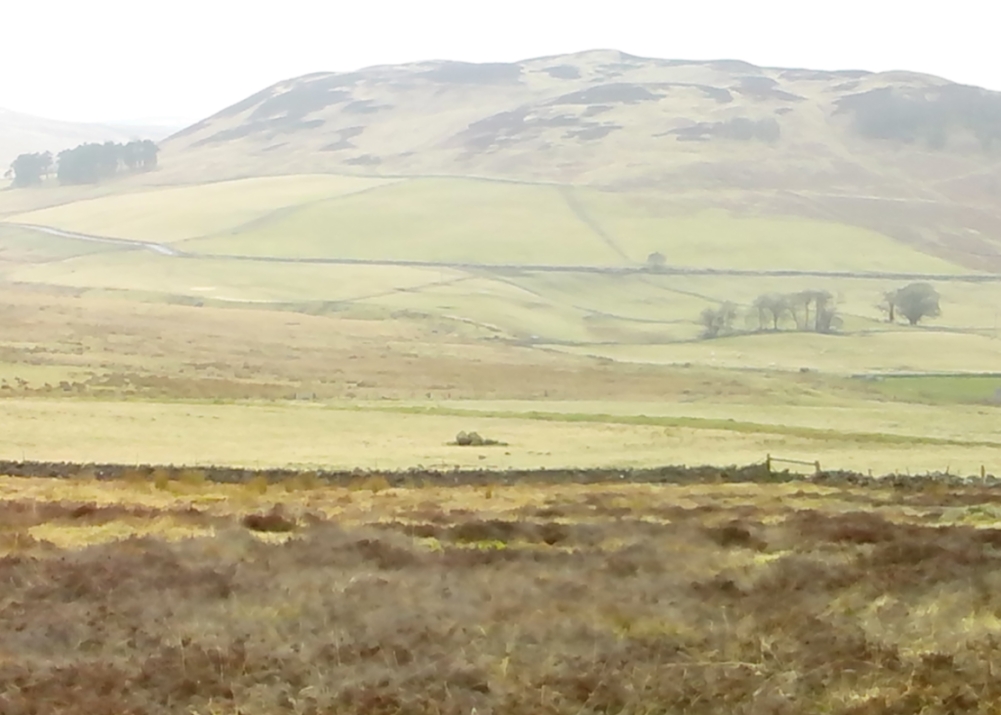
Landscape of the Giant's Knowe (image credit, Marion Woolley)
Landscape of Giants Knowe (photo by Marion Woolley)

Amidst the colourful and nurturing landscape close to the gigantic Dunruchan standing stones and just along the road from the solitary Craigneich stone, in the field across the road above Straid farmhouse could once be seen a fascinating-sounding prehistoric site that has sadly been destroyed.  Some of the remains of this old monument can be found in the field-clearance of stones just over the fence, above the top of the field (many fields round here have scatterings of large stone clearings at the field edges), but we have no detailed accounts of the site.  It was mentioned in early notes by the Ordnance Survey to have been,

“A large circular heap of small stone and gravel entirely removed in 1831. An urn filled with ashes and several stone coffins were found under it.”

The local historian John Shearer (1883) later told us that,

“A small mound of earth on the farm of Strayd, called Crock-nafion or the Giant’s Knowe, or the Fingalian’s Knowe, was cleared away several years ago.  An urn containing burnt bones was discovered.”

Any additional information about this site and its folklore, would be greatly appreciated.

Folklore

To the west along Glen Artney whence our view takes us from here, old legend told that the valley was once the abode of a great giant who lived in a cave in one of the mountains thereby.  In mythic lore, giants were the creation deities of hills, mountains and other geological forms, whose narratives were overturned and demonized by the incoming christian cult many centuries ago.  It is likely that this once great tomb was deemed as the burial-place of our local giant – which would make this prehistoric site neolithic in age.  But — logical though it is — this idea is pure speculation…

References:

  1. Hunter, John, Chronicles of Strathearn, David Philips: Crieff 1896.
  2. Shearer, John, Antiquities of Strathearn, David Philips: Crieff, 1883.

© Paul BennettThe Northern Antiquarian


Tir Artair, Killin, Perthshire

Standing Stone:  OS Grid Reference – NN 58870 34720

Also Known as:

  1. Canmore ID 24205

Getting Here

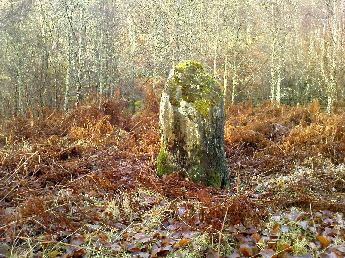
Standing stone of Tir Artair
The standing stone of Tir Artair

This lovely standing stone can be a pain-in-the arse to get to!  Unless you wanna clamber over the excess of increasingly stupid deer fences that are appearing all over the place (old locals aint happy), follow the directions to the Tir Artair cup-marking, then walk across to the fencing and follow it all the way down into the fields until you reach the stream on your right, running in front of the fenced woodland. There’s a large gate here into the trees. Go thru it. In front of you is some overgrown walling into the trees: follow this along, slowly, keeping your eyes peeled for the upright stone about 100 yards in.  Good luck!

Archaeology & History

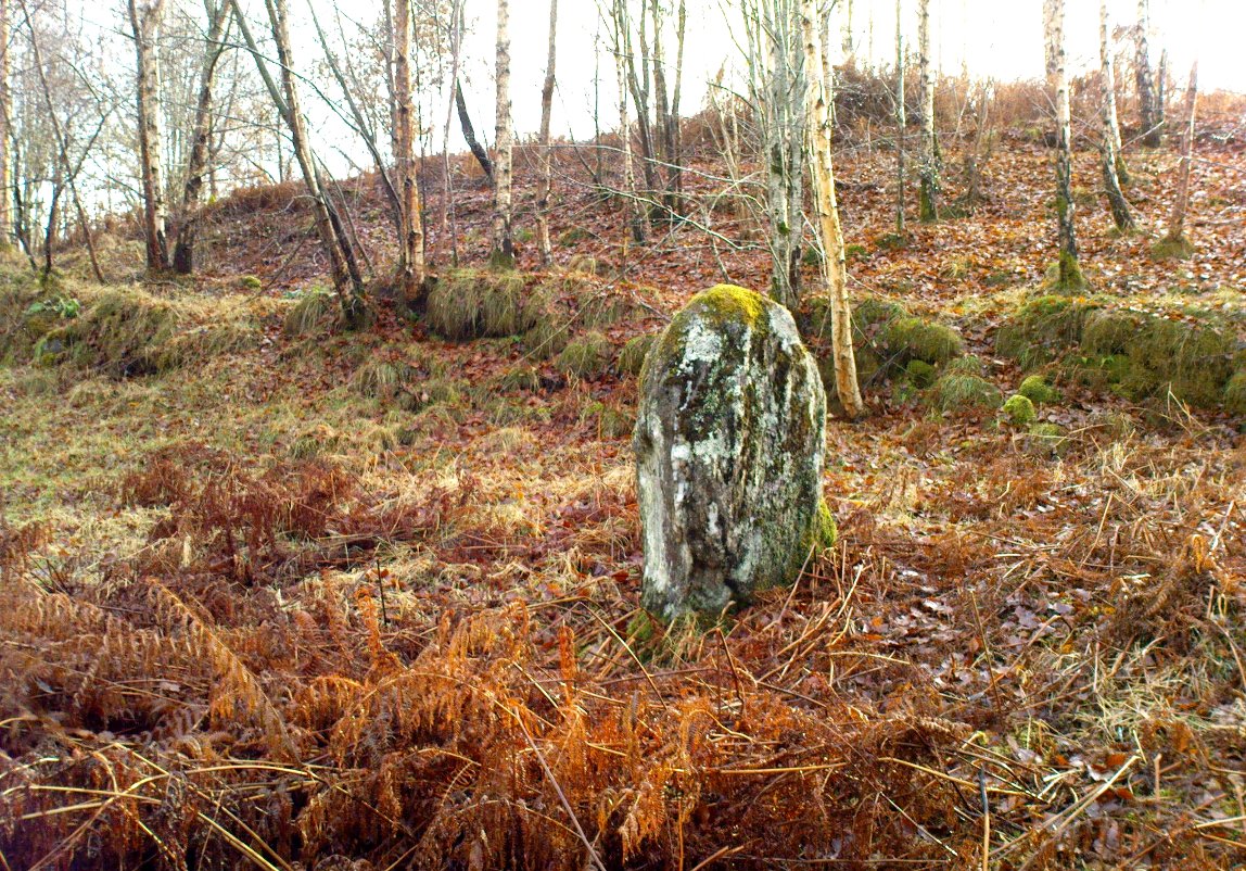
The old mossy stone
The old mossy stone

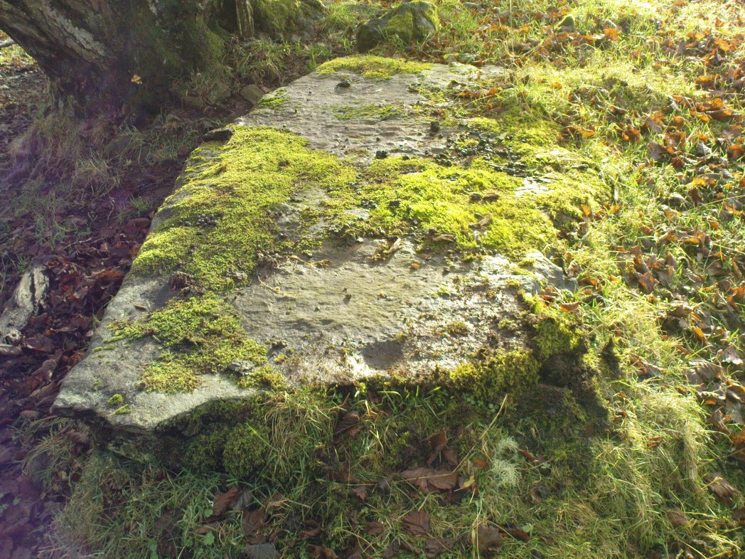
In this “land of Arthur”—as the place-name means—we find this beautiful moss and lichen-encrusted standing stone, living alone in remains of mainly birch woodland.  It stands less than 5 feet tall, just in front of some old walling encircling one of the many rounded knolls in this area.  The stone may have had some megalithic partners in bygone days, as we find, about 25 yards away sleeping amidst overgrown vegetation beside an old oak, a couple of other old stones laid on the ground that seem to have been placed here by human hands.  Their antiquarian nature is unknown.

References:

  1. Gillies, William A., In Famed Breadalbane, Munro Press: Perth 1938.

© Paul Bennett, The Northern Antiquarian

Tir Artair (01), Killin, Perthshire

Cup-Marked Stone:  OS Grid Reference – NN 59063 34807

Also Known as:

  1. Canmore ID 289905

Getting Here

Single cup-marked stone
Solitary cup-mark

Take the A827 road out of Killin to Fearnan and Kenmore.  A mile or so out of Killin, keep going go past the entrance to the Finlarig Power Station for just another 2-300 yards, keeping your eyes peeled for the small track on your right.  Go down here.   About 100 yards down the track bends, then another 50 yards it bends again – and just here there’s a small clump of trees, right by the bend.  You’re looking for the large flat rock therein.  You’ll see it!

Archaeology & History

Tir ArtairCR1b sm
Close-up of cupmark

Although listed by the lads at Canmore, I can find no previous literary reference to this stone — which is a simple thing to be honest: probably of little value to anyone unless you’re a real petroglyph fanatic!  The large flat rock has a single large cup-marking on its northern edge, 3 inches across and nearly an inch deep.  If you’re gonna visit here, you may as well check out the standing stone further down, in the trees on your right.

© Paul Bennett, The Northern Antiquarian

St. Fillan’s Well, Comrie, Perthshire

Holy Well: OS Grid Reference – NN 7080 2327

Also Known as:

  1. Well of St. Fillans

Archaeology & History

Found by the legendary hill of Dundurn, east of Loch Earn, this legendary healing site has been written about by many historians, both local and national. An early account of it was given by the local priest, Rev. Mr McDiarmid, minister of the parish of Comrie at the end of the 18th century, who informed those compiling the Old Statistical Account of the area, the following information:

“This spring, tradition reports, reared its head on the top of Dun Fholain (Fillan’s Hill) for a long time, doing much good, but in disgust (probably at the Reformation) it removed suddenly to the foot of a rock, a quarter of a mile to the southward, where it still remains, humbled, but not forsaken. It is still visited by valetudinary people, especially on the 1st of May and the 1st of August. No fewer than seventy persons visited it in May and August, 1791. The invalids, whether men, women, or children, walk or are carried round the well three times in a direction Deishal—that is from east to west, according to the course of the sun. They also drink of the water and bathe in it. These operations are accounted a certain remedy for various diseases. They are particularly efficacious for curing barrenness, on which account it is frequently visited by those who are very desirous of offspring. All the invalids throw a white stone on the Saint’s cairn, and leave behind them as tokens of their gratitude and confidence some rags of linen or woollen cloth. The rock on the summit of the hill formed of itself a chair for the Saint, which still remains. Those who complain of rheumatism in the back must ascend the hill, sit in this chair, then lie down on their back, and be pulled down by the legs to the bottom of the hill. This operation is still performed, and reckoned very efficacious. At the foot of the hill there is a basin made by the Saint on the top of a large stone, which seldom wants water even in the greatest drought, and all who are distressed with sore eyes must wash them three times with this water.”

We see from this early account that there’s a discrepancy regarding the location of St. Fillan’s Well, as the modern accounts indicate it to be at the top of the craggy hill. In some upland regions this occurred so as to maintain a sense of secrecy about the location of local sites, so ensuring they were not affected or disturbed by outsiders or incomers, who not only disrespected local customs and rites, but tried changing or altering them to their new ways. It also kept the local gods and spirits of the sites protected from tourism and the profane. This may explain the difference in locations described by Rev. McDiarmid.

About one hundred years after McDiarmid’s account, another priest called Tom Armstrong (1896) wrote a piece in the Chronicles of Strathearn (1896) all about this holy well, saying:

“People are prone to believe that the dirty pool of stagnant water which still remains in the driest summer on the top of St. Fillan’s Hill is the famous spring to which pilgrims at one time resorted. Any one who examines it will not fail to observe that it has all the appearance of an artificially built well, and must have been kept in order and preservation for a purpose. Tradition confirms the belief that this was at one time the well, but not always.”

The hill on which it is found was an ancient dun or fort, built in prehistoric times, making you wonder how far back in time its magickal abilities were known about.

References:

  1. Armstrong, Thomas, “By the Well of St. Fillan,” in Chronicles of Strathearn (David Phillips: Crieff 1896).
  2. Gordon, Seton, Highways and Byways in the Central Highlands, MacMillan: London 1948.
  3. Hunter, John, et al, Chronicles of Strathearn, David Phillips: Crieff 1896.
  4. Morris, Ruth & Frank, Scottish Healing Wells, Alethea: Sandy 1982.

© Paul BennettThe Northern Antiquarian


Tomochrocher, Glen Lochay, Perthshire

Cup-Marked Stone:  OS Grid Reference – NN 457 359  —  NEW FIND

Getting Here

The stone in its setting

From Killin heading out along the northern Loch Tay road, turn left just past the Bridge of Lochay hotel and go right to the very end of Glen Lochay, just past Kenknock.  From here you’ve gotta keep walking along the glen’s dirt-track, and when you go through the third gate along (about a mile), another 100 yards on, keep your eyes peeled for a reasonably large boulder on the left of the track. This is your marker to go up on the right-hand side of the track, where the large stone is about 20 yards up the slope.

Archaeology & History

Three cup-marks & their lichen

Not far from a prehistoric hut circle relocated by archaeologist Dugald MacInnes I found this, a previously unrecorded cup-marked stone, when I was ambling about around the top of this beautiful valley last week.  It’s only a simple cup-marked stone with two very distinct cups and a probable third in the middle of the well-defined ones.  A covering of aged lichen was living on the carved rock and it seemed that there may have been other cups beneath the lichen — but I’ve got a real love of these old plants and wasn’t about to tear them from their homely stone.

There are some other little-known unrecorded human remains all along the slopes above here, which I’ll have a look at when next up this Valley of the Black Goddess…

© Paul Bennett, The Northern Antiquarian

Fingal’s Stone, Killin, Perthshire

Standing Stone:  OS Grid Reference – NN 5712 3301

Also Known as:

  1. Canmore ID 24192

Getting Here

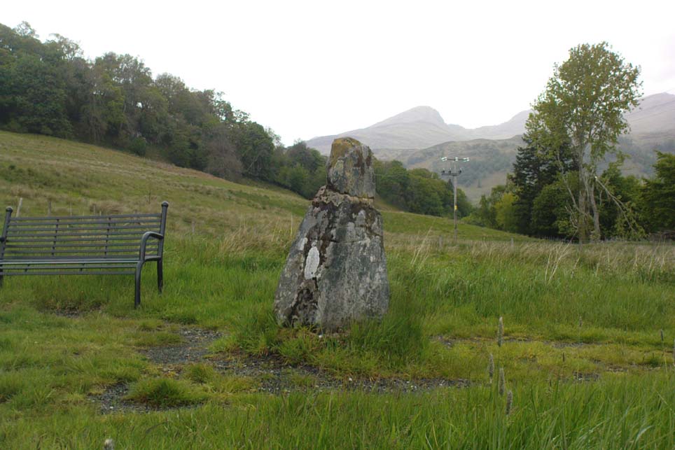
Fingal’s Stone, Killin

Less than 100 yards up the road from the Co-op in Killin, take the footpath on the same side of the road into the park at the back of the buildings. Keep following the footpath round the back of the buildings and you’ll see the stone in front of you soon enough.

Archaeology & History

Another curious site in this quite beautiful mountainous arena.  Thought to have originally stood by the rounded fairy knoll a bit further up the hill, no one knows for sure when the stone was moved to its present position—but locals will tell you how the curious knob-end atop of the stone was also a later addition to the fallen original, when it was resurrected in the latter half of the 19th century.  C.G. Cash (1912) also found the fairy mound and its companions on the slope above to be of interesting, wondering, as I have, that “they might have been burial mounds.” The local historian William Gillies (1938) said of the stone:

“Both the Old and New Statistical Accounts of the parish of Killin make reference to a site near the village that had been pointed out from time immemorial as the burial place of Fingal, the hero of Celtic folk stories. At this point, which is in the middle of a field immediately behind the schoolhouse, there is a standing stone 2 feet 8 inches high and 5 feet in girth.  The stone had fallen, but in 1889 it was re-erected by Mr Malcolm Fergusson, a patriotic native of Breadalbane.  Without any reference to the original arrangement, a smaller stone was fixed on the top, and others were placed near it. The lands in the vicinity of Fingal’s Stone used to be called Stix.  The name suggests that here, as at Stix between Kenmore and Aberfeldy, there were a number of standing stones, of which this one alone remains.”

And it certainly smells that way… Yet no further monoliths have been found hereby or on the slopes above.

Folklore

Reputed to be a stone that marks the grave of the hero-figure, Fionn.  Local historian  Duncan Fraser (1973) told that:

“Killin is steeped in history and one of its memorials of the past is a standing stone in a field behind the school, that is said to mark the spot where the mighty Fionn lies buried.  He is believed to have died about the end of the Iron Age, in 283 AD.”

Gazing N, to the Cailleach

William Gillies (1938) also reported how tradition said that an early church and graveyard was once to be found at the original site of Fingal’s Stone. Legends of Finn, his magick and his encounters with both faerie and men are found all over the landscape in this neck o’ the woods….

References:

  1. Cash, C.G., “Archaeological Gleanings from Killin,” in Proceedings of the Society of Antiquaries of Scotland, volume 46, 1911-12.
  2. Fraser, Duncan, Highland Perthshire, Standard Press: Montrose 1973.
  3. Gillies, William A., In Famed Breadalbane, Munro Press: Perth 1938.
  4. Wheater, Hilary, Killin to Glencoe, Appin Publications: Aberfeldy 1982.

© Paul Bennett, The Northern Antiquarian


Whooping Cough Stone, Struan, Perthshire

Legendary Rock: OS Grid Reference – NN 816 653

Getting Here

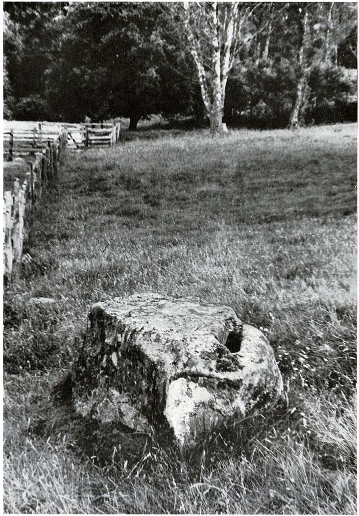
Old photo of the stone (after Duncan Fraser)

Up the A9 past Blair Atholl, a few miles later there’s the turning for Struan.  Scarcely a mile east of old Struan Church, head past the old farmhouse of Old Kindrochat and keep going eastwards along the edge of the trees for about 200 yards until you reach the sheepfold. There you’ll see a singular rock sitting alone by the fence. That’s it!

Archaeology & History

This little known healing stone was, at one time last century, of great repute in the Highlands. Today, very few people even know it exists. One of many rocks that were said to possess healing abilities, this one (obviously) was of great repute in the curing of whooping cough. But it wasn’t the rock alone that did the work here, for upon its edge was a small basin into which rainwater collected and this, when used correctly and in due accord with ancient ritual tradition, could enact the cure.  Mr Duncan Fraser said of this fascinating healing stone:

“The grey water-worn stone is about 4ft 6in long, 2ft 6in broad and 2ft high, with a deep gash on top, where the water lingers even in long dry spells. When full it holds about half-a-gallon. People were still coming here with their sick children as late as 1860 — and bringing a spoon made from the horn of a living cow. There was no cure without that.”

The ritual “spoon made from the horn of a living cow” was an important ingredient at another site with the reputation for curing whooping cough about 50 miles south of here, near Balquhidder. (see Whooping Cough Well, Killin)  What truly fascinates me is the origin of this stone and its medicinal virtues.  When  did the healing rites first start here – how long ago…?

References:

  1. Fraser, Duncan, Highland Perthshire, Standard Press: Montrose 1969.

© Paul Bennett, The Northern Antiquarian

Boat Stone, Blackford, Perthshire

Standing Stone (fallen): OS Grid Reference – NN 87202 07286

Getting Here

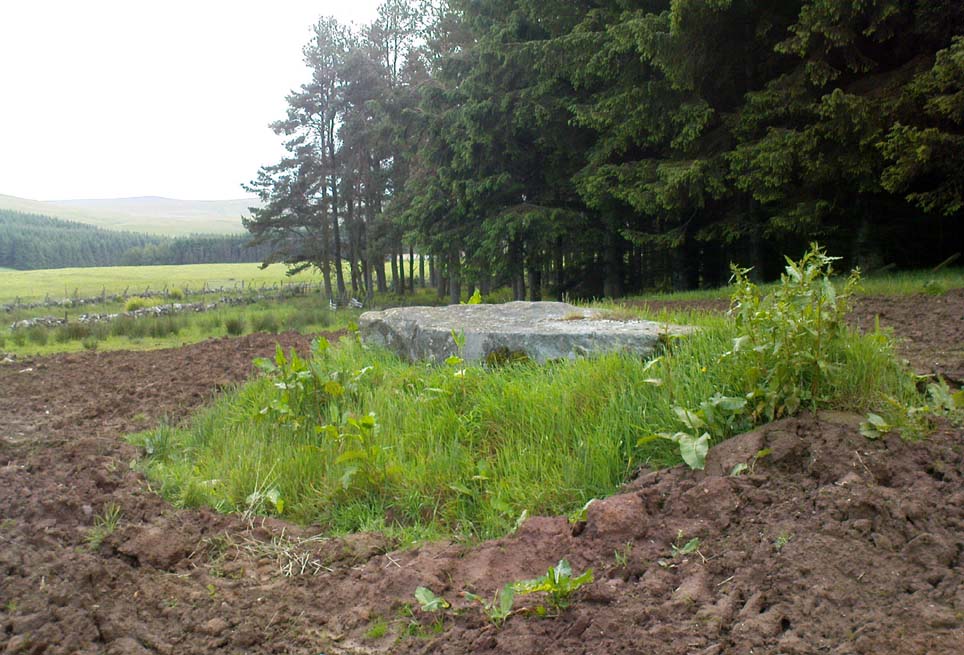
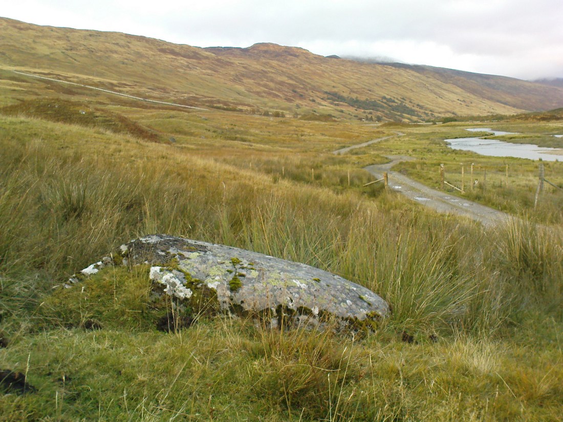
Fallen monolith in the grass

From Blackford on the north side of the A9, cross over and take the small B-road which quietly runs up and over Sheriffmuir towards Dunblane.  After a mile, keep your eyes keen for the approaching woodland on your right-hand side; for in the field just before the woods, you’ll see a patch of grass near the corner of the field with a long stone poking out of it. That’s it!

Archaeology & History

It seems that very little has been written about this monolith in any of the archaeology texts, but it’s ascribed locally to be a fallen standing stone.  The site’s described in Finlayson’s (2010) fine local megalith guide where he points out how it’s in line with other nearby standing stones at Gleneagles and the White Stone – and the line is damn close!

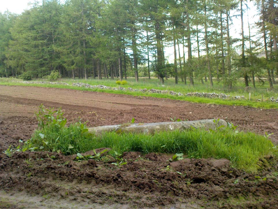
…and from another angle…

With a quartz vein running through it, the stone lays some thirteen feet long and was, at some time in the not-too-distant past, readied to be quarried, as evidenced by the chisel-marks cut into it, prior to the usual destruction. But this time, for some reason, someone must have come to the rescue and prevented its demise…thankfully…

The farmer annually cuts around the fallen stone, shaped like a long boat (hence the name), near the top corner of the field. It would have looked damn good when stood upright, standing about ten feet in height and visible for a good distance. But today it’s quite forlorn laid here, seemingly alone, in this quiet part of the country, and is probably only one of interest to hardcore megalithomaniacs amongst you!

References:

  1. Finlayson, Andrew, The Stones of Strathearn, One Tree Island: Comrie 2010.

© Paul Bennett, The Northern Antiquarian

Firbrush Point, Killin, Perthshire

Dun (destroyed):  OS Grid Reference – NN 603 337

Archaeology & History

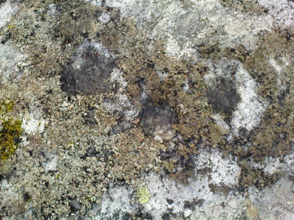
Not to be confused with the ‘fort’ shown on modern OS-maps on the wooded slopes a few hundred yards to the south, the denuded remains of this site were shown on an 18th century map of the area (the Breadalbane estate plans). Probably Iron Age in nature, the local historian William Gillies (1938) described the place in his fine work,

“According to the atlas of 1769 there were ruins of an ‘Ancient Castramentation’ at Firbrush Point on the farm of Auchmore. An examination of this little peninsula revealed the foundation of a very thick wall that at one time ran across its neck, and formed a defence on the landward side. It is probable that the stones were removed for the erection of the small pier and harbour close by.”

An assessment of the site by some of the Scottish Royal Commission lads in the late 1970s found no remains of the thick walling and it seems all remains of this fort have sadly been destroyed.

References:

  1. Gillies, William A., In Famed Breadalbane, Munro Press: Perth 1938.
  2. Royal Commission on the Ancient & Historical Monuments of Scotland, Archaeological Sites and Monuments of Stirling District, Central Region, Society of Antiquaries of Scotland 1979.

© Paul Bennett, The Northern Antiquarian 

Dunruchan ‘E’ Standing Stone, Muthill, Perthshire

Standing Stone: OS Grid Reference – NN 78997 16819

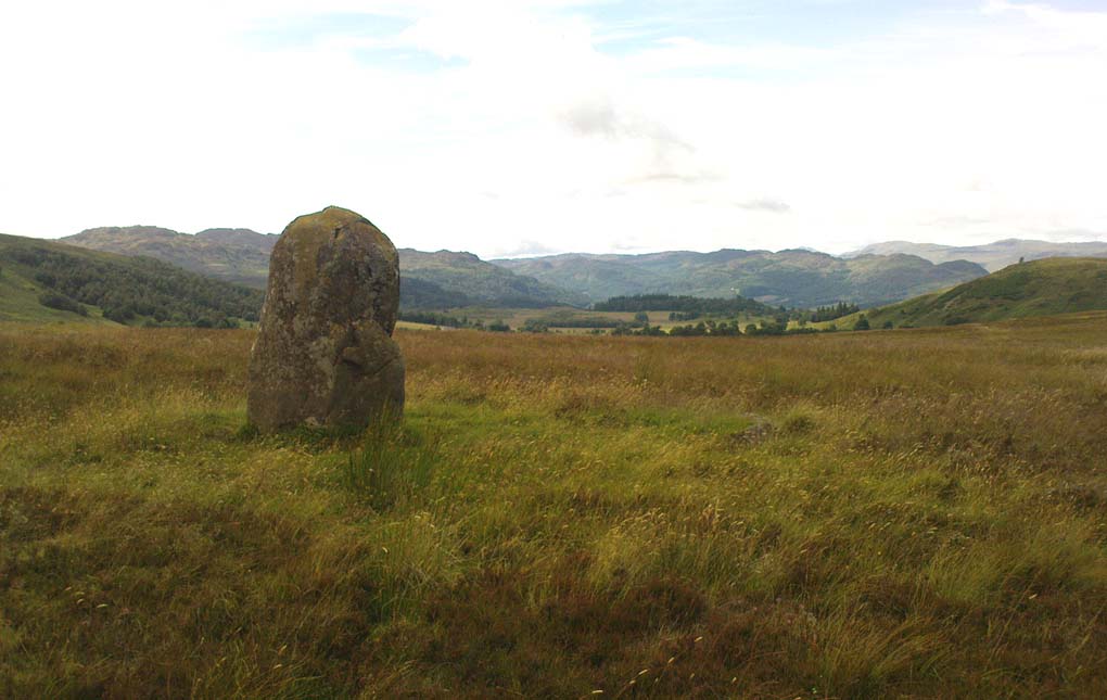
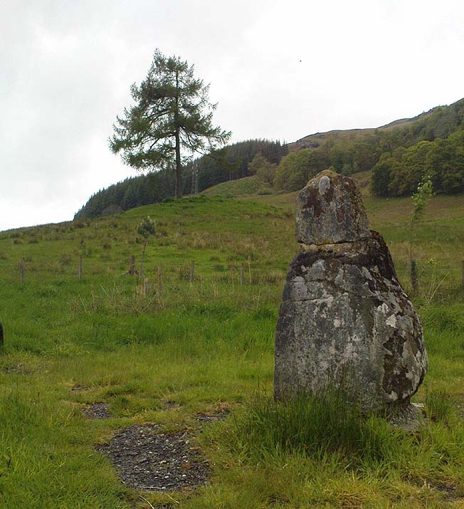
Dunruchan E stone, looking N

Also Known as:

  1. Aodann Mhor
  2. Canmore ID 24790
  3. Cornoch
  4. Shillinghill

Getting Here

Follow the directions to reach the standing stone of Dunruchan D, and there on the moor immediately to your south, 100 yards or so away, it stands before you!

Archaeology & History

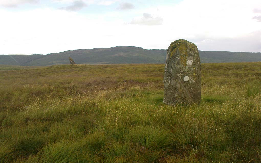
Dunruchan E stone, with Dunruchan D to rear

This is the southernmost of the impressive standing stones on the plain below Dunruchan Hill.  Notably more ’rounded’ at the top than most of its associates—giving a more distinct ‘female’ nature to the stone than its companions—we find again, scattered around the base of this 7-foot tall monolith, a number of smaller rocks that gives the impression an old cairn was once here.  Certainly there are a scatter of several other cairns nearby and we get the distinct impression with all of the Dunruchan stones, that a prehistoric cemetery was once in evidence here.

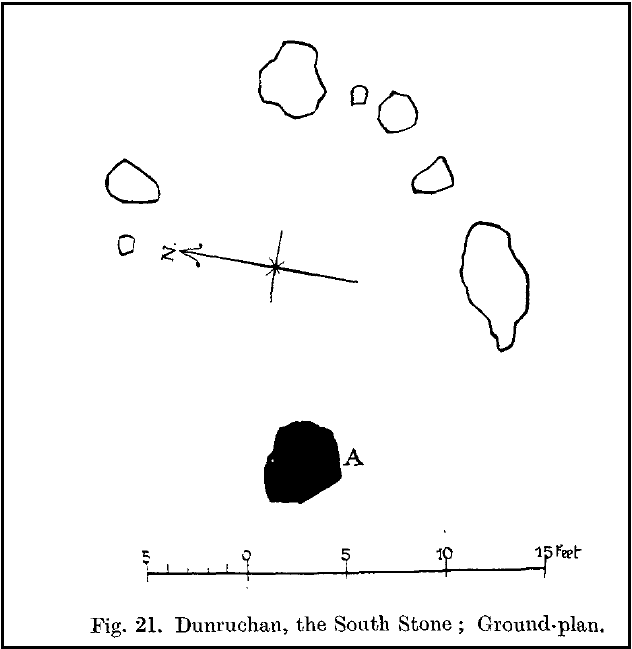
Ground-plan of stone & cairn
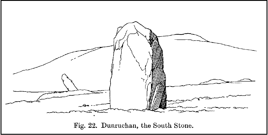
Cole’s drawing of Dunruchan E

Although this is the last of the known standing stones in this area, there is every probability of other prehistoric remains hidden amidst the heathlands—perhaps even more large standing stones that have fallen and are overgrown with vegetation. When Fred Cole came here one time with the great rock art writer, Sir James Simpson, one such fallen standing stone was reported a short distance tot he east, but it has yet to be recovered.  There may be more.

In Fred Cole’s (1911) report of this particular “south stone”, or Dunruchan E,  he wrote:

“This monolith, in respect of position, somewhat resembles the last, because it stands on the west arc of a rudely circular setting of small stones, which, however, are not placed on a mound (as in the case of Stone D), but merely lie on the flat of the moor. Five of these blocks are large enough to be noticeable, and they occupy the positions shown by the outlined stones in the ground-plan (fig. 21), the farthest to the east being 15 feet distant from the inner face of the standing monolith A.  The dimensions of this Stone are: height 6 feet 9 inches, basal girth 16 feet 1 inch. In the illustration (fig. 22) I show this Stone with the other great one near set on its platform, and to the right two of the numerous small, low cairns which are scattered about this part of the moor. ”

Folklore

According to an account in the Ordnance Survey Name Book of 1860, “these stones are believed to mark the graves or commemorate the death of Roman soldiers who fell in a battle fought here between the Romans and the Caledonians.”

References:

  1. Burl, Aubrey, From Carnac to Callanish, Yale University Press 1993.
  2. Cole, Fred, “Report on Stone Circles in Perthshire, Principally Strathearn,” in Proceedings of the Society of Antiquaries, Scotland, volume 45, 1911.
  3. Finlayson, Andrew, The Stones of Strathearn, One Tree Island: Comrie 2010.
  4. Hunter, John, Chronicles of Strathearn, David Phillips: Crieff 1896.
  5. Thom, A., Thom, A.S. & Burl, Aubrey, Stone Rows and Standing Stones – 2 volumes, BAR: Oxford 1990.

© Paul Bennett, The Northern Antiquarian