Legendary Rock: OS Grid Reference – NS 94135 99110
Also Known as:
- Canmore ID 48293
- Tom Baird’s Stone
- White Stone of Tombaird
Getting Here

Very troublesome for so little a stone. But to the nutters or climbers who enjoy a good bimble: if you’re coming on the A91 from Tillycoultry take the dirt-track up to Harviestoun, but if you’re coming from Dollar, take the dirt-track up past Belmont House – either way, keep walking till you get to Kennel Cottage. Walk past here and into the woods, then follow the burn (stream) uphill. It’s a steep climb, with waterfalls and mossy rocks. Once out of the woodland, keep following the stream. Several hundred yards uphill, you’ll pass a large rounded hillock on your left. Keep walking up the stream for another 200 yards, then walk to the right of the stream for about 100 yards. You’re damn close!
Archaeology & History

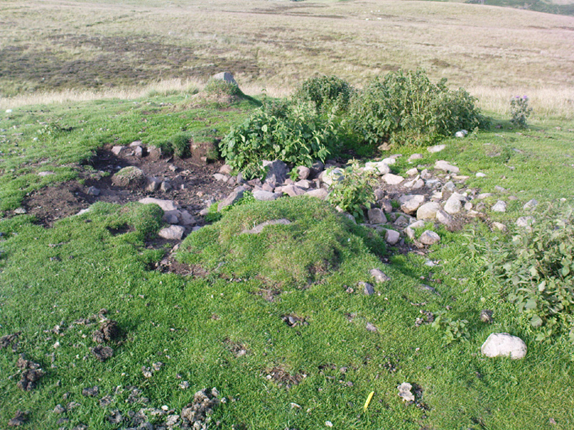
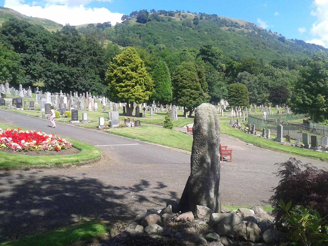
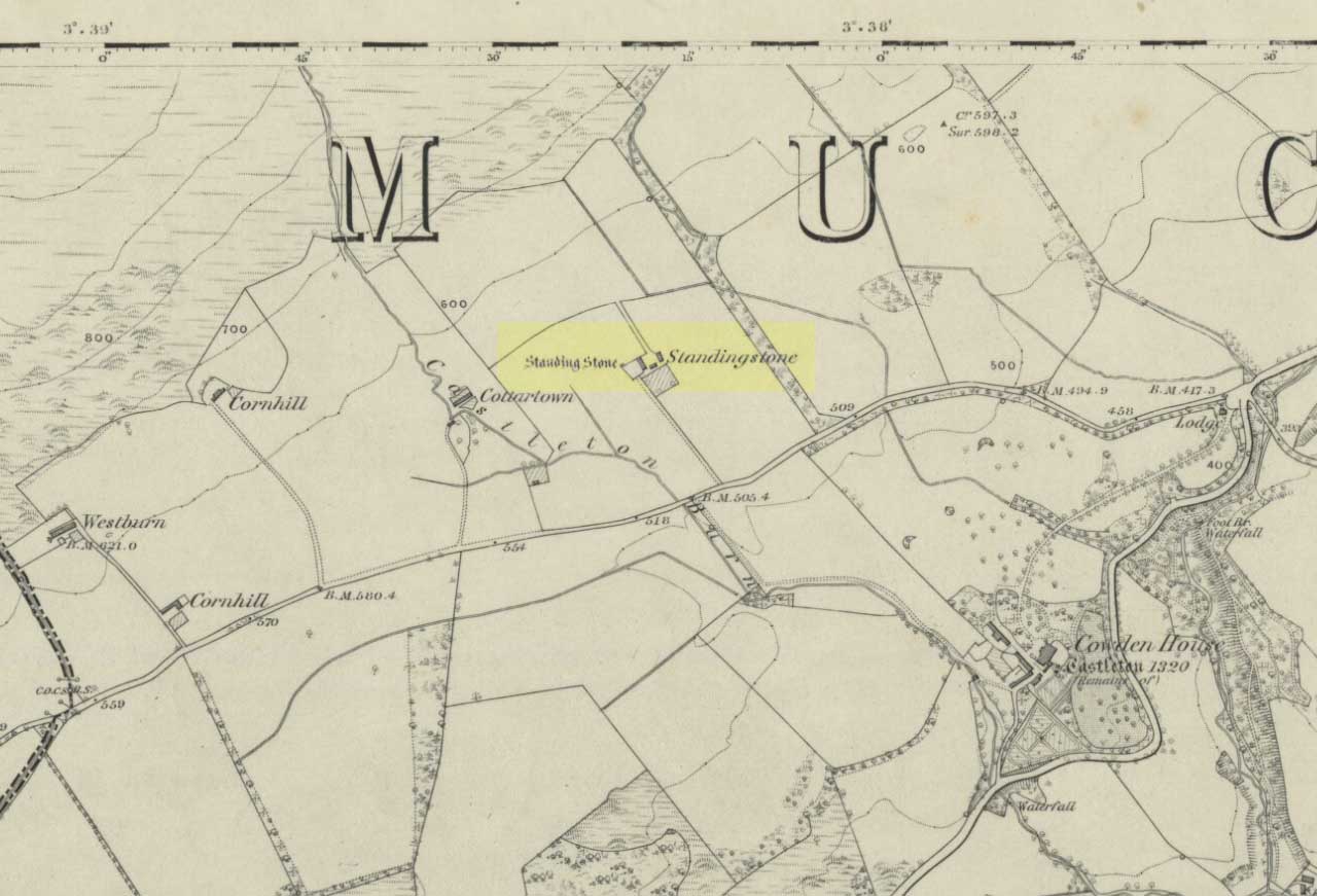
An obscure and little known site outside of the Ochils region, this stone seems to have been described for the first time in 1769 – though local people would obviously have known of its presence and mythic history centuries before this. It was then shown on the 1819 Plan of The Estates of Harviestoun and Castle Campbell, as shown here. The White Stane is a rounded quartz block about four feet long in the grasses, laid down and hard to find, it would have been impressive had it stood upright – which it may have done in ages not so long ago – in which case we would have had a shining standing stone on the edge of the steep slope halfway up the mountain. A curious ‘D’-shaped carving that seems to be etched on the top of the rock may simply be one of Nature’s simulacra.

When I arrived at the stone – after taking a typically circuitous bimble up the hillsides, and passing a variety of archaeological relics on the slopes east of the burn – the view was outstanding, looking some 60 miles south into the distant peaks of the Scottish Lowlands, with the sun casting itself over the entire landscape. The quartz rock by my side was gleaming brightly in the fresh daylight. Sitting down by its side, the cold wind cutting over us, a quietude befell the place and, and as I relaxed by its side, fell into a sleep for an hour or so. All was quiet and still in both mind and heart at the stone – then when I came round, I realised the sun was going down and thought it best to get off the mountains before dark!
In Angus Watson’s (1995) survey he told us,
“The 1860 OS Name Book says this is something of a mixture of whinstone and white marble, that the local tradition was that it had been erected to commemorate a battle between Wallace and the English, and that there was “no doubt whatsoever” that it was ‘druidical’!”
Watson also informs us that the name of the rock – Tom baird – is from the Gaelic, meaning the “bard’s knoll”. However, Bruce Baillie (1998) would have it that the The White Stone of Tam Baird,
“has possibly been derived from the Gaelic Tam a Bhaird, ‘the knoll of the enclosure.’”
And there is a large five-sided enclosure on the ridge of Dollar Hill, but that’s quite some distance away and would have little bearing on the naming of this quartz stone.
References:
- Baillie, Bruce, History of Dollar, DMT: Dollar 1998.
- Watson, Angus, The Ochils: Placenames, History, Tradition, PKDC: Perth 1995.
Acknowledgements: Huge thanks to Marion Woolley for directing us to the 1819 Estate map!
© Paul Bennett, The Northern Antiquarian


002")