Thor’s Stone, Thurstaston, Cheshire

Legendary Rock:  OS Grid Reference – SJ 24474 84933

Also Known as:

  1. Thor’s Rocks

Archaeology & History

Thor’s Rock (after J.Picton)

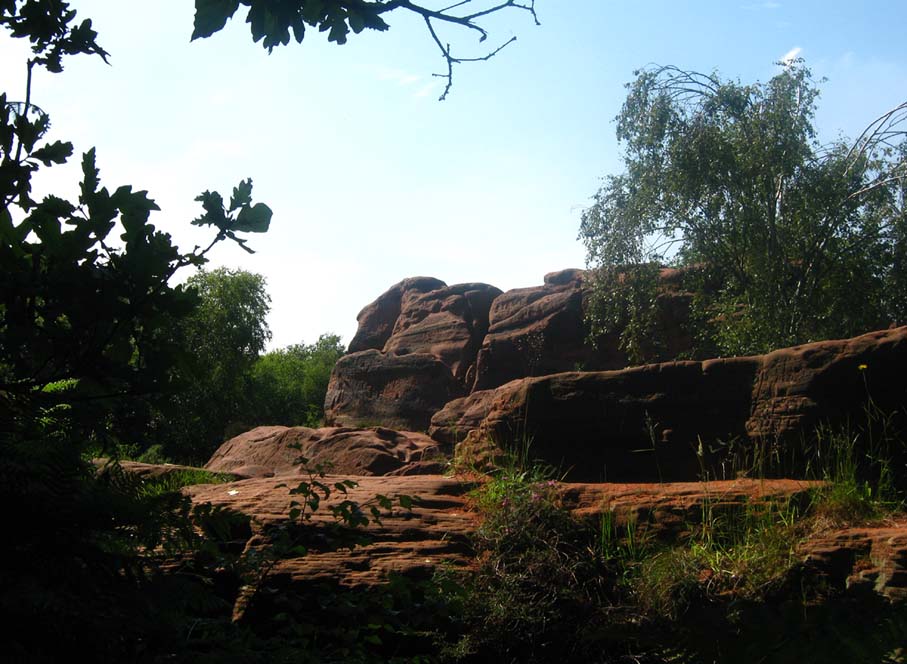
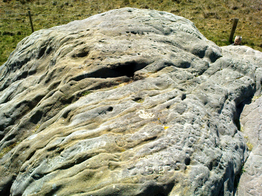
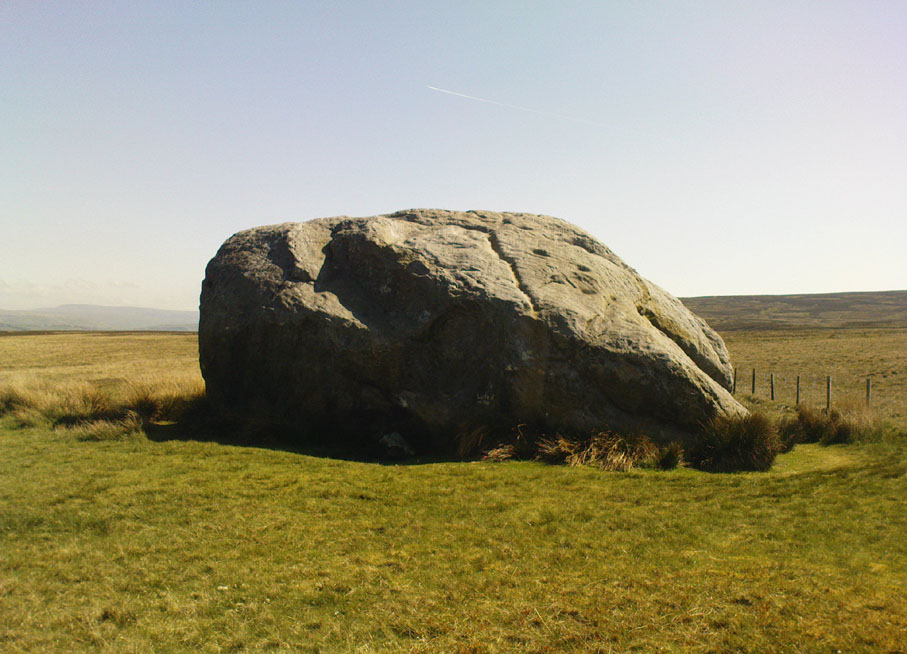
On Thurstaston Common a 298 foot high hill has a large red sandstone outcrop, on the landward side, known as Thor’s Stone. One large rectangular block of stone that is 50 feet in length, 30 feet wide by 25 foot high has been eroded over thousands of years. Described by J.A. Picton in 1877 as “the Great Stone of Thor,” the village itself seemed to have gained its name from this prominent mass of rocks.  It was described first of all in the Domesday book, as Turstanetone, and both village and rocks have been written as variants on the original ever since.  The place-names writers Mills & Room (1998) ascribe the name to being a “farmstead or village of a man called Thorstein”; but it’s just as likely to derive from “a farmstead of/at Thor’s Stone.” (Harrison 1898)  As early landscape features were traditionally equated with animistic and mythic lore, the Viking god Thor is more probable than some unlikely chap called Thorstein.

More than 100 miles southeast of here, we find another Thor Stone in the village of Taston, showing similar megalithic etymology.

Folklore

Local folklore tells that the rock is named after the Norse god Thor – he who causes thunder and lightning.  Viking settlers from Thingwell apparently settled here in the 10th century AD and, according to legend, these settlers used the stone as a pagan altar with blood sacrifices taking place here.  A creation myth of the site tells that Thor tossed the large stone here in anger; and yet another says that the stone was raised here to commemorate the battle of Brunanburh in 937 AD.  In modern more times, Morris dancers meet here and enact their rites on Mayday mornings.

The outcrop has been eroded away over thousands of years by the weather, post glacial erosion and even quarrying, leaving strange shapes, features and projections in the soft sandstone. There is much recent graffiti to be seen all over the rock, especially on the summit and sides including one set of graffiti carved by Professor Taylor in 1879.  There used to be a “fairy well” near the stone but this disappeared long ago.  Children took flowers to the well to decorate it, while adults visited it to receive a cure for various ailments of the body.  At nearby Thurstaston Hall, Christina Hole (1937) reported there lived the ghost of a troubled woman.

References:

  1. Harrison, Henry, The Place-Names of Liverpool, Elliot Stock: London 1898.
  2. Hole, Christina, Traditions and Customs of Cheshire, Williams & Norgate: 1937.
  3. Mills, A.D. & Room, Adrian, A Dictionary of English Place-Names, Oxford University Press 1998.

© Ray Spencer, The Northern Antiquarian


Bedd y Cawr, Llanymynech, Montgomeryshire

Chambered Cairn (destroyed):  OS Grid Reference – SJ 266 223

Also Known as:

  1. Llanymynych Hill
  2. Llech y Wydhon
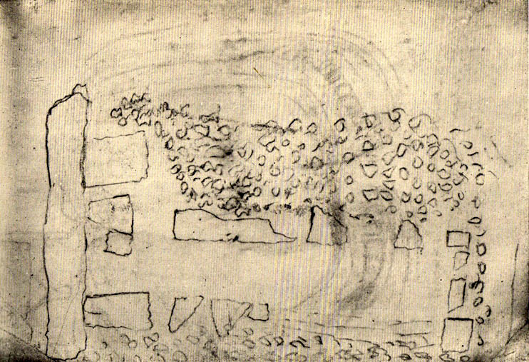
Scruffy 1835 ground plan of the lost tomb

Archaeology & History

An exact grid-reference for this once-impressive chambered tomb is difficult as “nothing remains of this site at the present day” (Daniel 1950) and the majority of the hilltop itself (a prehistoric hillfort no less), has been turned into one of those awful golf courses which are still spreading like cancer over our ancient hills.  It was obviously very close to the Shropshire border, as the folklorist Charlotte Burne (1853) said the grave was “on the Shropshire side of Llanymynech Hill,” perhaps placing it in the township of Pant.  But traditionally it remains within Llanymynech, within and near the top of the huge hillfort and east of Offa’s Dyke.

The old tomb was mentioned in an early letter of the great druid revivalist, Edward Lhwyd, who left us with the old ground-plan, reproduced above; and based on Lhwyd’s drawing and early narratives, Glyn Daniel (1950) thought the site “was perhaps a gallery grave”.  The best description we have of Bedd y Cawy was penned by John Fewtrell (1878) in his essay on the local parish in which he told:

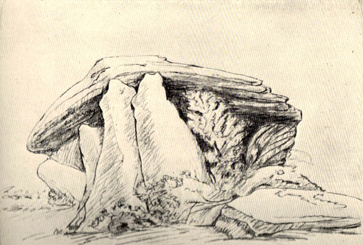
“This interesting relic of antiquity stood on the north-eastern end of the hill.  It was formed of four upright stones, on the top of which was placed a flat slab measuring 7ft by 6ft, and 18 in thickness.  It is known by the name “Bedd-y-Cawr” (the Giant’s grave).  The British name appears to support the theory that the cromlech is a burying place, and not an altar devoted to religious purposes.  The word is derived probably from the Welsh cromen, a roof, or vault, and lech, a stone, meaning a vault formed by a slab supported upon uprights ; or, according to some, ” the inclining flat stone”.  Rowlands derives it from the Hebrew cærem-luach, “a devoted stone”, but this is far-fetched for a word or name in common use among our British forefathers.  Many regard the cromlech as a distinct species of monument, differing from either a dolmen or a cairn.

“When the covering of stones or earth has been removed by the improving agriculturist, the great blocks which form the monolithic skeleton of the mound and its chamber usually defy the resources at his command.  As the skeleton implies the previous existence of the organised body of which it formed the framework, so, upon this theory, the existence of a ‘ cromlech ‘ implies the previous existence of the chambered tumulus of which it had formed the internal framework.  Sepulchral tumuli were formerly classified according to their external configuration or internal construction; but more extended and critical observation has shown that mere variations of form afford no clue to the relative antiquity of the structures. But as it has always been the custom of the prehistoric races to bury with their dead objects in common use at the time of their interment, such as implements, weapons, and personal ornaments, we have in these the means of assigning the period of the deposit relatively to the Stone, Bronze, or Iron age.” Sometimes no traces whatever of human remains are found in the chamber.  Search was made to some depth in this cromlech, but nothing was found.”

In Fewtrell’s same essay he also described another megalithic site (also destroyed) on the southwestern part of the Llanymynech Hill, where,

“stood two rows of flat stones, parallel, 6 feet asunder, and 36 in length. A tradition exists which states that in digging near this place a Druid’s cell was discovered, but of what shape or size it does not relate.  There were a number of human bones and teeth in a state of good preservation also discovered.  In digging between the parallel rows a stratum of red earth was found, about an inch thick.”

Folklore

As the name of this old tomb tells, it was once reputed as “the Grave of the Giant”, but in Charlotte Burne’s huge work on the folklore of Shropshire (volume 1), she told it to be the tomb of his lady:

‘The Giant’s Grave’ is the name given to a mound on the Shropshire side of Llanymynech Hill, where once was a cromlech, now destroyed. The story goes that a giant buried his wife there, with a golden circlet round her neck, and many a vain attempt has been made by covetous persons to find it, undeterred by the fate which tradition says overtook three brothers, who overturned the capstone of the cromlech, and were visited by sudden death immediately afterwards.”

There is also a legendary cave beneath Llanymynech Hill which have long been regarded as the above of goblins and faerie folk.  More of this will be told in the profile for the hillfort itself.

References:

  1. Burne, Charlotte Sophia (ed.), Shropshire Folk-lore, Trubner: London 1853.
  2. Daniel, Glyn E., The Prehistoric Chamber Tombs of England and Wales, Cambridge University Press 1950.
  3. Fewtrell, John, “Parochial History of Llanymynech,” in Collections Historical & Archaeological Relating to Montgomeryshire, volume 11, 1878.
  4. Wynne, W.W.E., “Letters of E. Lhwyd,” in Archaeologia Cambrensis, vol.3, 1848.

© Paul Bennett, The Northern Antiquarian


Foel Fawr, Llanfechell, Anglesey

Chambered Cairn:  OS Grid Reference – SH 36048 91995

Also Known as:

  1. Cromlech Farm
  2. Llanfechell Chambered Tomb

Getting Here

From Tregele village, take the minor southeast road towards Llanfechell, until you pass the second dirt-track on your right (both tracks take you to a local farm).  The second track takes you to the aptly-named farmhouse of ‘Cromlech’ – which is where you need to ask the farmer (a friendly chap) if you can have a gander at his rocks!  To which he should say, “Aye…it’s over there in the field.”  You can’t really miss ’em!

Archaeology & History

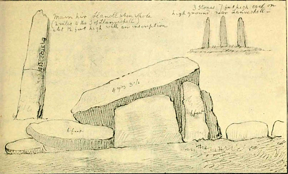
This was once an impressive prehistoric tomb by the size of things, but has been knocked about a bit over the centuries.  Even when Glyn Daniel (1950) described it, he said that “at present this site consists of nothing more than a number of large stones lying in a field — some flat and others slightly tilted.”  And it hasn’t changed much since then!  One of the earliest descriptions of Foel Fawr was by John Skinner (1908) in his fine tour around Anglesey in the early 19th century, where he told:

Skinner’s 1804 drawing
Foel Fawr tomb

“From hence passing by an old mansion named Cromlech now tenanted by a farmer we came to the spot where many large stones were lying scattered promiscuously on the ground and one nearly square measuring nine feet across leaning against some uprights about six feet high.  From the appearance of this place I should rather imagine that it had been the interior or cistfaen of a carnedd and this opinion seems somewhat confirmed by the accounts of the common people who remember great quantities of stone having been removed to form a wall.”

References:

  1. Daniel, Glyn E., The Prehistoric Chamber Tombs of England and Wales, Cambridge University Press 1950.
  2. Skinner, John, Ten Days’ Tour through the Isle of Anglesey, December 1802, Charles J. Clark: London 1908.

© Paul Bennett, The Northern Antiquarian


Newtyle, Dunkeld, Perthshire

Standing Stones:  OS Grid Reference – NO 04489 41057

Also Known as:

  1. Doo’s Nest
  2. Druid’s Stones
  3. New Tyle

Getting Here

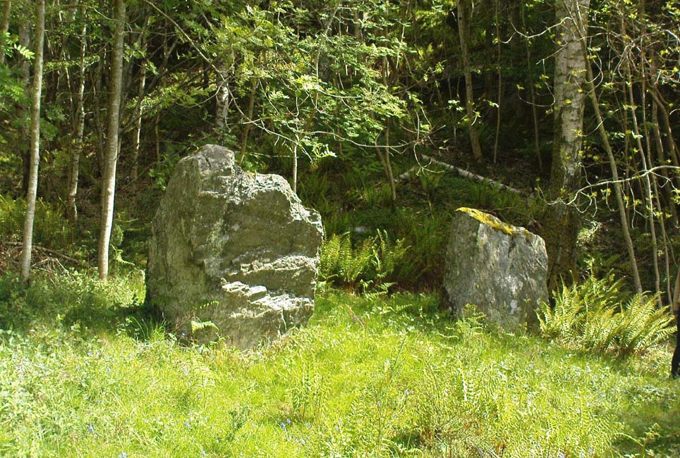
Newtyle’s standing stones

From Dunkeld travel southeast on the A984 road to Caputh and after about 1½ miles, set back a few yards from the road amidst the trees below the Newtyle Quarries (whose mass of slate and loose rocks cover the slopes), you’ll see these two large monoliths.  There’s nowhere to park here, but there’s a small road a coupla hundred yards before the stones aswell as a space to park on the verge by the side of the road a few hundred yards after them.  Take your pick!

Archaeology & History

When we visited these two tall standing stones a few weeks ago, guerilla archaeologist Hornby and I were a little perplexed at the state of these stones, wondering whether they were a product of the fella’s who dug the quarries above here, or whether they were truly ancient.  It seems the latter is the consensus opinion!

They were described by the great Fred Coles (1908) in one of his lengthy essays on the megaliths of Perthshire, where he thought the two stones here were all that remained of a stone circle that once stood on the flat, above the River Tay, but whose other stones “were destroyed in the making of the road” which runs right past here.  Not so sure misself!  He told that,

“An old cart-track runs up between the stones, leading from the main road…up to the quarry. The mean axis of the two stones runs N 13° W and S 13° E (true), and although their broader faces do not point towards the centre of a circle on the west, it is certainly much more probable that the other stones were on this side, the lower and flatter ground, than on the east, where the ground slopes and is more broken and rough.

“Both stones are of the common quartzose schist, but they differ considerably in shape.  A is 6 feet 7 inches high at the north corner, but only 4 feet 10 inches at the south, and its vertical height at the east is only 3 feet.  The basal girth is 13 feet 3 inches, and in the middle 15 feet 9 inches.  The broad east face measures 5 feet.  Stone B is level-topped and 5 feet in height; it has a basal girth of 12 feet 4 inches, and at the middle of 11 feet 8 inches.  Its two broad faces are of the same breadth.”

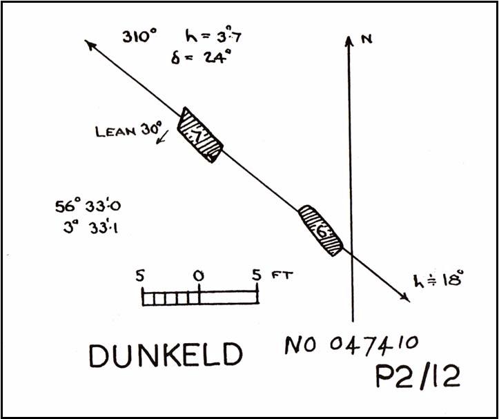
Little else was said of the two stones for many years and, to my knowledge, no real excavation has been undertaken here.  But when Alexander Thom (1990) visited the site he found that,

“This two stone alignment showed the midsummer setting sun.  The south stone may possibly, by itself, have shown the setting Moon at major standstill.”

Aubrey Burl’s description of the stones was succinct and echoed much of what Coles had said decades earlier, telling:

“Two very large stones stand only 9 feet (2.7m) apart in an unusually closed-in environment for a Perthshire pair.  The ground rises very steeply to the east.  To the west the stones overlook the valley of the River Tay.

“Both are of local quartzoze schist and are ‘playing-card’ in shape.  As usual it is the westernmost stone that is taller, 7ft 2in (2.2m) in height.  Its peak tapers almost to a point.  Conversely, its partner is flat-topped and only 4ft 9in (1.5m) high.  The pairing of such dissimilarly shaped stones has led to the interpretation of them as male and female personifications.”

Alex Thom’s groundplan
Back of the smaller stone

Burl’s latter remark thoughtfully recognises that such animistic qualities are found in many other cultures in the world and this ingredient was also an integral part of early peasant notions in Britain; therefore such ingredients are necessities to help us understand the nature and function of megalithic sites.  We must be cautious however, not to fall into the increasingly flawed modern pagan notion of such male and female ‘polarizations’, nor the politically-correct sexist school of goddess ‘worship’ and impose such delusions upon our ancestors, whose worldviews had little relationship with the modern pagan goddess fallacies, beloved of modern Press, TV shows and pantomime festival displays.

Folklore

In Elizabeth Stewart’s history of Dunkeld, she narrates the tale told by an earlier historian who told that,

“these two upright stones at the Doo’s Nest, but says they are supposed to mark the graves of two Danish warriors returning from the invasion of Dunkeld.”

References:

Burl, Aubrey, From Carnac to Callanish, Yale University Press 1993.
Coles, Fred, “Report on Stone Circles Surveyed in Perthshire – Northeastern Section,” in Proceedings of the Society of Antiquaries, Scotland, volume 42, 1908.
Stewart, Elizabeth, Dunkeld – An Ancient City, Munro Press: Perth 1926.
Thom, A., Thom, A.S. & Burl, Aubrey, Stone Rows and Standing Stones – 2 volumes, BAR: Oxford 1990.

© Paul Bennett, The Northern Antiquarian


Brown Beck Stone, Agra Moor, North Yorkshire

Standing Stone:  OS Grid Reference – SE 13499 82440  —  NEW FIND

Also Known as:

  1. Agra Moor Standing Stone

Getting Here

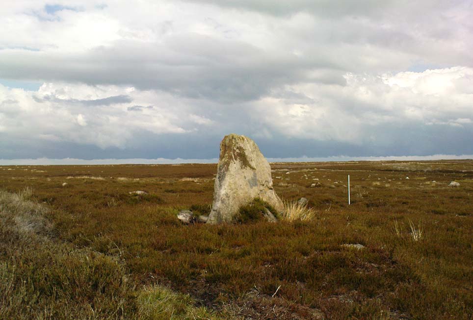
Agra Moor standing stone

From Masham, take the Fearby Road to the village, keep going on the same road through Healey village and less than a mile on where the road forks, bear to the right past and go along the gorgeous little-known vale of Colsterdale.  It’s bloody beautiful!  Less than 2 miles on, walk up the notable track veering to your right, diagonally uphill.  Walk along till you get to the moor edge.  Go thru the gate and follow the swerving uphill path to the bottom of Slipstone Crags.  Once you level out at the Crags top, look across the small valley to your left and, on t’other side, you’ll notice a standing stone upright in the heather, just 100 yards on the flat on the other side of the valley.  Head right for it!

Archaeology & History

Looking west

There are no known written references to this standing stone, which we visited for the first time yesterday, in a brief wander to the nearby Agra Woods cup-and-ring stones a few hundred yards southeast.  The monolith stands some four-and-half-feet tall and, at its base, is more than three feet broad and just one foot wide.  Just to its side and almost completely covered in peat and vegetation is what may have been another once-upright companion asleep in the Earth.  Another possibly fallen stone is less than 10 yards west.  The upright stands on the flat moorland overlooking the confluence of two (once) fast-flowing waters of Brown Beck and Birk Gill; and the landscape that reaches out from here is something to behold!

We found the remains of other old monuments on the moor, but some were obviously related to the industrial mining not far away.  However, two or three other small upright stones and a large stone circular structure were also located which very obviously predated any industrial or medieval workings.  We need to revisit this moorland and spend more time exploring to see what other things are hidden, lost midst the peat and heather.

© Paul Bennett, The Northern Antiquarian 


Newhall Bridge, Kenmore, Perthshire

Standing Stones:  OS Grid Reference – NN 7926 4668

Also Known as:

  1. Canmore ID 24910
  2. Newhall Stones
  3. Taymouth Standing Stones
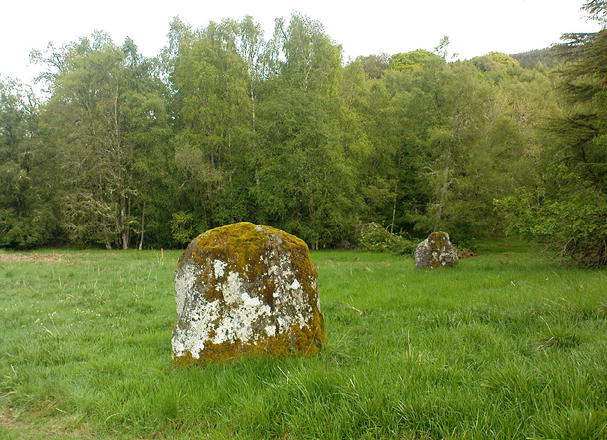
Newhall Stones, Kenmore

Getting Here

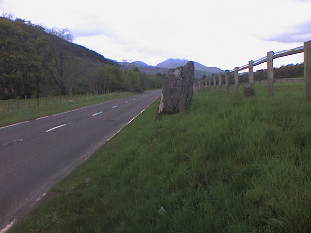
Pretty easy to find.  At the eastern end of Loch Tay, go through the old village of Kenmore along the A827, towards Aberfeldy, for about a mile.  At least a mile past Kenmore, keep your eyes peeled for a small left turn which takes you back into the grounds of Taymouth Castle.  Go on this small road, pass the ornate walling, and you’ll see these two standing stones in front of you, before the trees, on the left.  If you reach the Croftmoraig Stone Circle, you’ve gone a few hundred yards past the turning.

Archaeology & History

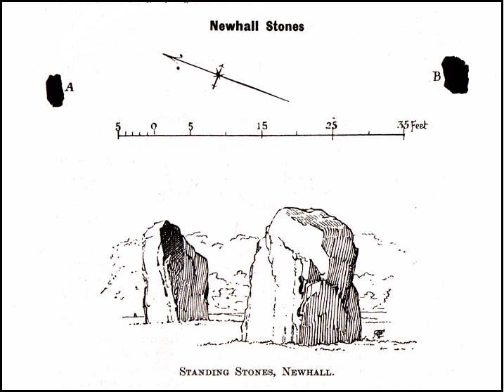
Fred Coles’ drawing & lay-out

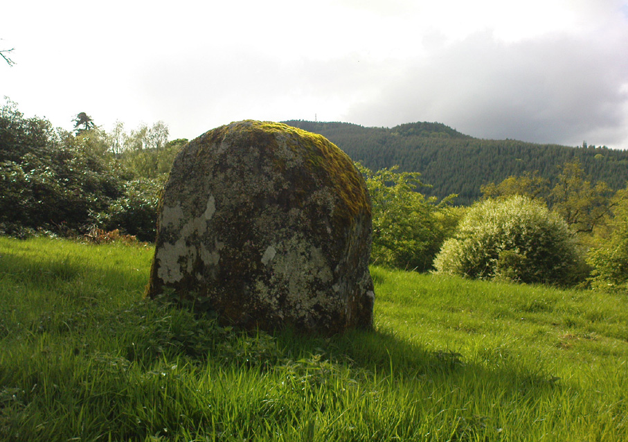
These fine-looking standing stones a mile northeast of Kenmore village, on the edge of the grounds of the superb Taymouth Castle, are worthy old monoliths, encrusted by the lichens of many centuries, resting within the long grass beside the track that runs to the castle.  But they have received little attention in archaeological terms.  When Fred Coles (1910) described them, he thought them to be the remains of a stone circle — an impression echoed by Margaret Stewart (1966) many years later (I got the same impression aswell), but no other stones have been found to substantiate this (although Mr Gillies’ folklore remnant is intriguing).  There is a notable rounded hillock immediately behind the two stones which may, or may not, have had other uprights surrounding it; though I can find no further data anywhere to substantiate such a thing.

In William Gillies’ (1938) historical survey of the area he related Mr Coles’ earlier findings of the two stones, telling us:

“There are two great standing stones just within the Principal Gate leading to Taymouth Castle.  The stone A (see plan) stands at a distance of 54 feet to the NNW of B — a somewhat greater diameter than is common among the Perthshire Circles.  These stones are almost equal in height — A is 4ft 9in, B is 4ft 7in — and they are both rugged blocks of a rough species of diorite.  Stone A measures round the base 10ft 8in, and stone B 14ft.”

The western stone
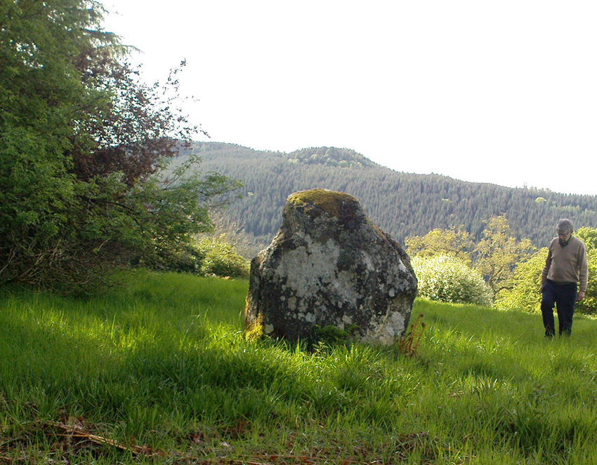
The eastern stone

But it seems that little else has been found about the place.  It’s in a gorgeous setting (but, round here, everything’s in a gorgeous setting!) and must have related to other sites in the area, but it’s hard to contextualize the place on a single visit.  If you stand behind the two stones, the shape of their ‘heads’ fits very nicely onto the rounded hillock on the northwestern skyline — which seems to have later been used as a hillfort.  Whether this has any astronomical potential, I aint checked. (though Thom says nothing about them)

In geomantic terms both of these stones possess a distinct female flavour to them; the easternmost thinner of the two, particularly so.  But then I could just be talking bullshit!  I’d have loved to have spent more time with these two stones — bimbling, sitting, focussing, dreaming — as people of olde naturally did; but we were on the move and had other places to see.  Tis a delightful spot indeed…

(NOTE – This site was first given a grid reference of NN 801 477 in Margaret Stewart’s (1967) fine essay on the standing stones at nearby Lundin; and the grid-ref has since been reproduced in texts by Burl (1993), Thom (1990) and others.  Please note that this grid-ref is incorrect and is nearly a mile away from the actual position of the stones.)

Easternmost stone from another angle

Folklore

There is the possibility that this site once played a part in an important megalithic stone row.  Mr Gillies (1938) once again notes an old tradition told by local people which “says that at one time there was a paved way connecting the circle, of which these stones are the remains, with the great Croftmoraig circle.”  Very intriguing indeed…

References:

  1. Burl, Aubrey, From Carnac to Callanish, Yale University Press 1993.
  2. Coles, Fred, “Report on Stone Circles Surveyed in Perthshire,” in Proceedings of the Society of Antiquaries, Scotland, volume 44, 1910.
  3. Gillies, William A., In Famed Breadalbane, Munro Press: Perth 1938.
  4. Stewart, M.E.C., “The excavation of a setting of standing stones at Lundin Farm near Aberfeldy, Perthshire“, in Proceedings of the Society of Antiquaries, Scotland, volume 98, 1966.
  5. Thom, A., Thom, A.S. & Burl, Aubrey, Stone Rows and Standing Stones – 2 volumes, BAR: Oxford 1990.

© Paul Bennett, The Northern Antiquarian


Acharn, Killin, Perthshire

Standing Stone:  OS Grid Reference – NN 56141 31601

Getting Here

Acharn’s standing stone

This one’s easy as it’s right by the roadside, so making it dead easy for those lazy ones amongst you who don’t like walking!  You can find it just past the turn-off (signed) for Acharn Lodge, a few hundred yards along the A827 road (off the A85 by the garage) from Lix Toll, less than a mile before reaching Killin.

Archaeology & History

This solitary standing stone, not much more than about three feet tall, originally stood in the adjacent field and was moved to the edge of the road sometime ago.  It was described briefly in William Gillies’ Breadalbane (1938) where he said, “Its height is 3 feet 10 inches and its girth at the base 6 feet 2 inches… This solitary stone is possibly the sole survivor of a group that once formed a circle,” though gives no more information to support this idea.  It seems more likely that the stone accompanied a cairn, that was levelled by farming sometime in the 19th century.

References:

  1. Gillies, William A., In Famed Breadalbane, Munro Press: Perth 1938.

© Paul Bennett, The Northern Antiquarian


Rudston Monolith, East Yorkshire

Standing Stone:  OS Grid Reference – TA 09803 67740

Getting Here

Rudston’s monolith (photo by ‘QDanT’)

To get to the monolith travel along the B1253 road to the west of Bridlington for about 5 miles or from York take the A166 in an easterly direction then onto the B1251 and at Fridaythorpe take the B1253 east again toward Bridlington. The huge stone cannot be missed from the road and from the surrounding area. It stands within the graveyard of All Saints’ church at the north-eastern side of Rudston village.

Archaeology & History

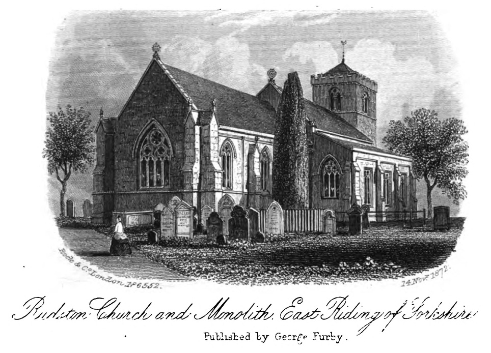
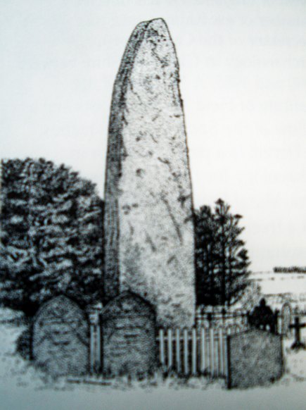
Located in the graveyard of All Saints’ church, this huge and mighty monolith or menhir stands at 25 foot 9 inches high (7.7 metres), and is the tallest prehistoric standing stone in Britain. It is estimated to weigh 40 tons, and it is thought to be the same in height below ground as what it is above the ground, though I don’t know whether anyone has ever checked that theory out. It probably dates from the Bronze-Age about 1,600 BC. Because of vandalism and erosion the top of the stone now has a lead cap, so it is said the stone could have originally been 28 feet high. So where has the top part gone to, I wonder. We are told that the stone was dragged, or rolled on logs, all the way from an outcrop at Cayton Bay some 10 miles as the crow flies to the north.

Royston’s 1873 drawing
Rudson Monolith (Louise Hutchinson 1988)

Rudston monolith stands at the end of at least one cursus monument on an old prehistoric alignment (see the Rudston B Cursus entry).  It would appear to have played an important ingredient in a huge ceremonial landscape on the Gypsey Race.  Also in the churchyard (north-east corner) there is a large slab-stone cist which was removed from a nearby round barrow and also a gritstone. At Breeze Farm about one mile to the south-west of the village is the site of a Roman villa.

Folklore

The folklore elements tell us that this is, in fact, a phallic stone and in pagan times some form of ritual was held around the monolith, but then the Christian church was built around it in the Dark Ages – it was a case of Christianity adopting the pagan religion and allowing the stone to stay where it was, but what else could they do because the stone was to big to move, so a lot of tolerance was in order here. The present church of All Saints’ dates from the Norman period. In any case the stone had stood here for a good 2,000 years or more before any church was established in the village. According to the legend, the devil hurled the huge stone at the first Christian church on the site, but as usual he just missed – doesn’t he always!

References:

  1. Bord, Janet & Colin, Ancient Mysteries of Britain, Diamond Books: London 1991.
  2. Anderton, Bill, Guide To Ancient Britain, Foulsham: London 1991.
  3. Darvill, Timothy, AA Glovebox Guide – Ancient Britain, AA Publishing Division: Basingstoke 1988.
  4. Royston, Peter, Rudston: A Sketch of its History and Antiquities, George Furby: Bridlington 1873.

© Ray Spencer, The Northern Antiquarian 2011


Great Stone of Fourstones, Lowgill, North Yorkshire

Legendary Stone:  OS Grid Reference – SD 66972 66292

Also Known as:

  1. Big Stone
  2. Four Stones

Getting Here

The Great Stone of Fourstones

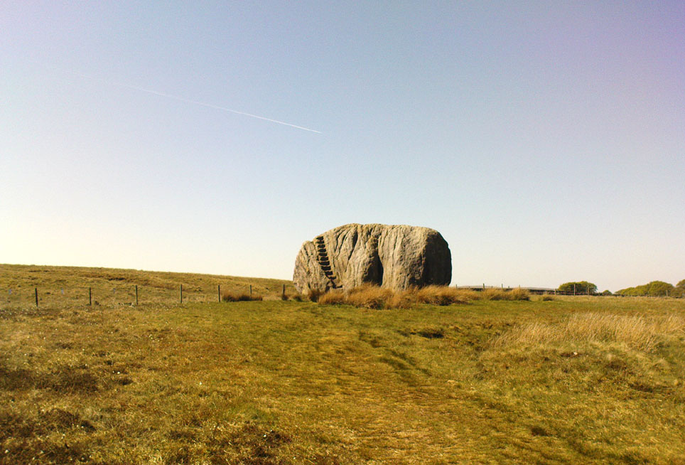
From near the middle of the large village (or small town!) of High Bentham, go down Station Road, over the river — where the road becomes known as Thickrash Brow! — and keep going for about a mile.  The landscape opens up into the hills and there, on the left-hand side of the road, is a car-parking spot with a footpath taking you straight up to the large boulder a 100 yards on: that’s our Great Stone!  You can’t really miss it.

Archaeology & History

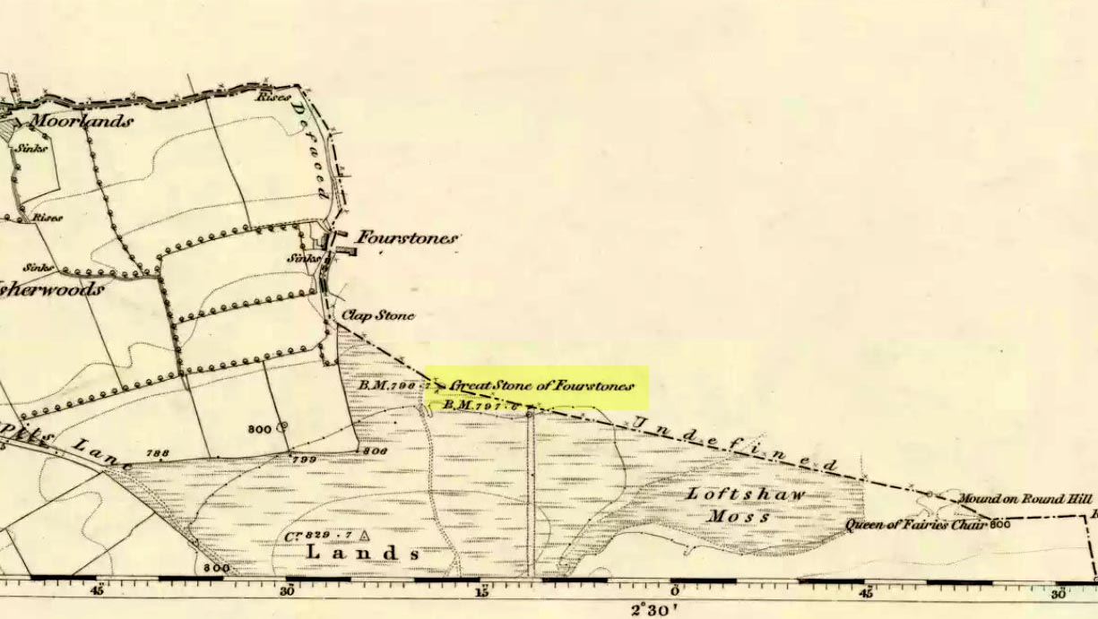
Great Stone on 1847 map

A meeting place of local tribes in more ancient days, the moorland plain upon which the Great Stone sits, beckons to a vast landscape on all quarters (north, south, east and west) calling the elders from their lands for annual rites and decisions to befit the health of the land and the people.  The stone rests on the ancient boundary of Yorkshire and Lancashire, just on the Yorkshire side, and was visited annually in more later centuries during the beating of the bounds, to define the edges of the local township.

Graffiti & cup-marks on the top

First described in a Yorkshire inquisition account from 1307, this Big Stone was visited by Harry Speight (1892) who described it as measuring 30 feet round and 12 feet high.  I came here for the first time in the 1980s when I was hitch-hiking into the Scottish mountains, but a good old “local” (from the Yorkshire side) took a detour to show me the place!  Once here, I climbed up the very worn “steps” which were carved into the side of the boulder several centuries back and it didn’t surprise me to find a number of cup-markings (no discernible rings) on its top surface.  When I came here again with Michala Potts and Paul Hornby yesterday, I couldn’t believe how many people had carved their names on top of the Great Stone in the intervening years — it’s almost covered in modern graffiti and the old cup-markings were much harder to see.  Taylor (1906) mentions them briefly in his holy wells survey, saying how,

“This great boulder is ascended on its eastern side by fourteen steps, and on the top are two circular holes about two inches deep and two inches in diameter.”

There used to be three others boulders very close to this one (hence its title), making a natural stone circle, but they were “broken up for sharpening scythes” a couple of hundred years back.  A much wider archaeological survey of this region is long overdue.

Folklore

Great Stone, looking east

Harry Speight (1892) told how the (original) Four Stones were the creation of our old friend the Devil, long ago, who dropped them in one his many megalithic travels across our land. The stones were also the meeting place of ancient councils, from the tribes either side of the Yorkshire-Lancashire border. Their presence here also had mythic relationship with the Queen of the Fairies Chair, about a mile southeast, along the same boundary line.

Weird how folklore changes. Whilst old Mr Speight told how the devil created the once great four stones that were here, many years later Jessica Lofthouse (1976) told how the three missing stones – which had been here “since the world began” – were actually taken from here by Old Nick. Carrying them over the land,

“His load he dropped on Casterton Fell, where the rocks he discarded, the Devil’s Apronful, are still lying around. He selected the most suitable, dressed them and carried them in panniers down to the (River) Lune”

— and built the legendary Devil’s Bridge at Kirkby Lonsdale – which itself has strange tales to tell.  Another creation myth about the Great Stone is told on the plaque near the stone, alongside the footpath, which tells:

“Legend has it that it is a small part of the debris hurled by the giant Finn McCool across the Irish Sea in a fit of anger.”

It’s very obvious that a lotta mythic landscape material has been neglected and overlooked around this site.  Something we need to remedy, if we can, in the coming years…

References:

  1. Lofthouse, J., North Country Folklore, Hale: London 1976.
  2. Speight, Harry, The Craven and Northwest Yorkshire Highlands, Elliott Stock: London 1892.
  3. Taylor, Henry, The Ancient Crosses and Holy Wells of Lancashire, Sherratt & Hughes: Manchester 1906.

© Paul Bennett, The Northern Antiquarian 


Monzie Carving, Crieff, Perthshire

Cup-and-Ring Stone:  OS Grid Reference – NN 88161 24176

Getting Here

Andy Finlayson’s original piece

From Gilmerton village, take the A822 Dunkeld road north.  Go for about 200 yards and take the little road to Monzie; watching carefully another 200 yards on for the dirt-track on the left taking you across the fields.  Go along the track, watching out for the small stones in the field on your right less than 200 yards along.  You can’t really miss ’em!  This small ring of stones is the Monzie Cairn Circle.  The carving is just in front of it!

Archaeology & History

Although we know this brilliant carved stone has some relationship with the Monzie cairn circle only five yards away (it was linked via a man-made stone causeway, running between the circle and the carving), the stone itself is very much deserving of its own entry here — and at the same time I can give Andrew Finlayson’s (2010) excellent book a decent plug aswell! (the superb drawings of the stone, top & bottom, are from Andy’s work)

Allen’s 1882 drawing
Carving & proximity of circle

First mentioned (I think) in Simpson’s (1867) early survey, the carving was described soon after by J. Romilly Allen (1882), who gave us an early drawing of the stone.  Thought by some to have originally stood upright, the carving was described by Aubrey Burl (2000) as being, “decorated with forty-six cupmarks, cup-and-rings, nine double, one triple, there are grooves and a pair of joined cups.”  It’s certainly an impressive carving!

Although the carving has been posited by some archaeologists as an outlier to the Monzie circle, it’s probable that the circle emerged from the carving — a concept that some may find difficult to understand.  I’m not aware of any modern excavations here (the last, I think, was in 1938), but my guess would be that the stone causeway laid between the cup-and-ring stone and the circle ran towards the circle from the carving, and not the other way round.  The carving is probably older than the stone ring — though of course, without excavation, my idea could be utter bullshit! (there are also some cup-marked stones in the circle aswell – though none as impressive as this)

The carving in shadow (© Andrew Finlayson)

One of my truly favourite megalith fanatics (despite some of his alignments being out), Alexander Thom, came here and thought this old carving “coincided with a rough stellar alignment from the centre-point of the cairn” (Hadingham 1974); though his notes in Megalithic Rings (1980) tell that,

“from the cupmarked stone beside the circle, the midsummer sun sets above an outlier some 800ft distant.”

The “outlier” that Thom mentions is known as the Witches’ Stone of Monzie, which Simpson (1867) appears to have mistakenly thought was the name of this very carving.

References:

  1. Allen, J. Romilly, “Notes on some Undescribed Stones with Cup Markings in Scotland,” in Proceedings of the Society of Antiquaries Scotland, volume 16, 1882.
  2. Burl, Aubrey, The Stone Circles of Britain, Ireland and Brittany, Yale University Press 2000.
  3. Finlayson, Andrew, The Stones of Strathearn, One Tree Island: Comrie 2010.
  4. Hadingham, Evan, Ancient Carvings in Britain, Garnstone: London 1974.
  5. Simpson, James, Archaic Sculpturings of Cups, Circles, etc., Upon Stones and Rocks in Scotland, England and other Countries, Edmonston & Douglas: Edinburgh 1867.
  6. Thom, Alexander, “Megalithic Astronomy: Indications in Standing Stones,” in Vistas in Astronomy, volume 7, 1966.
  7. Thom, A., Thom, A.S. & Burl, H.A.W., Megalithic Rings, BAR: Oxford 1980.

© Paul Bennett, The Northern Antiquarian