Takes a bitta finding this one. Best found by going along the gorgeous, little-known Dunning Glen in the eastern Ochils, till you reach Littlerig house. Cross the road from there and follow the line of the burn and forest till it veers sharp left. Keep along the fencing until the marshland levels out and streams fall away both east and west. From here, walk uphill until you reach level ground, then, looking down the Borland Glen, zigzag downhill for 100 yards. Keep your eyes peeled for stones emerging from the Juncus grasses.
Archaeology & History
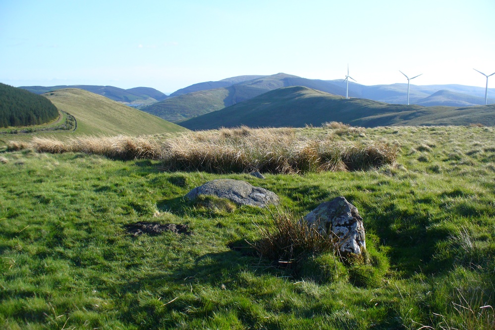
This four-poster stone circle isn’t included in Aubrey Burl’s (1988) survey of that name, nor his 2000 AD magnum opus on megaliths. The site appears to have only recently been rediscovered. Shown on modern OS-maps in non-antiquated lettering, this may be due to verification being required to authenticate its prehistoric status. It’s certainly in a peculiar position in the landscape here — and seems more likely to have been built just 100 yards uphill on the level grassland plain where views east, south and west open up almost with the majesty of Castlerigg!
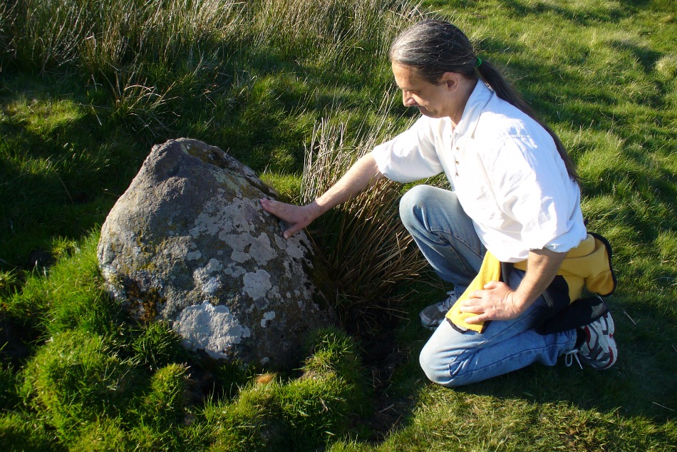
Fondling & puzzling over cup-marks on one of the stones
When Paul Hornby and I ventured here yesterday, we mistook the arc of three stones on the flat plain with the ring of stones that are down the Borland Glen slope ahead of us, so good was the position! But at least one thing came of this: of the arc of three stones shown in the photos here, one of the rocks possesses cup-markings, which you can make out here in one of the close-ups.
The dimensions of the four stones that make up the ‘circle’ down the slope was measured and described by the Scottish Royal Commission lads as follows:
It comprises four stones, which define a trapezium measuring 3.2m along its N and W sides, 2.7m along the S and 2.5m along the E. All the stones are set square at the corners with their long axes lying E and W, and they present a long flat face to the interior. The two on the N are markedly larger than the others, and that on the NW is also the tallest. The dimensions of the stones are as follows: NW – 1m by 0.5m and 0.65m high, NE – 0.8m by 0.4m and 0.3m high, SE – 0.73m by 0.43m and 0.2m high and SW – 0.73m by 0.38m and 0.4m high.
One of the most notable features a visitor to this site will find, is the utter silence as you walk up the slopes to reach the place. And then, once away in the opening landscape, a view of velvet Earth in all Her beautiful shades surrounds you – assuming you go here on a sunny day! Well worth the wander if quiet hidden megaliths are your pleasure…
References:
Burl, Aubrey, Four Posters: Bronze Age Stone Circles of Western Europe, BAR 195: Oxford 1988.
Burl, Aubrey, The Stone Circles of Britain, Ireland and Brittany, Yale University Press 2000.
Acknowledgements: Many thanks to Paul Hornby for use of his photos.
Along the A827 Loch Tay road between Morenish and Lawers, keep your eyes peeled for the Carie farmhouse on the mountain-side of the road (Tombreck is on the other side). The farmer here is very helpful and will let you walk up the land behind his abode if you ask. Go behind the trees round the back of his abode, following the small burn up for a couple of hundred yards until you see the stone in the long grasses on the right. It’s not too difficult to find.
Archaeology & History
Carie Stone, looking south
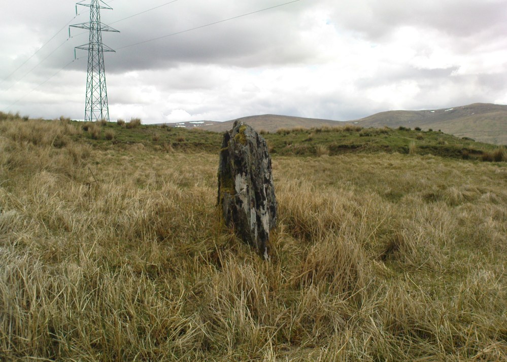
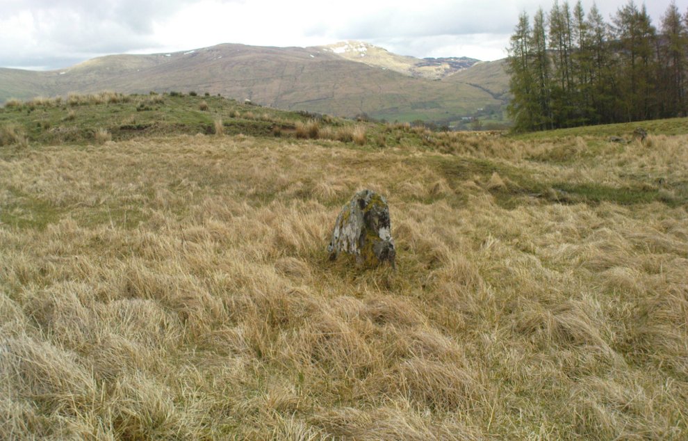
Nothing seems to have been written about this small standing stone, found close to the large cluster of cup-and-ring stones of Ben Lawers. It sits alone in now-boggy ground, in a small dip of land near the stream above Carie Farm. The stone is barely a foot thick, but stands 3½ feet tall and is more than 4 feet wide. Its isolation is curious and makes it difficult to contextualize; but the stone is worth visiting if you’re exploring the rock art on the slopes above.
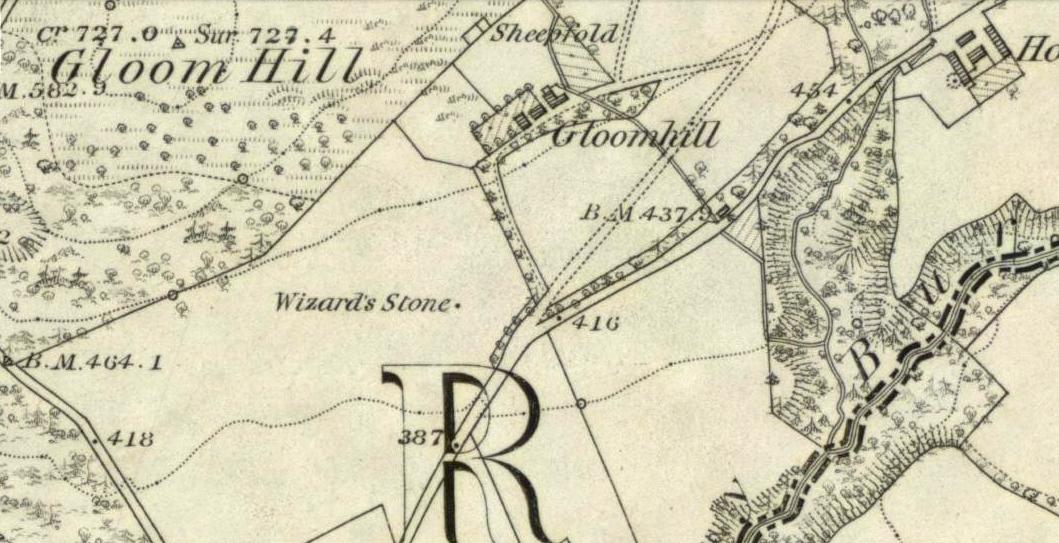
From Dollar town centre, take the road up to the gorgeous Castle Campbell, but instead of turning up towards the castle, keep on the road, uphill, for another quarter-mile. As the road begins to level out, a small field and driveway on your left heads up to Kiloran house. Stop here, and note the stone in the field, right by the fence alongside the footpath which runs uphill by the field-side up into the woods. That’s the Wizard’s Stone.
Archaeology & History
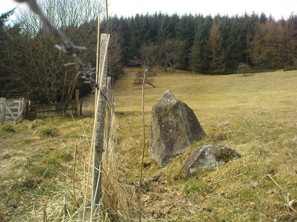
The Wizard’s Stone, Dollar
This site doesn’t seem to be the remains of an authentic prehistoric standing stone (unlike the one along the same ridge a mile east at Castleton), but is more of a memorial rock relating to some witch traisl that occurred here several centuries ago. By virtue of this, I felt it needed to be included on TNA.
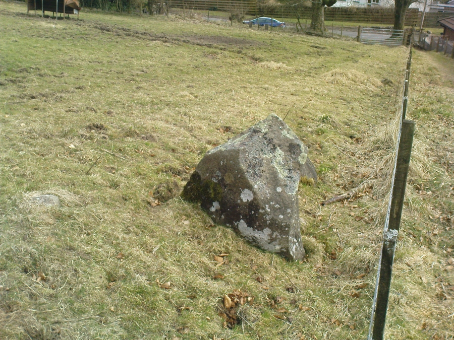
Not listed by Canmore, the stone is found in an area with a rich cluster of heathen place-names—most intriguing of which is the ‘Lochy Launds’ woodland, right above where this Wizard’s Stone now rests. The stone has been broken into smaller pieces in recent years—as the photos here show—and the small standing stone which remains is barely 3 feet tall at the edge of the field.
The local writer and historian Rennie McOwan (1989) told that it marked the spot where a warlock was burned in the 16th century. Years later, a local land-owner called John Moir erected the stone here as a memorial to the event. This was subsequently echoed by fellow local history writer Bruce Baillie (1998), when he wrote:
“A large whinstone in a field in a field is known as ‘The Wizard’s Stone’, having been set there by one of the Moirs to take the place of a rotting stake said to mark the spot where the last Dollar witch (and, naturally, the last Scots one), named Forrester, was burnt, though this is probably folk confusion with the vicar of Dollar, Thomas Forrest.”
Angus Watson (1995) could find no early references of this stone, other than it being mentioned in the 1860 Ordnance Survey Name Book. Further information on the site would be most welcome.
Folklore
Wizard’s Stone, looking down to the road
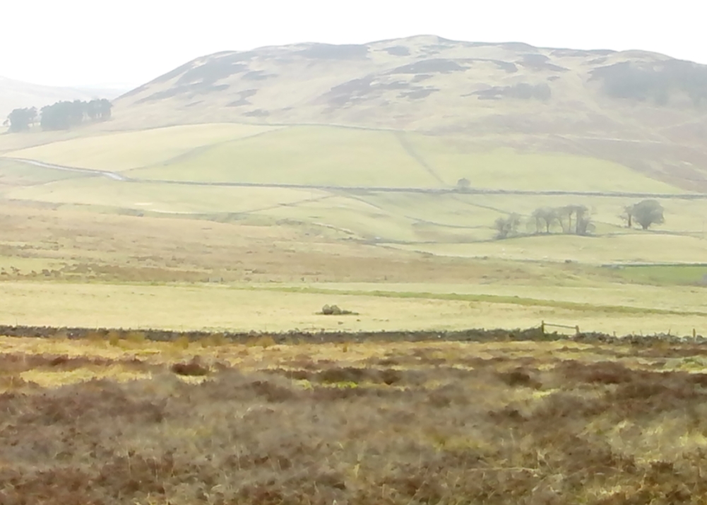
Reputedly one of the haunts and gathering places of the witches of the area, this spot was also known as Lochyfaulds, which the place-name giant W.J. Watson (1926) tell us means the ‘place of the Black Goddess,’ like the “Valley of the Black Goddess” of Glen Lochay, 40 miles to the northwest of here near Killin. Modern folklore ascribed the wizard here to have been Merlin—as highlighted in the adjacent place-name of “Merlin Park.”
References:
Baillie, Bruce, History of Dollar, DMT: Dollar 1998.
McOwan, Rennie, The Green Hills, CDL: Alloa 1989.
Watson, Angus, The Ochils: Placenames, History, Tradition, PKDL: Perth 1995.
Watson, W.J., The History of the Celtic Place-names of Scotland, Edinburgh 1926.
Landscape of Giants Knowe (photo by Marion Woolley)
Amidst the colourful and nurturing landscape close to the gigantic Dunruchan standing stones and just along the road from the solitary Craigneich stone, in the field across the road above Straid farmhouse could once be seen a fascinating-sounding prehistoric site that has sadly been destroyed. Some of the remains of this old monument can be found in the field-clearance of stones just over the fence, above the top of the field (many fields round here have scatterings of large stone clearings at the field edges), but we have no detailed accounts of the site. It was mentioned in early notes by the Ordnance Survey to have been,
“A large circular heap of small stone and gravel entirely removed in 1831. An urn filled with ashes and several stone coffins were found under it.”
The local historian John Shearer (1883) later told us that,
“A small mound of earth on the farm of Strayd, called Crock-nafion or the Giant’s Knowe, or the Fingalian’s Knowe, was cleared away several years ago. An urn containing burnt bones was discovered.”
Any additional information about this site and its folklore, would be greatly appreciated.
Folklore
To the west along Glen Artney whence our view takes us from here, old legend told that the valley was once the abode of a great giant who lived in a cave in one of the mountains thereby. In mythic lore, giants were the creation deities of hills, mountains and other geological forms, whose narratives were overturned and demonized by the incoming christian cult many centuries ago. It is likely that this once great tomb was deemed as the burial-place of our local giant – which would make this prehistoric site neolithic in age. But — logical though it is — this idea is pure speculation…
References:
Hunter, John, Chronicles of Strathearn, David Philips: Crieff 1896.
Shearer, John, Antiquities of Strathearn, David Philips: Crieff, 1883.
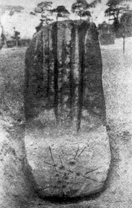
Similar in size and appearance to one of the cup-marked Tuilyies standing stones in Fife, Scotland, it was our old ley-hunter, Alfred Watkins, who described this stone in his Ley Hunter’s Manual (1927), along with giving us the old photograph taken by one of his mates here, which also showed the cup-and-ring carvings near the base of the stone. Are they still visible? (I’ve not been here, hence mi ignorance!) Watkins thought the cup-markings at the bottom represented some of the local leys—but unfortunately they don’t.
Folklore
Legend says that the deep grooves running down the stone were made by men sharpening arrow-heads on it (like a whetstone). There was also the usual christian Victorian fable that the stone was used by the druids and that the grooves on the stone were where the blood of their human sacrifices was channelled to the ground! The stone was also said to have some relationship with the nearby Calder Stones (which seems probable).
References:
Cowell, Ron, The Calderstones – A Prehistoric Tomb in Liverpool, Merseyside Archaeological Trust 1984.
Watkins, Alfred, The Ley Hunter’s Manual, London 1927.
Go west out of Dunfermline on the A994 till you hit the Torryburn roundabout, taking the A985 Kincardine road. Barely a half-mile along, stop at the first parking lay-by at the roadside – and there, over the barbed wire fence, you’ll see your standing stones right in front of you.
Archaeology & History
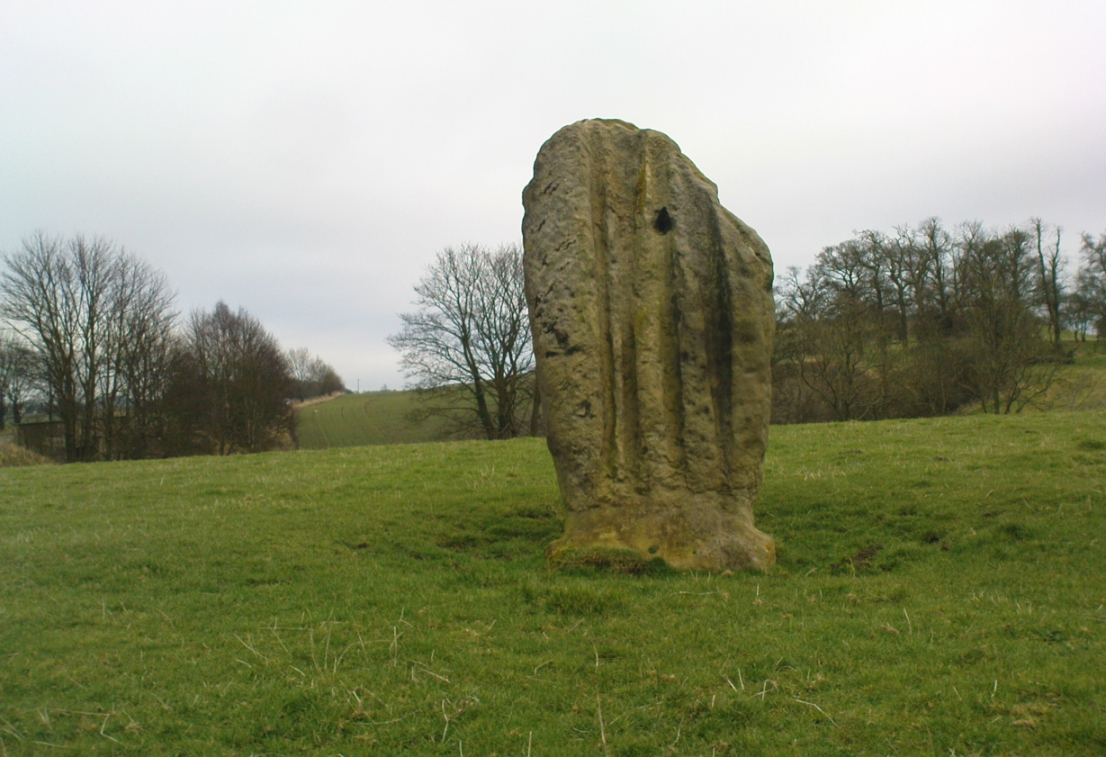
The Tuilyies standing stones
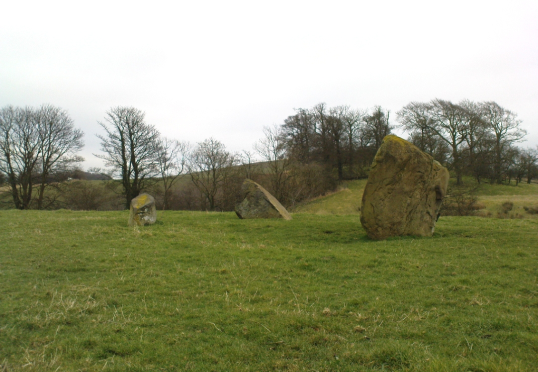
Overlooking the northern shores of the Firth of Forth is this fascinating group of standing stones which, old lore told, was once an old stone circle. You can see what they meant. The Tuilyies consists of a small group of three stones, between 3 and 7 feet tall, arranged in the form of a scalene triangle; and about 20 yards away stands the more impressive outlying 8 foot tall upright stone, somewhat akin to a petrified ancestor, with both natural and man-made cup-markings on at least two sides of its slim body. This outlying stone is of a very different character to that of its close neighbours—and a different type of stone as well—and is very similar in both size and appearance to the Robin Hood Stone at Allerton, near Liverpool. Curious…
The east-facing cup-marked Tuilyies stoneNatural ridges on its west-face
Whether the stones here were part of a stone circle we don’t know for sure. It was suggested as such in 1793 and Aubrey Burl (2000) includes them in his primary survey, but we have little evidence to prove as such nowadays. The parish of Torryburn not only had to contend with industrial agriculture knocking down any stones that may once have stood here, but in the 17th century the village also had to tolerate the psychiatric delusions of one reverend Allan Logan: one of the many deranged priests who saw witchcraft and demons in everything natural or animistic, persecuting local people for their old traditions, herbalism and peasant-lore. (Beveridge 1885; Cunningham 1902; Webster 1820, etc) These old stones were unlikely not to have received his depraved attention. But thankfully, some remain standing…
The Tuilyies seem to have been described first of all in the 1793 Old Statistical Account of Scotland—and in that narrative we find one of the earliest descriptions of cup-markings. It told that,
“In a pretty extensive plain field NE of the village of Torryburn, there is a flat stone, raised upon one end, of a shape nearly oblong and measuring, from the surface to the top, about 8 feet, and about 4½ in breadth, Round the edge of it there is a deep circle, and on each of the sides a number of ridges, all of which wear the appearance of art and antiquity. At about 18 or 20 paces from this stone, there is a number of smaller ones, which, from their present position, seemed to have formed part of a circle.”
Many years were to pass before these old stones heard from the men of words again. This time it was the renaissance of cup-and-ring designs that brought them back to light, when Sir James Simpson (1866), in his massive precursory essay to British Archaic Sculpturings (1867) talked about them:
“The stone at Torrie, Fifeshire…is a flattened sandstone flag, deeply guttered in longitudinal lines, and presenting cup- markings on its eastern side. It has been attempted to be made “a holed stone,” like (the) this block at Ballymeanoch (Argyll), but the artificially splayed perforations from the opposite sides do not meet in the middle. About fifty paces from it are the remains of a small circle of stones.”
The triangle of standing stones
Unusually, J. Romilly Allen only mentioned the stones in passing, simply repeating Simpson’s earlier words. Even local historians gave the site scant attention. In David Beveridge’s (1885) magnum opus he gave only a brief mention of the stones; and A.S. Cunningham (1902) did likewise. Thankfully after a visit to the stones by the Royal Commission lads in May 1925, a more detailed description was given. They wrote:
“The site of the cup-marked standing stone…is a plateau, 150 feet above sea level, in a field on Torrie Estate about half a mile to the northeast of the village of Torryburn, and on the north side of the drive to Torrie House. At a distance of 60 feet from it are three huge boulders, and the four are said to be the remains of a circle, although that idea is not borne out by their present disposition.
“The cup-marked stone rises to a height of 8 feet above the ground and has its narrow faces to the north-east and south-west. It is of irregular form, narrowing somewhat at 7 inches from the base, expanding outwards at the middle, and contracting again to a roughly convex top. On the east face the lower portion is covered with cup-marks. which vary from 1½ to 5 inches in diameter and from 1½ to 2 inches in depth. At a height of 6 feet from ground level, in the south-west angle of the stone, is a cavity 7 inches in depth, while there is a similar cavity of like depth opposite to it on the west face. The stone is also marked on the east and west faces, as well as on the top and down the narrow sides, with a series of perpendicular grooves of varying depth, but all these channels are due to weathering. Its measurements are: north face, 1 foot 3 inches; south face, 1 foot 4 inches; east face, 4 feet 4 inches; west face, 4 feet 3 inches; girth at base, 10 feet 8 inches; at 7 inches up, 8 feet 10 inches; at middle, 10 feet 5 inches.
“The three other boulders are set in the form of a triangle immediately to the south of this cup-marked stone, at intervals of 12, 15 and 16 feet apart. One has evidently fallen from an upright position and now lies with its major axis north and south. None of the three shows any markings. They are of whinstone, while the cup-marked standing stone is of grey sandstone.”
But as for the lack of cup-markings on the outlying smaller stones, when Ron Morris (1973) examined the site in the ’70s, he found what seemed to be some cup-marks on the largest of the group of three stones, as shown in the photos. On this he reported,
“25yds S of the well-known cup-marked standing stone are 3 large boulders. The W of these, measuring 7′ x 4½’ x 3½’ high, bears on its slightly W-sloping top surface 7 cups cup to 2″ diameter and ½” deep.”
When I visited the site the other day, these were difficult to see—cos as the photos here show, Nature gave us a bittova dark grey day and such carvings are notoriously temperamental when weather conditions aren’t to the stone’s liking!
Folklore
The Old Statistical Account of 1793 told that the stones were supposed to have “been the scene of a battle in some former period, and these stones…mark the graves of some of the chiefs, who had fallen in the engagement.” The lore was echoed in David Beveridge’s (1885) huge local history work, where he informed the reader that many standing stones along the Forth,
“are all connected with the Danish incursions. One specially may be mentioned, standing near Torryburn, the parish adjoining Culross, in a field which is still known by the name of the Tuilzie, or Battle Park.”
Morris, Ronald W.B., “Torryburn, Torry – Cup-Marked Rock’, in Discovery & Excavation in Scotland, 1973.
Royal Commission on the Ancient & Historical Monuments, Scotland, Inventory of Monuments and Constructions in the Counties of Fife, Kinross and Clackmannan, HMSO: Edinburgh 1933.
Simpson, James, Archaic Sculpturings of Cups, Circles, etc., Upon Stones and Rocks in Scotland, England and other Countries, Edmonston & Douglas: Edinburgh 1867.
Webster, David, A Collection of Rare and Curious Tracts on Witchcraft and Second Sight, D. Webster: Edinburgh 1820.
This lovely standing stone can be a pain-in-the arse to get to! Unless you wanna clamber over the excess of increasingly stupid deer fences that are appearing all over the place (old locals aint happy), follow the directions to the Tir Artair cup-marking, then walk across to the fencing and follow it all the way down into the fields until you reach the stream on your right, running in front of the fenced woodland. There’s a large gate here into the trees. Go thru it. In front of you is some overgrown walling into the trees: follow this along, slowly, keeping your eyes peeled for the upright stone about 100 yards in. Good luck!
Archaeology & History
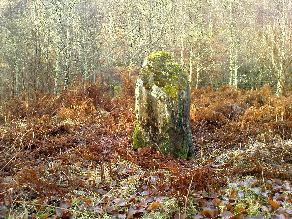
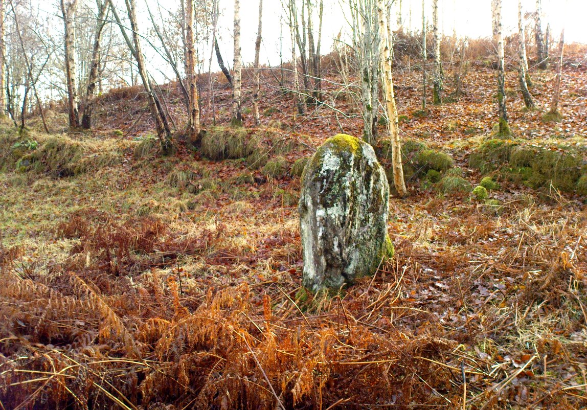
The old mossy stone
In this “land of Arthur”—as the place-name means—we find this beautiful moss and lichen-encrusted standing stone, living alone in remains of mainly birch woodland. It stands less than 5 feet tall, just in front of some old walling encircling one of the many rounded knolls in this area. The stone may have had some megalithic partners in bygone days, as we find, about 25 yards away sleeping amidst overgrown vegetation beside an old oak, a couple of other old stones laid on the ground that seem to have been placed here by human hands. Their antiquarian nature is unknown.
References:
Gillies, William A., In Famed Breadalbane, Munro Press: Perth 1938.
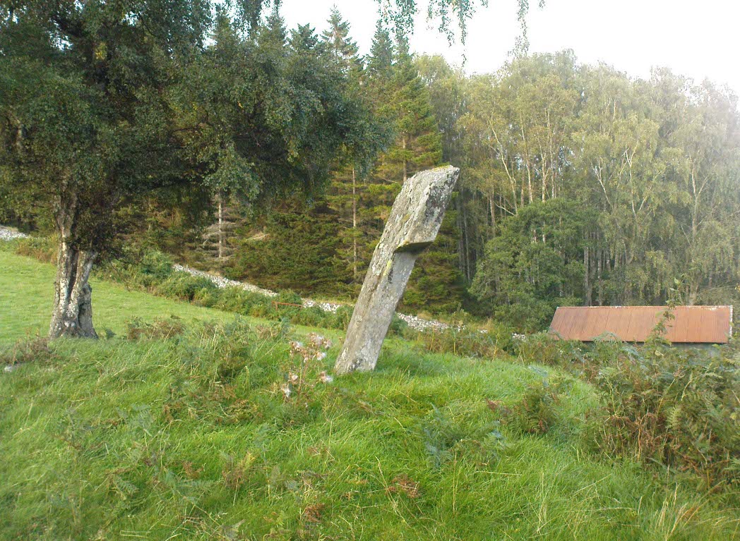
From the gorgeous village of Kinloch Rannoch, take the road along the north side of Loch Rannoch for about 2½ miles. As you go along the road, for a good mile or so it is wooded. Where the woods stop and the first field appears on your right, stop! You’ll see the standing stone perched erotically at an angle above you.
Archaeology & History
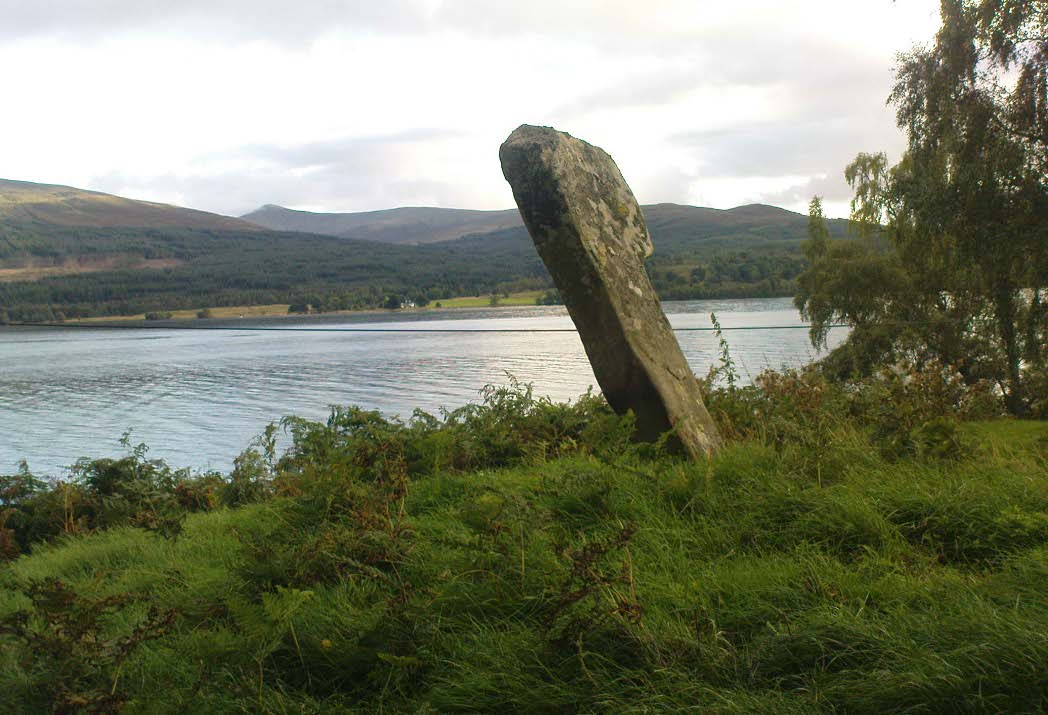
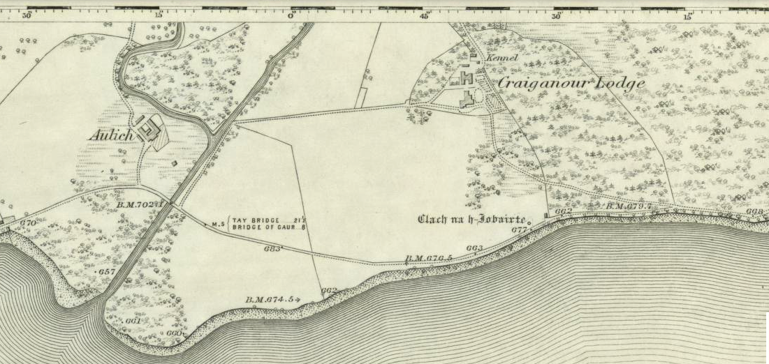
Clach na h-Iobairte, looking east
A fascinating site in a quite beautiful setting, typical of the Highlands. This stone of many names is a curiously-shaped monolith: like an erect stone penis at the edge of the field when seen from the roadside, calling out to christians and pagans alike, to be castigated or rubbed—whatever the religious preference of the surveyor! Leaning over at a slight angle, the stone is still nearly six feet tall and lives upon a large and equally prehistoric stone cairn about 30 feet across. This cairn, it is said, has been added to by locals when the field was cleared of stone and piled on top of the old tomb. No excavations have been done here, nor at the large ‘hut circle’ in the same field about 50 yards away.
Folklore
So far I have only found a short narrative of this stone in the pages of T.R. Barnett’s (1944) loving account of the Perthshire hills, where he tells that, close by the stone at Aulich, was once
“a famous smith, said to be in league with the devil, and he made the finest claymores in Rannoch.”
References:
Barnett, T. Ratcliffe, The Road to Rannoch and the Summer Isles, John Grant: Edinburgh 1944.
Cunningham, A.D., A History of Rannoch, privately printed 2004.
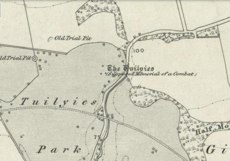
Stone Circles (destroyed): OS Grid Reference – SE 170 810
Archaeology & History
I was hoping to get a Northern Antiquarian team to explore this arena before moving to Scotland, as I lived in hope that we might uncover some remains of an important cluster of megalithic rings in this quiet North Yorkshire area — but we didn’t manage to get here. So this short profile is one based purely on texts.
A mile east of the standing stone and impressive cup-and-ring carvings of West Agra, was once to be found several stone circles — according to John Fisher (1865), who told us about them in his magnum opus on the history of the region. Not to be confused with the giant Druid’s Temple a couple of miles south, Fisher was contextualizing them with the “huge circles of upright stones” which our great heathen ancestors built. Although he made some mistakes trying to link the local place-names with these stone circles (a common pastime of Victorian writers), his remarks still make interesting reading. He told that,
“In this parish there are places which fully answer to this description, as well in situation and appearance, as in the names which they still bear. I refer more especially to Healey-Baals, Beldin Gill, and Baal Hill, which latter place is situate either upon or near to the range of hills known by the name of Healey-Baals. The very name of Baal-Hill, without reference to its appearance or locality, indicates that the place is a hill dedicated to the worship of the heathen god Baal; and the name Healey-Baals, according to the interpretation which I put upon these words, is, if possible, still more conclusive of the matter. I take it that the name of Healey is derived from Heil, holy or sacred, and ley, land consisting of fallow-ground, pastures, or meadows. If, therefore, I am right in my interpretation of the name of Healey, then Healey-Baals means simply land sacred to Baal. This supposition is strengthened by the circumstance of circles of upright stones having recently existed near to the place, and from ancient relics which have been found within the parish, and at but a short distance from Healey and Healey-Baals, which are supposed to have been used in the mystical rites of the Druids or priests of Britain, for at least antiquaries can assign no other use to them…”
There are very few other references I can find that tell of these lost stone circles. Edmund Bogg (1906) mentioned them briefly, saying that between Fearby and the hamlet of Healey a mile west, “there were formerly circles of upright stones and other relics suggestive of druidical origin.” But there’s little more.
In exploring the local field-names we find that three of them here carried the name “Standing Stones” – which seems to tell us where once we could find these old stones. It may be possible that some of the stones were removed into the hedgerows at the sides of the fields.
Folklore
Fisher told of the local tradition of quarterly fire ceremonies close by, which he thought may have related to religious practices at the stone circles, telling:
“There are traditions, too, which have been handed down to us, to the effect that the heathen custom of making feasts and Baal-fires (which although unknown to the persons making them, were in truth so made in honour of Baal) have been continued until very recent times in this district — and especially in Nidderdale — the remembrance of which is transmitted to us in the annual feast which is still held at Healey.”
References:
Bogg, Edmund, Richmondshire and the Vale of Mowbray, James Miles: Leeds 1906.
Cunliffe-Lister, Susan, Days of Yore, privately printed: Bath 1978.
Fisher, John, The History and Antiquities of Masham and Mashamshire, Simpkin Marshall: London 1865.
Smith, A.H., The Place-Names of the North Riding of Yorkshire, Cambridge University Press 1928.
Standing Stone (destroyed): OS Grid Reference – NS 99 77
Archaeology & History
Not included in the Canmore listings, nor that of the Scottish Royal Commission (1929), this lost standing stone once stood somewhere in Linlithgow town itself. It was referred to in the huge but obscure Registrum Magni Sigili Regum Scotorum from 1586 through to 1614 as one of the street-names in the town, written several times as ‘Standandstane’ — which, as MacDonald (1941) told in his fine survey, means literally a “Standing Stone.” The place was also referred to several times in other local accounts, dating from 1664, but was last mentioned in 1699 and, it appears, disappeared soon afterwards.
Perhaps some record of the site may be available in local witchcraft or folklore accounts. Does anybody know?
References:
MacDonald, Angus, The Place-Names of West Lothian, Oliver & Boyd: Edinburgh 1941.
Royal Commission on the Ancient & Historical Monuments of Scotland, Inventory of Monuments and Constructions in the Counties of Midlothian and West Lothian, HMSO: Edinburgh 1929.