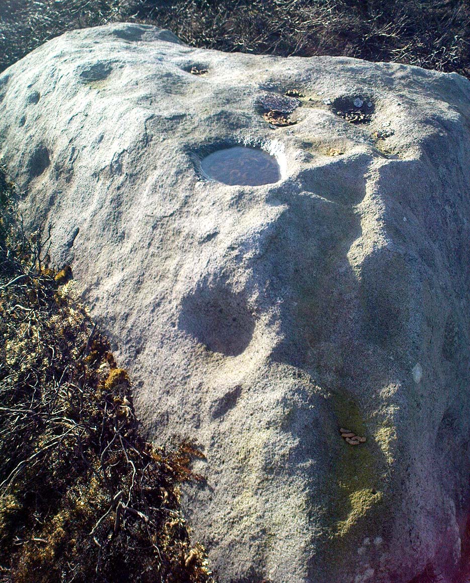
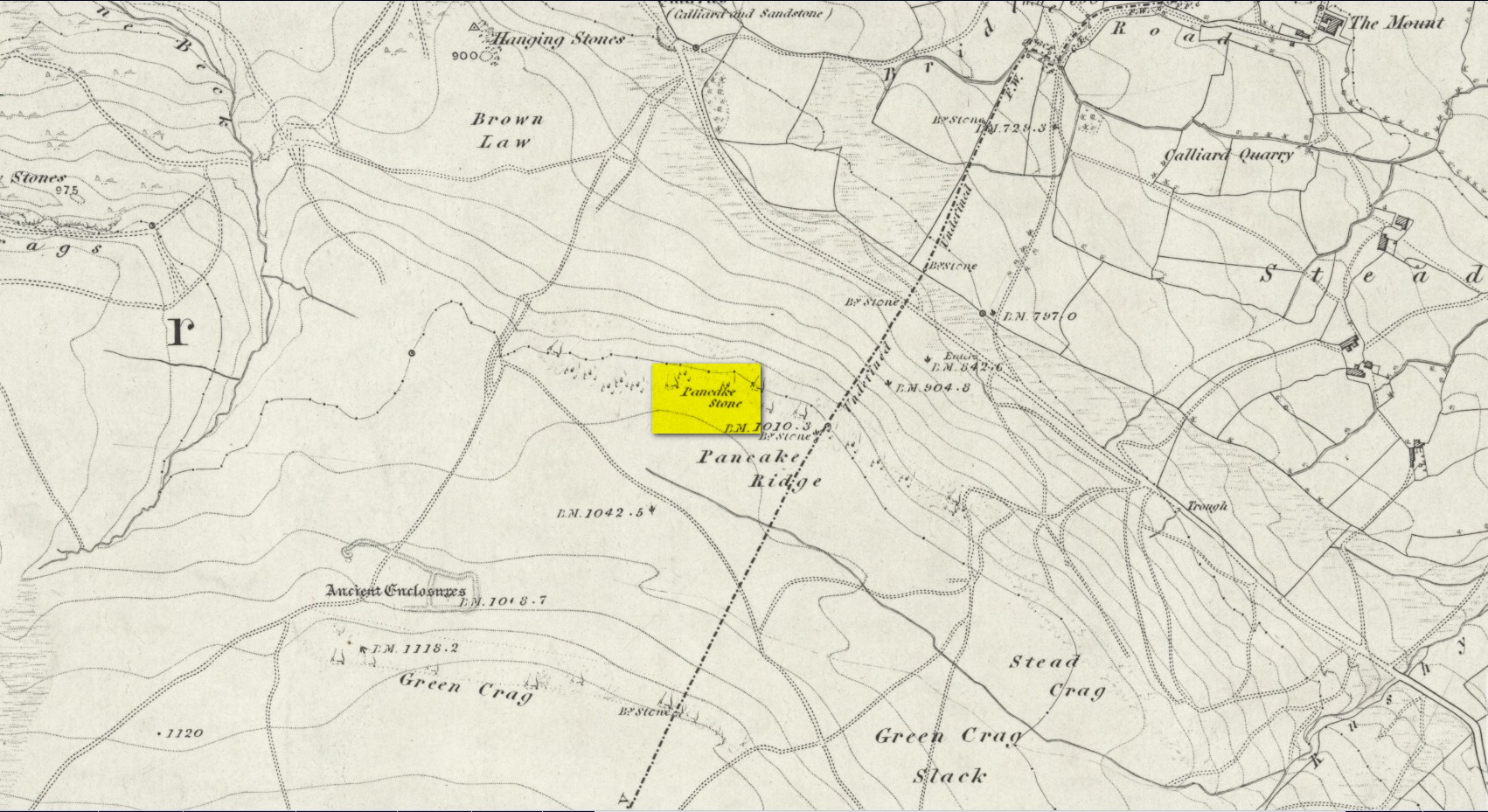
Cup-and-Ring Stone: OS Grid Reference – SE 12832 46163
Also Known as:
- Carving no.130 (Hedges)
- Carving no.287 (Boughey & Vickerman)
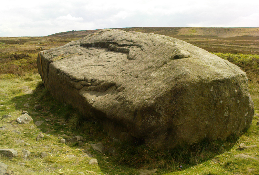
Follow the directions for getting to the Haystack Rock, then bear right (west) along the footpath, past the little Three Cups Stone, until the path bends and goes up onto the moor. A hundred yards or so, walk left into the heather (you’re straddling the remains of considerable prehistoric walling and enclosure remains by now) and look around. You’ll find it!
Archaeology & History
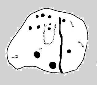
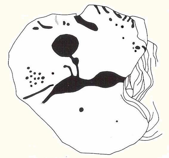
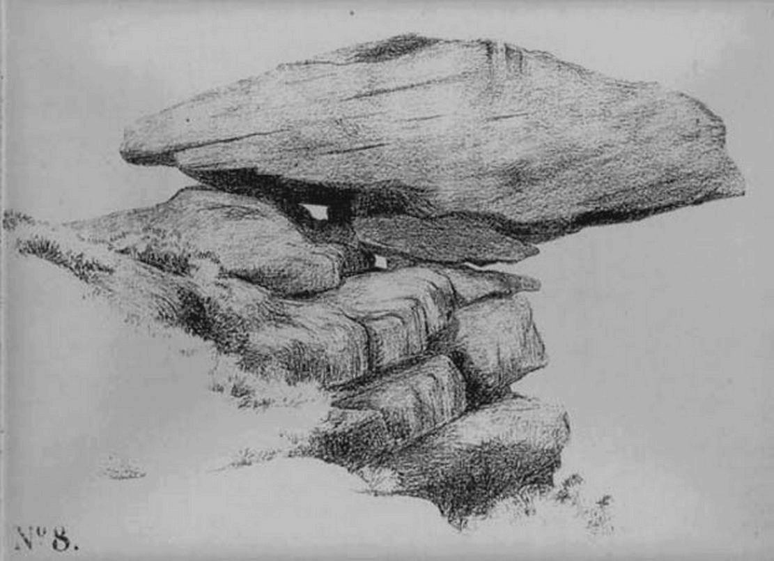
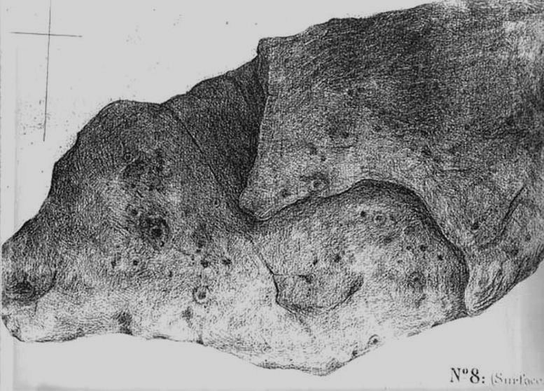
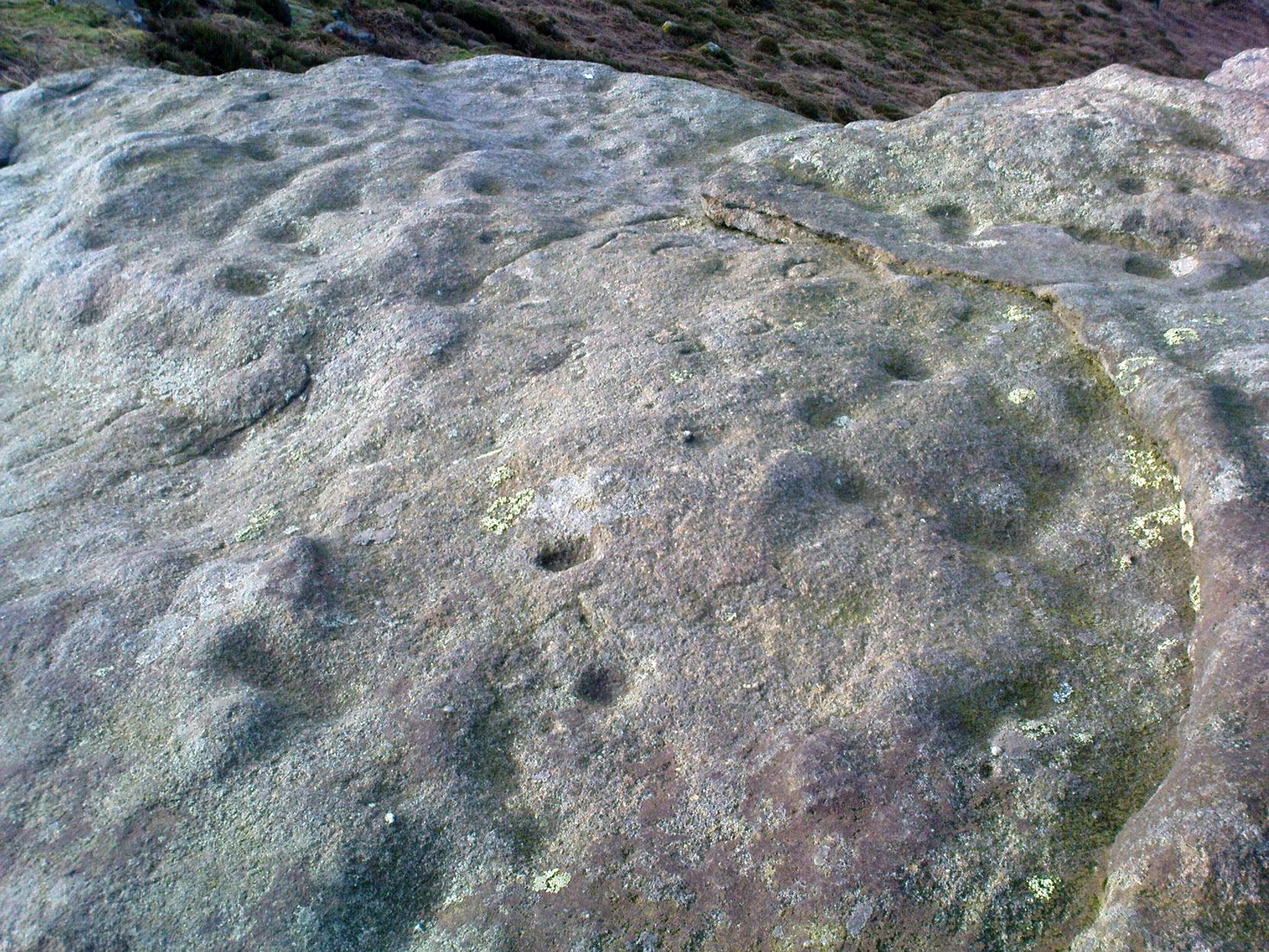
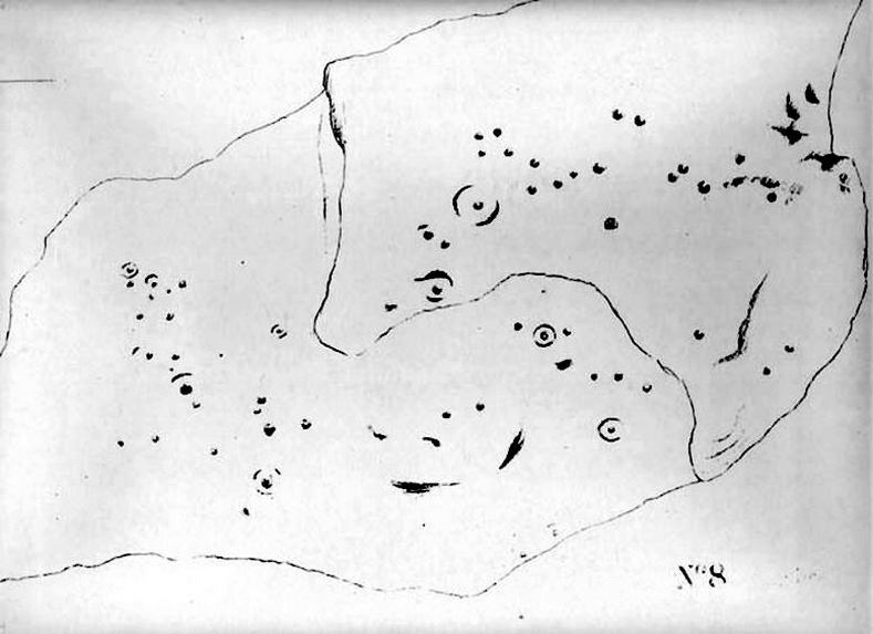
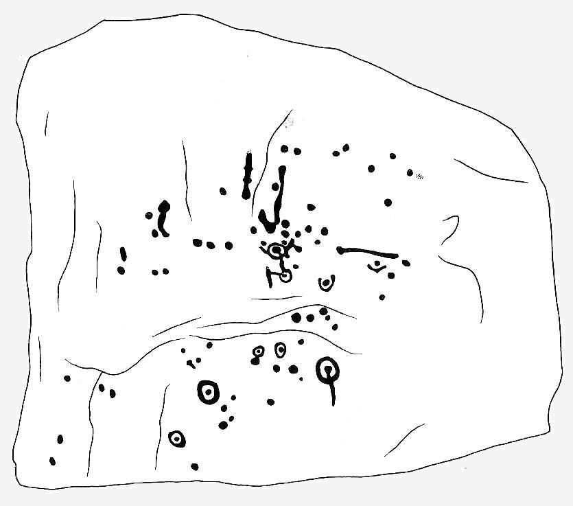
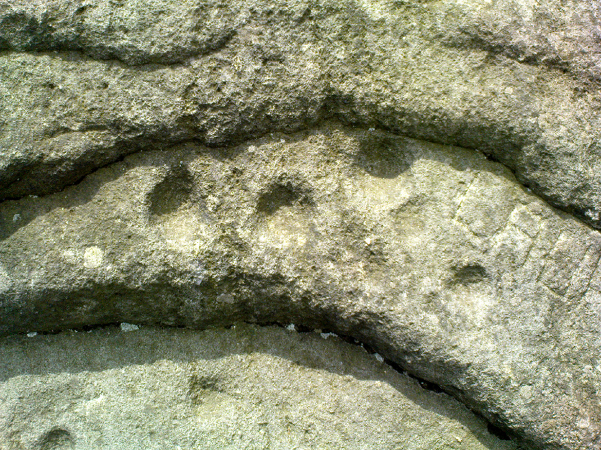
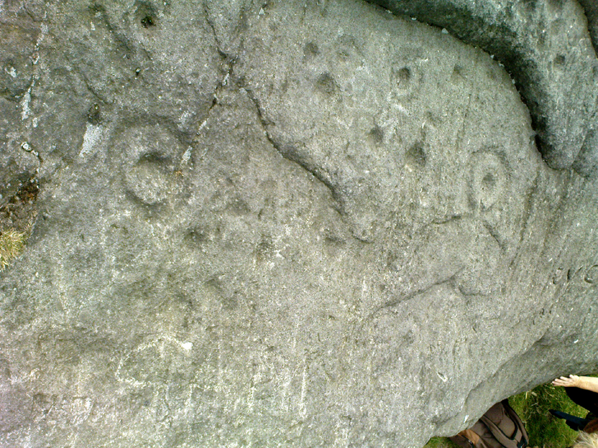
I was only about 12-years old when I first saw this and the nearby prehistoric carvings — but when I came to look for any references to it as a boy, there were none I could find at the time. Then, ten years later when John Hedges (1986) brought out his fine work on the cup-and-ring art of Ilkley Moor, its presence was shown in pen-and-ink at last. Found amidst the remains of an extensive settlement or series of walled enclosures, the carving’s name comes from the curious urn-like element that Hedges showed faintly. There is also an additional ring around one of the cups above the ‘urn’.

Excavations that were done on the prehistoric ‘enclosure’ close to this petroglyph in the 1990s, uncovered the remains of a decent amount of ‘grooved ware’ pottery and worked flint (Edwards & Bradley 1999), dated between 2900 and 2600 BC. As such pottery has been found elsewhere in Britain within and/or near earthworks and other prehistoric remains (obviously!), its incidence here isn’t really too much of a surprise. However, Edwards & Bradley (1999) speculate — albeit vaguely — that there may be a link between the cup-and-rings here and the pottery, saying, “if so, the rock carvings (here) might be indicating a place of special significance.”
This may be so: considering the prevalence of rock-art along the geological ridge and its close association with the large number of burial cairns. If it can be ascertained that the charred remains of humans were kept inside the pottery or vases, the relationship between death and the carvings (well established on this part of Ilkley Moor) would be reinforced.
References:
- Boughey, Keith & Vickerman, E.A., Prehistoric Rock Art of the West Riding, West Yorkshire Archaeology Service 2003.
- Edwards, Gavin & Bradley, Richard, ‘Rock Carvings and Neolithic Artefacts on Ilkley Moor, West Yorkshire,’ in Grooved Ware in Britain and Ireland (edited by Cleal, R. & MacSween, A.), Oxbow: Oxford 1999.
- Hedges, John, The Carved Rocks on Rombald’s Moor, WYMCC: Wakefield 1986.
© Paul Bennett, The Northern Antiquarian


 Allen 1879")


")