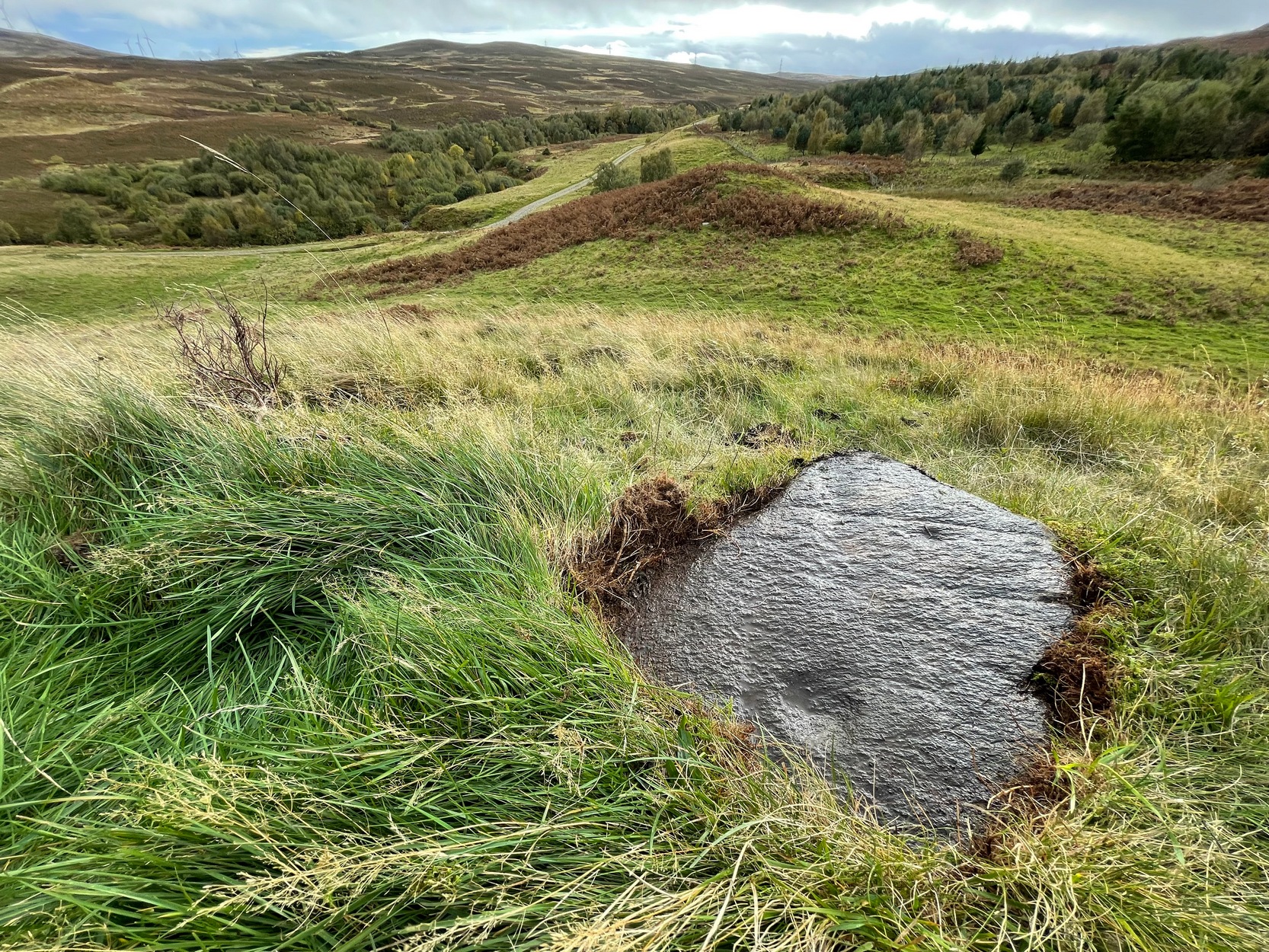
Take the B822 Fintry to Kippen road and just over 2 miles (3.3km) north of Kippen, take the small country lane on your left. Parking is truly troublesome along here, so: nearly half-a-mile along, a road/track on your right takes you into the huge forestry plantation (or ‘tree farm’ as Nina Harris calls them). Go up here and, when you reach the tree-line, walk along the outer perimeter fence to your left. Keep walking – and walking – through bog and over fence – keeping all along to the outside of the forest for more than a mile. You eventually reach a rise on the Balfron side with huge views to the west – and just here is an opening into the trees on your right where a long ridge of rock is obvious. You’re here!
Archaeology & History
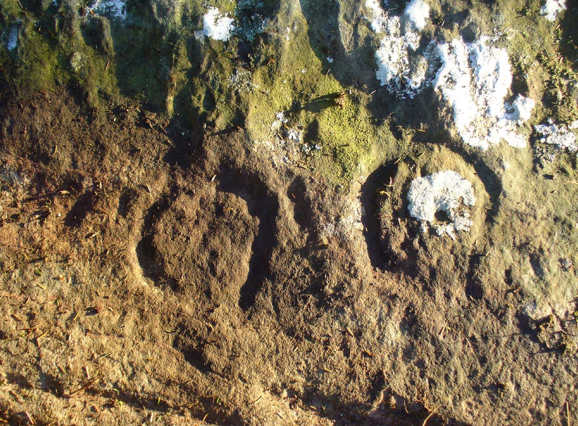
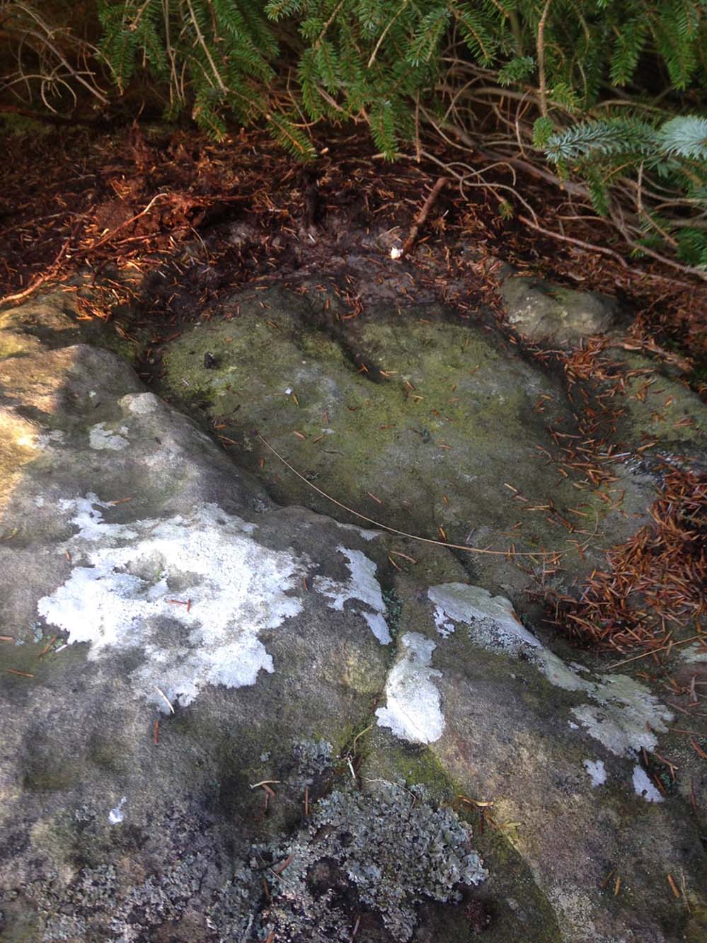
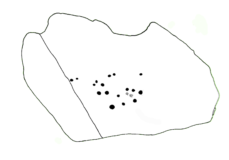
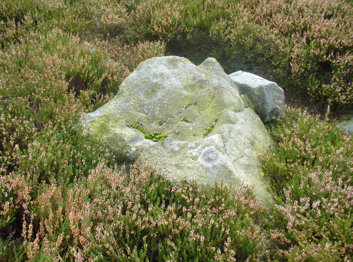
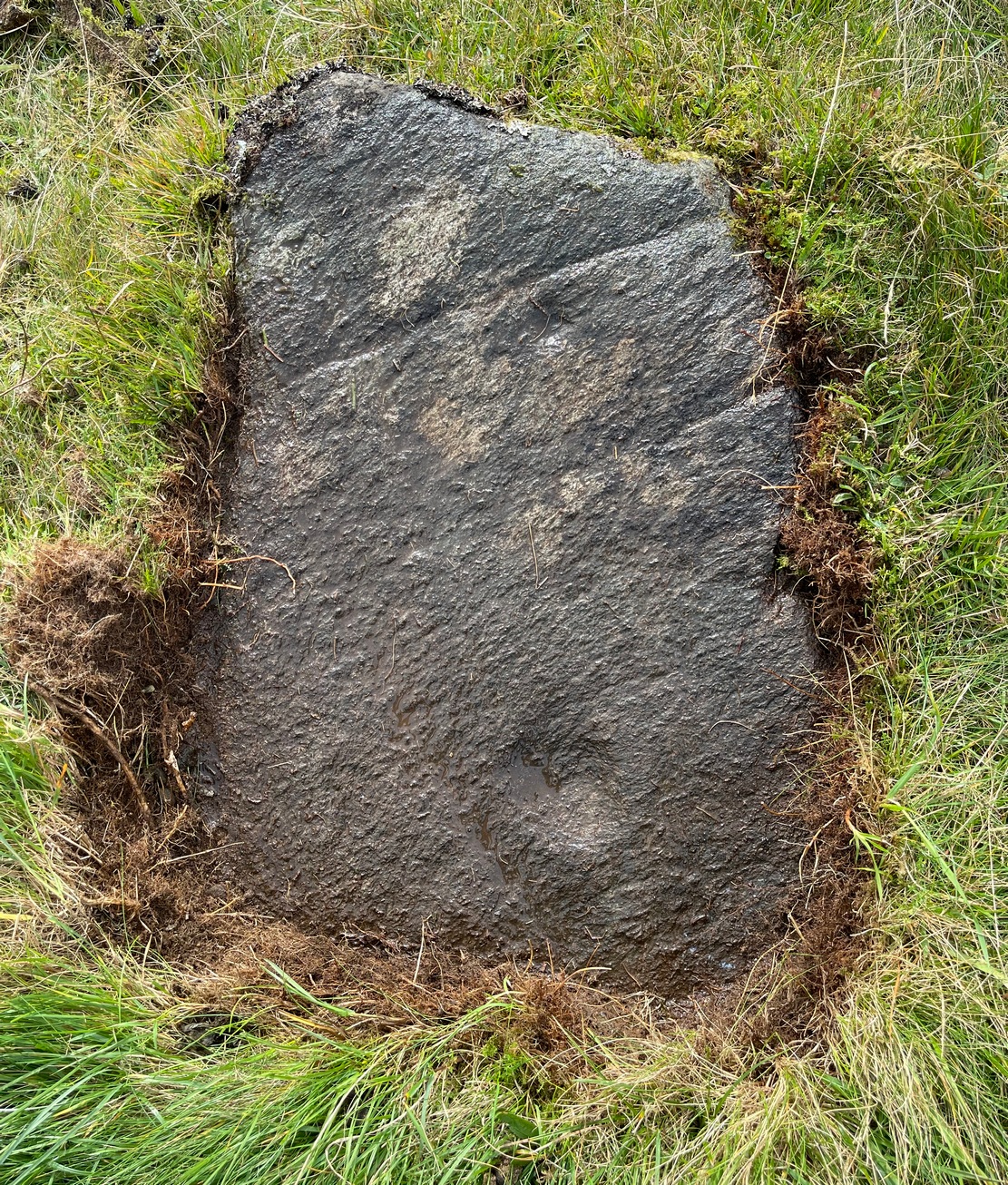
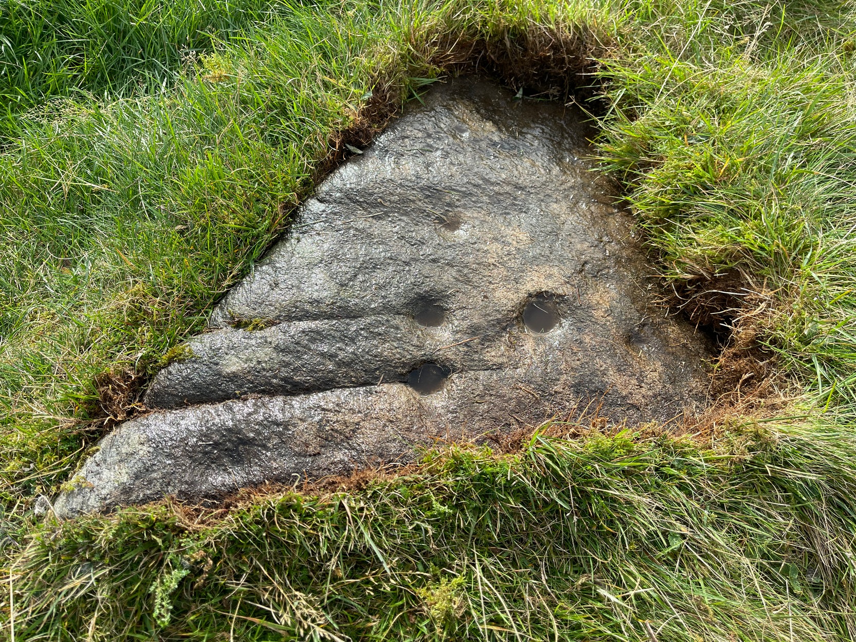
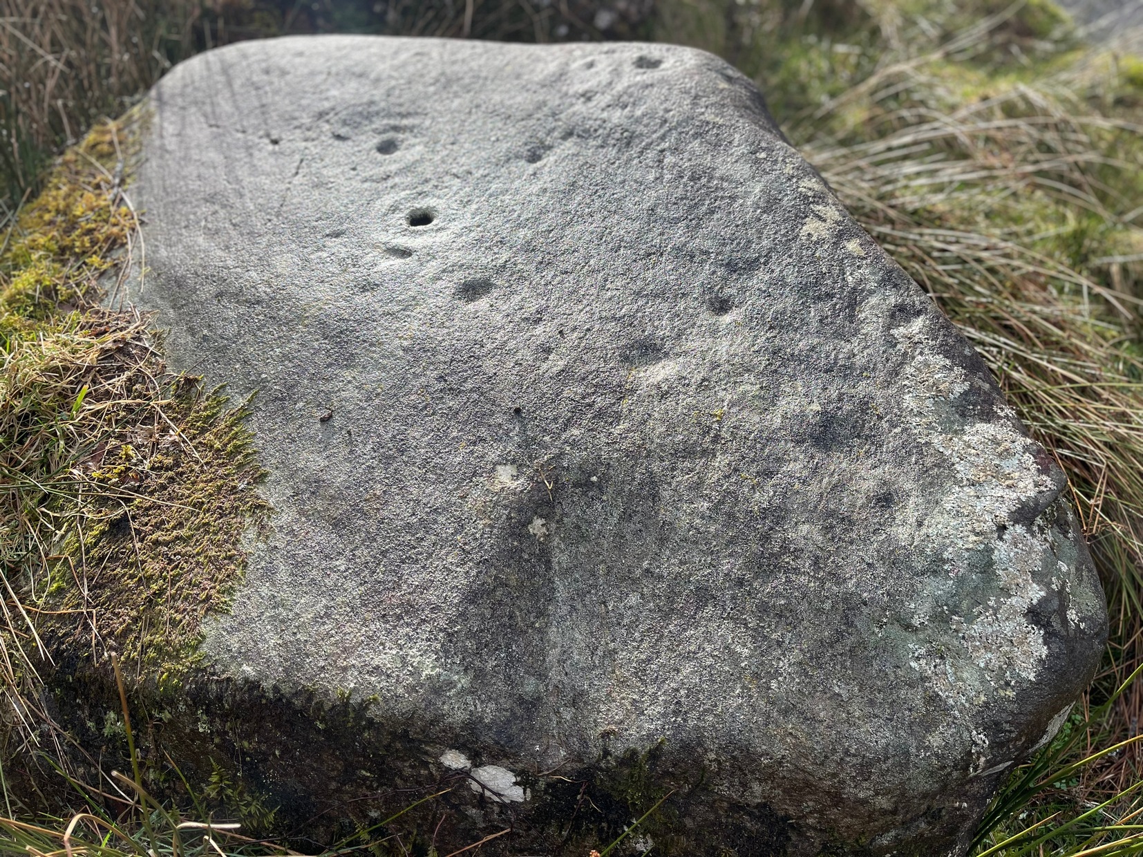
Main feature of the carving
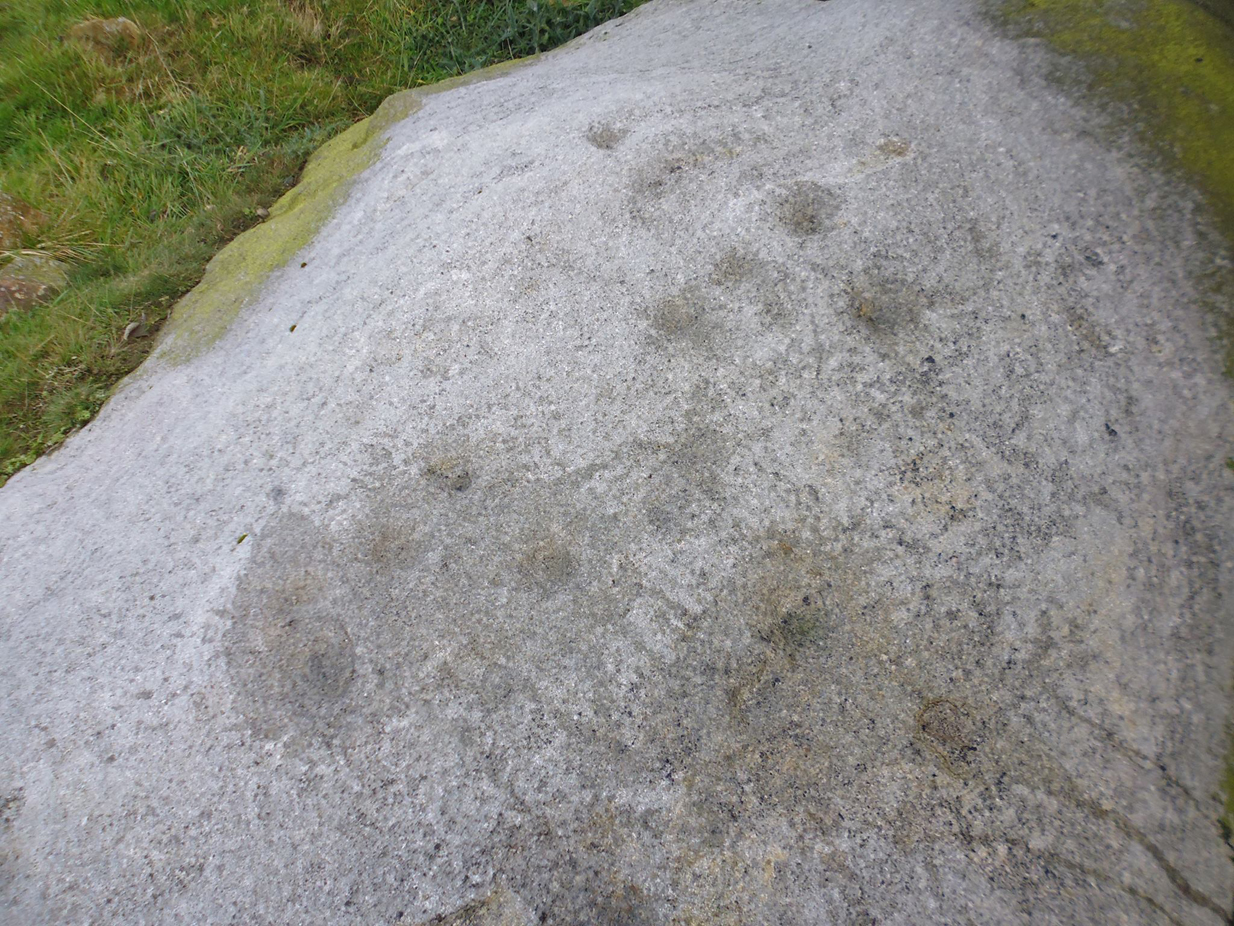
Not far from the recently rediscovered Footsteps Stone (coming soon…), this large cup-and-ring carving was found by Paul Hornby on an antiquarian rock art venture in November 2016 on a journey to the petroglyphs upon Balgair Muir, between Balfron and Fintry. It was a damn good day indeed! We’d been up here the previous week, but then the grey daylight gave little away. Upon revisiting the place on a brighter day, after a short while Paul called us over to where he’d been rummaging and, beneath a mass of fallen tree foliage, the long raised rock gave up some of its ancient symbols once again.
Very faint partial cup&rings?Main feature, looking ENE (photo by Nina Harris)
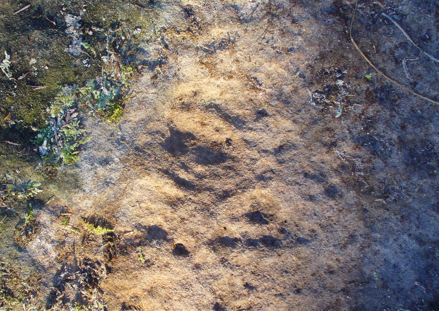
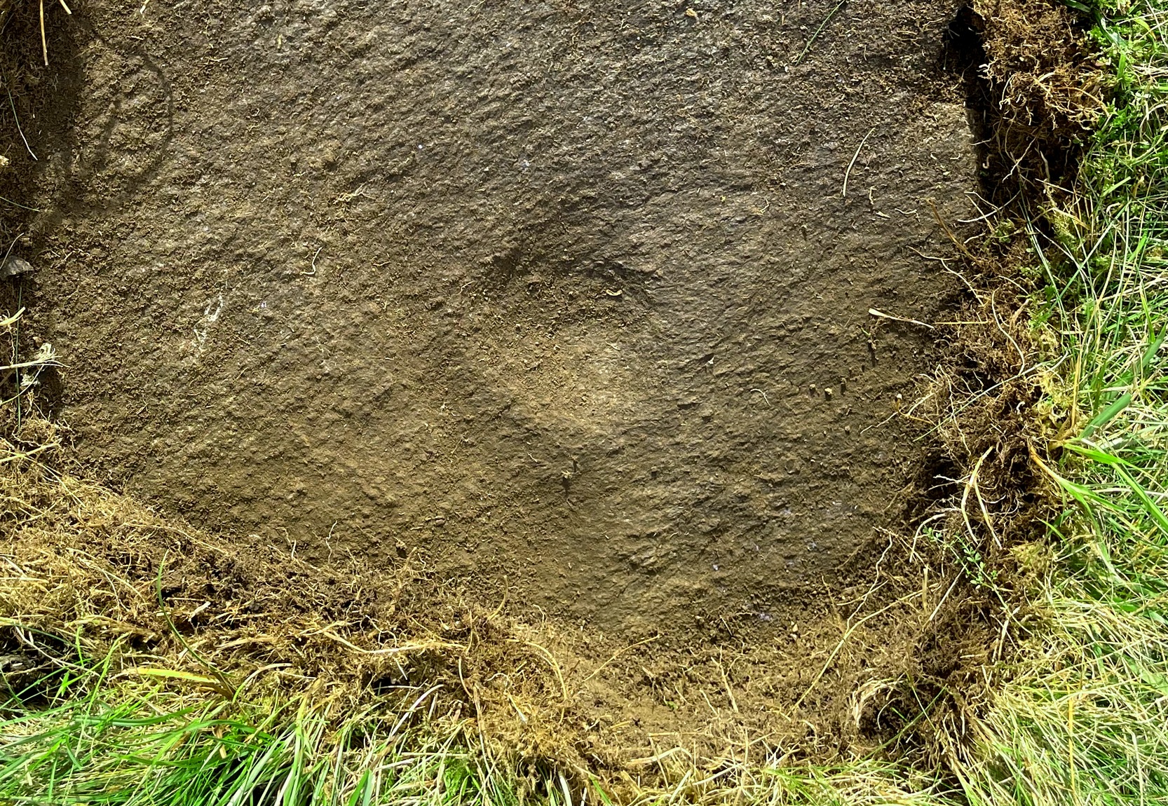
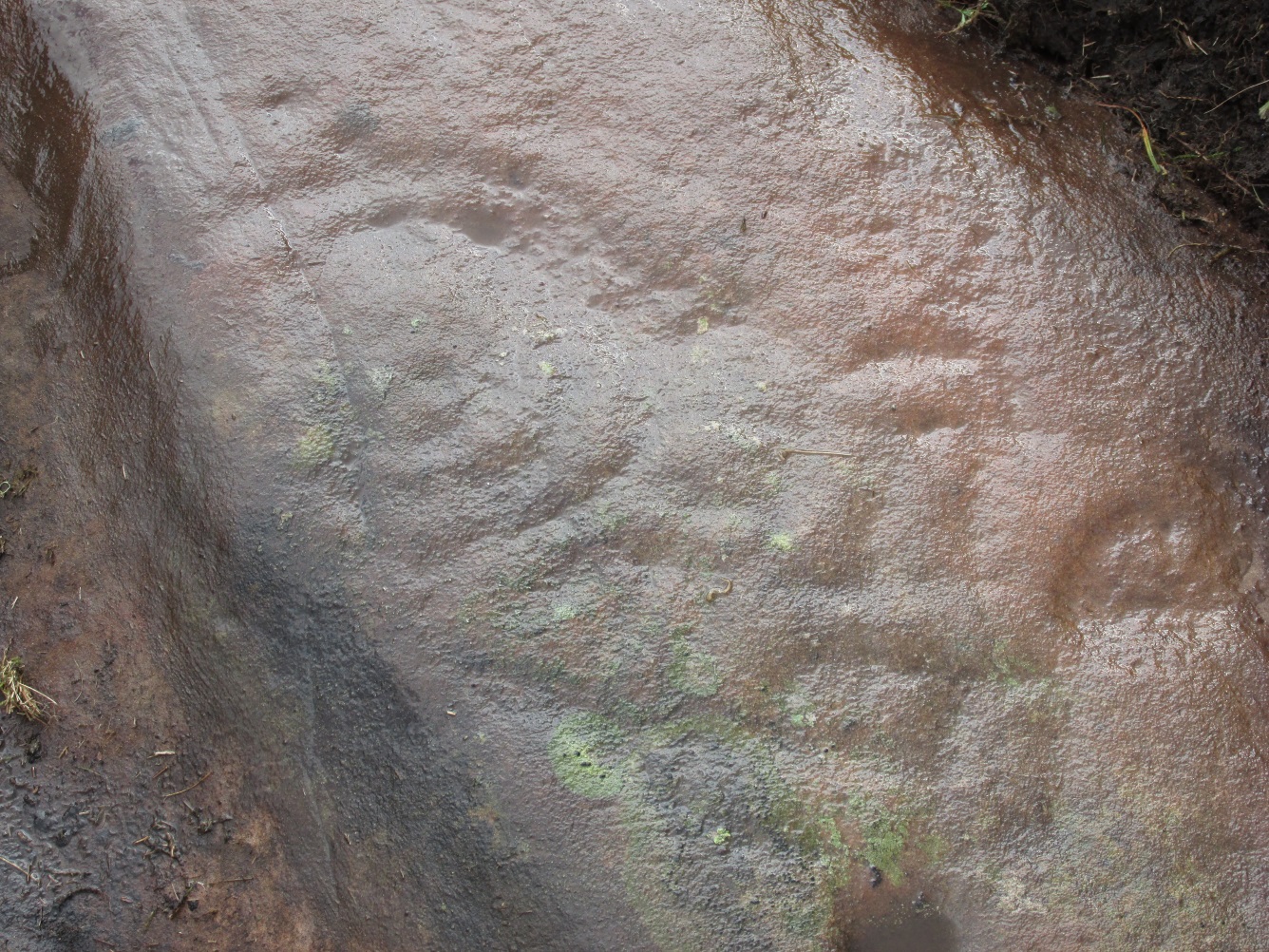
Along the main face of the stone are a variety of geophysical undulations and small natural hollows—lots of them!—some of which give the impression of being primitive cup-markings, but they’re more the result of erosion. However, amidst these are several very possible cup-markings, and some photo-images show that at least one of them has portions of a distinct faint ring around it, possibly two of them. On the whole however, we’d need a geological specialist to tell us with certainty about the other doubtful ‘cups’ here (TNA neeeeds an in-house crazy geologist into petroglyphs and things!).
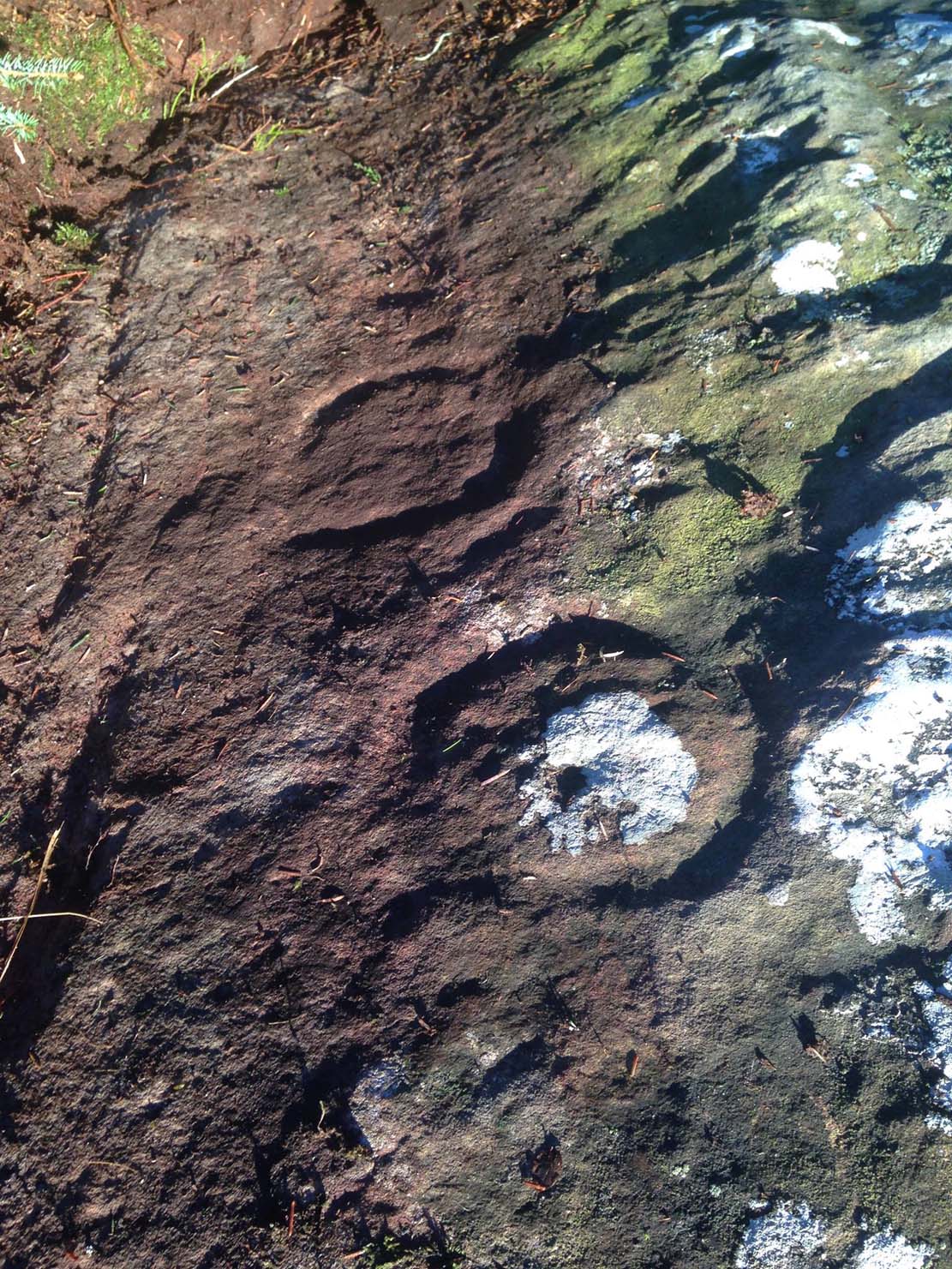
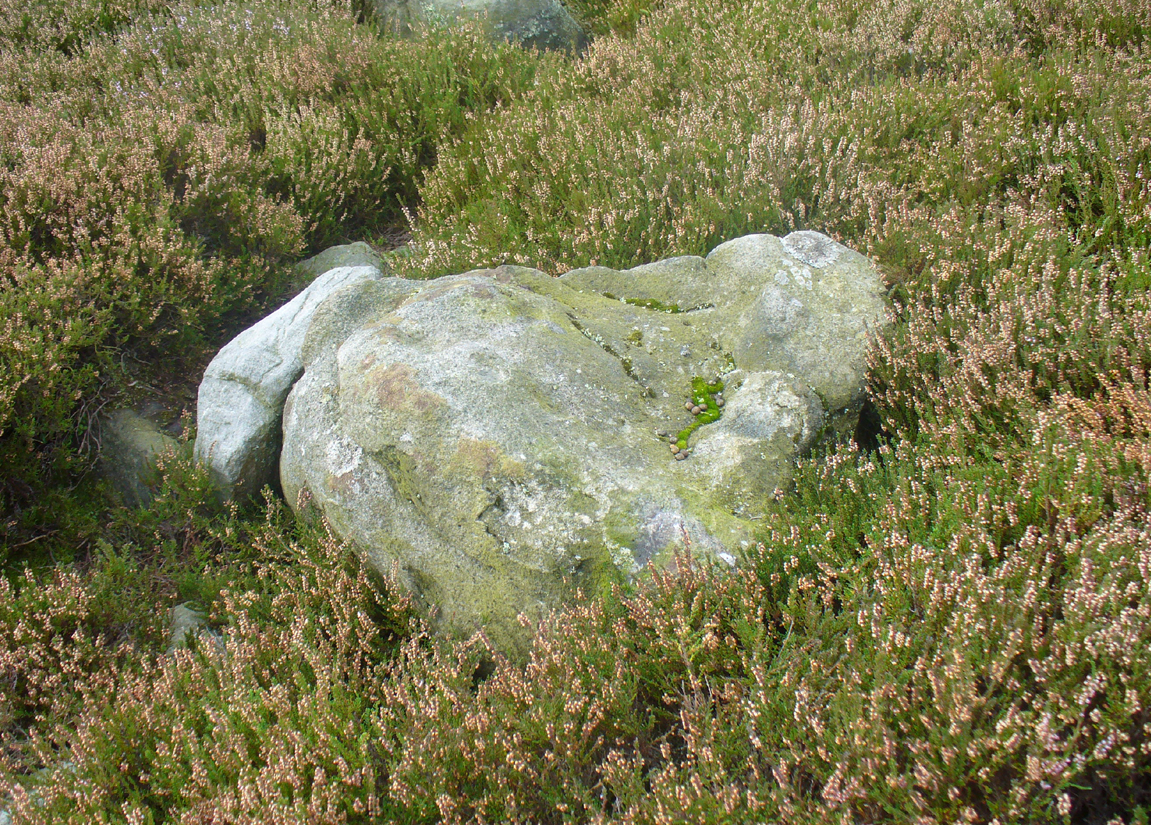
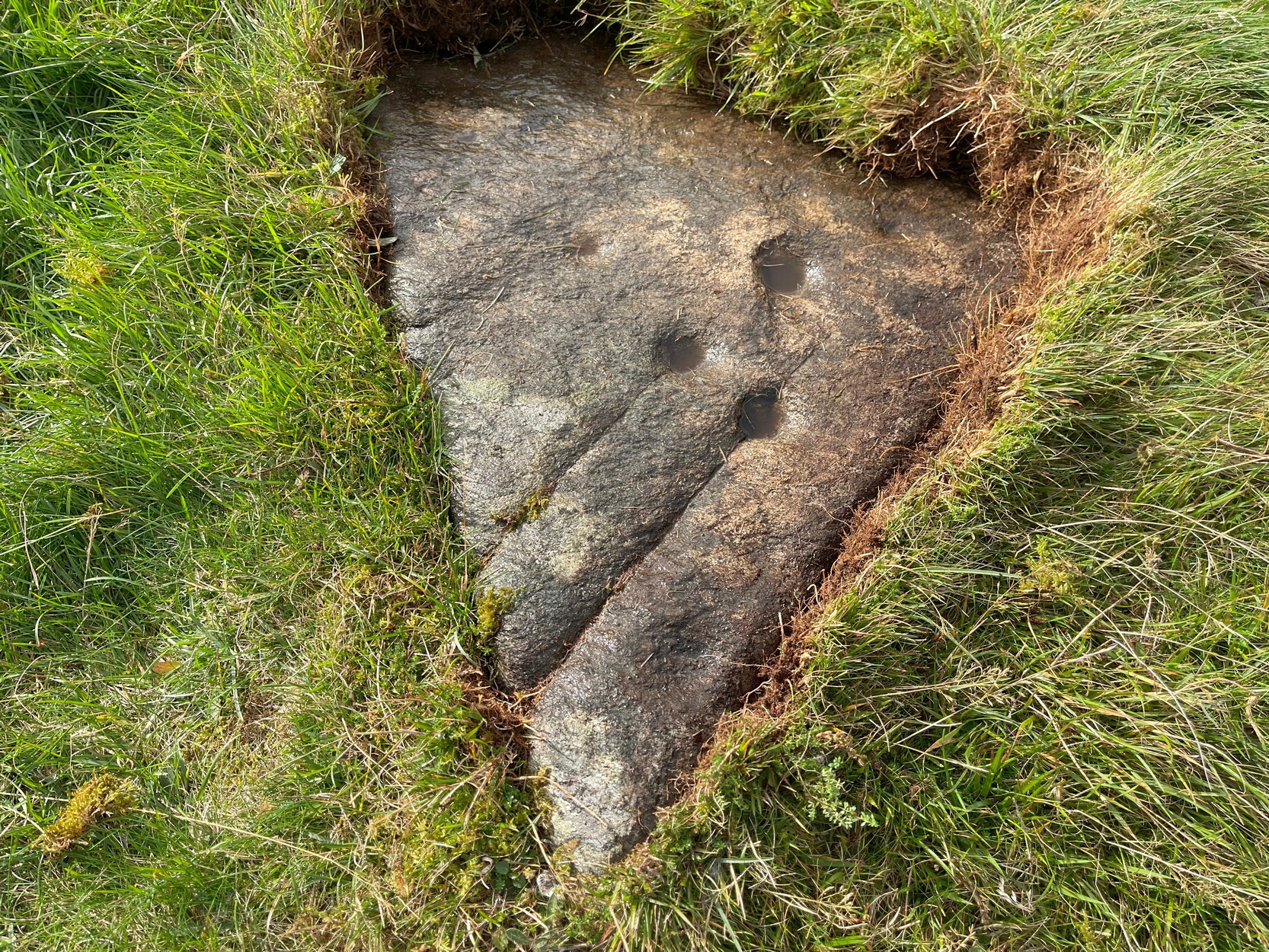
Balgair Muir Woods designMain feature, looking west
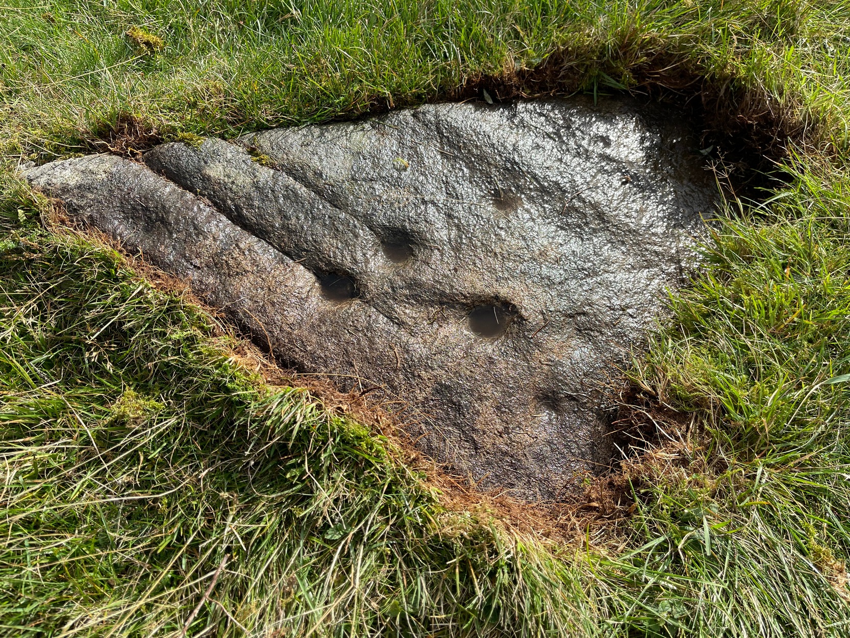
As the rock face slopes down on its northern edges, away from the many natural pits and nodules, Paul uncovered two large incomplete ‘rings’, each with short outer ‘lines’, distinctly carved. The ‘rings’ are somewhat larger than the average cup-and-ring motifs — but it also appears that at least one of the ‘rings’ may be lacking an internal cup-mark.
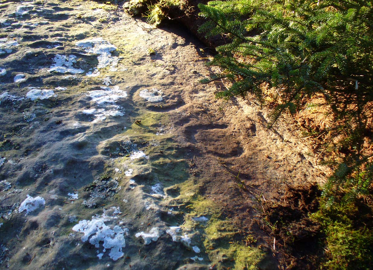
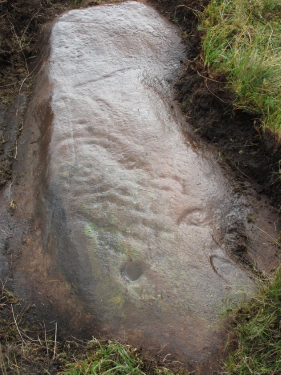
Large semi-carved ‘bowl’ (photo by Nina Harris)
On the same piece of rock, several feet to the east and almost covered by an adjacent tree, we also found a large half-natural half-carved ‘bowl’ more than 12 inches (30cm) across with a possible cup-marking near its centre. Whoever carved this section of the petroglyph has definitely utilised the natural features in the rock and, it seems, may never have finished the work.
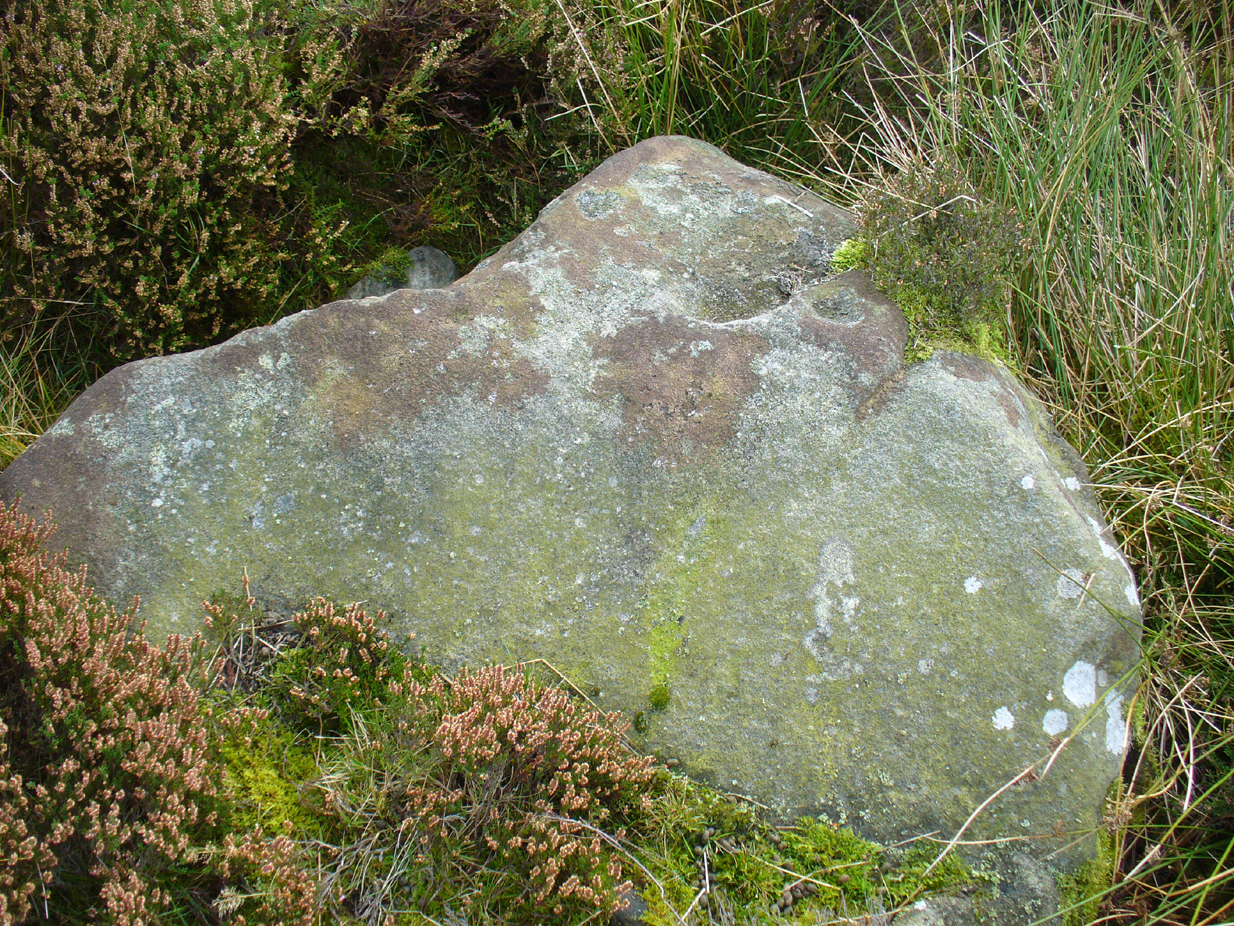
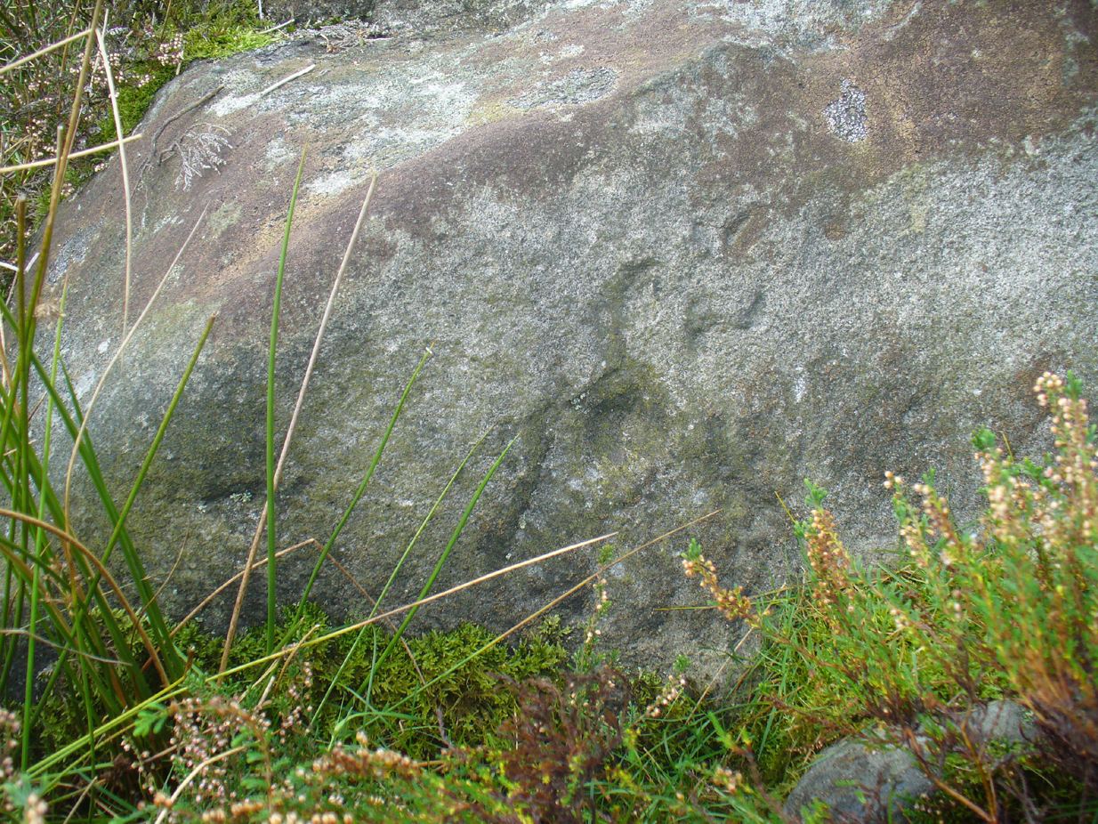
We need more visits to this area to find what more lies beneath the fallen forest debris.
Acknowledgements: Massive thanks to Paul Hornby for uncovering this carving. Huge thanks also to Nina Harris for her help and some of the photos; and also to Ann Rankin and Mick for all their relative help too. Until next time…
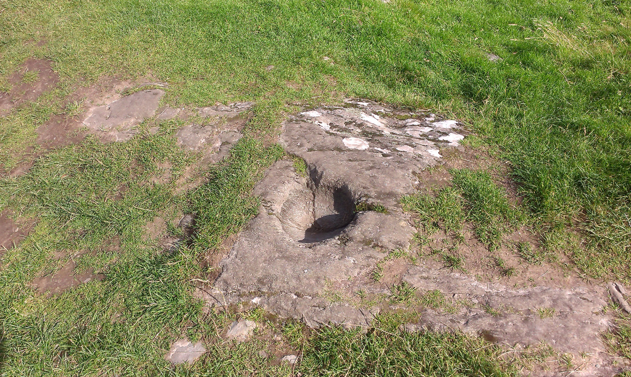
From Lochgilphead, take the A816 road north for several miles (towards the megalithic paradise of Kilmartin), keeping your eyes peeled for the road-signs saying “Dunadd.” Turn left and park-up a few hundred yards down. Go through the gate and walk up Dunadd. Just before the flattened plateau at the top you’ll come across a length of smooth stone, adjacent to the Dunnad Footprint Stone, with a deep large circular ‘bowl’ cut deep into the rock. That’s the spot!
Archaeology & History
Basin with encircling faint ring
This large ‘bowl’ or basin just below the top of Dunadd—next to the other carvings of footprint, Ogham and boar—is speculated by many to have been a part of the kingship rituals that were alleged to have occurred up here, going way back. But please remember that ‘kingship’ as it was in ages past has nothing to do with the touristy nonsense that prevails in the UK today. Kingship in its early forms relates to rituals for the benefit of the tribe/society, in many cases resulting in sacrifices. (see Frazer 1972; Hocart 1927; Quigley 2005, etc) This is quite probably what occurred at Dunadd. But whether this curious deep bowl with its semi-circular carved ring had anything to do with the kingship rites, we simply don’t know.
An early description of the Dunadd Basin is in Mr Thomas’ (1879) essay on the hill itself. It was a brief note:
“About four yards southwards from the (Dunadd) footmark is a smooth-polished and circular rock basin cut in the living rock; it is 11 inches in diameter and 8 inches deep.”
There is no mention of the incomplete ring which, though faded, can be seen to surround two-thirds of the hollow. And as Dunadd was used by people until medieval times (Lane & Campbell 2000) it not only begs the question: when was it carved; but also: was the myth behind this petroglyph still alive? We’ll probably never know.
The Royal Commission lads (1988) said the following:
“The rock-cut basin measures 0.25m in diameter by 0.14m in depth, and is bisected by a crack. It is surrounded by a shallow pecked ring about 40mm in width, but parts of this have been worn away, especially to the S where the path from (the) enclosure passes the basin.”
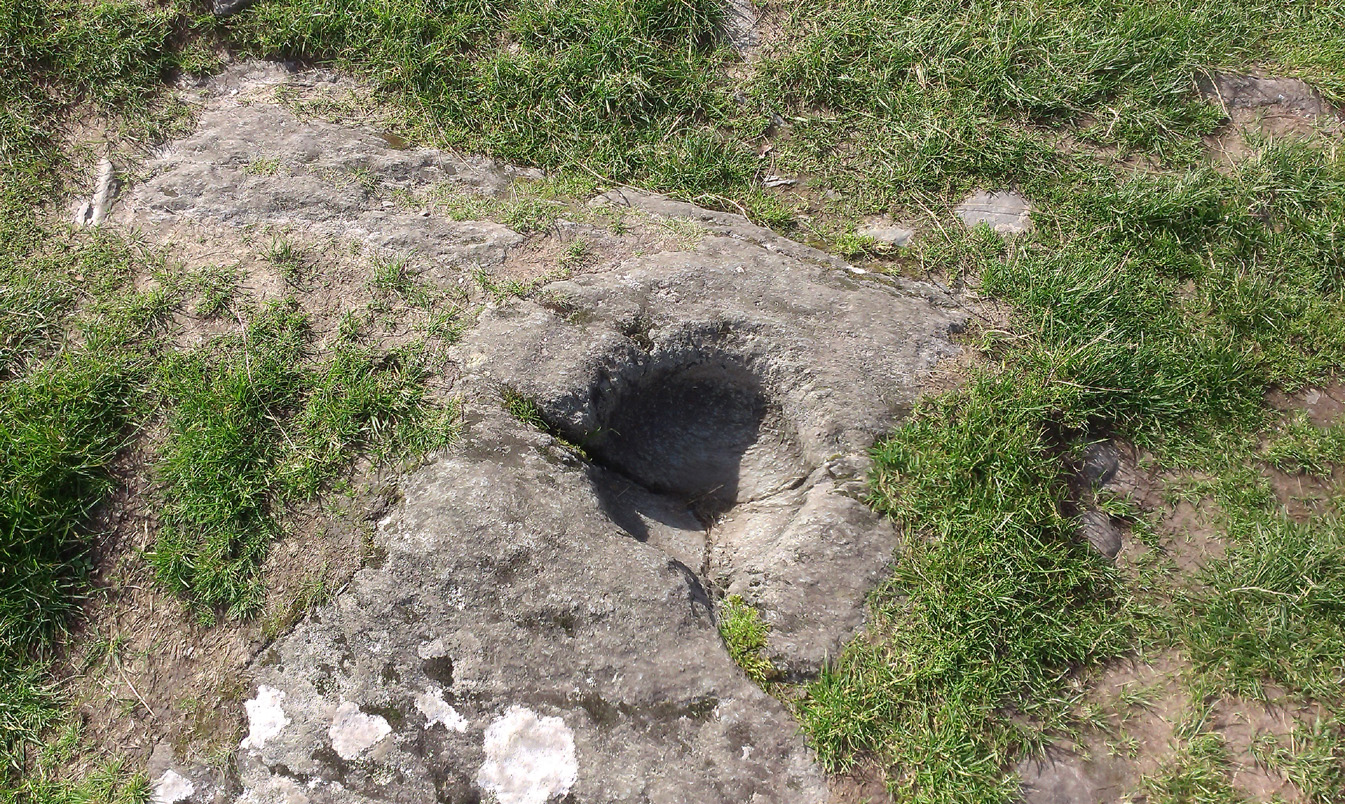
Folklore
…and from another angle
The basin here was said by the incoming priest R.J. Mapleton (1860) to be entirely natural in origin; though he also noted how Dunadd was known by local people to be the meeting place of witches and the hill of the fairies, whose amblings in this wondrous landscape are legion. Legends and history intermingle upon and around Dunadd. Separating one from the others can be troublesome as Irish and Scottish Kings, their families and the druids were here. One such character was the ever-present Ossian. Mapleton told:
“From these ancient tales we turn to a much later period of romance, when Finn and his companions had developed into extraordinary and magical proportions; a story is current that when Ossian abode at Dunadd, he was on a day hunting by Lochfyneside; a stag, which his dogs had brought to bay, charged him; Ossian turned and fled. On coming to the hill above Kilmichael village, he leapt clean across the valley to the top of Rudal hill, and a second spring brought him to the top of Dunadd. But on landing on Dunadd he fell on his knee, and stretched out his hands to prevent himself from falling backwards. ‘The mark of a right foot is still pointed out on Rudal hill, and that of the left is quite visible on Dunadd, with impressions of the knee and fingers.'”
As Mr Thomas clarifies: “The footmark is that of the right foot, and the adjacent rock-basin is the fabulous impression of a knee.”
References:
Bord, Janet, Footprints in Stone, Heart of Albion Press 2004.
Campbell, Marion, Mid-Argyll: An Archaeological Guide, Dolphin Press: Glenrothes 1984.
Campbell, M. & Sanderman, M., “Mid-Argyll: An Archaeological Survey,” in Proceedings of the Society Antiquaries, Scotland, volume 95, 1962.
Craw, J.H. “Excavations at Dunadd and other Sites,” in Proceedings of the Society Antiquaries, Scotland, volume 64, 1930.
Lane, Alan & Campbell, Ewan, Dunadd: An Early Dalriadic Capital, Oxbow: Oxford 2000.
Mapleton, R.J., Handbook for Ardrishaig Crinan Loch Awe and Pass of Brandir, n.p. 1860.
Morris, Ronald W.B., The Prehistoric Rock Art of Argyll, Dolphin Press: Poole 1977.
Royal Commission on the Ancient & Historical Monuments of Scotland, Argyll – Volume 6: Mid-Argyll and Cowal, HMSO: Edinburgh 1988.
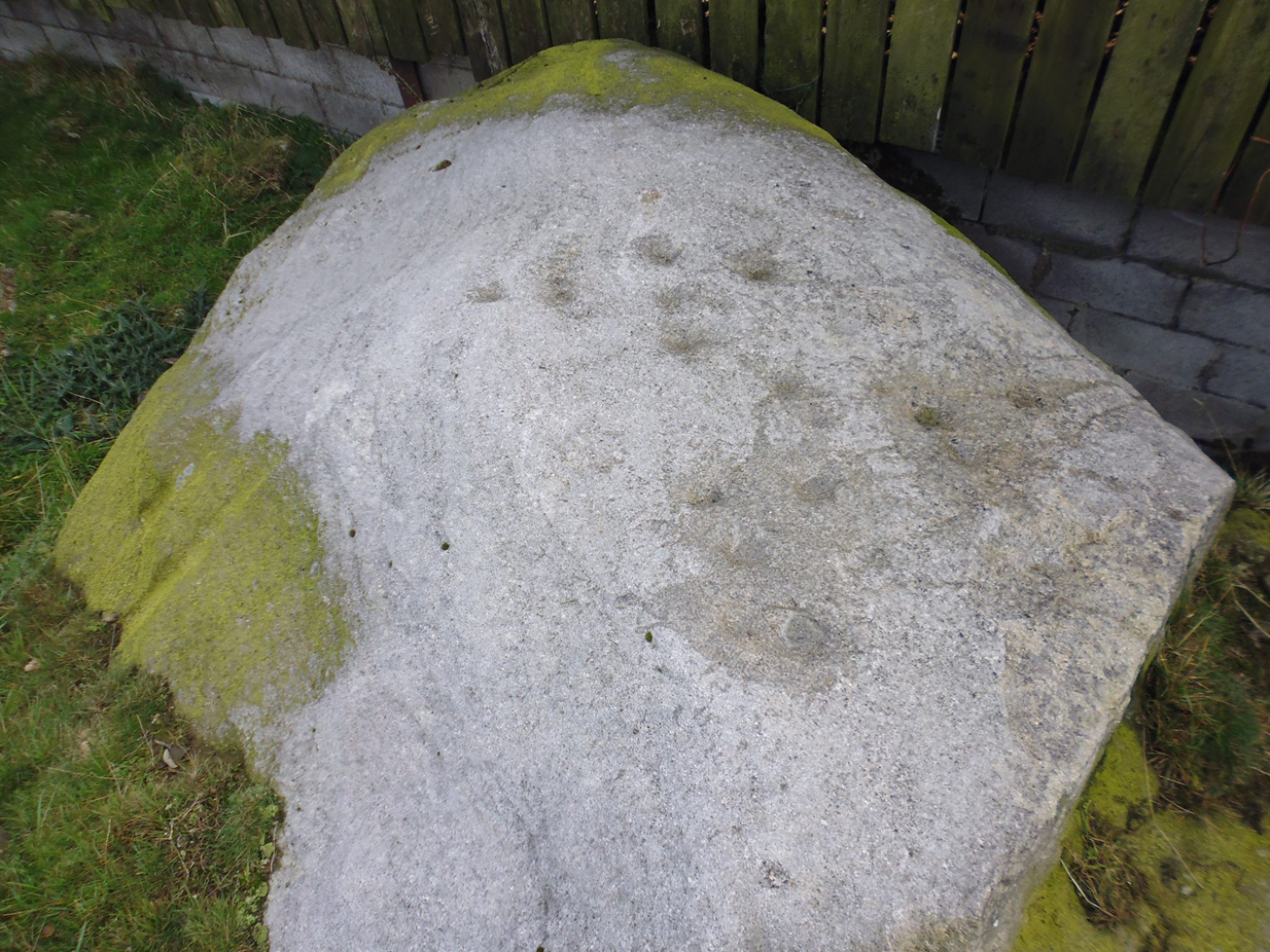
Take the same directions as if you’re visiting the Cob Stone Field carving; but instead of going into the field on your right, walk down the track about 100 yards towards the large barn below. As you walk down keep your eyes peeled to the field on your left and, right up against the wall of the barn, you’ll see a large boulder resting quietly. That’s what yer after!
Archaeology & History
This large faded cup-marked rock whose western side has been split off in recent years, has a scatter of “up to 21 small shallow worn cups” on its upper surface. They can be difficult to see in some light, but they’re definitely there (as Ray Spencer’s photos clearly show), fading slowly into Nature’s winds and storms. A couple of ‘lines’ running down the edge of the stone are due to modern farm-workings.
Close-up of the cupsSketch of the design
Several other rocks in this and adjacent fields have what may be faded remains of other cup-markings, but without guidance from a geologist or a stone-mason, we can’t know for sure whether they’re authentic or not. It’s likely that there are other authentic carvings hiding in this area—they just need sniffing out!
References:
Boughey, Keith & Vickerman, E.A., Prehistoric Rock Art of the West Riding, West Yorkshire Archaeology Service 2003.
Acknowledgements: Huge thanks to Ray Spencer for us of his photos in this site profile. Thanks Ray.
From the Askwith Moor Road parking spot, head across the road and take the directions to the Woman Stone carving about 510 yards (467m) across the moors to the west. From here, look straight down the slope and head towards the largest boulder at the bottom, 20-30 yards away. About 10-20 yards to the right of this, zigzag about in the vegetation until you find the small stone amidst the bracken. You’ll find it!
Archaeology & History
This small stone, whose natural contours and cracks have been utilised in the design of the petroglyph, may once have been part of a prehistoric tomb, perhaps rolled or thrown downhill from the nearby Askwith Moor Cairnfield. I say this due to the size and portability of the stone, i.e., it’s small and barely earthfast, giving an increased likelihood that its present position was not its original one. But we might never know…
Rough sketch of the designClose-up of the carving
It’s almost archetypal in design, being a primary cup-and-ring, with what appears to be a faint inner ring etched marginally within the larger notable incomplete circle, just an inch beyond the inner central cup. From this same cup runs a carved line, out to the near edge of the small stone. Single cup-marks occur on the edges of the rock, as can be seen in the photos: three, possibly four of them. One of the cups, where the stone narrows to a rounded point, may also have had a partial ring around it. When we found this stone a few weeks ago, the day was grey and overcast and the light was poor, so our photos do not highlight the carving too well.
(Note: the OS grid-reference for this stone is an approximation: pretty damn close, but not close enough. If someone ventures here and can get the exact grid-ref, we’d be most grateful.)
From the Askwith Moor Road parking spot, head west to the Askwith Moor cairnfield. Keep walking west, going downhill past the main cluster of rocks. If you begin zigzagging amidst the heather hereby, you’ll eventually come across this relatively small stone which, even when the heather is deep, thankfully rises to the surface. The Wester Cairnfield 1 carving is close by.
Archaeology & History
Although I presumed that Graeme Chappell and I found this petroglyph when we surveyed the area in the 1990s, I cannot find an early account of it in my files, so must presume that when James Elkington, James Turner and I came across it a few weeks ago, it was the first view of the stone in many a century… It’s another simple carving, only of interest to the mad rock art hunters out there.
…and from another angle
When we first found it, it seemed to me (with the sunlight effects on the stone) that two cup-marks had been etched here; but as Mr Elkington pointed out, from the angle he was looking at the stone, there were another two. He was right. But it’s nothing special to look at, sadly, and is probably only of interest to the real hardcore petroglyph nutters amongst you. (please note that the grid-ref for this carving needs revising and may be 50 yards either side of the one given)
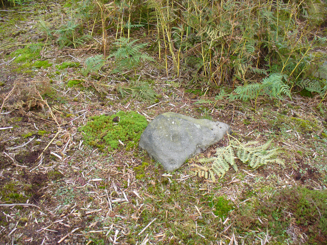
From the Askwith Moor Lane parking site, take the directions to the Askwith Moor Cairnfield. Walk westwards for about 100 yards down the gradual slope, towards the boggy land below, but before reaching the reeds, still in the moorland heather, there are a scatter of rocks. Just keep zigzagging about until you find it. It’s a reasonably large stone.
Archaeology & History
‘Cup mark’ on vertical face
This is one of several simple cup-marked stones found down the slopes about 100 yards west of the Askwith Moor Cairnfield. When James Elkington, James Turner and I re-surveyed this area again recently, I wondered whether it was a newbie or had already been located when Graeme Chappell and I did our tedious surveying of this region in the 1990s—and it turned out that we did! The carving is nothing special to look at, even if you’re a petroglyph zealot. Comprising of a distinct single cup-mark on the top nose of the rock, another is visible on the vertical south face, and another possible is on its eastern face.
1894 map of shooting target
When we look at the early maps of this area, we find that to the north and south of this stone once existed ‘Shooting Houses’. As we can see on the attached map, the position of one of the shooting targets is very close to the location of this stone and so we must conclude that the cups on the vertical face were done by gunshot and are not prehistoric. However, the distinct cup on top of the stone retains its prehistoric link.
Follow the same directions as if you’re going to the Black Burn (2) carving (which you’ll obviously be looking at if you’re checking this one out!); and from there, walk two or three steps southwards down the slope – and you’re just about stood on it!
Archaeology & History
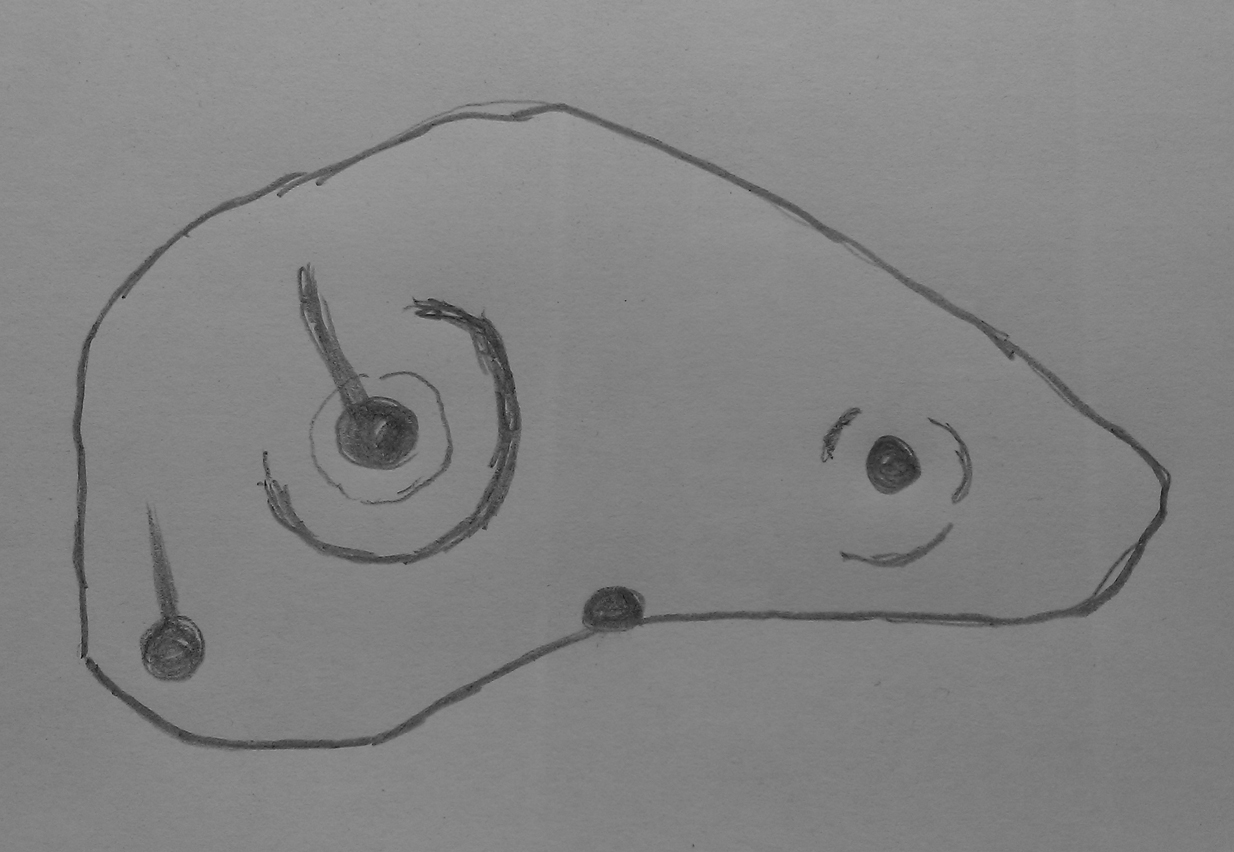
This, at first sight, seems little more than two cup-marks: one rather small, and the other somewhat larger than usual. I walked round it, crouched down and fondled it, poured water on it and heightened the carving… and noticed what seemed to be a carved arc around the western side of the large cup. But I couldn’t make my mind up whether this was natural or not. And then as laid down and looked across the stone, it seemed as if a very faint triangle completely enclosed the large cup! I crawled round it at ground level and the shape appeared and disappeared as the light altered. So I took a few more photos and wondered whether or not the shape would become obvious in them. And it did!
An eye in the triangle?Cup and faint triangle, or a trick of the mind?
It’s unusual – and I’m still not sure whether it’s natural or not. The carving needs more attention, in better daylight. Or perhaps the computer-tech kids might have a look at it and see if this really is an eye-in-the-triangle style design we’ve got here. It would be damn good! Anyhow, the carving was first mentioned by George Currie (2005), who told of it being two metres south of the Black Burn (2) cup-and-ring and, plainly, that it “has two cups: 60 x 15mm and 25 x 8mm.” It overlooks the urisk-haunted Urlar Burn, a creature known in some places for having milk and other offerings poured into cup-marks to appease it and gain good fortune.
References:
Currie, George, “Perthshire: Black Burn (Dull Parish) – Cup and Ring Marked Rocks”, in Discovery & Excavation Scotland, volume 6 (new series), 2005.
Take the A826 Crieff Road uphill for 275 yards then turn right up the Urlar Road. It’s a long uphill walk from here, up the private road, through and past Urlar Farm and along the track, making sure to go right where the track splits, keeping to the west-side of the burn. (don’t cross over it!) From here, the fields open up ahead of you into the distant hills. Keep along the track until, after a few hundred yards a small copse of trees is on your right. Walk past the bottom of this and then walk immediately up to the top of the large rounded knoll, or Tom, on your right. Once at the top, look for the triangular stone on its southwestern edge.
Archaeology & History
Upon this rounded tom, beloved of faerie folk and overlooking the urisk-haunted Urlar Burn, is this small flat triangular-shaped stone, embedded in the ground, possessing an unusual set of seven, possibly eight cup-markings (not five as Currie [2005] initially described) of varying depths and age, carved into straight geological fissures in the rock which, I hasten to add, were probably intended as part of the original design. Such elements are not unusual in carvings in other parts of the world, tending to relate to some spirit or ancestral ingredient. Whether that was important here, we might never know.
Black Burn (2) carvingBlack Burn (2) carving
But in addition to the cups on their geological cracks, a large faint wonky incomplete ring has been carved around the centre-most cup-mark, seemingly stopping where it meets the natural crack. You can just make it out in the photos. One side of this ring may continue onto the top of the longer crack, but it was difficult to see in the cloudy daylight and another visit is necessary.
The carving was first described by George Currie (2005), who told, in his usual minimalist manner:
“On W side of large knoll, triangular-shaped rock, 0.7 x 0.7m, flush with ground; five cups, largest being 50 x 20mm and smallest, 25 x 8mm.”
Two or three yards away, just slightly down the slope to your south, is another cup-marked stone: the Black Burn (3) carving.
References:
Currie, George, “Perthshire: Black Burn (Dull Parish) – Cup and Ring Marked Rocks”, in Discovery & Excavation Scotland, volume 6 (new series), 2005.
Acknowledgements:Huge thanks for use of the Ordnance Survey map in this site profile, reproduced with the kind permission of the National Library of Scotland.
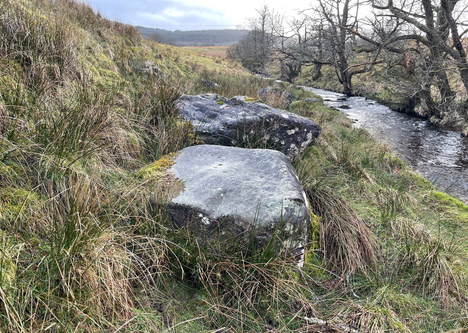
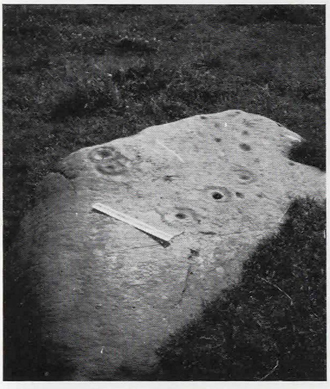
Take the same directions to locate the cup-and-ring stone of Ballochraggan 12. There are several rocks adjacent. The one immediately next to it, to the northeast, is the one you’re looking for. Be gentle and careful if you’re gonna look at it — deadly serious, be very careful indeed!
Archaeology & History
One of the most intriguing and most fascinating of all the prehistoric carvings I’ve yet to discover. Not that this was all my own work. If it hadn’t been for Paul Hornby, we might have simply walked past it as being little more than a single cup-marked stone—and in this area, single cup-marks tend to be little more than geological in nature.
After we’d looked over several of the registered carvings close by, I did my usual meandering back and forth, stroking stones and seeing if there were any carvings that had been missed by previous surveyors. And in walking past a small piece of smooth rock, a singular cupmark seemed to stand out. I walked past it, shouting across to my colleague.
“It looks like we’ve got a single cup-mark here Paul,” I said, “with possible half-ring.” Thankfully Mr Hornby gave it his better attention.
Mask Stone, with faint ‘urn’Close-up of features
The sun was still out and shining across the smooth rock surface, which tends to mean that you’re not seeing any carving on the stone quite as good as it actually is. Thankfully however, the sun was beginning to get lower and, when this happens, if we wet the rock, any carvings that might be there stand out much better. And this little fella just seemed to get better and more curious the more attention Paul gave it!
The first thing that became obvious were a series of faint carved lines above the single cup-mark. Initially these didn’t seem to merit much attention (straight lines on rock are usually more the product of geophysical action than that of humans), but as the rock got wetter, Paul saw something very distinct indeed.
“There’s a face on it!” he exclaimed. And indeed there was. A Rorschach response no doubt, but it was still very much like a face. This looked for all the world akin to the stylised olde English gentry sort of countenance, as in old cartoons. It was quite ‘distinct’, as such characters themselves insist on being! Yet around this initial face, more lines seemed to be emerging as the stone gave up more and more of its hidden story.
Standing back from an initial investigation, the carving was seen to consist of a triple-ring, but without the traditional ‘cup’ in its centre. Instead, the centre was marked simply by a small ‘dot’—perhaps, originally, being a small conglomerate hole formed as a result of another tiny harder fragment of stone falling away from its larger mass. But a ‘dot’ it was. The other carved ‘lines’ however, immediately below and attached to the triple-ring, gave us something almost unique—and another strong Rorschach response. As the photos clearly show, we have a distinct second ‘face’ made up of the same lines but in a quite different form. This ‘face’ has all the attributes we usually associate with pictures of mythical spirits, demons, or a mask—hence the name!
Paul took a series of fine photos, hoping that he could catch the image that our eyes could clearly see. And thankfully, his digital camera brought the image to life even better than our eyes did! The ‘mask’ is comprised of carved lozenge forms, akin to the more decorative ones we find at Kilmartin, and more especially around Newgrange, Ireland. We sat and talked about this: wondering and working out routes that we’d take over mountains and moors, from Ireland, to Kilmartin, then onto Ballochraggan, etching the same designs onto the rocks hereby and attaching similar mythic notions to them: of shamanism and kingship; underworlds and journeys—paradigms lost and certainly misunderstood in the non-polysemia of many modern academics.
Lozenges and rings
…The stone here was still slightly covered over and, beneath the loose grasses, another feature emerged of another petroglyphic rarity. At the topmost western side of the rock a straight line ran across the surface, seemingly marked by the hand of man, with a curious little line almost doubling back on itself for just an inch or so, and then feeling to run down the stone, towards the concentric rings and the face below. When we stood back and took the photos, this line and its tracer took on a form that I’ve only seen echoed in one of the Netherlargie tombs at Kilmartin, Argyll, 44.4 miles (73km) to the west. It is very distinct.
The beaker, rings & ‘face’
Spuriously ascribed as being ‘axe’ carvings (oh how archaeologists love this Rorschach projection), the Netherlargie North tomb cover-stone in Kilmartin has a series of burial ‘urns’ or beakers carved onto the rock, amidst a scattered collection of cup markings. (Beckensall 2005:73-4; Bradley 1983:92-3; Royal Commission 1971:68-70; Twohig 1972, etc) Here too at Ballochraggan we find another such symbol, but just a singular example, much larger and more clearly a beaker or urn, as are traditionally found within many old neolithic and Bronze Age tombs; although no tomb is immediately apparent at this Ballochraggan carving.
The entire carving is very faint indeed (you can’t even see it when you’re looking directly at it unless conditions are good) showing that it remained open to the elements for thousands of years. Other adjacent carvings lack the erosion that we find on this one, even on those which, as archaeologist Lisa Samson said, is “softer sandstone rock than this one”—implying that it’s one of the older carvings in this incredible cluster.
References:
Beckensall, Stan, The Prehistoric Rock Art of Kilmartin, Kilmartin Trust: Kilmartin 2005.
Bradley, Richard, Altering the Earth, Society of Antiquaries Scotland: Edinburgh 1993.
Royal Commission on the Ancient & Historical Monuments of Scotland, Argyll – volume 6: Mid-Argyll and Cowal, HMSO: Edinburgh 1971.
Twohig, Elizabeth Shee, The Megalithic Art of Western Europe, Clarendon: Oxford 1981.
Acknowledgments: Huge thanks again to Mr Paul Hornby for his considerable help with this site, and for use of his photos.
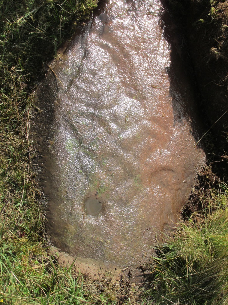
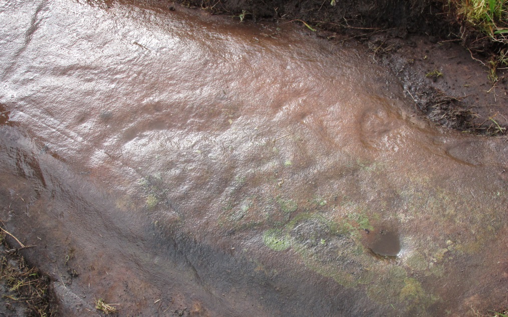
On the A81 road from Aberfoyle to Strathblane, about a mile south of Aberfoyle take the tiny right turn (keep your eyes peeled!) to Gartmore. At the end of the village, turn right at the T-junction. Just over a mile along the tiny road, just over the tiny road-bridge, turn right again up up the dead straight road to Drymen for nearly a mile and park up. A dirt-track is on your right: walk along here for ¾-mile (1.2km) and in a large field on your left a huge rock sits (no carvings on it). Keep walking on the track and where the field ends, a path to your left runs above a small burn. Naathen, 150 yards along here, look down at the waters and there’s a clump of large rocks. Check ’em out!
Archaeology & History
Morris’ old photo (from PSAS 1967)
This stone and others were mentioned in MacNair’s (1973) essay in the popular history guide to the region, after it had seemingly been rediscovered a few years earlier by Ron Morris (1967; 1969), who listed it in his petroglyph catalogues. It was originally located at the top of the slope above the burn, but was rolled down here shortly after Morris discovered the cup-and-rings on it. The farmer at the time had made a bore-hole into the rock with the intention of blowing it up, but Morris found it just in time and the stone managed to survive!
Faint CnR’s just visible
It’s a large rock with a decent ornate design that was clearly visible when Morris surveyed it (see photo, right). It comprises of, “a cup-and-two-rings, 18cm (7in) diameter, 6 cups-and-one-ring (2 of which are tangential) and at least 8 cups. All rings are complete. Greatest carving depth 2cm (¾in).” There also appears to be a line of four or five small cup-marks running in a short line by one of the lower cup-and-rings, but these are very faint indeed. The double cup-and-ring mentioned by Morris is the one at the top-centre in my photo, but the next cup-and-ring down may also be a double-ring. At the top-right of the photo is where two cup-and-rings are conjoined.
Since being rolled down the slope to the side of the burn, the carving’s much more in the shadows and is more difficult to work out. Sadly on the day when I visited here, Nature bestowed on me a wet and cloudy firmament, so the design was even more difficult to see, as my photos illustrate.
Morris (1981) told that “other stones in the immediate vicinity bear possible cup-marks,” and one of these may exist just a couple of stones away (Corrie 2), leaning up into the grasses: this is another rock that has been pushed down the slope and has curious natural cup-markings on it, with one or two that could be man-made, but we need a geomorphologist to have a look at it and tell us one way or the other.
References:
Edlin, Herbert L. (ed.), Queen Elizabeth Forest Park, HMSO Edinburgh 1973.
MacNair, A.S., “History,” in Edlin’s Queen Elizabeth Forest Park, HMSO 1973.
Morris, Ronald W.B., “Stirlingshire: Corrie Farm (Gartnabrodnaig) – Cup Marks,” in Discovery & Excavation, Scotland, 1967.
Morris, Ronald W.B., “The Cup-and-Ring and Similar Early Sculptures of Scotland; Part 2 – The Rest of Scotland except Kintyre,” in Transactions of the Ancient Monuments Society, volume 16, 1969.
Morris, Ronald W.B., The Prehistoric Rock Art of Southern Scotland, BAR: Oxford 1981.