White Caterthun Carving, Menmuir, Angus

Cup-Marked Stone:  OS Grid Reference – NO 54671 66022

Also Known as:

  1. Canmore ID 35007

Getting Here

White CaterthunCR01

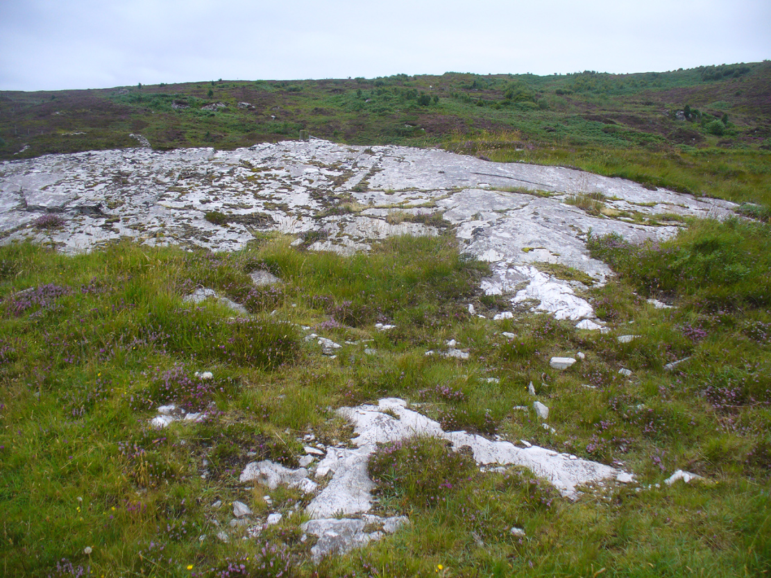
The carving below the walling

Many ways here, but from the nearest town of Brechin, take the minor north road out of town (not the B966) to Little Brechin, heading roughly north to the renowned hillforts of White and Brown Cathertun (ask a local if needs be).  Park up and walk up the slope to White Cathertun, following the immense walling around to the right.  Near where you reach the opposite side of the hillfort, look down the rocky slopes for a large boulder, just on the edge of the walling.  You’ll find it!

Archaeology & History

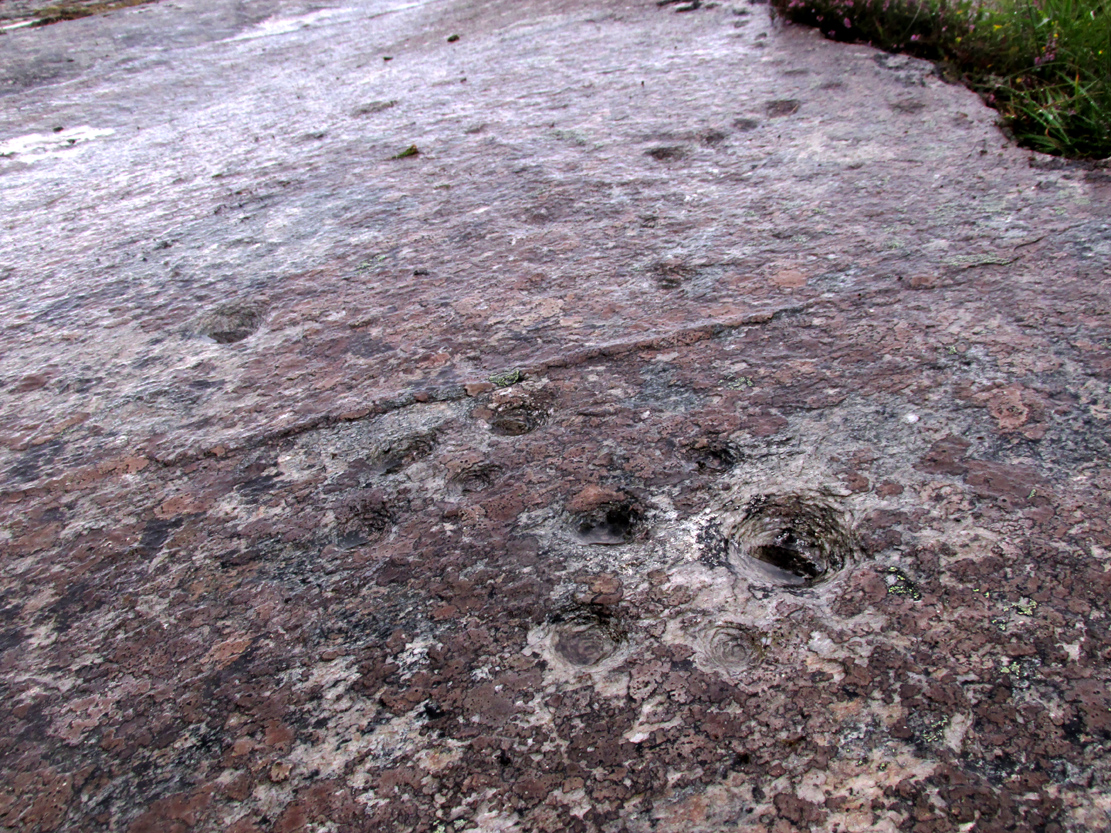
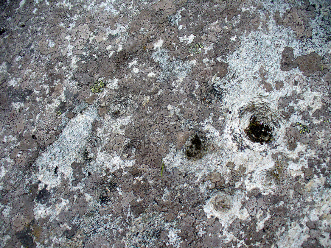
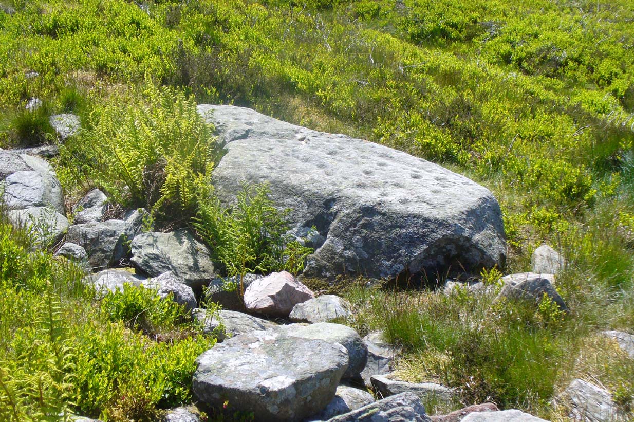
Although Canmore include this cup-marked stone in the site-profile of the incredible White Caterthun hillfort, it should really have an entry of its own, as it’s age and nature very probably pre-date the construction of the giant fortress.  But, this aside, if you’re visiting the hillfort (an incredible place!), at least give this heavily cup-marked stone your attention too.

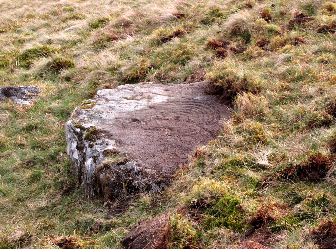
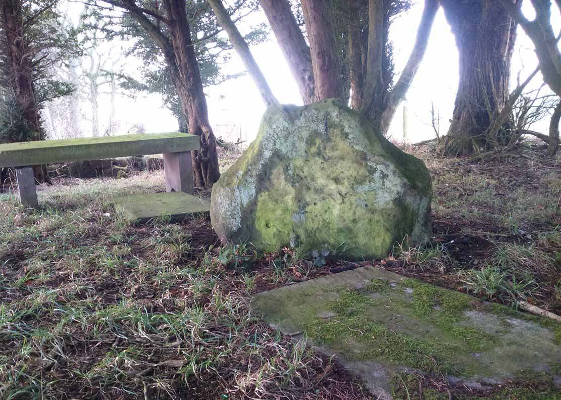
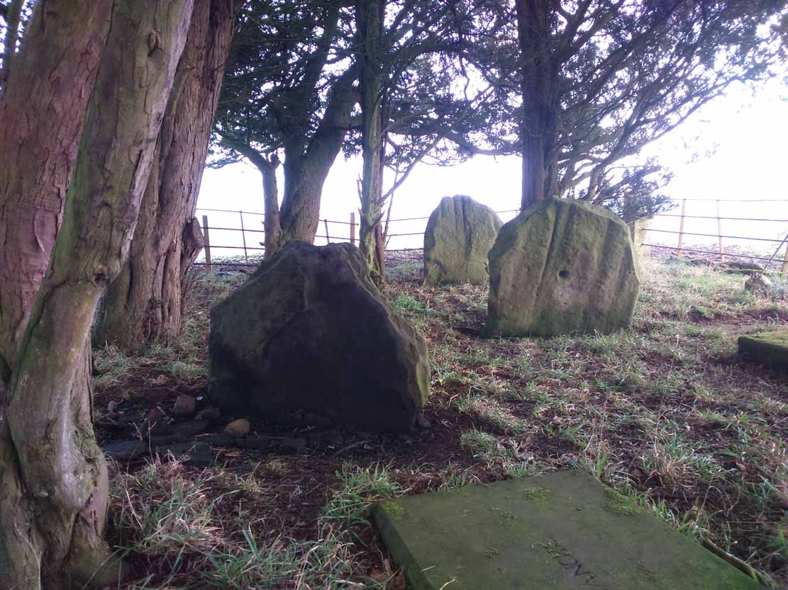
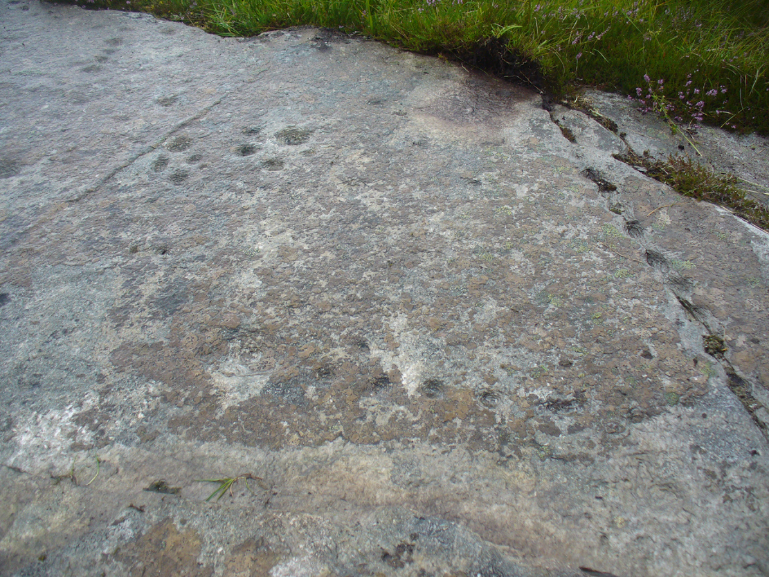
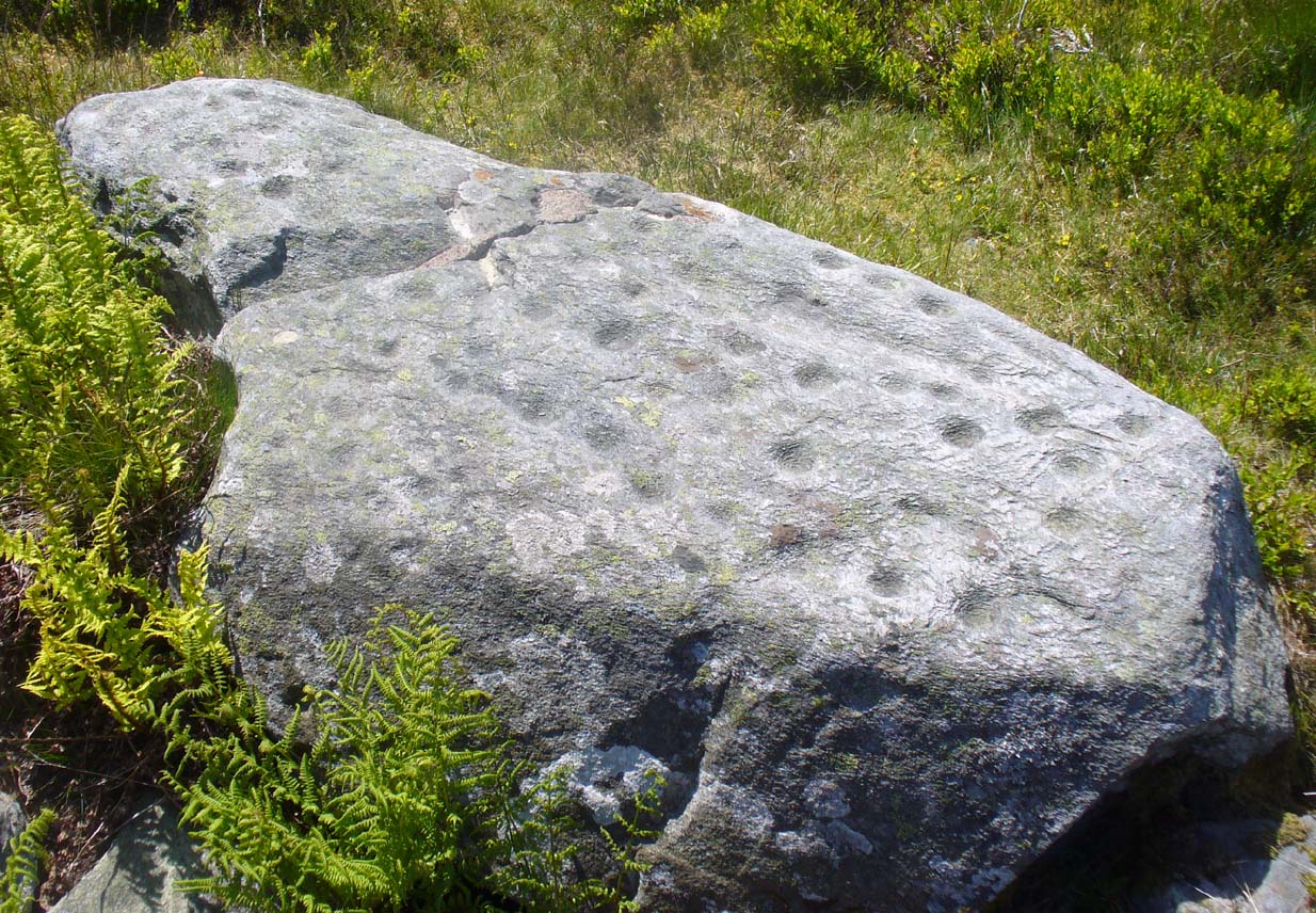
Looking across the carving

Looking across the carving

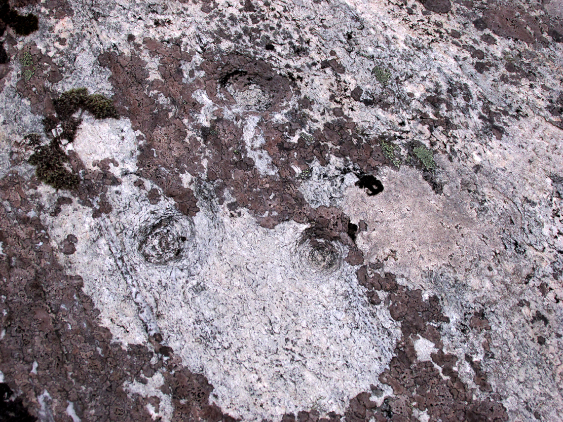
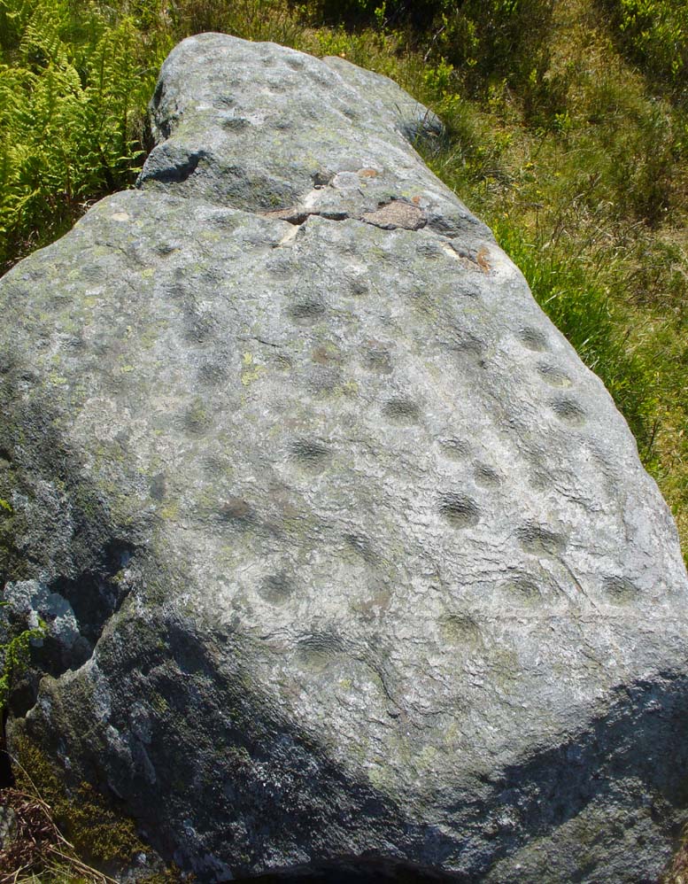
Close-up of the main cups

Close-up of the main cups

Probably neolithic in origin, there was a small portable cup-marked companion found 30 yards away, suggesting perhaps that a cairn might once have stood on this hilltop—but tradition is silent on the matter.  No other petroglyphs of any note have been located nearby, which is unusual.  In all probability other carvings remain undiscovered, particularly in the hills immediately to the north.

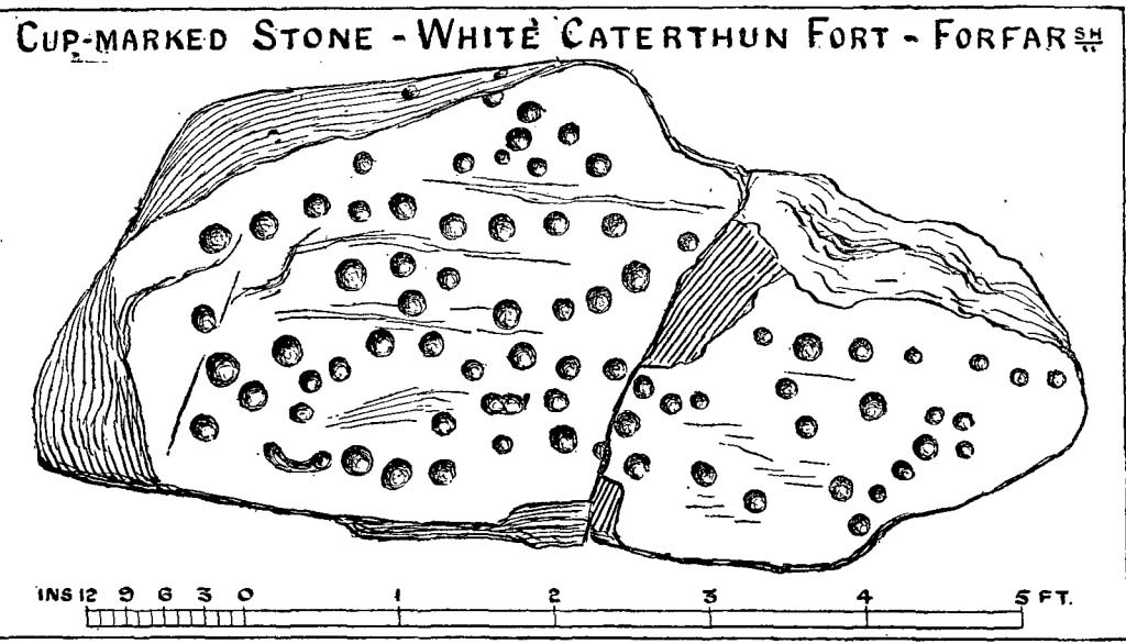
Consisting of around 80 cup-marks, several of which appear linked by carved lines, the stone has been bound together with concrete and metal bolts after some idiot damaged it in the 19th century.  It was first described by Miss Christian Maclagan (1875) in her stunning megalithic survey of the period.  She wrote:

“To Sir James Simpson’s list of cup-markings we are able to add the one at the Caterthun, on a large block 6 feet long, which is quite covered with very distinctly cut cup-markings.  It is a block of basalt…and the cups are so very clear and sharp in their lines that their freshness can only be accounted for by the stone having lain with the markings buried in the ground.  This curious stone has been quite recently broken in two.  It is a pity to see it so destroyed, because it is valuable to the antiquary in helping to establish a very remote antiquity for the fortification.  It lies on the north side of the fort, among a chaos of stones, having probably once formed the side of a gateway.”

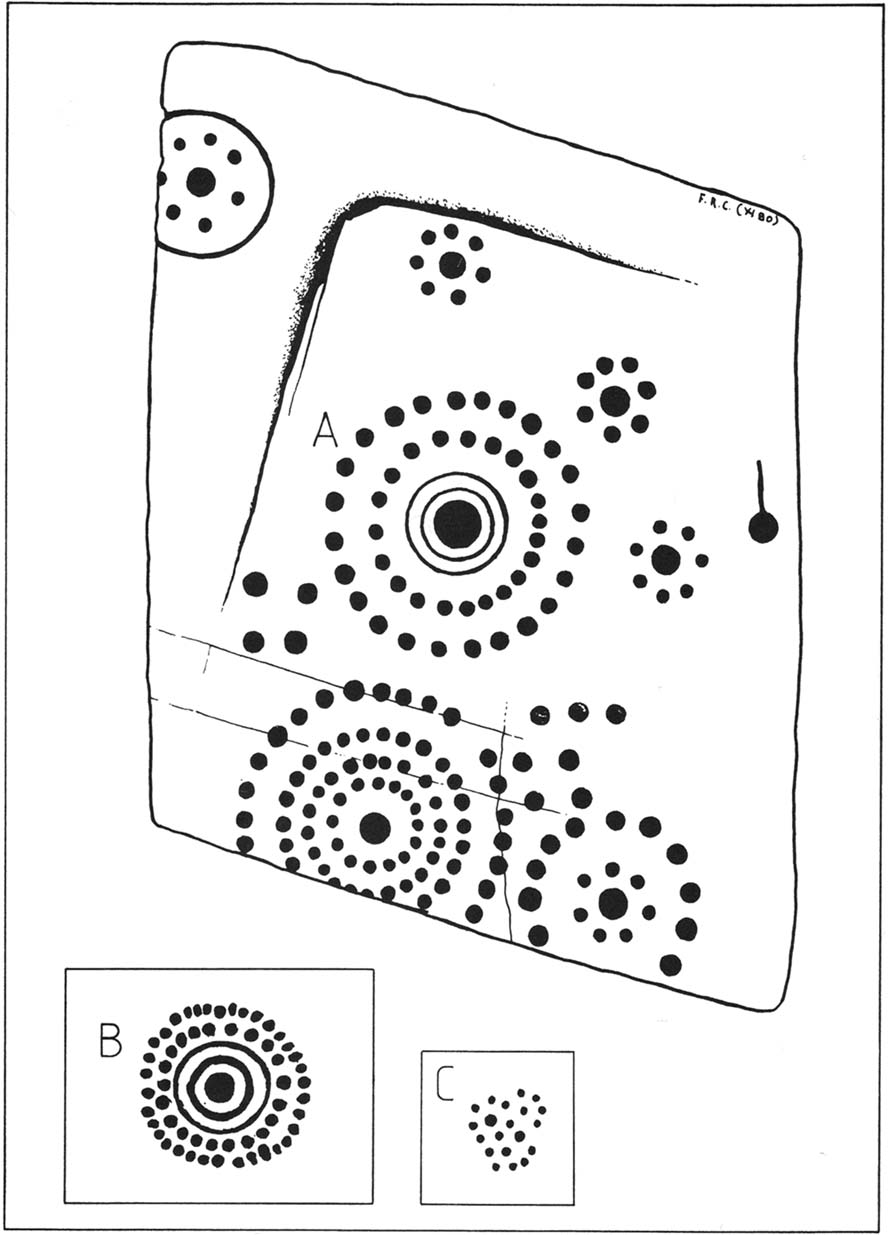
A few years later the late great J. Romilly Allen (1882) visited the site and gave us his description, telling:

“On the west side (of the hillfort), 10 yards north of the boundary of the fir plantation that covers one-half of the hill is a cup-marked boulder… The stone has been broken in two, and one portion of it lies at the foot of the stone rampart just above the first outer ditch, whilst the other half has been rolled down the hill by some mischievous person with more muscles than brains, and is to be found immediately below, where its further progress was arrested by coming in contact with the outermost wall.  The two fragments when placed together measure 6 feet 9 inches long by 3 feet wide, and 1 foot 9 inches thick.  The stone is greenish quartzose slate, and on its upper surface are carved eighty cups, varying from 1½ to 2½ inches diameter.  In two cases two cups are united into one by a connecting groove.”

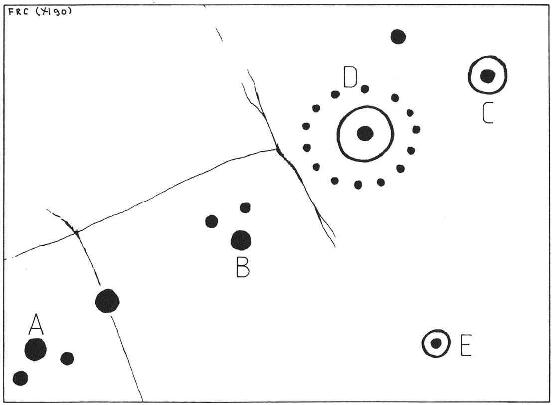
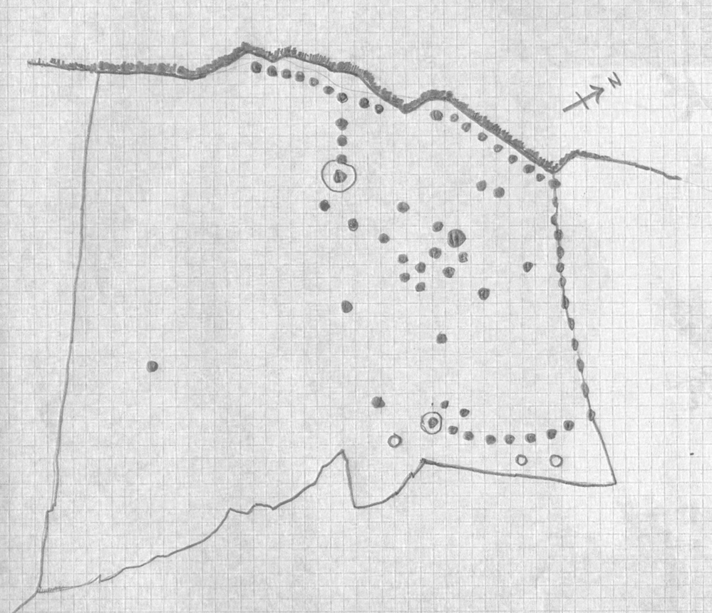
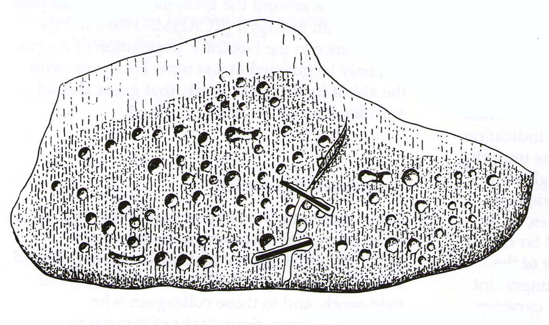
J. Sherriff's 1995 drawing

J. Sherriff’s 1995 drawing

J.R. Allen's 1882 drawing

J.R. Allen’s 1882 drawing

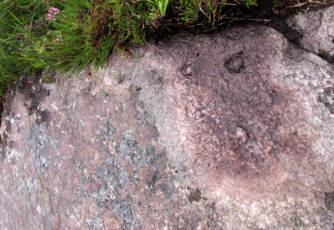
The most recent description and illustration of the stone is in John Sherriff’s (1995) survey. When we visited the carving recently we noticed three cup-marks etched onto the side of the stone, with a possible carved line running above one of them—but due to the bright sunlight on of the day of our visit, it was difficult to say whether this was a geological in nature or not (bright daylight can hamper good visibility of many carvings).  Check it out!

References:

  1. Allen, J. Romilly, “Notes on some Undescribed Stones with Cup Markings in Scotland,” in Proceedings of the Society of Antiquaries Scotland, volume 16, 1882.
  2. Kenworthy, J., “White Caterthun: Cup-Marked Stone”, in Discovery & Excavation, Scotland, 1980.
  3. MacLagan, Christian, The Hill Forts, Stone Circles and other Structural Remains of Ancient Scotland, Edmonston & Douglas: Edinburgh 1875.
  4. Sherriff, John, “Prehistoric Rock-Carvings in Angus,” in Tayside & Fife Archaeological Journal, volume 1, 1995.

© Paul BennettThe Northern Antiquarian


Witches Stones, Kirkton of Auchterhouse, Angus

Cup-and-Ring Stones (lost):  OS Grid Reference – NO 345 392

Also Known as:

  1. Canmore ID 31908
  2. Greenfield Knowe
  3. Greenford Knowe
  4. Sidlaw Hospital
  5. Spittal Stones

Archaeology & History

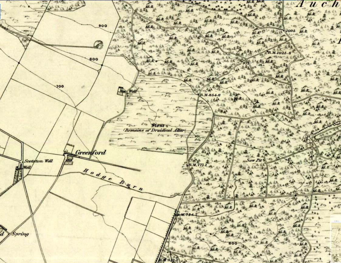
1843 map showing the 'Stone'

1843 map showing the ‘Stone’

We have no precise location for this carving, nor several of its petroglyphic relatives who lived within this arena for countless centuries until (you guessed it!) the advance of the Industrialists brought their profane ways to the region, with the usual disregard for local people and their unwritten traditions.   Which is a great pity, for there were obviously some old stories and important archaeology hereby.  Aubrey Burl (1988) for one, thought this cup-and-ring carving may have played its part in being one of the stones in a larger “four-poster” stone circle, although local history accounts tell that it was part of an impressive prehistoric tomb.

One of the Witches Stones

One of the Witches Stones

The Witches’ Stone we see illustrated here was one of at least two carvings in a cluster of stones.  The great J. Romilly Allen (1881) wrote about the it, although it seems he never visited the site himself.  Instead, his description came from that of a colleague, a Mr W. McNicoll, who told him that at the position marked on the early OS-map as a single “Stone” that was “Remains of a Druidical Altar” there were in fact

“two in number: one, an upright pointed stone, 5ft by 2ft by 3ft 6in high; ans the other lying 3ft 6in to the southwest, 7ft 6in by 5ft by 2ft 6in thick.  The latter has fifteen cups, varying from 2 to 3in in diameter; one with a single ring carved on the sloping face at the south end of the stone.  It lies horizontally and has two hollows, worn at the ends where the cups are, by the toes of persons climbing onto the top.  The ground under this stone has been partly removed and it appears to rest on two others; but the whole appears to be natural and not a cromlech or rocking stone.”

Folklore

One of the Witches Stones

One of the Witches Stones

Reference was made to this “Witches Stone” in the 1860 Object Name Book of the region, where it was said to have been part of a larger group, “considered to have been used by the Druids as a place of worship.”  This catch-all phrase of druidic relevance should be translated as “local traditional importance” where animistic rites of some sort would have occurred.  Certainly we find the usual reverence or fear in the local tale told by Mr Hutcheson (1905) which he thankfully recorded following his visit to the site:

“Here…occupying a small knoll known locally as Greenfield Knowe, towards the western end of the plateau…two upright standing stones of boulder character formed a conspicuous feature.  They were, if tradition be accepted, the survivors of a larger group.  The same tradition records that the farmer of Greenfield Farm, requiring stones for the erection of dykes, removed some of the standing stones from Greenfield Knowe.  He, however, speedily found unexpected difficulty in carrying out his intentions.  The dykers whom he had employed absolutely refused to use the stones, alleging they would thereby bring misfortune upon themselves and families, , and threatened, rather than risk such calamities, to throw up the job.

“While in this quandry the farmer, it is said, had a vision: a ghostly figure appeared to him, and in a hollow voice warned him against interference with he stones on Greenfield Knowe, and concluded by the adjuration, “Gang ower the howe t’ anither knowe.”  Needless to say, the farmer lost no time in obeying his ghostly visitor.  Next morning he carted back the stones he had removed and sought material for his dykes elsewhere.”

This is probably the same tale, slightly reformed, which the local historian W.M. Inglis (1888) described, when he told that,

“About the beginning of the present century, when a worthy old parishioner was having some repairs carried out upon his house, he removed a few of the large stones with the intention of having them built into the walls.  Throughout the night, however, an eerie feeling came over him, his conscience was on fire, he could get no rest.  Accordingly he got out of bed, yoked his horse into the cart, and like a sensible man replaced yjr sacred stones where he found them, went home, and thereafter slept the sleep of the righteous.”

References:

  1. Allen, J. Romilly, “Notice of Prehistoric Remains near Tealing, in Forfarshire” in Journal of British Archaeological Association, volume 37, 1881.
  2. Burl, Aubrey, Four Posters: Bronze Age Stone Circles of Western Europe, BAR 195: Oxford 1988.
  3. Hutcheson, Alexander, “Notice of the Discovery of Stone Coffins at Auchterhouse,” in Proceedings of the Society of Antiquaries, Scotland, volume 39, 1905.
  4. Inglis, W. Mason, Annals of an Angus Parish, John Leng: Dundee 1888.

© Paul BennettThe Northern Antiquarian


Old Lane Carving, Cowling, North Yorkshire

Cup-and-Ring Stone:  OS Grid Reference – SD 97300 42625

Getting Here

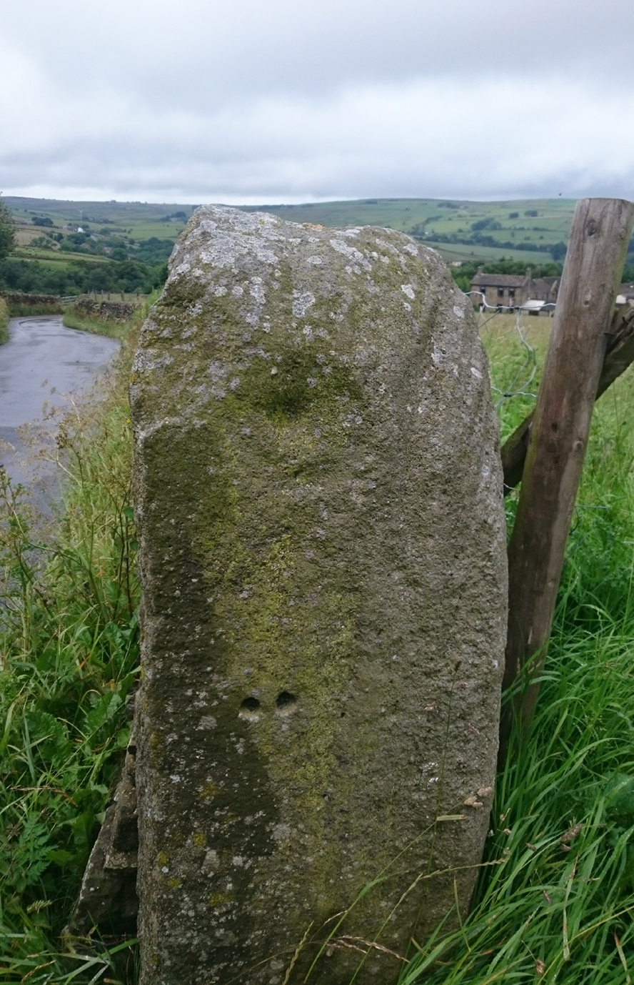
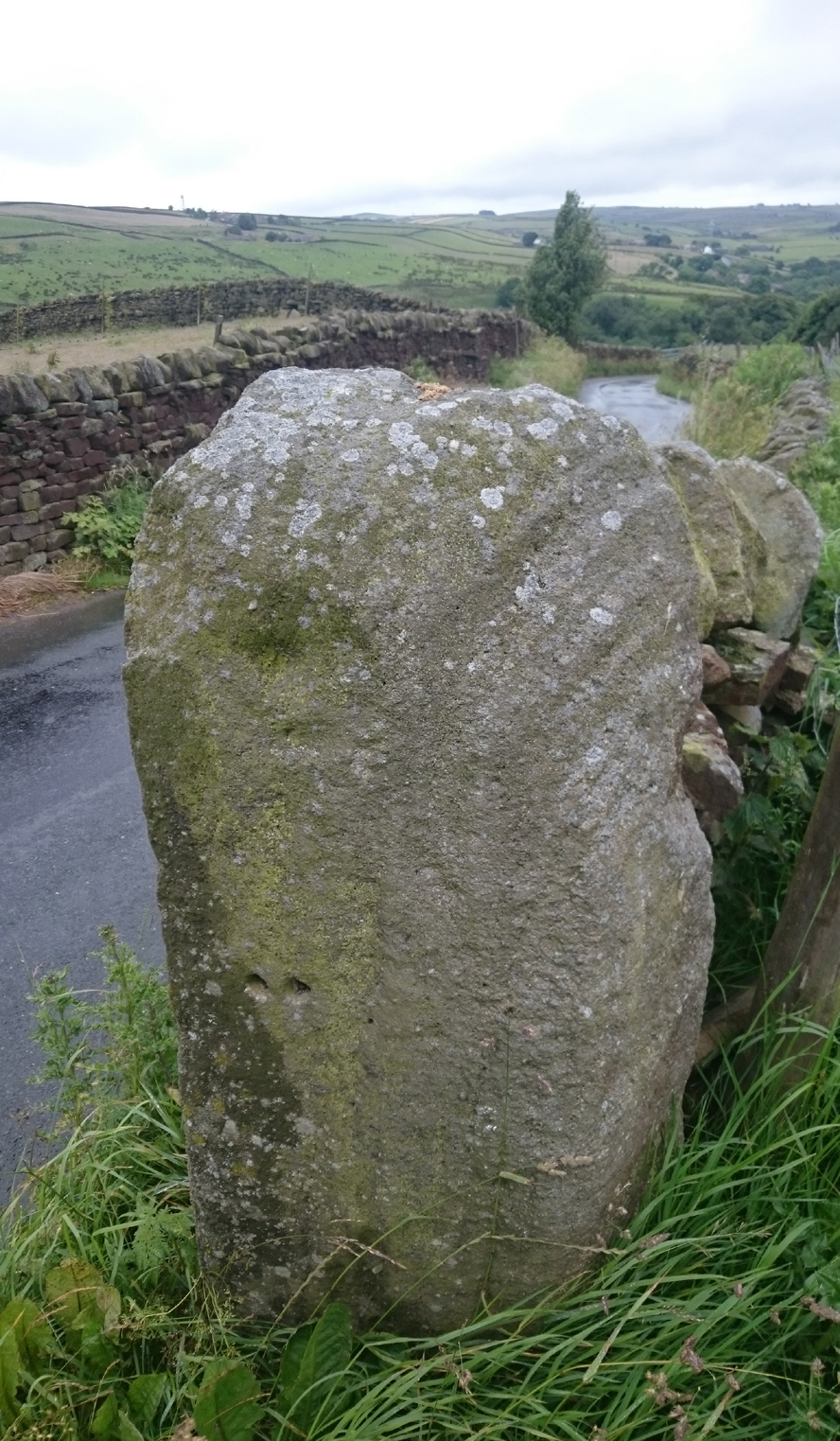
Old Lane Cup-and-Ring, Cowling

Old Lane Cup-and-Ring

This Stone is situated on Old Lane, Cowling, North Yorkshire. To get here coming from Crosshills, you come straight through the village and past the shops.  About 250 yards after the shops you will come to a sharp left hand bend, and once you have gone round this corner you will see a sign pointing to Oakworth (Old Lane).  You need to turn left here (up by the cemetery) and continue for about half a mile up that lane until you come to a sharp left-hand bend. Once you have gone round that left-hand bend you will see a driveway on the right, the stone is situated opposite, in the gateway.  Hope you can find it and enjoy it like I do every time I pass it.

Archaeology & History

...and from another angle

…and from another angle

I’ve driven past this stone many times, almost every day and never previously noticed any markings.  Then, one particular day, the weather was a bit miserable but the lighting was just right to illuminate this little gem.  Was this lump of rock a standing stone, or have modern day folk took advantage and moved it here to be used as a gatepost? I don’t think we ever will know.

(Editor’s Note – When Chris first informed us of this carving, I wondered whether or not it had anything to do with a cup-and-ring found on a gatepost in the 1950s or ’60s by Stuart Feather or Sidney Jackson, but this was not the case.  This petroglyph therefore, is yet another one that our users have discovered and it has to be classified as a new find. Keep up the good work sir!  PB)

© Chris Swales, The Northern Antiquarian


Sunrise Stone (605), Snowden Crags, Askwith, North Yorkshire

Cup-and-Ring Stone:  OS Grid Reference – SE 18066 51251

Also Known as:

  1. Carving 605
  2. Northern Earth Mysteries Stone

Getting Here

Sunrise Stone, Snowden Carr

Sunrise Stone, Snowden Carr

Take the same directions as if you’re going to visit the Naked Jogger Carving (stone 612), not far from the well-known Tree of Life Stone.  From the Naked Jogger carving, walk up the small outcrop of rocks that bends above you.  Barely 100 yards up when you reach the top, you’ll notice a single large sloping stone barely 50 yards ahead of you in the same field.  That’s the spot!

Archaeology & History

This is a little-known beauty of a carving just off the edge of the quiet moors that are littered with prehistoric remains.  It was only rediscovered a few years ago — by myself if you believe the writings of rock art student Keith Boughey (2010) in his essay on the validity of so-called “amateurs”who research and discover petroglyphs (Boughey’s essay is scattered with mistakes).  But I’d never even visited this carving until two years ago!  The stone was in fact found during a field-walk by early members of the Northern Earth Mysteries group in August 1989 (Wilson 1990) and subsequently described and illustrated for the first time by Phil Reeder (1990).

Close-up of main cluster

Close-up of main cluster

As can be seen in the photos accompanying this site profile, the rock on which the carving has been done has, at some point in the past, been cut into and its edges have been hacked away and destroyed, literally cutting into the overall design.  We have no idea what the original size of the stone was, obviously, but this petroglyph was once larger than the design that we see at present.  Such is the price of ‘progress’, as some folk call it.

Anyway – a few months after the carving was rediscovered, Phil Reeder (1990) wrote:

“After a visit to the Tree of Life stone…a cursory inspection by the NEM Group was made on nearby rock outcrops, part of which showed evidence of recent exposure due to soil erosion.

“One stone in particular stood out as five shallow cups and associated rings could be discerned.  When cleaned, it became apparent that further carvings extended beneath a thin eroding soil layer.  When this layer was cleared, a complex set of carvings were revealed.

“Only preliminary work at the site has been carried out to date, but it appears that the carvings comprise of at least 28 cups, 13 of which have associated rings; several of the cups are linked by gutters forming an intricate design, one gutter part enclosing 11 cups.  The carvings on the lower edge of the stone have weathered badly and are difficult to interpret.”

Reeder’s so-called “amateur” description is a good one. Certainly more accurate than the subsequent one by Boughey (“I’m a professional”) & Vickerman (2003):

“Large rock of coarse grit whose surface slopes with the hill. About forty cups, some large, many with single rings, and many curving grooves, the whole forming a remarkable, complex design.”

Phil Reeder's 1990 drawing

Phil Reeder’s 1990 drawing

Boughey & Vickerman's sketch

Boughey & Vickerman’s sketch

We can see in the respective drawings by both Reeder (left) and Boughey & Vickerman (right) that some elements which should have been included in the ‘official’ drawing were missed, yet had been accurately included in the earlier ‘preliminary’ drawing, as Mr Reeder put it.  I hope that readers will forgive me pointing out these seemingly minor elements; but I do it to illustrate the ineffectiveness of more recent rock art students who are gaining the title of ‘experts’ in this field.  It’s important to recognise that, in this field of study, “experts” are few and far between indeed… I’ve certainly yet to meet any!

Northern end of carving

Northern end of carving

Southern side of carving

Southern side of carving

The carving is mentioned briefly in Beckensall’s (1999) introductory study, with little comment.  But of note here is not only the curious linear feature running between two cup-and-rings, but the position of the stone in the landscape.  For if you sit either upon or next to this carving, you are looking east straight across the gorgeous Fewston valley directly at the prominent wooded hill of Sword Point.  As it slopes down into the present-day greenery of fields and scattered woods, the Wharfe Valley spreads out to the distant east and, as the sun rises and scatters its rays onto the wet morning stone here, the design on the rock awakens with much greater visual lucidity than that which our daytime eyes bestow to us.  In all likelihood, sunrise was an important element in whatever mythic function underscored this curious carving, with its human-like figure rising on its southern side, emerging from the edge of the rock, personifying perhaps the rising solar disc and the living landscape as the daylight breath awoke Earth’s creatures; or maybe it signifies a symbolic group of people gathered together watching the sunrise…

Of course, I’m dreaming… (how very amateur of me! 🙂 )

References:

  1. Barnett, T. & Sharpe, K. (eds.), Carving a Future for British Rock Art, Oxbow: Oxford 2010.
  2. Beckensall, Stan, British Prehistoric Rock Art, Tempus: Stroud 1999.
  3. Boughey, Keith, “The Role of the Amateur in the Study of UK Prehistoric Cup-and-Ring Art,” in Barnett & Sharpe, Oxford 2010.
  4. Boughey, Keith & Vickerman, E.A., Prehistoric Rock Art of the West Riding, WYAS: Leeds 2003.
  5. Chappell, Graeme, “North Yorkshire Rock Art – New Discoveries,” in Northern Earth, no.62, 1995.
  6. Michell, John, The Earth Spirit, Thames & Hudson: London 1975.
  7. Reeder, Phil, “Snowden Carr Rock Carvings,” in Northern Earth Mysteries, no.40, 1990.
  8. Wilson, Rob, “Pateley Bridge Gathering,” in Northern Earth Mysteries, 40, 1990.

© Paul Bennett, The Northern Antiquarian

Lochay Woods, Killin, Perthshire

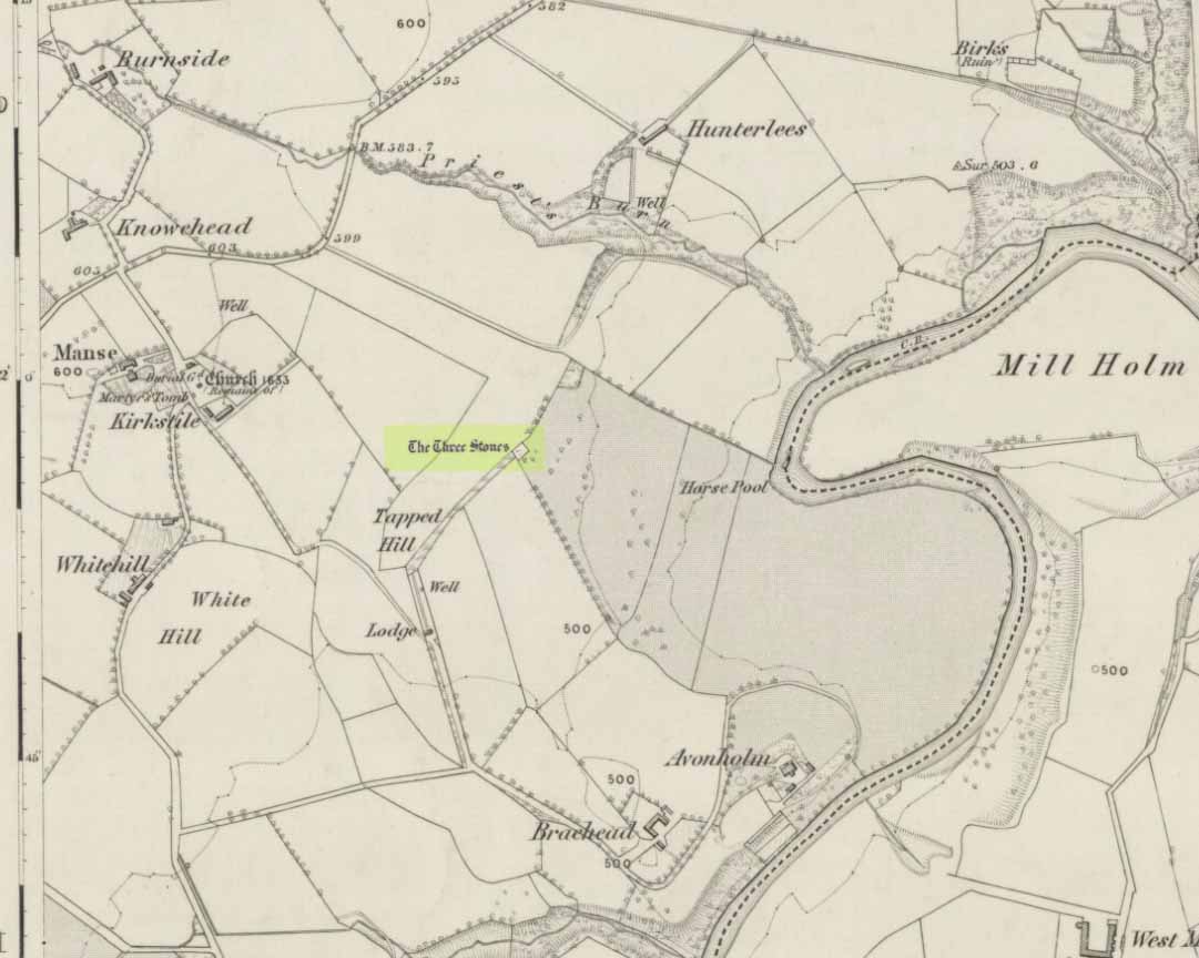
Cup-and-Ring Stone:  OS Grid Reference – NN 54125 35388

Also Known as:

  1. Canmore ID 274203

Getting Here

The stone in question

Going out of Killin towards Kenmore on the A827 road, immediately past the Bridge of Lochay Hotel, turn left.  Go down here for just over 2 miles and park-up where a small track turns up to the right, close to the riverside and opposite a flat green piece of land—right by The Green cup-marked rock-face.  Walk up the small bendy track for about ⅔-mile (1km) and eventually, high above the tree-line, the road splits.  Right here, go through the gate and walk downhill, over the boggy land, cross the burn, then the overgrown wall, and a second overgrown wall.  Very close hereby is a small rise in the land amidst the mass of bracken, upon which is the stone in question!

Archaeology & History

Close-up of some cups

This large long, undulating, quartz-rich stretch of rock has two main petroglyphic sections to it, with curious visual sections of natural geological forms accompanying the cup-markings, found either side of the stone on its north and south sides.  Its northern face has at least 20 cup-marks, of differing sizes, measuring between one and two inches across and up to half-an-inch deep.  Their visual nature is markedly different to those on the more southern side of the stone, where they are generally smaller and much more shallow, perhaps meaning they were carved much earlier than their northern counterparts. One of the cups on this section has a very faint incomplete ring around it.

Running near the middle of the rock is a large long line of quartz and a deep cleft in which I found a curious worked piece of quartz shaped like a large spear-head, and another that looks like it’s been deliberately smoothed all round the edges.  Both these pieces fit nicely in my hand.  All around the edges of the stone, many tiny pieces of quartz were scattered, as if they had been struck onto the stone—either to try carving the cups (damn problematic!), or for some visual/magickal reason.

© Paul Bennett, The Northern Antiquarian
Cow Keeper’s Field (2), Boulby, Easington, North Yorkshire

Cup-and-Line Stone:  OS Grid Reference – NZ 75402 19222

Also Known as:

  1. BOU-5 (Brown & Chappell)

Archaeology & History

Cup-marks and linear forms

Inside the once prominent prehistoric tumulus on the Cow Keeper’s Field (now destroyed), the northern antiquarians William Hornsby and John Laverick (1920) came across two small portable petroglyphs: the Cow Keeper’s Field 1 carving, plus this “peculiarly marked stone” as they put it, some “5ft south of the centre” where a cist, or stone-lined burial existed.  Measuring 18in by 7in, the rock carving consists of at least one large cup-marking which is clearly evident on top of the stone, plus what seems to be another one next to it, half-covered.  Along the side of the stone, a series of twelve roughly parallel lines have been carved out, running down to the bottom of the stone.  Rock art researcher and writer Graeme Chappell (2017) tells us the carving is supposed to be “in storage in the Dorman museum in Middlesborough,” although no one has seen it in years.  It would be worthwhile if fellow research students could visit the said museum to recover this and other portable cup-marked stones that were found in the area.

References:

  1. Brown, Paul & Chappell, Graeme, Prehistoric Rock Art in the North York Moors, Tempus: Stroud 2005.
  2. Chappell, Graeme, Personal communication, October 4, 2017.
  3. Crawford, G.M., Bronze Age Burial Mounds in Cleveland, Cleveland County Council 1990.
  4. Elgee, Frank, Early Man in North-East Yorkshire, John Bellows: Gloucester 1930.
  5. Hornsby, William & Laverick, John D., “British Barrows round Boulby,” in Yorkshire Archaeological Journal, volume 25, 1920.

© Paul BennettThe Northern Antiquarian


Over Glenny (05), Port of Menteith, Stirlingshire

Cup-and-Ring Stone: OS Grid Reference — NN 56991 02834

Getting Here

Over Glenny (4) C&R

Along the A81 road from Port of Menteith to Aberfoyle, watch out for the small road in the trees running at an angle sharply uphill, nearly opposite Portend, up to Coldon and higher. Keep going, bearing right past Mondowie and stopping at the dirt-track 100 yards or so further up on the left. Walk up this dirt-track for ⅔ mile, and just before reaching the planted forestry, turn right along another dirt-track. Less than 200 yards along there’s a large sycamore tree, and about 20 yards below it (south) are several open flat rock surfaces.  This is the most westerly of them.

Archaeology & History

…and again

On this small smooth rock surface we find an almost archetypal cup-and-ring stone, whose design consists of a double cup-and-ring and a faint cup-and-ring. The double-ring has several seemingly natural small fissures in the rock running at various angles into the central cup from the outside; and there are two faint ones running from the double-rings outwards to the cup-mark in the single-ring, framing the central cupmark in the middle. It may have been that these scratches on the rock gave rise to the position of the cupmark in this petroglyph.  It’s difficult to see whether or not the single cup-and-ring was ever completed.

Canmore’s description of this petroglyph tells simply: “The larger of the two is 180mm in diameter and has two rings around a cup that is 70mm in diameter and 15mm deep. The smaller has one ring around a cup.”

Once you’ve seen this, have a look at the Over Glenny (6) carving, about 10 yards east of here.

References:

  1. Brouwer, Jan & van Veen, Gus, Rock Art in the Menteith Hills, BRAC 2009.
  2. Sorowka, P., Davenport, C., & Fairclough, J., “Stirling, Over Glenny,” in Discovery & Excavation, Scotland, vol. 15, 2014.

Acknowledgements:  Massive thanks to Paul Hornby, Lisa Samson & Fraser Harrick for all their help on the day of this visit.

© Paul BennettThe Northern Antiquarian


Over Glenny (06), Port of Menteith, Stirlingshire

Cup-and-Ring Stone:  OS Grid Reference — NN 56993 02835

Getting Here

‘Over Glenny 5’ Carving

Along the A81 road from Port of Menteith to Aberfoyle, watch out for the small road in the trees running at an angle sharply uphill, nearly opposite Portend, up to Coldon and higher. Keep going, bearing right past Mondowie and stopping at the dirt-track 100 yards or so further up on the left (and ignore the english fuckers up here who might say “you’re not allowed to park here”, as Scottish government regulation allows you to do so unless you block the road).  Walk up this dirt-track for ⅔ mile, and just before reaching the planted forestry, turn right along another dirt-track.  Less than 200 yards along there’s a large sycamore tree, and about 20 yards below it (south) is the carving you’re looking for.

Archaeology & History

It’s difficult keeping up with the carvings in this region to the north of the Lake of Menteith, as we find new unrecorded ones on every visit, maintaining the tradition of fellow rock art students Maarten van Hoek, Kaledon Naddair, George Currie, Jan Broewer and the rest—and we know that there’s more of them hidden away.  This one doesn’t seem to be in the Canmore listings, but I put that down to the fact that they’ve got a grid-reference wrong somewhere, as it’s pretty plain to see.  Although, to be honest, in the rather vague descriptions of other adjacent carvings (Over Glenny 5 and 7), this carving is in-between them, so you’d expect it to be listed.  Anyway, that aside…

Looking down at the rings
Close-up of faint rings

This long flat exposed rock surface has two primary cup-and-rings upon it: one cup with a double-ring, and the other standard cup-and-ring; there are also two single cup-markings on the stone: one near the middle of the rock and the other on its lower-right side.  The main element is the double-cup-and-ring, which appears to be incomplete—not only in terms of its design, but also, as you can see in the photos, seems unfinished. From the central double-ring, a faint carved line runs out from the centre and into the other faint, incomplete, single cup-and-ring.

Series of metal-sharpening grooves
Arty-farty sketch of the design

At the bottom of the stone (as with several others hereby) a curious set of deep scars have been cut into the edge of the rock.  They’re unmistakable when you see them.  They have probably been created by metal artifacts being sharpened along the bottom of the rock—many many times by the look of it.  These deep cuts reminded me of the more famous Polisher Stone, down Avebury-way.  They may be explained by the fact that, several centuries ago, a battle occurred here and some of the men gathered in the area before the attack.  It would seem as if this and the other cup-and-ring stones were used to sharpen their blades before going into battle.  Whether this was done because of some local lore which imbued these stones with some sort of magick, we do not know.  Folklore here seems curiously scarce (english incomers destroyed local traditions, as writers were telling us in the 19th century), apart from the well-known one of the area being rife with fairies: Robert Kirk’s famous The Secret Commonwealth of Elves, Fauns and Faeries (1691) was written three miles west of here, at Aberfoyle.

References:

  1. Brouwer, Jan & van Veen, Gus, Rock Art in the Menteith Hills, BRAC 2009.

Acknowledgements:  Massive thanks to the rest of the crew: Paul Hornby, Lisa Samson & Fraser Harrick.

© Paul BennettThe Northern Antiquarian


Cock Lakes, Blubberhouses Moor, North Yorkshire

Cup-Marked Stone:  OS Grid Reference – SE 1524 5469

Getting Here

Faint cups highlighted by water

Follow the same directions as if you’re visiting the James Stone monolith.  From here, walk about 60 yards southeast and zigzag about in the heather until you find a small squarish-shaped earthfast rock, barely 6 inches above ground-level (might be hard to find when the heather’s fully grown).  If you’ve got a petroglyphic nose, you’ll find it!

Archaeology & History

A simple faded cup-marked stone, roughly 2½ feet by 2 feet across, can be found about 65 feet southeast of the James Stone and 40 yards west of the Benty Gate prehistoric enclosure.  Sadly when we visited the place a few days ago, the sky was grey and the conditions for good photos were poor.

Line of faint cups from centre
Extra faint cup near centre left

At least five cup-marks have been etched onto the stone, with the main element being a row a three cups in a straight line from the centre of the stone to its SE edge.  The central cup-mark has been carved where a natural crack in the rock, running from the edge of the stone, terminates.  There also seemed to be a carved faded line running along the bottom edge of the stone—but it was unclear and another visit is needed in better light to see if there’s more on the stone.

© Paul Bennett, The Northern Antiquarian

Lochan Hakel (01), Tongue, Sutherland

Cup-and-Ring Stone:  OS Grid Reference – NC 56988 52656 

Getting Here

Lochan Hakel’s cup & ring (photo by Sarah MacLean)

Whether you take the A836 or A838 into Tongue (through truly beautiful wilderness), make sure you go into the village itself—and then keep going, south, along the tiny country road.  Nearly 2½ miles along, note the small loch of Lochan na Cuilce on your right.  A few hundred yards past this, on the other side of the road (barely visible at first) is Lochan Hakel.  Walk around to the south-side of the loch and, across from where the small island of Grianan lives, you’ll see this large rounded boulder by the loch-side.

Archaeology & History

Stuck in a veritably stunning middle-o’-nowhere landscape below the outstretched northern moors beneath Ben Loyal & co, there is no previous literary account of this faded petroglyph, rediscovered in early April 2017 when Sarah MacLean took us on a visit to the more renowned multiple cup-and-ringer of Lochan Hakel 2, just yards away above the moorland rise (which is unmissable from here).  It’s not too special in comparison with its neighbour and many others—but try telling Sarah that!

Cup & ring atop of stone (photo by Sarah MacLean)

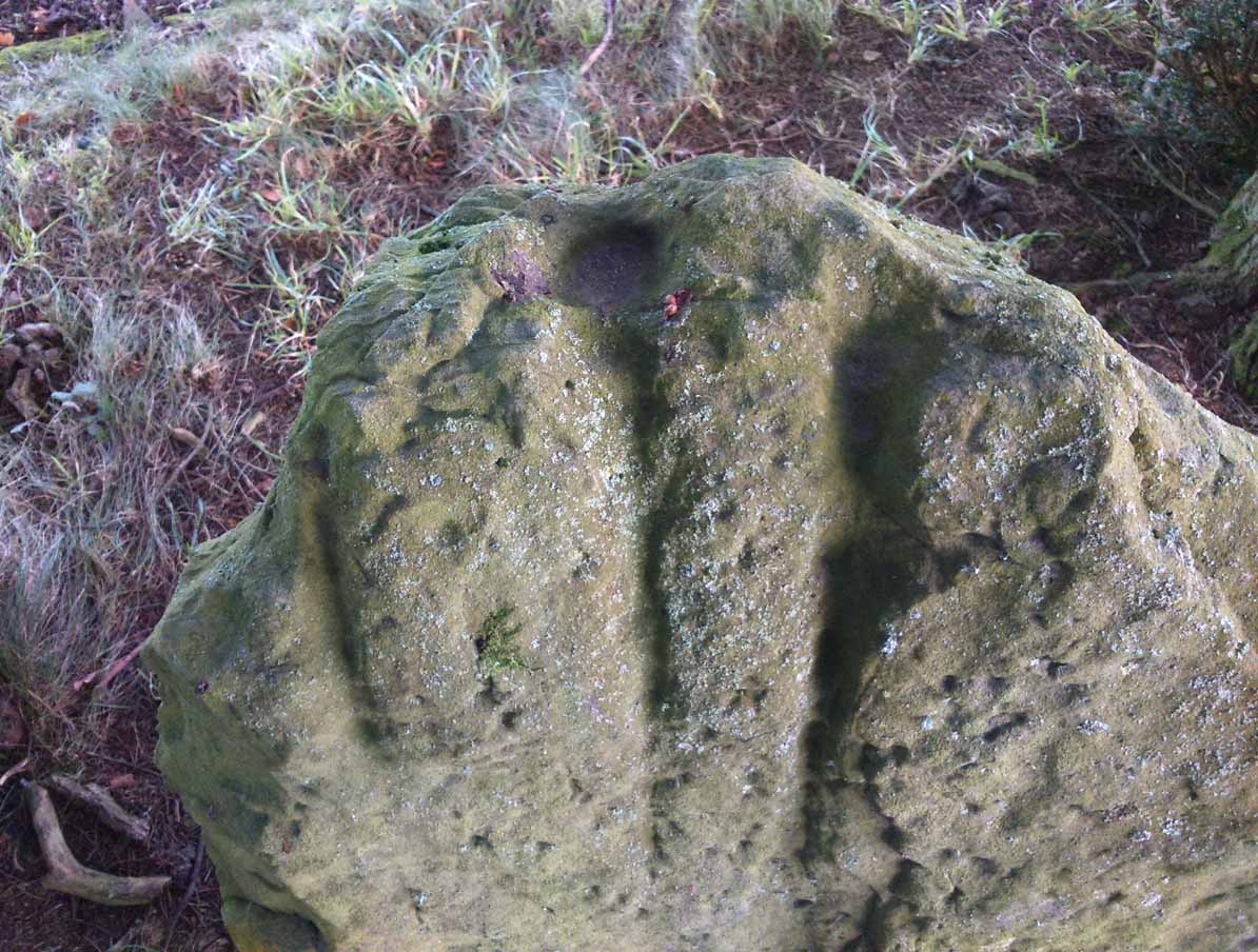
This large rounded lichen-covered boulder has, at its height, a carved ring around a natural rise—known as a ‘boss’—at the very top of the rock.  On its southern side, Sarah found a single cup-mark, along with a couple of others on the more northeasterly sloping face.  At the bottom of this face is another seemingly isolated small cup-marking.  There may well be other carved elements beneath the mass of ancient lichens, but we thought it best to leave them for the time being.  It’s also quite likely that other unrecorded carvings exist in the area.

Acknowledgments:  Huge thanks to Sarah MacLean, not only for helping to locate this carving, but for use of her photos in this site profile.  Cheers Sarah!  And to Donna Murray, for putting up with me whilst in the area! …Now, let’s find some more of them!

© Paul Bennett, The Northern Antiquarian