Ostensibly non-linear carved designs, generally assumed to be Bronze Age in date, but many originate in the neolithic period (some may indeed date back to 5000 BCE). Their central features are small rounded cup-markings, circles, semi-circles, curved lines (short, mid-length, and long), straight-ish lines, double- and multiple-rings, all in usually abstract design-forms. Their almost complete non-linear nature relate to non-egoic structuralisms, making them difficult to ‘intellectually’ grasp. Added to this is that no two carvings are the same. Although no direct ‘meaning’ can be ascribed to the carvings, many of them have a relationship with ancient notions of death and/or burial. In animistic terms, they relate to the spirit of rocks and other features of the natural landscape. They have very little relationship with alignment features (though exceptions in some megalithic rings have been found). Some modern writers allege positive relationships with water, but this ingredient (if tenable) cannot yet be said with any certainty: the idea should be forged onto animistic relationships with the land itself.
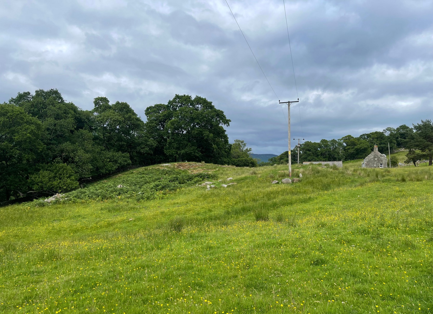
Take the same directions as if you’re visiting the Tormain (1) carving (the best one of the bunch here), but about five yards before reaching it, to your immediate left, just at the edge of where the hill drops down slightly, you’ll see a small flat rock poking out of the ground that may have been cut and quarried at some time in the past. That’s the one!
Archaeology & History
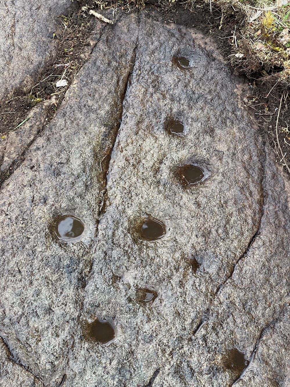
This small compact design looks like a typical cup-marked stone with the usual scatter of cups in no seeming order—until, that is, you walk around it and look at it from different angles, whereupon you’ll notice that a couple of distinct deep carved lines have been cut in a cross formation, with cup-marks at the ends of the crucifix. My view of this is that cup-marks were done first, probably in the standard Bronze Age period, and the ‘cross’ was cut into the stone at a much later date, probably during the early christian era. The depth of the lines which create the ‘cross’ is deep and thin at the bottom, suggesting a metal tool, which seems to have been cut into an natural crack. Visitors here will notice a small drill-hole near the edge of the stone which seems to have been done by local quarrymen, probably in the 19th century.
It was first described in Romilly Allen’s (1882) article on the Tormain stones. He called it ‘Stone E’ and told that it
Location of Tormain 5Cups, lines & cross form
“is situated about half-way between stones A and D, and is furthest to the east. It measures 1 foot 4 inches by 1 foot 9 inches, and projects 1 foot above the turf. Its upper surface is flat, and on it are carved eight cups varying in diameter from 1 to 2½ inches. There are two connecting grooves between three of the cups, forming a rude cross. Another cup has a channel leading over the edge of the stone.”
In November 1927, the Royal Commission dudes visited the carving (and its companions), but they had to roll back the turf to see it clearly. On the stone they saw that “at least nine or ten cup-markings, in some cases with connecting gutters, are still more or less clearly outlined.”
Carving highlighted (Morris ’82)Ron Morris’s old photo
When Ron Morris (1981) visited here, he highlighted the carving in chalk to get a decent impression of the design, as the attached photo here shows. Many traditional cultures ritually paint their carvings at set times of the year, in traditions that go back many centuries—perhaps even millenia. In all probability the same thing was done at some of the British petroglyphs, although there are no remaining traditions. Anyhow, Morris described it succinctly as:
“½m square, ¼m high…on which are: eight cups up to 7cm (3 in) diameter and 4cm (1½ in) deep and some grooves, to of which connect some of the cups to form a well-defined Cross.”
The stone was looked at by the great rock art explorer Kaledon Naddair of Edinburgh, but sadly I’m unable to locate his report and the fine illustrations that always tended to accompany them. If you’re reading this sir, give us your valuable input!
Beckensall, Stan, Rock Carvings of Northern Britain, Shire: Princess Risborough 1986.
Beckensall, Stan, British Prehistoric Rock Art, Tempus: Stroud 1999.
Feachem, Richard, Guide to Prehistoric Scotland, Batsford 1977.
Hadingham Evan, Ancient Carvings in Britain: A Mystery, Garnstone: London 1974.
Morris, Ronald W.B., “The Cup-and-Ring and Similar Early Sculptures of Scotland; Part 2 – The Rest of Scotland except Kintyre,” in Transactions of the Ancient Monuments Society, volume 16, 1969.
Morris, Ronald W.B., The Prehistoric Rock Art of Southern Scotland, BAR: Oxford 1981.
Royal Commission Ancient & Historical Monuments of Scotland, Inventory of Monuments and Constructions in the Counties of Midlothian and West Lothian, HMSO: Edinburgh 1929.
Acknowledgements: Huge thanks to Jan Carrington for use of her photos. 🙂
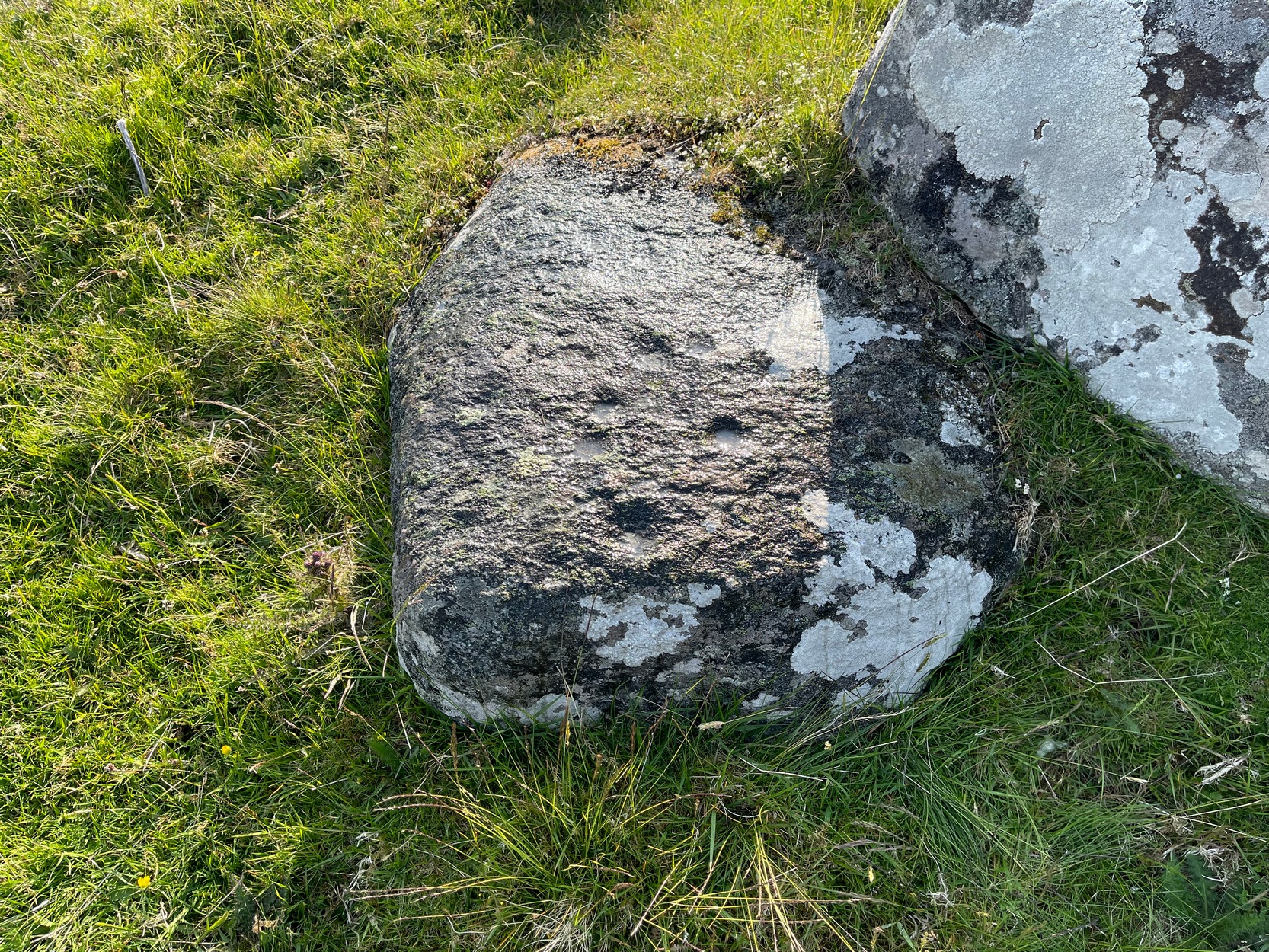
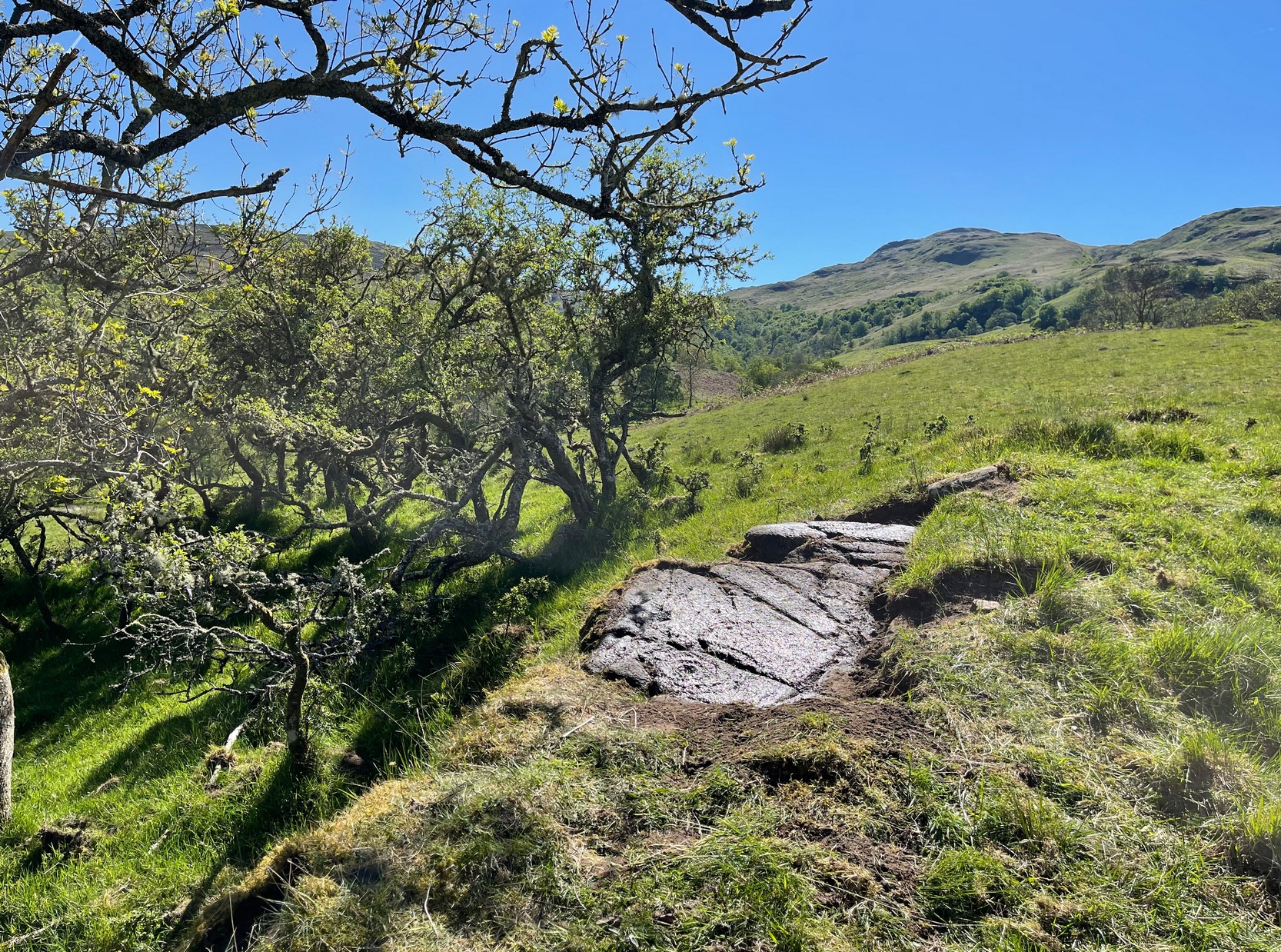
Go along the minor single-track road on the south-side of Loch Earn (between Edinample and the ugly Lochearn Leisure Park) and roughly halfway along the loch, there’s rough parking near Ardvorlich House (the starting spot for walking up Ben Vorlich). Walk east past the track to Ardvorlich, staying on the lochside road, for about 400 yards and then go up the dirt-track on your right. Walk up here for about 200 yards and, before you reach the trees, notice a small gate in the walling above you on your right, about 70 yards up the slope. Go through here and bear immediately left, up to the large oak on the large dome of rock. From the oak, with your back to the wall, take about 10 steps forward. You’re here!
Archaeology & History
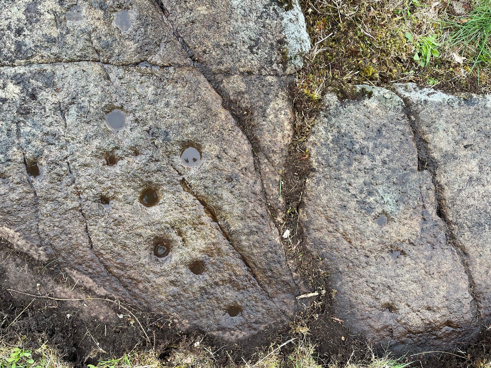
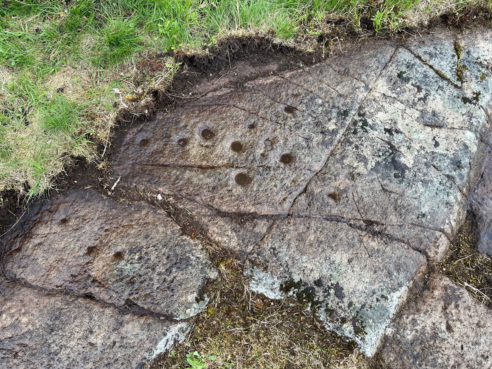
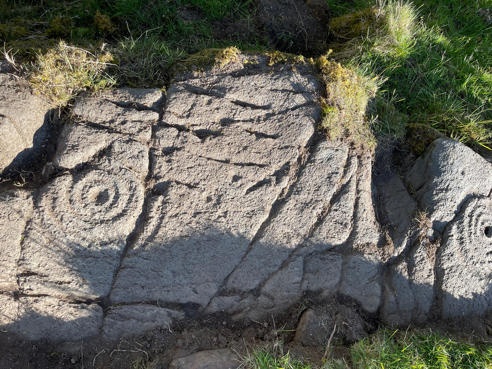
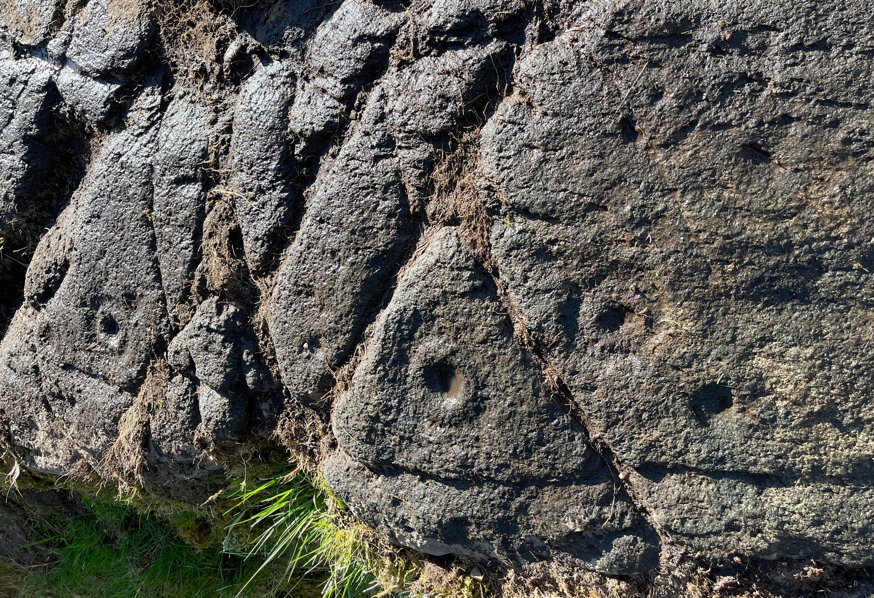
Deep cups & faint rings
The singular short reference to this impressive design was by George Currie (2011) who told us that it “bears at least 17 cup marks, three of which have single rings.” But there are in fact six of them with rings, possibly seven—with a few additional cup-marks scattered across the wider rock surface. It’s quite impressive, although on our visit here the daylight was gray and so the photos I have of the site do not do it justice. The sun popped out a couple of times, but only for a few minutes and we weren’t able to take advantage of it quickly enough.
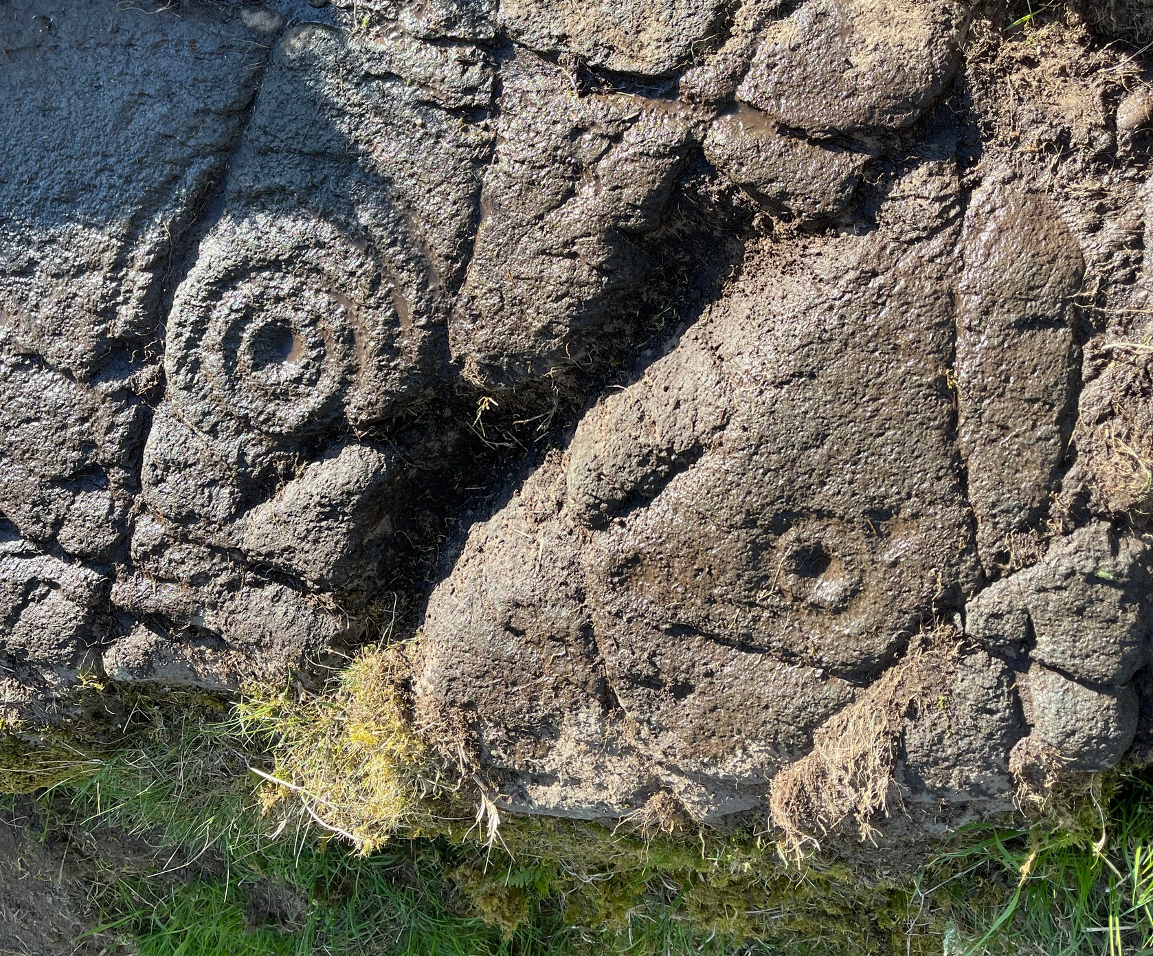
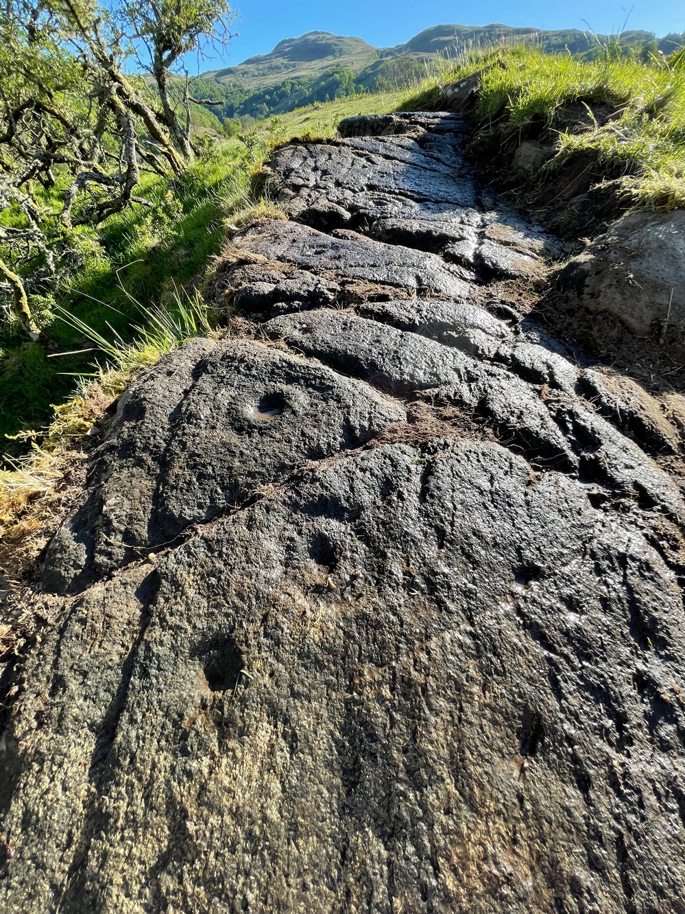
The distinctive section of this petroglyph are the deep cup-marks on its northern side: fourteen of them, three of which have faded shallow rings around them—or rather, uneven oval-shaped surroundings. The cup-marks have obviously been worked and re-worked over the centuries, whereas the rings were given less repetitive attention, for whatever reason. This is a pattern found at a great number of cup-and-ring stones across the country.
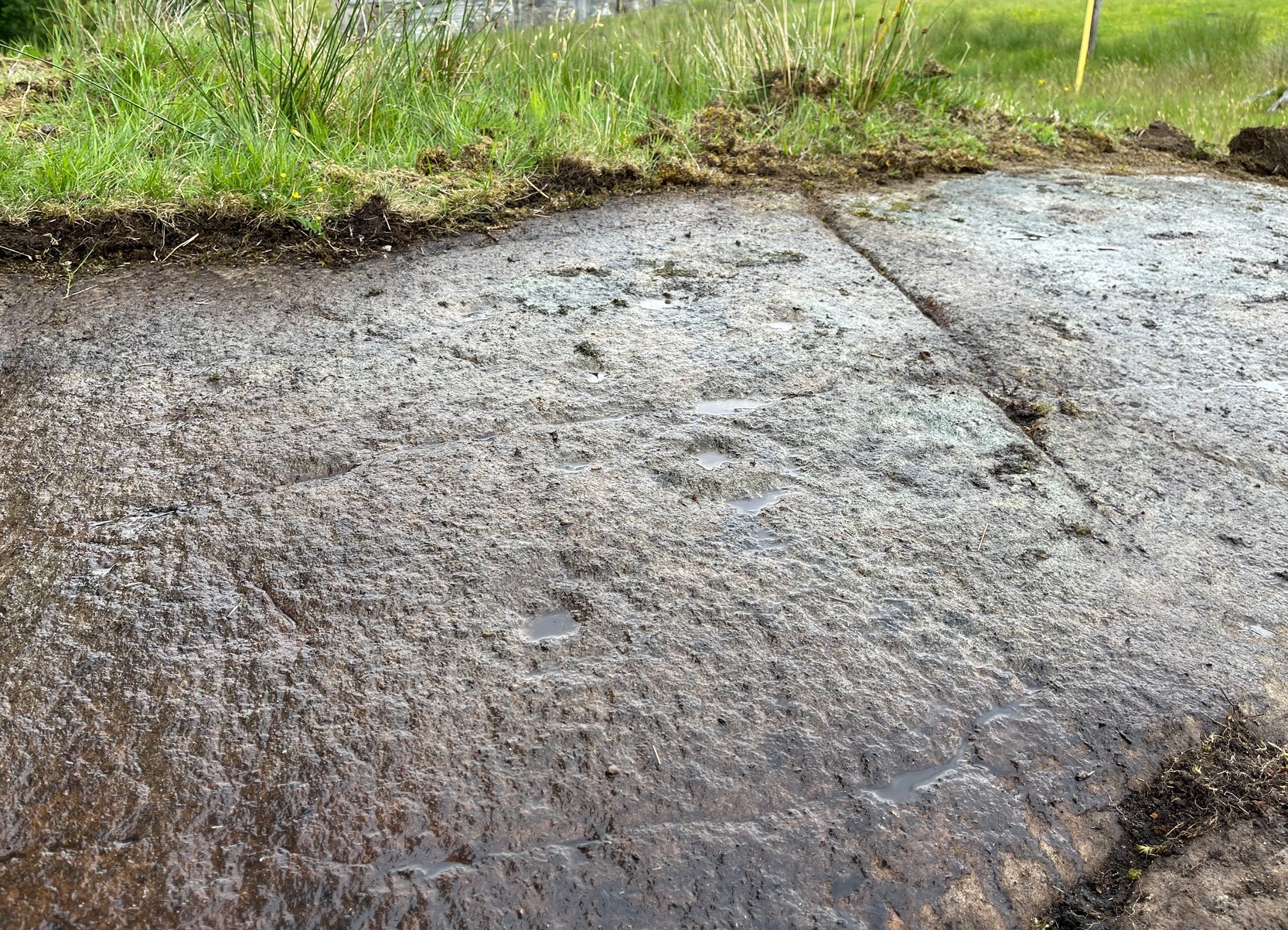
Shallow cups, faint ringsAnother angle of deep cups
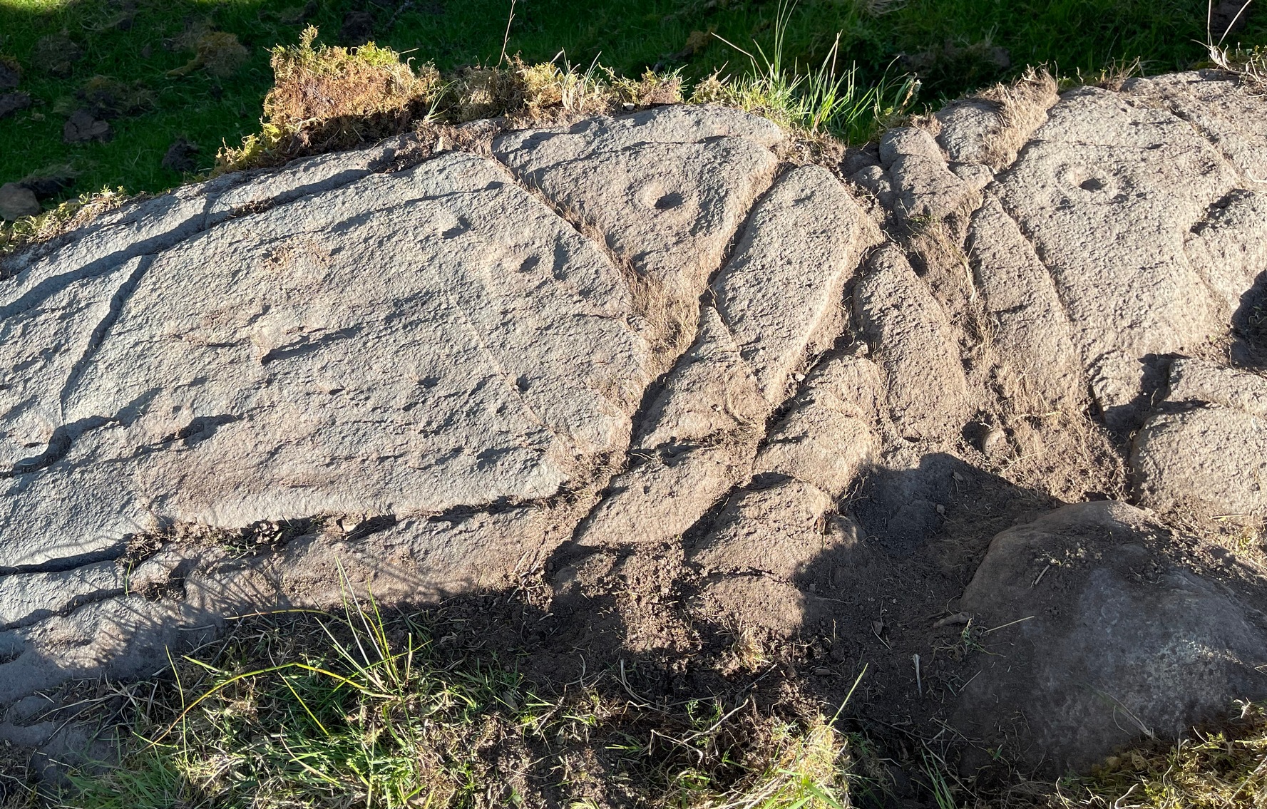
From this cluster of deep cups, walk two or three yards south onto the slightly lower smooth rock surface, where we find a much less pronounced scatter of several shallow cup-marks—may be five, may be six—but three of them have faint rings around them. They were difficult to see on our visit here due to the poor light. There’s what may be another incomplete cup-and-ring another two or three yards further along on the same rock face: a cup, certainly; the faint ring, perhaps. We need to revisit this in better light.
The rock surface continues for quite some distance all round here in the shape of a large dome, much of it covered in vegetation of varying depths. There are openings showing the bare rock and, at several other spots there are several other cup-marks, although none are as deep as the ones we’ve just described. On the edge of one piece, about three yards north of the deep cups, a couple of worn cup-marks are near the edge of one rise; two others are clearly notable a yard or so WNW of the deep cups; whilst there are several other single cups near and not-so-near of the main design. It all requires a lot more work before we see the entire picture.
It’s a gorgeous site: silent with the feel of winds and waters and the scree of buzzards touching the senses: elements that, at some petroglyphs, had mythic relevance…
References:
Currie, George, “Comrie: Balimeanach (BC 2), Cup-marked Rock”, in Discovery & Excavation Scotland, New series – volume 12, 2011.
Acknowledgements:Huge thanks for use of the Ordnance Survey map in this site profile, reproduced with the kind permission of the National Library of Scotland.
Cup-and-Ring Stone (removed): OS Grid Reference – NX 546 530
Archaeology & History
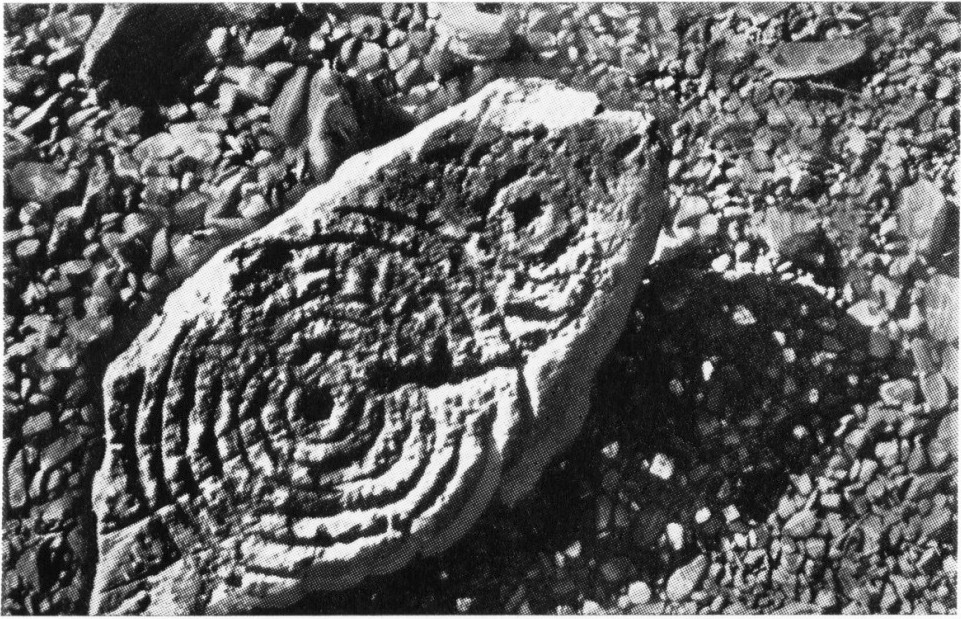
A.E. Truckell’s 1961 photo (TGDNHAS, 1961)
A small multiple-ringed archetypal design consisting of a central cup-mark with seven consecutive rings emerging from it, with a second outlying, incomplete cup-and-double-ring that nearly touches the outer edge of the seven-rings, was found by a Mr Sproat “in the bed of a shallow stream on Laggan farm” in 1960. The design, as the old photo (right) shows, is very well preserved, suggesting that it cannot have been in the stream for too long, as the erosion on the carving isn’t in anyway excessive. In all likelihood it originally came from a nearby prehistoric tomb: of which, there are several upstream from the farm.
Described by A.E. Truckell (1961) as “a particularly fine example”, the carving is on a particularly small and thin piece of stone, measuring 18 inch by 8 inch amd just 2 inches thick, with one edge of it snapped-off. It’s obviously no longer in situ and, I presume, is still resting somewhere in the Kirkcudbright museum.
References:
Morris, Ronald W.B., The Prehistoric Rock Art of Galloway and the Isle of Man, Blandford: Poole 1979.
Morris, Ronald W.B., “The Cup-and-Ring Marks and Similar Sculptures of South-West Scotland,” in Transactions of the Ancient Monuments Society, volume 14, 1967.
Along the A822 road from the Gilmerton junction on the outskirts of Crieff, heading up towards the Sma’ Glen, after literally 1¾ miles (2.8km) on the right-side of the road you need to follow the route to reach the Connachan rock art cluster by walking up the dirt-track leading up past Connachan Farm. Walk past the carving of Connachan (2) and up the track past Connachan (4), then onto the level ground and walk right to the low-lying ruined Connachan cairn. From here, look up the gentle slope to the fence. A small-ish stone protrudes out 40 yards away. Head straight for it!
Archaeology & History
Close-up of line of cups
You’ll check this out when you’re doing your tour of this petroglyph cluster and sit here to admire the view. It’s the last of the small bunch of carvings, on level ground, close to the denuded cairns. It consists of just eight cup-marks, all of which are carved close to the edge of the stone on its upper sloping surface; although this doesn’t tally with Margaret Stewart’s (1967) description of any of the carvings hereby. There’s nowt much more to be said about it to be honest; apart from saying how it’s highly likely that other carvings remain hidden, undiscovered, not far from this stone along the edge of these hills.
References:
Stewart, Margaret E.C., “Connachan, Crieff – Cup Marks and Hut Circle,” in Discovery & Excavation, Scotland, 1967.
Along the A827 Loch Tay road, halfway between Fearnan and Lawers just beyond the forestry, a track goes up into the fields across from Feadan house (big shed above you in field). Careful, or you’ll miss it. Go up here and head all the way up the steep winding track for 700 yards (as the crow flies) until, where the land starts levelling out, you hit the long straight line of old walling. Go over it and walk to your right (northeast) for a few hundred yards until it bears sharp left (NW), keep walking along it for another 45 yards and, where the fence turns down to the water, just keeping walking up the slope to the scatter of rocks. Look around!
Archaeology & History
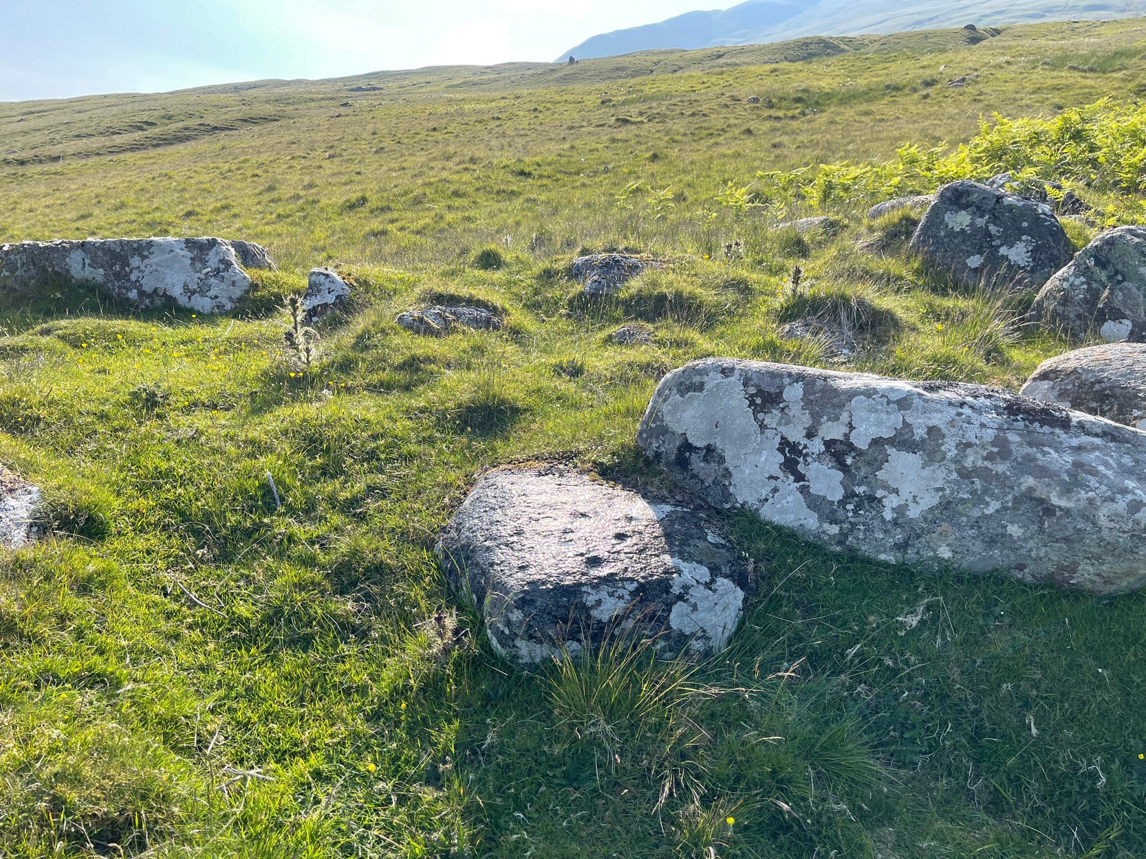
Looking down at the cups
When you consider there are multiple-ringed carvings close by on the same geological ridge as this carving, there’s little wonder this fella hardly gets any attention: the design here is nothing special compared to its close neighbours. That aside: on this small flat surface we have six or seven simple cup-marks; most of them quite small, with the largest of the lot having what looks like a small carved arc around one side of it—although I couldn’t make my mind up one way or the other to be honest. A few more visits might prove more conclusive.
Folklore
The stream at the side of this carving and others nearby—the Allt Coire Phadairlidh, or Padderlie’s Burn—was the haunt of an urisk, who gave his name to the waters. He lived a little further up on the knoll. Several other carvings are just below here. Urisks were plentiful in this area. They are variously described as demonic creatures, referred to by Alexander Carmichael as “a monster, half human half goat, with abnormally long hair, long teeth and long claws.” (teeth aside, that sounds like me! 🙂 ) They mainly live by lonely waterfalls and a small beautiful fall is very close by. They are associated in some places with cup-marked stones, where offerings of milk were made to placate them. In truth, these nature spirits seem to be folk remnants of solitary shaman figures cast into the edges of hills. A local lady who lived in this area said she’d met an urisk near here and he was anything but the fearful creatures they are made out to be…
References:
Currie, George, “Kenmore: Allt Coire Phadairlaidh (AP1): Cup-Marked Rock,” in Discovery & Excavtion Scotland, vol. 9 (new series), 2008.
Cup-Marked Stone (lost): OS Grid Reference – NU 2299 2989
Archaeology & History
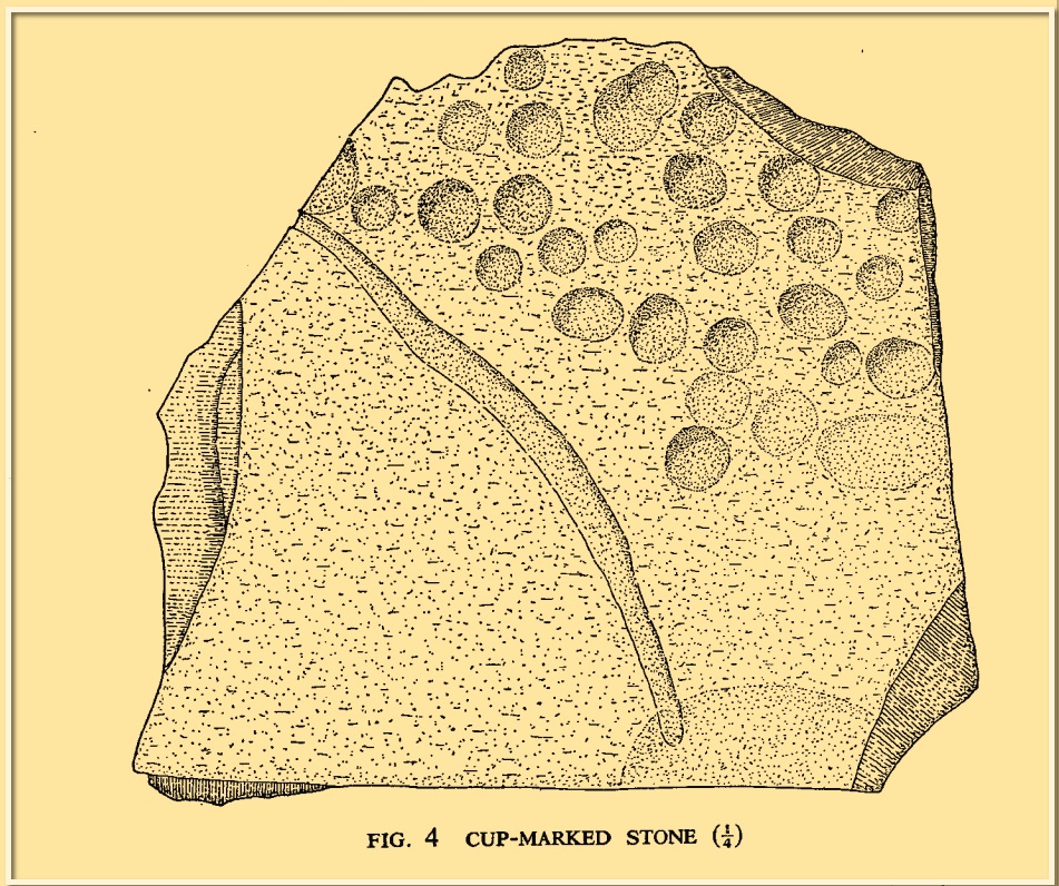
Tait’s 1971 sketch of the carving
When the Beadnell Caravan Park was being constructed in 1970, in cutting into the Earth the workmen destroyed a couple of prehistoric tombs—but not before one of them (the northernmost one of the two) was thankfully excavated. It was looked at by John Tait (1971), who described the covering cairn as measuring “nineteen feet in diameter and four feet high”. Beneath it, within a cist that had been modified at two very different periods in time, were a large number of human remains that had been deposited over equally extended periods, suggesting it was a place of considerable importance to either one family lineage or the tribal lineage (unless it was just a dumping spot for any old Tom, Dick and Harry!). Outside of the cist itself, but within the rocky mass of the cairn, this cup-marked stone was found (illustrated). It had already been moved by the workmen before Tait came to excavate it, so he was unable to ascertain its precise position in the tomb. Carved into a piece of sandstone were a number of odd-sized cup-marks, smaller than usual. Tait wrote:
“It measures 38cm by 36cm and bears 29 small cup-marks and one slightly sinuous duct leading into what may be part of an earlier and larger cup. It also seems probable that additional cups were added in antiquity, since some are distinctly more shallow than others and, in one instance, two cups impinge upon one another. The stone had been broken in antiquity and may have come from a larger inscribed slab, as is perhaps the case with some other “portable” stones of burials or cairns and other monuments of the second this nature.”
It is thought that the carving was laid back in the ground whence it was found.
References:
Beckensall, Stan, Prehistoric Rock Motifs of Northumberland – volume 1, Abbey Press: Hexham 1991.
Beckensall, Stan, Prehistoric Rock Art in Northumberland, Tempus: Stroud 2001.
Cup-and-Ring Stone (lost): OS Grid Reference – NX 68700 44699
Archaeology & History
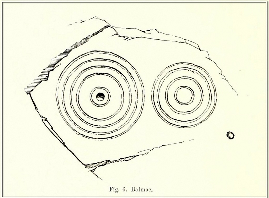
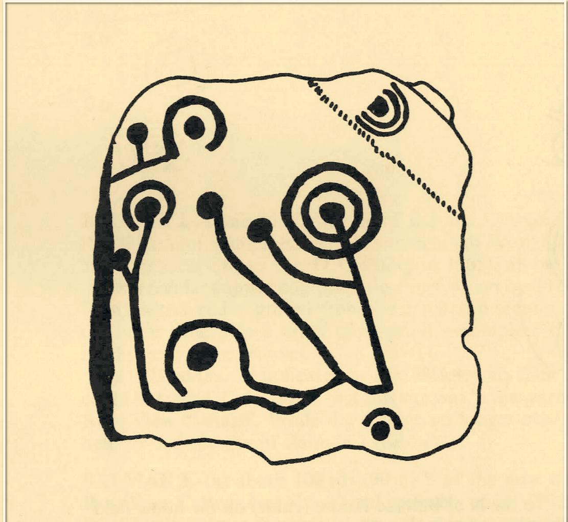
Coles’ 1895 sketch
This impressive-looking carving was rediscovered in the 1880s during one of Fred Coles’ ventures uncovering many of the petroglyphs in this area. It could be found, he said, “some three hundred yards south-east of Balmae House.” When the local historian Malcolm Harper visited Samuel Fletcher who lived in the cottage at Balmae a few years after it had been discovered, he spoke enthusiastically about the carvings and knew much about them, but Harper doesn’t specifically mention whether or not he’d seen this stone (he probably did). Nowadays the carving is covered in thickets of gorse and and, as a result, it hasn’t been seen in many a year. The great Scottish petroglyph hunter Kaledon Naddair may have been one of the last people to visit it.
It’s impressive, as Mr Coles’ (1895) sketch shows, comprising, as he said, of
“two sets of concentric rings, one having four, the other five and a central cup. It is smooth, and slopes to the W. at an angle of 40°. The largest ring is 24 inches in diameter.”
A number of other impressive multiple-ringed carvings exist hereby that have also fallen prey to the cover of gorse. So get some hedge-cutters and decent gardening gloves if you’re gonna look for this one!
Morris, Ronald W.B., “The Cup-and-Ring Marks and Similar Sculptures of South-West Scotland,” in Transactions of the Ancient Monuments Society, volume 14, 1967.
Morris, Ronald W.B., The Prehistoric Rock Art of Galloway and the Isle of Man, Blandford: Poole 1979.
Royal Commission Ancient & Historical Monuments & Constructions of Scotland, Inventory of Monuments and Constructions in Galloway – volume 2: County of the Stewatry of Kirkcudbrightshire , HMSO: Edinburgh 1914.
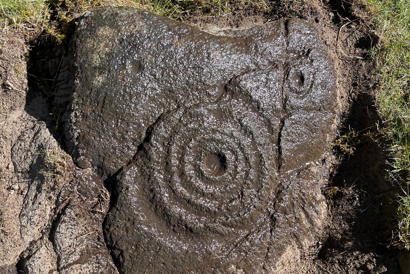
This is a relatively new find that was uncovered in 2019 by members of the Association of Certified Field Archaeologists, on the western edge of a small bowl of blackthorn trees, just past one of the Corrycharmaig East carvings — and it’s a bit of a beauty!
Topmost part of carving
Corrycharmaig (9) stone
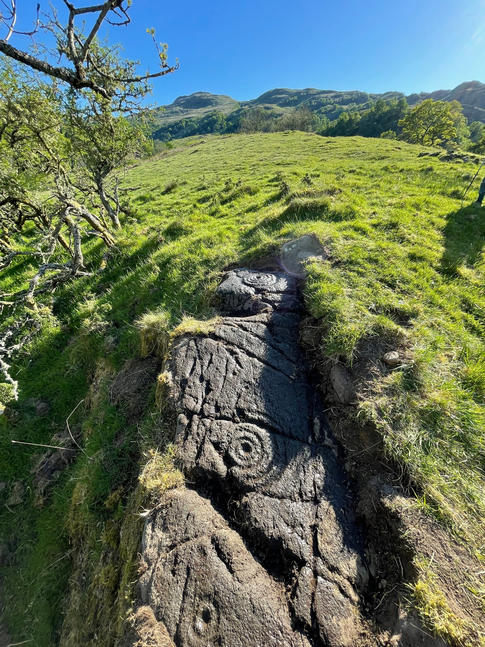
Described, albeit briefly, in the superb survey by Gardiner, King & MacInnes (2024), the carving here has been cut into a sloping straight line of rock along the ridge of a very tiny cliff and consists of cups, single rings and multiple rings. At its crown, so to speak, where the rock surface levels out and is flat, a very well-preserved multiple cup-and-ring greets our senses: a cup-and-four rings to be precise. The outermost edge of the rings cuts into a natural crack that runs to the edge of the stone; and close to where this crack reaches the edge, another standard cup-and-ring rests against it. On this same section you’ll see a single cup which, by the look of it, was intended to have a much wider ring surrounding it—but for some reason it was never executed.
Second multiple-ringer
Second multiple-ring
From the topmost section, the rock then slopes gradually downward and the design is broken by several natural splits in the stone before we reach a single unfinished cup-and-ring and a solitary cup-mark. These occur shortly before we reach a near-duplicate of the multiple-ringer that we’ve just seen on the flat top of the stone. The outer ring of this is broken and the edges of it are intruded (again) by natural cracks in the stone (a not uncommon feature). The erosion level of this and its fellow four-ringed compatriot at the top are much the same, suggesting that the two were executed at around the same time.
Lower-half with cup&rings
Close-up of cup&rings
As we move down the slope of the rock with its veritable scattering of geological splits, the rest of the design consists of several single cup-and-rings—at least three of them—over its lower-half, almost in a gentle arc over the surface. The one closest to the four-rings has a single cup-mark attached to its outer edge and another single one just a few inches away from it. The others don’t seem to have any additional carved features attached to them; although one or two other singular cup-marks can be seen on this, the lowest section of the carving.
Looking to the hills
From the bottom up
An interesting feature noted here is the direction that this line of rock points to: a dip between two distinct rocky peaks on the horizon and which is close to the winter solstice sunset. I should point out however, that the relationship between open air petroglyphs and astronomical alignments (in Britain at least) is very debatable. Even alignments from one carving to another are pretty meaningless, despite the attempts of some modern archaeologist to show otherwise. In my younger days when I raced into rock art studies, I threw everything I had to show astronomical and other alignments were involved in these carvings—but it turned out not to be…. Instead, it turns out that some of these seeming ‘alignments’ (and only a few) relate to pathways and ancient routes: pointers, if you like, to the way ahead. Makes sense…
References:
Gardiner, M., King, L. & MacInnes, Dugald, In the Glen of the Dark Goddess, Bell & Bain: Glasgow 2024.
Acknowledgements:Huge thanks for use of the Ordnance Survey map in this site profile, reproduced with the kind permission of the National Library of Scotland.
Cup-and-Ring Stone (lost): OS Grid Reference – NX 529 528
Also Known as:
Bardriston
Archaeology & History
In a region possessed with a good number of cup and ring stones, this one on the lower slopes of Barholm Hill may have once been part of a prehistoric tomb, or cist cover. A fairly decent design had been carved onto a small flat slab of stone which, when uncovered in the 19th century, doesn’t seem to have been in its original position. As the great Fred Coles (1894) told us:
Coles’ 1895 sketch
“The Bardristan slab…was removed from amongst the stones of an old drain in 1889, and, through Mr Kinna’s care, it is now preserved at Bardristan. The evident attempt to square the stone itself; the extreme smallness of the rings ; the direct connection of the grooves, in all cases but one, with cups; and lastly, the vivid sharpness of the whole sculpturing, in which the tool-work is clear much beyond the ordinary, all combine to render this Bardristan slab unusually interesting and valuable.”
Less than twenty years after Coles’ description, the Royal Commission (1914) lads visited the site hoping to make their own assessment, but the carving had already been lost. Referring to Coles’ account, they told how,
“inquiry there failed to elicit information concerning it, and it appears to have been lost. Mr Coles’ illustration…shows in the general intercommunication of the various cups a feature which characterises the stone at Kirkclaugh, about ¼ mile to the south of Bardriston.”
In the subsequent commentaries on this carving by Ron Morris (1967; 1979) and A.E. Truckell (1961), its whereabouts remained a mystery and, to this day, we know not what became of it…
Morris, Ronald W.B., “The Cup-and-Ring Marks and Similar Sculptures of South-West Scotland,” in Transactions of the Ancient Monuments Society, volume 14, 1967.
Morris, Ronald W.B., The Prehistoric Rock Art of Galloway and the Isle of Man, Blandford: Poole 1979.
Royal Commission Ancient & Historical Monuments & Constructions of Scotland, Inventory of Monuments and Constructions in Galloway – volume 2: County of the Stewatry of Kirkcudbrightshire , HMSO: Edinburgh 1914.
Truckell, A.E., “Cup-and-Ring-Marked Slabs in the Cairnholy and Auchinlarie Area,” in Transactions of Galloway & Dumfriesshire Natural History & Antiquarian Society, volume 40, 1961.
Acknowledgements:Huge thanks for use of the Ordnance Survey map in this site profile, reproduced with the kind permission of the National Library of Scotland.
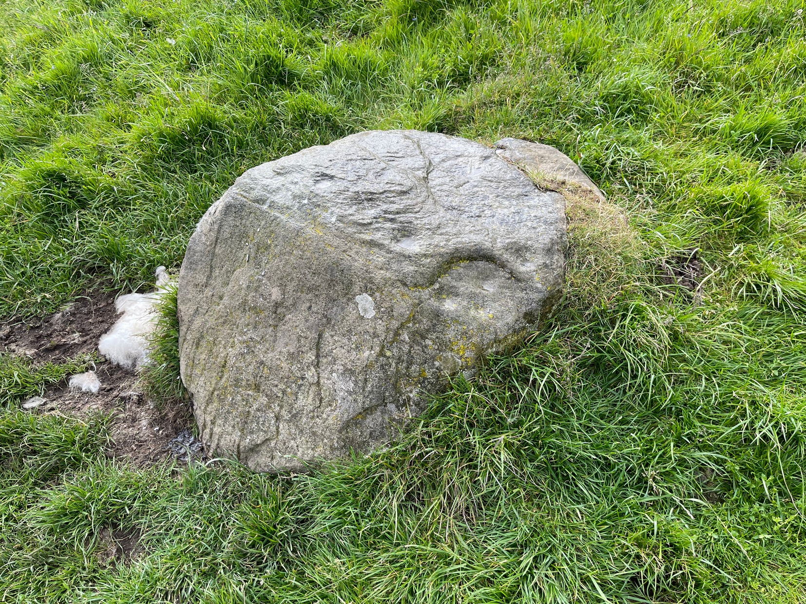
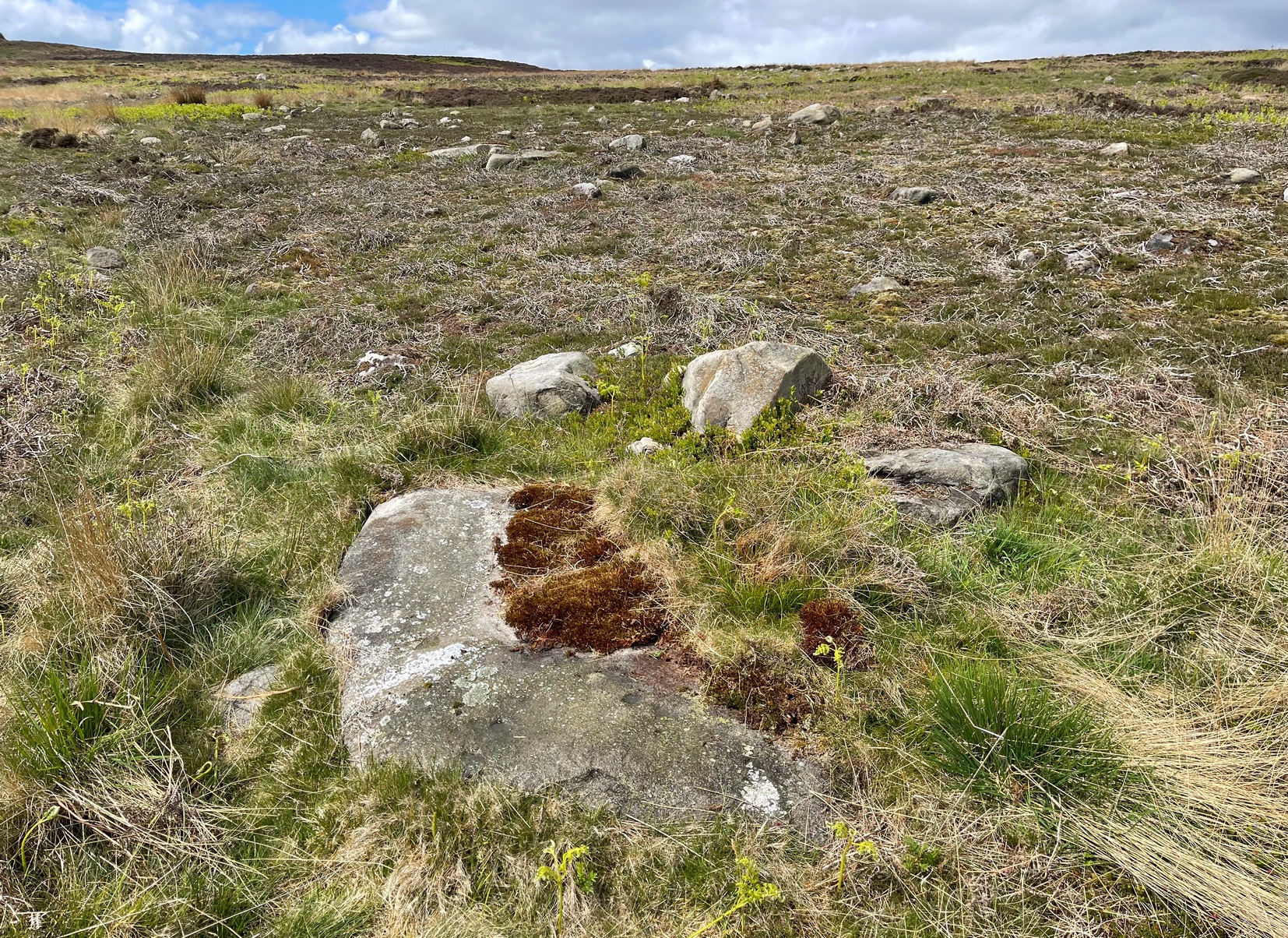
If you’re looking for this carving, you’ll have been to the impressive Tree of Life stone first. From there, you need to walk further away from the walling, 30-35 yards southwest, across the other side of the footpath. There’s a scattered mass of stones all over the ground here: you’re looking for a low-lying long curved stone—longer than most of them hereby. If the heather’s grown back over the stone, it might take some finding!
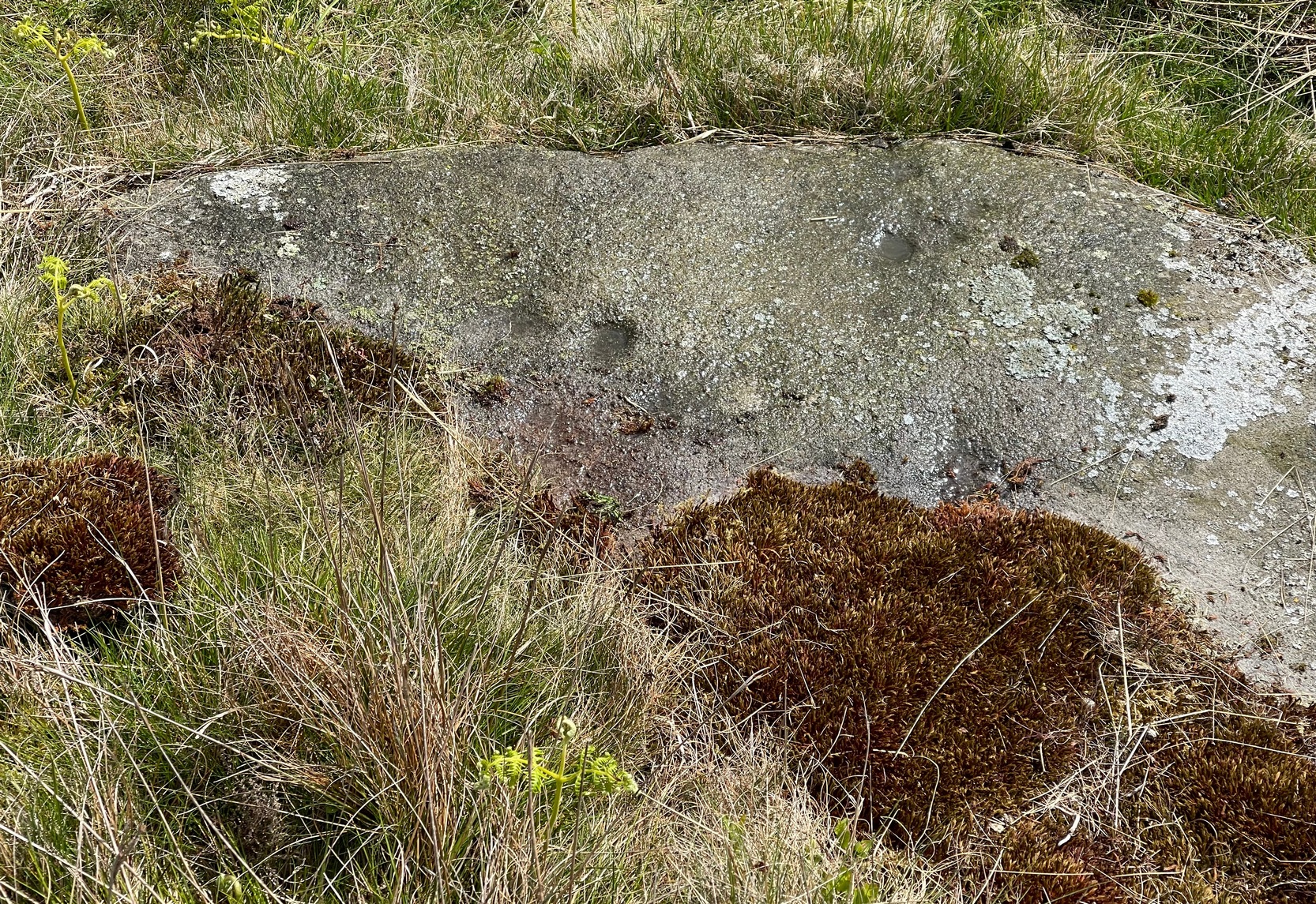
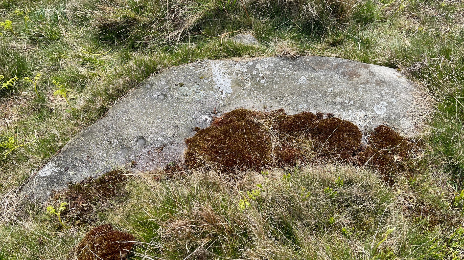
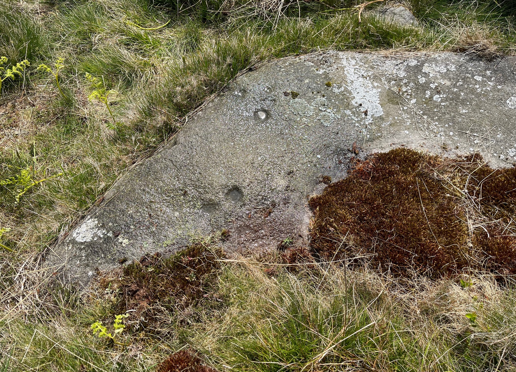
Archaeology & History
Close to a line of prehistoric walling (seemingly a section of a settlement), this typically curvaceous female stone is possessed of two pairs of faint cup-marks on the eastern side of the rock. It was included in Boughey & Vickerman’s (2003) survey where they described the carving as being, “two small cups visible and two further cups under heather.” A third possible cup exists close to one of the pairs. The carving is found in an area rich in untouched prehistoric remains.
References:
Boughey, Keith & Vickerman, E.A., Prehistoric Rock Art of the West Riding, WYAS 2003.