From Marske village, take the road west and uphill to the villages of Fremington and Reeth. At the top of the hill where the fields open up, several hundred yards along on your right, past the field with the track, a footpath sign points you up onto the moor. Go up the field till you hit the wall that goes right to the top of the moor. Where the four walls meet, go straight across and then walk northwards along the line of walling for 2-300 yards, keeping your eyes peeled for a solitary stone on its own, 100 yards west. You’ll find it.
Archaeology & History
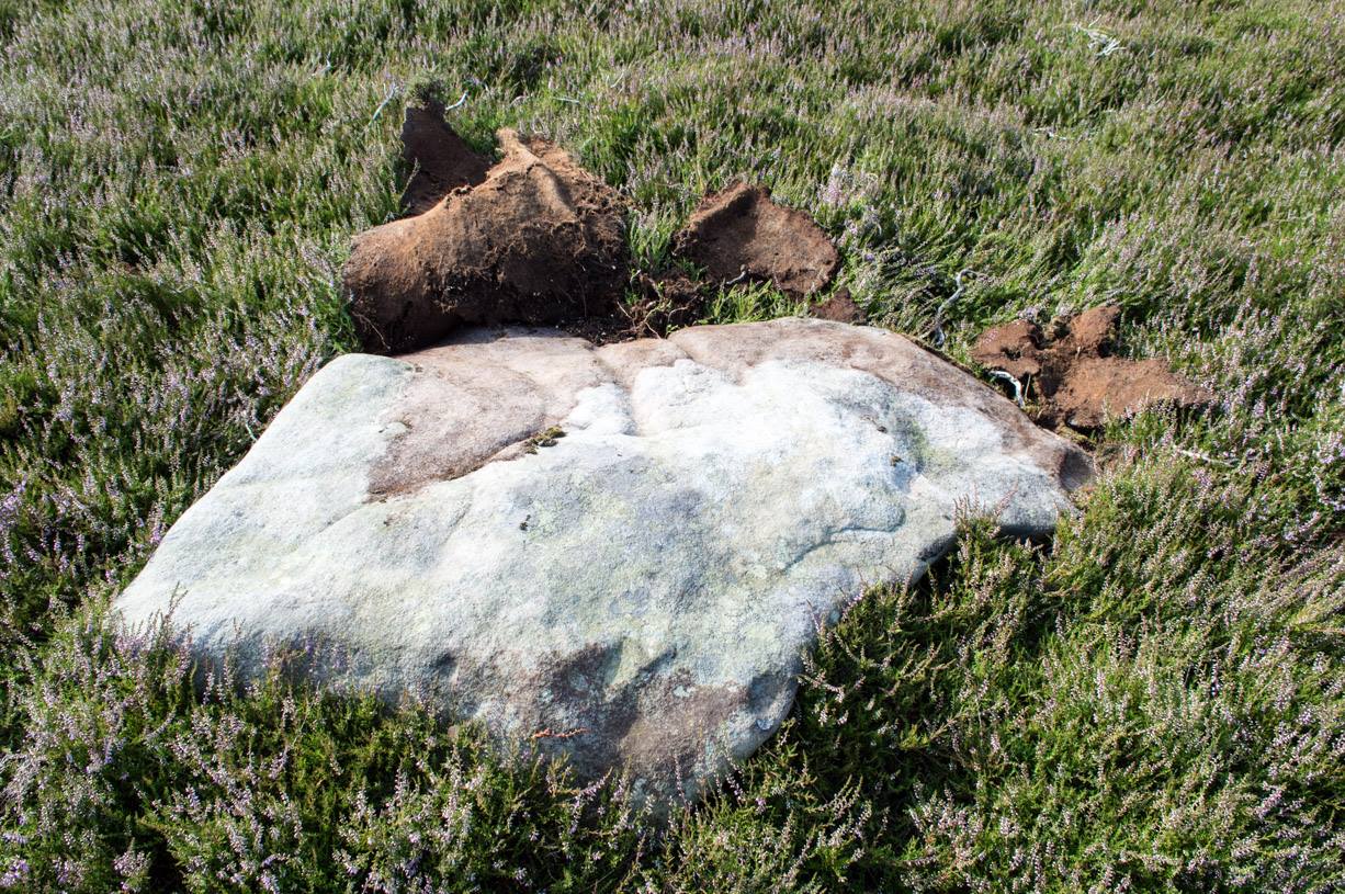
Deep carved line features
A pretty basic petroglyph located within a massive arena of prehistoric sites dating from the neolithic and continuing through the Bronze Age period and beyond. Found a few hundred yards northwest of the once giant cairn of Cock Howe, this design is characterized mainly by the two large deep channels deliberately cut into the stone that run from the middle of the upper surface down to ground level. One of them emerges from a single cup-marking, at an angle; whilst the other comes from the edge of a natural crack in the rock. The channels are wide and flattened. Other faint lines can be discerned too, which may have originally been carved. We need to explore this design in different lighting conditions to see if there are additional features here.
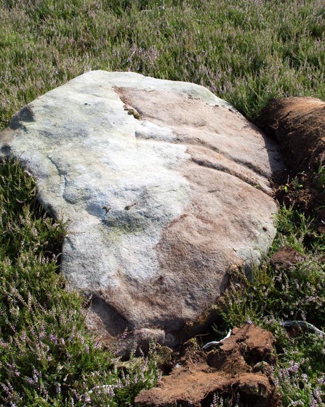
Looking east-ish
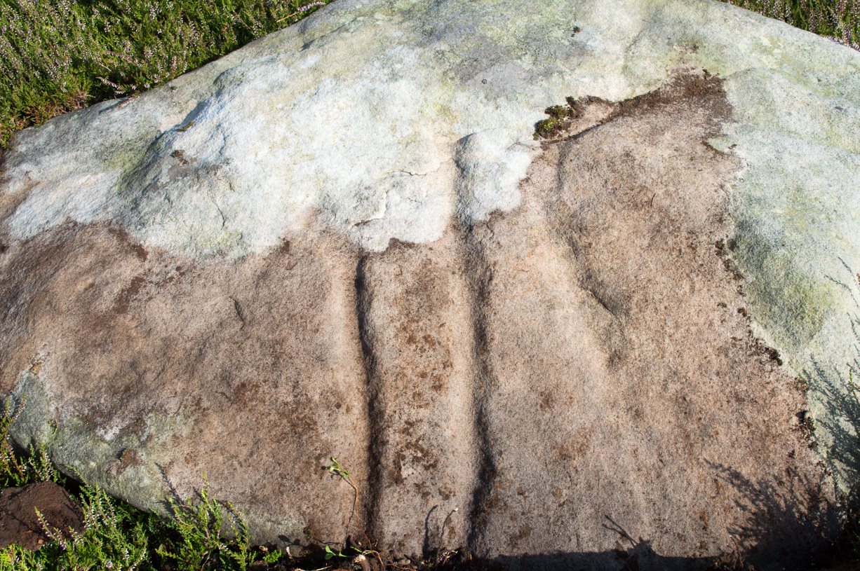
An archetypal cup-marking can seen on the vertical edge of the stone and three other faint ones scatter the top. Another small ‘cup’ is along the southern vertical face of the rock which, when we found it, thought was natural; but a photograph of the stone by James Elkington seems to show a ring surrounding much of the cup-mark. We need to go back and take another look at the place.
A number of other carvings described in Paul and Barbara Brown’s (2008) survey can be found in the region.
References:
Brown, Paul & Barbara, Prehistoric Rock Art in the Northern Dales, Tempus: Stroud 2008.
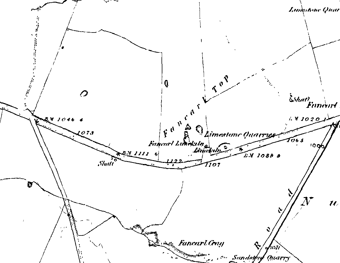
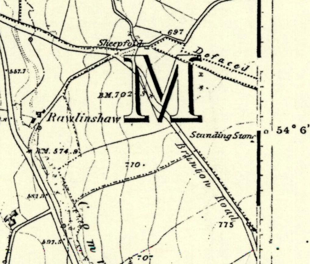
1st edition OS-map – the unmarked circle’s near the middle
Along the B6265 road between Grassington and Pateley bridge, heading east, past the hamlet of Hebden, a mile or so on where the road goes uphill, stop where it levels out a bit (before it goes further uphill to Stump Cross), a half-mile before the rocky outcrop of Nursery Knott on the left (north) side of the road. A gate into the field on the same side is what yer after, with a small disused quarry therein. Go up here to the quarry-top and then walk uphill for literally 100 yards and the curious small ring is right there.
Archaeology & History
Appletreewick stone circle (courtesy Paul Daw)
This small stone circle sitting on the grassy ridge overlooking the ritual rocks of Simon’s Seat and central Wharfedale to the south and the Yorkshire heathlands east and west, is probably not what it once was. Overcome by the excess of industrial workings in the fields and moors all round here, it is probable that its present condition is far from its original state. Indeed, if we move back to the 18th century, we find that place-name and map evidences tell us the site was a tomb. The 1771 Greenwood map names the site as the Fancairn — an etymological curiosity in itself, possibly deriving from the ‘Windy Cairn’, which makes sense. The place-name fell into its present title of ‘Fancarl’ after the great Ordnance Survey chaps came, heard dialect and went on their way…
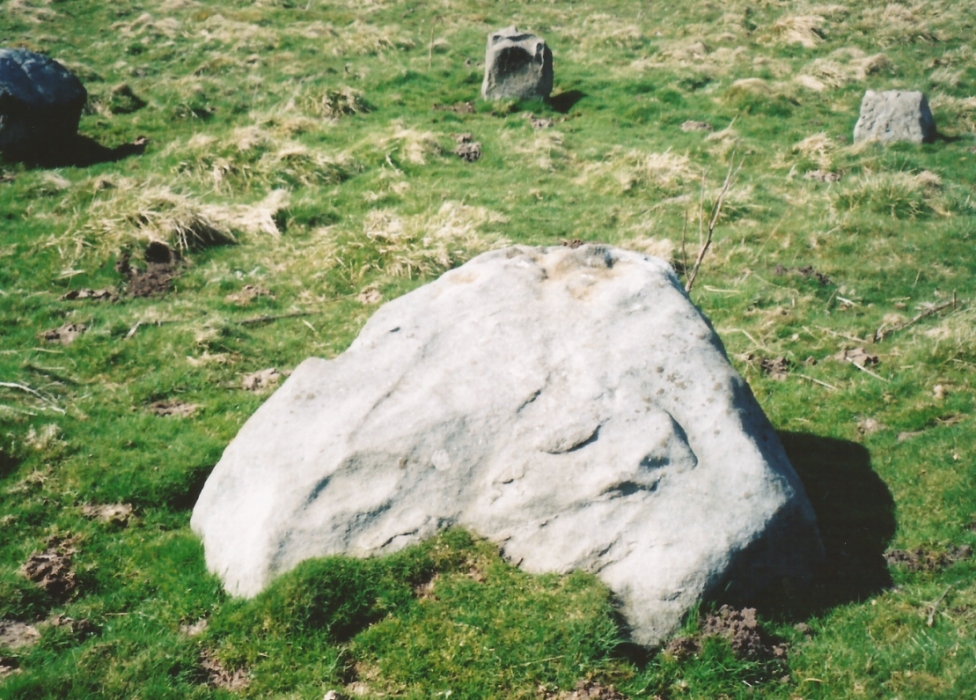
The largest rock in the ring (courtesy Paul Daw)
The circle doesn’t appear to have been noted by the great Yorkshire historians Harry Speight and Edmund Bogg in their literary rambles here (rather odd), but was brought to our attention first of all (in a literary sense anyway) by Arthur Raistrick. (1965) He first “surveyed” the site in 1950, but said little until a short remark was printed in the Yorkshire Archaeological Journal, where the notes told it to be one of “two stone circles, one with clear standing stones, 30ft in diameter, and the other a double circle of small recumbent stones, 12ft in diameter.”
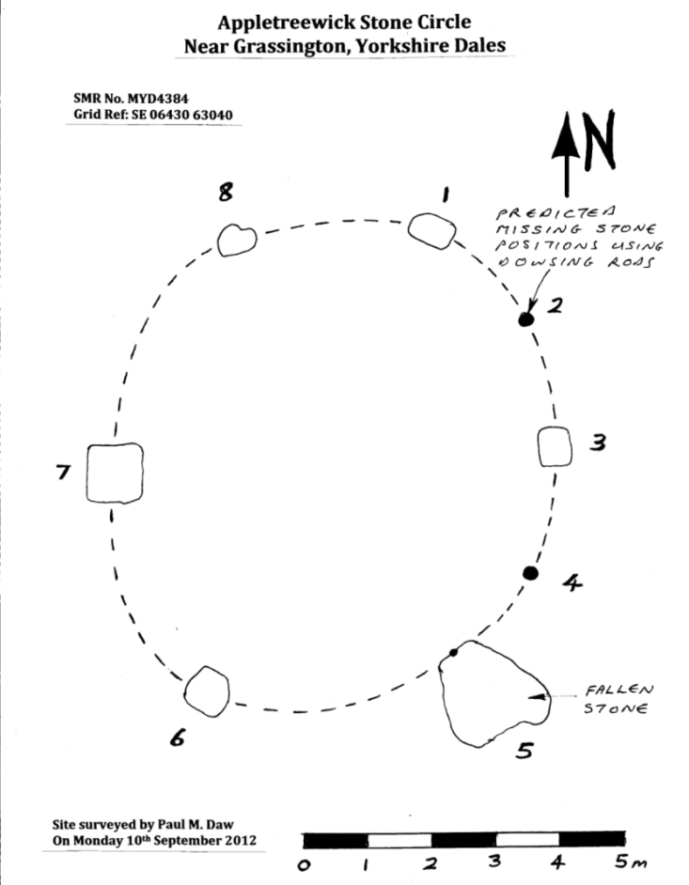
Ground-plan & missing stones (by Paul Daw)
The second, smaller double circle he mentions is probably a hut circle or cairn, faint traces of which are seen in the adjacent field. Remains of a prehistoric enclosure were also once evident in the same field; and thankfully to the south (across the road) we can still find many examples of cup-and-rings at Skyreholme.
John Barnatt (1989) and Aubrey Burl (2000) include the site in their relative major surveys, with both of them citing the circle, of six small stones, to measure 8.5m by 7.5m. The survey shown of this small stone ring was done by Paul Daw following his visit to the site on Monday 10th September 2012.
Folklore
Although we can only see six stones in this ring today, when the surveyor Paul Daw (2012) did a ground-plan of the place, he also did a dowsing survey of the site and found there were originally two extra stones on the eastern side of the circle. An archaeological dig would be interesting to see if post-holes or the remains of these two additional stones are under the turf. He wrote:
My dowsing survey revealed that the stone circle measured 7.7 metres diameter (N-S) and 7.0 metres (E-W). A reaction was received over the centres of stones 1, 3, 6, 7 and 8 indicating that they are still standing in their original positions, but stone number 5 to the south-south-east of the circle had a reaction at its northern end, which indicates that it was once standing but had fallen outwards. It is not therefore an earthfast stone, as speculated by A. Raistrick, when he visited the site. The stone measures 1.65 m x 1.65 m x 800 mm and fans out like a shell from bottom to top. It would have been an impressive stone when standing, but was top heavy, and the most likely stone to fall.
Stones 1, 3, 6, and 8 are all of a similar size, are much more stable, and stand at about 500 mm high. Stone 7 in the western sector is 800 mm high, and measures 950 mm x 850 mm, and looks like a rectangular block, with slightly rounded edges.
I also obtained a reaction at positions 2 and 4, indicating that there were once stones standing in these positions. To the north of the stone circle there are a number of stones lying on the surface. A. Raistrick suggested that there may have been another small stone circle in this area, but my dowsing rods did not detect anything, and it is probable that these are random stones lying on the surface.
This entire region is bedevilled with faerie, goblin and giant lore, plus creation myths of our peasant ancestors (Sutcliffe 1929) — some still living if you’re lucky enough to talk with the old folk, who might tell you a thing or two, or might not, depending on how you smell.
References:
Barnatt, John, The Stone Circles of Britain – 2 volumes, BAR: Oxford 1989.
Burl, Aubrey, The Stone Circles of Britain, Ireland and Brittany, Yale University Press 2000.
Daw, Paul M., “Appletreewick Stone Circle, Yorkshire Dales,” unpublished survey report 2012.
Take the B6265 east out of Grassington, thru Hebden, for another 2 miles till you pass the tiny road down to Skyreholme on the right. Another few hundred yards on, past Nussey Farm and Dry Gill house, park up and look for the track going south into the moors. Go down the track called Black Hill Road for a few hundred yards till y’ reach the gate on the right. A track bends downhill to the psilocybin-rich pastures of Nussey Green. Several hundred yards on, to the right-hand side of the track, we find this and its companions. Look around!
Archaeology & History
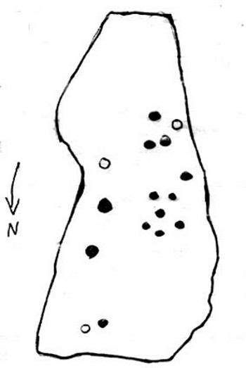
Quick sketch of design
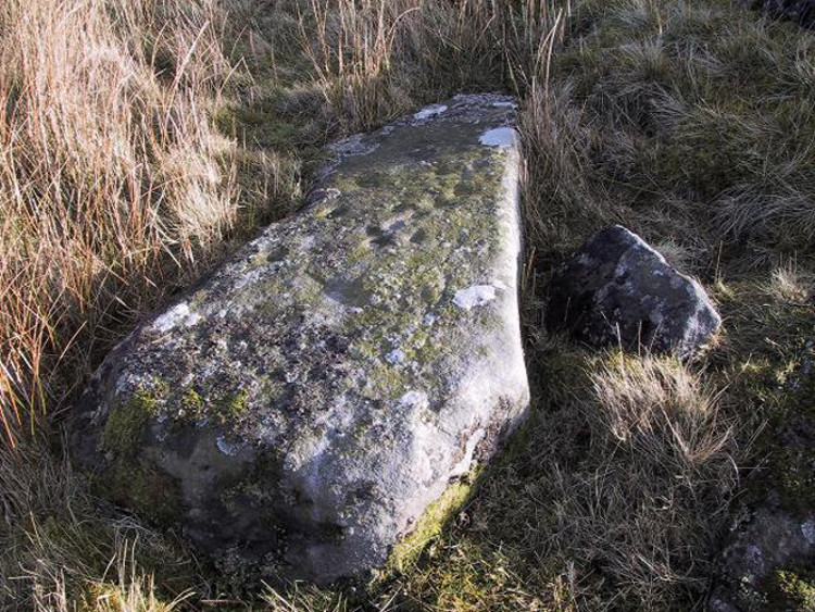
This medium-sized, recumbent standing-stone-shaped boulder has perhaps fifteen cup-markings on it. It’s a plain carving with others of a similar ilk in the area. First described by Stuart Feather in 1970 as one of “two cup-marked rocks” he found when ambling around; in Boughey & Vickerman’s (2003) survey they give it the wrong grid reference, though describe it correctly as a “long flat rock of irregular outline (with) fourteen to sixteen cups.” A cluster of other carvings are nearby, though some have been destroyed through mining operations.
References:
Boughey, Keith & Vickerman, E.A., Prehistoric Rock Art of the West Riding, WYAS: Wakefield 2003.
Feather, Stuart, “Appletreewick, W.R.,” in Yorkshire Archaeological Register, 1969, Yorkshire Archaeological Journal, part 168, 1970.
The great Yorkshire historian Harry Speight (1892) gave the directions for this place, which I’ve not located. On his walk down the southern side off Whernside, he told us to “follow the road which runs between Gunnerfleet and the white house at Winterscales, going under the long viaduct and round by Batty Wife Hole onto the main road at Ribblehead….” About 100 yards or so down the road, look over the walling into the field on the left-hand side. It’s there…..somewhere!
Archaeology & History
In an area that is pretty rich in prehistoric sites, one of our great Yorkshire antiquarians, Harry Speight (1892) seems to have described a site which our archaeologists have yet to get round to finding. He told that,
“nearer the wall there are indications of a rude, double circle, artificially formed of these dark weathered grits. The inner circle is about 20 yards in diameter and the outer one forms a narrow aisle surrounding it, with an outlet to the north; but some of the stones have been removed, probably to build and repair the adjoining fences. The situation is open and commands the country on all sides between the lofty moors and summits that hem in the dale-head. On the opposite side of the road are the remains of a couple of large cairns. They are presumably Danish. One was opened about a century ago (c.1790), and found to cover a rude stone coffin containing an entire human skeleton. The other large pile does not ever appear to have been examined. It is more than probable that many a furious battel has been waged here, as the possession of this prominent ridge, which dominates so many particular outlets, must have been of capital importance to every hostile tribe.”
Although the Victorian christian beliefs of ‘rudeness’ in everything and rampant hostile tribes, has long since subsided in the view of our ancestors. This area described by Speight does sound like an old burial ground. But from which age – and where now are the sites he described?
References:
Speight, Harry, The Craven and Northwest Yorkshire Highlands, Elliot Stock: London 1892.
From Settle, take the same direction as if you’re visiting the giant Apronful of Stones cairn. Walk past it, keeping to the walling for 350 yards (319m) until you reach the gate on your right. Go through this and walk along the grassy footpath ahead of you for 75 yards (68.5m) and there, right by your left-hand side, you’ll see this low grassy circular embanked monument, or cairn circle.
Archaeology & History
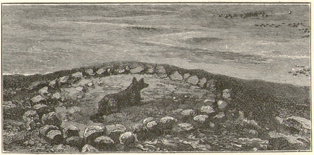
This gorgeous, little-known cairn circle, hiding almost unseen beside the ancient grassy pathway that leads down to the haunted Borrins Wood, sits innocently, forgotten by those who would claim its importance. When this overgrown ring of stones was first built, the trees of Borrins Wood grew around the sacred court of this monument, watching rites committed to the ancestors, annually no doubt at the very least, under guidance of the Moon. But now such ways have been swept from the memory of those living, into worlds made-up of artifacts, linear time and dualist ideals, and our thoughts when brought here are encloaked by beliefs not worthy of such a place. Like many other small rings of stone, this was important for the rites of the dead. For here we can see a small stone-lined cist (grave) near the middle still growing from the Earth, with the small outer ring encircling the place of rites. It was obviously of ‘religious’ importance to those who lived here, probably even centuries after initial construction.
Embankment and central ‘grave’Central & southern section of the ring
Similar in size and structure to the Roms Law Circle on Burley Moor, this site on the hills above Giggleswick seems to be Bronze Age in nature. From outer-edge to outer-edge the rough circular monument measures approximately 14½ yards (13m) north-south, by 15½ yards (14m) east-west, with an outer circumference of about 49 yards (43m). The edges of the ring, as you can see in the photos, is made up of an embankment of thousands of small stones and rubble, measuring between 1-2 feet high and between 2-3 yards across. The old cist in the middle of the ring—about 1 yard by 2 yards—has been dug into at some time in the past and a small mound of stones surround this central grave. The entire monument is very much overgrown, but still appears to be in relatively good condition. A new excavation of this and nearby prehistoric monuments would prove worthwhile.
The ruined circle has a tranquil spirit, enclosed within a rich green panoramic landscape, enhanced with the breaking of old limestone and gnarled hawthorns. Other prehistoric cairns can be found nearby and the remains of a previously unrecorded prehistoric enclosure stands out on a small rise 164 yards (150m) southeast. We’ve found other unrecorded prehistoric remains in this arena which will be added to TNA, as and when…
References:
Speight, Harry, The Craven and Northwest Yorkshire Highlands, Elliott Stock: London 1892.
Follow the same directions as if you’re visiting the Apronful of Stones giant cairn, above Giggleswick. Walk past the giant cairn for a coupla hundred yards until you reach the large section of fallen walling, which you can clamber over and head towards the small rise of the Sheep Scar enclosure 100 yards in front of you. Walk to the far end of this walled enclosure and look down the slope to your left, for 50-60 yards where you’ll see a small rocky mound rising above the edge of the hollow footpath. That’s it!
Archaeology & History
This lovely old overgrown prehistoric cairn seems to one of what were once the remains of many other old tombs that scattered this grassy rocky plain, on the western ridge between Stainforth and Settle. Although there are what seems to be the remnants of others nearby, this particular stone heap, its edges buried beneath centuries of earth, is a fine little-known specimen that deserves attention after so long a period in the sleep of ignorant moderns. The cairn is found within an area that Harry Speight (1892) called the “Field of the Dead”, where he came across “traces and remains of human graves which carry us back to the far dim ages of unwritten history.” Whether he saw this particular cairn rising up above the edge of the old track that winds up from Borrins in the valley below, he doesn’t say — but I’d be amazed if the diligent Speight missed it!
The overgrown cairn, looking NWCairn centre, with Sheep Scar enclosure above
Standing more than a yard high, when Paul Horby and I paced this old ruin, it measured 10 yards by 12 yards across — though so much loose and overgrown stone was beneath the surface that it could be much bigger. The top of the cairn had come loose, perhaps explored by some antiquarian in times gone by, exposing a considerable mass of small rounded and misshapen rocks, typical of such constructions. When Harry Speight found the place more than a hundred years earlier, he described the situation much as we’d found it, telling of,
“other mounds of similar and smaller dimensions within the same area, some of which have been examined, but others do not appear to have been disturbed. Many of the barrows or ‘raises’ have at some time or other been carelessly dug into in the hope of finding valuables, and as doubtless in most cases nothing was found but rude chests or coffins, containing bones, these were tossed aside and no record of them deemed worthy of preservation.”
A situation we find still prevalent thanks to the ignorance of some archaeologists in some regions of Yorkshire to this day (despite what they tell folk). We could see nothing of any note in our brief look at this old cairn, except that it had the usual hallmarks of prehistory in its form, probably Bronze Age. Possible remains of other similar-sized cairns can be seen a little further up the slope on the northeastern edges of the enclosure. The prehistoric Sheep Scar Cairn Circle and other ancient remains scatter the fields all round here; something indicated by the place-name Borrins found in the woods below the ridge, meaning simply, ‘burial place.’ (Smith 1956: 57-8)
References:
Smith, A.H., English Place-Name Elements – volume 1, Cambridge University Press 1956.
Speight, Harry, The Craven and Northwest Yorkshire Highlands, Elliott Stock: London 1892.
Follow the same directions to reach the recently discovered Slade-02 carving; and simply walk 30 yards southwest. The scattered ruins of numerous small stone piles, visible only when the heather’s been burnt back, is what you need to be looking for.
Archaeology & History
First discovered on a Northern Antiquarian outing in July 2011, it’s difficult to give an accurate appraisal of this site as much of the landscape all round here is very overgrown in deep heather. Added to this, there is evidence of more recent medieval and post-medieval industrial activity that’s intruded and/or affected the earlier prehistoric remains that are evident here. But these factors aside, we can say with certainty that here is a previously unrecognized prehistoric cairnfield — and it may be of some considerable size.
Ruined hut or cairn circle
We have so far located at least seven individual cairns and a cairn circle in relative proximity to each other, thanks to local rangers burning back the heather. It was the discovery of the cairns which then led to the discovery of the nearby cup-and-ring stones. Amidst the cairn-spoils there are also distinctive lines of stone, indicative of either walling or embankments of some form or another. Some of the stone making up this cairnfield appears to have been robbed. We also found that in walking through the deeper heather surrounding this ‘opening’ (where it had been burned away a few months previously), a number of other man-made piles of stone were evident that seemed to indicate more cairns. There is also evidence of further lines of prehistoric walling, whose precise nature is as yet unknown. But we do know that people have been on this moorland since Mesolithic times (structural and other remains of which are still evident less than a half-mile away).
The site requires greater attention the next time the heather’s been burnt back.
References:
Davies, J., “A Mesolithic Site on Blubberhouses Moor, Wharfedale,” in Yorkshire Archaeological Journal, part 161 (volume 41), 1963.
To reach here, follow the same directions to get to the Apronful of Stones giant cairn. Walk on the footpath past the cairn for about 200 yards until you reach a large gap where the old walling has collapsed. Go through this and walk across the limestone rocks, towards the small rocky hillock rising up 100 hundred yards in front to your east (not the more rounded one to the north). That’s it!
Archaeology & History
This is a most intriguing find, and one to which I can find no other literary reference (though I aint checked Brayshaw’s Giggleswick). An undeniably large natural hillock has been modified and added to by people at some considerable time long ago and at some considerable effort! Measuring more than 47 yards (43m) roughly east-west, and 21 yards (19m) north-south, the most definable man-made remains here is the length of elliptical walling on the southern and western edges. The internal circumference of the enclosure measures roughly 113 yards (103m) all round the edges. The northern and eastern sides of the hill would appear to be mainly natural, but seem to have been modified a little — not unlike the mass of settlements and enclosures a few miles to the east, like Torlery Edge, Lantern Holes and others around Malham Moor and district.
The site needs professional assessment: first to ascertain its period (which seems Iron Age on first impression, but could be much later), and second to ascertain its nature. On the ridges close by we find a veritable mass of archaeological remains, ranging between Bronze Age to Medieval in nature. The giant Apronful of Stones is only 172 yards (158m) south; the Sheep Scar cairn circle 156 yards (143m) northwest; and one of the remaining Sheep Scar cairns only 58 yards (53m) away. And hopefully when we return to the place next week (fingers crossed!), we’ll be able to get some more photos of the walling you can see that define some edges of the site…
…to be continued…
References:
Brayshaw, Thomas & Robinson, Ralph M., A History of the Ancient Parish of Giggleswick, Halton & Co.: London 1932.
From Feizor village, take the dirt-track south that cuts up between the two cottages and walk onto the level. From here, the walling bends round and a small cut runs up the slope on your left. Go up here and onto the top, bearing left again when you reach the footpath near the top of the slope. Walk along here until the hills open up before you and less than 100 yards along, just on the right-hand side of the path, you’ll notice the overgrown outline of a ring just by the side. Don’t miss it (like I did!).
Archaeology & History
Danny, Paul and I visited here a few weeks back on a fine sunny day and, my attention caught by some nearby rocks that got mi nose twitching, I just about walked past the place until Danny called me back and said, “Oy – ‘ave y’ not seen this?” Right under my nose no less!
Feizor Thwaite circle, looking northwest
The site’s a little known circular monument east of Feizor village, less than a mile northwest of the cairnfield above Stackhouse (where lives the Apronful of Stones and other prehistoric friends). Marked on modern OS-maps as an ‘enclosure,’ the site here is in fact an overgrown cairn circle, typical in size and form of the ones found at nearby Borrins Top, Burley Moor, Askwith Moor and elsewhere in the Pennines. Measuring (from outer edge to outer edge) 66 feet 6 inches east-west and 59 feet north-south, the remains here consist of a raised embankment of stones, encircling an inner flatter region consisting of many smaller stones beneath the overgrowth of grasses and vegetation. Locals told me that the some of the cairns up here were explored early in the 20th century by a local man called Tot Lord, but I’m unsure whether he looked at this one.
There are a couple of other smaller circular remains on the same grassland plain, clearly visible from aerial imagery, along with other crop-marks of human activity on this part of the Feizor Thwaite landscape. More antiquarian analysis could do with focussing here to see what can be found!
Standing Stone (destroyed): OS Grid Reference – SD 78570 67177
Archaeology & History
Feizor on 1851 map
There have been no previous archaeological reference to this site (until now), which was included in early place-names records (Smith 1961) and was also highlighted on the first Ordnance Survey map of the region around 1851. Probably as a result of the archaeological lacking, the upright stone has finally succumbed to the destructive actions of modern man. When we asked the farmer if he knew owt about any standing stone here, he said he knew “nowt abaat that.”
Feizor stone stumpand from another angle
All that can be seen today is the very small stump of stone, just visible above ground level, in the middle of the field. It’s not easy to spot either, as the grasses grow over what’s left. But we found the slim remnant of the stump embedded in exactly the spot marked on old and modern maps, measuring 24 inches in length and just 4 inches across at the widest, with what seemed like worn rounded edges at either end. We were unable to ascertain the depth of the remaining stone in the ground. The stone looks simply as if it’s been snapped at the base. We have no idea how tall this standing stone was.
If any local people know anything more about this stone, or have any old photos, we’d love to hear from you — and would obviously give due credit for any help on this matter.
References:
Smith, A.H., The Place-Names of the West Riding of Yorkshire – volume 6, Cambridge University Press 1961.