Watcher Stone, Ilkley Moor, West Yorkshire

Cup-Marked Stone:  OS Grid Reference – SE 11816 46563

Also Known as:

  1. Carving no.109 (Hedges)
  2. Carving no.263 (Boughey & Vickerman)
  3. White Wells 05

Getting Here

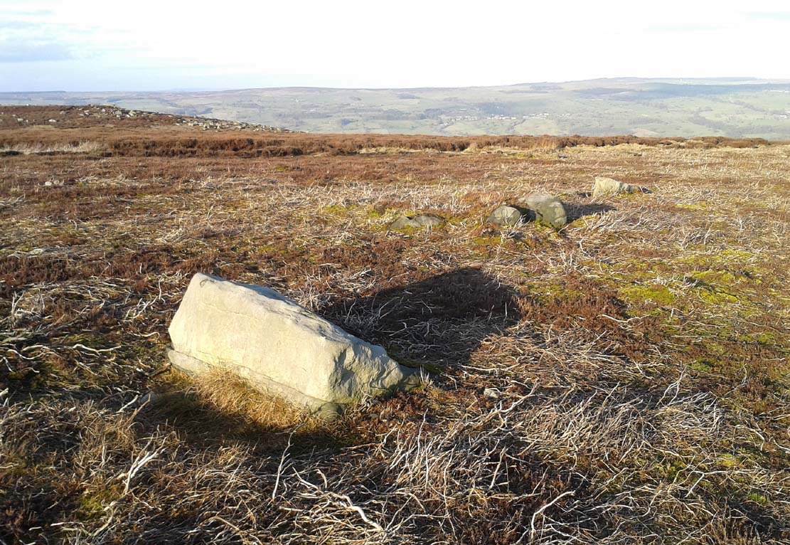
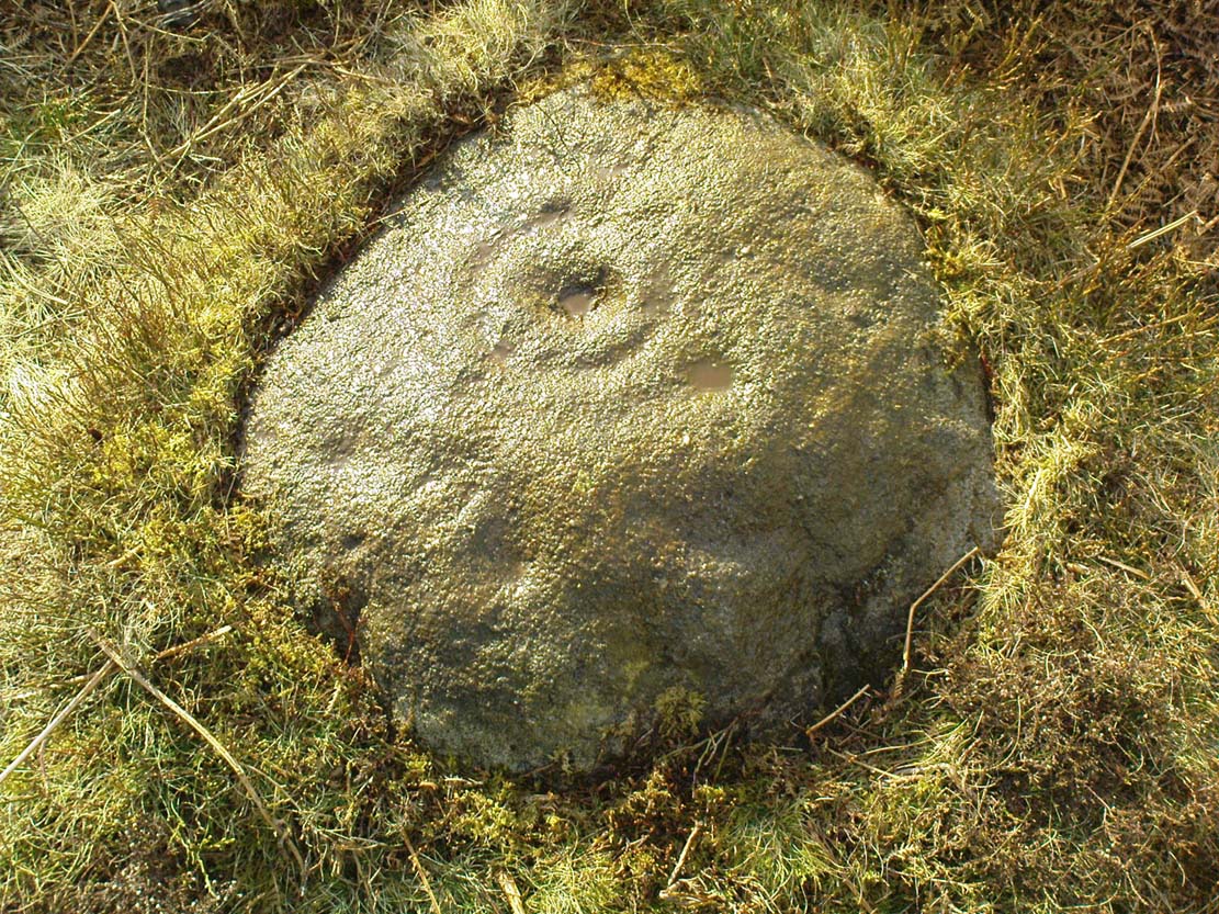
Watcher Stone by the path

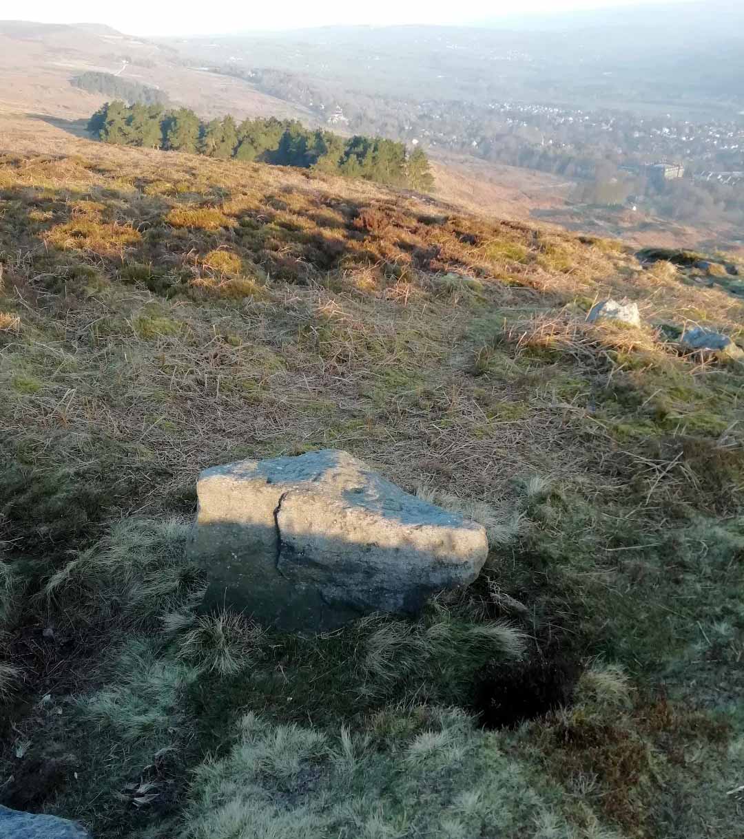
From Ilkley, go up to White Wells (ask a local if y’ get stuck) and walk round the back of the building. Walk to the trees and then follow the footpath up onto the moors; but after 70 yards a small footpath on your right goes up the slope.  Take this and after about 90 yards it veers round to your left, following the contours up towards the copse of trees.  Another 100 yards up it meets with another path and once here, just yards in front of you, right by the side of the footpath, is the stone in question.

Archaeology & History

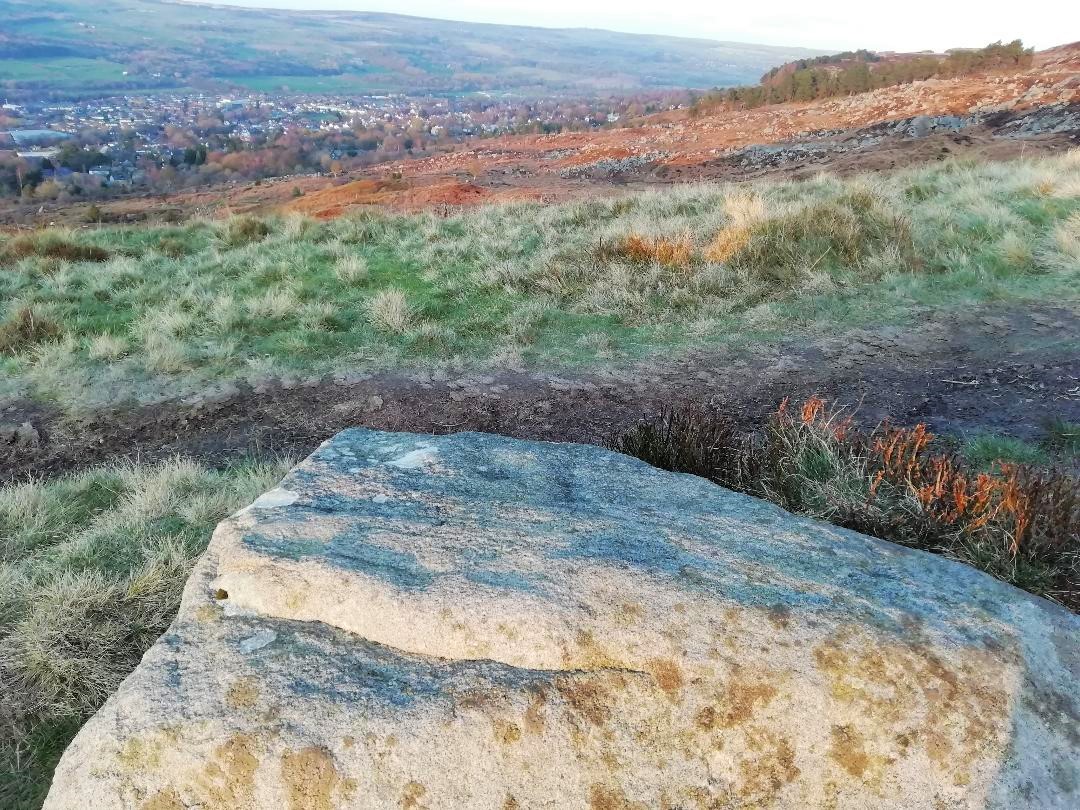
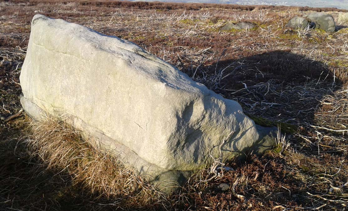
First described in John Hedges (1986) survey, this simple cup-marked stone typifies many petroglyphs on these moors: a barely visible design much eroded by centuries of wind and water, with markings perhaps only of interest to the devoted student and explorer.  But at least it’s a good place to sit, rest and watch the valley below.

Looking down at the cups
Hedges 1986 sketch

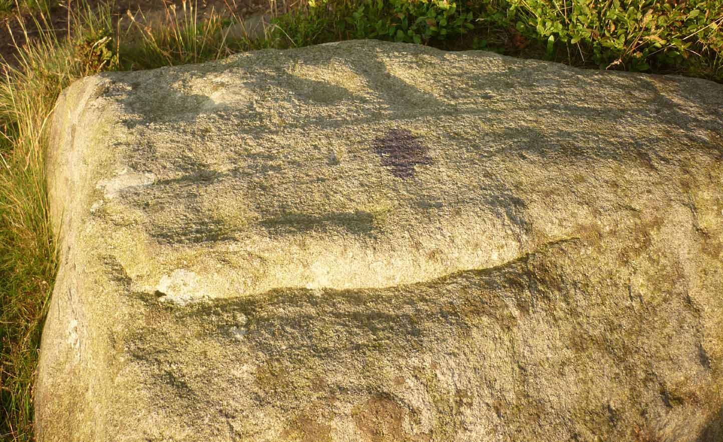
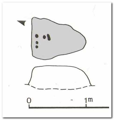
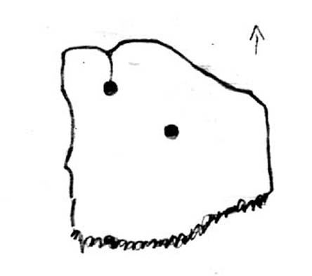
This old fella looks to have only five cupmarks on its supper surface, one of which is elongated, as shown in Hedge’s drawing.  However, when he saw this, he thought the elongated ‘cup’ consisted of three of them in a line, all linked up.  He saw a “medium sized smooth grit rock standing in grass, its surface triangular in shape, with flat top sloping slightly N to S.  Three cups connected by a groove, c. four other cups, all shallow and worn.”

This description was echoed in Boughey & Vickerman’s survey (2003), where they thought that the “triangular top surface has about seven worn cups, three connected by a short groove.”  But if the light isn’t quite right, this can be very difficult to see.

References:

  1. Boughey, Keith & Vickerman, E.A., Prehistoric Rock Art of the West Riding, WYAS: Wakefield 2003.
  2. Hedges, John (ed.), The Carved Rocks on Rombalds Moor, WYMCC: Wakefield 1986.

Links

  1. The Watcher Stone on The Megalithic Portal


Table Stone, Ilkley Moor, West Yorkshire

Cup-and-Ring Stone:  OS Grid Reference – SE 12233 46342

Also Known as:

  1. Carving no.114 (Hedges)
  2. Carving no.267 (Boughey & Vickerman)

Getting Here

Table Stone carving (photo by Jonathan Warrenberg)

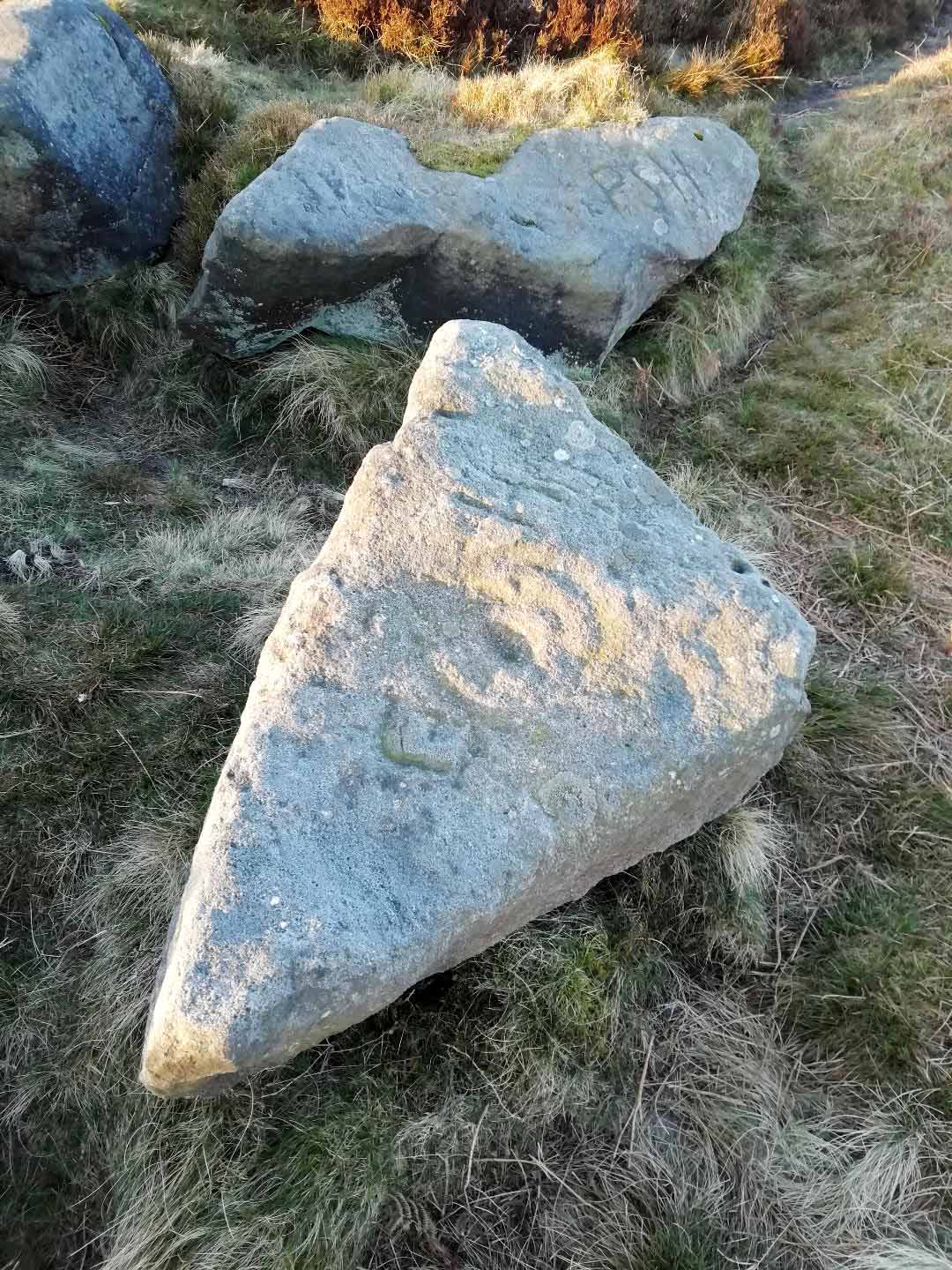
From Ilkley walk up to the White Wells and follow the footpath behind it up to the cliffs, up the stone steps and onto the moor itself.  Once you’ve climbed the steps, walk uphill onto the moor for 100 yards, then turn right up a small path for another 80 yards until you reach the large Coronation Cairn with its faint cup-and-ring stone.  From here there are two paths heading west: take the higher of the two for just 30 yards where a small group of rocks are by the path-side on your right.  The curiously-shaped ‘upright’ one is the stone in question.  You’ll see it.

Archaeology & History

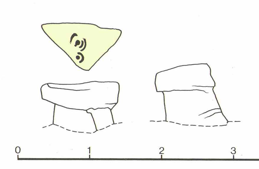
Found high up on top of an oddly-shaped stone, somewhat like an anvil or small table (hence the name, courtesy of Jonathan Warrenberg), is carved a slightly worn, incomplete cup-and-double-ring.  This aspect of the design is the one that stands out the most; but you’ll also see a cup-and-half-ring there too.

The carving seems to have been described for the first time in John Hedges (1986) survey (though I may be wrong), who described an additional feature to the design, saying:

“Small grit rock in possible cairn material, cut all round as if one pedestal, top surface triangular, sloping slightly SW to NE, overlooking Wharfe Valley, in grass and crowberry.  Large cup with two vestigial rings, second large cup with vestigial ring.  Possible third ring of corner edge (hewn off).  Recent carving of initials spoils original carving.”

John Hedges 1986 sketch
Looking from above (photo – Jonathan Warrenberg)

His description of the stone being “in possible cairn material” doesn’t seem true – although a number of petroglyphs are associated with cairns of varying sizes.  Several other carvings can be found close to this one.

In Boughey & Vickerman’s (2003) later survey, they copy Mr Hedges earlier description, but with less detail.

The view from this stone is quite impressive.  Even with the minor tree cover that would have existed when this carving was done, you’d still have clear views up and down the winding wooded valley that was carved by the River Wharfe.  The moors to the north at Denton and Middleton with their own petroglyphic abundance could be chanted at with ease from here when the winds sleep.  Tis a good spot to sit… if you’re lucky enough to get some silence…

References:

  1. Boughey, Keith & Vickerman, E.A., Prehistoric Rock Art of the West Riding, WYAS: Wakefield 2003.
  2. Hedges, John (ed.), The Carved Rocks on Rombalds Moor, WYMCC: Wakefield 1986.

LinksThe Table Stone carving on The Megalithic Portal

Acknowledgments:  Huge thanks to Jonathan Warrenberg for the use of his photos in this site profile – and also due credit for giving the stone its modern title. 🙂

© Paul BennettThe Northern Antiquarian


Lower Lanshaw Dam (02), Burley Moor, West Yorkshire

Cup-Marked Stone:  OS Grid Reference – SE 14223 44888

Getting Here

Along the moorland road between Cow & Calf and The Hermit pub, park up at the small wooded bit by the right-angle bend and cross over the Coldstone Beck.  Walk up onto the moor itself and stick to the path that runs roughly parallel with the slowly-drying stream, towards Lower Lanshaw Dam.  About 100 yards before it, walk left, into the heather, for about 50 yards.  You’re damn close!

Archaeology & History

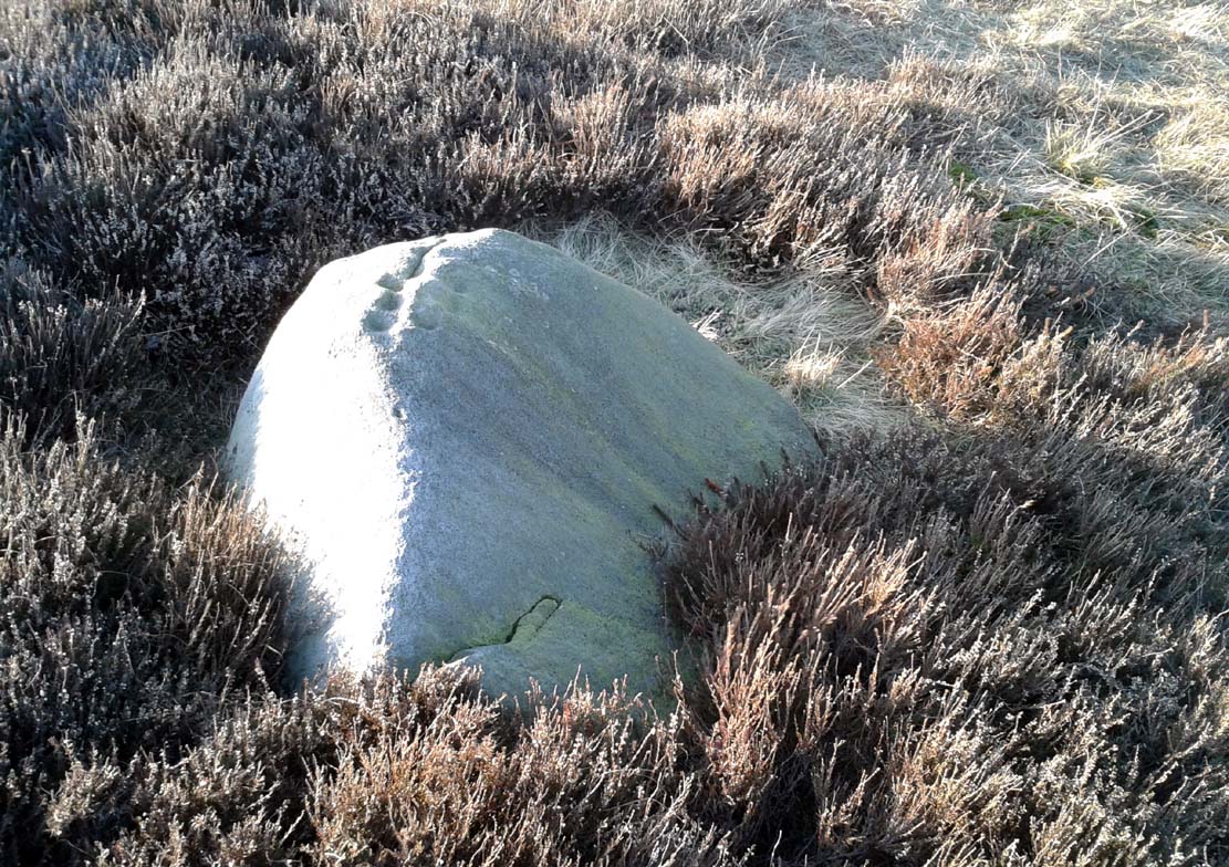
Lower Lanshaw Dam carving
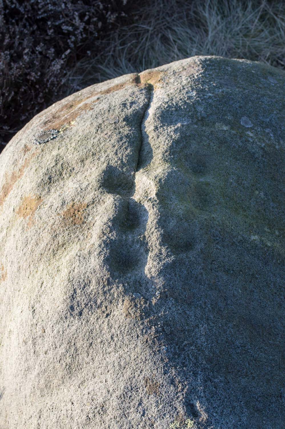
Close-up of cupmarks (by James Elkington)

This is another neolithic or Bronze Age carving I first came across during one of my weekly rambles across these hills as a child, and upon revisiting the place a few days ago with James Elkington, found it associated with nearby cairns and what looks to be the remains of prehistoric walling – none of which I noticed when I was a kid.  The petroglyph is a simple design, primarily consisting of two rows of three cup-marks: one row of three along the top or spine of the rock, and another one immediately beneath it, an inch or so below.  The topmost line of cups runs into a natural crack in the rock, which runs down the northwest edge of the stone.  A possible faint cup and partial ring emerges on the southeast side of the topmost row of cups, but this is difficult to make out.  On the sloping northwest face of the rock is another single cup-marking.

References:

  1. Bennett, Paul, Of Cups and Rings and Things, unpublished: Shipley 1981.

Acknowledgements:  Many thanks to James Elkington for use of his photo to illustrate this petroglyph

© Paul Bennett, The Northern Antiquarian


Lower Lanshaw Dam (01), Burley Moor, West Yorkshire

Cup-Marked Stone:  OS Grid Reference – SE 1416 4489

Getting Here

Take the same directions as if you’re visiting the Lanshaw Dam 2 petroglyph, then keep walking directly towards the Lanshaw Dam, 130 yards east.  Halfway between the two, closer to the footpath, look out for a stone of similar shape and dimensions to Lanshaw 2, just by a prehistoric cairn.  You’ll find it!

Archaeology & History

Cup-marked stone & cairn
Close-up of cup marking

As with a great number of petroglyphs in and around Yorkshire, this large single cup-marked rock is found in close association with a reasonably large prehistoric cairn (several others are close by), some 3 yards in diameter.  The cup-marking here is larger than yer average cup-mark on these moors, being four inches across. It can clearly be seen on the southern vertical face of the rock and doesn’t appear to have been recorded before.  On the whole, it’s nothing special to look at and is probably just one for the petroglyphic purists amongst you.

© Paul Bennett, The Northern Antiquarian

Little Almscliffe, Stainburn, North Yorkshire

Cup-and-Ring Stone:  OS Grid Reference – SE 23242 52260

Also Known as:

  1. Little Almes Cliffe
  2. Little Almias Cliff Crag

Archaeology & History

Little Almscliffe Crag (photo by James Elkington)

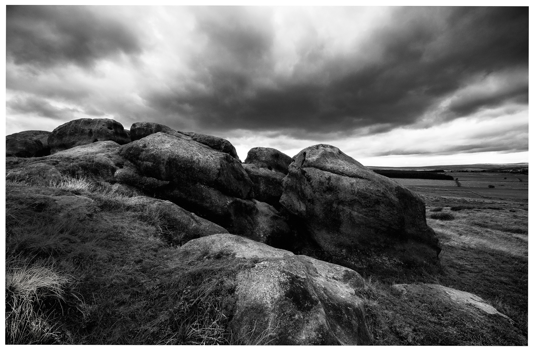
The crags of Little Almscliffe are today peppered with many modern carvings, such as are found on many of our northern rock outcrops.  Yet upon its vertical eastern face is a much more ancient petroglyph – and one that seems to have been rediscovered in the middle of the 20th century.  When the great northern antiquarian William Grainge (1871) visited and wrote of this place, he told us that, “the top of the main rock bears…rock basins and channels, which point it out as having been a cairn or fire-station in the Druidic days; there are also two pyramidal rocks with indented and fluted summits on the western side of the large rock” – but he said nothing of any prehistoric carvings. Curiously , neither the great historian Harry Speight or Edmund Bogg saw anything here either.

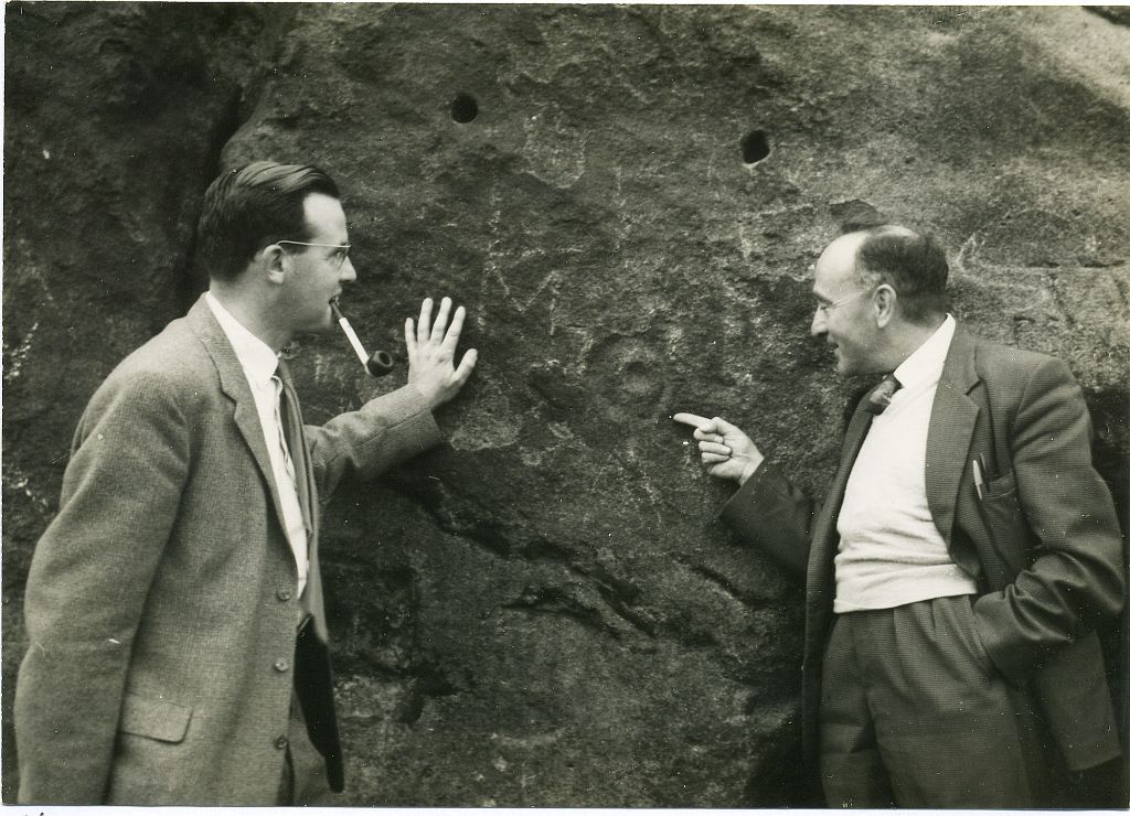
Stuart Feather & Joe Davies here, c.1955
Cup&Ring, left of ‘door’ (photo by James Elkington)

This singular cup-and-ring design seems to have been reported first in E.S. Wood’s (1952) lengthy essay on the prehistory of Nidderdale. It was visited subsequently by the lads from Bradford’s Cartwight Hall Archaeology Group a few years later; and in the old photo here (right) you can see our northern petroglyph explorer Stuart Feather (with the pipe) and Joe Davis looking at the design.  In more recent times, Boughey & Vickerman (2003) added it in their survey of, telling briefly as usual:

“On sheltered E face of main crag above a cut-out hollow like a doorway is a cup with a ring; the top surface of the rock is very weathered and may have had carvings, including a cupless ring.”

Close up of design

Indeed… although the carving is to the left-side of the large hollow and not above it.  Scattered across the topmost sections of the Little Almscliffe themselves are a number of weather-worn cups and bowls, some of which may have authentic Bronze age pedigree, but the erosion has taken its toll on them and it’s difficult to say with any certainty these days.  But it’s important to remember that even Nature’s ‘bowls’ on rocks was deemed to have importance in traditional cultures: the most common motif being that rain-water gathered in them possessed curative properties.

References:

  1. Bennett, Paul, The Old Stones of Elmet, Capall Bann: Milverton 2001.
  2. Bogg, Edmund, From Eden Vale to the Plains of York, James Miles: Leeds 1895.
  3. Bogg, Edmund, Higher Wharfeland, James Miles: Leeds 1904
  4. Cowling, E.T., Rombald’s Way, William Walker: Otley 1946.
  5. Grainge, William, History & Topography of Harrogate and the Forest of Knaresborough, J.R. Smith: London 1871.
  6. Parkinson, Thomas, Lays and Leaves of the Forest, Kent & Co.: London 1882.

Acknowledgements:  Huge thanks to James Elkington for use of his fine photos on this site.

© Paul BennettThe Northern Antiquarian

Longbarrow Field, Timble, North Yorkshire

Cairn (lost):  OS Grid Reference — SE 18 53

Archaeology & History

Described in the Field Lore of Timble village by William Grainge (1895) are the names and short histories of some of the local place-names—with this in particular standing out like a veritable sore thumb!  Quite plainly, as Grainge told us,

“The name ‘Longbarrows’ is indicative of some burial mounds of a very early day.  None exist at present.  The land is under the plough, and is about the best in the township.”

But I cannot locate the position of this long-lost site and it’s not shown on any of the early OS-maps hereby.  Grainge said that the land on which it once stood was owned by a local farmer called Charles Dickinson, who leased it out to others.  He wrote:

“Dickinson had in Longbarrows 3 roods* and 23 perches*, and William Jackson’s share in Longbarrows was 1 acre, 3 roods and 21 perches.  Besides these, John Ward of Nether Timble had 1 rood and 17 perches int he same field, a long narrow slip without fence, between Dickinson’s and Jackson’s lots.”

Does anyone know where this was?  One of my suspects is the gathering place of the Fewston witches, a half-mile south of the village; but no remains of anything can be found there today and I may just be barking up the wrong tree.

The area south and west of here is rich in little-known prehistoric heritage, from the cairn-fields of Askwith Moor, the cairn circle at Snowden Crags, the settlements of Snowden Carr and the extensive petroglyphs all over the place!  Giants cairns of the early Bronze Age and neolithic period were also once more numerous upon the moors to the west and south, so the former existence of a long barrow in Timble wouldn’t necessarily be too unusual.  But where was it?!

References:

  1. Grainge, William, The History and Topography of the Townships of Little Timble, Great Timble and the Hamlet of Snowden, William Walker: Otley 1895.

*  A rood is an English unit of area, equal to a quarter of an acre or 10,890 square feet; a perch was a more variable unit of measure, being lengths of 1612, 18, 21, 24 and 25 square feet.

© Paul BennettThe Northern Antiquarian 

Halo Stone (318), Ilkley Moor, West Yorkshire

Cup-and-Ring Stone:  OS Grid Reference – SE 13223 46505

Also Known as:

  1. Carving no.154 (Hedges)
  2. Carving no.318 (Boughey & Vickerman)

Getting Here

Looking straight down at it

Looking straight down at it

From Ilkley train station, head up Cow Pasture Road and get to the Cow & Calf Hotel (if needs be, ask a local).  From its car-park, cross the road and go along the straight-ish footpath onto the moor.  Less than 200 yards on, you’ll hit a main track (and a faint cup-marked stone).  OK – walk down this track (left) for 30-40 yards, then walk left again into the heather for about 10 yards.  You’re looking for a small rounded stone and you’re damn close!

Archaeology & History

...and from another angle

…and from another angle

Just over 40 yards east of the very basic Brown Law cup-marked stone, we find this slightly more exotic petroglyph, keeping low in the undergrowth.  Difficult to see unless the daylight is just right, preferably as the sun is rising or setting (as with many neolithic carvings), on this small slightly rounded stone we see a central cup-mark surrounded by a double-ring (unfinished, perhaps on its northern edge)—although an outer cup seems to touch the edge of this second ring.  As the faint images here show, there are other cups and shallow lines also etched onto the stone, but these are gradually fading as the years go by.  It was originally found close to a small cairn that has seemingly been destroyed in recent years.

CR318drThe carving can be troublesome to find when the heather and bracken gets growing, so it’s best explored in the Winter and early Spring—unless of course you want me to show you it, along with the hundreds of others on these moors!  If so, gimme a shout. 😉

References:

  1. Boughey, Keith & Vickerman, E.A., Prehistoric Rock Art of the West Riding, WYAS: Wakefield 2003.
  2. Cowling, E.T., Rombald’s Way: A Prehistory of Mid-Wharfedale, William Walker: Otley 1946.
  3. Hedges, John (ed.), The Carved Rocks on Rombalds Moor, WYMCC: Wakefield 1986.

© Paul BennettThe Northern Antiquarian


Skyreholme Carving (406), Appletreewick, North Yorkshire

Cup-marked Stone:  OS Grid Reference – SE 0740 6254

Getting Here

Skyreholme 406

Skyreholme 406 carving

Along the B6265 Pateley Bridge-Grassington road, roughly halfway between Stump Cross Caverns and the turn to Skyeholme and Applecross (New Lane) is a dirt-track on your right-hand side called Black Hill Road. Walk down here for a few hundred yards till y’ reach the gate on the right. A track goes downhill to the psilocybin-rich pastures of Nussey Green. Several hundred yards down, to the right-hand side of the track, we find this and its several companions. Look around!

Archaeology & History

Skyreholme-406 carving

Sketch showing cups

Just a few yards away from the Skyrehome Carving-404, this very basic petroglyph was rediscovered by Stuart Feather (1969) during one his many forays in this area.  Although the stone has what initially seems to be a number cup-marks on it, it seems only two of them are man-made. The rock art students Boughey & Vickerman (2003) think there may be up to four of them.

References:

  1. Boughey, Keith & Vickerman, E.A., Prehistoric Rock Art of the West Riding, WYAS 2003.
  2. Feather, Stuart, “Appletreewick, W.R.: Black Hill,” in Yorkshire Archaeological Journal, volume 42, part 167, 1969.

© Paul BennettThe Northern Antiquarian


Skyreholme Carving (405), Appletreewick, North Yorkshire

Cup-Marked Stone:  OS Grid Reference – SE 07395 62382

Getting Here

Skyreholme 405 Carving

Skyreholme 405 Carving

Going down (south) off the B6265 Black Hill Road towards Skyreholme, turn right and go all round the hill ahead of you, but instead of looking to the right (where other carvings, described elsewhere, are found), turn left where the collapsed entrance to a mine-shaft is visible about 50 yards up the hill on the left. Walk up here, keeping to the right side of the collapsed mine, till you reach this rock.

Archaeology & History

Only for the purist petroglyph fanatics amongst you, the rock art students Boughey & Vickerman (2003) allege there to be four cup-markings here—and debatable ones at that—but we could really only make out the topmost cup, shown in the picture and an elongated one (which they think may have been two cups merged into one).  A faint “X” is also carved on the stone, possibly from the mining days.

References:

  1. Boughey, Keith & Vickerman, E.A., Prehistoric Rock Art of the West Riding, WYAS: Wakefield 2003.

© Paul BennettThe Northern Antiquarian 


Arncliffe, Littondale, North Yorkshire

‘Carved Stone’:  OS Grid Reference – SD 93 72

Archaeology & History
The Arncliffe Carving

The Arncliffe Carving

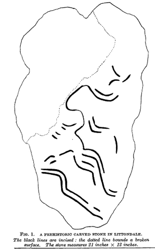
This is a frustrating site entry.  Not only do we not know where it is, this carving is not listed in any of the modern books on British petroglyphs, yet it was described and referenced by the famous archaeologist Jacquetta Hawkes following its discovery more than 80 years ago.  After a brief mention of the carving in Frank Elgee’s (1933) Archaeology of Yorkshire, an article describing the carving was penned in the journal Man, from which I draw the only information available. It appears to have been found in the early 1930s (no date or discoverer is cited), but has a couple of peculiarities which may bring the authenticity of the stone into question.  Mrs Hawkes (1934) told that the carved stone was,

“found in the bed of a moorland beck in the village of Arncliffe, Littondale, West Riding of Yorkshire.  It is of buff-coloured limestone measuring 21 inches x 12 inches x 6 inches in thickness; the decorated surface is almost flat.  The curvilinear pattern is executed in regular incisions about 4mm wide and 3mm deep; portions of it have been obliterated by water actions and, as is illustrated in the illustration, at one end the surface has broken away altogether.  The whole stone has been much battered and may well be only a fragment of a much larger one.  The state of preservation suggested that it had been in the stream for a considerable period; it is therefore probable that it was washed down from the open moorland above Arncliffe.  In the original (carving), the design is more coherent than it here appears owing to the fact that in the water-worn portions faint lines are visible to the eye which cannot be shown on a tracing.

“Mr W.J. Hemp, who has kindly examined the Arncliffe tracing, identifies the style of the design with the ‘entrail’ pattern of the well-known Pattern Stone from the chambered cairn of Bryn Celli Ddu in Anglesey…

“The technique of the Arncliffe tracing is comparable with the simple incisions which form the oldest of the four techniques recognizable in the Irish megalithic tumuli, where its early date is indicated by the fact that some examples are demonstrably older than the construction of the tumuli in which they occur…

“Mr Frank Elgee, who has also been good enough to comment on the Arncliffe tracing, cannot suggest immediate comparisons from this neighbouring group (around Ilkley, PB), but such evidence as there is he considers to be against assigning a date earlier than the MIddle Bronze Age.”

The late great Eric Cowling also mentioned the stone in his prehistoric survey of the mid-Pennines, but added no further details of his own and seems to have just copied what we have just read.

The fact that the ‘carving’ was found in a stream-bed may mean that the markings on the stone were due to natural erosion; and the fact that the rock was limestone may give added weight to this idea.  However, the fact that Mrs Hawkes, Frank Elgee and W.J. Hemp thought the carving to be authentic cannot be overlooked.  The area is also rich in prehistoric remains (see Douky BottomDewbottoms, Yockenthwaite, Blue Scar, etc)  The design itself is an odd one and has none of the traditional hallmarks consistent with neolithic and Bronze Age cup-and-ring stones, but seems more reminiscent of much earlier mesolithic and palaeolithic images of carved animals and dancing human figures.

If anyone knows more about this site, particularly its whereabouts (perhaps in private possession or hiding in some museum box, where increasing numbers of cup-and-rings are wrongfully kept), or whether the ‘carving’ has been disregarded as little more than natural weathering, it would be good to know for certain.

References:

  1. Cowling, E.T., Rombald’s Way: A Prehistory of Mid-Wharfedale, William Walker: Otley 1946.
  2. Elgee, Frank & Harriet, The Archaeology of Yorkshire, Methuen: London 1933.
  3. Hawkes, Jacquetta, “A Prehistoric Carved Stone in Littondale,” in Man, volume 34, 1934.

© Paul BennettThe Northern Antiquarian