Holy Well (lost): OS Grid Reference – NH 6072 8954
Archaeology & History
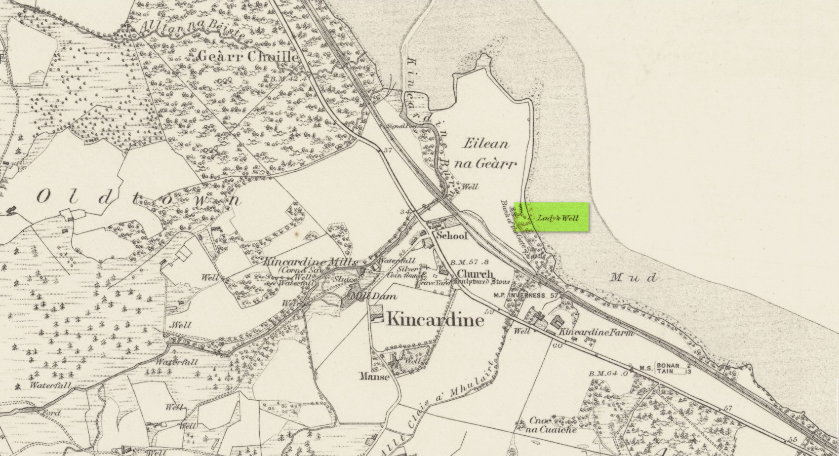
First highlighted on the 1879 Ordnance Survey map, information on this site is sparse, save for those reliable Statistical Accounts and Name Books, which simply give us its location. The only context that our Old Statistical lads gave us was its relationship and proximity to a castle, “the most ancient residence” of the Clan Ross Highland Chiefs which could “be seen in a beautiful field between the church and the sea side.” At the end of this field is “a steep bank, hanging over the sea at high water called the ‘Bank of the Gate’, and at the bottom there is a spring of excellent water, called the Lady’s Well.”
The water’s dedication to Our Lady was obviously grafted onto it by those in the church above, glossing over, no doubt, earlier dedications by local people, whose practices seem to have been lost. The site was included in the regional Name Book of the Ordnance Survey doods who, it seems, merely copied the notes about the place from the old Statistical Account. In what seems to have been their last visit, no trace of the well was evident. They concluded it “was under water at time of visit.”
It would be good to hear from local folk if this sacred site can still be found at the tree-line just above the sea, or whether Nature has taken it away from Her animals.
References:
- Gallie, Andrew, “Parish of Kincardine,” in Statistical Account of Scotland – volume 3 (edited by John Sinclair), William Creech: Edinburgh 1792.
Acknowledgements: Big thanks for use of the early edition OS-map in this site profile, Reproduced with the kind permission of the National Library of Scotland.
© Paul Bennett, The Northern Antiquarian