Corrycharmaig East (4), Glen Lochay, Perthshire

Cup-Marked Stone:  OS Grid Reference – NN 5311 3582  —  NEW FIND

Getting Here

Cup-markings to top & bottom of stone

Follow the same directions as if you’re going to the Corrycharmaig East 3 carving.  Walk off the rocky outcrop here, below the tree, and head diagonally across the boggy grasses back towards the River Lochay.  After about 50 yards you’ll see a rocky promontory ahead of you that overlooks the very edge of the river, with trees around it.  That’s the spot – right on the edge above the river!

Archaeology & History

Cup-markings on the Corrycharmaig East 4 stone

For me, this was the most intriguing of the newly-found Corrycharmaig East carvings.  Intriguing because this is on the same geological ridge as that on which the brilliant Stag Cottage carvings are found, right across on the other side of the river.  That singular rise of rock emerging from the field, heading to the river, continues on this side — though is much less conspicuous here, and is much smaller and covered with olde trees and Nature’s marshy greenery.  It was this fact which led me to look at these rocks in the first place…wondering if our neolithic ancestors had continued etching their mythographies on the other side of the living waters.  And so it turned out.

But don’t expect anything like as impressive as the Stag Cottage carvings.  Here instead, as the photos show, are just five distinct cup-markings: three running along one line near the SE side of the stone, with another two on its NW side.  The cups are all roughly the same size, being a couple of inches across; one is an inch deep.  There may be more beneath the excess of mosses along this and the adjacent rocks, but I didn’t look.

© Paul Bennett, The Northern Antiquarian


Corrycharmaig East (2), Glen Lochay, Perthshire

Cup-&-Ring Stone:  OS Grid Reference – NN 5294 3588

Getting Here

Faint cup-and-ring of Corrycharmaig East 2
Faint cup-and-ring

Follow the directions as if you’re visiting the other Corrycharmaig carvings, but as you cross the bridge over the River Lochay, turn immediately left and follow the edge of the river down the field till you reach the fence.  Go over here, but then head up the slope away from the river, over another fence up the small grassy hill ahead of you.  As you near the very top of the hill, you’ll find the stone in question.

Archaeology & History

Small overgrown cairn 10 yards away

Found near to the famous Stag Cottage and Duncroisk carvings, this previously unknown example is found on a small rounded female stone, barely 2 feet by 2 feet across.  The most notable feature is the large cup-marking, 2-3 inches wide and half-and-inch deep.  When I first found the stone, twas a cloudy grey day and I wasn’t sure whether a small carved arc along one edge of the cup continued into a semi-circle — but as the photo here shows, the cup-mark seems to have a large faint ring going about three-quarters of the way round it.  Hopefully I’ll get some better images of the stone when I visit again in the coming weeks.

The stone gave the impression that it belonged in a cairn of sorts, but a brief rummage in the grasses immediately around the rock showed nothing.  However, barely 10 yards down the grassy slope there was a small overgrown cairn — though it didn’t seem to have that prehistoric pedigree about it.  This carving is one in a group of at least four others—including Corrycharmaig East 3—not previously catalogued.  It’s likely that more remain undiscovered on the many other rocks nearby.

© Paul Bennett, The Northern Antiquarian


Corrycharmaig East 03, Glen Lochay, Perthshire

Cup-Marked Stone:  OS Grid Reference – NN 53056 35877 — NEW FIND

Getting Here

Cup-marked rocks of E.Corrycharmaig 3 (with the green hill of CE02 behind)

Follow the directions from Killin, down Glen Lochay, as if you’re going to the other Corrycharmaig carvings; but as you cross the bridge over the River Lochay, turn immediately left and follow the edge of the river along the field, crossing the first fence, keeping close to the riverside and over and over another fence.  Head across the boggy grassland and you’ll see a small green outcrop of rocks just above the tree-line above the river.  That’s the spot!

Archaeology & History

Two of at least 6 cup-markings on these mossy rocks

Another carving that’s a short distance from the famous Stag Cottage carvings on the opposite side of the river.  This lovely moss-covered rocky mass has two sections of cup-markings on it – both of which have proved difficult to photograph because of the vivid green primal cover.  It’s found less than 100 yards from the CE04 carving and below the hillock of the CE02 cup-and-ring (as you can see in the photo above).

The rock itself has two carved sections: an upper and lower section, with at least three cup-markings on the lower section and three on the upper portion as well.  Some natural geological marks on the lower part of the rock may have been added to, but this is by no means clear.  There may well be other elements to this ancient carving, but I wasn’t about to strip all the lovely moss from the stone just to find out.  It’s a truly beautiful stone in a gorgeous setting and, despite the day being grey and overcast, I wasn’t about to defile the greenery here.  It’s one of a group of at least four carvings east of Corrycharmaig that have not previously been catalogued.  Other carvings likely remain to be found close by.

© Paul Bennett, The Northern Antiquarian


Boiling Springs, Cambusbarron, Stirlingshire

Healing Wells (destroyed):  OS Grid Reference – NS 77 91

Archaeology & History

Old drawing of the lost wells

The old line drawing here is all that remains of a pair of healing wells that once bubbled up within their ancient stone well-houses, close to each other, in the middle of the old woods west of Stirling in the massive quarries at Gillies Hill.  It’s possible that the large pools of water that are now in the overgrown quarries are thanks to these ancient wells; although one of them was close to the old building of Fir Park, whose overgrown remains are within the woods at grid-reference NS 7787 9124.  Very little has been written about these wells, but thankfully the local historian Mr Fleming (1898) captured their demise in his lovely antiquarian work, saying:

“The sketch, opposite (taken in 1850) of the picturesque wells, then situated in a marshy dell and surrounded by a dense pine wood near to the ancient ‘Boiling Springs’, now dried up by the sinking of the lime pits, and immediately off the old bridle road from Stirling to Glasgow by Murrayshall, shows very ancient remains of wells connected with the original water supply of Stirling by lead pipes from ‘Lessfeerie Springs’, situated in the Touch Hills.  This supply was begun in 1774, and thus antiquity and interest are given to the sketch.  These wells, with their fringes of mosses and ferns and bramble bushes, are now, with the pine wood, demolished, and the whole face of the district changed by the operations in a quarry recently opened up in Gillies Hill crag, causing the locality to be now unrecognizable.”

References:

  1. Fleming, J.S., Old Nooks of Stirling, Delineated and Described, Munro & Jamieson: Stirling 1898.

© Paul Bennett, The Northern Antiquarian


Hawk Hill Cairn, Alloa, Clackmannanshire

Cairn:  OS Grid Reference – NS 8911 9282

Also Known as:

  1. Canmore ID 47168

Getting Here

The Hawk Hill cairn, Alloa

From the railways station, walk to the dual carriageway (crossing the road) and walk on the A907 road to your left; cross the next road & walk round the corner, crossing the next road by the zebra crossing. OK, walk to your right, bearing immediately left down Devon Road, then just 20 yards on take the footpath up the side of the house on your left, and keep walking until you go into the trees. Then keep your eyes peeled for the fairy mound with a rock on top of it!

Archaeology & History

Overgrown cairn, looking NE

This is a large rounded, almost archetypal tumulus, sitting just a couple of minutes walk out of Alloa town centre, sandwiched between streets in the remaining copse of trees running east-west along Hawk Hill.  Although the mound is of considerable size—with a large curious block of stone plonked on top—it hasn’t always been like that and has evidently been rebuilt sometime in the 20th century, for when the Royal Commission (1933) lads visited the site in July 1927, they reported only a bare trace of the old tomb, saying:

“The site of the cairn at Hawk Hill lies about 100 yds SSE of the lodge gate. The position is marked by a setting of young trees, but the ground has been cultivated and no definite outline of any structure can now be traced. A few loose stones of no great size, lying scattered about, are the only signs of a cairn.”

But the site is quite large, being more than 4 feet high and about 18 yards across, with a large flattened circular top.  Nearby there was reported to have been another cairn, but this turned out to be little more than some recent debris.

Folklore

Local folklore tells that this monument is along a ley line that links it with the Hawk Hill Cross and destroyed stone circle east of here and the remains of a little-known standing on the outskirts of Alloa, to the west. I’ve not checked the precision of this alignment, but a quick scan of it looks pretty decent!

References:

  1. Arabaolaza, Iraia, “Hawk Hill, Alloa,” in Discovery & Excavation in Scotland, New Series volume 10, 2009.
  2. Royal Commission on the Ancient & Historical Monuments, Scotland, Inventory of Monuments and Constructions in the Counties of Fife, Kinross and Clackmannan, HMSO: Edinburgh 1933.
  3. Royal Commission on the Ancient & Historical Monuments, Scotland, The Archaeological Sites and Monuments of Clackmannan District and Falkirk District, Society of Antiquaries of Scotland 1978.

© Paul Bennett, The Northern Antiquarian


St. Corbet’s Well, Touch, Stirlingshire

Holy Well:  OS Grid Reference – NS 738 925

Archaeology & History

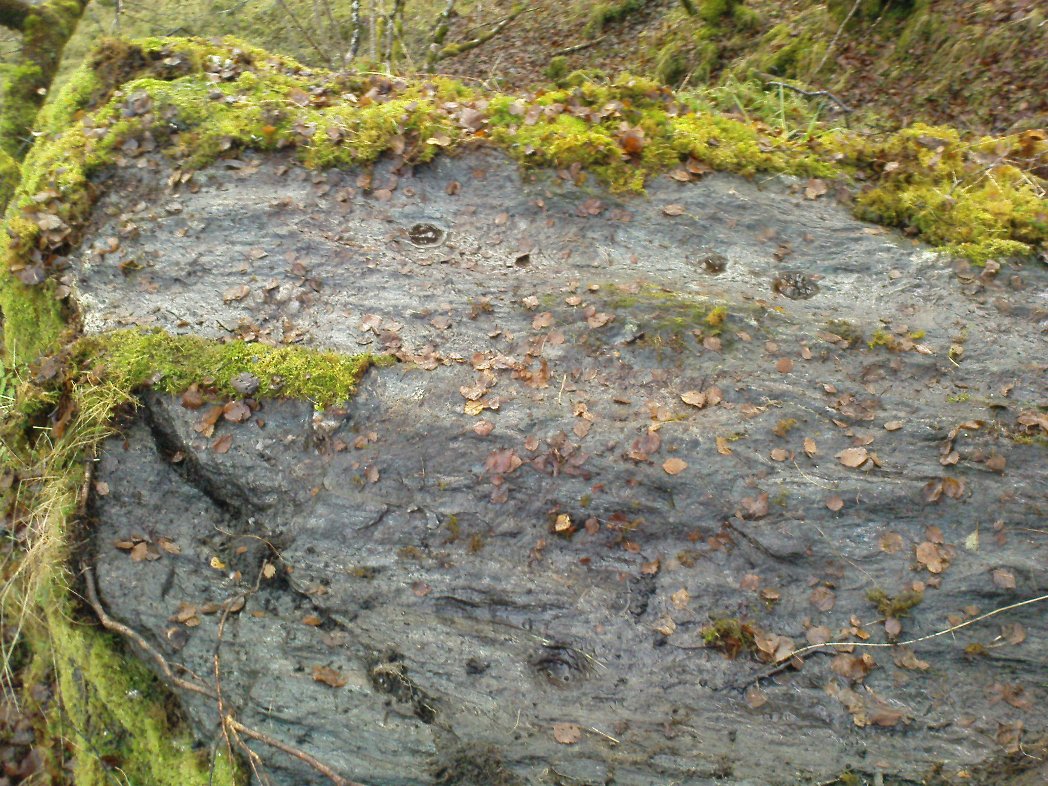
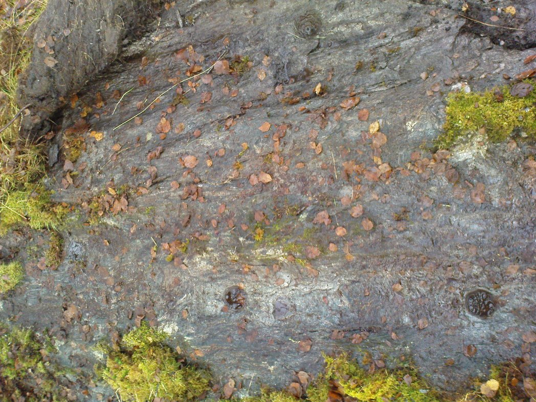
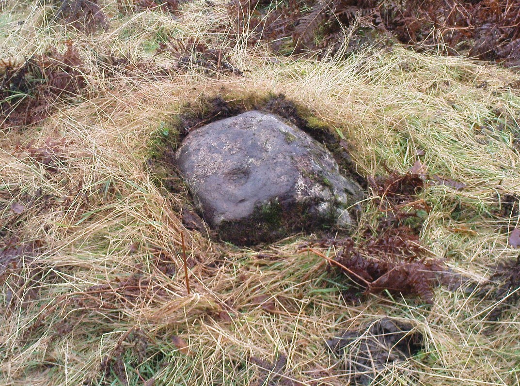
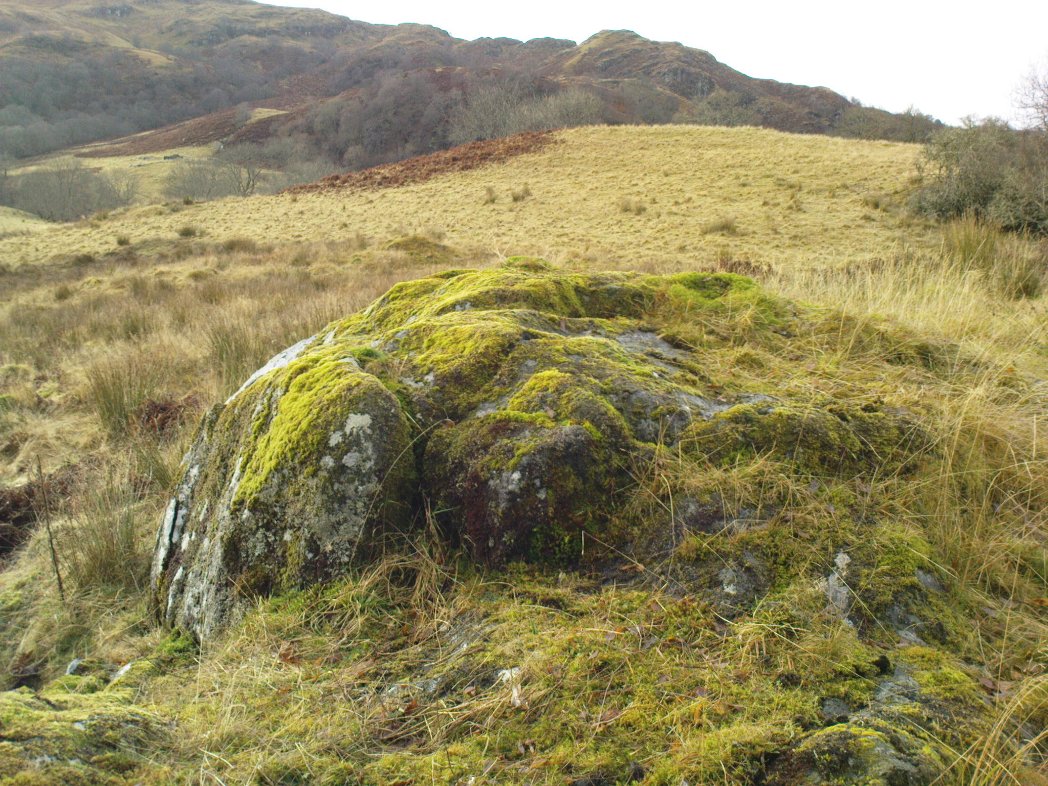
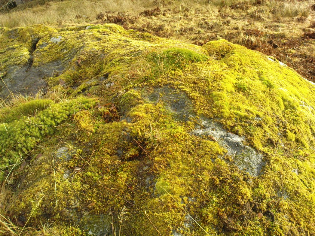
This little-known holy well on the northeastern edges of the Touch Hills is another part of our ancient heritage that may well have been lost.  All that now remains are the literary remnants telling of this once important site, around which local socio-religious elements occurred from time to time.  When the local historian J.S. Fleming (1898) wrote about the site, it had already disappeared, and was himself fortunate to recover information relating to its former existence. He told:

“My attention has been drawn to an article which appeared in the Stirling Journal of 31st October, 1834, describing what is claimed to be a Holy Well dedicated to Saint Corbet, or probably Saint Cuthbert.  The well was situated in Touch Glen, not far from Gilmour’s Lynn, and was, even at that time, reduced to a spring one foot deep and three or four feet in circumference, surrounded by boggy ground.  The writer states that there were people then alive who had resorted to this Well in their younger days.  Its virtues were restricted to one hour in the year, and that the hour of sunrise on the first Sabbath of May; the supposition being that by drinking of its waters at the Well by the adventurous pilgrims to such a wild and lonely spot at early sunrise, the devotee was assured of the preservation of his life during that year.  We have never come across this Saint’s name, but Saint Cuthbert had an altar in the Rude Kirk (High Church of Stirling) and, as for the Well, from its diminishing condition in 1834, its site no doubt has long been obliterated.”

It is possible that some remnant of the waters here can still be found, or are known about, by dedicated local practitioners—but without their aid, this sacred site may be forever lost…

Folklore

In Thomas Frost’s (1899) essay on the holy wells of Scotland, he echoed what Mr Fleming had told, saying:

“Of St. Corbet’s Well, on the top of the Touch Hills…it was formerly believed that whoever drank its water before sunrise on the first Sunday in May was sure of another year of life, and crowds of persons resorted to the spot at that time, in the hope of thereby prolonging their lives.”

This restorative folklore element, implicit in the nature of water itself, was obviously related to the cycles of renewal in the social activity of our peasant ancestors, as found in every culture all over the world. (Eliade 1959; 1989)

One account relating to the disappearance of St. Corbet’s Well told that it fell back to Earth as the spirit of the site was insulted by profane practices.  Janet & Colin Bord (1985) told that:

“This theme, of real or imagined insult to the well causing it to lose its power, move its location, or cease flowing altogether, is widespread.  St. Corbet’s Well on the Touch Hills (Stirling) was said to preserve for a year anyone who drank from it on the first Sunday in May, before sunrise, and it was visited by great crowds at the height of its popularity.  But the drinking of spirits became more popular than the drinking of well water, so St. Corbet withdrew the valuable qualities of the water, then eventually the water itself stopped flowing.”

References:

  1. Andrews, William (ed.), Bygone Church Life in Scotland, W. Andrews: London 1899.
  2. Bord, Janet & Colin, Sacred Waters, Granada: London 1985.
  3. Eliade, Mircea, The Sacred and the Profane: The Nature of Religion, Harcourt, Brace & World: New York 1959.
  4. Eliade, Mircea, The Myth of the Eternal Return, Arkana: London 1989.
  5. Fleming, J.S., Old Nooks of Stirling, Delineated and Described, Munro & Jamieson: Stirling 1898.
  6. Frost, Thomas, “Saints and Holy Wells,” in Bygone Church Life in Scotland (W. Andrews: Hull 1899).
  7. Morris, Ruth & Frank, Scottish Healing Wells, Alethea: Sandy 1982.
  8. “W.H.”, “St Corbet’s Well,” in The Stirling Antiquary, volume 3, 1904.

AcknowledgementsWith thanks to Ray Spencer for pointing out the Sacred Waters reference. Cheers Ray!

© Paul Bennett, The Northern Antiquarian


Standing Stone, Linlithgow, West Lothian

Standing Stone (destroyed):  OS Grid Reference – NS 99 77

Archaeology & History

Not included in the Canmore listings, nor that of the Scottish Royal Commission (1929), this lost standing stone once stood somewhere in Linlithgow town itself.  It was referred to in the huge but obscure Registrum Magni Sigili Regum Scotorum from 1586 through to 1614 as one of the street-names in the town, written several times as ‘Standandstane’ — which, as MacDonald (1941) told in his fine survey, means literally a “Standing Stone.”  The place was also referred to several times in other local accounts, dating from 1664, but was last mentioned in 1699 and, it appears, disappeared soon afterwards.

Perhaps some record of the site may be available in local witchcraft or folklore accounts.  Does anybody know?

References:

  1. MacDonald, Angus, The Place-Names of West Lothian, Oliver & Boyd: Edinburgh 1941.
  2. Royal Commission on the Ancient & Historical Monuments of Scotland, Inventory of Monuments and Constructions in the Counties of Midlothian and West Lothian, HMSO: Edinburgh 1929.

© Paul Bennett, The Northern Antiquarian 


St. Fillan’s Well, Comrie, Perthshire

Holy Well: OS Grid Reference – NN 7080 2327

Also Known as:

  1. Well of St. Fillans

Archaeology & History

Found by the legendary hill of Dundurn, east of Loch Earn, this legendary healing site has been written about by many historians, both local and national. An early account of it was given by the local priest, Rev. Mr McDiarmid, minister of the parish of Comrie at the end of the 18th century, who informed those compiling the Old Statistical Account of the area, the following information:

“This spring, tradition reports, reared its head on the top of Dun Fholain (Fillan’s Hill) for a long time, doing much good, but in disgust (probably at the Reformation) it removed suddenly to the foot of a rock, a quarter of a mile to the southward, where it still remains, humbled, but not forsaken. It is still visited by valetudinary people, especially on the 1st of May and the 1st of August. No fewer than seventy persons visited it in May and August, 1791. The invalids, whether men, women, or children, walk or are carried round the well three times in a direction Deishal—that is from east to west, according to the course of the sun. They also drink of the water and bathe in it. These operations are accounted a certain remedy for various diseases. They are particularly efficacious for curing barrenness, on which account it is frequently visited by those who are very desirous of offspring. All the invalids throw a white stone on the Saint’s cairn, and leave behind them as tokens of their gratitude and confidence some rags of linen or woollen cloth. The rock on the summit of the hill formed of itself a chair for the Saint, which still remains. Those who complain of rheumatism in the back must ascend the hill, sit in this chair, then lie down on their back, and be pulled down by the legs to the bottom of the hill. This operation is still performed, and reckoned very efficacious. At the foot of the hill there is a basin made by the Saint on the top of a large stone, which seldom wants water even in the greatest drought, and all who are distressed with sore eyes must wash them three times with this water.”

We see from this early account that there’s a discrepancy regarding the location of St. Fillan’s Well, as the modern accounts indicate it to be at the top of the craggy hill. In some upland regions this occurred so as to maintain a sense of secrecy about the location of local sites, so ensuring they were not affected or disturbed by outsiders or incomers, who not only disrespected local customs and rites, but tried changing or altering them to their new ways. It also kept the local gods and spirits of the sites protected from tourism and the profane. This may explain the difference in locations described by Rev. McDiarmid.

About one hundred years after McDiarmid’s account, another priest called Tom Armstrong (1896) wrote a piece in the Chronicles of Strathearn (1896) all about this holy well, saying:

“People are prone to believe that the dirty pool of stagnant water which still remains in the driest summer on the top of St. Fillan’s Hill is the famous spring to which pilgrims at one time resorted. Any one who examines it will not fail to observe that it has all the appearance of an artificially built well, and must have been kept in order and preservation for a purpose. Tradition confirms the belief that this was at one time the well, but not always.”

The hill on which it is found was an ancient dun or fort, built in prehistoric times, making you wonder how far back in time its magickal abilities were known about.

References:

  1. Armstrong, Thomas, “By the Well of St. Fillan,” in Chronicles of Strathearn (David Phillips: Crieff 1896).
  2. Gordon, Seton, Highways and Byways in the Central Highlands, MacMillan: London 1948.
  3. Hunter, John, et al, Chronicles of Strathearn, David Phillips: Crieff 1896.
  4. Morris, Ruth & Frank, Scottish Healing Wells, Alethea: Sandy 1982.

© Paul BennettThe Northern Antiquarian


Castle Campbell, Dollar, Clackmannanshire

Cup-Marked Stone:  OS Grid Reference – NS 9613 9928

Getting Here

Cup-markings at Castle Campbell

From Dollar, take the steep road up to Castle Campbell (ask a local if you get lost).  When you’ve got into the building and paid your fiver, walk straight forward as if you’re heading to the front gardens, but stay within the castle by walking left on the inner-front section of the building, all the way along to the dark room in the far corner at the end of the path.  Just before you walk into the end room, look at the ground rock beneath your feet.

Archaeology & History

My first and only visit to the superb half-restored ruins of Castle Campbell was in the company of the author Marion Woolley.  It was a damn good day and the castle here is really worth checking out!  But as Marion and I wandered the grounds and internal remains, my eyes caught sight of what looked like a cluster of cup-markings, never previously recorded, on a section of earthfast rock over which a section of the Castle had been built.

A distinct arc of at least four cup-marks was accompanied with outlying single cups on either side of it.  Beneath the gravel it seemed that more were waiting to be be unearthed—but we left them alone.  As you can see in the photo here, the cup-marks seem typical of those we find in their thousands across northern Britain.  However, the rock hereby is volcanic and conglomerate and may be the result of such natural processes.  I’m truly not sure.  A local archaeologist in Stirling thought the carving looked authentic – but we need to return here and brush off the rest of the gravel to see in greater detail the extent of the cups.  There seemed to be more of them hiding at the edges.

If anyone finds out more about this, or gets some better photos, or ascertains this as a simple geophysical artifact, please lemme know.

© Paul Bennett, The Northern Antiquarian


Tomochrocher, Glen Lochay, Perthshire

Cup-Marked Stone:  OS Grid Reference – NN 457 359  —  NEW FIND

Getting Here

The stone in its setting

From Killin heading out along the northern Loch Tay road, turn left just past the Bridge of Lochay hotel and go right to the very end of Glen Lochay, just past Kenknock.  From here you’ve gotta keep walking along the glen’s dirt-track, and when you go through the third gate along (about a mile), another 100 yards on, keep your eyes peeled for a reasonably large boulder on the left of the track. This is your marker to go up on the right-hand side of the track, where the large stone is about 20 yards up the slope.

Archaeology & History

Three cup-marks & their lichen

Not far from a prehistoric hut circle relocated by archaeologist Dugald MacInnes I found this, a previously unrecorded cup-marked stone, when I was ambling about around the top of this beautiful valley last week.  It’s only a simple cup-marked stone with two very distinct cups and a probable third in the middle of the well-defined ones.  A covering of aged lichen was living on the carved rock and it seemed that there may have been other cups beneath the lichen — but I’ve got a real love of these old plants and wasn’t about to tear them from their homely stone.

There are some other little-known unrecorded human remains all along the slopes above here, which I’ll have a look at when next up this Valley of the Black Goddess…

© Paul Bennett, The Northern Antiquarian