Holy Well (destroyed): OS Grid Reference – NT 4598 4454
Archaeology & History
At the edge of the ruins known as the Bishop’s Palace, up the slope behind the ruined church in Stow, could once be seen the waters of the Bishop’s Well which, wrote Thomas Wilson (1924), fed the palace hereby and was used by the clergy. Apart from a barely discernible circular depression at the edge of the old manse ruins, no trace of this site remains.
References:
Royal Commission Ancient & Historical Monuments, Scotland, Inventory of Monuments and Constructions in the Counties of Midlothian and West Lothian, HMSO: Edinburgh 1929.
Wilson, Thomas, The Stow of Wedale, Aberdeen Newspapers 1924.
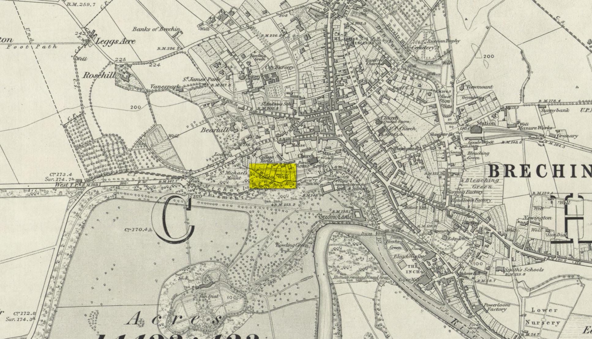
Highlighted on the 1865 OS-map, this lost water source was located between the Brechin cathedral/round tower and the curiously-named St. Michael’s Mount, whose history seems to be lost. It would seem to be the well which Ruth & Frank Morris (1981) name as the ‘Ancient Well’ in their survey.
Folklore
The reason behind this site being classified as a sacred (or holy) well is based on the tradition that the Culdees had a religious convent here in the 12th century and, according to David Black (1839),
“This convent is believed to have stood a little to the west of the present parish church, in the gardens now belonging to the kirk-session, still called “the College Yards.” A small well of delightfully pure water in these gardens receives the name of the College Well, and is reported, by tradition, to have been the well of the Culdee convent.”
On the issue of St. Michael, students of folklore will know that, in the christian cult, he was an early dragon-slayer. His annual commemoration day is September 29. One of his shamanistic functions “relates to the very old tradition of Michael as the receiver of the souls of the dead.” (Attwater 1965)
References:
Black, David D., The History of Brechin, Alexander Black: Brechin 1839.
Gibson, Colin, Folklore of Tayside, Dundee Museum c.1968.
Acknowledgements: Huge thanks for use of the 1st edition OS-map in this site profile, Reproduced with the kind permission of the National Library of Scotland.
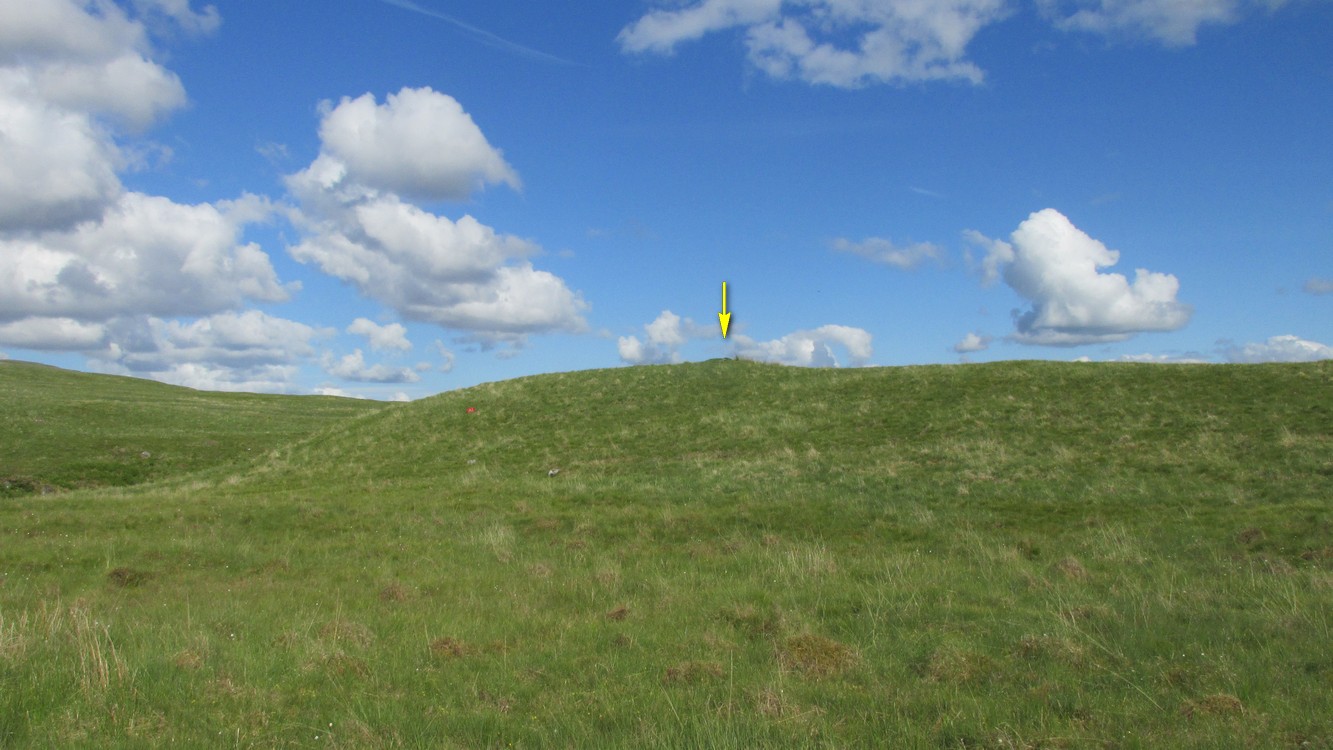
This is a helluva long way to walk to find such a small site, but the landscape makes it all the worthwhile. So… From Callander, head up the Bracklinn Falls road, going past the car-park there and on for 1½ miles, watching for the track on your left where you park-up. Walk down the track, over the river, then uphill until another track veers to your left. Follow this for nearly a mile until meeting another track that veers right. 4-500 yards along, on the same side as the burn on your left, the hill slopes up where a small grassy mound sits on its ridge. That’s it.
Archaeology & History
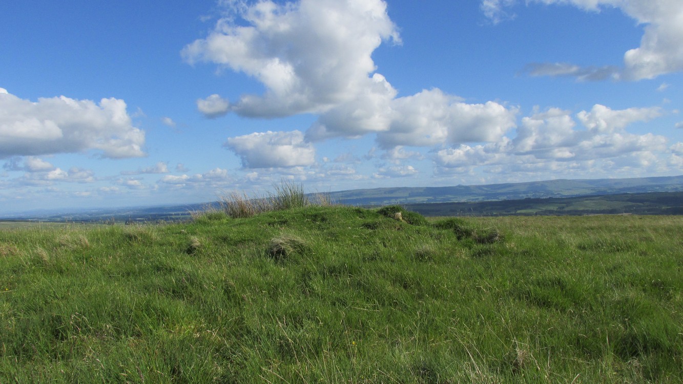
From the cairn to the SE
This site is likely to be of interest only to the hardcore antiquarians amongst you. It’s a small singular cairn sitting on a small hillock of once woodland-clad grasslands, a few hundred yards east of the much-ruined chambered cairn of West Bracklinn. Much of it is covered in vegetation, but sections of its stone structure are visible mainly on its south sides. Measuring 6 yards across and less than a yard high, it has been classed by Historic Scotland as Bronze Age in nature, although no excavation has been done here.
Reference:
Royal Commission Ancient & Historical Monuments of Scotland, Braes of Doune: An Archaeological Survey, RCAHMS: Edinburgh 1994.
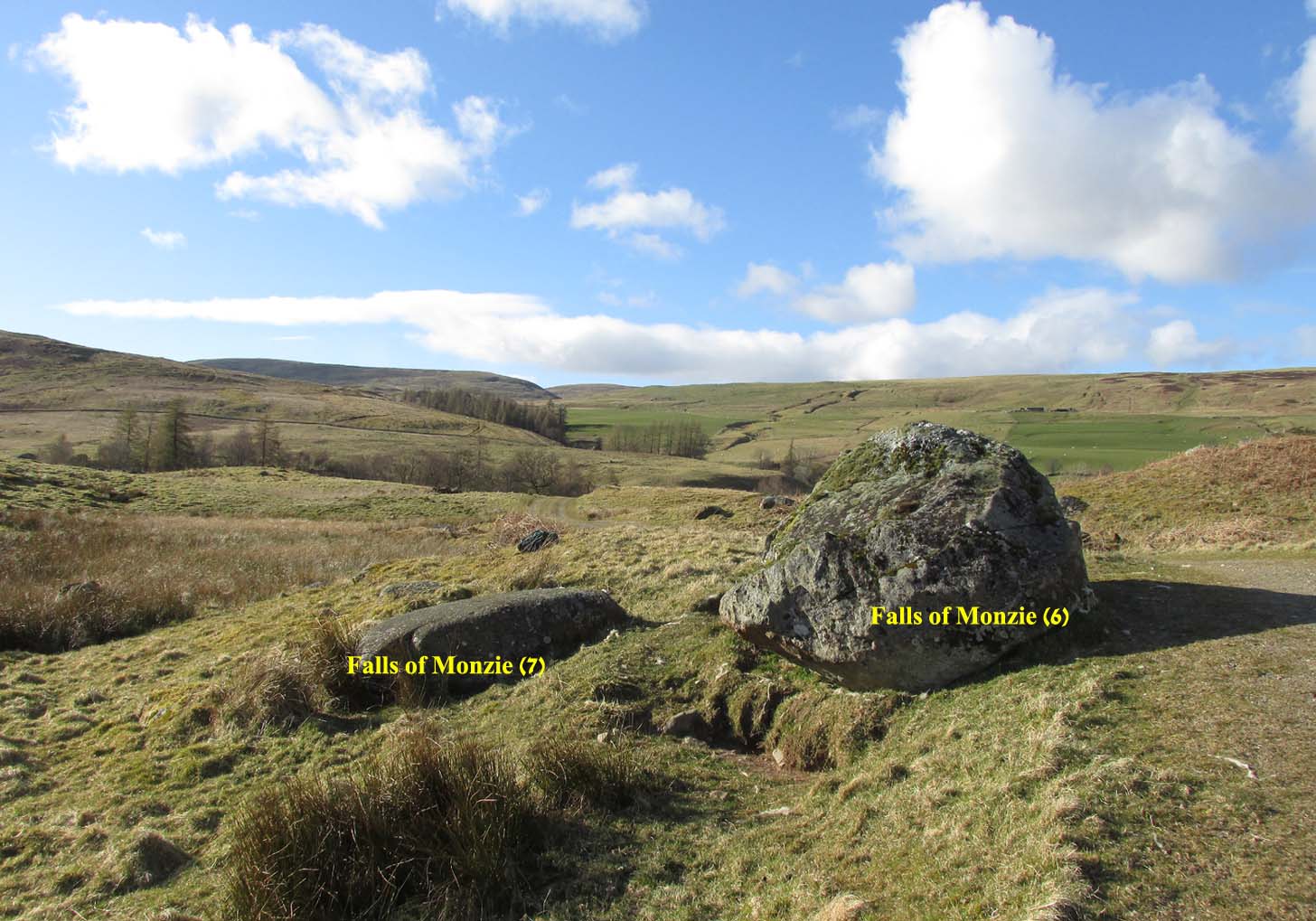
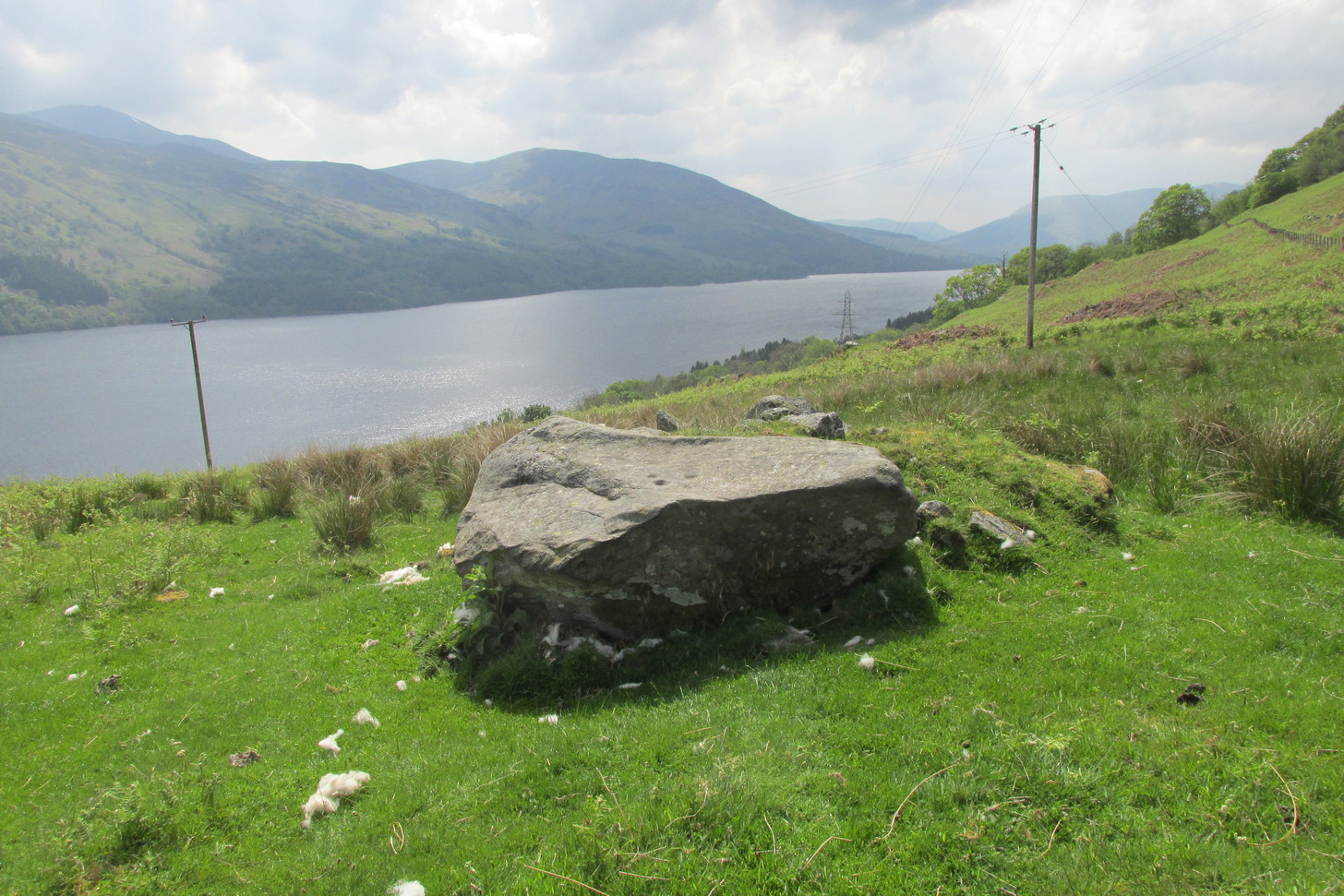
A couple of miles east of Crieff, take the A822 road from the Gilmerton junction towards the Sma’ Glen. After literally 1¾ miles (2.8km)—just 100 yards before the track up to Connachan Farm—you’ll reach a dirt-track on your left that leads into the hills. Go on here and after an easy walk of 400 yards or so, you’ll reach the conspicuous boulder known as the Falls of Monzie (6) stone. Two or three yards to its side is a large flat stone. That’s it!
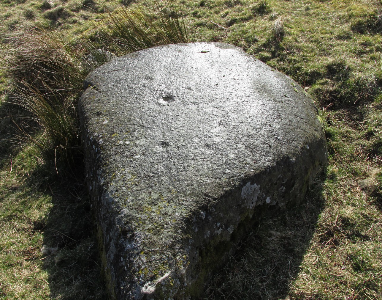
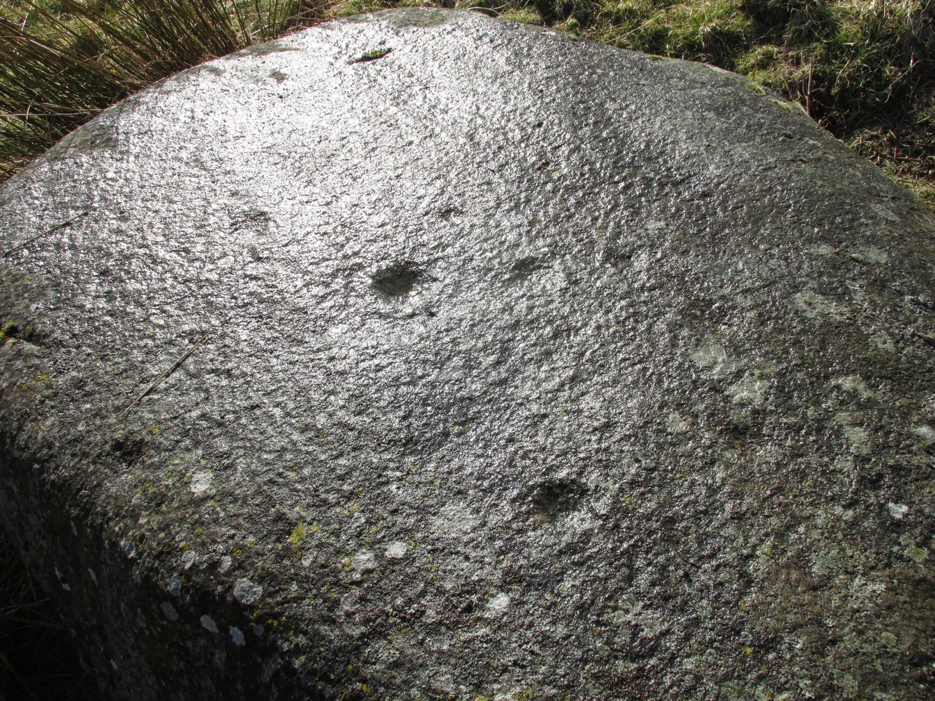
Archaeology & History
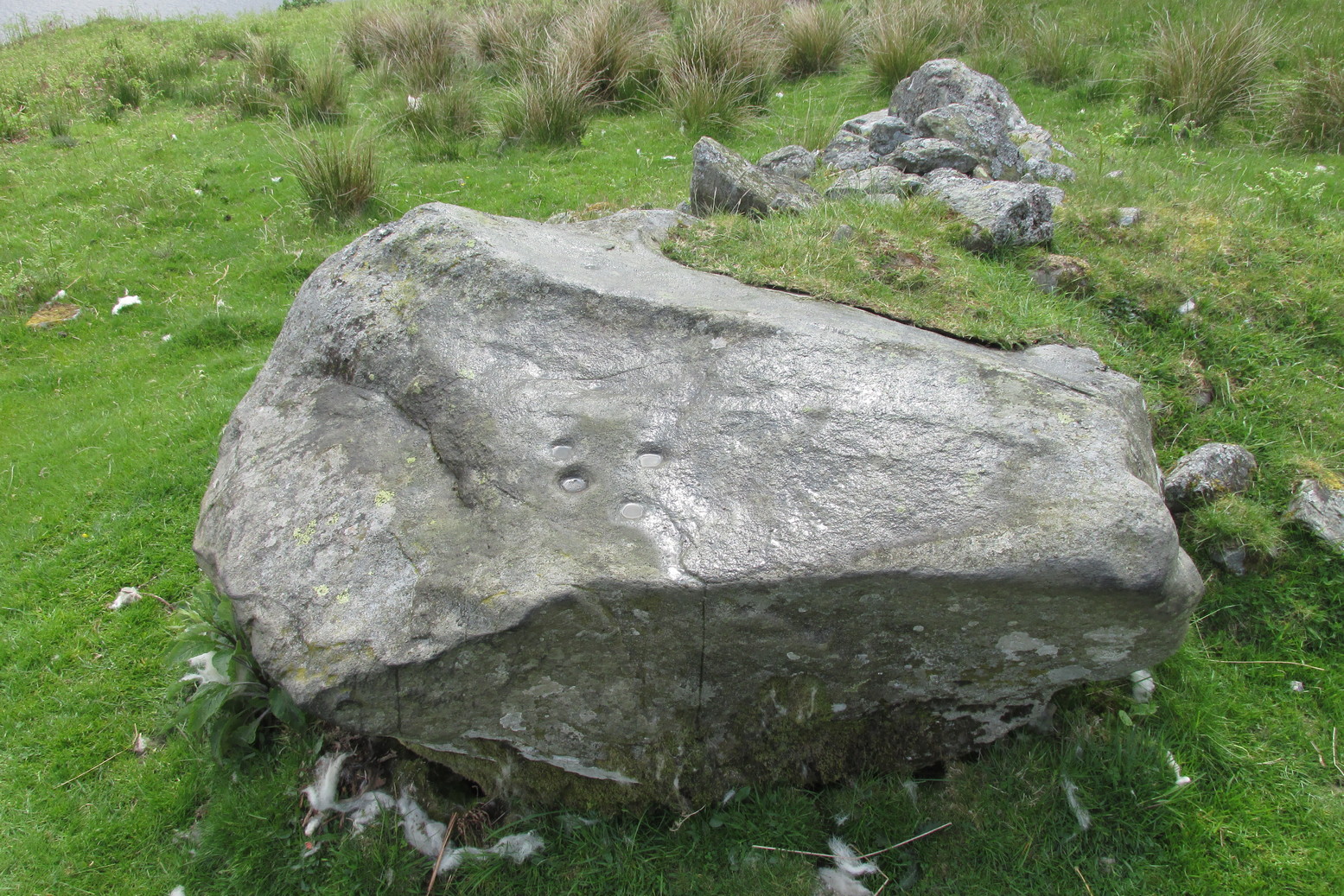
This large flat smooth earthfast rock, is possessed of a number of very faint cup-marks. Altogether there are at least nine cup-marks, most of which are closing in to the middle of the stone, with other single cups near the western and southern edges.
The faint cupmarksClose-up of cups
Near the middle of the rock, one cup has an equally faint semi-circular arc, just visible on the photos here. Close-up photos of this semi-circle seem to suggest it was more complete in ages gone by, but the erosion is such that it’s difficult to say with any certainty. (possibly the computer-tech kids could give us a bit more certainty). The nearest other carving with more definite cup-and-rings can be found on the Falls of Monzie (8) stone, about 200 yards to the west.
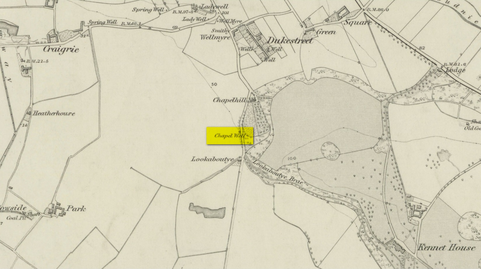
A little-known holy well on the south-side of the village has seen better days – if indeed it’s still there! Located 500 yards due south of the destroyed Lady Well, this spring of water gained it name, according to local lore, from its proximity to an ancient chapel—remains of which have been frugal to say the least! Shown on the earliest Ordnance Survey maps and continued to be shown until the 1950s, it seems that the first written account of it was in the Object Name Book of 1861 where it was told:
“A Spring well adjacent to Chapelhill. It is cut in a freestone rock, from which issues a constant supply of pure spring water even in the dryest Seasons. It is not impregnated with any Kind of Mineral. A Chapel Stood near it at one time, the site of which Cannot be pointed out by any person in the neighbourhood.”
A visit by one of the Ordnance Survey lads here in 1950 found the well to be blocked-up by silt and soil; and on a quick visit I made here today I could find no remains of the well, but it may have been beneath the mass of excessive vegetation. A subsequent visit in the winter may prove more fruitful – he sez, hopefully…..
A small and seemingly prehistoric grave, or cist, destroyed sometime around 1840, once existed on the top of a large hillock close to the River Carron where the bridge leads from Dunipace to Denny. Thankfully, memory of its existence was preserved by Robert Watson (1845) in his short description of Dunipace parish. He first began by talking of some large natural mounds on the eastern side of the township which, folklore told, gave rise to the place-name Dunipace; but from those mounds,
“About two miles to the westward of these hills, there was a very beautiful one about forty feet in height, and covering nearly three roods of ground, said also to be artificial. This hill was mutilated, from time to time, for the purpose of repairing roads and other purposes. It was entirely removed about six years ago, to form an embankment on the turnpike road near Denny bridge. The strata of which this hill was composed, were carefully observed during its removal. These were so regular, and as if rising out of, and gradually returning again to similar strata in the circumjacent level ground, as to afford conclusive evidence that the hill was not the work of man. On the top of this hill, and about three feet below the surface, was found a coffin or tomb, composed of five large un wrought stones, in which were the bones of a human body, scull and teeth not much decayed. Along with these, was a vase of coarse unglazed earthenware, containing a small quantity of material resembling the lining of a wasp’s nest, probably decayed paper or parchment, which in the lapse of ages had assumed that appearance. No conjecture could be formed about the individual here interred, tradition being entirely silent on the subject ; but this circumstance corroborates the opinion of some writers, that the hills of Dunipace might have been used as burying-places for ancient chiefs.”
The site was included in the Royal Commission’s (1963:1) Inventory, but they found no additional data about it.
References:
Royal Commission on the Ancient & Historical Monuments Scotland, Stirling – volume 1, HMSO: Edinburgh 1963.
Royal Commission on the Ancient & Historical Monuments of Scotland, Archaeological Sites and Monuments of Stirling District, Central Region, Society of Antiquaries of Scotland 1979.
Watson, Robert, “Parish of Dunipace,” in New Statistical Account of Scotland – volume 8, William Blackwood: Edinburgh 1845.
Healing Well (lost): OS Rid Reference – NS 579 884
Archaeology & History
One-and-a-half miles east of Balfron, this curiously-named well could once be seen – and indeed may still be there. Mentioned just once in D.S. Buchanan’s (1903) Guide as a well-known place, I’ve been unable to locate it and can find no other accounts of the place. He wrote:
“A little beyond Dailfoil there is a road to the right, down which, about 200 yards, there is a stile over the fence, only a few feet from the famous Gerchew Well, on the banks of the Endrick. Here the visitor can repose for a time under the shade of the trees, and quench his thirst in its pure, cool, and bubbling waters.”
His directions seem to indicate it as being just off the small road that runs to the ruins of Easter Gerchew, but there is nothing of note hereby. A half-mile away was Wester Gerchew house, which seems contrary to his directions —and there’s nothing in evidence there either. And so I enter it here in the hope that someone might be able to relocate this healing well. (the grid reference is an approximation based on Buchanan’s description)
References:
Buchanan, D.S., Buchanan’s Popular Illustrated Guide to Strathendrick, Aberfoyle and District, J. & C. Buchanan: Balfron 1903.
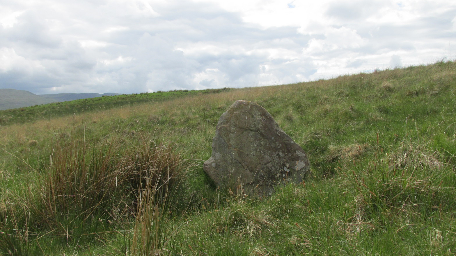
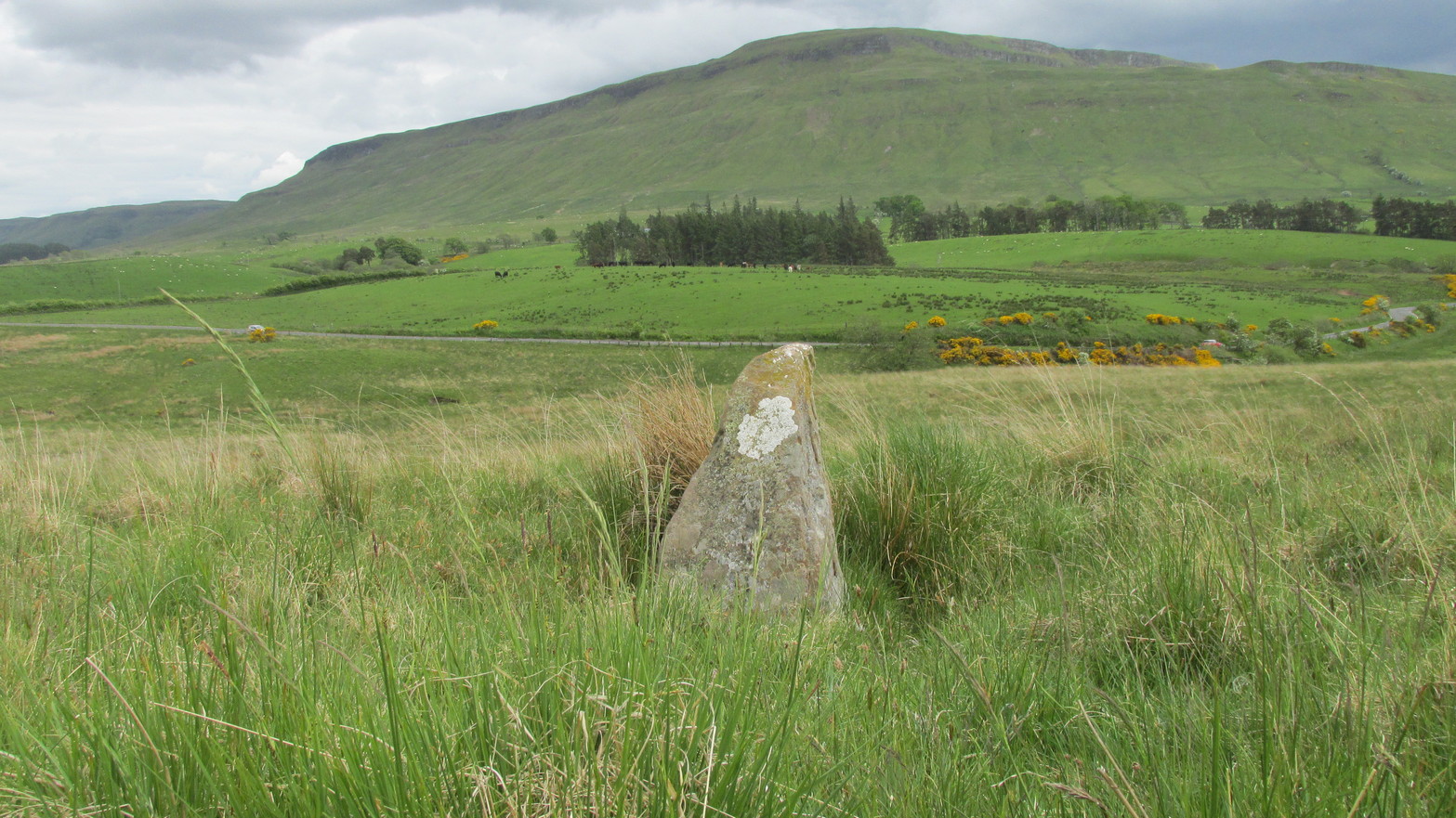
Go up the B822 road from Fintry for literally 2.5 miles (about 500 yards below the small copse of trees that almost hide Balafark Farm above you) and at a very small ‘parking’ spot are 2 farm-gates. Go through the lower of the two and head downhill, crossing the small burn and up the other side for just over 100 yards where you’ll meet a very low, old and very overgrown wall. Keep your eyes peeled for it! Walk left along this wall, uphill, for another 100 yards till you meet a a dried-up dyke that runs downhill. 10-15 yards down this, a small stone greets you…
Archaeology & History
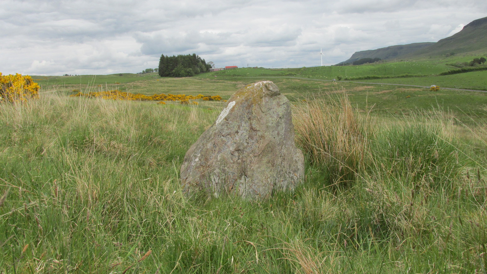
It’s difficult to call this a ‘standing stone’ and, as far as I’m concerned, is even more troublesome to cite it as a legitimate prehistoric monument. Nevertheless it is shown on the modern OS-maps as such and was listed by the Royal Commission (1963:1) lads in their standing stones inventory. But it’s really pushing it to be honest! They told us:
“This stone stands about 180 yds NW of a gate which opens off the Fintry-Kippen road, 340 yds N of its crossing of the Lernock Burn. It is triangular in profile and wedge-shaped in section, measuring 3’3″ both in height and breadth along its base, by 1’7″ in greatest thickness. It may well have been a boundary stone as it is near the corner of some ground which is enclosed by a turf dyke and has been cultivated.”
Looking southwestLooking up to the ancient cairn of Stronend
In truth, if we call this a standing stone, then there are hundreds of others that I’ve come across over the years—frobbling off-path across huge swathes of moorland—that must also be added to our prehistoric inventories, as the height of this isolated rock is echoed in countless others which are off the archaeological listings. One such stone ‘stands’ 100 yards northeast of here—although there are many others with much greater potential. …I think the only thing that may sway this as being a possible prehistoric upright is the fact that the top of the stone appears to have been broken off, albeit a few hundred years ago if the weathering is owt to go by. But a cursory look for any broken top-piece found nothing.
References:
Royal Commission on the Ancient & Historical Monuments Scotland, Stirling – volume 1, HMSO: Edinburgh 1963.
Follow the same directions as if you’re visiting the Wester Glentarken (1) carving, but some 10-15 yards before reaching it, you’ll notice this smaller rock with a series of curious naturally-eroded features on it.
Archaeology & History
This rounded stone has a series of natural deep cracks and undulating geological features on its surface, some of which look like elongated man-made cup-marks—but they’re not! The only man-made ingredient on this stone is the deep single cup-mark close to the centre of the stone, as you can see in the photo. That’s it—nowt else!
1½ miles out of St Fillans on the A85 road to Lochearnhead you’ll reach the boating marina by the lochside. A hundred yards or so past this, park up. Cross the road and walk 50 yards to your right then follow the dirt-track up into the trees. After ⅓-Mile (0.5km) turn left to the old house on your left and follow the green path around it, then around the right-side of the rocky knoll in front of you. Once you’re on the level ground around the knoll, walk forward for less than 100 yards. Y’ can’t really miss it!
Archaeology & History
4 of the 5 main cups
A simple design, but a clear one, of four deep cup-marks which can be seen on the eastern side of the stone, with a solitary one—much more faint—just over the rise on the more western section of the rock.
There are a number of other large sections of rock around the knoll with what appear to be cup-markings of various forms, but apart from perhaps one or two exceptions, the vast majority of them—as Currie (2005) also noted—seem to be natural.
References:
Currie, George, “Wester Glentarken, Perth and Kinross (Comrie parish), cup-marked rocks,” in Discovery & Excavation Scotland, vol. 6, 2005.
 At the edge of the ruins known as the Bishop’s Palace, up the slope behind the ruined church in Stow, could once be seen the waters of the Bishop’s Well which, wrote Thomas Wilson (1924), fed the palace hereby and was used by the clergy. Apart from a barely discernible circular depression at the edge of the old manse ruins, no trace of this site remains.