Healing Well: OS Grid Reference – NS 68613 65094
Archaeology & History
This old well, named after Queen Mary (one of at least three dedicated to her in Lanarkshire), was illustrated on the earliest Ordnance Survey map of the area in 1864. Local tradition tells us that the site gained its name when the great Mary Queen of Scots visited this old healing well, amidst a period when she stayed at Provan Hall 1½ mile away. Both she and her horse stopped and drank here for refreshment.
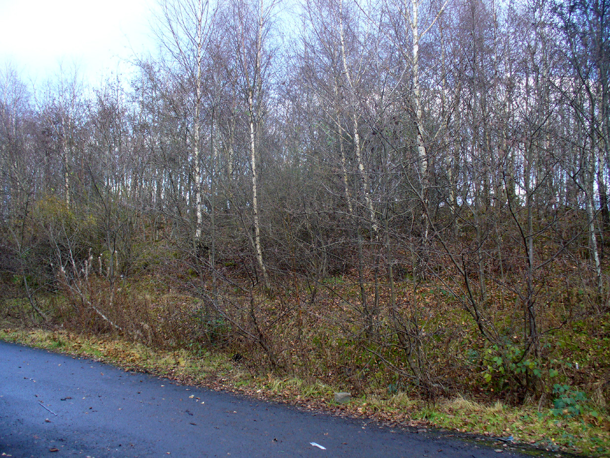
In the 19th and early 20th century, the well was converted into a pump and supplied the water to a row of cottages that used to be here. When we visited the site yesterday, no trace of the pump, nor any spring of water could be found. It seems that a huge pile of industrial crap has been piled on top of the well, then trees planted to give the impression that Nature has taken back the place. The well seems to have been completely destroyed (the photo here shows the spot where the well should be, just a few yards into the young trees). Due to this site being an important part of Scotland’s heritage, its ignorant destruction must be condemned.
Acknowledgements: Big thanks to the team – Nina Harris, Paul Hornby and Frank Mercer – for their work here. And to Dan Holdsworth and John Bestow for their additional input.
© Paul Bennett, The Northern Antiquarian
Reblogged this on Irish history, folklore and all that.
Actually if you look at the old maps of the area, the last time the well site is named is on the 1899 map. On the 1912-13 town plans, the symbol WT crops up rather a lot; this apparently means “Water Tap”. Glasgow started to be supplied with a public source of water around about 1850 or thereabouts, first from the river Clyde and later from loch Katrine further away.
This too proved inadequate, and the second phase of the Loch Katrine project came on line in 1901. Throughout all this time, water mains were being built and water was being supplied to more and more of Glasgow, hence a lesser reliance on natural spring sources.
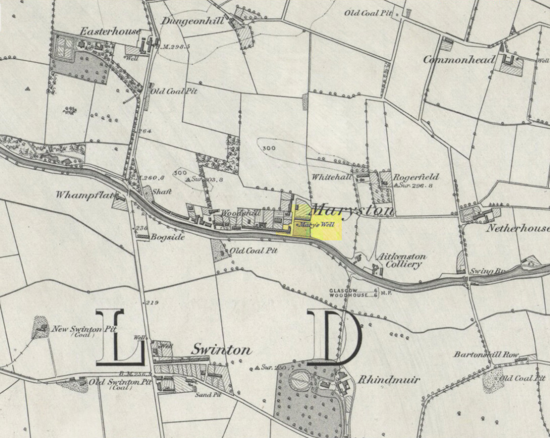
St Mary’s Well is in an interesting geological area. It is at the bottom of a gentle hill, sloping down from the north. Immediately to the north the bedrock is an igneous intrusion, the well its self is in coal measures. Water generally runs downhill, so the well’s catchment area is quite small, and the water is mostly surface water filtered through rock. It is therefore quite likely that as the industrial revolution went on, and local small coal pits proliferated then were abandoned, that the well either dried up or became much less wholesome to drink; mains water supply would have led to abandonment over a century ago.
I grew up not far from here in Denmilne St. and often played in the fields between Rogerfield Rd and Denmilne St and in the ruins of what I now know was Maryston. On the East side of Rogerfield Road, where it turns north, away from the motorway/canal route, there was a coalyard, (Hamilton’s?) The front section of this area is, as your picture shows, now planted with trees. However, on the section of map included in the article the well seems quite a bit back from the road. A check of Google Maps for that area shows behind the trees what could be a damp patch of ground where the water from the well can still be seen. See https://www.facebook.com/john.bee.14473..