The Whetstones, Churchstoke, Montgomeryshire

Stone Circle (destroyed):  OS Grid Reference – SO 303 976

Archaeology & History

Although geographically closer to the village of Priest Weston, this site — when still in existence — was in the parish of Churchstoke.  To be found a half-mile west of White Grit (near the famous Mitchell’s Fold megalithic ring and standing very close to the local boundary line), the Welsh Royal Commision report (1911) told that its position was, “at the foot of the northern slope of Corndon Hill, and close to a stile on the south side of the road near the turning to Cliffdale Mine.” Found close to a number of other prehistoric remains, the Report told:

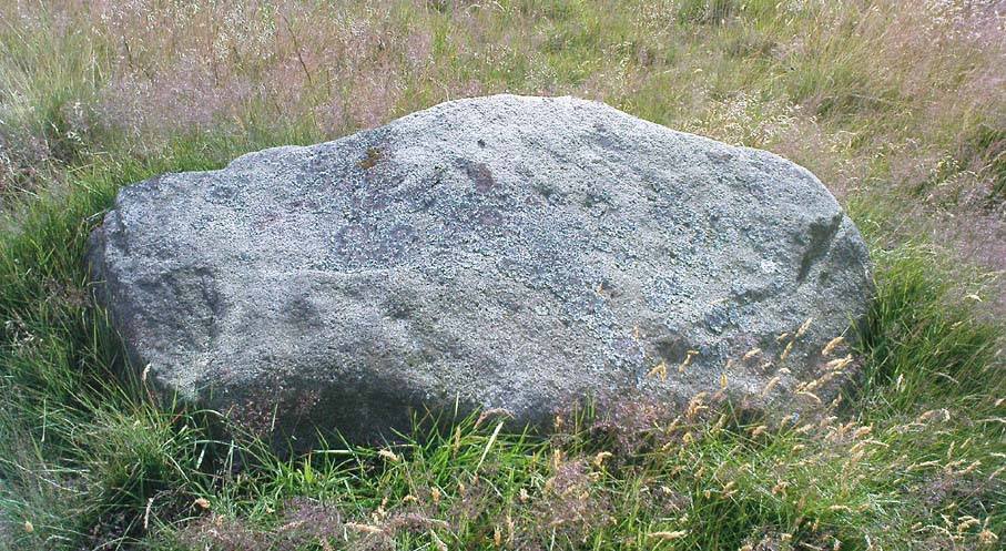
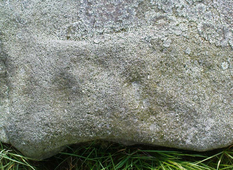
“It is certain that at this place there once stood a circle of eight or nine stones.  An intelligent man, named John Jones, aged 74 years and a resident in the vicinity since his youth, remembers four stones arranged as though forming parts of a circle, with an appendage in a curve “like a hook.”  About 100 yards distant was a cairn, the foundation of which is still discernible.  The land was then unenclosed, but on its enclosure the cairn and the circle were rifled to provide stone for the construction of the existing fence.  Mr Jones pointed out the four stones which had been members of the circle.  The Rev. C. Hartshorne’s account of this circle in Salopia Antiqua, 1841, p.33, gives a slightly different account of the stones.  He observes, “these three stones (the Whetstones) were formerly placed upright though they now lean, owing to the soft and boggy nature of the soil.  The stand equidistant and assume a circcular position… The highest of these is four feet above the surface; 1 foot 6 inches in thickness; and 3 feet in width.”

When the Royal Commission lads got round to examining the remains here, they reported that,

“Only one stone is now to be found, embedded in the ground close to the stile entering the field, and this is so small that it is not likely to have formed one of the stones of the circle, or it must be a mere fragment of a larger mass.”

However, from the air, a very distinct circle is clearly visible, showing that something was here in bygone times.  In all likelihood, there’s gonna be something just beneath the surface here to tell us more about whatever once stood here.

References:

  1. Crawford, O.G.S., The Long Barrows of the Cotswolds, John Bellows: Gloucester 1925.
  2. Royal Commission on Ancient & Historical Monuments, Wales, County of Montgomery, HMSO: London 1911.

© Paul Bennett, The Northern Antiquarian


Esholt Lane Carving, Esholt, Bradford, West Yorkshire

Cup-Marked Stone:  OS Grid Reference – SE 1743 3975

Also Known as:

  1. Carving no.10 (Boughey & Vickerman)

Getting Here

Seemingly not visible anymore, but directions given by a Miss N. Hutchinson in the early 1960s worked for me and Dave Pendleton when we checked this out at the end of our teens.  We had to look around till we found it, based on the following directions.  The carving was found “on top of a low dry wall on Esholt Lane, Esholt…on the stretch of road from the junction of Gill Beck with the River Aire to the stone-built barn on the left-side of the road, that is, going towards Esholt.”

Archaeology & History

Esholt Lane Carving, Bradford

First described by Miss Hutchinson in a letter she sent to Sydney Jackson (1964), editor of Bradford Archaeology group newsletter.  When we first found this small carving (not far from where we grew up) we were at the end of our teens, and followed the directions cited in the Cartwright Hall Archaeology Group Bulletin (see above).  The carved design was typical of the primary arcs found in many of the Baildon Moor cup-and-ring carvings a bit further up the hill, but with two other small faint cup-markings on it.  According to Boughey & Vickerman (2003), the carving’s now been hidden in a section of walling that’s been rebuilt.  The drawing here is from one of my unpublished notebooks. (1984)

References:

  1. Bennett, Paul, Ramblings of Archaeological Remnants in West Yorkshire, unpublished: Shipley 1984.
  2. Boughey, Keith & Vickerman, E.A., Prehistoric Rock Art of the West Riding, WYAS 2003.
  3. Jackson, Sydney, ‘Cup-Marked Rock – Esholt Discovery,’ in Bradford Cartwright Hall Archaeology Group Bulletin, 9:4, 1964.

© Paul Bennett, The Northern Antiquarian


Line Stone, Skyreholme, Appletreewick, North Yorkshire

Cup-Marked Stone:  OS Grid Reference – SE 0732 6251

Also Known as:

  1. Carving no.401 (Boughey & Vickerman)

Getting Here

Skyreholme 401 carving (photo © Richard Stroud)

Along the B6265 Pateley Bridge-Grassington road, roughly halfway between Stump Cross Caverns and the turn down to Skyreholme and Appletreewick (New Lane) is a dirt-track on your right-hand side called Black Hill Road. Walk along here for a few hundred yards till y’ reach the gate on the right. A track meanders downhill to the psilocybin-rich pastures of Nussey Green. Several hundred yards down, to the right-hand side of the track, we find this stone and its several nearby companions. Look around – you’ll find it!

Archaeology & History

I like this carving — I think because of the initial impression it gave, which was one of numeracy and linearity: an unusual quality for a cup-and-ring stone. Those of you with an astronomical or mathematical slant may have a similar response.

Line Stone Carving, Skyreholme

The stone was first described in one of Stuart Feather’s (1964) many short notices.  Its existence then remained dormant until it was eventually listed in Boughey & Vickerman’s (2003) survey on the West Riding rock-art, where they catalogued it as ‘stone no.401.’  The carving comprises of two parallel lines—one quite deep—with cup-marks at either end; one of the lines having another 2 cups along it. A third line at an angle has one or two cups along it aswell.  Several other single cups scatter the rock (forgive my crap drawing of it!).

References:

  1. Boughey, Keith & Vickerman, E.A., Prehistoric Rock Art of the West Riding, WYAS 2003.
  2. Feather, Stuart, ‘Appletreewick (WR),’ in Yorkshire Archaeology Journal 41, 1964.

© Paul Bennett, The Northern Antiquarian


Skyreholme Wall Stone, Appletreewick, North Yorkshire

Cup-and-Ring Stone:  OS Grid Reference – SE 0772 6231

Also Known as:

  1. Carving no.413 (Boughey & Vickerman)

Getting Here

Skyreholme Wall Carving
Skyreholme Wall Carving (after Boughey & Vickerman)

Various ways here, but for the sake of newcomers I’d say it was best following directions from Burnsall.  From here, take the Appletreewick road thru the village, past the left turn a few hundred yards along, and another 500 yards or so there’s a split in the road: take the one on your right!  Follow this up, keeping right (don’t turn into Perceval Hall, tempting though it may be!) and park-up where the road turns into a track.  Walk up the track, past the haunted junction, bearing left uphill up Black Hill Road until you reach the very peak of the track where, in the walling on your left, you’ll see this big boulder.  If you can’t see it, you’re bloody close!

Archaeology & History

This is at the very peak of Black Hill Road, with excellent views of Simon’s Seat climbing to the immediate south, the prominent and rounded Nursery Knot Hill immediately north, and grand views to peaks east and west. It is very likely this position had something to do with it being deemed worthy of relevance.  The rock itself defines a point along the old boundary line.

Skyreholme Wall Boundary carving

One peculiarity on this boulder is the deep cup-mark with a strange ‘lip’ to it, which has been mentioned by others in the past.  This is surrounded by at least five others cups — not dissimilar to some of the ‘rosary-designs’ of cup-and-rings further north.

The rock art student’s Boughey & Vickerman’s (2003) drawing of this design is pretty accurate — where they call it stone 413 — though it doesn’t actually give this carving the justice it deserves.  They also erroneously tell that some of the cups here are doubtful.

Check it out for y’self.  This is an excellent stone for cup-and-ring lovers! (with plenty of other sites scattered about all round here)

References:

  1. Boughey, Keith & Vickerman, E.A., Prehistoric Rock Art of the West Riding, WYAS 2003.

© Paul Bennett, The Northern Antiquarian


Currer Woods Stone, Steeton, West Yorkshire

Cup-and-Ring Stone:  OS Grid Reference – SE 0251 4384

Getting Here

On the opposite side of the road (B6265) from Airedale General Hospital, Steeton, you’ll notice a footpath going up the field into some woods.  Go up here.  Once you come out the top of the woods, follow the dodgy path on your right (west) along the rocky edges for 250 yards, following the edges of the field walling.  You’ll eventually reach the field with lots of rocks in it.  It’s the field before this one, close to the walling.  Look around!

Archaeology & History

I’ve been a little cautious about putting this carving on TNA simply because it seems to be an isolated example and was a little unsure about its veracity.  If I’d have found the stone on the edges of Ilkley Moor, Rivock Edge, or the heights above Askwith, I wouldn’t have hesitated.  The fact that no other carvings occur nearby has been my main trouble.  But I suppose if the carving turns out to be nowt of the sort, I can discard it at a future date and, of course, make sure that a lot of other cup-and-ring stones are disregarded at the same time (there are a number of other designs much less defined than this one which have been okayed by archaeo’s who’ve been into this subject for much shorter periods of time than myself).  But less of the waffle!

Currer Wood Carving, Steeton

When we first found this, in April 2009, I was out looking for the remains of an old well (called Jane Well, a few hundred yards west of here).  The heaven’s opened and I ended up in the woodland and then found the field full of large rocks, some seemingly used by man in more recent centuries, atop of the woods, and so had to check them out!  But this was one of the first stones we found.

Currer Woods Stone
Currer Woods Stone

The rock itself, as the photo shows, appears to have had one end of it split or broken off (not unlike one edge of the Hanging Stones, Ilkley Moor) at some time in the past, intruding on the arc, or line, beneath which are two distinct ‘cups’.  A possible third cup-marking and other linear aspects seem apparent, with the design giving the distinct impression of a face.  I keep meaning to go back and get a rubbing of the carving, but aint got round to it yet.  When (if!) I gerrit done, I’ll add it onto this profile.

And although there are said to be no other prehistoric remains close to this old carving, the fields a coupla hundred yards west used to be called the Barrow Fields, where tombs were once found; and a little further along the same geological ridge atop of the excellent Kirk rocks, possible cup-markings scatter the edges of two sections — but they’re a little dubious; then there’s the Dragon Stone and associated cup-marked stone not far away.  In the adjacent woods are the remains of old walling, but I’ve not found other carvings hereabouts.  However, the rule tends to be: “where there’s one, there are more!”

Watch this space!

© Paul Bennett, The Northern Antiquarian


Pathway Stone, Holden, Silsden, West Yorkshire

Cup-Marked Stone:  OS Grid Reference – SE 07021 44884

Also Known as:

  1. Rough Holden CR-9

Getting Here

Pathway Stone, Holden, Rivock

Follow the footpath running from the Rivock TV mast northwest, where it cuts diagonally across the field, heading towards the drystone wall.  About 200 yards before the walling – stop! It’s just to your right-hand side, very close by!

Archaeology & History

First discovered in July 2009 when Keighley volunteer, Michala Potts of Bracken Bank, did further ramblings amidst the long grasses hereabouts.  Its name comes from the fact that it’s found just next to the footpath that cuts across Rough Holden from the TV mast beneath Rivock.  The carving’s a very simple plain design, as the photos show, with just three faded cup-markings etched onto the stones northeast face.

Close-up of cup-markings

This stone aint too far from the cup-marked Dump Stone and the nearby Rough Holden design, but all across the Holden Rough grasslands are the faded remains of old pit-workings.  It makes you wonder just how many other carvings once existed across this flatland.  The fact that this and the other ones nearby still remain is damn fortunate!

© Paul Bennett, The Northern Antiquarian


Dane’s Stone, Moulin, Pitlochry, Perthshire

Standing Stone:  OS Grid Reference – NN 9425 5942

Also Known as:

  1. Pitfourie Stone

Getting Here

Dane's Stone under a brilliant sky
Dane’s Stone under a brilliant sky

Going thru Pitlochry town, turn up the A924 road for about a mile till you hit the Moulin Inn on your left-hand side.  Just past here, take the road left and continue for 2-300 yards until the stone in the field stands out on your right-hands side.  Y’ can’t really miss it!

Archaeology & History

I should mebbe have this site entered as a ‘stone circle’ and not just an old monolith, as numerous other standing stones were in close attendant not too long ago and it was said to have been a circle.   Certainly when the great Fred Coles (1908) talked about this place, he

“was informed by the tenant, Mr Reid…that many years ago, in his grandfather’s time, “there were several more stones standing”, all smaller than this monolith and that, upon the orders given by Mrs Grant Ferguson of Baledmund, some of these were saved from total demolition, and are supposed to be lying half-buried in the field to this day.”

...and here's the big man close-up
…and here’s the big man close-up

Though I imagine these remnants have now been removed.  Aerial images, when conditions are just right, might prove fruitful here.

But the solitary stone still standing here is quite a big fella.  Heavily encrusted with quartz and more than 7 feet tall, it’s a nice fat chunky thing, with its lower half being somewhat slimmer than the top.  Well worth having a look at!

Folklore

Once an old moot site, folklore also tells that an old market was once held here (there was some other folklore I had of this place, but can’t for the life of me find it at the moment!).

References:

  1. Coles, Fred R., ‘Report on Stone Circles Surveyed in Perthshire,’ in PSAS 42, 1908.
  2. Liddell, Colin, Pitlochry: Heritage of a Highland District, PKPL: Perth 1993.
  3. Reid, A., ‘Monumental Remains in Pitlochry District,’ in PSAS 46, 1912.

Links:

  1. Stravaiging Round Scotland

© Paul Bennett, The Northern Antiquarian


Balnakeilly Stone, Moulin, Pitlochry, Perthshire

Standing Stone:  OS Grid Reference – NN 9463 5943

Getting Here

As you go through Pitlochry’s main street, watch out for the right-turn up the A924 road.  Go up here for perhaps a mile.  You’ll know you’re getting close as you pass the Moulin pub and the seeming avenue of trees opens on either side of the road.  A coupla hundred yards up into the trees, there’s the left-turn up the Balnakeilly driveway.  Stop! It’s on your left.

Archaeology & History

The Balnakeilly Monolith

Knocking on for nine-feet tall, there’s some debate as to the archaic authenticity on this standing stone.  Ian Armit and his mate (1998) certainly wondered whether this was an ancient stone or not and, gotta say, when I came up here a coupla weeks back, I got the same impression.  It doesn’t have that feel about it which comes from the real olde ones; but this could be due to it having been moved in the not-too-distant past.  Though when Alan Reid wrote about it in 1911 he told us that,

“it bears marks of having been…worked slightly into shape by some pointed tool whose traces are plainly seen on several of its angles.”

Not something you’d find on monoliths that are a few thousand years old!  But if this stone was moved when the entrance to Balnakeilly drive was done, or the road widened, this could account for such markings.  We could do with digging into any archives that may exist about Balnakeilly or the Pitlochry roads to see if there’s any record of this stone to end the debate once and for all.  Tis a good site to visit though – check it out!

References:

  1. Armit, I. & Johnson, M., ‘Balnakeilly (Moulin parish), ‘modern standing stone’,’ in Discovery and Excavation in Scotland, 1998.
  2. Reid, Alan, ‘Monumental Remains in Pitlochry District,’ in PSAS 46, 1911-12.

© Paul BennettThe Northern Antiquarian


Hollin Tree Hill, Askwith Moor, North Yorkshire

Standing Stone:  OS Grid Reference – SE 16611 50818

Getting Here

Follow the directions to reach the Man Stone carving.  Walk up the sloping hillside from there until you reach the top.  From there, walk down the slope heading slightly to your left.  You’ll find it!

Archaeology & History

A small upright stone, less than three feet tall, but once a little taller as you’ll see that it’s head has been knocked off in the not-too-distant future and lies on the ground by its side.  A small scatter of what seems like possible cairn-material lies around its base, but not enough to imply that a tomb of any sort was ever here (aswell as that, the position on the slope seems wrong).

A curious little thing, without archaeological companions.  When we came here the other day, we explored the ground all round the stone as all the heather had been burnt back; but there was nothing anywhere near it to give a hint as to why it stands here, alone, at what seems like a strange spot two-thirds the way up a moorland slope. It’s been speculated that in the middle of its more north-facing side there is a cup-mark on it, but this is very dubious and, in my opinion, should be discounted as such.  The marking is a gun-shot wound – and more recent ones have just been added, as seen  in the photo.

© Paul Bennett, The Northern Antiquarian


Market Cross, Newcastle-under-Lyme, Staffordshire

Cross:  OS Grid Reference – SJ 84857 45979

Archaeology & History

Market Cross, Newcastle-under-Lyme

The old town’s Market Cross can be seen outside the north end of the Guildhall, but originally it was opposite the Ironmarket up the High Street.  It was first built sometime in the medieval period (exact year seems to be unknown), but required some restoration work on it in 1579, which was organized by the town Mayor: a Mr Randle Bagnall at the time.  It’s thought that the five steps upon which it stood were also erected around this time.  However, these steps and the cross were moved a few years before 1820 and then resurrected by the Guildhall.  The curious standard lamps were also added to the top of the cross when this restoration work was done.

References:

  1. Kennedy, J. (ed.), Newcastle-under-Lyme: A Town Portrait, Newcastle Civic Society 1984.

© Paul Bennett, The Northern Antiquarian