Take the directions to find the unusual and impressive West Strathan petroglyph, and keep following the road up past the carving until you reach the dead-end. A footpath takes you down to the river, where a rickety bridge takes you to the other side. From here, a footpath to your right goes up the slope at an easy angle and into the wilds ahead. Just a couple of hundred yards up, keeps your eyes peeled some 10-20 yards above you, to the left. It is a little difficult to see, and perhaps is better looked at from above the footpath, then looking down onto it. If you’re patient, you’ll find it!
Archaeology & History
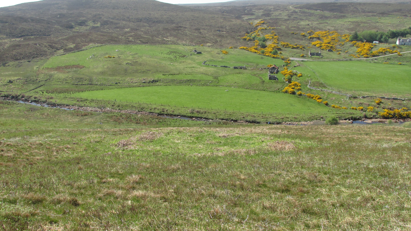
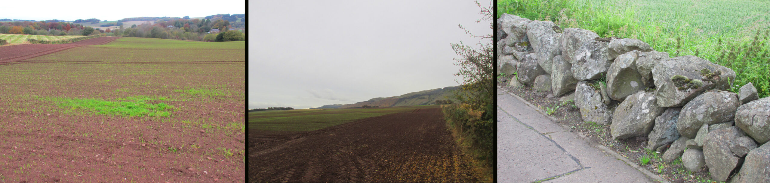
Stuck out on its own, way off the beaten track, this seemingly isolated ‘hut circle’—as it’s been officially termed—rests on a small level piece of land some 400 yards north from the ruins of Dalvraid’s chambered cairn. It’s nowt much to look at to be honest, and is probably only gonna be of interest to the hardcore antiquarians amongst you.
When I came here, the walling was mainly covered in dead bracken and internally is a veritable lawn!—but it was pretty easy to make out. Slightly ovoid in form, with its entrance on the southern side, the circle is 10 yards across; and the although the low walling is barely a yard high on three sides, on the eastern section the natural slope was dug into to create a higher wall on that side.
Travelling north, turn right to Wolfhill off the A93 at Cargill, then up the hill, turning left at the first junction. The stones are buried in the field to your left before the bend.
Archaeology & History
The earliest description of these stones, and the only one written while they were still standing comes from J.P.Bannerman, writing in the Old Statistical Account in 1793:
‘Near the village of Cargill may be seen some erect stones of considerable magnitude, having the figure of the moon and stars cut out on them, and are probably the rude remains of Pagan superstition. The corn-field where these stones stand is called the Moonshade to this day.’
Later writers, who only had verbal reports of the stones from locals who remembered them, gave differing descriptions of them. The people who spoke to the Ordnance Survey name book scouts around 1860, described them as:
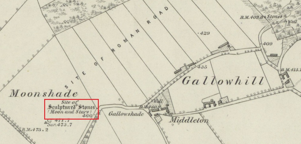
‘Moonshade – “This name is applied to an arable field immediately west of Gallowhill. Two large Standing Stones having the representation of the Moon and 7 Stars cut out on one of them were removed from this field about 60 years ago.”‘
The local antiquary Andrew Jervise wrote in 1861 that the stones were:
‘interesting relics….purposely buried below the reach of the plough, appear to have been of the same class of antiquities as the sculptured stones at Meigle and, from the desire which is now being manifested for the preservation of national antiquities, it is hoped that those relics will soon be disinterred, so that their symbols may be properly examined.’
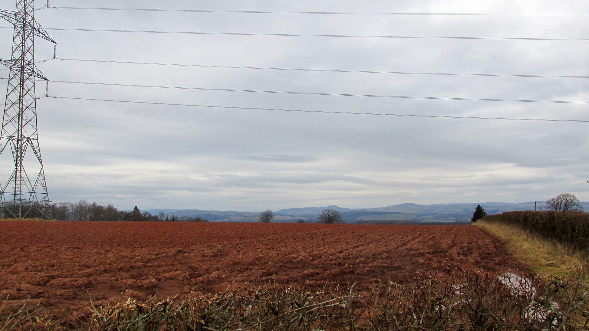
Looking north from the road the stones stood to the right of and beyond the pylon
Or as another writer puts it, they were; ‘dug around and under, and buried, in the agricultural improvement of theground’. For all we know from the written descriptions that have come down to us the stones may be prehistoric monoliths, with it seems only one of them carved. As they stood alongside the Roman road from Muthill to Kirriemuir, the moon and stars may have been cut by the Romans, or they could equally have been from the hand of a Pictish or later mediaeval mason. The field in which they stood was alternatively known as ‘Moonstone Butts’ or ‘Moonbutts’ – where the local archers practised.
Folklore
While the word ‘moonshade’ doesn’t appear in Jamieson’s Scottish Dictionary, nor the online Dictionaries of the Scots Language, the Oxford English Dictionary defines it as an obsolete word for ‘nightshade’, citing a quotation from Sir Francis Bacon’s Sylva Sylvarum of 1627:
‘The Ointment, that Witches use, is reported to be made, of the Fat of Children, digged out of their Graves; Of the juyces of Smallage, Wolfe- bane, And Cinquefoile; Mingled with the meale of fineWheat. But I suppose that the Soperiferous Medicines are likest to doe it; Which are Henbane, Hemlocke, Mandrake, Moone-Shade, Tobacco, Opium, Saffron, Poplar- Leaves.’
Given the stones are in the Perthshire witch country (the Witches Stone of Shakespeare’s Macbeth is only 2½ miles due south of here), this is nevertheless almost certainly a ‘red herring’, with the field deriving its name from the carvings on the stone. Only when we can again see the Moonshade Stones, ‘digged out of their grave’ will we be able to begin to understand them. So will there be any motivation to excavate them?
The easiest way is to turn south off the A91 at Gateside onto Station Road, and the site of the cairn is in the third field to the left over the railway bridge. I accessed the site walking along the old railway line and climbing up the embankment.
Archaeology & History
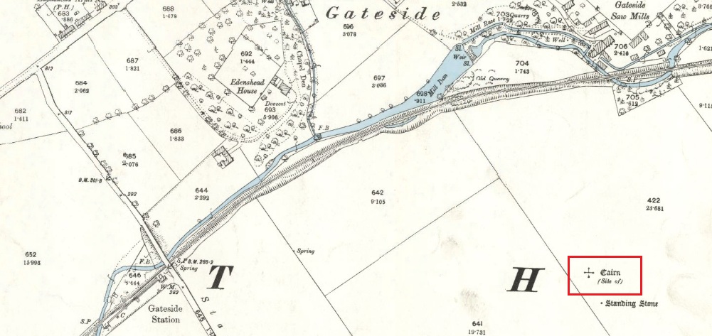
The site of the Cairn on the 1894 25 in. OS map.
In the shadow of the Lomond Hills of Fife, what was once a very large pre-historic cairn, officially described as of ‘unassigned’ period, was quarried to destruction around two hundred and twenty years ago, presumably to provide stones for dykes (stone walls), at that time of enclosures of common land and what the landowners liked to call ‘agricultural improvements’.
In the early nineteenth century, this part of the Eden Valley between Gateside and the Lomond Hills was what would now be called a ritual landscape. There were, according to Miller:
‘nearly in a line between the two Laws ( Lomond Hills) noless than eight “druidical temples” (Stone circles) close together‘
and a number of impressive burial cairns, of which Easter Nether Urquhart seems to have been the largest. There were in addition large numbers of graves containing masses of cremated of human bones. Nearly all this archaeology has been subsequently destroyed by the farmers.
Two local antiquarian writers proposed that all these human remains had been buried there following the battle of Mons Graupius between the Roman Invaders under Agricola, and the Caledonians, and went on to argue that the Eden Valley was the site of this historic defeat for the ancient Caledonians defending their homeland. Whatever and whenever the origins of the cairns and human remains, subsequent researchers disagree with these nineteenth century arguments in favour of the Eden Valley, and tend to favour a more northerly location for Mons Graupius. Nevertheless we have these two historians to thank for leaving us descriptions of the cairn.
One of the antiquarians, Rev. Andrew Small wrote in 1823:
‘The Slaughter here seems to have been so dreadful, that even after the lapse of 17 Centuries the Common tradition of the Country bears, and seems to be as fresh in the Mouths of both old and young as though the battle had been fought only a hundred years ago, – that after this battle the River Eden ran red with blood for two days…’
It seems more likely that the event remembered was part of the campaign by Roman Emperor Septimus Severus and his son Caracalla to subdue the Caledonians around 209-210 CE. Modern writer, Simon Elliott:
‘Archaeological data is now emerging to show ….. a major depopulation event, indicating something close to a genocide was committed by the Romans in the central and upper Midland Valley.’
Andrew Small describing the cairn and some of the cremation remains in 1823:
‘There was also a very large cairn laid upon these ; and the proprietor lately told me that when removing the stones, besides the ashes already mentioned, there was also a pit of pure fine sand by itself, about as fine as is usually put into sand-glasses, which he thinks had been used for regulating the fire in burning of the dead. This cairn stood a little north of an ancient Druids temple, only one stone now remaining, out of ten of which it formerly consisted ‘.
Lieutenant – Colonel, Miller writing in 1829:
‘Farther west ….a very large cairn stood, containing upwards of two thousand cart-loads of stones. Upon removing it about thirty years ago, a pit six feet long, two broad, and of the same depth, was found, quite full of burnt bones; and near it another, two feet square and two deep, full of the finest sand. An urn was also found, near the surface of the cairn, full of bones. A very fine Druid’s temple stood on the south side of it, consisting of seven very large stones…’
As the builders of the cairn didn’t have access to carts, and that the stones all had to be moved by hand, it gives an indication of the manpower needed to build the cairn, and the status of the individuals whose remains were buried there. And we have to question why a special chamber been built into the base of the cairn to hold fine sand, and what was the purpose of this sand?
Left – View of Cairn site looking north, centre of the field beyond the tractor tracks. Centre – View looking south. Right – The cairn recycled? Walling on the south side of A91 at Gateside
Folklore
While not writing specifically of the cairn, Revd. Small recounts these tales of the surrounding land, relating it to his belief that it was the site of Mons Graupius:
‘I cannot forbear to mention here, also, a singular circumstance I had from the landlord and landlady, both yet alive, — viz. that before parking or inclosing took place, they were accustomed to have folds built of feal or turf for the cattle lying in at night ; but that, when the folds happened to be in this place where the dead had been burnt, the cattle would never lie in them, but always broke through or leaped over the dyke ; that they were obliged to give a man a boll of barley extra to watch them, when they lay in this spot, which was obliged to be repeated every four or five years in rotation ; but that sometimes the man was not able to keep them in by all his endeavours, the cattle looking wild and terrified in appearance ; and sometimes it required the united efforts of all the hands that could be had to keep them in, oftentimes springing over the fold dykes close beside them, and frequently crouching and trembling as if they would have fallen down with terror, although nothing appeared visible to the visual organs either of the man or those that occasionally assisted him. However, after the discovery of so many ashes and fragments of human bones, the man declared that, had he known of these being so near, he would not have been so fond of watching.’
‘The late farmer of Upper Orquart, a most respectable man, with whom I was well acquainted, and upon whose farm the principal part of the battle was fought, told me also that always when the folds happened to be both at where the Caledonians were burnt as well as the Romans — but particularly he specified the spot where the Romans had been burnt, or the Witch Know or Knoll — the cattle would never lie in the fold, but were always breaking ” the fauld,” as he called it, except when they were particularly watched ; and even that was not always effectual for keeping them from doing it either. This would insinuate as if the spirits of these departed heroes of antiquity sometimes visited and hovered about the places where their ashes had been deposited ; though invisible to the more refined visual organs of the human eye, yet obviously visible in some shape or other to the more gross visual organs of the irrational or bestial tribe, else how can these forementioned occurrences be accounted for? This hypothesis seems to be borne out by Balaam’s Ass perceiving the Angel twice, when he himself could not do so till his eyes were supernaturally opened.’
Afterword
Although the cairn no longer exists, its stones were probably reused for local walling, and it’s likely, but not provable, that the wall on the south side of the A91 past the Station Road turning is built from stones removed from the cairn.
References:
Elliott, Simon, Septimus Severus in Scotland, Greenhill Books, 2018.
Miller, Lt. Col., “An Inquiry Respecting the Site of theBattle of Mons Grampius“, 1829, published in Archaeologica Scotica vol. IV, 1857.
Small, Andrew, Interesting Roman Antiquities Recently Discovered in Fife, John Anderson, Edinburgh, 1823
Tumulus (destroyed): OS Grid Reference – TL 6122 6358
Archaeology & History
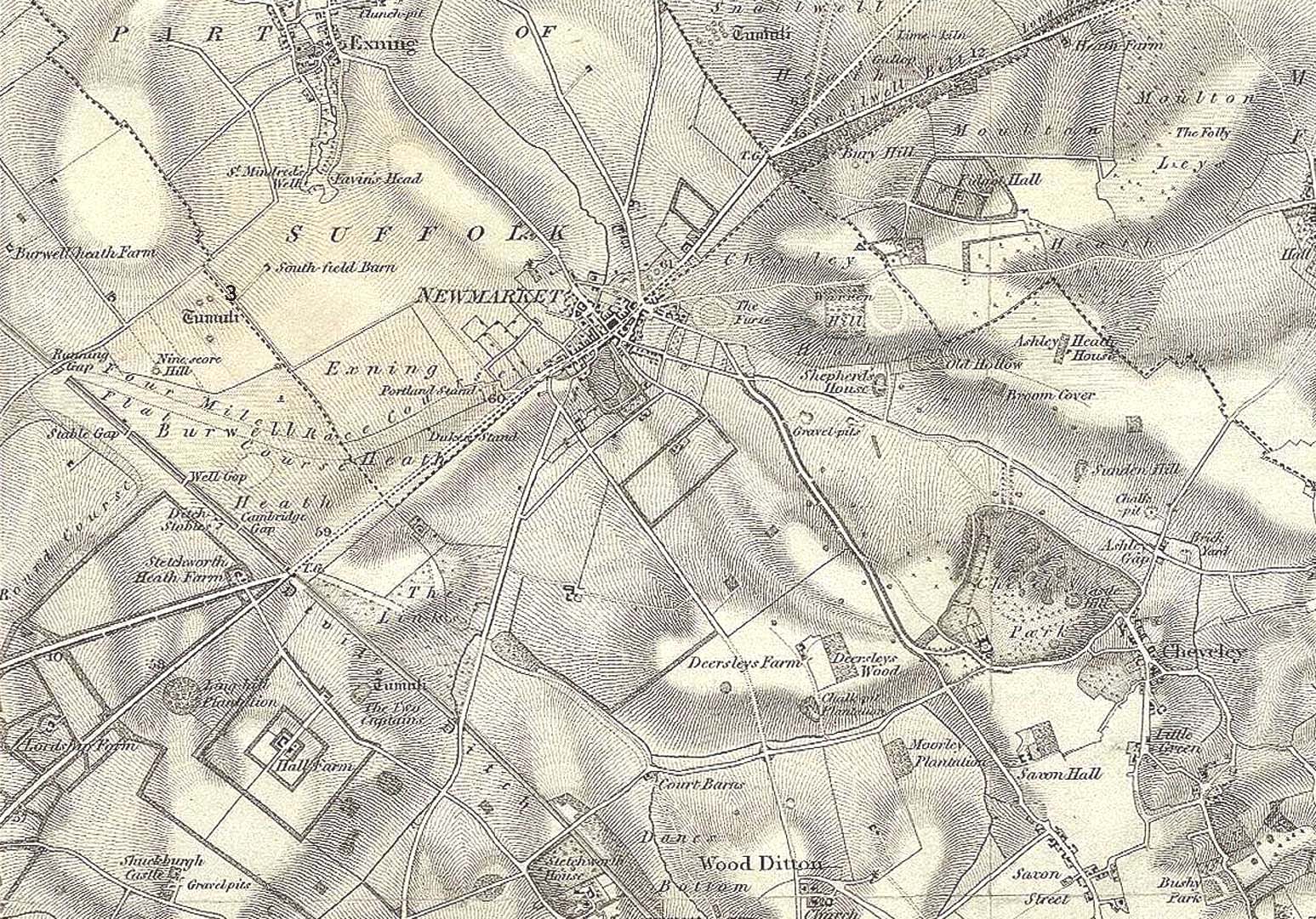
Tumulus ‘3’ on 1834 map
This is one of at least five prehistoric tombs that were known to have existed in and around the Newmarket race-course—all long gone. It stood some 50-60 yards northeast of the Newmarket Heath (2) tumulus and was one in the cluster highlighted as ‘tumuli’ on the 1834 OS-map (right). Despite its destruction sometime in 1883, a scar of the monument was seen from the air in the 1940s by J.K.S. St Joseph as a ploughed-out ring ditch, showing it to have been some seventy feet across. Sadly, no ground trace of the monument exists.
Royal Commission Ancient Historical Monuments, Inventory of Historical Monuments in the County of Cambridgeshire – Volume 2: North-East Cambridgeshire, HMSO: London 1972.
Tumulus (destroyed): OS Grid Reference – TL 6116 6352
Archaeology & History
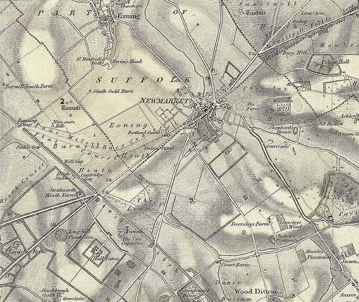
Tumulus 2, centre-left
This is one of at least five prehistoric tombs that were known to have existed in and around the Newmarket race-course. Found some 600 yards NNE of the Ninescore Hill tumulus, and some 40 yards from its nearest companion, it was shown as one in a group of ‘Tumuli’ on the 1834 OS-map (right) but, along with the rest, was subsequently destroyed sometime around 1883. A landscape scar of the monument was seen from the air in the 1940s by J.K.S. St Joseph as a ploughed-out ring ditch some 75 feet across. This was reported as still visible by the Royal Commission doods in the 1970s, but no ground trace whatsoever exists.
Royal Commission Ancient Historical Monuments, Inventory of Historical Monuments in the County of Cambridgeshire – Volume 2: North-East Cambridgeshire, HMSO: London 1972.
This is one of many long lost prehistoric tombs that were known to have existed in and around the Newmarket race-course, but unlike the Newmarket tumuli 1 – 4 which were all on the first OS-map of the area, this one had been destroyed before the Ordnance Survey lads came here. As a result we don’t know its exact whereabouts.
Described in both the Cambridge Chronicle and Gentleman’s Magazine in 1827, the accounts even then were talking about it in the past tense, albeit pretty recently. The race-course at Newmarket was being modified, leading to the destruction of our ancient landscape—and with it, this tumulus. In those days however, such destruction was deemed as an ‘improvement’, as Sylvanus Urban (1827) tells at the start of his account:
“The improvements making in the exercise ground at Newmarket, Cambridgeshire, have led to some discoveries which may, perhaps, tend to the elucidation of the hitherto obscure origin of the entrenchment commonly called “The Devil’s Ditch.” In removing one of the monumental remains denominated barrows, or tumuli, which are numerous in this neighbourhood, the skeleton of a person was found deposited near the surface, whose remains were too recent to be associated with the area of its place of interment; but, upon clearing away the earth to the centre of the mound, a discovery was made of an urn, of rude construction and materials, containing ashes, together with some beads, which, it is presumed, formed the ornaments of the person to whose honour the barrow was dedicated. There were also found two coins, supposed to be Roman, and a fragment of a cup, of far superior manufacture to the urn, lying promiscuously at the depth of about two feet.”
A summary of this was included in Babbington’s (1883) archaeological survey. But in Cyril Fox’s (1932) list of barrows near Cambridge he seemed to confuse this “tumulus on Exercise Ground” (no.16) with what he thought was another tumulus (no.17), which he described as, “Exact site unknown. Contained a cremation interment. Burnt bones and sherds of Bronze Age type, also Roman sherds.” The two are the same thing.
Royal Commission Ancient Historical Monuments, Inventory of Historical Monuments in the County of Cambridgeshire – Volume 2: North-East Cambridgeshire, HMSO: London 1972.
Urban, Sylvanus, “Domestic Occurrences,” in Gentleman’s Magazine, September 1827.
Tumulus (destroyed): OS Grid Reference – TL 613 633
Archaeology & History
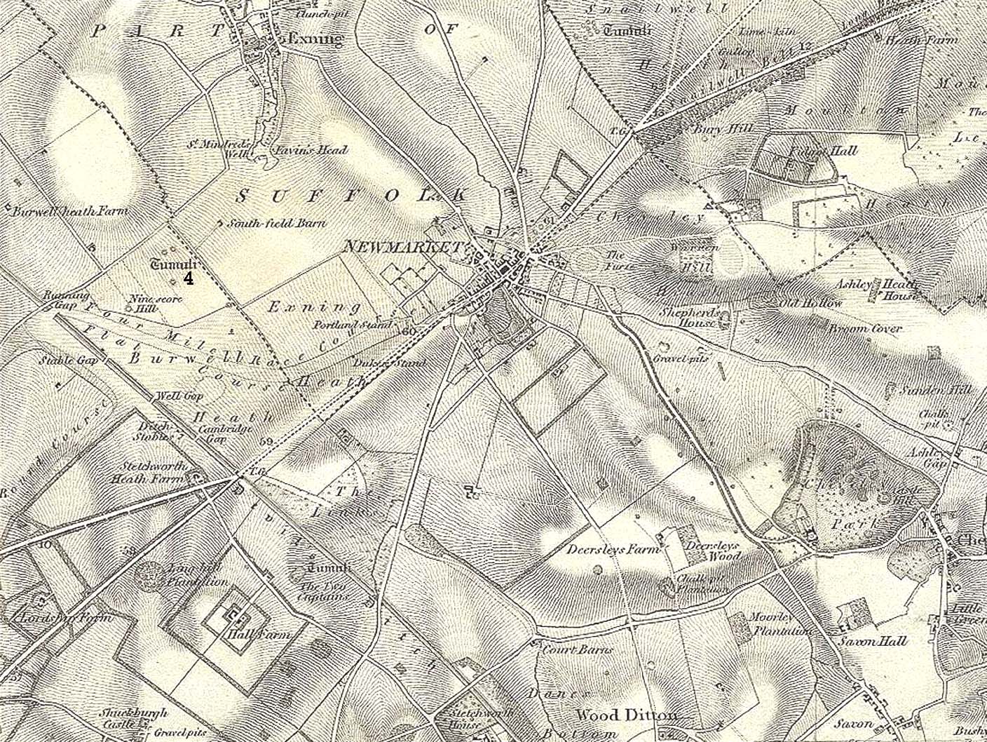
Tumulus 4, centre-left
This is one of at least five prehistoric tombs that were known to have existed in and around the Newmarket race-course. It could be seen five-hundred-and-odd yards northeast of the Ninescore Hill tumulus and about 280 yards southeast of its Newmarket Heath 2 companion. The site was shown as one of the “tumuli” on the 1834 OS-map (right) but, along with its friends, was destroyed sometime around 1883. Unlike its companions, no scar of its remains are visible from the air so we don’t know how big it was, but I’d assume the olde fella to be of a similar size and style to its close neighbours.
Royal Commission Ancient Historical Monuments, Inventory of Historical Monuments in the County of Cambridgeshire – Volume 2: North-East Cambridgeshire, HMSO: London 1972.
Tumulus (destroyed): OS Grid Reference – TL 6091 6304
Also Known as:
Newmarket Heath 1
Ninescore Hill Barrow
Archaeology & History
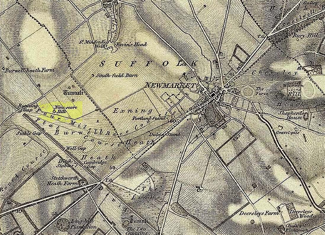
Ninescore Hill on 1834 map
Upon the small and curiously-named Ninescore Hill on the edge of Newmarket’s race-course, the old-school archaeologist Cyril Fox (1923) told that “800 yards due east of Running Gap”, was a prehistoric burial mound that was destroyed in 1885. Highlighted on the 1834 OS-map, a 19th century excavation found that the tomb “contained two inhumation interments associated with beakers,” along with some “flint arrowheads, and a secondary interment, probably Saxon.” In more recent times, the doods from the Royal Commission (1972) added the site to their inventory and noted that a faint outline—known as as ring ditch—is visible from the air when conditions are just right. But there’s bugger all left of it at ground level.
References:
Fox, Cyril, The Archaeology of the Cambridge Region, Cambridge University Press 1923.
Royal Commission Ancient Historical Monuments, Inventory of Historical Monuments in the County of Cambridgeshire – Volume 2: North-East Cambridgeshire, HMSO: London 1972.
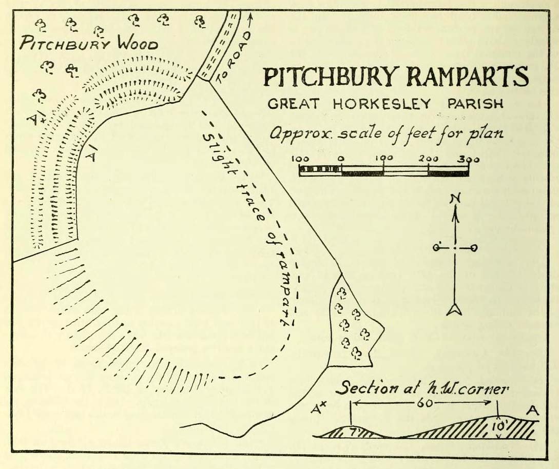
Along the A134 in Horkesley Heath, turn west along Coach Road and after a half-mile where it veers right, keep going for another half-mile where you’ll reach the woodland on your left. A path goes into the trees just before Pitchbury Lodge. Go along here and near the very far (southern) end of the trees, just before the open fields, you’ll see the large undulating ramparts of earth. Keep your eyes peeled. You’ll see them!
Archaeology & History
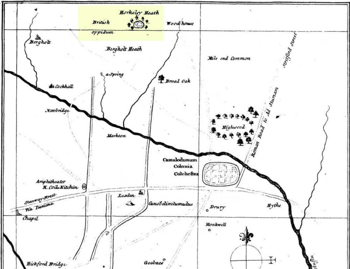
Stukeley’s 1759 map
This once large hillfort was described in the Colchester township perambulations of 1671 and cited in Philip Morant’s classic work. (1748) He told how the boundary line ran “under Chesterwell along the Rampiers by Horkesley Heath,” and which P.H. Reaney (1935) tells was our wooded hillfort. In Morant’s day, the place was all but complete and so would have been well recognised by local people. Certainly it came the attention of the great antiquarian William Stukeley who, in 1759, came to Colchester and met with Morant. Stukeley mainly surveyed the area south of here, at Lexden Heath, but one of his sketch maps clearly highlighted a place he called “a circular work on Horkesley Heath”, i.e., Pitchbury Rings. The site seems to have remained relatively intact until the middle of the 19th century when a local land-owner took it upon himself to plough over and vandalise much of the site, leaving only a small proportion of the earthworks that we can still see to this day.
The ruins were described in I.C. Gould’s (1903) piece for the Victoria County History, where he told, at Great Horkesley,
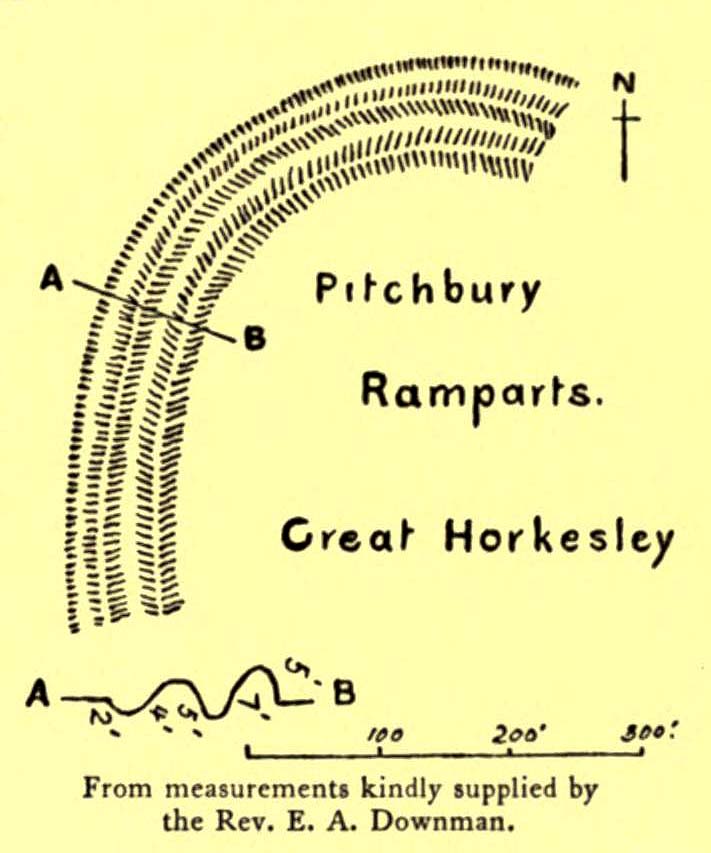
Gould’s 1903 sketch of the remainsRoyal Commission’s 1923 ground-plan
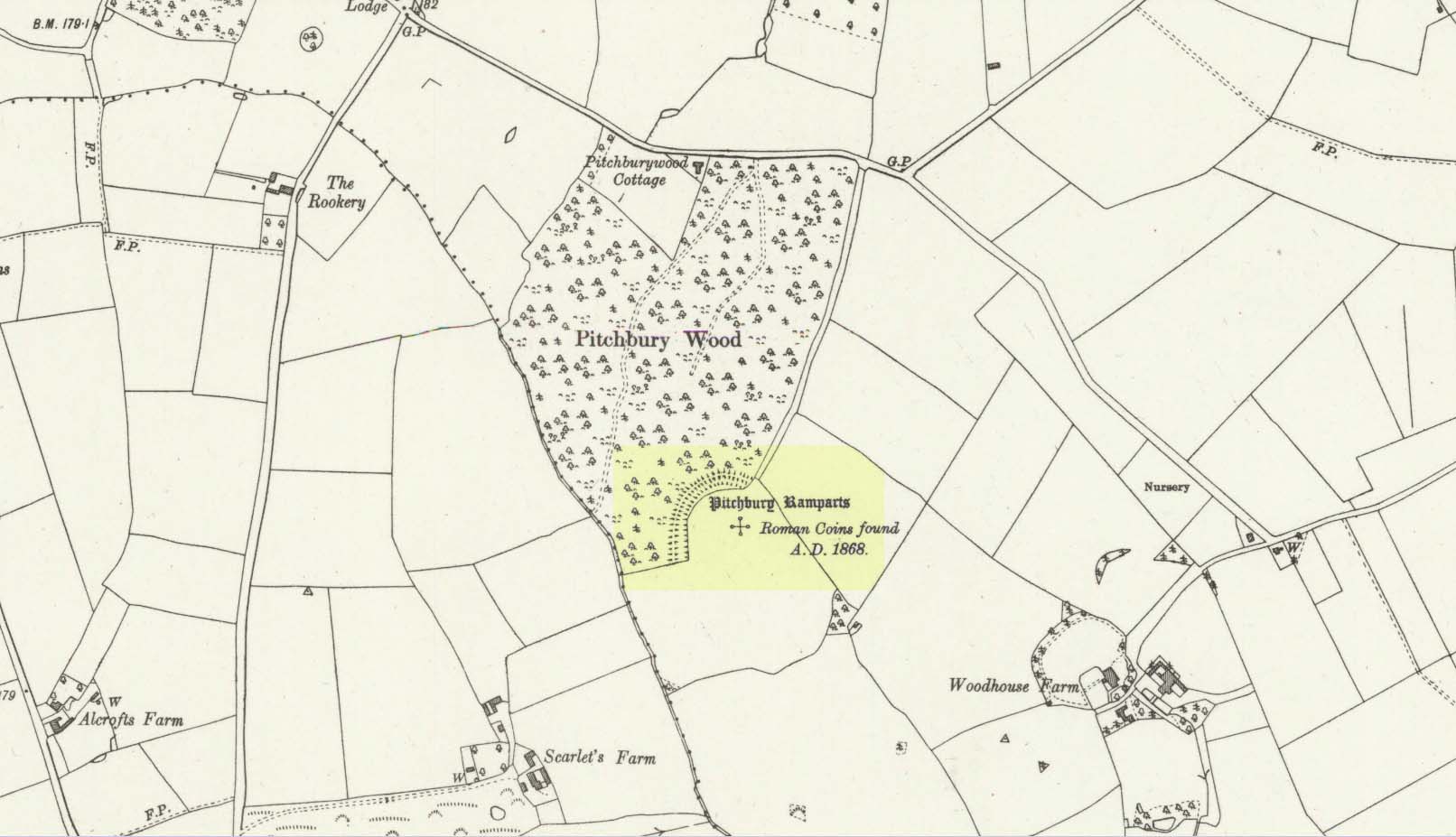
“are some remains of an earthwork known as ‘Pitchbury’ or ‘Pitsbury Ramparts.’ When the late Rev. Henry Jenkins described the camp in 1841, he stated that it was of oval shape, and contained about 6 acres. Most of it was levelled for agricultural operations about fifty years ago, but there are still some remains, consisting of two banks with their accompanying ditches. The lines moreover of that part which was destroyed, can be partially traced in the adjoining fields.”
When the Royal Commission (1922) doods wrote about the site nearly twenty years later, things hadn’t changed too much and they simply reported how the “ramparts have nearly disappeared, except for the north section.” In this “imperfect” condition, as they called it, they gave the following brief description:
“Pitchbury Ramparts, in Pitchbury Wood, about 2 mile south of the church, are the north end of a large camp, roughly oval in shape, and defended by a double rampart and ditch. The defences are well preserved in the wood, the inner rampart being 10 ft. above the ditch, which is 60ft wide from crest to crest, but the greater part of the work has been almost obliterated by the plough, and is now only faintly discernible in a large field S. of the wood. The camp appears to have been 800 ft. long and 600 ft. wide.”
Thankfully there seems to have been no real increase in damage to the site since then. It was excavated in some detail in 1933 and again in 1973 and the finds were published by the highly reputable Colchester Archaeological Trust, whose subsequent report by Hawkes & Crummy (1995) is required reading for anyone wanting to know the detailed archaeology of this and other sites in the area.
Folklore
An intriguing piece of folklore was described in John Round’s (1882) history of the early battles around Colchester Castle. During the time when the Roman Empire was starting to crumble, the great Pictish tribes of Scotland ventured here and, we are told, took control of the Pitchbury Rings where they stayed before attacking Colchester Castle.
“Traces have been discovered of some violent catastrophe, possibly the first capture of the Colony by the marauding Picts from the North. Allured, in one of their Southern raids, by the wealth of the goodly Colony, they swooped down like eagles on their quarry from the wooded heights of ‘Pictsbury’.”
References:
Gould, I. Chalkley, “Ancient Earthworks“, in Victoria History of the County of Essex – volume 1, Archibald Constable: Westminster 1903.
Reaney, P.H., The Place-Names of Essex, Cambridge University Press 1935.
Watson, J.Y., Sketches of Ancient Colchester, Benham & Harrison: Colchester 1879.
Acknowledgements: Big thanks for use of the 1st edition OS-map in this site profile, Reproduced with the kind permission of the National Library of Scotland.
Tumulus (destroyed): OS Grid Reference – TQ 1686 4958
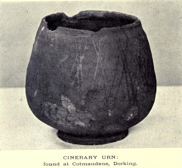
The Cotmandene urn
Archaeology & History
Highlighted on the 1914 OS-map (as ‘Site of’), nothing now remains of the prehistoric structure that either covered or surrounded the ancient burial urn, found fortuitously by a Mr Turner in the garden of Southdown Cottage at the beginning of the 20th century. Believed to be either Iron Age or Romano-British in origin, the find was noted by Mr Malden (1913) in his brief in the Surrey ArchaeologicalCollections, who wrote:
“Early in 1913 it came to my knowledge that some years ago some discoveries had been made in the garden of a house on Cotmandene, Dorking. Mr Turner…was digging for sand in his garden when he found a small cinerary urn (see illustration), with ashes in it. The height is only 5 inches, the diameter across the top about 4 inches, but at the widest part 5⅜. The urn is so small that it probably contained the ashes of a child: it is wheel-made, but badly; the diameter is not precisely the same across the top from every direction: Mr Reginald Smith attributes it to the first century BC. Some fragments of other urns were found. Mr Turner has kindly presented the whole specimen to the Society’s Museum. At a lower depth in the same garden were numerous flints, some implements, many flakes, and traces of a hearth with several burnt stones. These clearly belonged to an earlier date, considerably, than the interments, but as the finds were made about 1906-7, and not investigated till this year, it is impossible to be precise about the depth at which they occurred.”
References:
Malden, H.E., “A Cinerary Urn and other Matters found at Dorking and Betchforth,” in Surrey Archaeological Collections, volume 26, 1913.