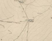
Ralph Cross, Westerdale Moor, North Yorkshire

Cross:  OS Grid Reference – NZ 67724 02092

Also Known as:

  1. Ralph’s Cross
  2. Young Ralph’s Cross

Getting Here

The cross stands high-up on Danby High Moor between Hutton-le-Hole and Castleton, just by the junction of two moorland roads to Rosedale and Westerdale, in north Yorkshire.  The monument stands on private land. (Ed. – though in Yorkshire, many of us ignore such signs)

Archaeology & History

Mr Woodwark’s 1930s photo of Young Ralph

First described in old deeds from the early 13th century, Ralph’s Cross stands nine feet high on a solid stone base.  There is uncertainty about its age; the present-day cross could date from the 18th century though some historians date it to around 1200, certainly the base could date from that time.  It seems likely that a much older cross once stood on this site — perhaps an Anglo-Saxon one that was actually made of wood.  At that time it may have been referred to as ‘The Roda Cross’ (Rude Cross).  More than likely the cross acted as a medieval highway marker because it stands at the junction of two moorland roads. Originally there were some letters carved on the cross, one in particular, being the letter “R” for Ralph was carved on the south face.

Over the centuries the cross has suffered damage and vandalism by being knocked down, particularly in the 1960s and again in 1984 after which it lay in two pieces. However, in 1985 the cross was lovingly restored and re-erected by some local men, Mr Robert Dixon, Mr Tom Rudd and Mr Michael Smith, at the English Heritage Commission’s stone masonry workshop at Mount Grace Priory.  The middle section of the cross was made from new stone from nearby quarries; the top section was not badly damaged, but a section of delta metal was inserted inside the shaft to make a secure link between the sections and the cross-head.  The cross is a listed monument.

A few hundred yards to the south stands another cross called ‘Old Ralph’ which is just 5 feet high and is located on Blackey Ridge. This cross dates from the beginning of the 13th century and is perhaps a memorial to Ralph, bishop of Guisborough.

Folklore

According to legend, the cross was set up to mark the resting place of a monk from Farndale and a nun from Rosedale.  They would often meet here and a romantic liason of sorts occurred, but they were found out by their superiors and came to a nasty end, possibly with their deaths.  But the most common folk-tale tells us that a farmer called Ralph from Danby found the dead body of a traveller at this spot.  He was so moved by this that he decided to erect a cross in memory of this poor unfortunate traveller, who had starved to death and was found to be penniless.  Ralph had a hollow carved into the top of the cross so that more wealthy travellers, those on horseback, might place a few coins for the benefit of any less fortunate travellers, or as a thanksgiving for having reached this point on their journey. The poor traveller was able to take a coin, if he/she could reach the hollow, and buy a hot meal at the nearest inn.  Ralph then vowed that such a terrible thing would never ever happen again, and it seems to have worked, thanks to him.

References:

  1. Ford, Joseph, Some Reminiscences and Folk-Lore of Danby Parish & District, Horne and Son: Whitby 1953.
  2. Ogilvie, Elizabeth & Sleightholme, Audrey, An Illustrated Guide to the Crosses on the North Yorkshire Moors, Village Green Press: Thorganby 1994.
  3. Woodwark, T.H., The Crosses on the North York Moors, Whitby Literary & Philosophical Society 1934.

© Ray Spencer, 2011


Peg o’ Nell’s Well, Clitheroe, Lancashire

Sacred Well:  OS Grid Reference – SD 7355 4257

Also Known as:

  1. St. Margaret’s Well

Getting Here

Peg o’ Nells Well

The well is located in the grounds of Waddow Hall close by Brungerley Bridge, near Waddington, in the Ribble Valley. The hall is just off the B 6478 road about three-quarters of a mile south-east of Waddington village. It is on private land, but you can see the well by walking along a footpath at the western side of the hall running along the banks of the River Ribble at the southern side of the hall grounds.

Folklore

The legend originates from the 18th century although the well is a pre-Christian spring. According to this most often told ‘legend’ Peg O’ Nell was a servant girl at Waddow Hall.  However, she often fell out with her masters, the Starkie family, often quarreling with and being disobedient to them. One night, in particular, Peg had a blazing row with Mistress Starkie after saying she didn’t want to fetch water from the well; the mistress was so enraged that she shouted at the servant saying “I hope you fall and break your neck”. At a later date this came true when on a particularly icy night Peg went to fetch water from the well, but on her way there she slipped on some ice and fell into the River Ribble, at a treacherous spot, and did indeed break her neck. From that time on there seems to have been a curse on the Starkie family – anything and everything that happened at the hall was blamed on Peg, or her ghost, which was now haunting the house and grounds. Mistress Starkie became so fed up with the curse that she took an axe and chopped off the head of a statue that had earlier been placed beside the well in memory of poor Peg. Thinking that by doing this the curse would come to an end, and it seems to have done just that, because afterwards peace and quiet seems to have come upon the hall.

Peg o’ Nells Well on 1884 map

Another legend or tale says that Peg dwelt by the well, perhaps as a kind of sprite, but that she caused a local Puritan preacher to fall into the River Ribble.  As a punishment for this dastardly trick the head of the statue was chopped off.  Folklore says that a water spirit or “sprite” lived in the well which was connected underground to the nearby River Ribble.

But the truth about this seems to be that the headless statue is that of St Margaret of Antioch who was beheaded for her faith in the early centuries of Roman rule. St Margaret’s feast day was on 20th July. Apparently, her statue was brought to Waddow Hall from either Sawley Abbey or Whalley Abbey where it had stood in its own niche, or possibly it came from a local Catholic church. The headless statue appears to be holding a bible in one hand; so it was probably placed at the side of the well in order to make the well holy and sacred to pilgrims who used to visit the site for healing purposes on the saint’s day. The head of the statue used to reside in an upstairs room at the hall, but it was lost for a time, only to be re-discovered and embedded into a wall at Brungerley farm not far from the bridge.

But we may never know what really did happen here because legend and folklore have become mixed in with other tales that may, or may not, be true. The holy well stands in a meadow in the hall grounds and is a square-shaped hollow in the ground where water still flows, possibly fed by the river close by. The statue still stands at the side; and fencing now surrounds this sacred site. The hall and grounds are still said to be haunted by a ghost, but whether it is Peg’s ghost we do not know, because this particular ghost is said to be hooded ? The curse itself used to claim a victim once every seven years; the screaming spirit of Peg would rise up from the murky waters of the river on stormy nights – an animal could apparently suffice as a victim, rather than a human.   This story was almost certainly made-up probably to frighten the Starkie family who it was originally aimed at.

Waddow Hall is now a Training and Activity Centre, but it used to be a Centre for girl guides and during the second world war it was an isolation hospital.

References:

  1. Bord, Janet & Colin, Sacred Waters, Paladin Books 1986.
  2. Hilton, J.A., “Return to Peggy’s Spout”, in NEM 70, 1997.
  3. Nelson, Carole, “Peg o’ Nell’s Well, Clitheroe, Lancashire,” in Source No.6, Summer 1998.
  4. Harte, J., “Death by Water – Rivers and Sacrifice,” in White Dragon 1998.
  5. Taylor, Henry, The Ancient Crosses and Holy Wells of Lancashire, Sherratt & Hughes: Manchester 1906.
  6. Whitaker, Terence W., Lancashire’s Ghosts and Legends, Robert Hale: London, 1980.

© Ray Spencer, 2011


Our Lady’s Well, Fernyhalgh, Preston, Lancashire

Holy Well:  OS Grid Reference – SD 555 335

Also Known as:

  1. Holy Well
  2. Lady’s Well
  3. St. Mary’s Well

Getting Here

The well can be reached along a narrow country lane to the east of the A6 road, some 3-4 miles north of Preston. Fernyhalgh is a tiny hamlet between the villages of Broughton and Grimsargh with pleasent countryside on all sides. The holy well of Our Lady is in the garden of a house with a Roman Catholic chapel and pilgrimage centre at the side of a secluded country lane; entrance through a little gate.

Archaeology & History

Our Ladys Well, Fernyhalgh

There was a chapel on this site way back in 1348, and the spring itself is obviously a pre-Christian one with its dedication to Our Lady – St Mary the Virgin.  According to the legend, in about 1471 a merchant sailing across the Irish sea was caught in a terrible storm; afraid that he was going to drown he prayed to the Virgin Mary and vowed that if his life was saved he would undertake some work of devotion to her.  Soon the storm cleared and he found himself washed-up but safe on the Lancashire coast but he himself had no idea where he was. At that moment a heavenly voice spoke to him and told him to find a place called Fernyhalgh and there build a chapel at a spot where a crab-apple tree grew – the fruit of which had no cores, and where a spring would be found. He began to search around for this sacred place but no matter how much he tried he could not find the place.

The merchant found lodgings in Preston and, was about to give up altogether, when he overheard a serving girl at the inn. She started to explain why she was so late on arrival.  She went on to say that she had had to chase her stray cow all the way to Fernyhalgh.  He asked her if she could take him to this place. In a short time he discovered the apple tree with fruit bearing no cores and beneath it a spring and also a lost statue of the Virgin and child. The merchant began to build a chapel close by in memory of Our Lady and soon pilgrims were visiting the holy well and receiving miracles of healing. However, during the time of persecution from the reign of King Henry VIII and through to the reign of King Edward VI the well was abandoned and left derelict; the chapel itself was demolished.

The holy well of Our Lady was fully restored in the late 17th century and a new chapel was built in 1685 when persecutions towards Catholics had eased.  Again, the place became a place of pilgrimage and many miraculous cures were being recorded there; the chapel (which is now built onto a house) being used by religious sisters as a place of retreat.  Today it is a renowned Roman Catholic pilgrimage centre with thousands of visitors coming from far and wide. The holy well stands within a rectangular enclosure with steps descending down; the well itself being a small-square shaped basin overlooked by a niche inside which stands the Virgin Mary holding baby Jesus. It is very well cared for by the Catholic community with flowers usually adorning the site during the Summer months. Coins are often thrown into the well, though it is not regarded as a “wishing well”. Visitors are always welcome and, you don’t have to be a Catholic, everybody regardless of what persuasion you are can visit the well.

References:

  1. Bord, Janet & Colin, Sacred Waters, Paladin Books 1986.
  2. Fields, Ken, The Mysterious North, Countryside Publications.
  3. Taylor, Henry, The Ancient Crosses and Holy Wells of Lancashire, Sherratt & Hughes: Manchester 1906.

© Ray Spencer, 2011


Swinden Cross, Colne, Lancashire

Cross:  OS Grid Reference – SD 878 409

Archaeology & History

Carved cross design

In the 19th century a fragment of an Anglo-Saxon cross was dug up in the grounds of Alkincoats Hall between Colne and Foulridge — this area was probably once an early Medieval settlement that was taken over by Knights Hospitallers in the 12th and 13th centuries.  However, the carved cross-head was lost for a long period of time but was thought to have come to light again in more recent times when the sewerage works were being built at Swinden on the boundary between Colne and Nelson. If the cross had stood at Swinden then it almost certainly marked the boundaries between Colne and Marsden (Merclesden).

This fragment was thought to be almost certainly the same as that found at Alkincoats Hall.  The piece of cross-head would have adorned the top of a late Saxon or early Medieval cross-shaft dating from the 10th-11th century. The carvings of knotwork interlacing on the arms and central boss were thought reminiscent of Anglo-Norse work — similar to the crosses at Whalley and Burnley.

I believe that the cross fragment was housed in St Bartholomew’s parish church at Colne, but I don’t know whether it still resides there. What a shame that the shaft has long gone – because almost certainly it would have looked resplendent.

References:

  1. Byrne, Clifford H., “A Survey of the Ancient Wayside Crosses in North East Lancashire,” unpublished manuscript, 1974.
  2. Taylor, Henry, The Ancient Crosses and Holy Wells of Lancashire, Sherratt & Hughes: Manchester 1906.

© Ray Spencer, 2011


Hades Hill, Whitworth, Lancashire

Cairn:  OS Grid Reference – SD 909 202

Getting Here

The Hades hill cairn/barrow is located high on the moors some 3 miles north-east of Whitworth and the smaller village of Facit, near Rochdale. Its exact location is close to a footpath halfway between Hades hill and Rough hill, though it is not mentioned on modern OS maps. It is quite difficult to get to so be ready for a long hard walk.

Archaeology & History

This small, low barrow or cairn — a couple of miles north of the little-known Man Stone — measures 15 metres north to south, 13 metres east to west and is 0.9 metres high (about 3 feet in height). But not a great deal can be seen today.

It was excavated in 1898 when a number of artefacts were discovered near the centre of the barrow. The most famous of these ancient artefacts was a Celtic two-tiered urn (of the Pennine type) which had rope imprints and chevrons; inside this urn were the burnt bones of a female, flints, a scraper and a fine pointed borer. Other stuff that came out of the barrow included animal bones, charcoal, flint implements and an arrow head. The urn was placed in the hands of The March Collection at The Rochdale Free Library (now known as Touchstones). A more recent excavation was carried out in 1982 but nothing was recorded at this time. In Dr Whitaker’s History of Whalley, he described there being “the remains of a large beacon, with the foundations of a large circular enclosure” on Hades Hill.

References:

  1. Abraham, John Harris, Hidden Prehistory around the North West, Kindle 2012.
  2. Barrowclough, David, Prehistoric Lancashire, Oxbow: Oxford 2008.
  3. Whitaker, Thomas Dunham, An History of the Original Parish of Whalley – volume 2, George Routledge: London 1876.

© Ray Spencer, 2011


Emmott Cross, Colne, Lancashire

Cross:  OS Grid Reference – SD 888 401

Also Known as:

  1. Touch Cross

Archaeology & History

The Emmott Cross

At the north side of St Bartholomew’s church-yard, Colne, stands the medieval Emmott Cross or Touch Cross. It was re-erected here in 1967 by local historian Mr Wilfred Spencer and a team of volunteers having being removed from the grounds of Emmott Hall, Laneshawbridge, when the old hall was being pulled down. The cross had stood for centuries close to the famous Hallown Well, both of which were highly venerated by pilgrims travelling between Whalley Abbey and Yorkshire. It appears that originally the cross had stood at the side of the Stanbury to Haworth road over Herders, close by Emmott.

The cross shaft stands 7 feet tall and is referred to as of the English Gothic style, probably 13th century. It stands in an octagonal socketed stone base which is 2 foot high and 4 foot square. Its slender octagonal shaft tapers away towards the top where there is a carved capital or corona – this may once have held a cross head or some other religious object. There used to be some faint lettering on the shaft but this has now worn away. A local historian Dr Whitaker described the lettering as “I.H.S.” along with the Greek omega symbol.

Taylor’s 1906 sketch

It was to all intent and purposes a preaching cross to which pilgrims would congregate and listen to the word of God and many would be baptised in the Hallown Well at the same time. In the penal times of the 16th century the cross was in great use, but by the 17th century it was being referred to as a “papist cross”.  During this period in history it suffered damage and the shaft broken in two places; the cross-head taken away and smashed. For safety reasons the cross-shaft was removed to Colne church-yard but returned to the grounds of Emmott Hall in 1728 when relative calm had returned.

The slender cross shaft and its hefty base are said to weigh about 2 tons and I have no doubt it does. It is now grade 11 listed.

Folklore

The name Touch Cross probably comes about in the sense that pilgrims touched the cross in the hope of a safe pilgrimage, or the name may be something to do with a troop of soldiers who were stationed at the hall in the past. They touched the stone too, but for different reasons – that they would live to fight another day in battle.

References:

  1. Byrne, Clifford H., “A Survey of the Ancient Wayside Crosses in North East Lancashire,” unpublished manuscript, 1974.
  2. Taylor, Henry, The Ancient Crosses and Holy Wells of Lancashire, Sherratt & Hughes: Manchester 1906.
  3. Whitaker, Thomas Dunham, An History of the Original Parish of Whalley and Honor of Clitheroe, Nichols, Son & Bentley: London 1818.

© Ray Spencer, 2011


Aiggin Stone, Blackstone Edge, Lancashire

‘Standing Stone’:  OS Grid Reference – SD 97329 17069

Getting Here

From Littleborough, take the Ripponden and Halifax A58 road up-uphill till you get to the White House pub near the very top.  From here, cross the road and walk  along the track below the disused quarry for a coupla hundred yards till you meet with the straight uphill track.  Go up here and, near the very top, you’ll see the upright stone right beside the footpath on your left.

Archaeology & History

Aiggin Stone and cairn

This ancient boundary stone has long been an etymological oddity.  It aint a prehistoric stone by any means (soz…), though its nature has never truly been decided for sure.  Some have posited it as Roman in origin, others that it’s merely a waymarker (in case y’ get lost in the fog up here), others that it’s a milestone, and the more common notion is that it’s a boundary marker of the counties of Yorkshire and Lancashire (it’s position in the landscape presently sits it in Lancashire).  As far as I’m concerned, the stone’s late-medieval in nature…

Standing by the old Roman road a short distance from the very top of these high Pennine hills on the Yorkshire-Lancashire border, a faint old Latin cross, plus the letters “I.T.” are etched onto its sides.  In the 1930s the stone was found laid in the moorland heather, but was thankfully resurrected in 1933.  Since then however, it’s been knocked over a couple more times, but presently stands proudly upright — until the day comes when some other halfwits decide to knock it down again!  In its earlier days, James Maxim (1965) described the stone thus:

“It is an irregular block of gritstone 7 feet long, tapering from 2 feet 6 inches to 2 feet wide and it is about 10 inches thick.  On one bedding face and a few inches from the top is an incised cross with the ends of the arms slightly expanded.  This is 1 foot 4 inches long and 10 inches wide, the horizontal bar crossing the vertical at about 5 inches from its upper end.”

Looking northeast

First highlighted on an engineer’s map from 1800, Herbert Collins (1950) assumes Aiggin to be “a corruption of Agger”, being a Latin word meaning, “a pile, heap, mound, dike, mole, pier – in Roman antiquity, an earthwork or other artificial mound or rampart.”  Due to the monolith’s proximity to the supposed Roman road there is great likelihood in it being as such, plus “agger” can also mean a Roman road or military way.  Collins cites other possibilities: aggerere, “to bear to a place, to heap up,” or “that which is gathered to form an elevation above a surface” – which is certainly applicable here!  James Maxim (1965) thought,

“The name ‘Aiggin’ suggests a pronunciation resembling either ‘edge’ or ‘hedge’ and thus it might mean ‘Edge Stone’. Alternatively it could be derived from the French ‘aguille’, meaning a needle or sharp-pointing rock.”

The view from here is truly excellent — though if you walk to the rocky crags of Blackstone Edge a half-mile to the south (y’ can’t miss ’em from here) and sit by Robin Hood’s Bed, it gets even better!  A smaller, possible standing stone can be seen just 200 yards northwest of our Aiggin Stone; with the top of the stone seemingly knocked off in bygone years. Not far from here are the remains of some old hut circles, emerging from beneath the old landscape.

References:

  1. Collins, Herbert C., The Roof of Lancashire, J.M. Dent: London 1950.
  2. Maxim, James L., A Lancashire Lion, J.L. Maxim Trustees: Leeds 1965.

Links:

  1. Ray Spencer on the Aiggin Stone

© Paul Bennett, The Northern Antiquarian 


St. Helen’s Well, Sefton, Lancashire

Holy Well:  OS Grid Reference — SD 3544 0128

Getting Here

It is best to start at the Punch Bowl Inn car park, Sefton, then travel a short distance along Lunt Road by St Helen’s church. A footpath/lane is reached where a barrier stands and about 10 metres opposite the main road beneath the undergrowth is St. Helen’s holy well, or what remains of it.

Archaeology & History

St Helens Well, Sefton 1850
St Helen’s Well on 1850 map

The well is now, sadly, capped off with an inscribed stone that recalls ST HELEN’S WELL.  The well originally stood inside a rather nice little wellhouse with a pyramid-shaped, overlapping roof, with railings running around it.  It was renowned for its icy waters which were especially good for people suffering from rheumatism, sprains, bruising and, also nervous problems.  It had a hand pump at the side of the well-house to enable people to drink the water. But all this has now gone, though the church congregation still visit the site on the saint’s feast day and are still hoping that some day the well will be restored again.

It was probably a pre-Christian spring that in the Middle Ages turned into a pilgrimage site, especially so in the 14th century when the church was built close by.

Folklore

In pre-Reformation times it was much in use, but later on and in more recent times it had become a wishing well; pins were thrown into the well by young folk. Apparently, if the pin could be seen at the bottom of the well a favourable outcome was likely with regard to good luck in a forthcoming marriage by a couple much in love.

Addenda:

To complement Ray’s entry, here are Mr Taylor’s notes from his Ancient Crosses and Holy Wells (1906), in which he wrote the following:

“This celebrated spring rises at a distance of three hundred yards in a westerly direction from Sefton Church.  In the year 1891 the well was walled round, and a handsome canopy placed over it, from the designs of Mr John Douglas, at the cost of William Philip, fourth earl of Sefton.  The traditions connected with this holy well are thus graphically summed up in the History of Sefton:-

“”We must not omit to mention St Helen’s Well, which springs near the first cottage in the Thornton Road, beyond the inn.  Formerly a ‘pad-road’ only led from the well to the church, the Thornton Road passing through the Rectory grounds.  In the Churchwarden’s accounts we find several items of expenditure incurred for the keeping in order of St Helen’s Well.  Thus we read in 1758: ‘For a new Dish and Chain for S. Ellen’s Well, 2/-.’  Ashcroft  [writing about the year 1819] tells us ‘that this well was once in great repute for curing rheumatism, strains, bruises and weaknesses of the nerves.  It has no mineral quality, however, and he remarks that its principal virtue seems to have been its coldness.’  In different times great respect was paid to wells ’eminent for curing distempers upon the Saint’s Day whose name the well bore,’ and it was once the custom to decorate the wells of Holy Thursday with boughs of trees, garlands of flowers, etc, places in various devices, and after service in the church the parson and singers repaired to the well, where they sang psalms and prayed.  The bottom of the well, which is of no great depth and very clear, may generally be strewn with pins which are dropped in by superstitious young country folks to denote to them the probability of their marriage, which is said to be near if the pin falls pointing towards the church.  Pins and pebbles were often dropped into wells, and the circles formed thereby on the surface of the water (or the question whether the water was troubled at all) were used as omens by which the observers drew inferences of future events.  Mr Hampson, in his Medii Ævi Kalendarium, says: ‘I have frequently seen the bottom of S. Helen’s Well, near Sefton, Lancashire, almost covered with pins, which I suppose must have been thrown in for like purposes.'”

“…Mr Gregson wrote: ‘With regard to the curious frequency of well dedication to S. Helen, I formed a theory many years ago that the S. Helen of the county of Lancaster is not unconnected with the Celtic S. Elian, who is a frequent patron saint of wells in North Wales.  Do they not both draw a common ancestry from Ella, the water sprite?'”

References:

  1. Caroe, W.D. & Gordon, E.J.A., Sefton: A Descriptive and Historical Account, Longmans Green: London 1893.
  2. Taylor, Henry, The Ancient Crosses and Holy Wells of Lancashire, Sherratt & Hughes: Manchester 1906.

© Ray Spencer, 2011


Skyrakes West, Stirton, Skipton, North Yorkshire

Cup-Marked Stone:  OS Grid Reference – SD 965 544

Getting Here

Skyrakes West cup-marks

Takes a bitta finding this one!  Take the B6265 road north out of Skipton, and about a mile along, turn left up the small road to Stirton village.  But once on the level and the open countryside opens to your right, where there’s a notable bend in the road and a track goes up into the field, stop!  Walk up past the closed fields and, where the open country starts, veer to the left track (not up the official footpath).  Keep walking up here till you’re approaching the bend in the old walling; but veer into the grasses, right, about 50 yards before it.  Good luck!

Archaeology & History

Very recently, Mr Paul Hornby called us to come and check a number of features he’d come across on a portion of open countryside not far from Skipton.  At the very least it was gonna be a nice day out, ambling abaat and seeing some potentially new prehistoric sites — and we weren’t to be disappointed!

Close-up of cups
Single cup-mark nearby

Although this site aint much to write home about, it is found close to a number of other recently rediscovered prehistoric features.  Upon a fairly large stone a coupla hundred yards east of a supposed tumulus to the southern ridge of Sharp Haw, we find an arc of three cup-markings on the rock’s northeastern face, with a possible fourth cup along the same line (though I aint sure misself).  And that’s it I’m afraid.  Nowt else. (and I’ll try getting some better images when we’re next up there)  Another stone nearby to the west has a near-perfect single cup-marking on its flat surface.

ACKNOWLEDGEMENTS:

Huge thanks to Paul Hornby for the use of his photos!

© Paul Bennett, The Northern Antiquarian


Brimham Rocks, Hartwith, North Yorkshire

Legendary Rocks:  OS Grid Reference – SE 210 649

Also Known as:

  1. Brimham Crags

Getting Here

Sunfall behind Mushroom Rock

From the lovely village of Summerbridge (near Pateley Bridge), go up the steep Hartwith Bank road, going straight across at the crossroads for another few hundred yards, passing the old tombs of Graffa Plain on your right…and they’ll start appearing on your left-hand side (west).  Do not go into the expensive National Trust car-park.  Instead (if you’ve already gone too far), about 100 yards before the Car Park you’ll find a small dirt-track on your left a short distance away.  But if you drive past the rip-off car park, another 100 yards on there’s another spot where you can easily park up on the right-hand side of the road.  Then cross the road and follow y’ nose…

Archaeology & History

The OS grid reference given above is an approximation — for obvious reasons.  This is a huge area that’s covered by Britain’s finest natural megalithic features, obviously sculptured by Nature Herself — though many are the historians who sought to give Druids the credit here.   God knows how!  The area over which these magnificent rock sentinels live covers some 60 acres and is some 1000 feet above sea level.  The view from the hill around which the encircling parade of rocks guards is excellent, allowing our eyes to catch focus on the distant lands of Whernside, Simon’s Seat, York Minster, the Cleveland Hills and Kilburn’s white horse.  It’s quite a view.

Easternmost Rocking Stone
Idol Stone (Godfrey Higgins 1826)

But this tends to be overlooked when you first visit the place, as the rocks which surround and walk alongside you overwhelm with impressions not encountered before.  To those with spirit, you’ll be bouncing and running all day here, clambering upon rocking stones, jumping between dodgy gorges that await falls, and just aching to climb pinnacles that deny you.  But then, if you need the selfishness of silence, this arena will only grant such solace when the rains are about, or dense fog and low cloud keeps others from this haunting amphitheatre.  And it’s not surprising…  The mass of rocks contort into the most beautiful and curious simulacra, which would not have gone unnoticed, nor deemed unimportant in the sacred landscape of our ancestors…

Brimham Rocks have been written about since the 17th century, though they didn’t receive the serious attention of outsiders until the 19th, when numerous Victorian writers — from antiquarians and geologists, to archaeologists and Druids — got to hear about the place.  And by the beginning of the 20th century, a veritable mass of articles had been written in journals and travelogues of all persuasions!  These quiet Yorkshire Rocks had become truly famous!

Brimham Rocks (Walbran 1856)
Old Woman and her consort

A lengthy essay was written in the distinguished archaeology journal of its time, Archaeologia, by northern historian Hayman Rooke (1787), who thought that some of the rocks here had been tampered with by the druids; with the legendary Cannon Rock in particular possessing oracular properties.  The site as a whole was, he posited, a temple for Druids in ancient days.  Certainly the place would have been deemed as sacred, whether by the druids or our more remote neolithic and Bronze Age ancestors.

Harry Speight & his mates, c.1890

In Harry Speight’s magnum opus, Nidderdale (1894), he described these rocky giants as best as he could, admitting as others before and since, that no mere words can convey the impression that only a personal encounter liberates, saying:

“The Brimham Rocks are among the greatest natural wonders of Yorkshire, and many have been the theories from time to time advanced as to the cause of their extraordinary aspects… The resemblances to natural and artificial objects are most striking.  There we have the Elephant Rock, the Porpoise Head, the Dancing Bear (a very singular, naturally-shaped specimen), the Boat Rock, showing the bow and stern completely, etc.  Then there is the great Idol Rock, a most mysterious-looking object, of almost incredible size and form.  It is a perfectly detached block, fully twenty feet high, weathered along face joints into three roughly circular pieces, each from 40 to 50 feet in circumference, piled one above the other; the whole mass, weighing by estimation over 200 tons, being poised on a pyramid 3½ feet in diameter; the pivot itself supporting this immense column having a diameter of barely 12 inches.

“East of the guide’s house are the famous Rocking Stones, consisting of a group of four rocks, which were discovered to be movable in the year 1786.  The two on the west side weighing approximately 50 and 25 tons, require but little force to vibrate, while those on the east side, though much smaller are not so well poised and do not move readily.  Each of the larger stones has a basin-like cavity on the top, and a kind of knee-hole open to the north, said to be the work of Druids.  Close to the Rocking Stones are the appropriately-named Oyster-shell Rock, and the Hippopotamus’ Head.  Turning now some thirty yards north of the Idol Rock we ascend Mount Delectable, where is the agreeable Courting or Kissing Chair, happily at not too close quarters with the above Hippopotamus’ Head and Boar’s Snout.  The Chair consists of a single seat, but why it should be so called, I had better leave the amorous lover to solve.  West of these is the more sober Druid’s Reading Desk, with its church-like lectern on a stout stone base.  The we come to the Lover’s Leap, a gigantic and abrupt face of beetling crag, weathered to the west, and rising to a height of 60 to 70 feet, with three immense fragments balanced in a very remarkable manner at the summit.  The rock is in tow principal sections, and an iron hand-rail has been fixed across the chasm to enable visitors to look down from the top.  Further south are the Frog and Tortoise Rocks, the latter presenting from one point of view a capital resemblance to a tortoise creeping up the face of the crag towards the imaged frog.  A little below this is a good imitation of a cannon, projecting from the edge of the cliff.  In addition to these singular resemblances there are many others which the guide points out, such as the Yoke of Oxen, Mushroom Rocks, Druid’s Oven, Dog’s Head, Telescope, and the curiously perforated Cannon Rock, etc.”

In a later work, Speight (1906) also mentioned the existence of a Druid’s Circle some 300 yards west of the main natural temples, but this site appears to have been destroyed.  Thankfully the large standing stone on Hartwith Moor, a mile to the south, can still be found upright…

Folklore

Idol Stone (Hargrove 1809)

In folklore, there’s little surprise this place was held by just about every 18th and 19th century historian as a ‘druidic site.’ But more interesting – in the light of Paul Devereux’s (2001) work on acoustic archaeology – is what Edmund Bogg (c.1895) said of these huge contorted stones:

“In bygone days these immense stones were supposed to be the habitation of spirits. The echo given from the rocks was said to be the voice of the spirit who dwelt there, and which the people named the Son of the Rocks. From a conversation we had with the peasantry not far from here, it seems the ancient superstition had not yet fully disappeared.”

This is precisely the notion of spirit given to rocky places elsewhere in the world, where the very echo was perceived as the ‘voice of the rocks’.  Meditate on it a bit, in situ. (a fine summary of this notion and its implications — which has crept into archaeology of late — can be found in Paul Devereux’s work, Stone Age Soundtracks)

One of Brimham’s southwestern rocks was known as the Noon Stone when Mr Rooke (1787) came here.  There are many stones with this name scattering Yorkshire and other northern counties, each with the same mythic background: that the sun casts a shadow from it at midday to indicate the time of day.  Of this Noon Stone Mr Hooke also told us that,

“On Midsummer Eve fires are lighted on the side.  Its situation is apposite for this purpose, being on the edge of a hill, commanding an extensive view.   This custom is of the most remote antiquity.”

On the very southern edge of Brimham’s Rocks (some might say beyond their real border) is the Beacon Rock — and it is aptly named: as in the year 1887 on the day of Queen Victoria’s Jubilee, a great beacon fire was lit here, signalling to others in the distance.  Its title however, pre-dates Victoria’s Jubilee, though we don’t know how far back in time it goes…

…to be continued…

References:

  1. Bogg, Edmund, From Eden Vale to the Plains of York, James Miles: Leeds c.1895.
  2. Devereux, Paul, Stone Age Soundtracks: The Acoustic Archaeology of Ancient Sites, Vega: London 2001.
  3. Grainge, William, The History and Topography of Harrogate and the Forest of Knaresborough, John Russell Smith: London 1871.
  4. Harrison, William, A Descriptive Account of Brimham Rocks in the West Riding of Yorkshire, A. Johnson: Ripon 1846.
  5. Michell, John, The Earth Spirit: Its Ways, Shrines and Mysteries, Thames & Hudson: London 1975.
  6. Michell, John, Simulacra, Thames & Hudson: London 1979.
  7. Rooke, Hayman, “Some Account of the Brimham Rocks in Yorkshire,” in Archaeologia journal, volume 8, 1787.
  8. Speight, Harry, Nidderdale and the Garden of the Nidd, Elliot Stock: London 1894.
  9. Speight, Harry, Upper Nidderdale, with the Forest of Knaresborough, Elliot Stock: London 1906.
  10. Walbran, John Richard, A Guide to Ripon, Fountains Abbey, Harrogate, Bolton Abbey, etc, Johnson: Ripon 1856.

© Paul Bennett, The Northern Antiquarian