Cup-Marked Stone (lost): OS Grid Reference – NO 003 650
Archaeology & History
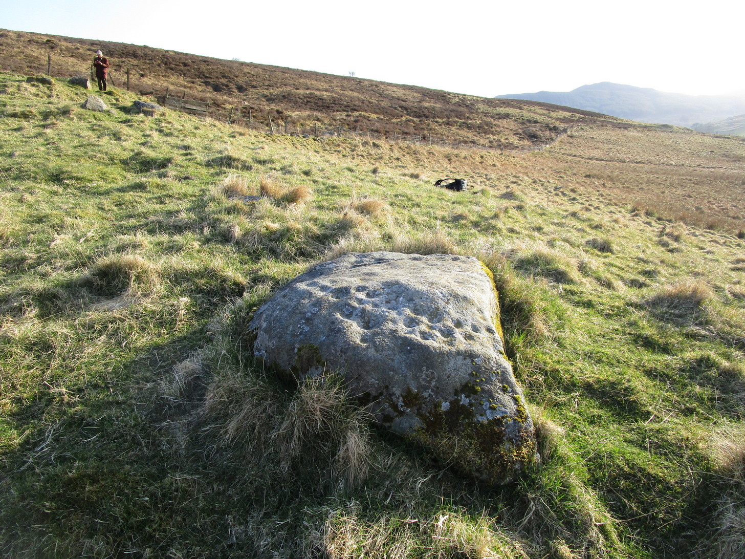
When you’ve visited the impressive cup-marked stone at Dalnavaid, this long lost carving might be worth seeking out by the real explorers among you. It’s not been seen for a hundred years and was only reported in brief by the reputable local historian Hugh Mitchell (1923). It’s located a mile north of the Dalnavaid carving, up in the hills on the other side of the road, “on the East side of Clunskea Burn, and on the West shoulder of Ben Skievie.” He described the carving as “having some 16 or 18 cups, and at present it forms part of a grouse butt.”
So if we locate the grouse-butt (they’re usually not too difficult to find), the carving will obviously follow. Mitchell gave us an extra piece of info regarding its location. He described the existence of several other seemingly prehistoric remains within a few yards of the grouse-butt, curious “pit dwellings”, three of them:
“they are of circular shape, about 9 feet in diameter and nearly 5 feet below the surface of the ground, and had evidently been roofed over at one time. The entrance to each is at the lowest level and acts as a drain, to keep the house dry. They are almost the only examples in the district of neolithic dwellings.”
Let us know if you find it!
References:
Mitchell, Hugh, Pitlochry District: Its Topography, Archaeology and History, L. Mackay: Pitlochry 1923.
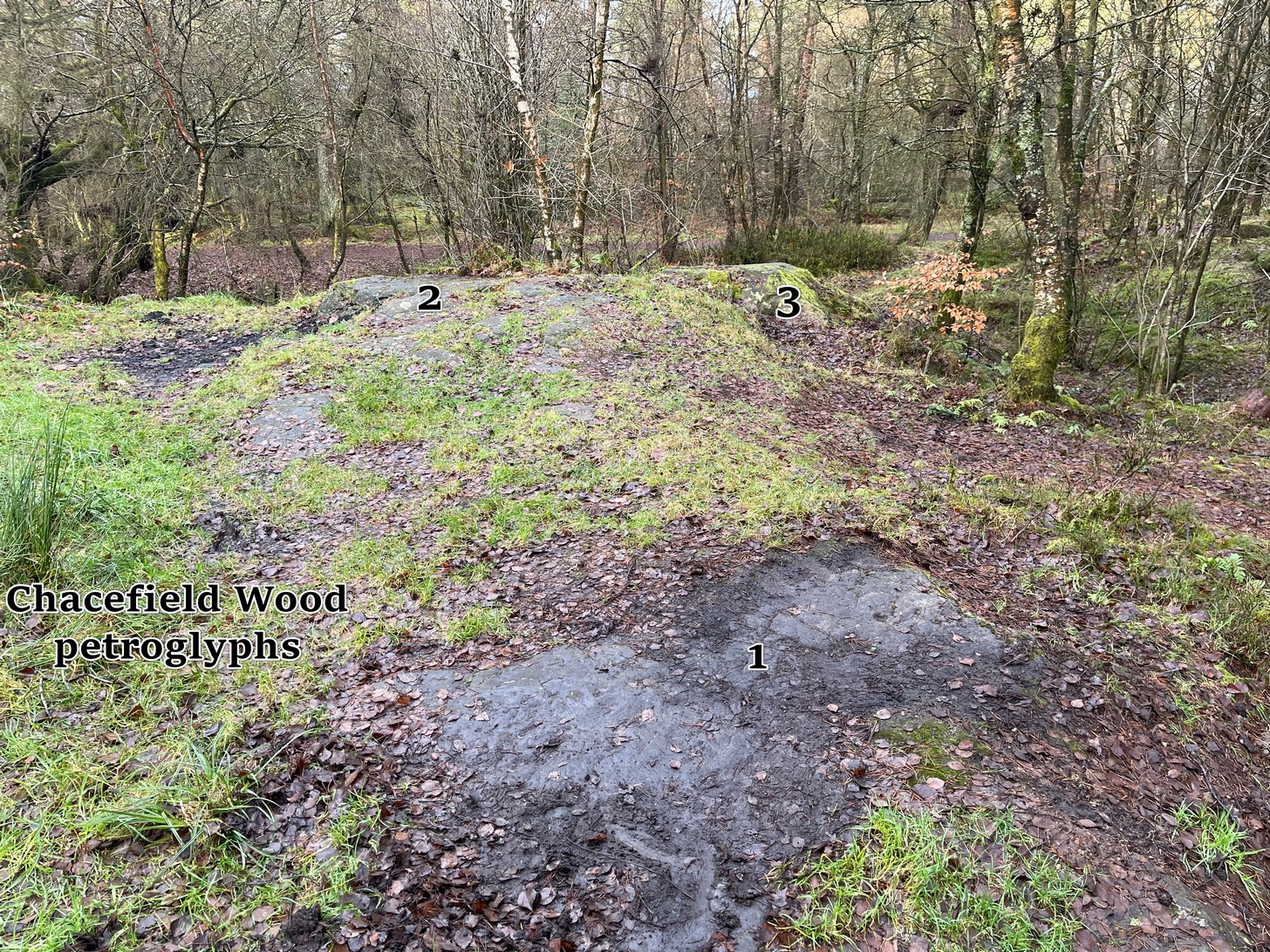
We took the A872 road on the south-side of Denny to Dennyloadhead and Longcroft, but a few hundred yards before you go under the M876, keep your eyes peeled for Drove Loan on your left. Go down here for literally ¼-mile (0.4km) where there’s a footpath into the woods on your left. Walk on the path into the trees and you’ll reach a track that heads to your right (east). Less than 200 yards on, you’ll see a pond on your right and above here is a small quarried rock outcrop. This carving’s up top, on the gently sloping rock behind carvings no.2 and no.3.
Archaeology & History
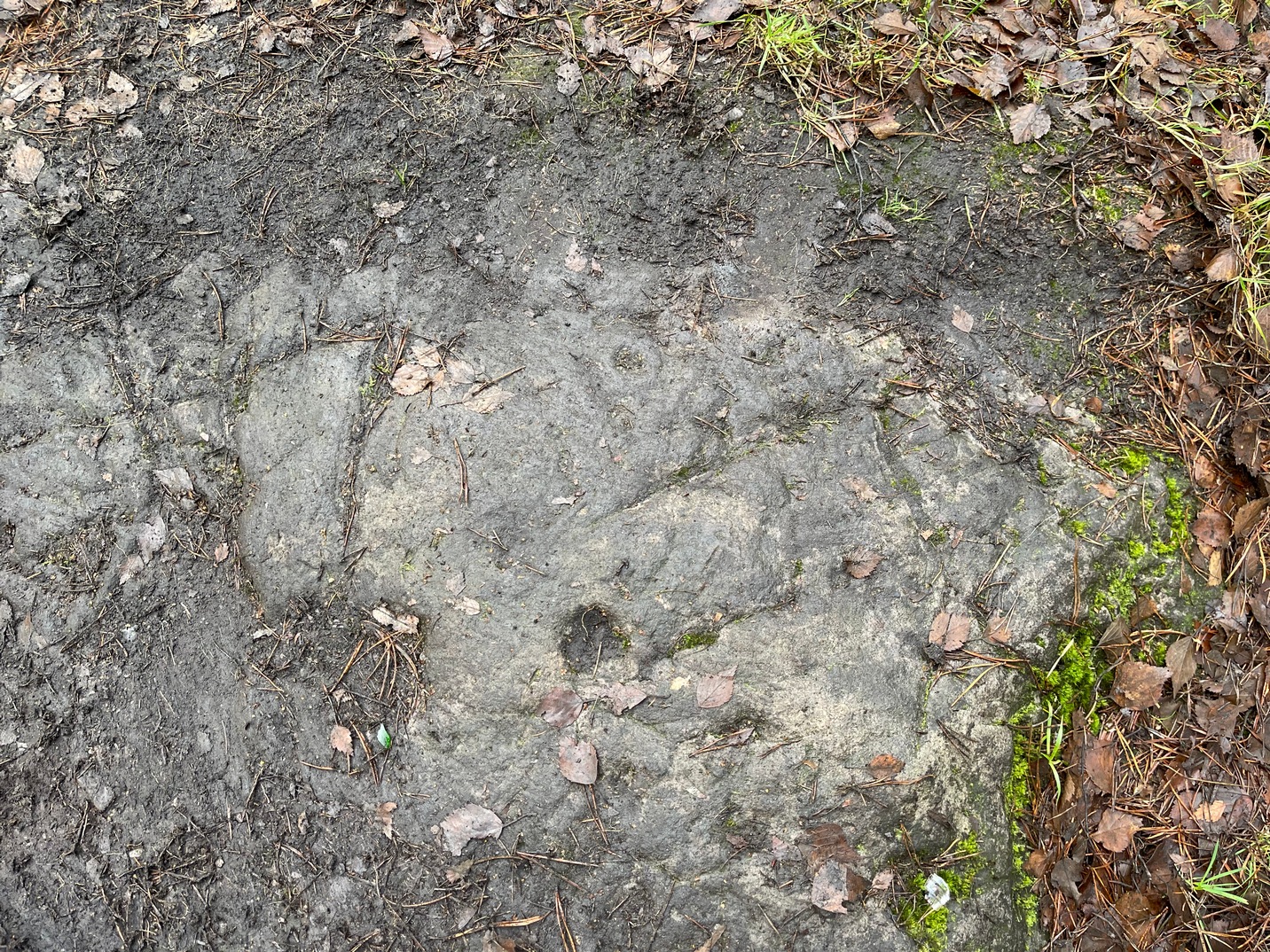
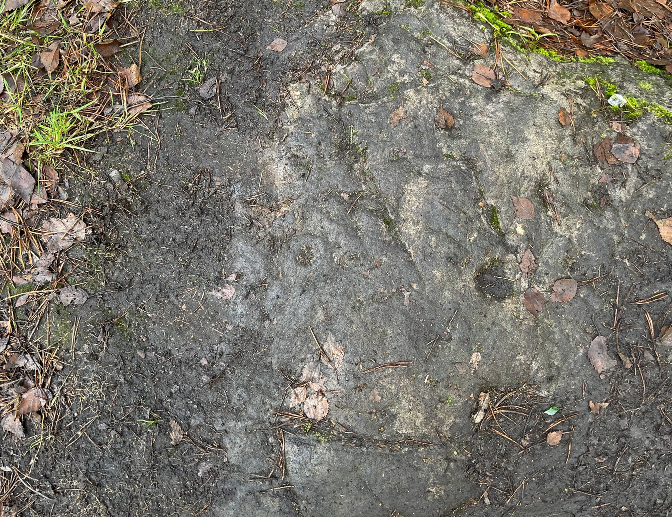
Half-covered in mud and vegetation, the first thing you’ll notice on this sloping smooth surface is what looks to be a standard cup-marking, all on its own. But it has company—albeit quiet and faint. A single incomplete cup-and-ring can be seen about 18 inch above (north-ish) this single cup-mark, which may itself be natural. You can make out the cup-and-ring pretty clearly in the photos.
When we found this, we began to clear the rest of the stone but stopped pretty quickly as a scatter of broken glass was mixed into the mud and I was lucky not to cut my hand open. Some kids have evidently been getting pissed here and have left their mess on the rock. But there may well be more symbols beneath the mulch, so if any local folk want to clean it, please make sure to wear some good gardening gloves to protect your hands! And if you find any other hidden elements, please let us know! 🙂
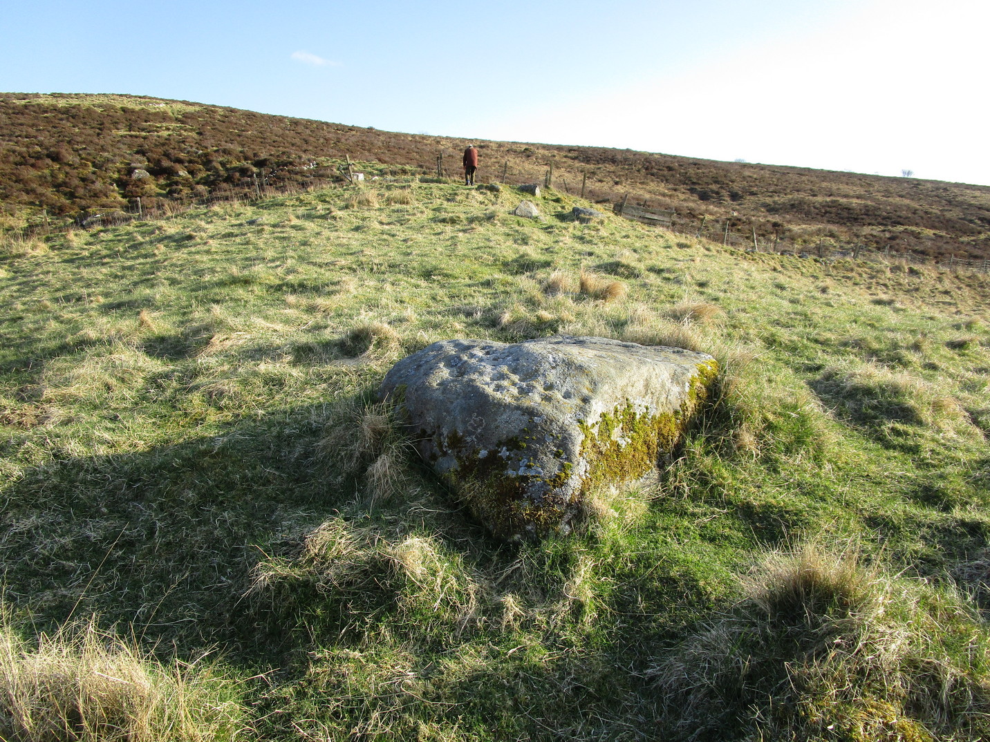
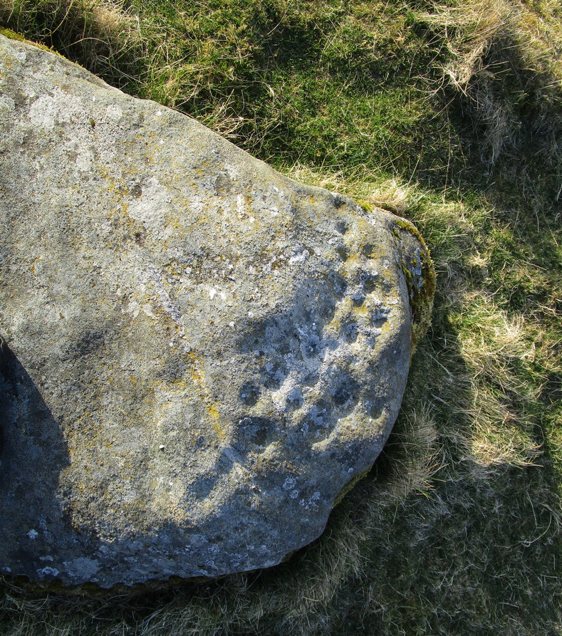
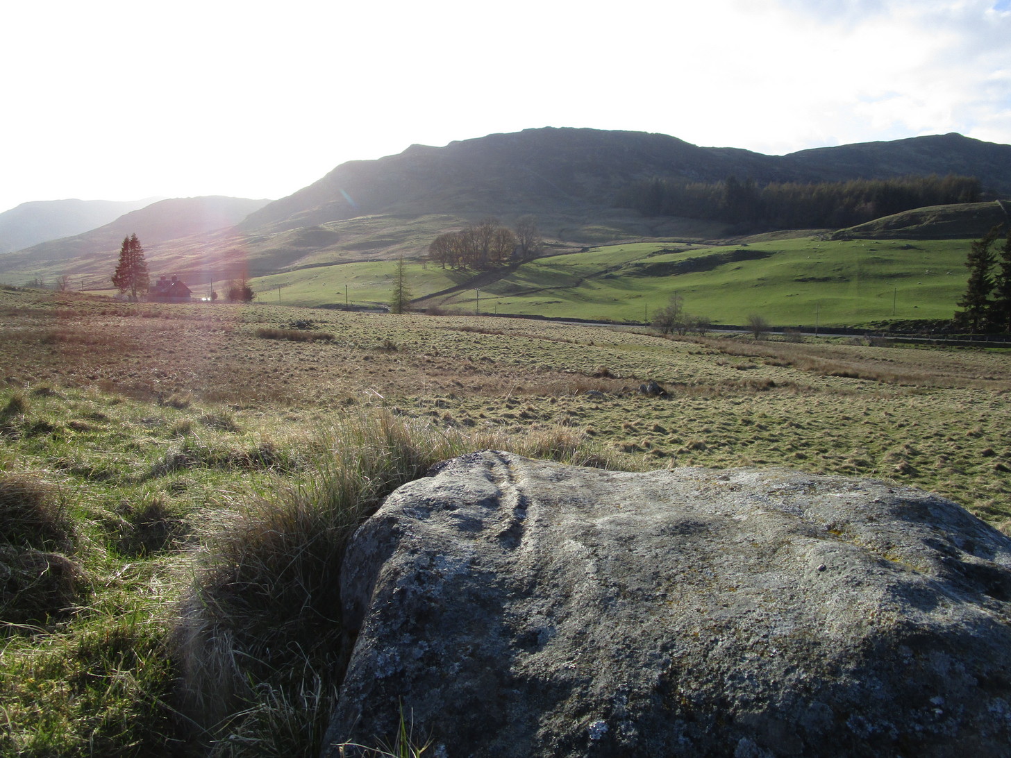
The quickest and easiest route is to take the A924 road from Pitlochry to Kirkmichael. It’s a gorgeous route in itself! Anyhoo… Once you’re out past the houses of Pitlochry and Moulin, you begin to make the real ascent up the winding road, past the hairpin bend and, 5 miles up where the road has levelled out and the craggy moorlands surround you, green fields begin to appear on your left. The first farm on your left is Dalnacarn and less than a half-mile past here, on your right, a small track takes you to Dalnavaid house. Walk along here, past the house and into the field, then the next field where a section rises up towards the fencing. On top of this are several rocks. You can’t really miss it!
Archaeology & History
This typically female rounded rock has, unusually, a series of cups in almost three rows along its easternmost slope, with one or two single cups on its top and southern side. It was first described by Fred Cole (1908) merely as “a small boulder, with a remarkable triple row of cup-marks, resting on a cairn-like mound”; but it wasn’t until John Dixon (1921) came here that a full description appeared. He told us,
Primary rows of cupsLong worked (?) line
“About 200 yards due east of (Dalnavaid) house a ridge or spit of land juts out from the adjoining hillside on to an almost level field. The ridge has sloping sides, and the nearly flat top is 10 or 12 feet above the general surface of the field. Near the end of the ridge stands the cup-marked stone… The dimensions of the stone are: length 4 feet 8 inches; width 3 feet; height from 1 foot 11 inches to 2 feet 4 inches. The cups are all near the north-east side of the upper surface of the stone, and are more or less in rows. Some are large, with a diameter of 3 inches and a depth of nearly 1 inch; others are much weathered, and vary from small, scarcely measurable, hollows, to cups 2 inches in diameter and ½ inch deep. The hollows are no doubt cups almost obliterated by ages of weathering. Reckoning them so, there are in all thirty or thirty-one cups. All are of the plain type, without rings or connecting grooves.”
Looking (roughly) west
A few years later Mitchell (1923) counted 26 cups on it. Along the western side of the stone are two natural cracks that run across it roughly north-south. It wasn’t until I crouched down to look at what seemed to be another cup on its vertical face that I noticed how these lines appeared to have been enhanced by human hands.
For petroglyph enthusiasts, this is a decent carving well worth the visit. What looks to be a cup-and-ring design is found on a stone due south of here and, in all probability, others are hiding away nearby—the “lost” cup-marked stone of the Clunskea Burn, a mile north of here, being one such place. Let us know if y’ find it!
Cup-and-Ring Stone (lost): OS Grid Reference – NN 880 252
Archaeology & History
A long lost carving, probably quite impressive in design, was recorded by John Laurie, schoolmaster in Monzie. He told us that,
“a large Druid stone with rude carving upon it lies on the side of the public road between the villages of Monzie and Keppoch. This stone was one of a Circle which Mr Monroe, the then minister, caused to be broken and dispersed.”
When Fred Coles looked for the remains of this “circle” at the beginning of the 20th century, he questioned Laurie’s location of the site, but found remains of one in an adjacent field consisting of two stones, but told that “on neither of them could we discern any carving of any sort.” It’s likely that the carving has been completely destroyed, or if we’re lucky it may be hiding in some nearby walling.
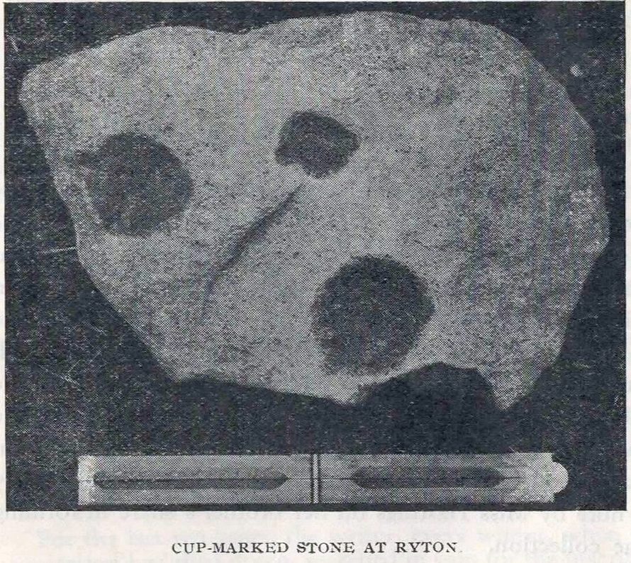
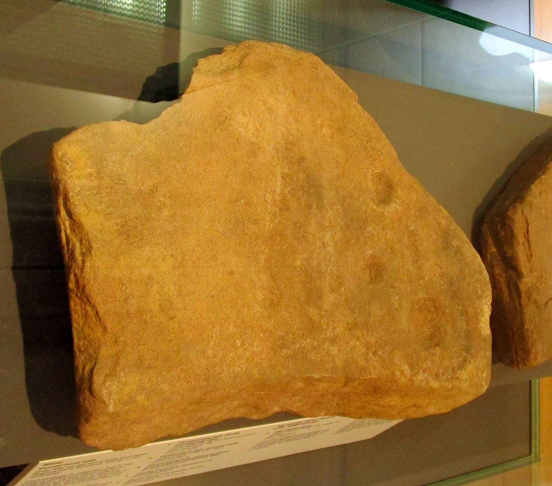
Cup-Marked Stone (removed): OS Grid Reference – NZ 1480 6417
Archaeology & History
Ryton cup-marked stone
In a short piece read before Newcastle’s Society of Antiquaries in 1942, a Mr Cocks (don’t laugh!) told that when a friend of his was clearing out an old land drain in his garden, he found this fragmented cup-marked stone, “which had been made use of as a corner slab on the drain”! It was located “about 40 yards south-west of Tweedy’s Buildings,” on the west side of town. Broken from a larger piece of stone, the attached photo here shows the simple design of the basic cup-marks, measuring respectively 2½, 2 and 1⅝ inches across. Mr Cocks told that “there are also two finger-tip hollows on the stone tone which or may not be natural. A dark line running between the cups is a natural fissure.”
Last we heard, the stone was living in a box somewhere in the archives at the Great North Museum, Newcastle.
References:
Cocks, W.A., “A Cup-Marked Stone at Ryton,” in Proceedings Society of Antiquaries Newcastle-upon-Tyne, volume X, no.2, January 1943.
Cup-and-Ring Stone (removed): OS Grid Reference – NO 378 308
Archaeology & History
Cup & ring stone of Balgay Hill
This little-known cup-and ring stone was found at ground level sometime around 2003, near the top of Balgay Hill. A small portable stone that may have been broken from a larger slab, it has what seems to be two if not three cup-and-rings, accompanied by two or three single cup-marks. One of the rings seems to have a faint line coming out of it. Unfortunately none of this is clear in the photos I took (the one attached here is the best), as it lives under glass in Dundee Museum, so it was very difficult to get decent images. It is now housed in the McManus Museum in Dundee (a damn good place, with very helpful staff) and well worth checking out if you’re in the area.
Cup-Marked Stone (lost): OS Grid Reference – NO 074 458
Archaeology & History
In J. Romilly Allen’s (1882) lengthy essay on rock art in Scotland, he mentions a singular boulder that was “found by Dr Rattray” at Laighwood, near Butterstone—but, unlike him, he gave no further details regarding its appearance or exact whereabouts. It was included in the Royal Commission (1990) survey of the area, with no additional details. It remains lost. In the event that you manage to rediscover it, grab some good photos of it and stick ’em on our Facebook group. (the grid-reference to this site is an approximation)
Royal Commission on the Ancient & Historical Monuments of Scotland, North-East Perth: An Archaeological Landscape, HMSO: Edinburgh 1990.
Acknowledgements:Huge thanks for use of the Ordnance Survey map in this site profile, reproduced with the kind permission of the National Library of Scotland.
Cup-Marked Stone (lost): OS Grid Reference – NO 0617 2328
Archaeology & History
Site shown on 1933 map
First highlighted on the 1933 OS-map of the area, it was located alongside the old fence-line hereby, but no subsequent description of the carving has been made since then. A small boulder and a number of other stones can be found along the line of fencing, but none seem to be possessed of petroglyphs and apart from it being shown on the old maps, I can find no reference or description of it. It may have been destroyed. Some researchers have wondered if the carving was mistakenly marked at this spot by surveyors who confused it with another one more than 500 yards to the southeast (and described by Fred Coles in 1903), but this would seem an unlikely error to have been made. Whilst this was described as a simple “cup-marked stone”, its neighbour at West Lamberkine (2) was a distinct and more complex cup-and-ring design.
References:
Coles, Fred, “Notices of …(4) of Some Hitherto Undescribed Cup-and-ring-marked Stones…” in Proceedings Society Antiquaries Scotland, volume 37, 1903.
Acknowledgements:Many thanks for use of the Ordnance Survey map in this site profile, reproduced with the kind permission of the National Library of Scotland.
Legendary Rock (destroyed): OS Grid Reference – HP 5223 0467
Archaeology & History
Whilst classifying this as a “legendary” rock, it was as much a functional stone that played an integral part of local village life in the 19th century and, most probably, way before that. This large stone possessed a large cavity in the shape of a giant human footprint, measuring 12 inch by 4 inch. It could be seen “above the Deeks of Bracon, North Yell, up Hena”, but when first described in 1865, it was said to be “no longer in existence.” Despite this, when an Ordnance Survey dood came looking for it in 1969, he reported it as “still in existence” and known of by local people. Is there anyone in the far far north who can tell us?
Folklore
The impression of the large footprint was natural, but the use to which local people made of it is valuable when we seek to understand pre-industrial customs. The Royal Commission (1946) lads echoed the folklore handed down by J.T. Irvine from 1865, telling that,
“Formerly the people used to wash in dew or rain-water that had gathered in the cavity and stand in it to get rid of warts. The tradition was that a giant had planted one foot here and the other on a stone on the Westing of Unst.”
Healing stones with such properties can be found everywhere on Earth.
References:
Royal Commission Ancient & Historical Monuments, Scotland, Inventory of the Ancient Monuments of Orkney and Shetland – volume 3, HMSO: Edinburgh 1946.
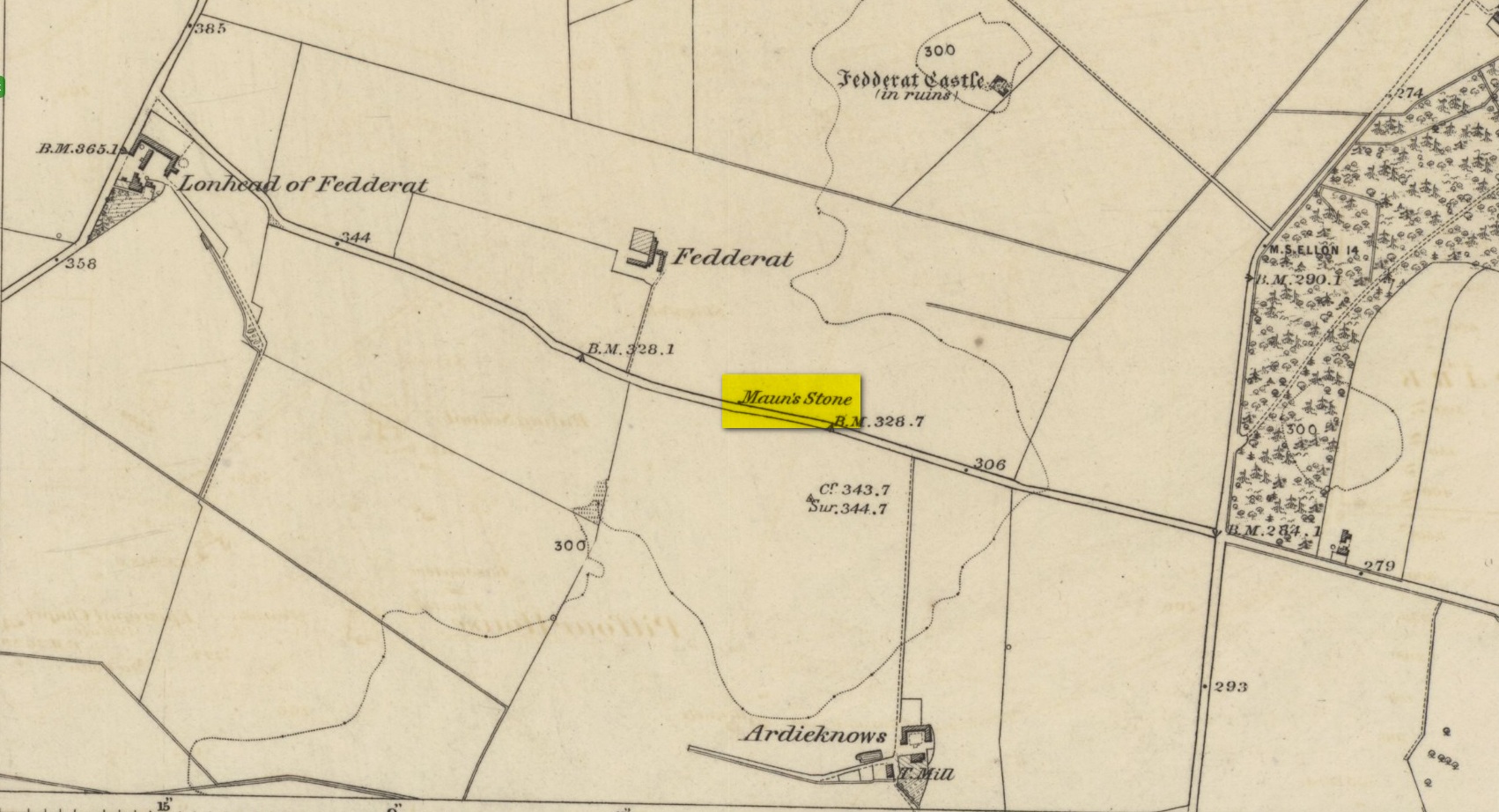
Legendary Rock (destroyed): OS Grid Reference – NJ 89397 49502
Also Known as:
Crawey Stone
Crawford Putting Stone
Crawstane
Devils Putting Stone
Archaeology & History
Stone shown on 1874 map
A site whose main claim to fame is its legendary nature. Seemingly buried or destroyed around the end of the 19th century, there have been suspicions that the stone might have had cup-marks on it (see Folklore below), but we’re not sure. Modern lore tells that when roadworks were done here in the 1950, a large stone was uncovered. A local man who was passing by told that he’d seen the Crawey Stone in his youth and that the stone they’d uncovered was one and the same.
Folklore
The story that used to be told amongst local people was thankfully preserved in an article by the pseudonymous “Mormond” (1889) in Scottish Notes & Queries. He told that:
“In the parish of New Deer, and in a field near the Old Castle of Fedderat, there is a large boulder of ten or twelve tons known as the Crawey Stone. I am unable to say if it still occupies its old site, or if it has been broken up for building purposes. The legend connected with this stone used to be well known in the parish, and a version of it appeared in The Aberdeen Magazine some 70 or 80 years ago. This version is substantially the same as the legend known in the district, and relates how a Crawford, the lord of the castle and lands, one day “as he looked o’er his castle wa’ ” — a phrase which often occurs in old ballads — observed a crunkled carl (old woman or witch, PB) inspecting the stone and afterwards successfully lifting up one end clear of the ground. Not to be conquered by such a shabby looking stranger, the laird, who was famed for his athletic powers, went out and challenged the carl; but on attempting to lift the boulder, burst a blood vessel; and the carl, who stood by watching him, suddenly disappeared in a flash of fire taking the remains of the laird along with her. The tradition is that the laird was not mourned for in the district, and the moral drawn was “He couldna hae expected ony ither en’.” When passing the boulder going to school, the legend was often referred to, and some indentations on it pointed out as the marks of the ill man’s fingers made at the time the superhuman feat was accomplished.”
These finger marks have been taken as possible cup-markings. They might have been, but we simply don’t know; they may just have been curious natural markings that gave rise to this animistic creation myth. Another tale told that the markings were due to an old giant in the neighbourhood who used the rock as a putting stone and rolled it to the spot where it used to stand. Giants are always attached to indigenous creation myths, some of which go back thousands of years.
“a large Stone of a roundish shape, built on an old fence, forming a side of the Public road leading from New Deer to Brocklay. Tradition asserts that it has been the putting Stone of a Giant in ancient times. There are Several holes in the Stone said to be the finger marks of the Giant.”