Cup-and-Ring Stone: OS Grid-Reference – NS 85887 88394
Also Known as:
- Castleton 1 (Morris 1891)
- Castleton 1a (van Hoek)
- Gosham Park
Getting Here
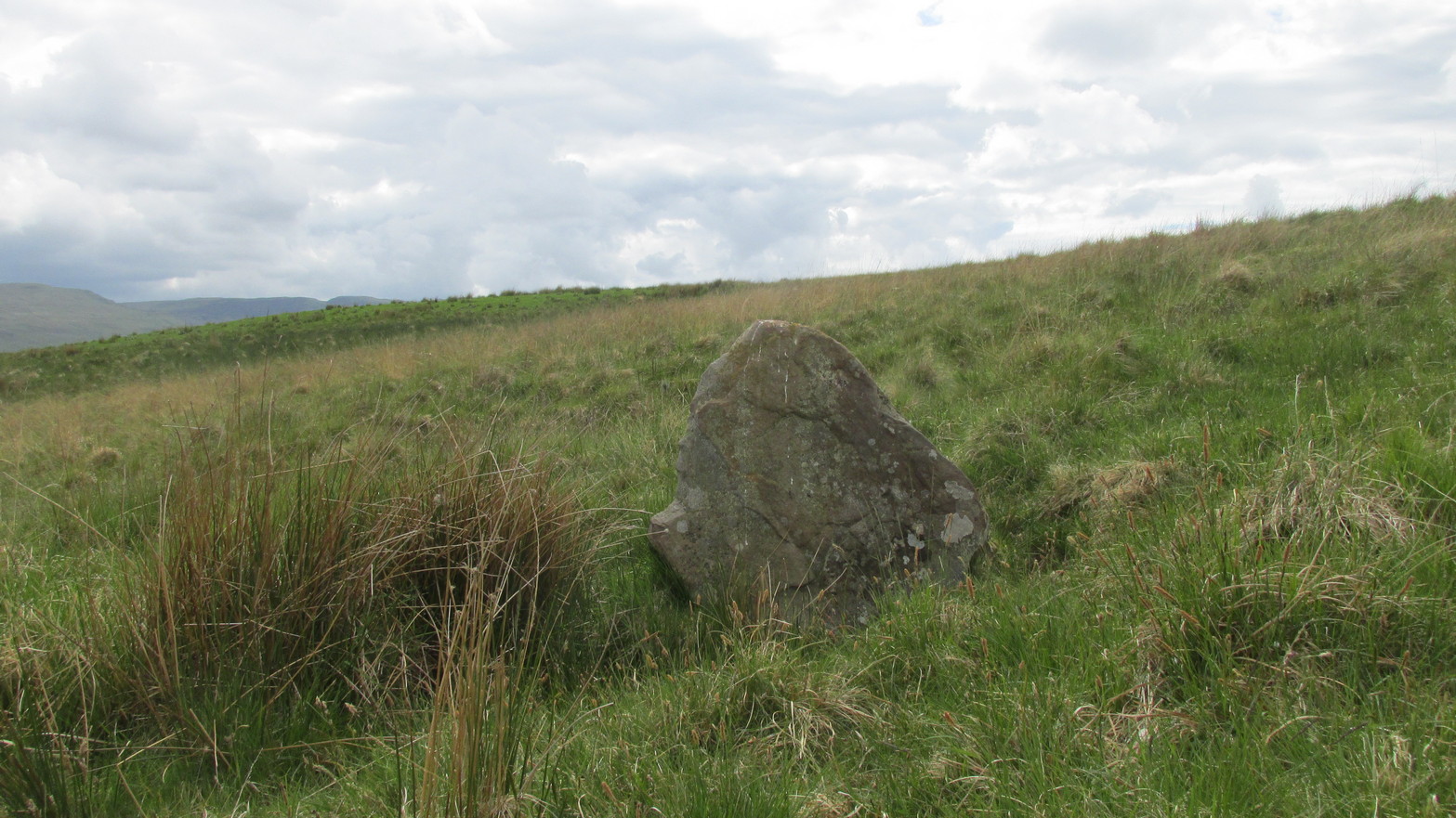
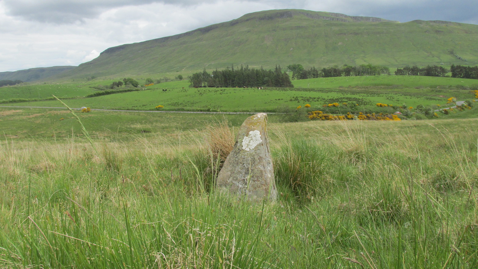
To reach here from Stirling or Bannockburn, take the B9124 east to Cowie (and past it) for 3¾ miles (6km), turning left at the small crossroads; or if you’re coming from Airth, the same B9124 road west for just about 3 miles, turning right at the same minor crossroads up the long straight road. Drive to the dead-end of the road and park up. You’ll notice that this is a crossroads of dirt-tracks. Walk along the one that heads to the houses you can see on a rise above the fields, eastwards. About 300 yards on, instead of going up towards the houses, walk thru the gate and along the wall-edge for 85 yards and go thru the gate to your right. You’ll see a small rise covered in gorse trees 100 yards in front you and roughly in the middle of it all, you’ll find this carving.
Archaeology & History
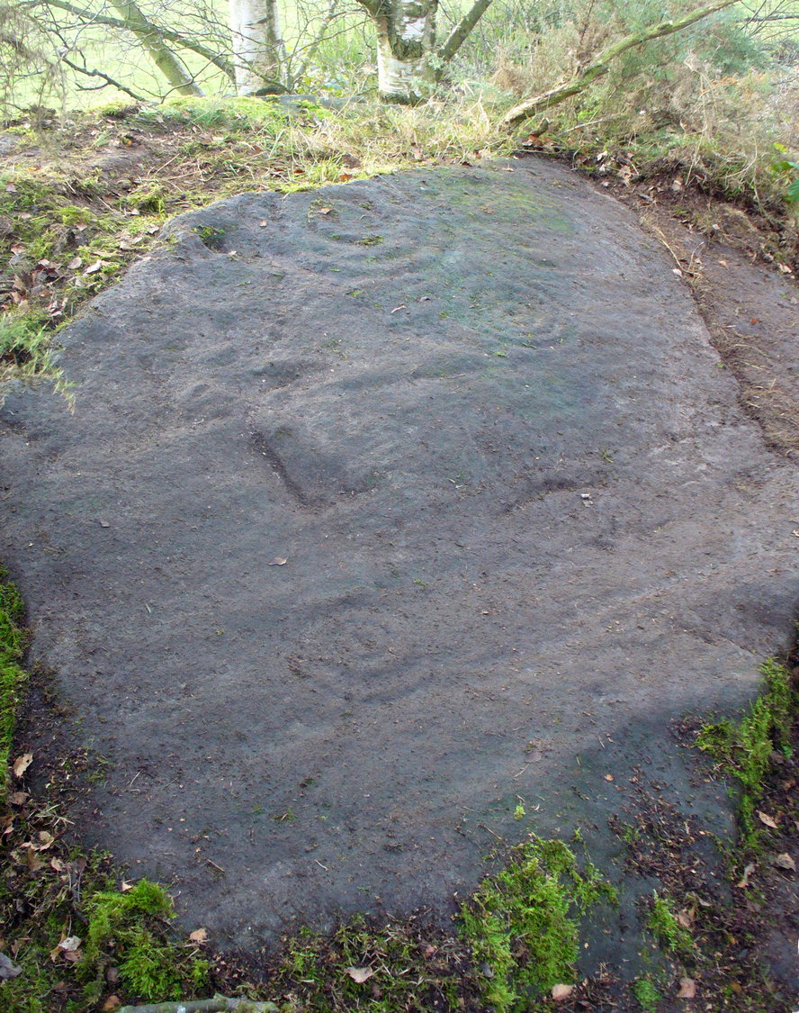
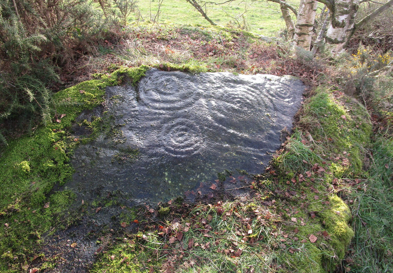
When John Bruce (1896) wrote his article on the mighty Cochno Stone a few miles north of mighty Glasgow, he left some end-notes about a petroglyph near Carnock (near Castleton) that was “found to bear a few much weathered cups with concentric circles.” He wasn’t at all clear where the carving was located, merely telling that it was “in the Gosham Park” area on the Carnock estate. This vague description was probably the reason why, when the lads from the Royal Commission came looking for it in August 1955, they left without success. Nevertheless, when Ron Morris (1981) explored this area he located the place-name of Gosham Field and, therein, this multi-ringed carving. It seems more than likely that this was the carving described by Mr Bruce – and it’s an impressive one!
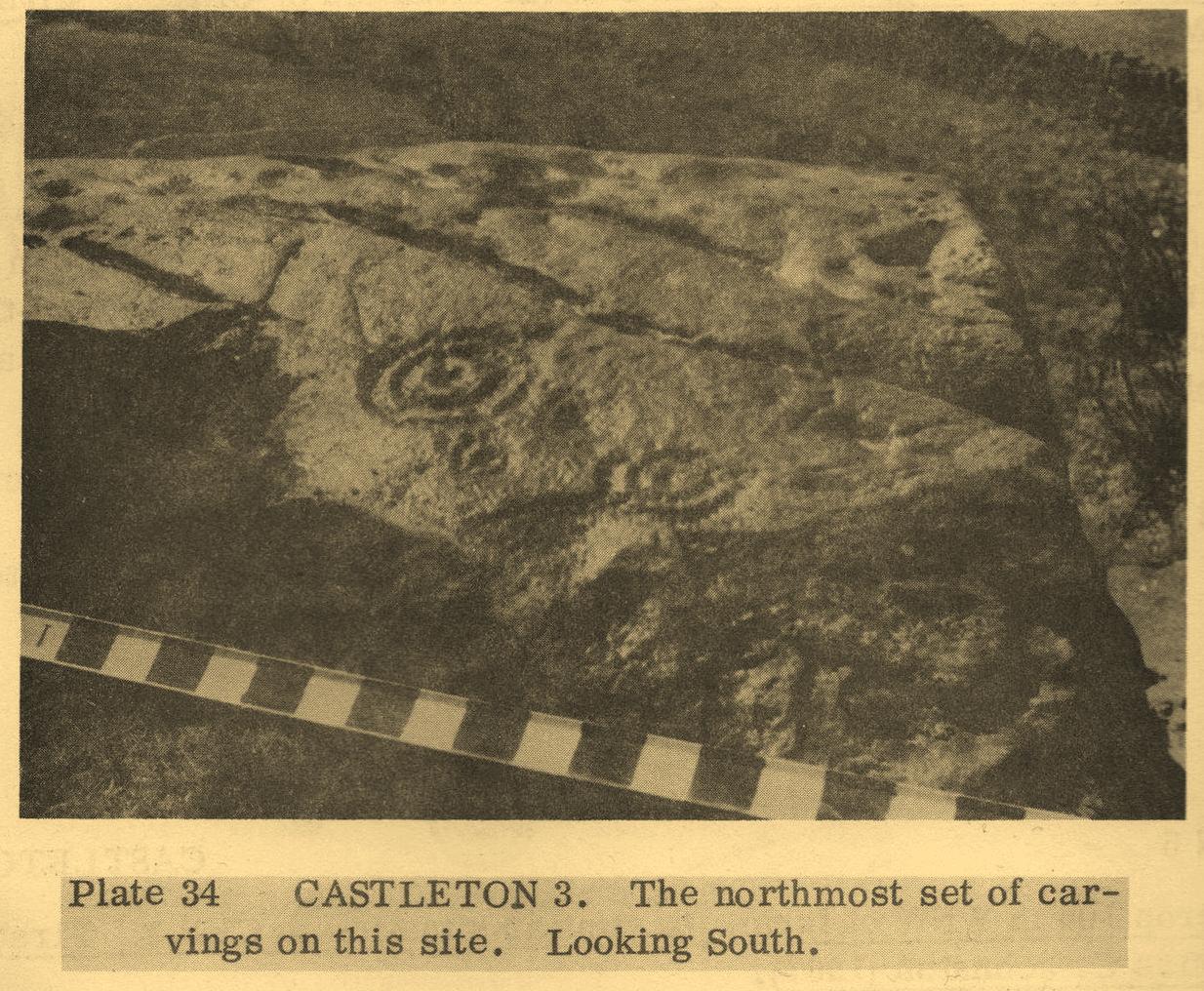
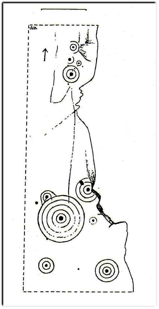
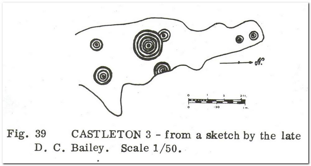
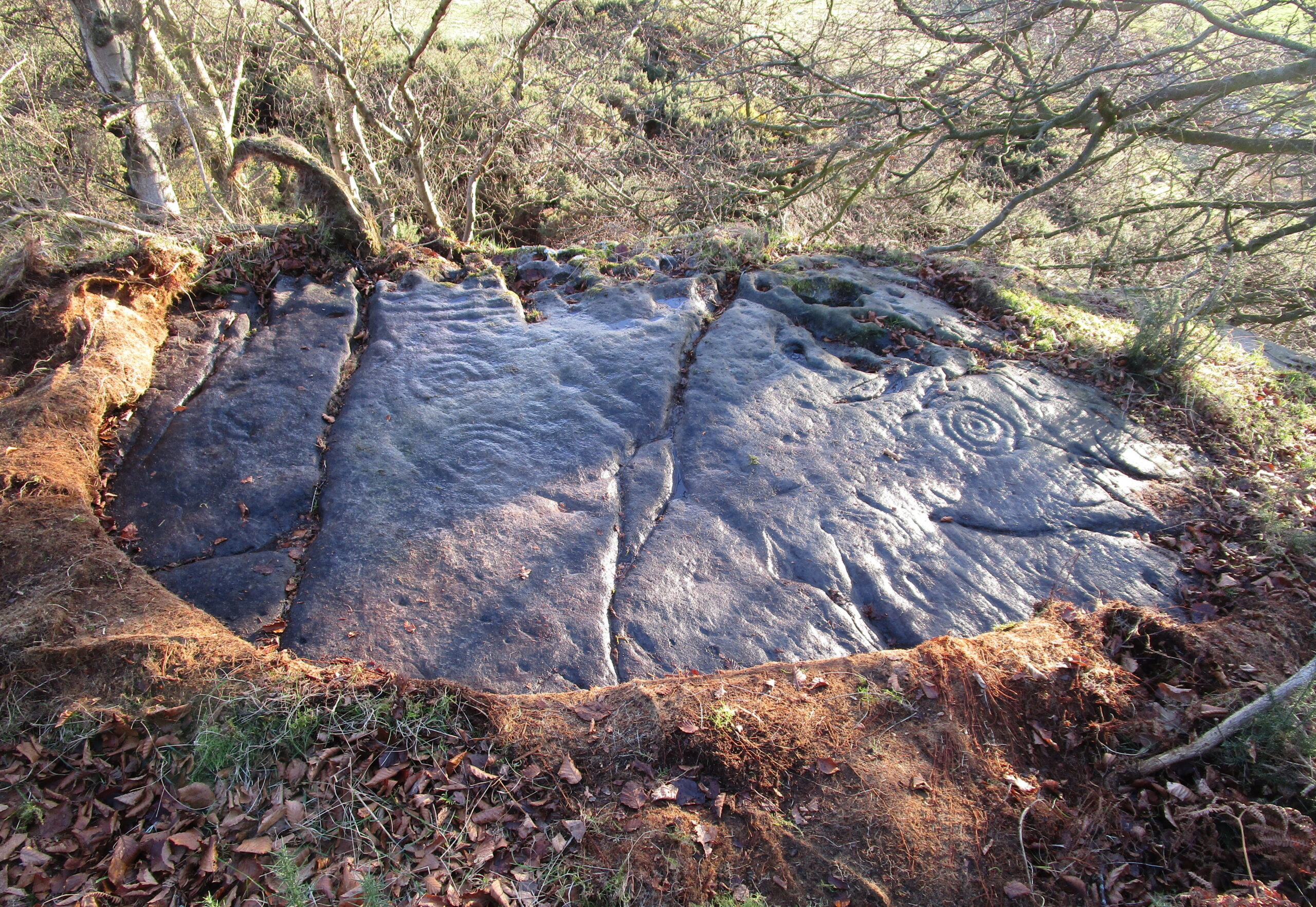
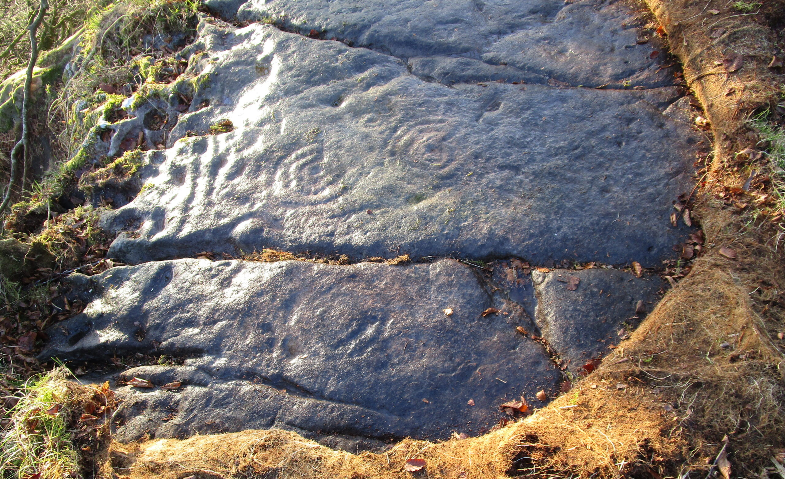
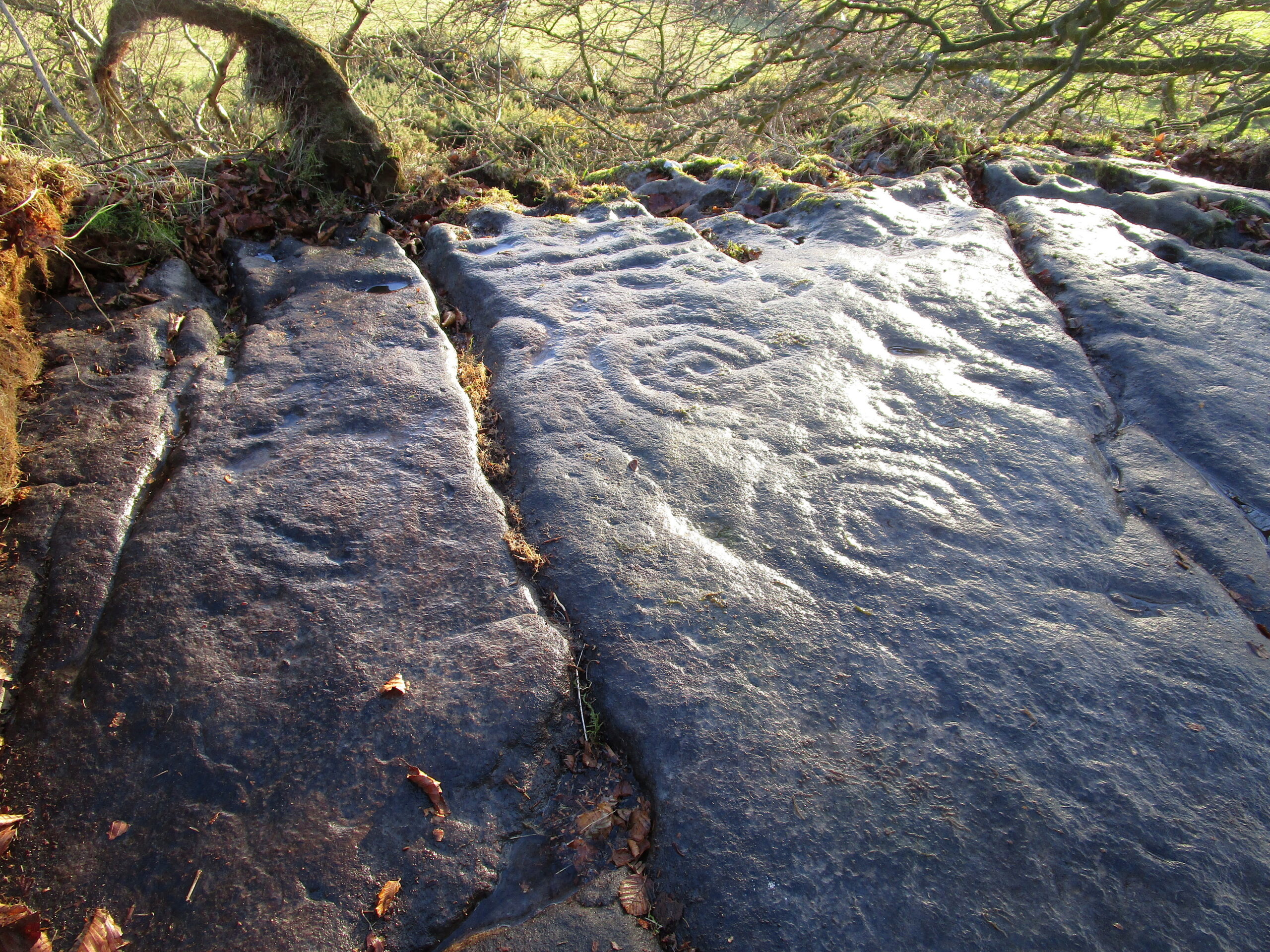
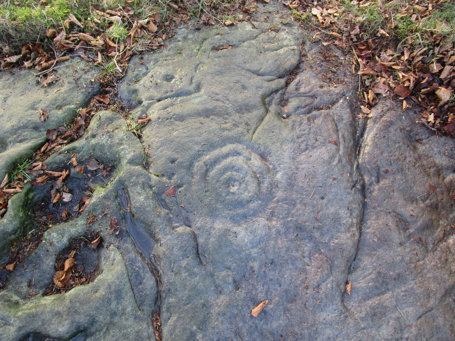
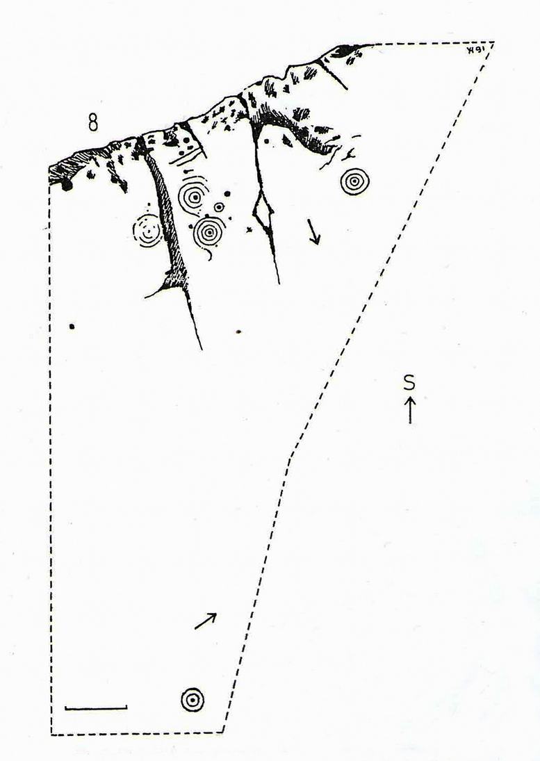
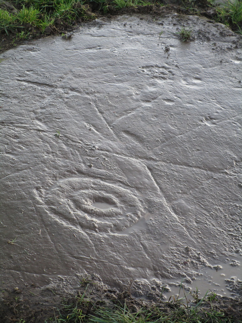
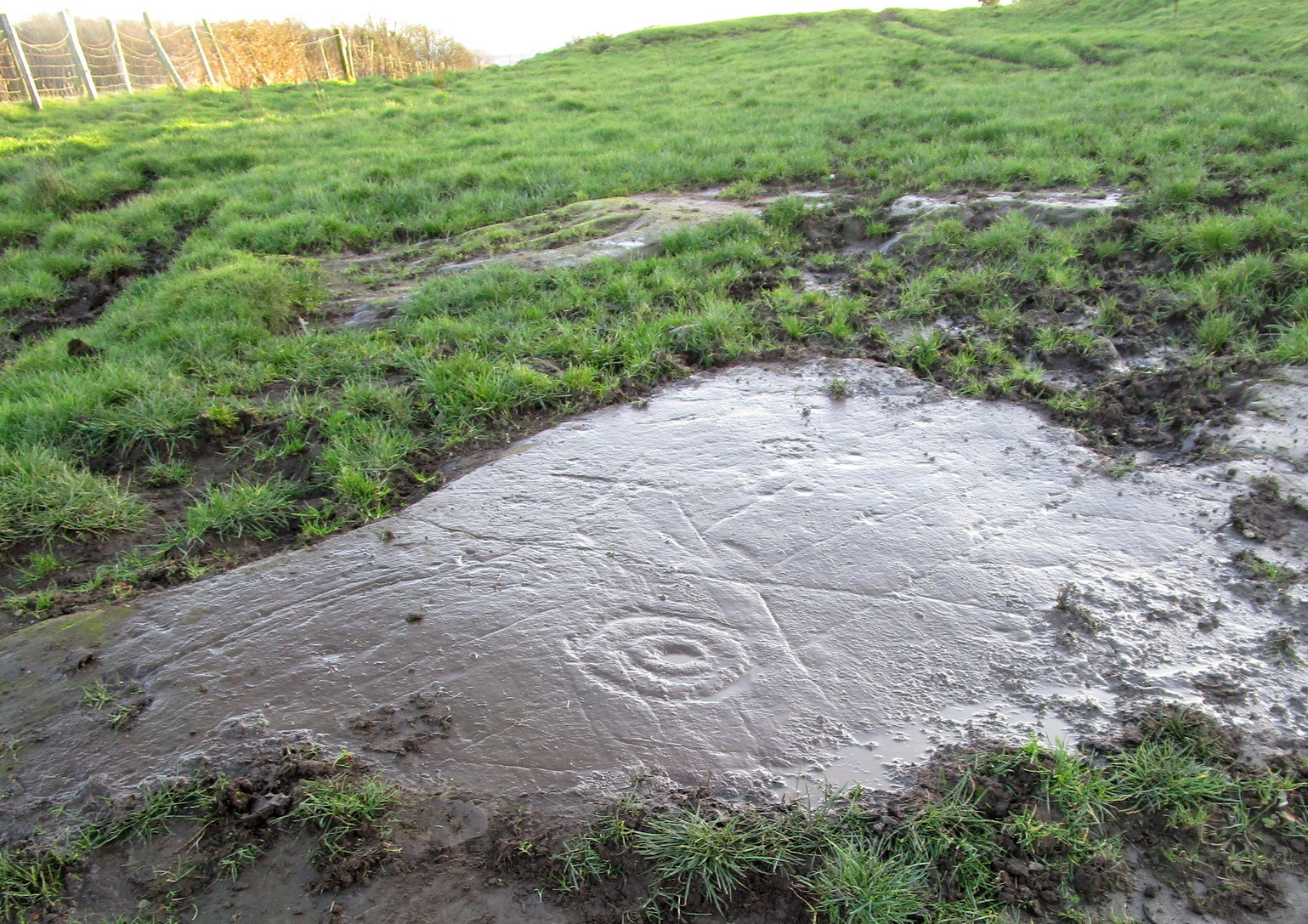
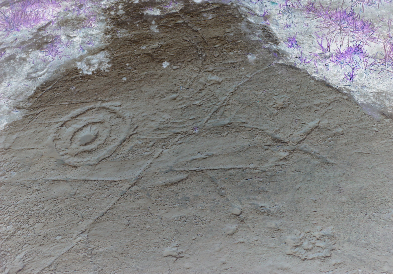
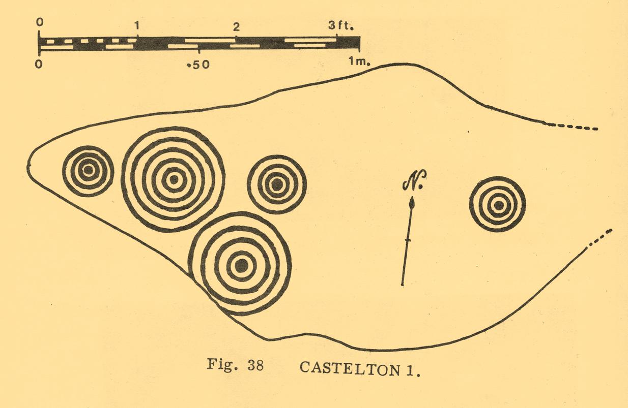
Despite being eroded by the passage of time, the carved design is still pretty easy to see, comprising a cluster of archetypal cup-and-multiple rings in close proximity to each other, etched onto a sloping stone. Ron Morris’s (1981) description told that, 125 yards east of Gosham Field’s western wall,
“is a prominent greywacke outcrop, part of a rocky ridge running NW-SE, exposed in 1969-75 for 3m by 2m (10ft x 6ft), 4m (12) high on its S, but at ground level elsewhere, sloping 15° NE. On its fairly smooth surface are:
“5 cups-and-complete rings, with no grooves, 3 with three rings, 1 with four, and 1 with five rings, up to 36m (14in) diameters and 1cm (½in) depth.”
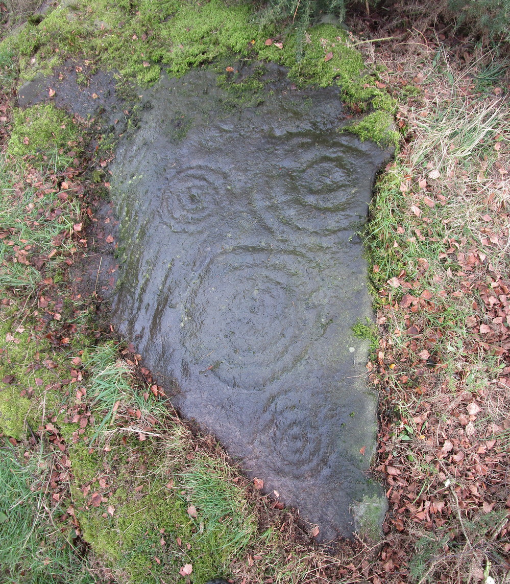 Yet contrary to Morris’ description, there are some “grooves”, or carved lines emerging from some of the rings; faint but definitely there. You can make them out in the accompanying photos above. (are there any sketch artists out there could accompany us to these carvings, so we get some good portraits of the stones?) When Maarten van Hoek (1996) visited this carving he also missed these ‘ere carved grooves.
An additional feature that needs to be mentioned is the cluster of small geological deep natural cups, inches away from the carved rings on the southern edge of this stone (completely covered in vegetation in the attached photos). The same feature also exists on the southern edges of the Castleton 5, Castleton 6 and Castleton 12 carvings and it probably had some mythic relationship with the petroglyph.
There’s another cup-marked stone about 30 yards east of here, along this same geological ridge. It was previously covered in gorse, which was thankfully removed following a fire caused by the hot weather at one of the other carvings, preventing a cracking of the rock which would damage the carvings. All of the rock surfaces in the Castleton complex need to be laid bare to enable a greater visual experience of the wider Castleton complex and to prevent them being damaged by the gorse roots cracking the rocks, as well as stopping fires which will also damage these vitally important petroglyphs. People in the Cowie area want to see and experience their own local history…

References:
- Bruce, John, “Notice of Remarkable Groups of Archaic Sculpturings in Dumbartonshire and Stirlingshire,” in Proceedings Society Antiquaries, Scotland, volume 30, 1896.
- Morris, Ronald W.B., “The cup-and-ring marks and similar sculptures of Scotland: a survey of the southern Counties – part 2,” in Proceedings of the Society of Antiquaries, Scotland, volume 100, 1968.
- Morris, Ronald W.B., The Prehistoric Rock Art of Southern Scotland, BAR: Oxford 1981.
- Ritchie, Graham & Anna, Edinburgh and South-East Scotland, Heinemann: London 1972.
- Royal Commission on the Ancient and Historical Monuments of Scotland, Stirlingshire: An Inventory of the Ancient Monuments – volume 1, HMSO: Edinburgh 1963.
- Royal Commission on the Ancient & Historical Monuments of Scotland, Archaeological Sites and Monuments of Stirling District, Central Region, Society of Antiquaries of Scotland 1979.
- van Hoek, M.A.M.,”Prehistoric Rock Art around Castleton Farm, Airth,” in Forth Naturalist & Historian, volume 19, 1996.
© Paul Bennett, The Northern Antiquarian