Murlaganmore, Killin, Perthshire

Cup-Marked Stone:  OS Grid Reference – NN 5402 3455

Also Known as:

  1. Morlagganmore

Getting Here

Murlaganmore02
Murlaganmore stone & setting

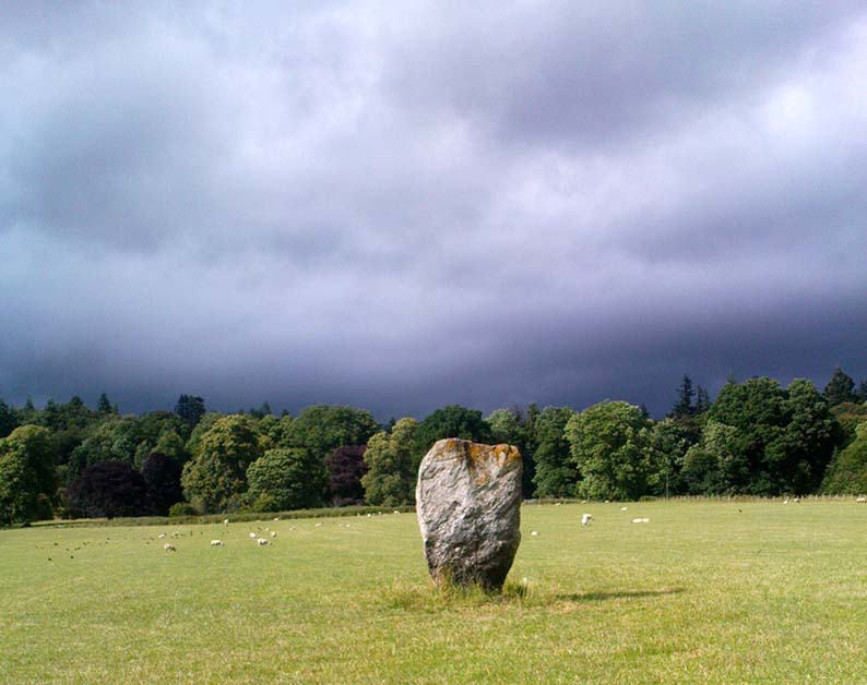
From Killin, take the Glen Lochay Road past the Moirlanich Longhouse, but keep on for another mile, and take the track on the left up to Murlaganmore cottages.  As the track turns right of the tree-line, cross the field (left) up towards the open gate as if you’re going to the Murlaganmore 2 carving, where you’ll see this large flattish rock in the grasses about 100 yards before it.

Archaeology & History

When we visited this old boulder last week, we had the misfortune of grey days and dark clouds throwing their faded light across this cup-marked rock, not really letting us see with any clarity the many cups which pepper (mainly) the edges of the rock.  But the cups are faded anyway, so accounts tell, and the 15 which we counted were same 15 recorded about 100 years ago in C.G. Cash’s (1912) survey.  There, he described this old stone as,

“about 200 yards south of the house, in the middle of the uppermost pasture. It is a large block of quartz schist stuck thick with garnets, and bearing fifteen cup-marks, only one of which — 3 inch in diameter and 1 inch deep — is really well defined, and several of which are faint.”

Murlaganmore03
Faint cups barely visible
Murlaganmore01
C.G. Cash’s early drawing

But despite the grey day (She was absolutely teeming with rain half of the time!), I found the setting here absolutely gorgeous, with the many shades of old trees and the clear blood of pure waters falling through the landscape.  And, without doubt, there are other carved stones nearby that have yet to capture the attention of surveyors.  You can smell them!

References:

  1. Cash, C.G., ‘Archaeological Gleanings from Killin,’ in PSAS 46, 1911-12.
  2. Royal Commission on Ancient & Historical Monuments, Scotland, The Archaeological Sites and Monuments of Stirling District, RCAHMS: Edinburgh 1979.

© Paul Bennett, The Northern Antiquarian


Murlaganmore 2, Killin, Perthshire

Cup-Marked Stone: OS Grid Reference – NN 5395 3455

Getting Here

Murlaganmore 2 - 01
Murlaganmore 2

Take the same direction to reach the Murlaganmore Footprint, continuing up past the cottages. 100 yards on, where there’s a bend in the track, cross the field on your left and go thru the gate higher up the slope.  Stick to the small rough ‘path’, past the Murlaganmore 1 carving for nearly 100 yards, where a small rocking-stone-like rock is ahead of you. That’s it!

Archaeology & History

Close-up of cup-marks

This stone’s in a lovely setting, with the craggy rise of Creag Mhor and the waterfall of Airigh an Fhraoich up the rich coloured slope behind it.  But the carving here is a simple one, with perhaps only 2 cup-markings etched on the stone’s upper surface, as the photo here shows.  Tis a lovely setting though, and there are other carved rocks living nearby which aint yet seen the pages of any record-books.

It was first mentioned in C.G. Cash’s (1912) essay on the antiquities of Killin and district, who told that here was “one well-cut cup, 3 inches in diameter and 1½ inches deep, and also a doubtful or faint one.”  The carving was later listed in the Royal Commission’s Stirling District report (1979) as simply “a boulder bearing cup-marks.”

References:

  1. Cash, C.G., ‘Archaeological Gleanings from Killin,’ in PSAS 46, 1911-12.
  2. Royal Commission on Ancient & Historical Monuments, Scotland, The Archaeological Sites and Monuments of Stirling District, RCAHMS: Edinburgh 1979.

© Paul Bennett, The Northern Antiquarian


Murlaganmore Footprint, Killin, Perthshire

Carved Rock:  OS Grid Reference – NN 54321 34840

Also Known as:

  1. CEN 16 (Morris 1981)
  2. Murlaganmore 3

Getting Here

From Killin, take the small road to the Moirlanich Longhouse, but keep on for another mile. Just before the road crosses the river, stop! In the fields above you to the left are a few trees and some rocks. Walk uphill till you’re nearly level with the cottages at Murlaganmore (the gate’s about 10-15 yards away) just above the gorze bushes and check out the long rock.  If you can’t see it at first, bimble about till you find it. You’re just about on it!

Archaeology & History

Murlaganmore footprint02
Murlaganmore’s ‘Footprint’ carving – probably Nature’s artwork

Although shown on modern OS-maps as a ‘Sculptured Rock’ and included in the Canmore survey, when we visited this site a few days ago I have to say that unless evidence to the contrary can be obtained, this ‘site’ should be declassified as an archaeological remnant of the prehistoric period.  It appears to be natural — though could have had some agricultural purpose or origin in centuries past.

The ‘footprint’ appears to have been described first of all by F.W.L. Thomas (1879) in his essay on the inaugural seat of Kings at Dunadd, where a similar footprint is found at the top of the fort.  Thomas thought that this curious footprint could have had a similar function — though even folklore hereabouts seems silent on such a matter.  The site is included in Ron Morris’ 1981 survey, where he too described it as “probably natural but just possibly man-improved.”

References:

  1. Morris, Ronald W.B., The Prehistoric Rock Art of Southern Scotland, BAR: Oxford 1981.
  2. Thomas, F.W.L., ‘Dunadd, Glassary, Argyllshire: The Place of Inauguration of the Dalriadic Kings’, in Proc Soc Antiq Scot, vol.13, 1879.

© Paul Bennett, The Northern Antiquarian


Carra Bhroin, Lochboisdale, South Uist

Standing Stone:  OS Grid Reference – NF 8117 2248

Also Known as:

  • Carragh broin

Archaeology & History

The nature of this site seems a little disputed.  Shown on modern OS-maps and cited as being visited and seen in April 1967,the Canmore website also describes it in the present tense — but when I.A. Crawford (1965) wrote of this site he told that, “this standing stone…has been destroyed in fencing operations” — i.e., building a fence or wall, not some doods having a fencing fight!

Equally curious would be the stature of the site; as in the Royal Commission report (1928), the stone was told to be only 2-feet tall — which would mean that if this site is included as an authentic archaeological site, then we’re gonna have to double or treble the number of standing stone sites nationally!  There are masses of ‘monoliths’ two-feet tall and above which are in the ‘natural’ category.  But this stone, for whatever reason (the folklore probably), has been granted the providence as an authentic standing stone.

Folklore

Tradition told that this old stone was “alleged to mark a battle site” in ancient days.  The variation on this theme tells that the stone marked the grave of a man who was slewn in battle here.  Seems likely that there will be prehistoric tombs nearby…

References:

Crawford, I.A., ‘Carra Bhroin, S.Uist,’ in Discovery & Excavation in Scotland, 1965, SRG & CBA 1965.
Royal Commission on the Ancient & Historical Monuments & Constructions of Scotland, Inventory of Monuments and Constructions in the Outer Hebrides, Skye and the Small Isles, HMSO: Edinburgh 1928.

Allt na Ceardaich Knoll, Killin, Perthshire

Cup-Marked Stone:  OS Grid Reference – NN 564 364

Getting Here

Truly troublesome if you aint into walking.  Many ways up, but the easiest has to be the zigzagging trackway up from the valley bottom just by The Green a few hundred yards past Lochay Power Station, up the southern edge of Creag na Cailleach. At the end of the trackway, take the stream uphill for a few hundred yards and watch out for the rocky rise to your right (east).  Head for it and check out the rocks there.  You’ll find it!

Archaeology & History

Allt na Ceardaich01
Single cup-marked rock below Creag na Cailleach

I’m not sure that anything’s previously been written about this curious single cup-marked boulder. I say ‘curious’, simply because of the location and position of the clear cup-mark on this near-gigantic piece of embedded stone.  We walked upon the rocky outcrop south of Creag na Cailleach (above the tree-line where the land levels out) and first saw the cup-marking at the top-end of this huge rock (amidst a number of others) on the large rise a coupla hundred yards west of Allt na Ceardaich.  And as the carved cup was on the top-end of the boulder, I was expecting to find much more of the rock with other motifs scattering its body — but was amazed to find that this was the only single cup-marking on an otherwise huge stone.  A mixture of bewilderment and disappointment came over me as I shook my head in disbelief that only a single cup had been scribed into an otherwise massive rock.

Allt na Ceardaich02
Close-up of the cup-marking

However, the light was poor with low cloud and it was nearing sunset, so there may have been other aspects to this carving which we missed out on.  One other ‘possible’ cup-mark might have been done, but it seemed very dubious even in the poor light.  I was all for having another look at it the following day; but wandering halfway up a mountain just to see if this was the only cup-marking on this outcrop was summat my daughter wasn’t into doing!  So the site must await another mad cup-and-ring-crazed traveller on another day to get a more detailed inspection!  George – are you out there anytime soon!?

© Paul Bennett, The Northern Antiquarian


Dun Dubh, Ford, Argyll

Dun:  OS Grid Reference – NM 8640 0479

Getting Here

From Ford village, take the track that goes uphill (west) running near the edge of the forest-line. Keep going until you hit the top of the forest and the large rocky hill above you (on your right) is where you need to be heading.  The rise to your left is Dun Chonallaich.  Walk around the bottom of the hill until you get to the other side (you should be 100 yards or more above the tree-line) where you’ll notice a ‘pass’ running west, with a rocky knoll above you on your right.  That’s it!

Archaeology & History

Thought to date from the Iron Age, the remains here cover an area 15 yards by about 25 yards.  Remains of walling around the edge of the summit nearly a yard wide in places define quite clearly where the ‘fort’ was centred.  The entrance to the site was found on the northwestern side.  In more recent times however, animal pens have intruded on the remains here and the archaeological remnants are much denuded.

Folklore

Samhain fires were lit on the larger ridge above this ruined fort until recent years, as some old local folk will tell you. These Halloween fires (done to celebrate the old New Year) were stopped a short time after the new ‘owner’ of the Auchinellan Estate (on whose land Dun Dubh is found) took exception to them and, for all intent and purpose, deemed them a fire hazard! The lady in question who inherited the Estate was in fact a devout christian who took exception to the local “pagan” goings-on, contrary to the beliefs of the previous Estate owner, who not only allowed such old events, but played a part in them.  Local folk hereabouts, not surprisingly, aint too keen on their part-time dictatorial christian neighbour.

The fires up here were also related to the linear cemetery at Kilmartin. Here the giant tombs all line up & point to Dun Chonallaich, behind which hides the more flattened top of Dun Dubh. When the Halloween fires were lit on top of this, the glow from behind the great pyramid of Chonallaich all the way down the Valley of the Kings, was spectacular!  One wonders just how long the local people had been doing this.  Quite a long time I imagine….

References:

  1. Royal Commission on the Ancient & Historical Monuments, Scotland, Argyll – volume 6, HMSO: Edinburgh 1988.

© Paul Bennett, The Northern Antiquarian


Tobar na H-aoise, Iona, Argyll

Holy Well: OS Grid Reference – NM 2839 2525

Also Known as:

  1. Canmore ID 21613
  2. Pool of Healing
  3. Well of Age
  4. Well of Healing

Folklore

Although ascribed as a holy or healing well, this site is actually a curious natural water-filled depression near the top of Dun I, on the northern side of the island.  It is one of three magickal wells to be found hereby.  F.M. McNeill (1954) described this Well of Eternal Youth as having a fame that had spread far and wide, saying,

“Here, through ages past, pilgrims of each generation have lingered at the enchanted hour of dawn, ‘to touch the healing water the moment the first sun-ray quickens it.'”

In doing so, devotees would recover the energies of youth once more and live a longer healthy life.

References:

  1. Hannan, Thomas, Iona and some Satellites, W. & R. Chambers: London 1928.
  2. McNeill, F. Marion, Iona, Blackie & Sons: Glasgow 1954.

© Paul Bennett, The Northern Antiquarian


Na Clachan Bhreige, Kirkibost, Strathaird, Skye

Stone Circle:  OS Grid Reference –  NG 5432 1768

Also known as:

  1. The False Stones
  2. Na Clachan Breitheach
  3. Strathaird Circle

Getting Here

Way off from seemingly anywhere this one – on the southern foothills of the great Cuillins, by the western edge of a seemingly unnamed loch. (most unusual) Take the Elgol road (A881) south from Broadford, nearly to its end, keeping an eye out for Kirkibost a few miles from the very end of the road. Just past here, stop and walk the track west to Camasunary a half-mile along, through the small forestry-bit, then follow the line of the trees north and keep going a bit more till y’ reach the nice stream that feeds that unnamed loch. Cross the stream!

Archaeology & History

Alexander Thom's 1967 drawing
Alexander Thom’s 1967 drawing

A fascinating little site this one! Perhaps consisting of as many as eight stones at one time, only three stand visible today.  Alexander Thom (1967) reported finding other stones in this circle “being buried in the peat, but prodding revealed their position roughly” — as shown on his drawing here.  There may at one time have been as many as eight stones here, but the site itself is quite small, making a ring of stones only 21-feet across (or 8 megalithic yards as Thom had it).  The ruinous state of the site was put down to the stupidity of the Church of Scotland issuing “instructions that all stones in Skye were to be thrown down” a few centuries back.

Aubrey Burl's later 'four-poster' summary
Aubrey Burl’s later ‘four-poster’ summary

Aubrey Burl reported that “there were once at least 4 stones here, the tallest being of 6ft 6ins (2m) high,” and wondered whether this was one of the many ‘four-poster’ stone circles that scatter Scotland and elsewhere.  An issue he seemed comfortable to proclaim a few years later in his survey of such sites. (Burl 1988) Of those stones still standing, the tallest is just 5 feet high; but there’s the impressive 11½-foot long monolith laying on the southeast edge of the ring!  Mr Burl also pointed out that some

“casual digging  inside the ring around 1860 uncovered a blackpolished stone about 1½ ins (4cm) long, ‘somewhat resembling a small pestle.'”

I found the proximity of the Cille Mhaire burial ground a mile west of here more than a bit intriguing (though didn’t have time to assess its geomantic relationship further).  And the reported presence of prehistoric cairns nearby imply that the Na Clachan Bhreige ‘circle’ had some relationship with death and burial.

Folklore

The folkname of ‘The False Stones’ comes from that well-known tale of the site “supposedly being the remains of three men turned into stone for deserting their wives.”  Something which Otta Swire (1964) thought was likely told by christian converts.  It would have probably replaced an earlier tale of the stones being the site where some ancestral spirits lived.  Swire also told that,

“these were once, if tradition is to be believed, Stones of Wisdom who could both foretell the future and show justice as between man and man.”

Burl (1988) also points out how,

“The name, Na Clachan Bhreige, has been variously pointed translated as ‘the judicial stones’, a place where medieval law courts were held, as in several other Scottish rings.  It has also been interpreted as ‘the stone of lies, or falsehood.'”

References:

  1. Burl, Aubrey, Four Posters: Bronze Age Stone Circles of Western Europe, BAR: Oxford 1988.
  2. Grinsell, L.V., Folklore of Prehistoric Sites in Britain, Hale: Newton Abbot 1976.
  3. Swire, Otta F., Skye: The Island and its Legends, Blackie & Sons: Glasgow 1961.
  4. Thom, Alexander, Megalithic Sites in Britain, Oxford University Press 1967.
  5. Thom, A., Thom, A.S. & Burl, Aubrey, Megalithic Rings, BAR: Oxford 1980.

© Paul Bennett, The Northern Antiquarian

Dane’s Stone, Moulin, Pitlochry, Perthshire

Standing Stone:  OS Grid Reference – NN 9425 5942

Also Known as:

  1. Pitfourie Stone

Getting Here

Dane's Stone under a brilliant sky
Dane’s Stone under a brilliant sky

Going thru Pitlochry town, turn up the A924 road for about a mile till you hit the Moulin Inn on your left-hand side.  Just past here, take the road left and continue for 2-300 yards until the stone in the field stands out on your right-hands side.  Y’ can’t really miss it!

Archaeology & History

I should mebbe have this site entered as a ‘stone circle’ and not just an old monolith, as numerous other standing stones were in close attendant not too long ago and it was said to have been a circle.   Certainly when the great Fred Coles (1908) talked about this place, he

“was informed by the tenant, Mr Reid…that many years ago, in his grandfather’s time, “there were several more stones standing”, all smaller than this monolith and that, upon the orders given by Mrs Grant Ferguson of Baledmund, some of these were saved from total demolition, and are supposed to be lying half-buried in the field to this day.”

...and here's the big man close-up
…and here’s the big man close-up

Though I imagine these remnants have now been removed.  Aerial images, when conditions are just right, might prove fruitful here.

But the solitary stone still standing here is quite a big fella.  Heavily encrusted with quartz and more than 7 feet tall, it’s a nice fat chunky thing, with its lower half being somewhat slimmer than the top.  Well worth having a look at!

Folklore

Once an old moot site, folklore also tells that an old market was once held here (there was some other folklore I had of this place, but can’t for the life of me find it at the moment!).

References:

  1. Coles, Fred R., ‘Report on Stone Circles Surveyed in Perthshire,’ in PSAS 42, 1908.
  2. Liddell, Colin, Pitlochry: Heritage of a Highland District, PKPL: Perth 1993.
  3. Reid, A., ‘Monumental Remains in Pitlochry District,’ in PSAS 46, 1912.

Links:

  1. Stravaiging Round Scotland

© Paul Bennett, The Northern Antiquarian


Balnakeilly Stone, Moulin, Pitlochry, Perthshire

Standing Stone:  OS Grid Reference – NN 9463 5943

Getting Here

As you go through Pitlochry’s main street, watch out for the right-turn up the A924 road.  Go up here for perhaps a mile.  You’ll know you’re getting close as you pass the Moulin pub and the seeming avenue of trees opens on either side of the road.  A coupla hundred yards up into the trees, there’s the left-turn up the Balnakeilly driveway.  Stop! It’s on your left.

Archaeology & History

The Balnakeilly Monolith

Knocking on for nine-feet tall, there’s some debate as to the archaic authenticity on this standing stone.  Ian Armit and his mate (1998) certainly wondered whether this was an ancient stone or not and, gotta say, when I came up here a coupla weeks back, I got the same impression.  It doesn’t have that feel about it which comes from the real olde ones; but this could be due to it having been moved in the not-too-distant past.  Though when Alan Reid wrote about it in 1911 he told us that,

“it bears marks of having been…worked slightly into shape by some pointed tool whose traces are plainly seen on several of its angles.”

Not something you’d find on monoliths that are a few thousand years old!  But if this stone was moved when the entrance to Balnakeilly drive was done, or the road widened, this could account for such markings.  We could do with digging into any archives that may exist about Balnakeilly or the Pitlochry roads to see if there’s any record of this stone to end the debate once and for all.  Tis a good site to visit though – check it out!

References:

  1. Armit, I. & Johnson, M., ‘Balnakeilly (Moulin parish), ‘modern standing stone’,’ in Discovery and Excavation in Scotland, 1998.
  2. Reid, Alan, ‘Monumental Remains in Pitlochry District,’ in PSAS 46, 1911-12.

© Paul BennettThe Northern Antiquarian