The name of this site alone insisted that I bring it to people’s attention! If it was a healing well relating to its name, I wonder what it was used for! It’s described just once in the New Statistical Account (1845) for Lanarkshire, where Pete Brown said briefly:
“On the south side of the road from Auchinloch to Glasgow, there is still the Cockplay Well, over which many proprietors and feuars have a servitude.”
Two roads came out of the village at the time of the NSA notes: one to the immediate west and the other to the south. None of the maps cite the place-name ‘Cockplay’, but two ‘wells’ occur on the outgoing western road. One is in the village itself, behind some cottages; this is not likely to be the site in question, as the description would surely have stated that the well was in the village. However, “on the south side of the road” one mile west of the village, roughly halfway between Wallace’s Well and Cardyke there is a ‘Well’ shown on the early OS-maps. This has to be the most likely contender.
The etymology may revolve around variants on the word old english word cocc, which in this instance is likely to be ‘bird/s’ or a cock, as a in the male domestic fowl; effectively making it the ‘well where the birds played.’ More help and information on it would be good.
Take the B822 Fintry to Kippen road and just over 2 miles (3.3km) north of Kippen, take the small country lane on your left. Parking is truly troublesome along here, so: nearly half-a-mile along, a road/track on your right takes you into the huge forestry plantation (or ‘tree farm’ as Nina Harris calls them). Go up here and, when you reach the tree-line, walk along the outer perimeter fence to your left. Keep walking – and walking – through bog and over fence – keeping all along to the outside of the forest for more than a mile. You eventually reach a rise on the Balfron side with huge views to the west – and just here is an opening into the trees on your right where a long ridge of rock is obvious. You’re here!
Archaeology & History
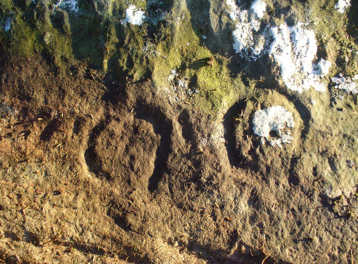
Main feature of the carving
Not far from the recently rediscovered Footsteps Stone (coming soon…), this large cup-and-ring carving was found by Paul Hornby on a TNA rock art venture in November 2016 on a journey to the petroglyphs on Balgair Muir, between Balfron and Fintry. Twas a damn good day indeed! We’d been up here the previous week, but the grey daylight gave little away. Upon revisiting the place, Paul eventually called us over and, beneath a mass of fallen tree foliage, the long raised rock gave up its ancient symbols once again.
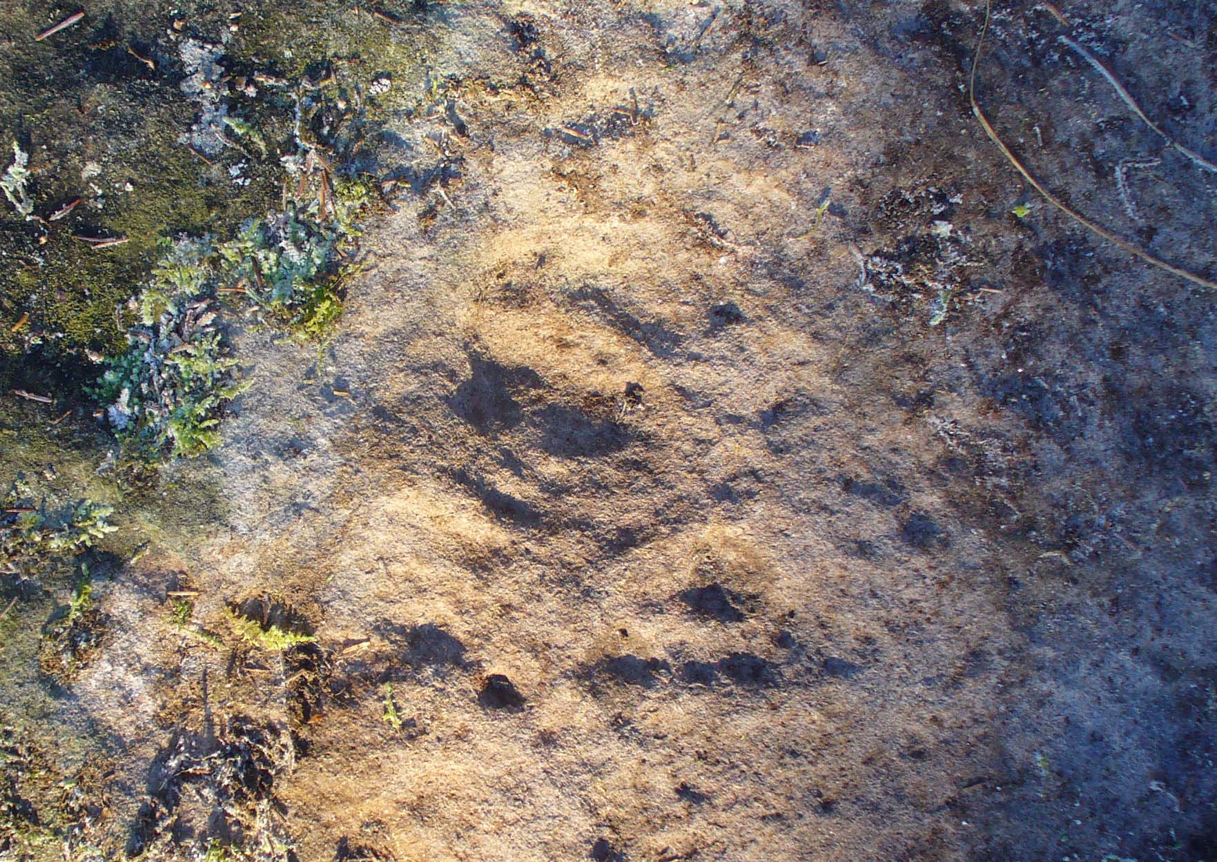
Very faint partial cup&rings?Main feature, looking ENE (photo by Nina Harris)
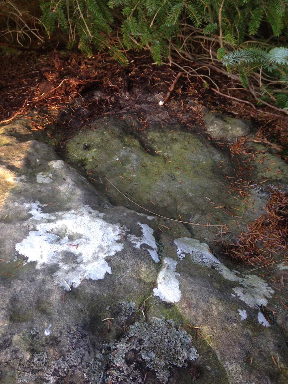
Along the main face of the stone are a variety of geophysical undulations and small natural hollows—lots of them!—some of which give the impression of being primitive cup-markings, but they’re more the result of erosion. However, amidst these are several very possible cup-markings, and some photo-images show that at least one of them has portions of a distinct faint ring around it, possibly two of them. On the whole however, we’d need a geological specialist to tell us with certainty about the other doubtful ‘cups’ here (TNA neeeeds an in-house crazy geologist into petroglyphs and things!).
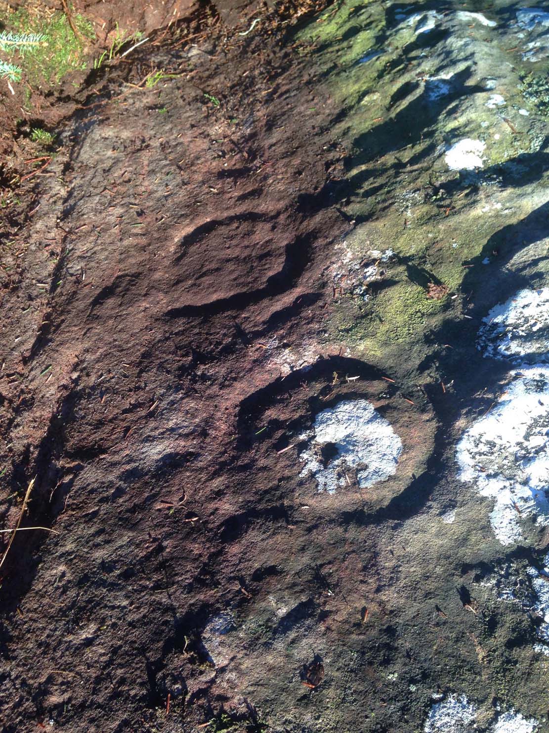
Balgair Muir Woods designMain feature, looking west
As the rock face slopes down on its northern edges, away from the many natural pits and nodules, Paul uncovered two large incomplete ‘rings’, each with short outer ‘lines’, distinctly carved. The ‘rings’ are somewhat larger than the average cup-and-ring motifs — but it also appears that at least one of the ‘rings’ is lacking an internal cup-mark.
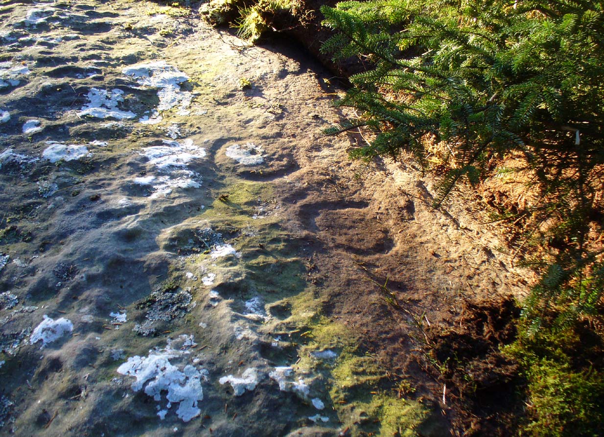
Large semi-carved ‘bowl’ (photo by Nina Harris)
On the same piece of rock, several feet to the east and almost covered by an adjacent tree, we also found a large half-natural half-carved ‘bowl’ more than 12 inches (30cm) across with a possible cup-marking near its centre. Whoever carved this section of the petroglyph has definitely utilised the natural features in the rock and, it seems, may never have finished the work.
We need more visits to this area to find what more lies beneath the fallen forest debris.
Acknowledgements: Massive thanks to Paul Hornby for uncovering this carving. Huge thanks also to Nina Harris for her help and some of the photos; and also to Ann Rankin and Mick for all their relative help too. Until next time…
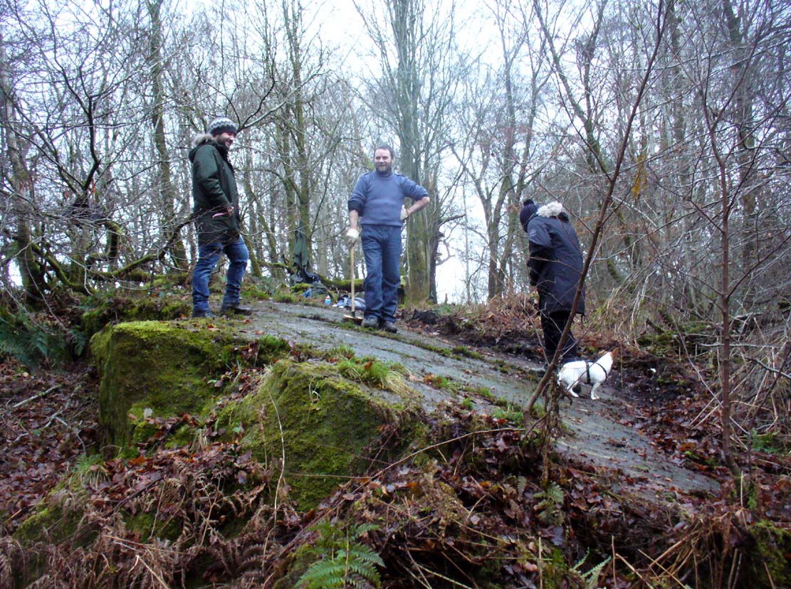
The TNA Rock Art Team on site – Fraser, Frank, Lisa, Leo & Aish
Get yourselves to Johnstone or Elderslie (which just about fuse into each other) and off the B789 road, make your way to Johnstone Castle football ground on Auchenlodment Road and go uphill, past the housing estate, until the fields open up on either side. 350 yards further, woodland appears. Go past the hair-pin kink in the road and, 50 yards or so past this, walk into the trees on your right. About 20 yards in, a large sloping rock face is what you’re looking for… (there’s a decent car-park on the left-hand side of the road 400 yards further along if you’re driving here)
Archaeology & History
4 cup-and-rings in poor light
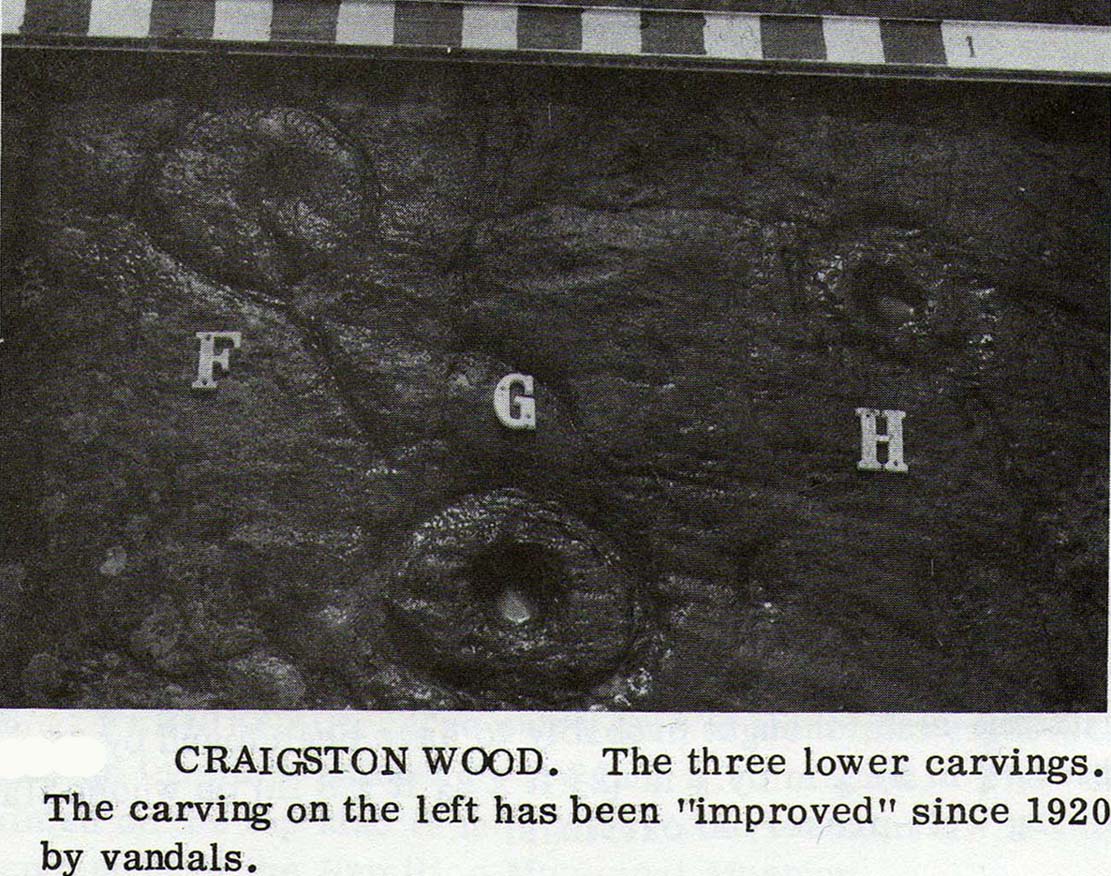
A seemingly solitary but vandalised petroglyph at the top of the Craigton Woods above Johnstone Castle estate: vandalized by the industrialists, whose quarry cut into a once larger rock, at whose edges cup-markings exist and whose design extended much further onto the now-vanished rock. The carving was also painted onto by some ignorant bastard many years ago (as the photos show); and one of the cup-and-rings here has either been damaged or isn’t prehistoric. The paint was daubed onto the stone in the 1960s and is shown in one of Ron Morris’ (1981) several descriptions of the site; and whilst it interferes with the design, it hasn’t damaged it anything like as badly as the industrialists have done.
Craigenfeoch cup-and-rings
Vandalism aside: it’s still quite an impressive carving, albeit hidden in the shadows of the surrounding trees. The design has been etched onto a large rock, some 35 feet long and perhaps up to 10 feet across, sloping at an angle of about 30-35° down (slippery when wet, as we all found out!). When we visited the site a few days ago, low cloud and mist didn’t really allow us a decent inspection of the site. But what we did find was more than our predecessors….
James Kirkwood (1938) gave the first literary account of the site—and in some detail. When he found the place it was “mostly covered with vegetation”, much like we found it on our visit. He wrote:
“The group of markings comprises five cups, each surrounded by a single encircling ring, whole lay-out being contained in an area of about 9 square feet. The setting corresponds almost exactly with the four cardinal points of the magnetic compass. The cup and ring to the north is the best preserved, the cup being 2½ inches in diameter and cut to a depth of 1 inch; the ring is somewhat elliptical, measuring 8½ and 7½ inches on its major and minor axes. A channel or gutter connects this cup with that within the eastern ring. The remaining cups vary from 2 inches to 2½ inches in diameter, and the rings from 6½ to 7 inches diameter. It is significant that the east and west cups are equidistant from the north one at about 15¼ inches; they are also equally spaced from the southeast cup at 19½ inches, and this latter dimension measures the distance from the west to the southwest cup. The four cups and rings on the main cardinal points are all moderately distinct, but the southwest sculpturing can only be very faintly discerned.”
James Kirkwood’s drawingRon Morris’ sketch
Kirkwood’s fascination with the alignments and measurements betwixt certain elements on the petroglyph was something of a fad at the time (resurfacing with some vigour in some quarters today), but is likely to have little if any authentic relevance with the animistic dynamics implicit in the function of the design.
When Ronald Morris (1981) entered the carving into his Southern Scotland survey, he made the now standard bland description of the carved elements:
“At least 5 cups-and-one-complete-ring (some ovoid), at least one with a long wavy groove downhill from the ring, and at least 5 cups, some of which may have been ringed. The ring marked ‘F’ in the (black-and-white photo, below) has been ‘improved’ since 1934 — the author has an older photograph showing it similar to the others. The 2 upper rings can only be seen just after sunrise, when wet—they are much weathered. Greatest ring diameter – 17cm (7in) and carving depths up to 2cm (1in).”
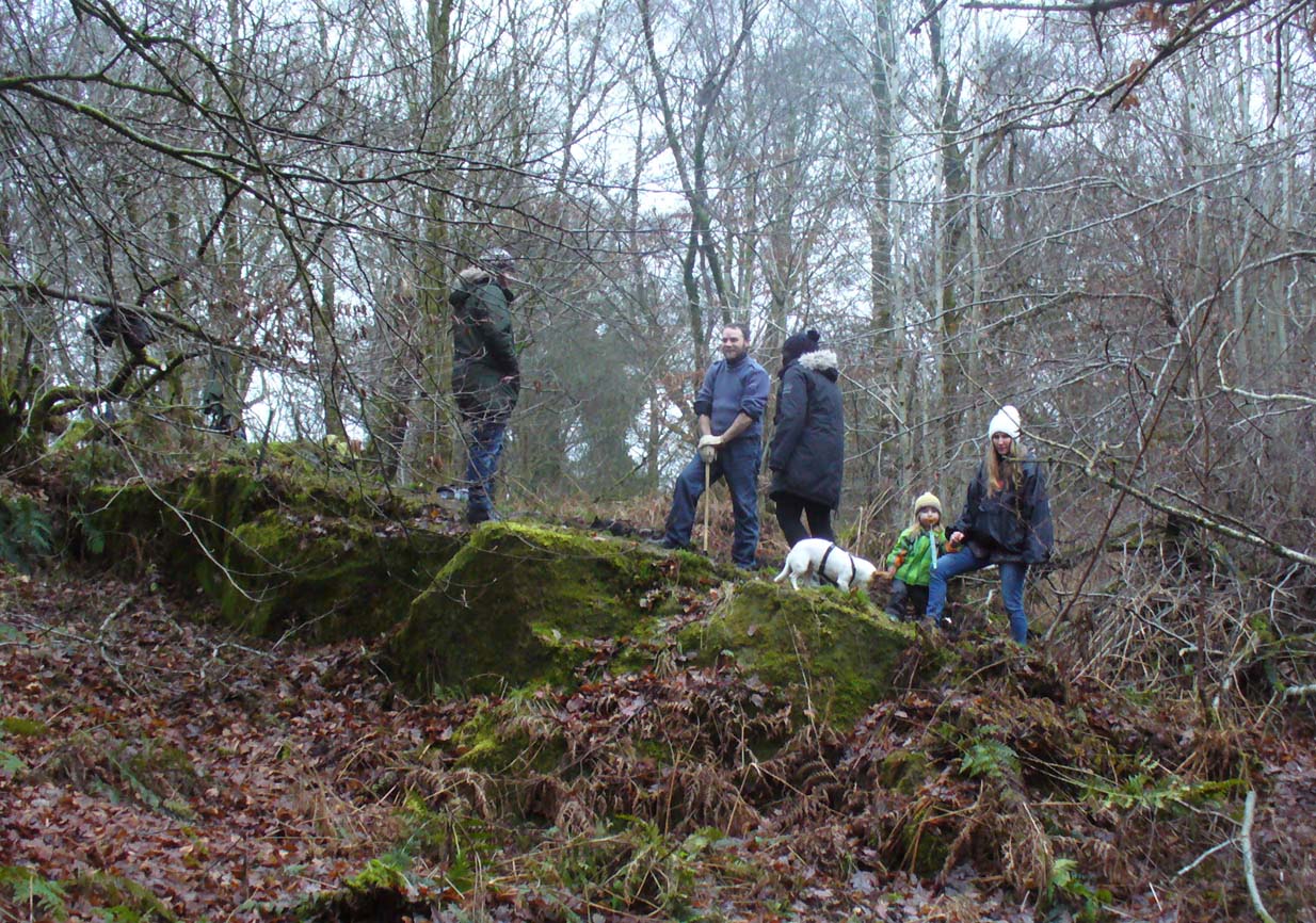
Fraser, Frank & Lisa at work
A good drawing of the carving would be worthwhile (are there any rock art-ists out there wanna join us on our next visit?), as the archaeological blandness never does petroglyphs descriptive justice. Ostensibly, from the bottom slope of the elongated stone—below where Fraser, Frank and Lisa are standing, right—a number of geophysical marks run across the stone. You can see in the photo how several geophysical ‘lines’ cut across the rock at an angle, roughly parallel, marked by the green vegetation. One of these is a small natural tunnel hole running through the stone, possibly made by the softer rock of a fossilized tree root or branch which has since disintegrated over time. Just above this ‘hole’ the carvings begin.
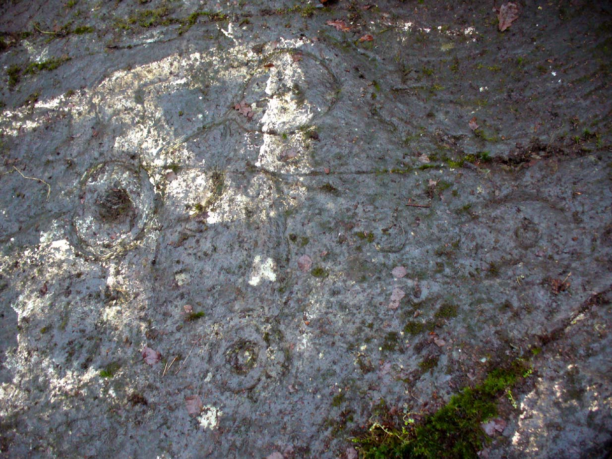
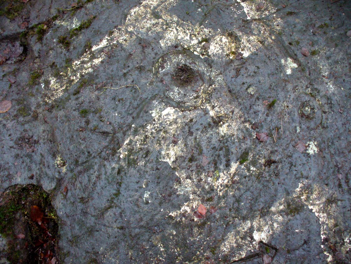
Cup-and-ring & carved lineOuter cup, ‘fan’ & CnRs
A number of possible cup-marks are overshadowed by the definite series of well eroded cup-and-rings (at least four of them) all close to each other, with lines connecting some to the others, including one which runs down to the tunnel hole. Some other lines on this part of the rock may or may not be geophysical (is there a geologist in the house!?). Close to the edge of the stone (where Fraser stands in the photo above) a singular cup-mark has been etched within a series of five lines, like an open fan, that all run to a point at the entrance of the natural tunnel in the stone. We were unsure as to whether these lines were natural or man-made (we need that geologist!); but it should be noted that an element very similar to this ‘fan’ of lines occurs in a carving near Killin, Perthshire, which we have yet to fully excavate—and in the Killin example the lines reach out from a central point like spokes on a bike wheel to an entire surrounding ring of cup-and-rings! Intriguing…
R.W.B. Morris early photo
One of the cup-and-rings in this cluster has clearly been either vandalized or else carved within the last century, as the erosion on it is wholly different to the rest, and the angle of the cuts into the stone shows clearly that a metal tool has made it. However, as Ron Morris stated above, this was apparently not the case with this ‘ring’ when he visited it in 1934 (it would be good to see the photo which he says shows its original state).
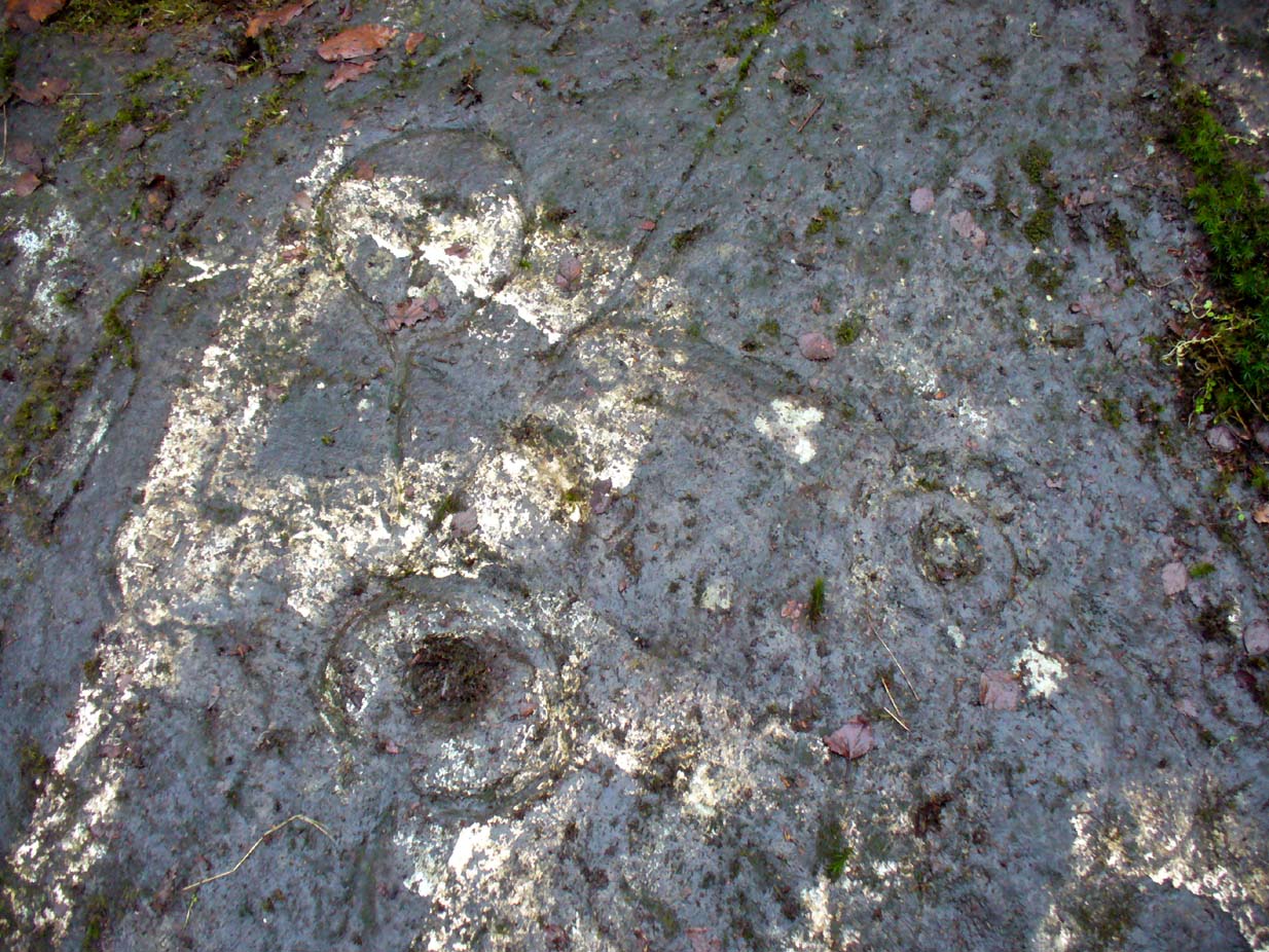
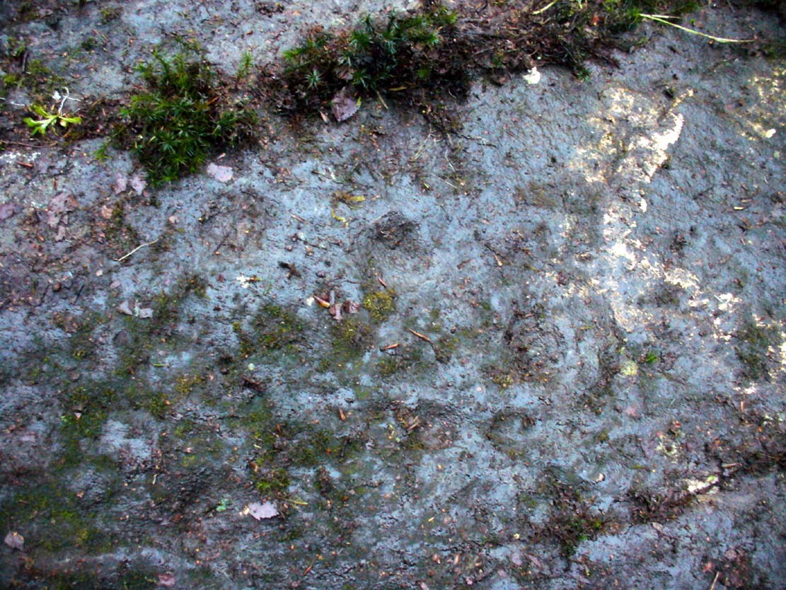
Faint cup-marks halfway up
Further up the slope of the rock we reach a near-parallel row of natural cracks across the stone. Inside this, about halfway along, a cluster of well eroded cup-marks exist—at least four of them. One of them has either a curved line arching out of it, or a semi-circular arc. Above the parallel cracks there is a large and very well eroded cup which, from differing angles, appeared to have faint sections of a ring around it, but we all agreed this was more a Rorschach response in our respective feeble minds!
We need to visit the site again in much better weather to gain a more accurate picture of the entire design. It appeared there were other elements to be seen here, but the lighting conditions were working against us that day…. That’s our excuse anyway!
References:
Kirkwood, James, “Notes on Cup and Ring Markings at Craigenfeoch, Renfrewshire”, in Transactions of Glasgow Archaeological Society, 9:2 (New Series), 1938.
Morris, Ronald W.B., “The Cup-and-Ring Marks and Similar Sculptures of South-West Scotland,” in Transactions of the Ancient Monuments Society, volume 14, 1967.
Morris, Ronald W.B., The Prehistoric Rock Art of Southern Scotland, BAR: Oxford 1981.
Acknowlegdments: With huge thanks to what Nina Harris called “the TNA rock art team” – Aisha Domleo (and Leo), Nina Harris, Frank Mercer, Lisa Samsonowicz & Fraser Harrick.
Holy Well (destroyed): OS Grid Reference – NS 6029 6547
Also Known as:
Minister’s Well
Archaeology & History
Site of the Priests Well in 1865
A ‘holy well’ with a bit of a difference when it was designated as such, however many centuries ago. Found on the southern slopes below Glasgow ‘s Cathedral, just a few yards west above the Molendinar Burn (upon which Wishart Street now sits), this was deemed to be a well only to be used by the christian ministers or priests from above. Local people were not supposed to drink here it seems! Instead, they were supposed to either drink from the burn, or walk a short distance down to the Lady Well (now badly polluted) 175 yards to the southeast. I don’t expect many Glasgow folk paid that much attention to such arrogant ministerial laws!
Shown on the earliest OS-map, simply as a ‘Well’, this is one of at least four water sources within a square mile of the Cathedral (including St. Mungo’s and Lady Well) that were deemed as ‘sacred’. It truly makes you wonder what on Earth was here before the christians came along and built their huge temple on the rocks above…. What animistic heathen rites and traditions were suppressed around this natural landscape before the toxic blanket of christianity was imposed upon us?
Healing Well (destroyed): Os Grid Reference – NS 5931 6500
Also Known as:
West Port Well
Archaeology & History
Once found near the old crossroads of Trongate, Arygle Street and Stockwell Street, the Trongate Well is another of old Glasgow’s lost sites, piped-off and added to the city’s water system sometime in the 19th century. A pity, as the fresh water from here was highly regarded (moreso than the modern stuff with its chlorine and other unnecessary additives). The well could be found where the Highland Gaelic Society built their own public house and, as a result, was very popular with local folk. It was,
“Opposite the old Black Bull in Trongate…afterwards covered in, which was famous in the palmy days of cold punch, and which is alluded to in Cyril Thornton as ‘the West Port Well.’” (MacGeorge 1880)
Old cattle markets were held here and MacGeorge (1880) wrote how it was a very popular and favourite place in its day, “surrounded by large numbers of the town’s people waiting a supply.”
The old Black Bull pub was much used by drovers and across from it was the old draw well, whose waters were of such renown that they were described in the verse, The Lament of Capt Paton, thus:
“Or if a bowl was mentioned,
The Captain he would ring,
And bid Nelly to the West Port,
And a stoup of water bring;
Then he would mix the genuine stuff,
As they made it long ago,
With limes that on his property
In Trinidad did grow.
O! we ne’er shall taste the like
Of Captain Pateon’s punch no mo’!”
Healing Well (destroyed): OS Grid Reference – NS 594 645
Archaeology & History
Mentioned briefly in James MacKinlay’s (1893) classic survey, this site was an ancient draw-well sunk near the old city centre but, like the ancient Moot Hill close by, has long since been destroyed. It is described amidst Andy MacGeorge’s (1880) historical survey of the ancient wells where he wrote:
“There was another…at the Barras Yet, near the port of that name at the foot of Saltmarket. It is mentioned in a minute of council in 1664, which ordains that ‘in respect of the heighting of the calsay at the Barrazet the well there be heightit twa stones higher round about, for preservation of childerin falling therein.’”
Although its exact whereabouts is not known, the proximity of the old fountain known as the Sir William Collins Memorial Fountain 100 yards east into the Glasgow Green Park at the bottom of the Saltmarket, might have robbed the Barrasyett Well of its water supply to gain existence.
Holy Well (destroyed?): OS Grid Reference – NS 553 658
Archaeology & History
This is the conjectural title conferred by T.C.F. Brotchie (1920) upon a Well uncovered during construction of the Pearce Institute in Govan in 1908. It was certainly an old site and very well made by the sound of it: being “a stone-built well some ten feet deep (and) some eight feet below the present surface of the ground.” Brotchie thought it to be medieval in age – and he may have been right.
On asking local people if they knew anything about the site, he was lucky to meet “a very old man, a Mr Rellie”, who told him that when he was a boy his granny spoke of a lost “guid well (that) was near the kirk.” He continued:
“I have no doubt that the well discovered in 1908 was the guid well, and judging from its proximity to the god’s acre, and also from adjective ‘guid’, that the well was at one time the holy well of St. Constantine, who in the 6th century founded a church in Govan. Of course, that is conjecture, but I venture to think that the conjecture is reasonably well founded.”
The church is immediately adjacent and is indeed dedicated to St. Constantine. Inside of it are a variety of fascinating archaeological relics: not least of which is what Sam Small (2008) called the ‘Pagan Sun Stone’ upon which is carved an ancient swastika! That – I’ve got to see!
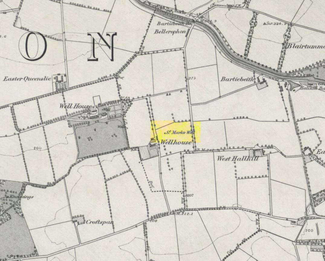
Holy Well (destroyed): OS Grid Reference – NS 667 653
Archaeology & History
St Marks Well on 1864 map
Information on this long forgotten holy well that once flowed a few miles east of Glasgow city centre, beneath what is now Wellhouse estate, is all but lost. Local history works of the area tell us little (though there must surely be something somewhere?) and even the place-name surveyor of this area—Peter Drummond (2014)—could find nothing. Noted by the Ordnance Survey lads in 1858, when they came to re-survey the area again in 1899 its waters had, it seems, been covered and carried into the ‘Well house’ less about 50 yards to the southwest (another ‘Wellhouse’ found 150 yards further west is the site that gives the estate its present name). From thereon, this wellhouse and St. Mark’s Well fell into the forgotten pages of history and, sadly it seems, even its oral tradition has died…
The origin and nature of the ‘well house’ isn’t too troublesome, as Drummond (2014) explains:
“The name Wellhouse exists in several places in Scotland, and could indicate a ‘house beside wells’, or a protective ‘house over wells’; the early record here suggests the former, since the first Glasgow Water Company’s Act was obtained in 1806, many years later.”
However, the reasons behind the dedication to St. Mark at this probably heathen arena in times gone by, seems to be quite a mystery. Perhaps the folklore of the saint concerned may be of some help.
Customs practiced on St. Mark’s Eve and St. Mark’s Day (April 24-5) are replete with animistic elements throughout and are certainly not christian! Six months after the old New Year, we find rituals once more allowing, not for the passing of, but the emergence of the dead: bringing the spirits into the Spring and Summer. Divination rites were practiced with Cannabis sativa no less! Prophecy and wise-women were advisors to the young. Walking backwards around wells were known at some St. Mark’s wells; whilst others without his name—but on this saint’s day—were leapt across, symbolizing the crossing of danger and darkness in the ritual calendar. All around this period of time, up to and including Beltane, the end of the dark cold year has passed, and these plentiful rites are prequels to the lighter days, warm spring, summer and good autumn: all vital rites for the people in their myths of the eternal return…
St. Mark’s Well at Glasgow meanwhile, seems to have lost its old tales… Surely not?
References:
Banks, M. MacLeod, British Calendar Customs: Scotland – volume 2, Folk-lore Society: Glasgow 1939.
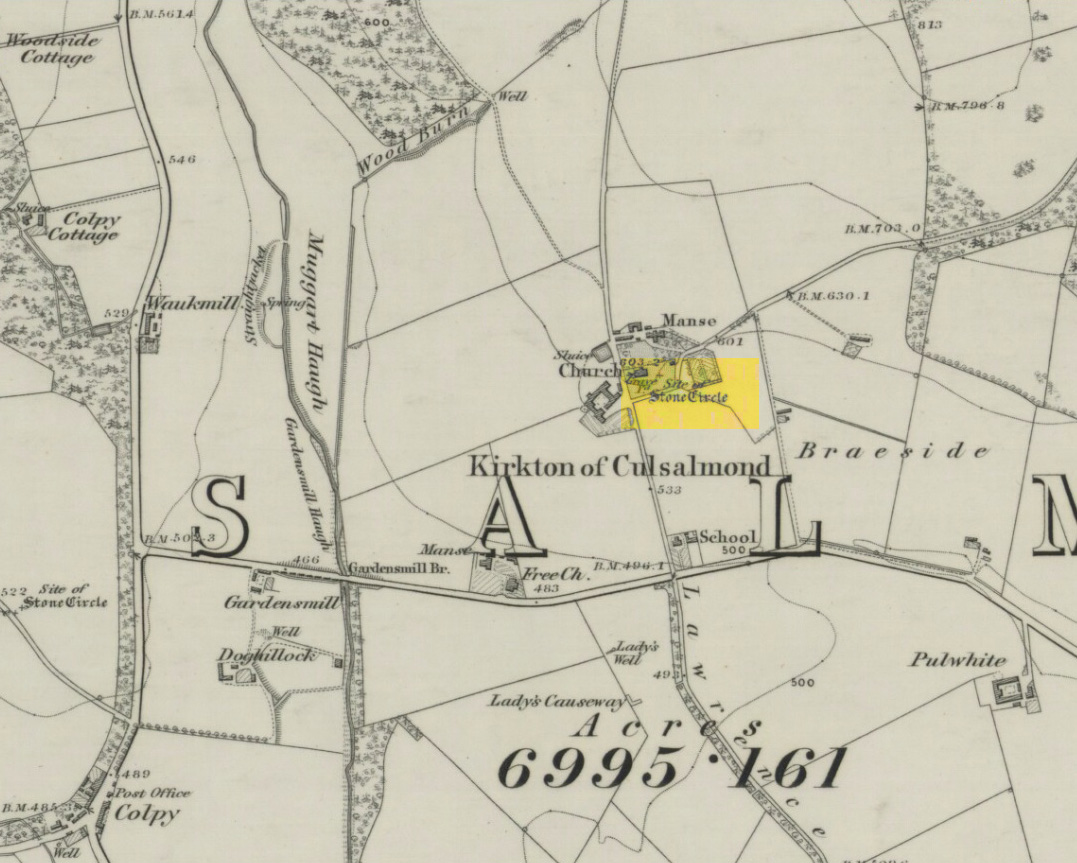
After standing at the same spot for 3000 years or more, near the beginning of the 19th century this stone circle was destroyed by the self-righteous christian cult that was rampaging its way through cultures far and wide. After all, they needed to rid the area of local traditions and “improve” the locals, whether they liked it or not! Thankfully however, one of their creed—a reverend Ferdinand Ellis: minister of the parish for forty years—recorded its destruction in the New Statistical Account between 1834-45. Amongst a variety of important traditional monuments that once existed hereby,
“A Druidical place of worship anciently stood about the middle of the churchyard or burying ground. It consisted of a circle of twelve upright large granite stones from Benochee, which were overturned when the first Christian temple was erected. One of these was taken up in 1821 and now remains above ground, near the spot where it was taken up. The other eleven are still underground. This is proof that the first christian missionaries, in this country, erected their places of worship as near as possible to the holy hills of the heathens, that the people might be more easily persuaded to assemble there.”
‘Persuaded‘ being a very broad term indeed when it came to the land confiscation of indigenous folk…
The stone that Ellis said “was taken up in 1821 and now remains above ground” was gone when Fred Coles (1902) surveyed the site, but he told how an earlier antiquarian and writer for the Scottish Society of Antiquaries, J.G. Callander, lived nearby, and who was
“told by the aged sexton, Florance, that he many a time came across a great stone, when preparing graves, and that he had himself blasted these more than once.”
It seems that all trace of this single stone, and the rest of them, either still lay in the ground or were used for local building material.
When John Barnatt (1989) came to add this circle in his corpus, for some reason he postulated that
“the number of stones suggest it was a recumbent stone circle”,
…that is: a stone circle possessing one large stone in the ring that’s laid down with two standing stones either side. However, there seems no real evidence to show that this was the case.
References:
Barnatt, John, Stone Circles of Britain – volume 2, BAR: Oxford 1989.
Browne, G.F., On Some Antiquities in the Neighbourhood of Dunecht House, Aberdeenshire, Cambridge University Press 1921.
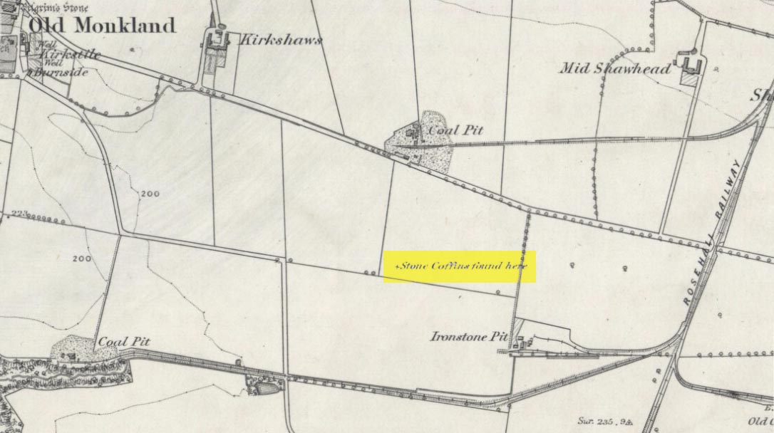
On the flat meadowlands below the slopes of Old Monkland, half-a-mile southeast of the legendary Pilgrim’s Stone, an old mound once lived. It may have been here for thousands of years but, with the encroachment of the toxic Industrialists, its time was coming to an end. The mound was levelled in 1832 and, beneath it, relics from a truly ancient past were unearthed – and destroyed of course. The account of its demise was told in the Glasgow Evening Post of May 26 that year. Many years later, the Royal Commission (1978) lads unearthed the information and included the site in their inventory for prehistoric sites in Lanarkshire. They told:
“In 1832 four cists were discovered during the levelling of a small mound 900m SE of Old Monkland Church. The cists, which measured about 1m by 0.6m, contained the remains of crouched inhumations, two of them double burials with the skulls at opposite ends of the cists. A stone hammer-head and a coin were found in one cist, the latter no doubt indicating subsequent disturbance. There is now no sign of the site, and it is not certain from the report whether the cists were inserted into a small natural mound or were covered by a barrow.
“The present farmer states that his father discovered a single cist during ploughing in the same field; it contained a pottery vessel which the landowner, Mr Sholto Douglas, was thought to have presented to a museum, but it cannot now be traced.”
References:
Royal Commission on the Ancient & Historical Monuments of Scotland, Lanarkshire: An Inventory of the Prehistoric and Roman Monuments, HMSO: Edinburgh 1978.