West Agra Plantation 3, Colsterdale, North Yorkshire

Cup-and-Ring Stone:  OS Grid Reference – SE 14236 81675

Also Known as:

  1. WAP 3a & 3b (Brown & Brown)

Getting Here

West Agra 3 Rock

From Masham take the Fearby Road & go through the village, onwards & past Healey village and less than a mile on where the road forks, bear to the right past and go along the gorgeous little-known vale of Colsterdale.  Less than 2 miles on, walk up the notable track veering to your right that goes diagonally uphill and past the bottom of West Agra farm along the wallside till you reach the gate.  Thru the gate, walk immediately uphill on your right following the walling for a coupla hundred yards until you reach another gate into the field on your right.  You’ll see a cluster of large boulders in the first field, which you need to walk past and look at the large boulder up against the walling in the next field.  You can’t miss it!

Archaeology & History
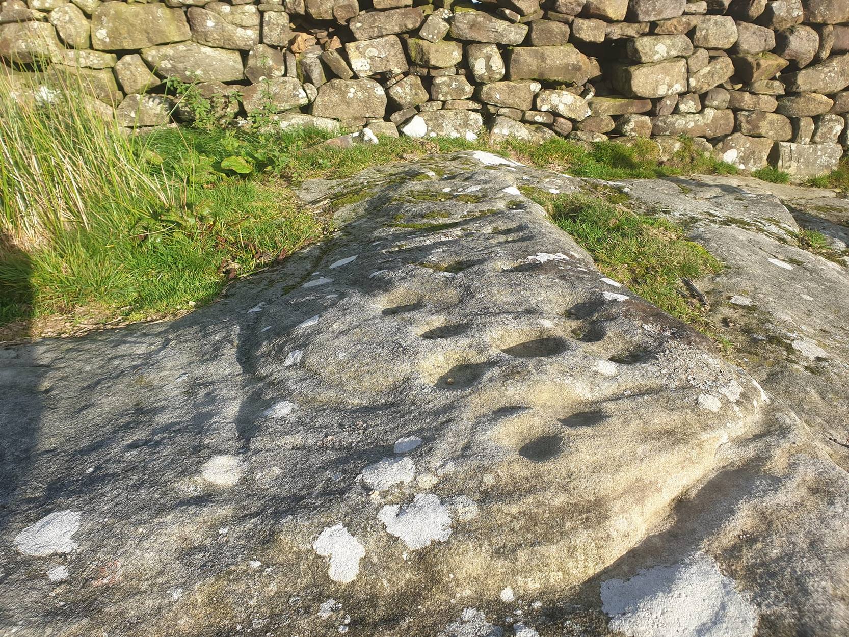
Photo by Geoff Watson

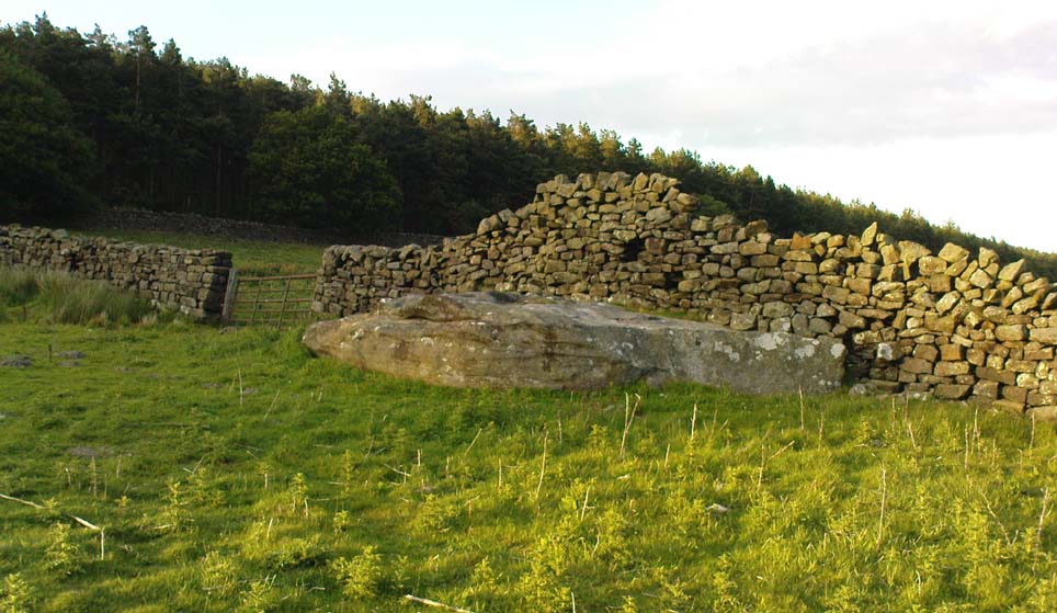
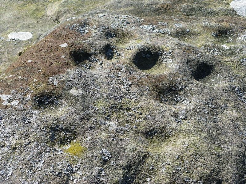
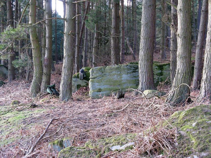
First mentioned — albeit briefly — in Brown’s (2008) work, this large bedrock stone, covered down its eastern side by a line of drystone walling, has a good scattering of cups and lines, mainly on its central and westerly side.  A cluster of them were etched onto a natural rise near the middle of the rock, which itself has a long circuitous line running around its northern and western sides, which you can just see below centre in the photo (below left).  Altogether on this side of the rock surface there appears to be some 56 cup-marks plus a number of long carved grooves curling in differing directions: some of these appear to have been Nature’s handiwork that were subsequently modified by human hands.  It’s an impressive-looking petroglyph.
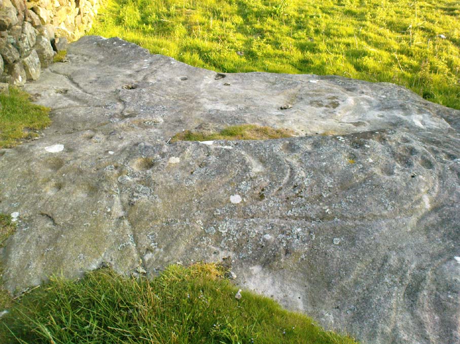
Main rock surface
Cluster of cups – by QDanT

If we go over to the other side of the walling, we find more cup-markings.  This discovery led Paul & Barbara Brown (2008) to classify the site as being two separate carved rocks — calling them 3a and 3b — thinking that the much smaller carved area on the other side of the wall, “may have originated from WAP 3a’s quarried southern section.”  On this smaller section we find some 7 cup-markings with possible carved lines running off the edge of the stone and some running roughly parallel to the walling.  Whatever the truth of the Browns’ assertion, this is a fine carving well worth looking at!

References:

  1. Brown, Paul & Barbara, Prehistoric Rock Art in the Northern Dales, Tempus: Stroud 2008.

Links:

  1. Agra Wood Rock Art – more notes & images

Acknowledgements:  For use of their photos, many thanks to Geoff Watson; and QDanT and his Teddy!

© Paul Bennett, The Northern Antiquarian

West Agra Plantation 2b, Colsterdale, North Yorkshire

Cup-Marked Stone:  OS Grid Reference – SE 14126 81669

Also Known as:

  1. WAP 2b (Brown & Brown)

Getting Here

West Agra Carving 2b

From Masham, take the Fearby Road to the village, keep going on the same road through Healey village and less than a mile on where the road forks, bear to the right past and go along the gorgeous little-known vale of Colsterdale.  It’s bloody beautiful!  Less than 2 miles on, walk up the notable track veering to your right that goes diagonally uphill and past the bottom of West Agra farm along the wallside till you get to the gate.  Thru the gate, follow the wall immediately uphill to the right for a coupla hundred yards until you reach a gate into the field on your right.  The cluster of large boulders in front of you is where you need to be!

Archaeology & History

Cluster of cups on WAP-2b (image by ‘QDanT’)

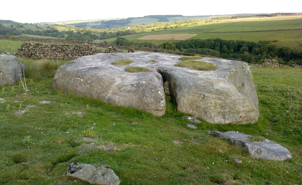
This carving is to be found on the largest of the boulders in this cluster.  It’s a large scattered cluster of cup-markings and natural bowls all over the rolling surface of the rock.  It was first described in the Browns’ (2008) survey, although as they have given this and one of the adjacent stones incorrect grid-references, it made it troublesome to initially work out which carving was which!  But the photos here certainly lets you know which one I’m describing!  In the event that I’ve got the wrong title for this one, someone lemme know and I’ll remedy the situation!

Brown (2008) describes this design as being “cups some linked by grooves, a rectangular feature and eroded cups and depressions.”  We couldn’t work out any further elements on the stone, but the cloudy conditions when we were here prohibited a decent view of the surface.

References:

  1. Brown, Paul & Barbara, Prehistoric Rock Art in the Northern Dales, Tempus: Stroud 2008.

Links:

  1. Agra Wood Rock Art – more notes & images

© Paul Bennett, The Northern Antiquarian


West Agra Carving, Colsterdale, North Yorkshire

Cup-Marked Stone:  OS Grid Reference – SE 14069 81627

Getting Here

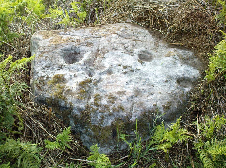
Cup-marked stone near West Agra

From Masham, take the Fearby Road to the village, keep going on the same road through Healey village and less than a mile on where the road forks, bear to the right past and go along the gorgeous little-known vale of Colsterdale.  It’s bloody beautiful!  Less than 2 miles on, walk up the notable track veering to your right that goes diagonally uphill and past the bottom of West Agra farm along the wallside till you get to the gate.  Thru the gate, follow the wall immediately uphill to the right and, about 100 yards up, watch out for the large flat stone by the side of the footpath.  You can’t really miss it.

Archaeology & History

Initially we thought that this carving was one described in Paul Brown’s work as ‘West Agra Plantation no.1’, but this is clearly a different carved stone.  It is found close to WAP-1 (as he called it), but a few yard further up alongside the footpath by the walling.  With two large bowls on the top of the stone and another at the edge, two average-sized cup-markings are several inches away to the bottom-right of the largest bowl.  What seems to be a carved line runs from one of the cups.  We need to visit this stone again and look at it when there’s better lighting conditions so we can get a more accurate assessment of its nature.

References:

  1. Brown, Paul & Barbara, Prehistoric Rock Art in the Northern Dales, Tempus: Stroud 2008.

Links:

  1. Agra Wood Rock Art – more notes & images

© Paul Bennett, The Northern Antiquarian


Brown Beck Stone, Agra Moor, North Yorkshire

Standing Stone:  OS Grid Reference – SE 13499 82440  —  NEW FIND

Also Known as:

  1. Agra Moor Standing Stone

Getting Here

Agra Moor standing stone

From Masham, take the Fearby Road to the village, keep going on the same road through Healey village and less than a mile on where the road forks, bear to the right past and go along the gorgeous little-known vale of Colsterdale.  It’s bloody beautiful!  Less than 2 miles on, walk up the notable track veering to your right, diagonally uphill.  Walk along till you get to the moor edge.  Go thru the gate and follow the swerving uphill path to the bottom of Slipstone Crags.  Once you level out at the Crags top, look across the small valley to your left and, on t’other side, you’ll notice a standing stone upright in the heather, just 100 yards on the flat on the other side of the valley.  Head right for it!

Archaeology & History

Looking west

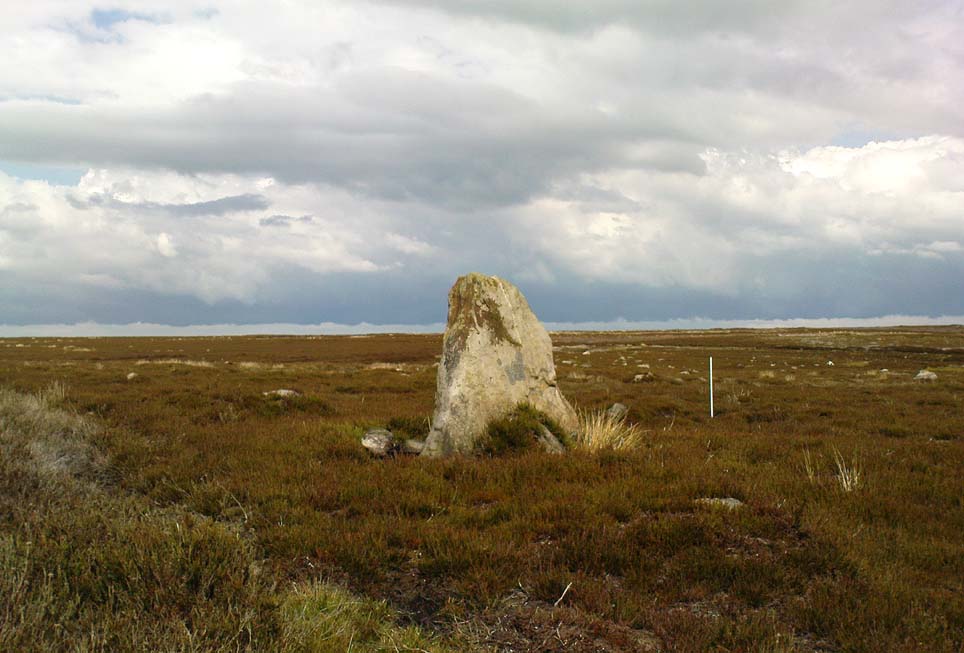
There are no known written references to this standing stone, which we visited for the first time yesterday, in a brief wander to the nearby Agra Woods cup-and-ring stones a few hundred yards southeast.  The monolith stands some four-and-half-feet tall and, at its base, is more than three feet broad and just one foot wide.  Just to its side and almost completely covered in peat and vegetation is what may have been another once-upright companion asleep in the Earth.  Another possibly fallen stone is less than 10 yards west.  The upright stands on the flat moorland overlooking the confluence of two (once) fast-flowing waters of Brown Beck and Birk Gill; and the landscape that reaches out from here is something to behold!

We found the remains of other old monuments on the moor, but some were obviously related to the industrial mining not far away.  However, two or three other small upright stones and a large stone circular structure were also located which very obviously predated any industrial or medieval workings.  We need to revisit this moorland and spend more time exploring to see what other things are hidden, lost midst the peat and heather.

© Paul Bennett, The Northern Antiquarian 


Dissenters Well, Kelbrook, Earby, Lancashire

Healing Well:  OS Grid Reference – SD 92104 43179

Getting Here

From Kelbrook village head south past Old Stone Trough then continue as far as the lane goes. Then head eastwards for about 1 mile on footpaths to a building called Laycocks. From here continue east along footpaths for another 1 mile or so until you reach Copy House (now called Hawres Farm). Go to the back of the farm where you will see in the wall a cross-incised boundary stone. At the side there is a square-shaped holy well. (You may need to ask permission at the farm).

Archaeology & History

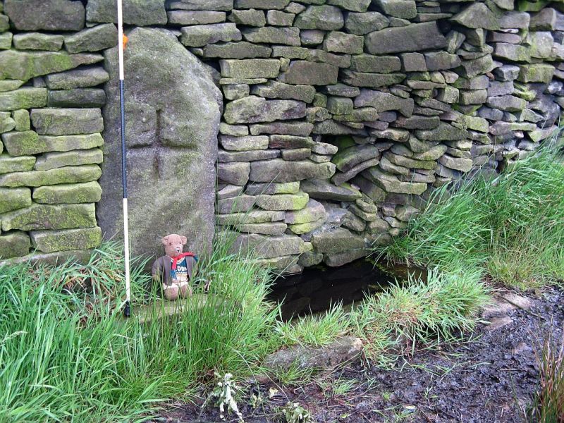
Dissenters Well & Cross (image courtesy ‘QDanT’)

The so-called Dissenters’ Well is a rectangular feature in the ground next to the wall.  It is said locally to date from the 17th-18th century, but is most probably an ancient moorland spring.  The well was in use from the 17th century by Quakers, Baptists, Methodists and possibly Roman Catholics, at a time when there was much animosity towards non-Conformists.  Legislation was passed stopping all illegal gatherings to be held within a 5 mile radius of any church – thus leading to religious gatherings in bleak, remote places on the moorland above towns and villages.  In 1812 an Act of Parliament against non-Conformists was repealed and dissenters were given equality regarding where they could worship. The water in the well no doubt had some medicinal qualities or, was a source of spiritual up-lift at the time.

By the well there is 3 foot high pointed boundary stone or waymarker known as ‘Tom’s Cross’ and it has a thin incised cross carved onto it.  The stone is partly embedded in the wall.  It probably marks the old boundary between Lancashire and Yorkshire.  I don’t know who Tom was though he may have been the person who set up the stone. The age of the stone is not known.

The Bleara Lowe tumulus and its nearby prehistoric companion can be found upon the hilltop a mile north of here.

References:

  1. Oldland, Fay, The Story Of Foulridge, Pendle Heritage Centre Ltd, 1990.

Copyright ©  Ray Spencer 2011


Newhall Bridge, Kenmore, Perthshire

Standing Stones:  OS Grid Reference – NN 7926 4668

Also Known as:

  1. Canmore ID 24910
  2. Newhall Stones
  3. Taymouth Standing Stones
Newhall Stones, Kenmore

Getting Here

Pretty easy to find.  At the eastern end of Loch Tay, go through the old village of Kenmore along the A827, towards Aberfeldy, for about a mile.  At least a mile past Kenmore, keep your eyes peeled for a small left turn which takes you back into the grounds of Taymouth Castle.  Go on this small road, pass the ornate walling, and you’ll see these two standing stones in front of you, before the trees, on the left.  If you reach the Croftmoraig Stone Circle, you’ve gone a few hundred yards past the turning.

Archaeology & History

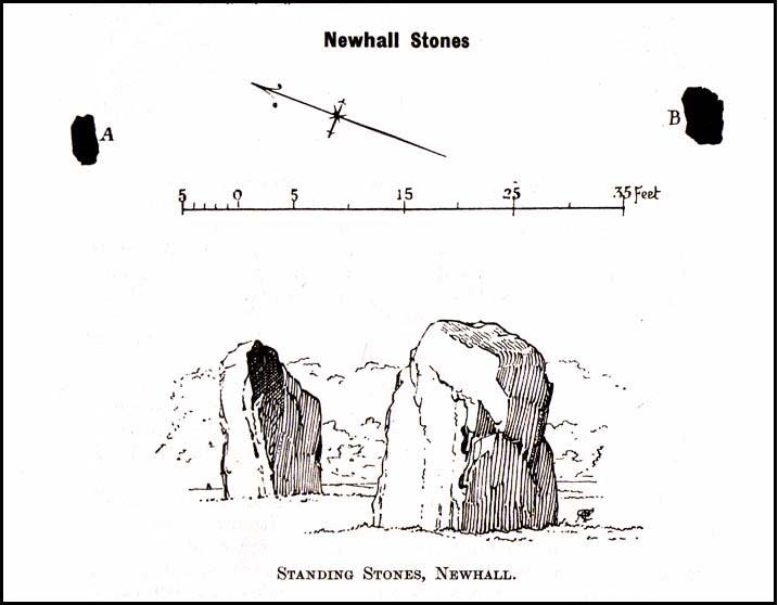
Fred Coles’ drawing & lay-out

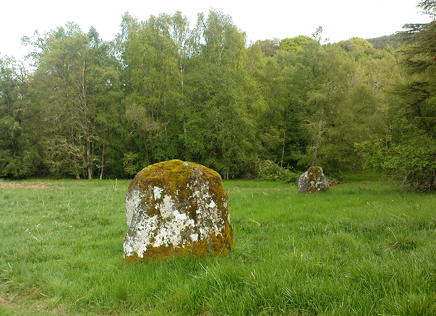
These fine-looking standing stones a mile northeast of Kenmore village, on the edge of the grounds of the superb Taymouth Castle, are worthy old monoliths, encrusted by the lichens of many centuries, resting within the long grass beside the track that runs to the castle.  But they have received little attention in archaeological terms.  When Fred Coles (1910) described them, he thought them to be the remains of a stone circle — an impression echoed by Margaret Stewart (1966) many years later (I got the same impression aswell), but no other stones have been found to substantiate this (although Mr Gillies’ folklore remnant is intriguing).  There is a notable rounded hillock immediately behind the two stones which may, or may not, have had other uprights surrounding it; though I can find no further data anywhere to substantiate such a thing.

In William Gillies’ (1938) historical survey of the area he related Mr Coles’ earlier findings of the two stones, telling us:

“There are two great standing stones just within the Principal Gate leading to Taymouth Castle.  The stone A (see plan) stands at a distance of 54 feet to the NNW of B — a somewhat greater diameter than is common among the Perthshire Circles.  These stones are almost equal in height — A is 4ft 9in, B is 4ft 7in — and they are both rugged blocks of a rough species of diorite.  Stone A measures round the base 10ft 8in, and stone B 14ft.”

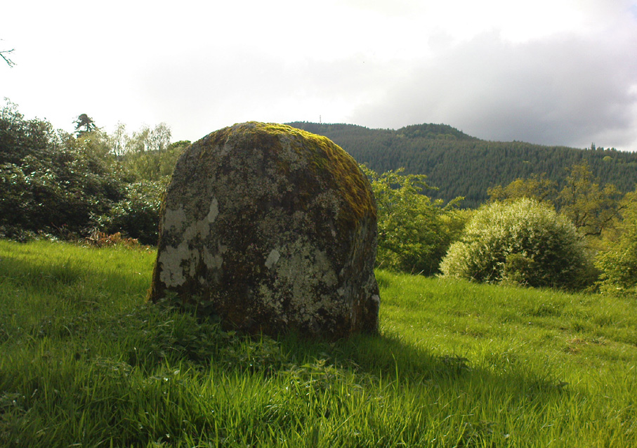
The western stone
The eastern stone

But it seems that little else has been found about the place.  It’s in a gorgeous setting (but, round here, everything’s in a gorgeous setting!) and must have related to other sites in the area, but it’s hard to contextualize the place on a single visit.  If you stand behind the two stones, the shape of their ‘heads’ fits very nicely onto the rounded hillock on the northwestern skyline — which seems to have later been used as a hillfort.  Whether this has any astronomical potential, I aint checked. (though Thom says nothing about them)

In geomantic terms both of these stones possess a distinct female flavour to them; the easternmost thinner of the two, particularly so.  But then I could just be talking bullshit!  I’d have loved to have spent more time with these two stones — bimbling, sitting, focussing, dreaming — as people of olde naturally did; but we were on the move and had other places to see.  Tis a delightful spot indeed…

(NOTE – This site was first given a grid reference of NN 801 477 in Margaret Stewart’s (1967) fine essay on the standing stones at nearby Lundin; and the grid-ref has since been reproduced in texts by Burl (1993), Thom (1990) and others.  Please note that this grid-ref is incorrect and is nearly a mile away from the actual position of the stones.)

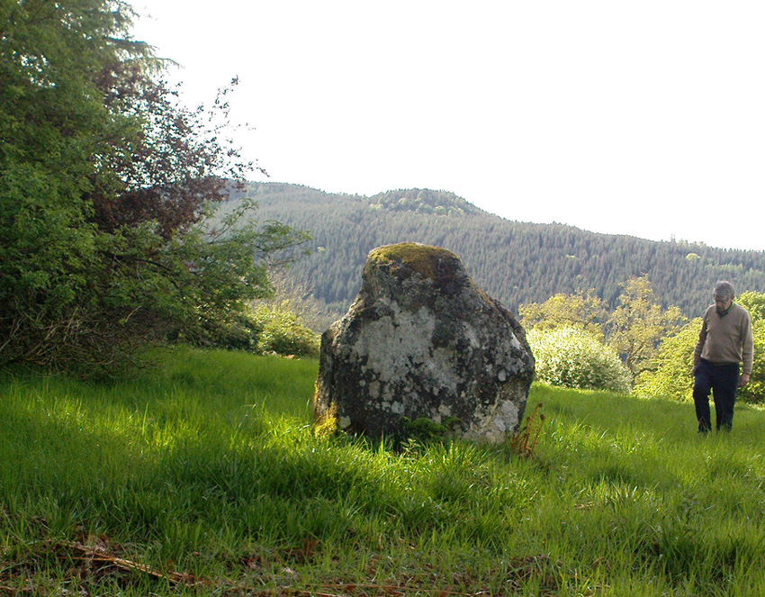
Easternmost stone from another angle

Folklore

There is the possibility that this site once played a part in an important megalithic stone row.  Mr Gillies (1938) once again notes an old tradition told by local people which “says that at one time there was a paved way connecting the circle, of which these stones are the remains, with the great Croftmoraig circle.”  Very intriguing indeed…

References:

  1. Burl, Aubrey, From Carnac to Callanish, Yale University Press 1993.
  2. Coles, Fred, “Report on Stone Circles Surveyed in Perthshire,” in Proceedings of the Society of Antiquaries, Scotland, volume 44, 1910.
  3. Gillies, William A., In Famed Breadalbane, Munro Press: Perth 1938.
  4. Stewart, M.E.C., “The excavation of a setting of standing stones at Lundin Farm near Aberfeldy, Perthshire“, in Proceedings of the Society of Antiquaries, Scotland, volume 98, 1966.
  5. Thom, A., Thom, A.S. & Burl, Aubrey, Stone Rows and Standing Stones – 2 volumes, BAR: Oxford 1990.

© Paul Bennett, The Northern Antiquarian


West Agra Plantation (8), Colsterdale, North Yorkshire

Cup-and-Ring Stone:  OS Grid Reference – SE 14250 81756

Also Known as:

  1. WAP 8 (Brown & Brown)

Getting Here

The ‘West Agra 8’ Stone (after ‘QDanT’)

From Masham, head westwards along the country lanes to Fearby village (passing the old cross on the green), through old Healey village (where once stood four stone circles, seemingly destroyed) and onwards to Gollinglith.  From here, keep going up the winding steep lane until you’re at the top where, on the right-hand side of the road, a footpath takes you diagonally northwest over the uphill fields.  When you hit the walling which leads to the woods, follow it up and, once at the corner of the trees, follow the track back eastwards along the wall edge, keeping your eyes peeled when you pass the second line of walling that runs down the slope.  You’re damn close!

Archaeology & History

One of a cluster of fascinating carvings in this remote region of the upland Dales, this is perhaps the most impressive multiple-ringed carving of the group, known collectively as the West Agra Plantation group.  The carving was rediscovered sometime in 2002 by Emily McIntosh and was described by Brown & Brown (2008) thus:

“This boulder measures 5.5 x 3.1 x 1.28m and has a multiringed motif 50cm in diameter linked by a number of grooves and isolated cups.”

Teddy with his rings! (after ‘QDanT’)
Primary cup-and-multiple-rings (after ‘QDanT’)

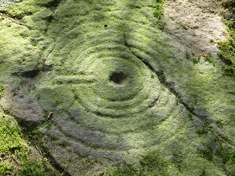
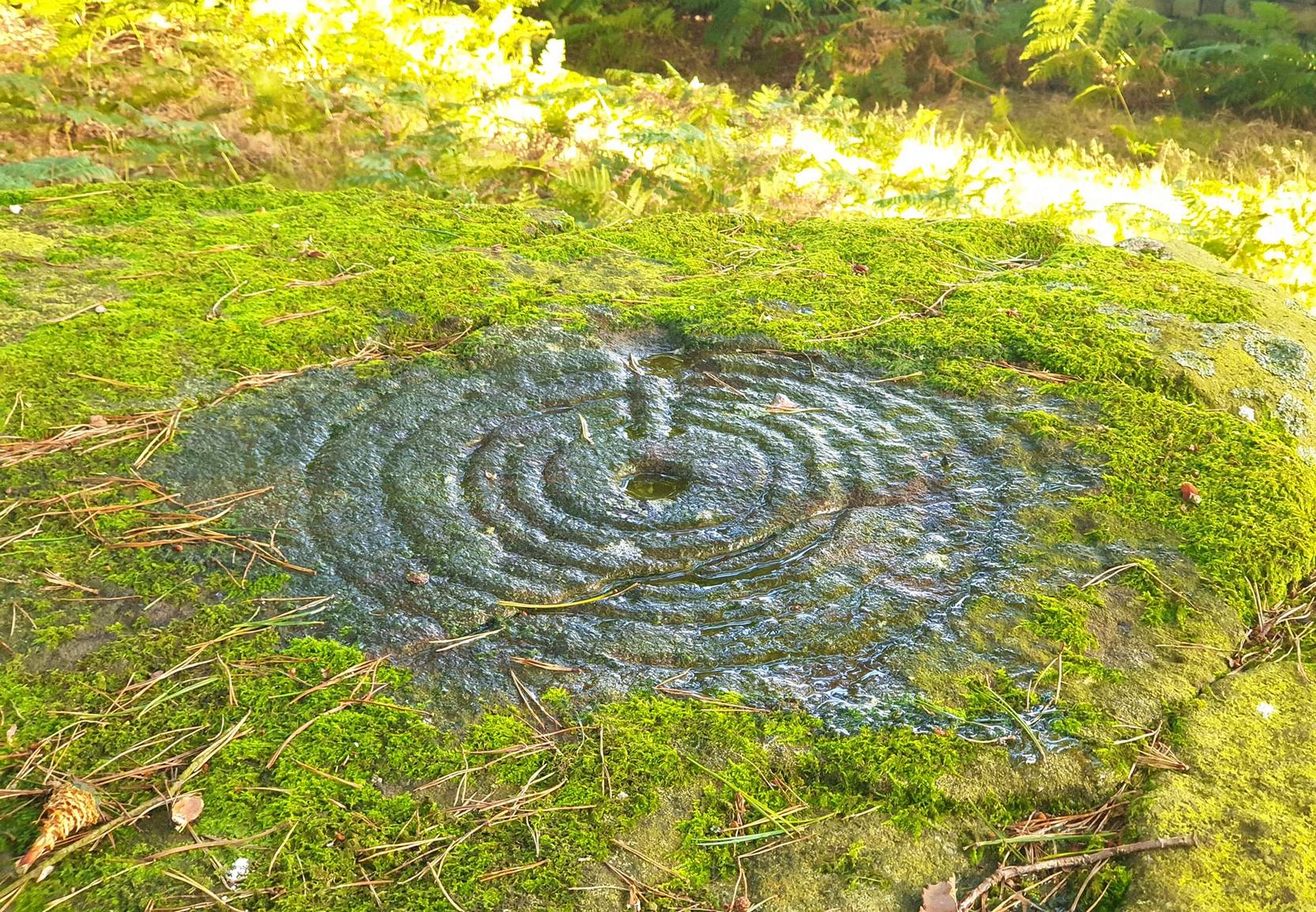
But this barely does the stone justice.  The main focus is on the cup with six surrounding rings, intersected by an intrusive double-line from outside the series of rings then running into the central ring itself — though not touching the focal cup at the very centre.  This double line points to the southeast and is somewhat akin to a sliver of light running to or from old solar designs.  It is a little bit like some aspects of the carved stones found on Ilkley’s Panorama Stones (though Ilkley’s carvings are much fainter).  At the end of the intrusive double-line is a small cluster of cup-marks.  There’s also another curious singular carved line running outwards from the third ring, running out of the concentric rings then heading off further down the stone.  More cups and lines scatter other parts of the stone and there may be another faint line running from near the central cup all the way out of the rings close to the main ‘ray’ of lines.

Photo by Geoff Watson

A large standing stone can be seen if you walk a few hundred yards east along the side of the wall.  It’s quite impressive.

Apparently the woodland in which this carving (and its associates) can be found is supposedly ‘private’ and one is supposed to contact some group calling itself Swinton Estates to set foot in the woods.  Not the sort of practice we usually put up with in Yorkshire.  If anyone has their contact details, please add them below in the event that anyone has need to ask ’em about going for a walk here.

References:

  1. Brown, Paul & Barbara, Prehistoric Rock Art in the Northern Dales, Tempus: Stroud 2008.

Links:

  1. Agra Wood Rock Art – more notes & images

Acknowledgements:  For use of their photos, many thanks to Geoff Watson; and QDanT and his Teddy!

© Paul Bennett, The Northern Antiquarian

Boatbridge Quarry, Thankerton, Lanarkshire

Cists (destroyed):  OS Grid Reference – NS 981 376

Also Known as:

  1. Tinto Quarry

Archaeology & History

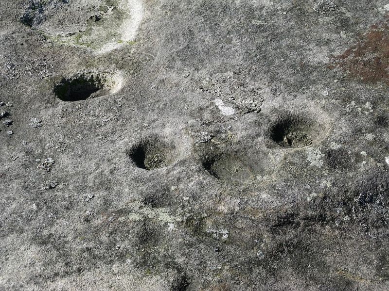
The sites that were once here have long since been destroyed as a result of quarrying operations.  But thankfully this place was given a quick appraisal by those renowned Scottish archaeologists, Anna Ritchie and D.V. Clarke, before final destruction.  They recorded the site in an early edition of Discovery & Excavation in Scotland:

“Two short cists were discovered in November, 1970, during the removal of a long low gravel ridge protruding into the flood plain of the River Clyde.  The two cists were both aligned NE-SW and were 14m apart.  Both employed identical construction techniques.  The side slabs overlapped both end slabs and the N end slab was shorter than the other three slabs, necessitating a building-up of the floor by some 30cm.  Both appear to have had a double layer of capstones although this is uncertain in one case.  The cists contained and adult and child without grave goods on a gravel floor in one, and an adult with a beaker on a ‘crazy-paving’ floor in the other.”

Crazy-paving in prehistoric times sounds good!  The Scots got there first!

References:

  1. Clarke, D.V. & Ritchie, Anna, “Boatbridge Quarry: Short Cists,” in Discovery & Excavation in Scotland, 1971.

© Ian Carr, The Northern Antiquarian 


Acharn, Killin, Perthshire

Standing Stone:  OS Grid Reference – NN 56141 31601

Getting Here

Acharn’s standing stone

This one’s easy as it’s right by the roadside, so making it dead easy for those lazy ones amongst you who don’t like walking!  You can find it just past the turn-off (signed) for Acharn Lodge, a few hundred yards along the A827 road (off the A85 by the garage) from Lix Toll, less than a mile before reaching Killin.

Archaeology & History

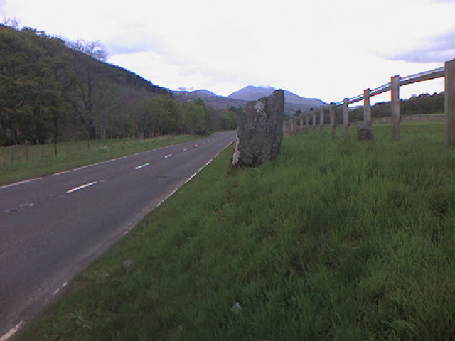
This solitary standing stone, not much more than about three feet tall, originally stood in the adjacent field and was moved to the edge of the road sometime ago.  It was described briefly in William Gillies’ Breadalbane (1938) where he said, “Its height is 3 feet 10 inches and its girth at the base 6 feet 2 inches… This solitary stone is possibly the sole survivor of a group that once formed a circle,” though gives no more information to support this idea.  It seems more likely that the stone accompanied a cairn, that was levelled by farming sometime in the 19th century.

References:

  1. Gillies, William A., In Famed Breadalbane, Munro Press: Perth 1938.

© Paul Bennett, The Northern Antiquarian

Broadbank Earth Circle, Thursden, Burnley, Lancashire.

Enclosure: OS Grid Reference — SD 9024 3522

Also Known as:

  1. Burwains Enclosure
  2. Burwains Camp

Getting There

From Nelson town centre go north east towards Catlow, turning left near the Shooters Arms public house, then turn right again to the Coldwell Activity Centre.  Carry on towards Thursden Valley till you see the World War 2 pillbox on the right.  Here turn right and after 300 yards a picnic site and carparking area is reached along the Briercliffe road. On the opposite side of the road over a wall and barbed wire is Broadbank Earth Circle, though unfortunately there is not much to see there today. 

Archaeology

First excavated in 1950 by the Archaeology Department of Liverpool University and again in the 1960s, the earthworks here stand at 1,147 feet above sea-level (350m). The site comprises of an earth circle 150 feet (46m) in diameter which encloses an inner ditch 1 foot (30.5cm) deep and 10 inches (25.4cm) across. The bank was composed of boulder clay thrown out from the ditch. A hearth was found below the bank at the eastern end.  Some rough flint and chert flakes were also found together with a stone axe of Langdale origin. This is four-and-half inches or 11.4cm wide.  It has a curved cutting edge and a thin rounded head. Its surface is ground smooth but there is no evidence of polishing.

The earthworks at Broadbank have suffered through farming activity over many centuries and the earthen circle is now difficult to see at ground level, though the inner ditch is still visible. The low hillside or, what look like ramparts, at the northern end by the pillbox are probably not in any way connected, though this low bank may have added to the building of the bank. Archaeologists consider the site to be of Iron Age origin.

References:

  1. Liverpool University Archeology Department, Report and pamphlet, 1950.
  2. Powell, J.G.E., “Excavations of a Circular Enclosure at Broadbank, Briercliffe, Lancs,” in Transactions of the Historical Society of Lancashire & Cheshire, 104, 145-151.

Copyright © Ray Spencer, The Northern Antiquarian 2011