Eastwoods Farm Cup, Heyshaw, North Yorkshire

Cup-Marked Stone:  OS Grid Reference – SE 1852 6201

Also Known as:

  1. IAG637a (Boughey)

Single cup-marked stone in the field below Eastwoods Farm

Getting Here

From the large village of Summerbridge, go west along the B6541 towards Dacre Banks, where you’ll see the signpost for the Nidderdale Way footpath.  Follow this past the disused quarry and onto the meadows.  When you hit the Monk Ing road, bear right (north) and keep going till you’re 100 yards from Eastwoods Farm.  Go right, down into the fields for 50 yards or so.  Look around!

Archaeology & History

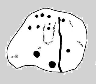
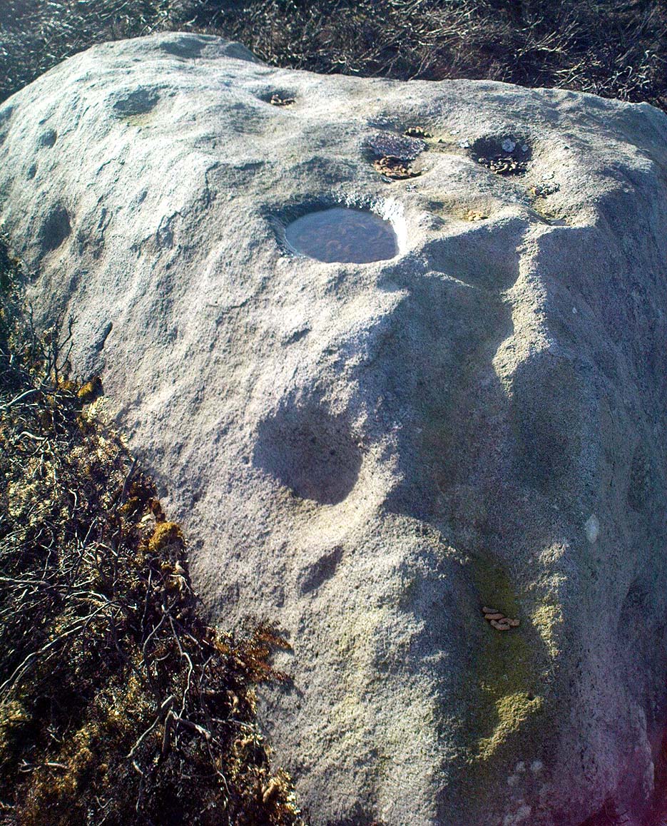
A previously unlisted single cup-marked stone which is likely to become overgrown by the grasses pretty soon.  Several other carvings are in close attendance in this field.  It’s not far from the cup-marked Eastwoods Cross Base (aka CR 637) in the same field, but a little further down.  In all probability there are other carvings yet to be found in this area.  The rock art student Keith Boughey (2007) mentioned it briefly in an article on the other carvings nearby, saying simply:

“A small area of rock (very possibly bedrock) measuring 40cm x 14cm at its greatest extent pokes up through the turf, showing one worn but clear cup-mark on its western edge (Fig 3). On its own, this marking would not be significant were it not for the fact that four other carved rocks are already recorded from this particular locality.”

The hugely impressive Morphing Stone and a prehistoric lightning-carving can be found in the next field, full of rocks, on the other side of the stream.

(NB: In a more recent visit to the site (August 2011), the carving had all but disappeared beneath ever-growing Earth.)

References:

  1. Boughey, K., “Prehistoric Rock Art: Four New Discoveries in Nidderdale,” in Prehistoric Research Section Bulletin, no.44, Yorkshire Archaeological Society 2007.

© Paul Bennett, The Northern Antiquarian


Green Crag Top Cairns, Ilkley Moor, West Yorkshire

Cairns:  OS Grid Reference – SE 131 458

green-crag-top-cairn02-sm
Larger of the Green Crag Top cairns – with blizzard in background!

Getting Here

Follow directions for getting to the Haystack Rock.  Once here, walk dead straight south onto the moor and go up the slope you see a few hundred yards ahead of you.  Once you’re at the top of the slope, a few yards onto the ridge itself, look around!  If there’s deep heather growth when you arrive, you’ve no chance!

Archaeology & History

To my limited knowledge, it appears there’s no previous references to the cairns here.  We found at least two of them, with a probable third not far away; but we were lucky inasmuch that the heather had all been burnt away, allowing a clearer inspection of the sites.  The larger of the two is nearly four yards across and nearly a yard high.  It’s somewhat larger than the majority of what are thought to be single-person cairns along Green Crag Slack ridge, down the slope.

Much denuded cairn
Much denuded cairn

A smaller cairn less than 100 yards west on the same ridge (near the large boulder with a couple of cup-markings on top) looks as if it was robbed of stone sometime in the past.  About six-feet across, this one is more typical of the cairns found on the Ridge below.

There are what seems to be other remains along this ridge, including a very distinct thin, six-foot-long stone, which looks very much as if it could have stood upright in the not-too-distant past.  We could do with more heather-burning on this part of the moor to help us out!

© Paul Bennett, The Northern Antiquarian


Cat Heaps, Swanston, Edinburgh, Midlothian

Cairns (destroyed):  OS Grid Reference – NT 2447 6828

Archaeology & History

Not far from the giant cup-marked Caiy Stone, there used to be two very large prehistoric cairns, which local historian Daviid Shankie told us “were foolishly broken up by some sacriligious hand and used for road metal”!  Not good…  Remains of human bones and several fragments of old weapons were found in them.  Fred Coles (1903) told us that:

“In the neighbourhood of this [i.e. Morton Hall], but further southwest, on the grounds of Comiston, were found, in forming the public road, under large heaps of stones, various sepulchral stone enclosures, in which were deposited urns with dead men’s ashes, and divers warlike weapons.” And again, when speaking of the levelling of a part of the ground close to the old (so-called Roman) road, by Sir John Clerk of Pennycuick, the same writer adds, there ” were discovered several stone coffins with human bones.”

Folklore

According to Shankie (1902), these two great cairns were built upon lands previously known as the Templelands of Swanston and commemorated a great battle that was fought “between the ancient Picts and Scots.”

References:

  1. Coles, Fred, ‘Notice of…Cairns and Standing Stones in Midlothian and Fife,’ in PSAS 37, 1903.
  2. Harris, Stuart, The Place-Names of Edinburgh, Gordon Wright: Edinburgh 1996.
  3. Royal Commission for the Ancient & Historical Monuments of Scotland, Midlothian and West Lothian, HMSO: Edinburgh 1929.
  4. Shankie, David, The Parish of Colinton, John Wilson: Edinburgh 1902.

© Paul Bennett, The Northern Antiquarian


Three Cups Stone, Ilkley Moor, West Yorkshire

Cup-Marked Stone:  OS Grid Reference – SE 12998 46314

Also Known as:

  1. Carving no.138 (Hedges)
  2. Carving no.298 (Boughey & Vickerman)

Getting Here

Dead easy!  Follow the directions to the unmissable Haystack Rock, then look at the small upright stone about 40 yards west, just off the footpath.

The Three Cup Stone

Archaeology & History

This is another one of the many carvings I first saw when I was a small lad, about 12 years old, in one of my countless walkabouts over these moors.  It’s thought by some to be a small cup-marked standing stone (it’s possible I s’ppose, but improbable); whether that’s the case or not, it certainly has three distinct cup-markings on its east-facing vertical face.  There are also what appears to be lines cutting through the cups and running out to near the edge of the stone which may or may not be natural.  A small, cute little thing!  Boughey and Vickerman (2003) make a note that this carving may be recent — but if so, it was done some considerable time before 1975, when I first clapped eyes on it!

References:

  1. Boughey, Keith & Vickerman, E.A., Prehistoric Rock art of the West Riding, WYAS: Wakefield 2003.
  2. Hedges, John, The Carved Rocks on Rombalds Moor, WYMCC: Wakefield 1986.

© Paul Bennett, The Northern Antiquarian


Urn Stone, Green Crag, Ilkley Moor, West Yorkshire

Cup-and-Ring Stone: OS Grid Reference – SE 12832 46163

Also Known as:

  1. Carving no.130 (Hedges)
  2. Carving no.287 (Boughey & Vickerman)

Getting Here

Drawing of the Urn Stone (after Hedges 1986)

Follow the directions for getting to the Haystack Rock, then bear right (west) along the footpath, past the little Three Cups Stone, until the path bends and goes up onto the moor.  A hundred yards or so, walk left into the heather (you’re straddling the remains of considerable prehistoric walling and enclosure remains by now) and look around.  You’ll find it!

Archaeology & History

I was only about 12-years old when I first saw this and the nearby prehistoric carvings — but when I came to look for any references to it as a boy, there were none I could find at the time.  Then, ten years later when John Hedges (1986) brought out his fine work on the cup-and-ring art of Ilkley Moor, its presence was shown in pen-and-ink at last.  Found amidst the remains of an extensive settlement or series of walled enclosures, the carving’s name comes from the curious urn-like element that Hedges showed faintly.   There is also an additional ring around one of the cups above the ‘urn’.

Excavations that were done on the prehistoric ‘enclosure’ close to this petroglyph in the 1990s, uncovered the remains of a decent amount of ‘grooved ware’ pottery and worked flint (Edwards & Bradley 1999), dated between 2900 and 2600 BC.  As such pottery has been found elsewhere in Britain within and/or near earthworks and other prehistoric remains (obviously!), its incidence here isn’t really too much of a surprise.  However, Edwards & Bradley (1999) speculate — albeit vaguely — that there may be a link between the cup-and-rings here and the pottery, saying, “if so, the rock carvings (here) might be indicating a place of special significance.”

This may be so: considering the prevalence of rock-art along the geological ridge and its close association with the large number of burial cairns.  If it can be ascertained that the charred remains of humans were kept inside the pottery or vases, the relationship between death and the carvings (well established on this part of Ilkley Moor) would be reinforced.

References:

  1. Boughey, Keith & Vickerman, E.A., Prehistoric Rock Art of the West Riding, West Yorkshire Archaeology Service 2003.
  2. Edwards, Gavin & Bradley, Richard, ‘Rock Carvings and Neolithic Artefacts on Ilkley Moor, West Yorkshire,’ in Grooved Ware in Britain and Ireland (edited by Cleal, R. & MacSween, A.), Oxbow: Oxford 1999.
  3. Hedges, John, The Carved Rocks on Rombald’s Moor, WYMCC: Wakefield 1986.

© Paul Bennett, The Northern Antiquarian


Young Idol Stone, Ilkley Moor, West Yorkshire

Cup-Marked Stone:  OS Grid Reference – SE 13264 45943

Also Known as:

  1. Carving no.158 (Hedges)
  2. Carving no.323 (Boughey & Vickerman)

Getting Here

The Young Idol Stone (bottom) & parental Idol Stone above

Take the directions to reach the Haystack Rock, then head onto the moor following the south-east footpath for a few hundred yards, towards where the moor slopes uphill.  20-30 yards before the uphill slope, a yard to the right of the path, a couple of yards below the well-known Idol Stone carving – you’ll find it!

Archaeology & History

Described simply as a “small, rounded, smooth grit rock,” this long-tooth-shaped stone has just two cup-markings on its upper face: one on the more southern tip, and the second smaller cup several inches below it – as shown on the photo.  The adjacent carving seen at the top of the photo is the parent guardian, Idol Stone!  If you visit this, or any adjacent carvings here, please remember that all along this moorland plain are numerous unexcavated prehistoric tombs. You’re effectively stood at the edge of, or within, a huge prehistoric cemetery.

References:

  1. Boughey, Keith & Vickerman, E.A., Prehistoric Rock Art of the West Riding, WYAS 2003.
  2. Hedges, John, The Carved Rocks on Rombalds Moor, WYMCC: Wakefield 1986.

© Paul Bennett, The Northern Antiquarian


Green Crag Top Stone, Ilkley Moor, West Yorkshire

Cup-Marked Stone:  OS Grid Reference – SE 1304 4582

Getting Here

Green Crag Top stone - from above
Green Crag Top stone – from above

Head for the binary-like Idol Stone carving and keep walking on the footpath, up the hill.  Once on top of the ridge, walk along it to your right (west) for about 300 yards, then walk south (left) into the flat heathland plain.  Look around!

Archaeology & History

I’m probably not reading it right – but it seems this large stone with several distinct cup-marks on its vertical south-face, isn’t in the surveys of either Hedges (1986) or Boughey & Vickerman (2003).  If someone can correct me on this one – please do!

Green Crag Top Stone, looking north

This is quite a large boulder, as the photos here show.  At least two average-sized cup-markings have been etched onto the south face, and two larger ones accompany them on the same edge.  There’s another larger cup-mark on the northeast side of the stone, and a possible companion, which may or may not be artificial.  Then on top of the stone we have several large cups and a ‘bowl’ — though some of these upper markings may be natural, or just well-eroded cup-marks.  It’s hard to tell for sure!

Now I’m gonna have another look in the Hedges, Boughey & Vickerman surveys.  They surely can’t have missed this!

© Paul Bennett, The Northern Antiquarian


Lidstone, Chipping Norton, Oxfordshire

Standing Stones:  OS Grid Reference – SP 35487 24627

Also Known as:

  1. King Lud’s Stone
  2. Leodwine’s stone

Getting Here

Just get to the top of the hill thru the village and where the sharp bend turns, you’ll find one of the monoliths up against the wall above the roadside (hard to find in the undergrowth sometimes!).  The other stone is on the eastern side of the road through Lidstone from the A44, halfway into the village itself.

Archaeology & History

Lidstone monolith
Lidstone monolith

There are two small stones to be found in the lovely little hamlet of Lidstone.  The main one—Leodwin’s Stone—is at coordinate SP 35517 24656; and the smaller stone further up the hill is at SP 35487 24627.  First described in a treatise from 1235 AD as Lidenstan, the great place-name writer Ekwall (1940) thought this derived from ‘Leodwine’s Stone.” A few years later Gelling (1954) told us that “there is a monolith at Lidstone”, which she thought gave rise to the place-name, and not some chap named Leodwine.  Whichever it may be, we certainly have two small upright stones here — both worth having a look at if such things take your interest. (Tom Wilson and I included them in our short survey of the standing stones of the region in 1999) Further up at the top of the hill from here are the remains of an old tumulus.

Folklore

Said by Caroline Pumphrey (1990) to be the resting place of old King Lud, one of England’s last great pagan kings; another local writer Elsie Corbett (1962) also told a tale well-known to folklore students about this little monolith.  She related how a local man they knew as Mr Hitchcock told them,

“that they used to kid the boys there by telling them that when the stone hears the clock strike twelve it goes down to the stream to drink, and that it was just a ‘catch’ because there was no striking clock in the first place; but it is a ‘catch’ tacked onto some tale that must have been told in the hamlet long ages before there were clocks at all.”

The said stream is a short distance due north of here, down the little valley.  The tale may come from it once acting as a shadow-marker, highlighting midday when the sun was high in the sky due south.  Makes sense of the folktale anyway!

References:

  1. Bennett, Paul & Wilson, Tom, The Old Stones of Rollright and District, Cockley: London 1999.
  2. Corbett, Elsie, A History of Spelsbury, Cheney & Sons: Banbury 1962.
  3. Ekwall, Eilert, Oxford Dictionary of Place-Names, OUP: Oxford 1940.
  4. Gelling, Margaret, The Place-Names of Oxfordshire – volume 2, Cambridge University Press 1954.
  5. Pumphrey, Caroline, Charlbury of our Childhood, Sessions Books: York 1990.

© Paul Bennett, The Northern Antiquarian 


Loch Seil, Kilninver, Argyll

Crannog (submerged):  OS Grid Reference – NM 80390 20292

Also Known as:

  1. Canmore ID 22994

Getting Here

A beautiful place found along the roadside towards Seil Island, on the B844 a few miles south of Oban.  When you get near the south end of the loch right by the road, have a gander!  If the waters are low you can sometimes see the ghostly island appear above the waves…

Archaeology & History

You’re lucky to see anything here – as the crannog has all but submerged.  This old artificial island could once be clearly seen less than 400 yards south of Duachy farmhouse, near the southwestern edge of the loch.  It measured roughly 10 yards by 8 yards, was built of stones, seemingly “with a boat-slip on the west side and a ‘square place’ on the east as if for a landing stage.”  All trace of the causeway linking it to the shore has apparently vanished.  But if you do stop here, check out the Duachy Standing Stones on the hillside behind you!

References:

  1. Royal Commission on the Ancient & Historical Monuments of Scotland, Argyll – volume 2: Lorn, HMSO: Edinburgh 1974.#

© Paul Bennett, The Northern Antiquarian


Minning Low, Ballidon, Derbyshire

Cairns:  OS Grid Reference – SK 2091 5731

Also Known as:

  1. Minninglow
  2. Roystone Cairn

Getting Here

Minning Low from the air, looking NE (photo © Pete Glastonbury)

You can see the copse of trees here from all directions it seems, and there seem various ways in.  Don’t think there’s a direct footpath, but from all accounts the locals are friendly and you can cross the fields from various directions.  From either Pikehall to the north, Aldwark to the east, or Brassington from the south, head towards the distinct wooded copse atop of the hill and you’ll get there!

Archaeology & History

This superb-looking view catches the remains of at least two prehistoric tombs.  In Marsden’s (1977) brief notes of the site he describes,

“Disturbed mound in plantation with exposed limestone cist.  Primary cist rifled.  Secondary cremation.  A second barrow had been raised against the earlier cairn, containing a primary cremation in situ., with a burnt bronze razor, 2 flint knives and a bone tool.”

Barnatt & Collis (1986) give more detailed descriptions of the respective tombs.  The first is categorized as a passage grave chambered cairn:

“This large but mutilated barrow measures c.45 x 38m and in parts is over 2m high.  It had been much robbed for stone before the site was first recorded in the late 18th century.  The ruined remains of four chambers can be seen.  In 1843 Bateman located a fifth partially-collapsed chamber passage, now lost somewhere within the mound.  Rooke recorded a further one of two structures to the north and possibly west sides of the mound (Douglas 1793), that had gone or been reburied in Bateman’s day.  Small excavations by Marsden in 1973-4 clarified the design of the four visible chambers.  Each originally had tall portals, back stone, side slabs, low septal slabs and short entrance passages.  Drystone walling had been used to fill gaps between orthostats and in places to increase the heights of the sides.”

Although human remains were found here, the authors tell how the site was initially plundered as far back as the Romano-British period.  It had once been a long cairn, aligned ENE-WSW, but they give no notice of any potential astronomical orientation (does anyone know?).

References:

  1. Barnatt, John & Collis, John, Barrows in the Peak District, J.R. Collis: Sheffield 1986.
  2. Bateman, Thomas, Vestiges of the Antiquities of Derbyshire, London 1848.
  3. Douglas, J., Naenia Britannica, London 1793.
  4. Marsden, Barry M., The Burial Mounds of Derbyshire, privately printed: Bingley 1977.

© Paul Bennett, The Northern Antiquarian