Almscliffe Crags, North Rigton, North Yorkshire

Legendary Rocks:  OS Grid Reference – SE 2681 4900

Also Known as:

  1. Ormscliffe Crags

Getting Here

This is an outstanding site visible for miles around in just about every direction – so getting here is easy! If you’re coming from Harrogate, south down the A658, turn right and go thru North Rigton.  Ask a local.  If you’re coming north up the A658 from the Leeds or Bradford area, do exactly the same! (either way, you’ll see the crags rising up from some distance away)

Archaeology & History

Almscliffe Crags – looking east

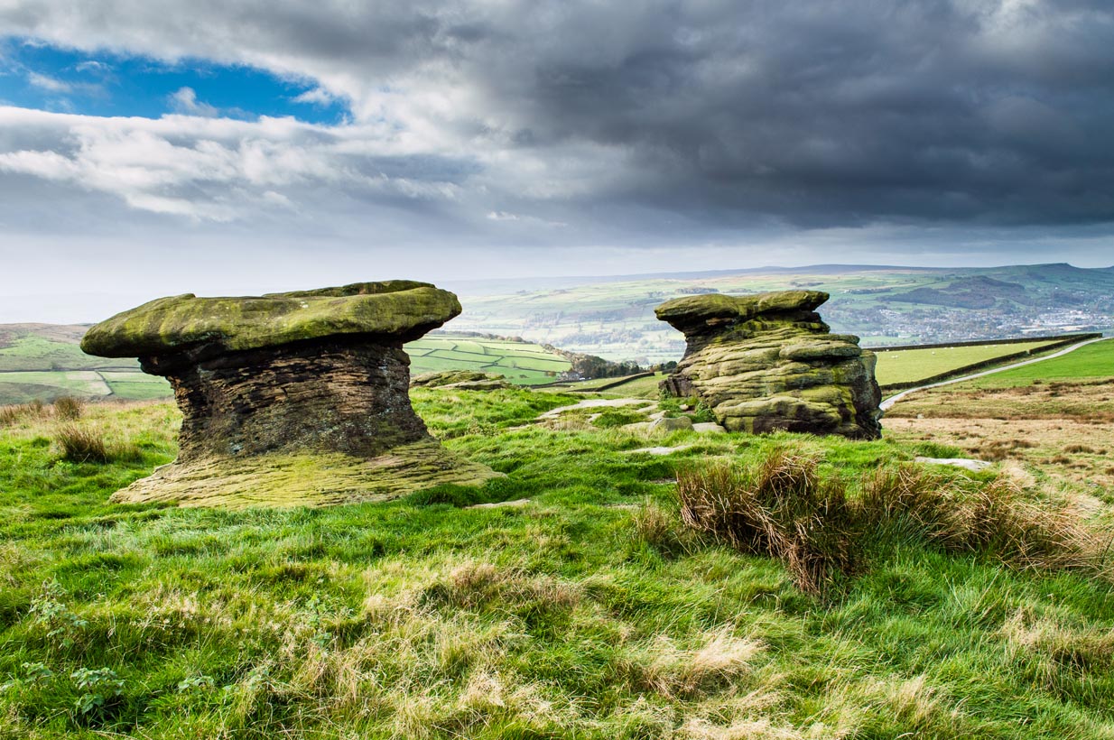
This giant outcrop of rock rises out from the meadowlands here like a miniature volcano, visible for many miles all round.  The history and legends surrounding the aged edifice are prodigious and the view from its tops on a fine day is one to be remembered.   It is likely, although there is little corroborative historical evidence, that is was an “omphalos”, or navel centre of the universe for the local people many centuries ago.  A great cutting runs through its centre and “runs from nearly north to south, and forms the boundary between the townships of Rigton and Stainburn, so that a portion of the rock is in each township.”  On the respective sides of this division are carved the letters “T.F.” and “E.L.”, being the initials of the families who owned the land here in olden days, Thomas Fawkes [of the legendary Guy Fawkes’ family] and Edwin Lascelles, of the ancient Harewood family.

Although Almscliffe Crags have been described in a great many local history books, it almost beggars belief to find it omitted from all the ancient mystery or “sacred sites” books ever written.  Curious…  Such lesser sites as Alderley Edge, the Cow and Calf rocks, Kilburn’s White Horse, Twelve Apostles stone circle, and many more, whilst having their respective virtues, don’t touch this place for ritual or sacred intent.

First described in the early 13th century records of Fountains Abbey, A.H. Smith (1961) thought the name of Almscliffe itself originally came from a hypothetical lady’s name, which seems an all-too-easy proclamation to make, instead of the humble option of  “I don’t know”!  But Smith wasn’t the only one to throw some curious ideas up about the etymology of Almscliffe.  Said by some local etymologists to derive from the Celtic Al-, a rock or cliff, and mias, an altar, there are other attempts to bring its rocky form into a consensus meaning.  The anglo-saxon Ael or El, being fire, and messe, or mass; and the Scandinavian Ormcliff, being the “cliff of the serpent”.  In Jones’ History of Harewood (1859), he tells

“it to have derived its name from the distribution of almes, at certain times, agreeably to the tenor of legacies left to the chapel which stood there in the sixteenth century, and was at that time dedicated to the Virgin Mary.”

It’s difficult to say which one tells its true title.  Many a druidic tale has also been carved into its form.  Such is the nature of this site that Grainge (1871) wrote how,

“it would not be difficult to show, with the exception of the artificial temple or circle of stones, this place possesses all the accessories of that ancient worship as…typical of the worship of the sun.”

Simpson’s 1879 drawing of the Almscliffe ‘cromlech’

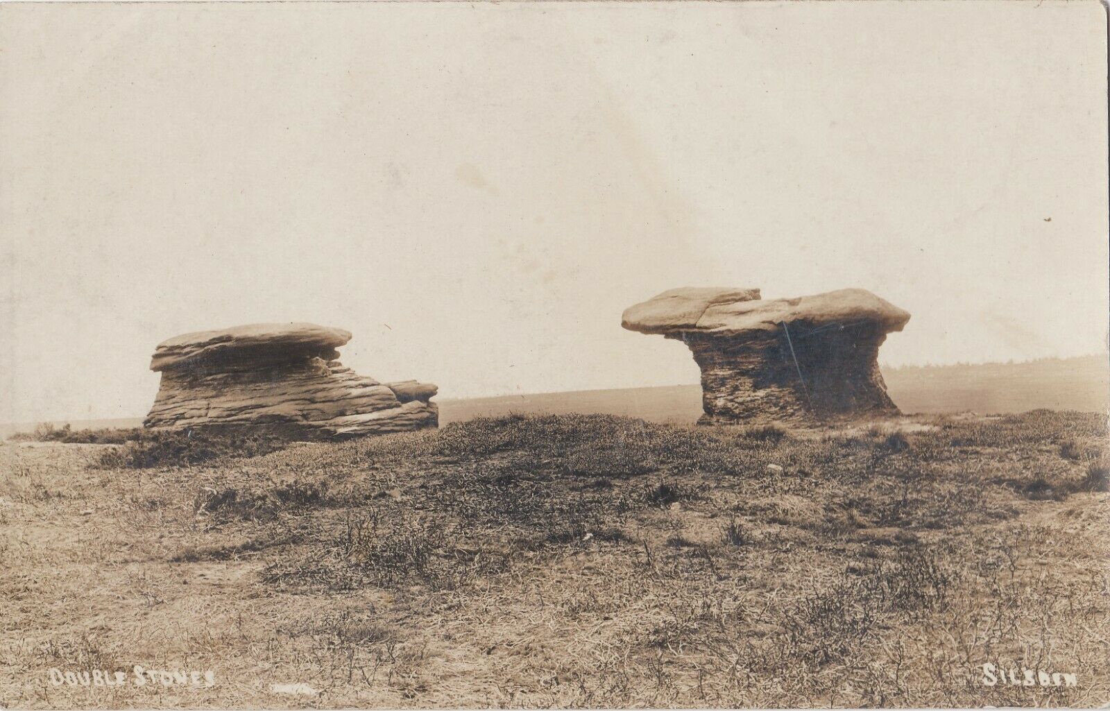
A remark that was even echoed by one of Yorkshire’s finest and most sober historians, Harry Speight. (1903)  Grainge also pointed out that in his day there were three standing stones by the great Crags, one fallen, but “two of these rocks yet stand upright.”  A few years later we find that the ranting christian writer,  Henry T. Simpson (1879), described similar megalithic remains here, though his description was of a “cromlech.” (illustrated here)  I can find no trace, nor further references to these relics; but think it reasonable to suggest that, perhaps, Simpson’s cromlech and Grainge’s standing stones may have been one and the same monument.

In the field 100 yards immediately north of the Crags (the one with the two rocks in it) there used to be seen the remains of some primitive early walling, suggestive of a small, early settlement site.  Very little can be seen of these remains today and, as far as I’m aware, no archaeological survey was ever done of them. In all honesty, it’s highly probable that a number of other important prehistoric sites were once in evidence at varying distances around Almscliffe Crags…

Folklore

The creation myth of Almscliffe tells that, long long ago, the great giant Rombald — whose main place of residence tended to be Ilkley Moor — was having a fight with the devil upon his homeland heath.  As is common in the myths of giants, the ‘devil’ picked up a great boulder and threw it at Rombald, but it missed and fell just short of the village of North Rigton, creating Almscliffe Crags. A variation of this tale tells that it was Rombald and his wife having the argument and she threw the stones to create the place.  Several sites have been named as the place where the mythological argument occurred: the Cow and Calf rocks, the Great Skirtful and Little Skirtful of Stones all cited in the folktales of our Yorkshire peasants.  Another variation of the tale tells that the devil was simply carrying some stones (as devils and giants are renowned to do in the folk-tales of the world) and he accidentally dropped them where the Crags now stand.  Such rock-throwing tales are, once more, symptomatic of cailleach tales more commonly found in Ireland and Scotland.

There are a great many cup-markings on the top surface of these Crags, most of which seem natural, but it is not unreasonable to think that, perhaps, some may have been carved by human hands? (not sure misself)  Eric Cowling (1946) sincerely believed the antiquity of some carvings here.  One of them particularly, three feet across and eighteen inches deep, though seemingly natural, has for several centuries been known as  the “Wart Well.”  Its name is attributed to folklore that is more commonly found in Ireland and the Scottish highlands; that is, should you have a wart, prick it with a pin until a drop or two of blood drips into the water that gathers in the stone bowl, then dip your hand in afterwards.  The wart is sure to vanish.  Another method to achieve the same end is to merely wash the skin affliction in the water, and it will soon fade. (Interestingly, an old psychotherapist friend, afflicted with the damned things, did just this and they promptly vanished.)

A more minor creation myth tells that the stone bowls we see on top of the Crags here – including the Wart Well – was actually made when the giant Rombald stepped from his home onto the Crags and left his footprint embedded in the rock face.  He was said to have made it in just one step, from the Giant Skirtful of Stones prehistoric cairn [where one legend reputes him buried].

Faerie folk were also long held to live here.  On the northwest side of the Crags is the entrance to a small cave that was always known as the Faerie’s Parlour, as it was said to be an entrance to their supernatural world.  In times past, many people have scrambled down into the cave, but never reached their Otherworldly paradise.  William Grainge (1871) wrote how the little people “were all powerful on this hill and exchanged their imps for children of the farmers round about.”  This is typical of old changeling lore!  In outlying villages surrounding the Crags there is a particular excess of faerie and old heathen lore.

One very curious-sounding tale tells how a goose was sent down the hole and, after some considerable time, re-emerged 3½ miles away out from a well near Harewood Bridge.  The goose is one of the many symbols of the sun and one of its primary symbolic attributes is that of winter.  Interestingly perhaps, as the rock art writer Graeme Chappell has pointed out, the underground journey of the goose from Almscliffe to Harewood Bridge coincides closely with the rising of sun on morning of the winter solstice.  This tale may simply be a folk remnant — and an archaic one at that — of just that event: ritualising winter solstice from these Crags.  In Norse lore, shamans tell of geese carrying the great god Wotan across the skies at the coming of the Yule period.

Another ritual date that was celebrated here was Beltane, or May 1.  Not only do we find many of the outlying villages possessed their own maypoles, but in 1879 Mr Simpson of Adel reported seeing Beltane fires atop of these rocks.  Other meetings were made here as the Crags are spliced in half by the local boundary line, and perambulation records show that people came here during the ‘beating of the bounds’, as they used to be called.  This boundary perambulation moot ingredient is what strongly implies the site to have had ritual importance.  And the fact that a mass of folktales emerge from here adds to this.  Then of course we have the physical situation of the Crags at the heart of the mid-Wharfedale landscape.  All these ingredients combined, strongly suggest the site would have been, not just the ritual meeting place of tribal elders in pre-christian times, but an omphalos: it rises majestically from the land and all monuments gaze towards its giant form.  Important giant prehistoric monuments from the hills miles away tell of myths that come and go from this proud mass of stone.  Although we have other omphali just over the extended horizons from Almscliffe, this is where the World began in the creation myths of ancient times in mid-Wharfedale, at the heart of the ancient kingdom of Elmet.

But there is still more lore to be told of these rocks…

The centre piece of the Crags is known as the Altar Rocks.  Upon its western side is carved the “figure of a large tree, which we take to be the monogram of the Celtic Jupiter,” says Grainge.  This assumption is derived from an eighteenth century writer who, said Speight (1903), told that “Almnus and Alumnus are titles of Jupiter, to whom this high altar was dedicated.”

The highest part of the Crags, to the west, is known as Lover’s Leap where, in 1766, a daughter of a respectable Rigton farmer of the name Royston, having been disappointed in love, decided to kill herself.  She jumped, so legend reputes, from a point some sixty feet above ground, but a strong wind blowing at the time caught hold of her dress and carried her through the air until she landed safely in an adjoining field with naught but a sprained thumb!  The said lady realised the stupidity of her ways and was said to have lived out a long and fine life.

In recent years earthlights (UFOs) have been seen floating above and around the great outcrop.  It is likely that these were the same things which, in days of olde, the people would call the faerie.  I highly recommend visiting the place!

References:

  1. Bennett, Paul, The Old Stones of Elmet, Capall Bann: Milverton 2001.
  2. Bogg, Edmund, From Eden Vale to the Plains of York, James Miles: Leeds 1895.
  3. Bogg, Edmund, Higher Wharfeland, James Miles: Leeds 1904
  4. Cowling, E.T., Rombald’s Way, William Walker: Otley 1946.
  5. Eliade, Mircea, Patterns in Comparative Religion, Sheed & Ward: London 1958.
  6. Grainge, William, History & Topography of Harrogate and the Forest of Knaresborough, J.R. Smith: London 1871.
  7. Jones, John, The History and Antiquities of Harewood, Simpkin Marshall: London 1859.
  8. Simpson, William, Archaeologia Adelensis, W.H. Allen: London 1879.
  9. Smith, A.H., The Place-Names of the West Riding of Yorkshire – volume 5, Cambridge University Press 1961.
  10. Speight, Harry, Kirkby Overblow and District, Elliott Stock: London 1904.

© Paul Bennett, The Northern Antiquarian


Rivock Nose (2), Keighley, West Yorkshire

Cup-Marked Stone:  OS Grid Reference – SE 07360 44629

Also Known as:

  1. Carving no.11 (Hedges)
  2. Carving no.46 (Boughey & Vickerman)

Getting Here

Follow the same directions for reaching the Wondjina Stone.  Once here, walk to the edge of the cliffs less than 10 yards away and the second largest of the rocks is the one you’re after. (the Rivock Nose [1] and [3] carvings are the rocks either side of this one)

Archaeology & History

Possible cup-markings at Rivock Edge

I’ve gotta admit, I was slightly surprised to find this carving logged in both Hedges (1986) and Boughey & Vickerman’s (2003) surveys.  Although we find the distinct appearence of cup-markings near the edge of the cliff at the northwestern end of Rivock Edge, these seem a little too close to being natural to be comfortably acknowledged in archaeo-texts without notes the contrary.  I took a photo of them when we were up visiting the other day, but didn’t expect them to be in the books.  Not only do they include this probably natural example, they also add another two rocks found along the cliff edges (Hedges 12 & 13; B&V 45 & 47).  In the event that these carvings are deemed authentic, then those along the edge of the great Kirk cliffs above Steeton must also be added to the same pot.

In the photo here you can work out perhaps nine cup-marks near the edge of the cliff, which is what the textbooks say.  Make your own mind up when your next looking at the Wondjina Stone and others nearby.

References:

  1. Boughey, Keith & Vickerman, E.A., Prehistoric Rock Art of the West Riding, WYAS 2003.
  2. Feather, Stuart, ‘Mid-Wharfedale Cup-and-Ring Markings: Nos. 7 & 8, Rivock Edge,’ in Cartwright Hall Archaeology Group Bulletin, 6:8, 1961.
  3. Hedges, John (ed.), The Carved Rocks on Rombald’s Moor, WYMCC: Wakefield 1986.

© Paul Bennett, The Northern Antiquarian 


Wondjina Stone, Rivock, Keighley, West Yorkshire

Cup-and-Ring Stone:  OS Grid Reference – SE 07366 44628

Also Known as:

  1. Carving no.10 (Hedges)
  2. Carving no.49 (Boughey & Vickerman)

Getting Here

Wondjina Stone, Rivock

A wonderful site, though a bittova walk for city-minded folk.  Head up the road from Riddlesden, Keighley, towards the southern edge of Rombalds Moor and keep going till you reach the road which surrounds the moor (called Silsden Road).  At the T-junction in front of you is a path which takes you onto the fields and moor.  Go over the stile and walk straight up the steepish field that follows the straight line of the forest, all the way to the top.  Climb over the wall on your left when you reach the top of the tree-line, walk past the triangulation pillar for 100 yards or so till you hit the end of the walling before it drops back into the trees.  The carving’s under your nose!

Archaeology & History

Wondjina Stone01
Rivock Edge’s ‘Wondjina’ carving

The name of this carving is based on a first impression I got of it when I came here as a young lad, still in my teens.  The ‘Wondjina’ is a name given to primal aboriginal spirits whose images are etched and painted on rock surfaces in various parts of Australia (usually rock overhangs or in caves).  Don’t ask me why, but that was the impression I first got of this stone — and it’s something that stays with me.  Some archaeo’s won’t like the association such mythic ancestral beings may have upon people’s notions of cup-and-ring art, but they tend to be the ones who have little educational background regarding the animistic nature of rocks in traditional and peasant societies: ingredients that are integral to these ancient carvings, as research worldwide clearly shows.

The carving was first described by our old Yorkshire historian Arthur Raistrick (1936) in an early essay on Yorkshire rock carvings; and then again in a later article by Stuart Feather. (1961)  The primary design is of a large single cup-and-ring at one end of the rock, with a series of seemingly unbroken lines reaching up (or perhaps moving away) from the cup-and-ring.  A long central line runs through the middle of the Wondjina ‘being’, which initially seems to have been a series of cups linked by this line; though these cups (at least four of them) have eroded over time and are difficult to see without good sunlight.  What seem to be several other very eroded cup-marks are also found on two of the other long lines.  These can be made out in the photograph here.

Close-up of lines & cup-marks

Another carving is on the stone right next to this one (2ft away) and there are several other cup-marked stones to be found along the same ridge (carving numbers 058, 059, 060, etc).  And for those of you into landscape archaeology, take the position of this carving into consideration.  The view from here is  quite superb and on clear days a number of prominent hills and important mythological landscape features stand out.  To those of you who think such things unimportant or of little relevance in the mythography of our ancestors — you’ve a lot to learn!  Otherwise, a visit to this carving and its associates is well worth a trek!

References:

  1. Bennett, Paul, ‘The Prehistoric Rock Art and Megalithic Remains of Rivock & District (2 parts),’ in Earth, 3-4, 1986.
  2. Boughey, Keith & Vickerman, E.A., Prehistoric Rock Art of the West Riding, WYAS 2003.
  3. Feather, Stuart, ‘Mid-Wharfedale Cup-and-Ring Markings: Nos. 7 & 8, Rivock Edge,’ in Cartwright Hall Archaeology Group Bulletin, 6:8, 1961.
  4. Hedges, John (ed.), The Carved Rocks on Rombald’s Moor, WYMCC: Wakefield 1986.
  5. Raistrick, Arthur, “‘Cup-and-Ring’ Marked Rocks of West Yorkshire,’ in Yorkshire Archaeology Journal, 32, 1936.

© Paul Bennett, The Northern Antiquarian


Dymond Stone, Burley Moor, West Yorkshire

Cup-Marked Stone:  OS Grid Reference – SE 12629 45206

Also known as:

  1. Carving no.118
  2. Carving no. 275

Getting Here

Dymond Stone, Ilkley Moor

It’s not too far from the main footpath from Ilkley to the Twelve Apostles stone circle.  As its discoverer C.W. Dymond (1880) said, “It lies alone, on and near the foot of a steep slope, about a furlong, or less than five minutes’ walk, north from the ruins of a small stone-circle (Twelve Apostles) which crowns the crest of the pass leading south-south-east from Ilkley to Eldwick, and just one mile and three-quarters from the former place.  If approached therefrom, it will be easily found about two hundred yards to the east of the point where the road surmounts the steep, to enter upon the upper plain.”  Otherwise, walk through the Twelve Apostles from the main footpath and out the other side, following the land where it slopes down and, near the bottom, you’ll see this large stone sitting quietly on its own…

1880 image of Dymond's carving
Dymond’s 1880 sketch

Archaeology & History

Not too sure about the veracity of this one to be honest.  It was first described by archaeologist C.W. Dymond (1880) as “a stone marked with a striking group of cups” – but these are small and untypical of the usual markings.  “The stone is 9 ft. 6 ins. in length, 6 ft. 3 ins. in breadth, and about 2 ft. in thickness; its upper surface dipping a little, with the ground, toward the north. Upon it may be seen a group of small cups, for the most part about half an inch in diameter,” he said.

Dymond thought that the design on the rock may have represented parts of the night sky, saying, “here we may have a rude attempt to portray the starry heavens spanned by the galaxy ; and that the outlying groups may have been intended to represent two of the constellations perhaps Orion, and another not so easily identified.”  But I think we can take this with a pinch of salt.

Included in Hedge’s (1986) survey without comment, Boughey and Vickerman (2003) correctly thought that the “small peck marks which are not typical cup-marks” might be “doubtful”.

References:

  1. Boughey, Keith & Vickerman, E.A., Prehistoric Rock Art of the West Riding, West Yorks Archaeology Service 2003.
  2. Dymond, C.W., ‘Cup Marks on Burley Moor,’ in Journal of the British Archaeological Association, volume 36, 1880.
  3. Hedges, John, The Carved Rocks of Rombalds Moor, WYMCC: Wakefield 1986.

© Paul Bennett, The Northern Antiquarian


Doubler Stones, Ilkley Moor, West Yorkshire

Cup-and-Ring Stones:  OS Grid Reference – SE 0723 4652

Also Known as:

  1. Carving Nos. 41 & 42 (Boughey & Vickerman)
  2. Carving Nos. 6 & 7 (Hedges survey)
  3. Doublestones
  4. The Fire Stones

Getting Here

The great Doubler Stones (photo, James Elkington)

Various ways to get here, but the 2 most common are: (1) from Brunthwaite village, above Silsden, following the road uphill for a mile, then turning right (west) onto the moorland dirt-track to Doubler Stones Farm.  Just before here there’s a footpath uphill (north) for 200 yards to the stones.  (2) follow the Millenium Way footpath south up Addingham Moorside, onto Addingham High Moor.  Keep going on the same path another 500 yards and they’ll appear ahead of you.

Archaeology & History

First described as the ‘Doublestones’ in the local Addingham parish records of 1786, these great mushroom-shaped rocks were later brought to the attention of archaeologists by J. Romilly Allen in 1879 and they greatly intrigued numerous Victorian antiquarians, who puzzled as much about their exotic forms as the cup-marks on their tops!  Allen wrote of them:

Cowling’s old drawing
Hedges (1986) sketch of the design

“These rocks are by far the most remarkable freaks of Nature to be seen in the district. They occupy a prominent position, perched on the extremity of a rocky knoll which juts out into the valley; and as seen from below, with their weird forms standing out clear and sharp against the background of blue sky, they present so extraordinary an appearance that they would at once attract the attention of even the most unobservant.  In general outline they resemble gigantic toadstools; and I presume that they are called Doubler Stones from the fact of their shapes being almost identical.  They may be appropriately described as Nature’s Twins.  The upper surface of the cap of one of these stones has three large basin-shaped cavities in it.  Two of these lie along the central axis of the stone, and measure respectively 1ft 3in by 2ft 9in deep, and 1ft 9in by 1ft 3in by 9in deep.  They are united by a deep groove, a continuation of which runs out over the edge of the stone at each end.  There is another basin lying to the west side of the two central ones, with one of which it is connected by grooves.  It measures 2ft by 1ft 9in and is 9in deep.  There is no direct evidence that these basins are artificial; but it is quite possible that they may have been so originally, and have been enlarged by natural agencies.  But in addition to the basins, are twenty-six cup-markings of distinctly artificial origin.  They vary in diameter from 2 to 4 in.  One group of cups appears to be arranged in parallel rows.”

Doubler Stones, c.1890

Although the writer thought there were no artificial cup-markings on the other Doubler Stone (the one on the left in the photo), John Hedges (1986) and Boughey & Vickerman (2003) cite there to be at least two cup-markings on this rock.  Other writers have given different numbers for the respective cup-marks thought to be on these rocks down the years.

If you’re into prehistoric rock-art, check this place out.  If you’re a geologist and aint been here, you’ll be even more impressed!

Folklore

Approaching the Doublers (photo – James Elkington)

In Nicholas Size’s Haunted Moor (1934) he described the Doubler Stones as being the abode of ghosts and a place of sacrificial rites in ancient days. While in Guy Ragland Phillips’ Brigantia, we find that the word ‘doubler’ itself “is a large shallow dish, bowl or plate” – which we find on top of the greater one of these two well-worn-weirdoes.  As well as being haunted, there is some other little-known, though not unexpected folklore here, which told these old stones to be the meeting place of witches in previous centuries.

In addition to this, we are told that the witches of Fewston valley to the west used to meet up with the more famous Pendle witches at these stones.  One historian proclaimed that this notion was spurious, as it would be too far for the Pendle witches to walk – which says more about the historian in question than the people of previous centuries.  The distance from Pendle to the Doublers can be traversed in a day and is an ideal meeting spot, away from the prying eyes of a wrathful Church, that sought war against the animistic practices of our ancestors.

References:

  1. Allen, J. Romilly, ‘The Prehistoric Rock Sculptures of Ilkley,’ in Journal of the British Archaeological Association, volume 35, 1879.
  2. Allen, J. Romilly, ‘Notice of Sculptured Rocks near Ilkley,’ ibid, volume 38, 1882.
  3. Bennett, Paul, The Old Stones of Elmet, Capall Bann: Chieveley 2001.
  4. Boughey & Vickerman, Prehistoric Rock Art of the West Riding, West Yorkshire Archaeology Service 2003.
  5. Cowling, Eric T., Rombald’s Way, William Walker: Otley 1946.
  6. Hedges, John, The Carved Rocks on Rombalds Moor, WYMCC: Wakefield 1986.
  7. Jennings, Hargrave, Archaic Rock Inscriptions, A. Reader: London 1891.
  8. Phillips, Guy Ragland, Brigantia: A Mysteriography, RKP: London 1976.
  9. Size, Nicholas, The Haunted Moor, William Walker: Otley 1934.

Acknowledgements:  Massive thanks to landscape photographer, James Elkington, for use of his images in this site profile.  Thanks mate! 

© Paul Bennett, The Northern Antiquarian


Simon’s Seat, Skyreholme, North Yorkshire

Sacred Hill:  OS Grid Reference – SE 0788 5981

Getting Here

Simon’s Seat in the centre & the Lord’s Seat immediately east

Tons of ways here.   To those who drive, take the Grassington-Pateley Bridge (B6265) road and a couple of miles past the village of Hebden, you’ll see the high rocks climbing on your southern horizon, with another group of rocks a few hundred yards along the same ridge.  That’s it!

Archaeology & History

This is an awesome site, full of raw power. It commands a brilliant view all round, but it is the north which truly draws the eye’s attention. Beneath the great drop of this huge outcrop is the haunted and legendary Troller’s Ghyll. The scent of as yet undisclosed neolithic and Bronze Age sites purrs from the moors all round you and there can be little doubt that this was a place of important magick in ancient days.

What seems to be several cup-markings on one of the topmost rocks are, to me, authentic. Harry Speight mentioned them in his 1892 work on the Craven and Northwest Yorkshire Highlands – but there are a number of other rocks in this giant outcrop with “possibles” on them.

Folklore

The name of this great rock outcrop has long been a puzzle to historians and place-name experts.  One tale that was told of Simon’s Seat to the travelling pen of one Frederic Montagu in 1838, told that,

“It was upon the top of this mountain that an infant was found by a shepherd, who took it to his home, and after feeding and clothing it, he had the child named Simon; being himself but a poor man, he was unable to maintain the foundling, when it was ultimately agreed to by the shepherds, that the child should be kept “amang ’em.”  The child was called Simon Amangham and the descendants of this child are now living in Wharfedale.”

The usually sober pen of Mr Speight thinks this to have been one the high places of druidic worship, named after the legendary Simon Druid. “It is however, hardly likely,” he wrote, “that he ever sat there himself, but was probably represented by some druidical soothsayer on whom his mystic gifts descended.”

I’ve gotta say, I think there’s something distinctly true about those lines. Visit this place a few times, alone, during the week, or at night – when there’s no tourists about – and tell me it isn’t…

References:

  1. Bogg, Edmund, Higher Wharfeland, James Miles: Leeds 1904.
  2. Montagu, Frederic, Gleanings in Craven, Simpkin Marshall: London 1838.
  3. Speight, Harry, The Craven and Northwest Yorkshire Highlands, Elliott Stock: London 1892.

© Paul Bennett, The Northern Antiquarian


The Kirk, Steeton, West Yorkshire

Legendary Rocks:  OS Grid Reference – SE 0418 4391

Also known as:

  1. Garlic Kirk

The Kirk, Hawkcliffe Woods, Steeton

This is a stupendous site!  It looks like some of this may have been quarried, a long time ago, but it also seems that nothing at all has been written about it – even in the simple travelogues beloved by our Victorian historians.  To come across it quite by accident, as I did (only yesterday), was excellent!  When I first got here, by following the wooded ridge betwixt Hollins Lane and the main Keighley-to-Steeton road (A629), the place seemed brilliant; but as time went on and my amblings through the sometimes dense and also very old woodland were overcome by the dream of the place, I couldn’t believe how this place had become forgotten.  Adrenalin rushed through me for a while, but then it was the dream of the place again.  The memories here were ancient – and you could feel them.  In places there was the solace of darkness, beloved of those who know old trees and dangerous places.  For here, walk the wrong place too quickly and Death comes.  Broken limbs await in the curious gorges which just appear in the woods, only a yard wide, but 50-60 foot deep, only to vanish again away from sight a few yards later.  Caves and dark recesses, seemingly unknown, reach out to climb down.  And all round is the aged covering of lichens and mosses that know centuries.

Shown as 'Garlic Kirk' on 1853 map
Shown as ‘Garlic Kirk’ on 1853 map

The Kirk itself – meaning simply, ‘place of worship’, in the old sense – is like something out of Lord of the Rings!  If you walk along its top, as I did, the great cliffs below come late to the senses.  A curious ridge of cup-markings, seemingly natural ones, stretch along the very edges of the drop – which stretches on for some distance.  And then as you walk along its edge, you find this great drop which looks north, is now on both sides of your feet!  It’s quite breathtaking!

Cup-markings on the edge (probably natural)

Trying to get down into the gorge below can be done, but it’s a bit dodgy!  If you aint agile and crazy, stick to doing it by walking round – a long way round…  Someone a few centuries back either cut into the rock, or laid steps, reaching into the mossy gorge, which runs to nowhere.

You can appreciate how this place would have been a sacred site:  it’s big, it’s old, it takes your breath away, and it looks across to the great Rivock Edge where many fine cup-and-ring stones were cut.  I’ll try and get some images of the place when I call here again in the very near future, but they’ll never capture the experience of being here.

Folklore

The only thing I have come across which seemingly relates to this great edifice, tells of a great cave in the woodland, which legend tells stretches many miles to the north and emerges at Bolton Abbey. (Clough 1886)  I wondered about the potential visibility factor in this legend and found it obviously didn’t work.  However, if you stand on a certain part of The Kirk and look north, a dip in the horizon enables us to see, far away, hills which rise up directly above the swastika-clad Bolton Abbey.  Twouldst be good to work out exactly which hill above the Abbey we can see from here.

On another issue, John Clough (1886) told that “on top of the rock there is a footprint and the initials of one of the Waites, who is said to have leaped over the chasm.”

References:

  1. Clough, John, History of Steeton, S. Billows: Keighley 1886.
  2. Gray, Johnnie, Through Airedale from Goole to Malham, Walker & Laycock: Leeds 1891.

© Paul Bennett, The Northern Antiquarian


Brimham Rocks Circle, Summerbridge, North Yorkshire

Stone Circle:  OS Grid Reference – SE 2056 6507

Archaeology & History

Druid's Circle on 1854 map
Druid’s Circle on 1854 map

A site that was illustrated by the early Ordnance Survey lads between the haunted Boggart Crag and Brimham Rocks to the south, I haven’t thoroughly explored this area so don’t know if anything at all remains of what was described.  It may or may not have been an early folly.  The earliest reference to this missing circle comes from Mr Hayman Rooke’s (1787) essay on the Brimham Rocks complex in Archaeologia journal.  Described in context with other prehistoric remains in the locale, Mr Rooke said,

“About a quarter of a mile further to the west (of Brimham Rocks) is a Druid circle, with a vallum of earth and stones, thirty feet diameter. It is exactly of the same construction as those on Stanton Moor, in the Peak of Derbyshire. There are likewise several small tumuli. Thirteen of them are ranged in a kind of circle, the largest not above eighteen feet in diameter. They are formed of earth and large stones. Two of these I opened; towards the bottom the effects of fire appeared on the stones; and ashes were scattered about, but there were no urns to be found.”

This description was echoed a few years later by Ely Hargrove (1809) and reiterated by Godfrey Higgins (1829) in his work on the Druids, but neither authors added anything new (strongly implying they never actually saw this ‘circle’).  The last description I’ve found of the site is in Mr Speight’s (1906) survey — which gives the reality of the site considerably more credence!  He told us:

“About 80 yards west of the Cannon Rock is a large tumulus, and about 300 yards still further is a Druid’s Circle, thirty feet in diameter, mentioned by Hargrove in 1809.”

But that’s it!  Nowt else!  It would seem from Hooke’s initial writing, that we are perhaps looking at a lost cairn circle in this locale, but until someone finds it we will never know for sure.

Intriguingly, there are a number of other prehistoric remains not far from this seemingly lost ‘circle’.  There’s a large standing stone not far away on Standing Stone Hill a half-mile south (kinda gives the game away really, dunnit!?) which I first saw as a kid; some cup-and-ring stones nearby; and the seemingly lost tumuli of Graffa Plain, southeast of Brimham Rocks, showing that prehistoric folk were up to the usual tricks nearby.  But the ‘circle’ is seemingly lost.  Is there anyone out there who knows anything more about yet another one of Yorkshire’s lost stone circles?  More information about the circle or the tombs would be very welcome!

References:

  1. Hargrove, Ely, The History of the Castle, Town and Forest of Knaresborough, Hargrove & Sons: Knaresborough 1809.
  2. Higgins, Godfrey, The Celtic Druids, R. Hunter: London 1829.
  3. Rooke, Hayman, “Some Account of the Brimham Rocks in Yorkshire,” in Archaeologia journal, volume 8, 1787.
  4. Speight, Harry, Upper Nidderdale, with the Forest of Knaresborough, Elliot Stock: London 1906.

© Paul Bennett, The Northern Antiquarian