Take the directions to the hugely impressive Dunruchan A standing stone. Walk directly south, over the gate and follow the fence straight down the fields, crossing the burn at the very bottom. Walk over the boggy grassland and start veering uphill, southeast. You’ll notice the land goes up in geological ‘steps’ and, a few hundred yards up, a small standing stone pokes up on the near skyline ahead of you. Head straight for it!
Archaeology & History
This small standing stone was first noted after a quick visit to the major Dunruchan megalithic complex in the summer of 2016. Photographer James Elkington was taking images of the landscape and the standing stones when he noticed a stone on the horizon a half-mile away. As we were in a rush, he took a couple of photos from different angles on the way back to the car—both of which looked promising. And so, several months later, we revisited the site again. Lisa, Paul and Mr Fukner and I meandered up the geological steps of the hillside until we reached the site in question.
Looking northwestLooking northeast
Standing just over four-feet tall, this solitary stone overlooks the megalithic Dunruchan complex a half-mile or so to the north and northwest. Like the Dunruchan C monolith, this smaller upright is conglomerate stone. Paul Hornby noted what may be a single cup-marked stone roughly 100 yards east along the same ridge. (Please note that the grid-ref may be slightly out by perhaps 50 yards or so at the most. If anyone visits and can rectify my ineptitude on this matter, please let me know.)
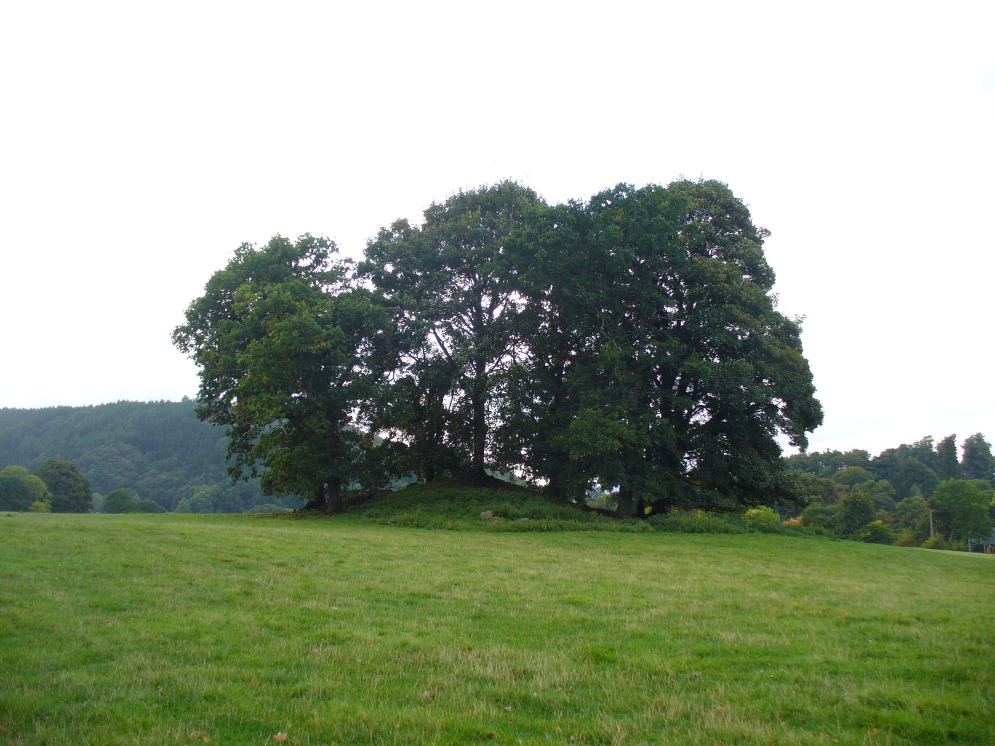
If you’re coming southwest out of Crieff on the A822, as you cross the river take the right-turn just before leaving the town along the country lane onto Strowan and Dalginross. Nearly 2½ miles along there’s the small junction on your right to Strowan House and church. Just past this turning, the next field on by the roadside, has a large rounded tree-covered mound living quietly. That’s the fella!
Archaeology & Folklore
Found halfway between Crieff and Comrie in the field on the north-side of the road, this large oak-covered tumulus was, seemingly, first described in notes made by the old archaeologist O.G.S. Crawford following a quick visit he made here in 1936. The place has, since then, never been excavated to find out exactly what might be hiding therein! It’s quite a big fella too: about 10 feet high and 40 yards across (east-west)—similar in size and design to the prehistoric burial mounds at Tulloch and Kinpurnie. Some large rocks make up the sides and edges of the mound, with smaller ones scattered here and there, giving the distinct impression of a very overgrown cairn of sorts.
Tis a quiet and tranquil arena, amidst fervent colours of meadows and old trees. Another 2 miles further down the same road is the equally tranquil (though ruined) megalithic ring of Dunmoid…
From the main road running through lovely Comrie, take the south B827 road over the old river bridge. Go dead straight for several hundred yards until the road bends right; but take the left turn here. 100 yards or so along note the trees on your right, and the road begins to swerve round here. Just round the corner in the trees, the stones are in the clearing right by the roadside. You can’t miss them! (if you hit the graveyard, you’ve gone past them)
Archaeology & History
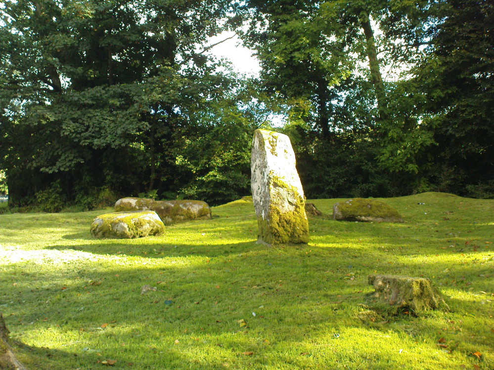
This is a truly lovely, almost warming enclosed megalithic site—albeit damaged by the ruin of centuries; but on the occasions I’ve been here it feels quite nurturing and elicits a quite natural meditative state. Whether or not this is due to the surround of trees, or the natural electromagnetic field, or just me, I dunno….
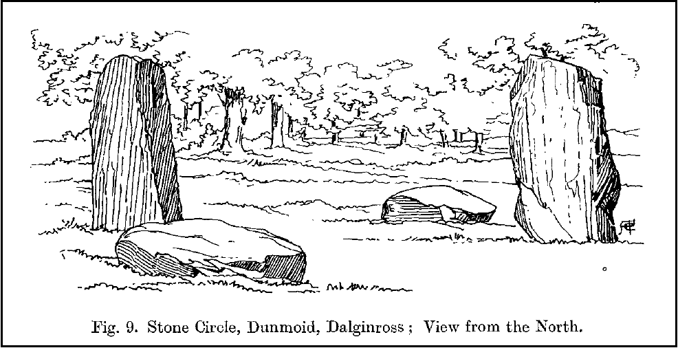
Dunmoid Circle, looking SEDunmoid from the North (Coles 1911)
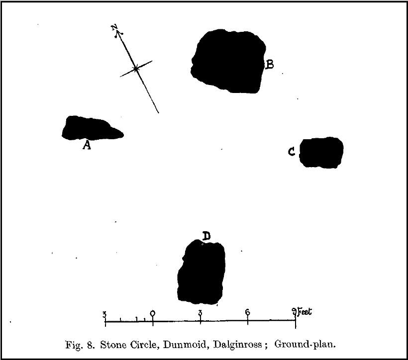
The ‘circle’ is constructed upon a flat rounded section of ground, surrounded by a ditch on two-thirds of its edges, very reminiscent of a typical henge monument—but there is no mention of this in modern surveys. One of the earliest accounts of Dunmoid was written by John MacPherson (1896) who gave us as much of the known history of the site as is still known by any modern academic. He wrote:
“At the west side of the new cemetery, close to the public road, there is a curious round knoll, which at one time must have been used as a place for the burial of the dead. The attention of the writer of this was drawn to it about twenty years ago. There were three large slabs of stone lying upon the ground, which apparently had been at some former period placed erect by some loving hands to mark the last resting-place of some departed friend or hero. By the aid of some of the Comrie masons the stones were placed in a standing position. Curious to know what lay beneath the surface, we dug up the earth in front of the largest slab, and came upon a stone cist placed north and south, 7 inches long, 1 foot 8 inches broad, and 1 foot 3 inches deep. The only remains discovered was a thigh-bone, but whether it at one time formed a part of the leg of a Celt, a Roman, or a Saxon we could not tell. An old man who then lived in the village of Comrie told us that in his young days the same mound was dug up, when an urn filled with ashes was discovered. This, perhaps, would indicate that it formed a place of burial for Romans rather than for Caledonians. The spot is called Dunmoid, or ‘hill of judgment.'”
Fred Coles 1991 planDunmoid from SE (Coles 1911)
The circle gained the attention of the prolific Fred Coles (1911) in his Perthshire surveys, whose drawings and measurements are still repeated in the modern textbooks more than a century later. When he visited the site, two of the stones were still upright, but today only one still stands. In Aubrey Burl’s (1988) survey on ‘four-poster’ stone circles, he reiterated Coles’ words, telling:
“Originally four stone stood at the corners of a rectangle on a mound some 75ft (23m) across and 2ft (60cm) high. Coles’ plan showed the NW stone standing 5ft 4ins (1.6m) high and the SE, opposite, 5ft 2ins (1.6m), with the thick NW stone prostrate, 4ft 6ins (1.4m) long, with the more slender SW pillar also supine and 4ft (1.2m) long. The longer SE and NW sides of the oblong were roughly 9ft 6ins (2.9m) long and the others 9ft (2.7m) in length. The circle on which the stones had been placed had a diameter 13ft 2ins (4m), of which the Megalithic Yard is not an integer.”
The circle is included in Andrew Finlayson’s (2010) modern survey of the region.
References:
Burl, Aubrey, Four Posters: Bronze Age Stone Circles of Western Europe, BAR 195: Oxford 1988.
Finlayson, Andrew, The Stones of Strathearn, One Tree Island: Comrie 2010.
Hunter, John (Ed.), Chronicles of Strathearn, David Philips: Crieff 1896.
Hutchison, A.F., “The Standing Stones of Stirling District,” in The Stirling Antiquary, volume 1, 1893.
MacPherson, John, “At the Head of Strathearn,” in Chronicles of Strathearn, Crieff 1896.
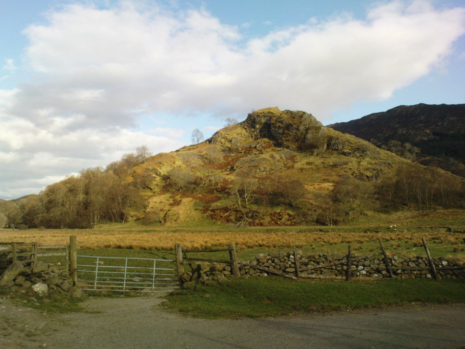
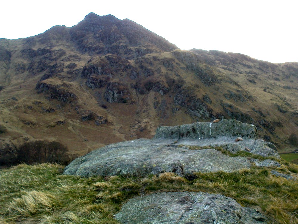
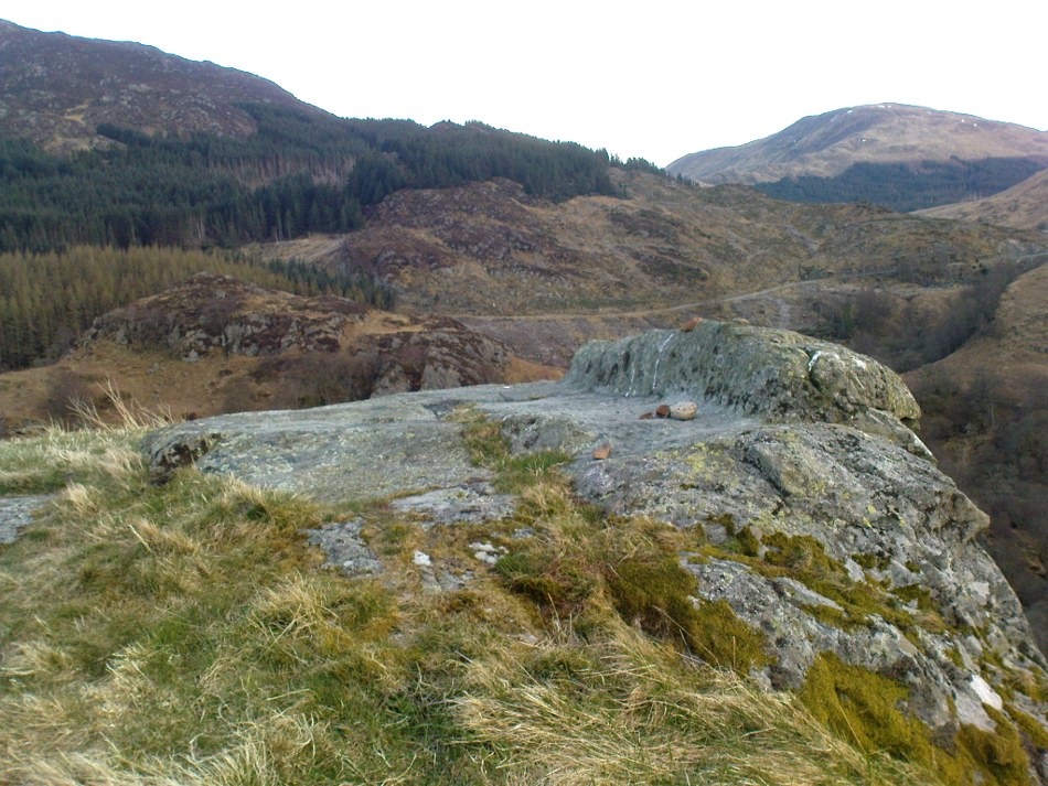
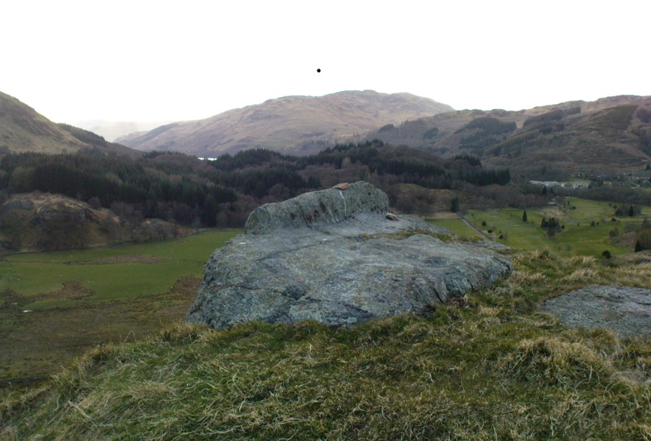
Not hard to find. Between the small towns of Comrie and St. Fillans along the A85 road, keep your eyes peeled for the small but rocky crags that rise in front of the background of dramatic mountains not far from the roadside to the south. It looks truly majestic even on a dull day. Just as you reach the eastern edge of St. Fillans village, take the small road over the river-bridge and go to the golf club. Walk past the golf club itself, keeping along the track that leads you to Dundurn hill. It’s easy enough. Then climb to the very top of the hill where you’ll find this curious, large, flat bed-like rock right in front of you!
Archaeology & History
St Fillan’s rocky bed or ‘chair’
The archaeological data for St. Fillan’s Chair relates more to the folklore practices of the people upon Dundurn hill than anything else and ostensibly little can be said by such students. The place is more satisfying for geologists than archaeologists, who would adore the rocky fluctuations and geophysical propensities with greater verve than any archaeologist could muster! For this rocky bed-shaped feature is a fascinating structure whose only potential interest to archaeologists are what may be a couple of reduced cup-marks on the top of the stone (and even then, such potential rock art is more the province of religious historians and anthropologists than archaeologists).
Small quartz offerings left on St Fillan’s Chair at BeltaneView of the Chair from below
But this ‘bed’ or ‘chair’, as it was locally known, was – and it seems, still is – important in the social history of the area, as its folklore clearly tells. The ‘chair’ plays an important part in the holistic role of Dundurn as a hill, a fort, a healing centre, an inauguration site, and very probably an omphalos: a sacred centre whereupon the ordination of shamans, kings and the cosmos as a whole was brought to bear here… (these features will be explored in greater depth when I write a singular profile of Dundurn as a ‘fort’).
Folklore
Looking west over St Fillan’s Chair
The character of St. Fillan was described by James Cockburn (1954) as “an Irish Pict” and the “son of a King – his father being Angus mac Nadfraich who died in battle in 490 AD.” Quite an important dood in his day! The relationship this early christian figure had with this Chair was in its supposedly curative properties. Yeah…you read it right: curative properties! As with countless rocks all over the world, some of Nature’s outcrop boulders were imbued with a spirit of their own and, when conditions and/or the cycle of the spirit ‘awoke’, healing attributes could be gained from the place. And such was the case at St. Fillan’s Chair, especially on Beltane morning (May 1). And some element of this traditional pilgrimage is still done; for when the author Marion Woolley and I visited the site on Mayday 2013, it was obvious that some people had been up earlier that Beltane morning and left some offerings of quartz stones on the top end of the bed.
The earliest written reference of this medicinal virtue was told in the Old Statistical Account of Perthshire (1791):
The rock on the summit of the hill, formed, of itself, a chair for the saint, which still remains. Those who complain of rheumatism in the back, must ascend the hill, sit in this chair, then lie down on their back, and be pulled by the legs to the bottom of the hill. This operation is still performed, and reckoned very efficacious.
More than a hundred years later, the sites was still being used and was described in similar vein in MacKinlay’s (1893) excellent study:
“On the top of green Dunfillan, in the parish of Comrie, is a rocky seat known in the district as Fillan’s Chair. Here, according to tradition, the saint sat and gave his blessing to the country around. Towards the end of last century, and doubtless even later, this chair was associated with a superstitious remedy for rheumatism in the back. The person to be cured sat in the chair, and then, lying on his back, was dragged down the hill by the legs. The influence of the saint lingering about the spot was believed to ensure recovery.”
The origins of this dramatic rite were probably pre-christian in nature and we should have little doubt that St. Fillan replaced the figure of a shaman or local medicine woman of some sort. The ritual “dragging down the hill” may be some faint remnant of initiation rites…
References:
Cockburn, James H., The Celtic Church in Dunblane, Friends of Dunblane Cathedral 1954.
Eliade, Mircea, Rites and Symbols of Initiation, Spring: Woodstock 1995.
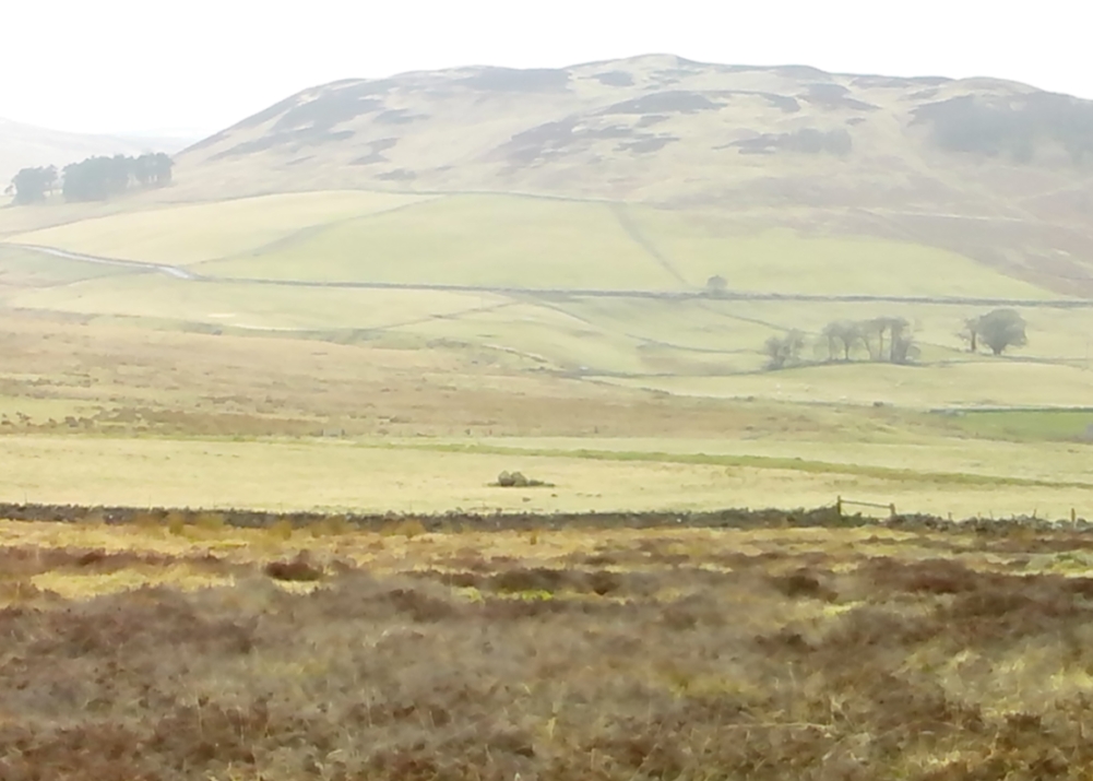
Landscape of Giants Knowe (photo by Marion Woolley)
Amidst the colourful and nurturing landscape close to the gigantic Dunruchan standing stones and just along the road from the solitary Craigneich stone, in the field across the road above Straid farmhouse could once be seen a fascinating-sounding prehistoric site that has sadly been destroyed. Some of the remains of this old monument can be found in the field-clearance of stones just over the fence, above the top of the field (many fields round here have scatterings of large stone clearings at the field edges), but we have no detailed accounts of the site. It was mentioned in early notes by the Ordnance Survey to have been,
“A large circular heap of small stone and gravel entirely removed in 1831. An urn filled with ashes and several stone coffins were found under it.”
The local historian John Shearer (1883) later told us that,
“A small mound of earth on the farm of Strayd, called Crock-nafion or the Giant’s Knowe, or the Fingalian’s Knowe, was cleared away several years ago. An urn containing burnt bones was discovered.”
Any additional information about this site and its folklore, would be greatly appreciated.
Folklore
To the west along Glen Artney whence our view takes us from here, old legend told that the valley was once the abode of a great giant who lived in a cave in one of the mountains thereby. In mythic lore, giants were the creation deities of hills, mountains and other geological forms, whose narratives were overturned and demonized by the incoming christian cult many centuries ago. It is likely that this once great tomb was deemed as the burial-place of our local giant – which would make this prehistoric site neolithic in age. But — logical though it is — this idea is pure speculation…
References:
Hunter, John, Chronicles of Strathearn, David Philips: Crieff 1896.
Shearer, John, Antiquities of Strathearn, David Philips: Crieff, 1883.
Found by the legendary hill of Dundurn, east of Loch Earn, this legendary healing site has been written about by many historians, both local and national. An early account of it was given by the local priest, Rev. Mr McDiarmid, minister of the parish of Comrie at the end of the 18th century, who informed those compiling the Old Statistical Account of the area, the following information:
“This spring, tradition reports, reared its head on the top of Dun Fholain (Fillan’s Hill) for a long time, doing much good, but in disgust (probably at the Reformation) it removed suddenly to the foot of a rock, a quarter of a mile to the southward, where it still remains, humbled, but not forsaken. It is still visited by valetudinary people, especially on the 1st of May and the 1st of August. No fewer than seventy persons visited it in May and August, 1791. The invalids, whether men, women, or children, walk or are carried round the well three times in a direction Deishal—that is from east to west, according to the course of the sun. They also drink of the water and bathe in it. These operations are accounted a certain remedy for various diseases. They are particularly efficacious for curing barrenness, on which account it is frequently visited by those who are very desirous of offspring. All the invalids throw a white stone on the Saint’s cairn, and leave behind them as tokens of their gratitude and confidence some rags of linen or woollen cloth. The rock on the summit of the hill formed of itself a chair for the Saint, which still remains. Those who complain of rheumatism in the back must ascend the hill, sit in this chair, then lie down on their back, and be pulled down by the legs to the bottom of the hill. This operation is still performed, and reckoned very efficacious. At the foot of the hill there is a basin made by the Saint on the top of a large stone, which seldom wants water even in the greatest drought, and all who are distressed with sore eyes must wash them three times with this water.”
We see from this early account that there’s a discrepancy regarding the location of St. Fillan’s Well, as the modern accounts indicate it to be at the top of the craggy hill. In some upland regions this occurred so as to maintain a sense of secrecy about the location of local sites, so ensuring they were not affected or disturbed by outsiders or incomers, who not only disrespected local customs and rites, but tried changing or altering them to their new ways. It also kept the local gods and spirits of the sites protected from tourism and the profane. This may explain the difference in locations described by Rev. McDiarmid.
About one hundred years after McDiarmid’s account, another priest called Tom Armstrong (1896) wrote a piece in the Chronicles of Strathearn (1896) all about this holy well, saying:
“People are prone to believe that the dirty pool of stagnant water which still remains in the driest summer on the top of St. Fillan’s Hill is the famous spring to which pilgrims at one time resorted. Any one who examines it will not fail to observe that it has all the appearance of an artificially built well, and must have been kept in order and preservation for a purpose. Tradition confirms the belief that this was at one time the well, but not always.”
The hill on which it is found was an ancient dun or fort, built in prehistoric times, making you wonder how far back in time its magickal abilities were known about.
References:
Armstrong, Thomas, “By the Well of St. Fillan,” in Chronicles of Strathearn (David Phillips: Crieff 1896).
Gordon, Seton, Highways and Byways in the Central Highlands, MacMillan: London 1948.
Hunter, John, et al, Chronicles of Strathearn, David Phillips: Crieff 1896.
Take the A907 road between Clackmannan and Comrie and, close to Bogside Farm at the roadside, but on the other side of the road where the bridge crosses a burn, take the dirt-track uphill and into the woodland. About 300 yards up (before you hit the signs pointing you to the farm) , walk uphill into the trees on your left until the ground levels out. Look around! (and best visited between December and May, before the bracken covers the place)
Archaeology & History
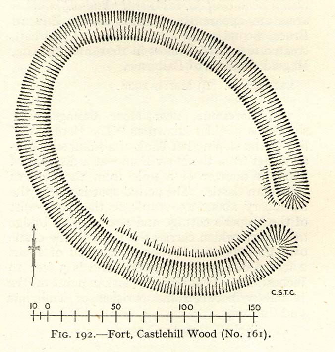
Visiting this site is pleasure in itself. Situated in an open forest, with traditional pine trees in abundance, there are scattered amidst the edges of this large oval-shaped Iron Age structure, the aged boughs of ash and beech, centuries old, along its edges and throughout the woods. It is a truly superb setting! When visited by the Royal Commission lads in April, 1925, they found the remains here in good condition. A few years later in their impressive Inventory, they told:
“In Castlehill Wood, about 250 yards to the southwest of Bogside Railway Station, and at an elevation of 200 feet above sea-level, is a small plateau of very regular oval form with its major axis northwest and southeast. It is surrounded by a single ditch, the well-marked enclosure thus produced having a maximum measurement of 185 by 135 feet. At the southeast the ditch has been left uncut in order to provide a passage for entrance. This passage has been about 20 feet wide, and at its inner end there are on either side faint traces of a low mound, which in all probability once ran right round the edge of the enclosure and which may have been palisaded.”
RCHAMS 1933 plan of site
Sadly when I came here a few days ago, much of the was very overgrown with bracken and other vegetation, making it impossible to see the site properly and preventing any decent photos. We’ll go back here in a few months time to get better images!
Folklore
This site was mentioned, albeit briefly, in David Beveridge’s (1885) magnum opus on the history of Culross. With equal brevity he noted several standing stones in the region, saying how tradition afforded them a Danish origin. This site was the same for
“a tradition prevails that after the battle of Inverkeithing the Danish army or a portion of it retreated to a station in the north of Culross parish, where they erected the earthwork or camp of Castlehill, still existing near the Burrowine Farm.”
References:
Beveridge, David, Culross and Tulliallan: Its History and Antiquities – volume 1, William Blackwood: Edinburgh 1885.
Royal Commission on the Ancient & Historical Monuments, Scotland, Inventory of Monuments and Constructions in the Counties of Fife, Kinross and Clackmannan, HMSO: Edinburgh 1933.
Follow the directions to reach the standing stone of Dunruchan D, and there on the moor immediately to your south, 100 yards or so away, it stands before you!
Archaeology & History
Dunruchan E stone, with Dunruchan D to rear
This is the southernmost of the impressive standing stones on the plain below Dunruchan Hill. Notably more ’rounded’ at the top than most of its associates—giving a more distinct ‘female’ nature to the stone than its companions—we find again, scattered around the base of this 7-foot tall monolith, a number of smaller rocks that gives the impression an old cairn was once here. Certainly there are a scatter of several other cairns nearby and we get the distinct impression with all of the Dunruchan stones, that a prehistoric cemetery was once in evidence here.
Ground-plan of stone & cairnCole’s drawing of Dunruchan E
Although this is the last of the known standing stones in this area, there is every probability of other prehistoric remains hidden amidst the heathlands—perhaps even more large standing stones that have fallen and are overgrown with vegetation. When Fred Cole came here one time with the great rock art writer, Sir James Simpson, one such fallen standing stone was reported a short distance tot he east, but it has yet to be recovered. There may be more.
In Fred Cole’s (1911) report of this particular “south stone”, or Dunruchan E, he wrote:
“This monolith, in respect of position, somewhat resembles the last, because it stands on the west arc of a rudely circular setting of small stones, which, however, are not placed on a mound (as in the case of Stone D), but merely lie on the flat of the moor. Five of these blocks are large enough to be noticeable, and they occupy the positions shown by the outlined stones in the ground-plan (fig. 21), the farthest to the east being 15 feet distant from the inner face of the standing monolith A. The dimensions of this Stone are: height 6 feet 9 inches, basal girth 16 feet 1 inch. In the illustration (fig. 22) I show this Stone with the other great one near set on its platform, and to the right two of the numerous small, low cairns which are scattered about this part of the moor. ”
Folklore
According to an account in the Ordnance Survey Name Book of 1860, “these stones are believed to mark the graves or commemorate the death of Roman soldiers who fell in a battle fought here between the Romans and the Caledonians.”
References:
Burl, Aubrey, From Carnac to Callanish, Yale University Press 1993.
Cole, Fred, “Report on Stone Circles in Perthshire, Principally Strathearn,” in Proceedings of the Society of Antiquaries, Scotland, volume 45, 1911.
Finlayson, Andrew, The Stones of Strathearn, One Tree Island: Comrie 2010.
Hunter, John, Chronicles of Strathearn, David Phillips: Crieff 1896.
Thom, A., Thom, A.S. & Burl, Aubrey, Stone Rows and Standing Stones – 2 volumes, BAR: Oxford 1990.
Dunruchan D Stone – with Dunruchan E in background
Follow the directions to reach the Craigneich standing stone, then across the road and uphill past the Dunruchan B standing stone, uphill further past the Dunruchan C standing stone and onto the moorland plain just behind it. You’ll see two large standing stones ahead of you on the moor to the south, a coupla hundred yards away. The nearest one is Dunruchan D.
Archaeology & History
Fred Coles’ 1911 drawing
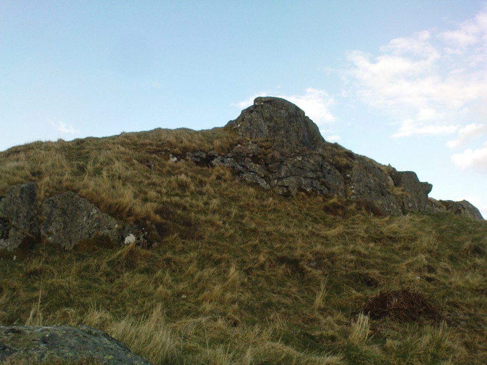
Another fine large standing stone in this curious but excellent megalithic complex on the hills south of Comrie. This great monolith leans at a slight angle, and would be some 10 feet tall if the ages had kept it perpendicular. It’s truly impressive; and it emerges from the edge of a large raised cairn which almost surrounds it. The cairn is overgrown yet some 3-4 feet tall and made up of thousands of small stones. It’s the most notable of the cairns scattering the plains of Dunruchan, and gives the best impression of the standing stones here being memorials to some ancient chief, queen or shaman. As far as I know, this cairn has not been excavated, so we know not yet who or what lies beneath it.
Carved parallelogram design
A small section of the standing stone has some faded carving on its eastern side. These seem to be relatively recent, though a curious parallelogram design echoes the carving (albeit larger) on the Gleneagles B standing stone, 10 miles southeast, and which is thought to be Pictish. The carving here, however, doesn’t have that feel to it.
The stone and the cairn were noted in Fred Coles’ (1911) survey, in which he called this the “south-west stone” and wrote:
“New features are presented in combination with this Stone. In lieu of being set absolutely solitary on the heath, there are, extending for a considerable area almost around its base, many stones and boulders laid in the form of a flattish circular cairn or platform (see ground-plan). The monolith, which leans over towards the north, is set to the south of the crest of the cairn, and there is a considerable fall from the crest to the level of the moor around it, indicating that a very great quantity of small stones must have been employed in making the cairn. The interior, shown dotted on the plan, bears signs of having been partially excavated, probably the cause of the Stone being so much out of the vertical. The stony cairn or platform measures 15 feet in diameter, and consists of moderate sized stones. The base of the great Standing Stone is oblong, and measures in girth 14 feet 2 inches. Down the slope of its back the length is 10 feet, and its present vertical height 8 feet 6 inches. The longer axis is almost exactly due east and west. From this spot the next Stone in order can be easily seen…”
Coles’ groundplan of cairn & stone
Several other small cairns scatter this grassy and heathland plain, all of them overgrown and none of them excavated.
Dunruchan D, looking south
As with the other Dunruchan monoliths, this one has been included in the megalithic stone row surveys by both Alexander Thom (1990) and Aubrey Burl (1993), but the staggered alignment this has with the other standing stones is more likely fortuitous than deliberate. But this doesn’t detract from the magnitude of the megalithic cluster on this small section of moorland. A truly brilliant site!
Folklore
According to an account in the Ordnance Survey Name Book of 1860, “these stones are believed to mark the graves or commemorate the death of Roman soldiers who fell in a battle fought here between the Romans and the Caledonians.”
References:
Burl, Aubrey, From Carnac to Callanish, Yale University Press 1993.
Cole, Fred, “Report on Stone Circles in Perthshire, Principally Strathearn,” in Proceedings of the Society of Antiquaries, Scotland, volume 45, 1911.
Finlayson, Andrew, The Stones of Strathearn, One Tree Island: Comrie 2010.
Hunter, John, Chronicles of Strathearn, David Phillips: Crieff 1896.
Thom, A., Thom, A.S. & Burl, Aubrey, Stone Rows and Standing Stones – 2 volumes, BAR: Oxford 1990.
Follow the directions to get to the Dunruchan B standing stone, on the slopes south of Craigneich. Once there, on the hillside further above you, you’ll see a large upright stone on the moor about 300 yards to the south, standing just below the rise of a small hillock. That’s it!
Archaeology & History
Fred Coles’ 1911 drawing
The second biggest of the Dunruchan monoliths is what Fred Coles (1911) described as “the Middle Stone,” or Dunruchan C. Standing just below the rise of a large natural mound of earth, obstructing any immediate view of the western hills, it too has a long upright shape with a pointed end to the stone, leaning at a considerable angle. The massive stone of Dunruchan A is clearly visible on the grassy cairn-scattered plain 543 yards to the east and the smaller Dunruchan B to the north on the slopes below. Dunruchan C was deemed as one of the central stones in this unlikely megalithic stone row by both Aubrey Burl (1993) and Alexander Thom (1990). Mr Coles’ description of the site told:
“This huge block…rugged and irregular…makes, from the extraordinary angle at which it leans over southwards, a surprisingly picturesque object amid the heather and the various small boulders that lie scattered about in its vicinity. Of oblong basal section, the Stone tapers sharply up to a small narrow edge, which is at present 9 feet 4 inches in vertical height above the grassy ledge surrounding the base. In girth it measures over 17 feet, and the slope of its upper surface is over 12 feet in length. Intervening undulations in the moorland prevent one seeing the two Stones which stand farther down south-wards. The main axis of its base is N. 18° W. by S. 18° E. ”
Dunruchan C, looking eastThe leaning pillar of Dunruchan C
Once you walk onto the mound above this stone, the landscape opens up all round you. The southernmost monoliths of the Dunruchan complex awake to the south; what seems to have been another significant boulder sits low down a few hundred yards to the west; the faint outline of a large man-made enclosure of some sort is another 100 yards west of that; and the rocky mountains west and north of here captures you with a relaxing exultation, typical of the Scottish hills. This arena is an absolute must for all megalith fanatics!
Folklore
According to an account in the Ordnance Survey Name Book of 1860, “these stones are believed to mark the graves or commemorate the death of Roman soldiers who fell in a battle fought here between the Romans and the Caledonians.”
References:
Burl, Aubrey, From Carnac to Callanish, Yale University Press 1993.
Cole, Fred, “Report on Stone Circles in Perthshire, Principally Strathearn,” in Proceedings of the Society of Antiquaries, Scotland, volume 45, 1911.
Finlayson, Andrew, The Stones of Strathearn, One Tree Island: Comrie 2010.
Hunter, John, Chronicles of Strathearn, David Phillips: Crieff 1896.
Thom, A., Thom, A.S. & Burl, Aubrey, Stone Rows and Standing Stones – 2 volumes, BAR: Oxford 1990.


")
")

")

")


")

