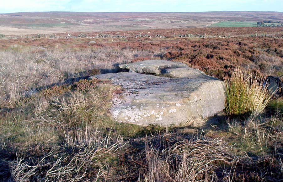
Nine Stones Close, Harthill, Derbyshire

Stone Circle:  OS Grid Reference – SK 2254 6264

Also Known as:

  1. Grey Ladies
  2. Hartle Moor Stone Circle

Getting Here

Nine Stones Close circle

From Bakewell take the A6 Matlock road, follow this till just past the signs for Haddon Hall where you take a right (the first major junction) for Youlgreave the B5056.  After about 1km take the first left over the bridge.  You then take the first right turn: a steep lane with restriction signs (don’t worry there’s access for cars but no wide vehicles). Take the first left you come to by the barn and then just follow the road, up through the woodland where the lane narrows then shortly after you’ll see Robin Hood’s Stride to your left.  Park a little way after the field gateway and look across the field to your left.  The stones are visible from the road.

Archaeology & History

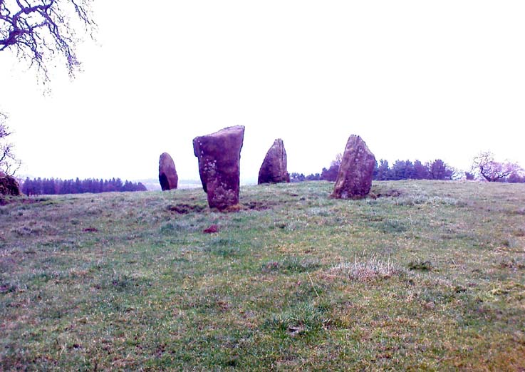
This is a fine-looking ring of stones — though perhaps the word ‘ring’ is slightly misleading here, as only four of (apparently) nine originals still remain and they are, by definition, more in a square-shape than a circle!  But it’s a lovely site.  When Geoff brought us here for the first time only last weekend, despite the dark clouds and cold grey day, along with the fact that we’d been sleeping rough the night before and got soaking wet through, there was a subtle feel to this place which my shivering senses still touched.  Only just though…!
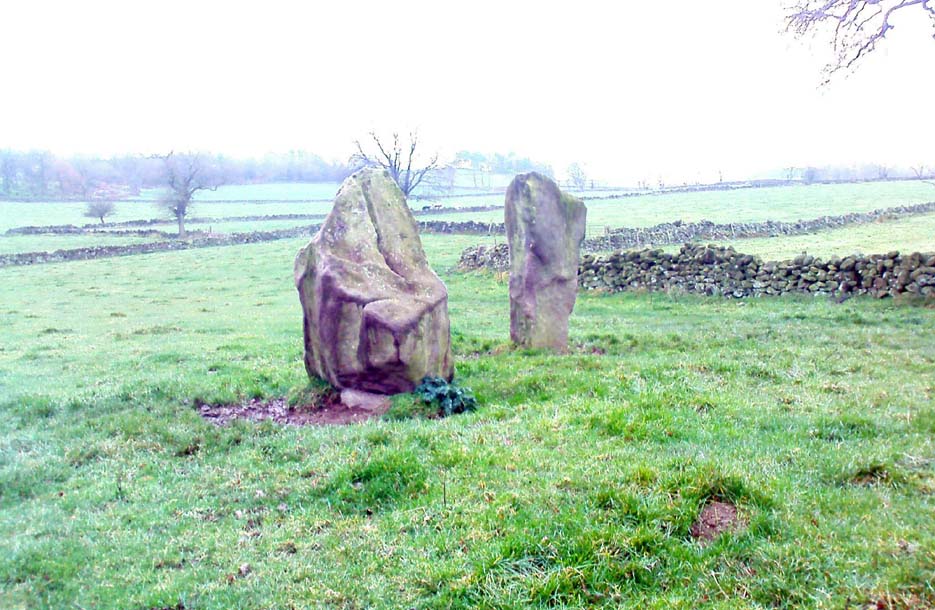
Two southernmost stones

Mebbe it was the rising crags of Robin Hood’s Stride to its immediate south?  Or the quietly hidden companionship with other stones and sites in the locale?  I don’t really think so.  There was something a little more about its own genius loci that tingled very slightly on the rise in the field upon which the circle sits.  Some people would, perhaps, acquaint my sense of a subtle genius loci here to the various leys or ley-lines that have been drawn through here by other writers— but it wasn’t that.

When earlier writers came here, they too had various inspirations of differing forms.  John Barnatt’s (1978) early impressions of the place had him signing astronomical events in and around the remaining stones here, despite knowing that the site had been damaged.  In later years he revised his early notions — as most of us do as our perspectives are enriched — but the astronomy is still assumed here.  As Clive Ruggles (1999) told:

“Other rings are located where natural features coincide with astronomical events, such as Nine Stone Close in Derbyshire…from which the Moon at the southern major standstill limit, sets behind the gritstone crag of Robin Hood’s Stride to the SSW, between ‘two stubbly piles of boulders jutting up at either end of its flat top.'”
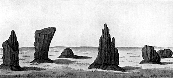
Major Rooke’s drawing of the Nine Stones Circle, c.1780

The stones that remain here are quite tall, between 6½ and 8 feet tall.  One of them seems to have originally been taken from a stream or river-bed.  They stand upon the small rise in the field and has diameters of 40 and 45 feet respectively.  Aubrey Burl described there being seven uprights still here in 1847, and the early drawing of the site near the end of the 18th century by Major Hayman Rooke highlights 6 stones around the spot where the circle now stands.  In J.P. Heathcote’s (1947) summary, he wrote that,

“Bateman, in his Vestiges, says an excavation in 1847 yielded some indications of interments in the form of ‘several fragments of imperfectly-baked pottery, accompanied by flint both in a natural and calcined state.’  In 1877, Llewellyn Jewitt and Canon Greenwell…turned their attention…to the Nine Stones.  They dug at the foot of the second highest stone and the Canon directed a good deal of digging within the circle, but nothing special turned up. The area in the circle is now quite level, but it is probable that there was, as Bateman says, a tumulus in the centre.”

This latter remark is the impression I got of the place.  Tis a really good little site.  All around here are a number of other sites: cup-marked stones, enclosures or settlements, prehistoric trackways, and more.

Folklore

One of the old names of this site was The Grey Ladies.  This came from the well known tale found at other sites across the world, that some ladies were dancing here at some late hour and were turned into stone.  A variation on this theme told how Robin Hood stood on the nearby rock outcrop to the south and pissed over the landscape here, “where seven maidens upon seeing it turned to stone.”  In this case, Robin Hood replaced an older, forgotten account of a giant, who forged the landscape and the sites around Harthill Moor.

Another tale — whose origins and nature are allied to that of the petrification of the Grey Ladies — narrated with considerable sincerity by local people, was that the circle was a place where the little people gathered and where, at certain times of the year, “fairy music and the sight of hundreds of dancing shapes around the stones” would happen.

Said by Rickman and Nown (1977) to be “Derbyshire’s most magical ancient site,” they thought the site was on a ley that linked up with Arbor Lowe, less than 5 miles west, crossing a couple of tumuli on its way.

References:

  1. Barnatt, John, Stone Circles of the Peak, Turnstone: London 1978.
  2. Burl, Aubrey, A Guide to the Stone Circles of Britain, Ireland and Brittany, Yale University Press 1995.
  3. Clarke, David, Ghosts and Legends of the Peak, Jarrold: Norwich 1991.
  4. Heathcote, J. Percy, Birchover – Its Prehistoric and Druidical Remains, Wilfrid Edwards: Chesterfield 1947.
  5. Rickman, Philip & Nown, Graham, Mysterious Derbyshire, Dalesman: Clapham 1977.
  6. Ruggles, Clive, Astronomy in Prehistoric Britain and Ireland, Yale University Press 1999.
  7. Thom, A., Thom, A.S. & Burl, Aubrey, Megalithic Rings, BAR: Oxford 1980.

© Paul Bennett, The Northern Antiquarian

Nine Stones Monolith, Harthill, Derbyshire

Standing Stone:  OS Grid Reference – SK 2253 6256

Getting Here

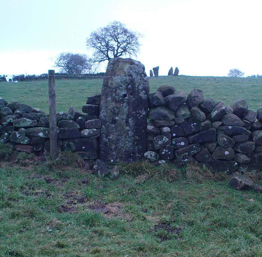
Taking the roughly north-south road betwixt the village of Elton and the town of Youlgrave, rising up to see the great rock outcrop of Robin Hood’s Stride, park-up by the roadside and walk down the path across the fields to the Nine Stone Close stone circle. Once at the circle, look at the wall immediately south of here (looking towards the great Robin Hood’s Stride rock towers) about 100 yards away and you’ll see a large, nicely-worn ‘standing stone’ in the walling, with another a few yards to its side.

Archaeology & History

Nine Stones monolith, with stone circle behind

It seems like there’s been quite a lot written of this particular stone — much of it deeming, or speculating, that it once had summat to do with the stone circle of Nine Stones Close (which you can see in the background on one of the photos). The local archaeologist and writer, J. Percy Heathcote (1947) told us that around 1819, a Mr Glover said that this stone and a companion stood next to each other, but Mr Heathcote thought that,

“Judging from its size alone, only one of these is large enough to be compared to the stones in the circle.”

Standing Stone and Robin Hood’s Stride in background

Heathcote continued:

“Dr Phillips apparently assumes this stone to be connected with the circle in the same way as the similarly placed King Stone was connected with the Nine Ladies (Stanton Moor).  However, it seems more reasonable to suppose that the stone was brought by a farmer into the wall and not that he built the wall up to the standing stone.”

In more modern times however, John Barnatt (1978) thought that this stone was originally in the circle, but “has been moved across the field to the south to act as a gatepost.”

It’d be hugely improbable that it didn’t have summat to do with the stone circle, but exactly what, we can only speculate.

References:

  1. Barnatt, John, Stone Circles of the Peak, Turnstone: London 1978.
  2. Heathcote, J. Percy, Birchover – Its Prehistoric and Druidical Remains, Wilfrid Edwards: Chesterfield 1947.

© Paul Bennett, The Northern Antiquarian

Nine Stones Cup-Mark, Harthill, Derbyshire

Cup-Marked Stone:  OS Grid Reference – SK 2254 6284

Getting Here

Taking the roughly north-south road betwixt the village of Elton and the town of Youlgrave, rising up to see the great rock outcrop of Robin Hood’s Stride, park-up by the roadside and walk down the path across the fields to the Nine Stone Close stone circle. Once at the circle, the walling closest to the stones runs along a bit (north), then downhill. Follow it. About 25 yards before hitting more walling that crosses your path, there’s a break in the wall to a field immediately left. Just below this gate opening, in the same wall, a few yards down, look for the stone!

Archaeology & History


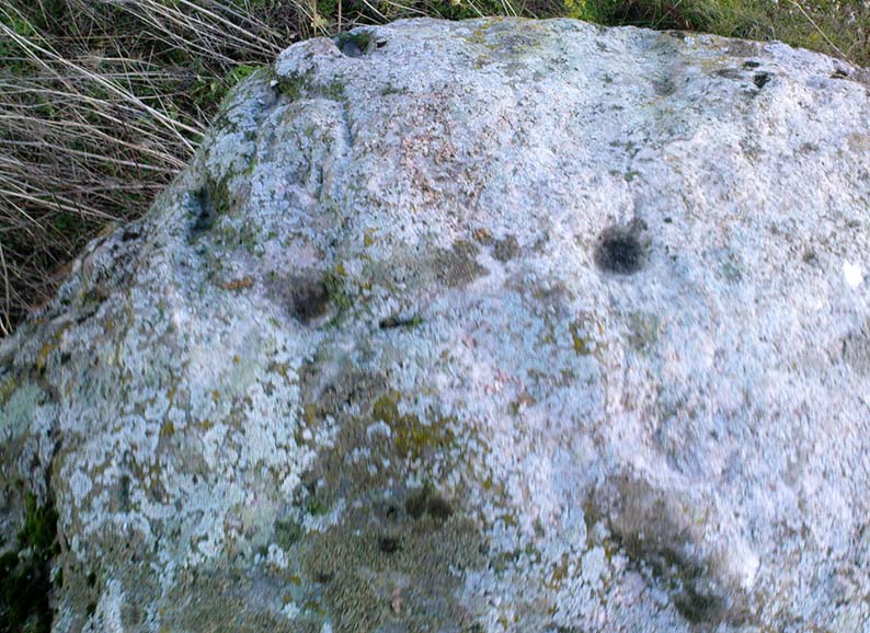
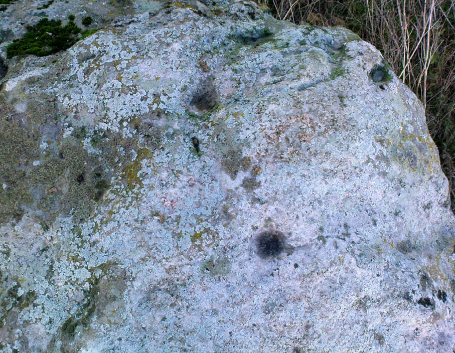
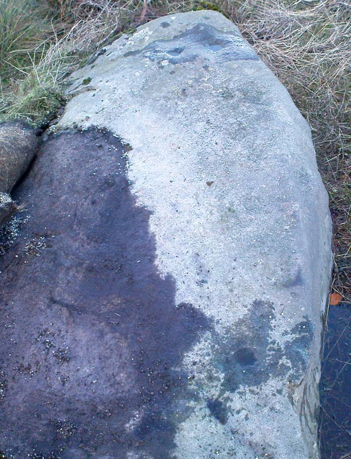
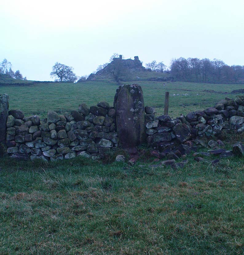
This small carved stone, typical of the size you get in drystone walls all over the country, was discovered for the first time on November 29, 2009, by Geoff Watson, during an ambling foray exploring the megalithic sites in and around the Birchover district.  Not quite sure how his nose picked this little fella out, but once seen (and eyes adjusted!) it was obviously a portable cup-marked stone.  Though what, we first wondered, was it doing in the walling here?

Similar in size and form to the Bent Head cup-marked stone found in drystone walling near Todmorden, West Yorkshire, the proximity of the Nine Stone Close megalithic ring further up the slope from this example illustrated that prehistoric man found this location of some importance; but as the cup-markings — two definites, perhaps a third — had been etched onto a small portable rock, typical of those found in prehistoric tombs, we wondered whether or not a prehistoric grave had once stood close by. Thankfully, a persual of Barry Marsden’s (1977) catalogue later proved fruitful.  For in the adjacent field below where this carved stone sits in its wall, at SK 2255 6286, there’s a scattered mass of loose rocks and smaller stones (akin to the one here with its cup-markings), which Marsden listed as a prehistoric tomb.  It seems probable that this cup-marked ‘portable’ originally came from this much denuded burial spot.

Likelihood is — there’ll be more of ’em hiding in walling and elsewhere hereby…

NB – Please note – the images we took of the stone aint too good as the sky was grey, cloudy and overcast all day. We await a better visit on a finer day, when conditions allow for better images. As we all know, gerrin’ decent photos of cup-markings and their ilk can be a pain in the arse even on the best of days!

References:

  1. Heathcote, J. Percy, Birchover – Its Prehistoric and Druidical Remains, Wilfrid Edwards: Chesterfield 1947. (see MegaDread’s comment, below)
  2. Marsden, Barry, The Burial Mounds of Derbyshire, privately printed: Bingley 1977.

© Paul Bennett, The Northern Antiquarian

New Hagg Standing Stone, Hallam Moors, South Yorkshire

Standing Stone:  OS Grid Reference – SK 25815 87058

Getting Here

New Hagg Stone
New Hagg Stone

From Redmires Road, follow the path on the opposite side of the road from the reservoirs that follows the “conduit”: a man-made dyke marked on the map at SK 2601 8578.  You’ll need to follow this for about 1km till you come to a junction with a path crossing a small bridge on your left, and a path to your right onto the moor.  You need to take the latter for about 200 metres downhill.  The standing stone is roughly 100 metres onto the moor in a NNE direction.

Archaeology and History

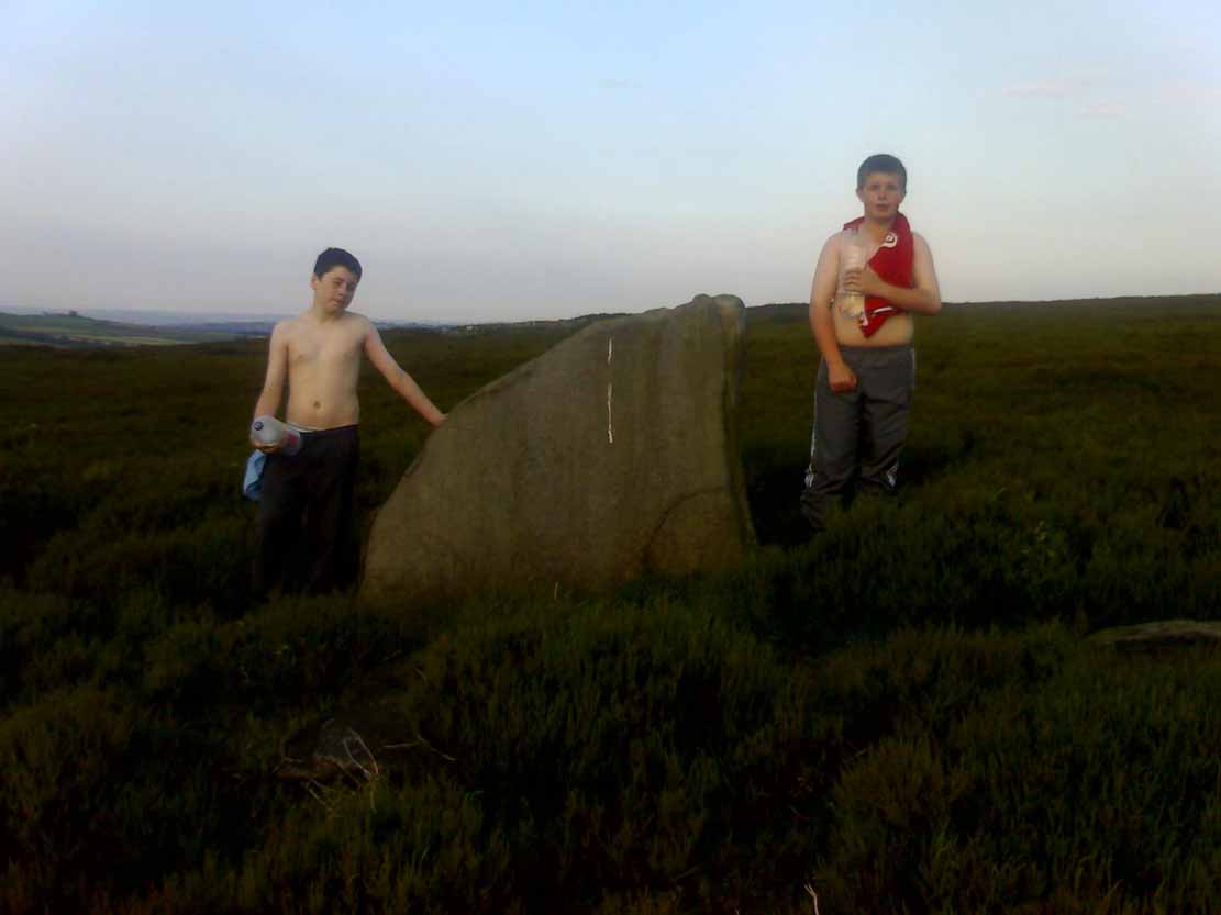
New Hagg, with kids for scale

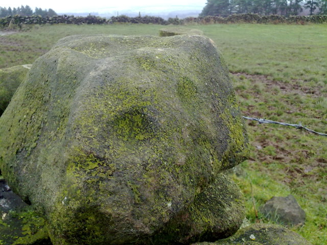
None that I know of!  I didn’t know of its existence until I found it whilst wandering the moor one day.  Though I can find no record of it anywhere, the weathering on its top in comparison with other authentic standing stones suggest that it’s been stood for a very long time and probably since prehistory.

Four feet tall, the stone stands roughly half a kilometre SSE from the Headstone which can be seen from here – and roughly half a kilometre from the Reddicar Clough Long Cist, ESE of here.

© Geoff Watson, The Northern Antiquarian


Hordron Edge Stone Circle, Moscar Moor, Derbyshire

Stone Circle:  OS Grid Reference – SK 2152 8685

Also Known as:

  1. The Seven Stones of Hordron

Getting Here

Park up at Cut Throat bridge on the A57 or alternatively  at the huge parking area that’s signposted a little further uphill. Either way, the easiest access point is at Cut Throat Bridge – though be aware the route between the two areas is the narrow grassy verge of the road: take care, kids and dogs on a very short rein!  There are many ways to access the circle but I’ll deal with only two here: one, a scramble up the steep bank of the edge; and the other, a longer route which takes in a quite a steep path, but is much easier than the first option if you’re not up for a scramble!


Route 1: The shorter scrambly route – Climb the stile into the wooded area & follow the path till your out of the wood, carry on for another 100 metres then head to your left & up the banking.  The circle is thereabouts 40 metres onto the moor in the grassland, not the heather.

Route 2: The longer way but following a relatively easy path – Access the moor via the stile and just follow the path for around ½-mile till it veers to the left at Jarvis Clough & takes a steep route uphill.  You then need to head left along the edge for around ¼-mile till you see the circle off to your right in the grassland.

Archaeology and History

Don’t let the bastardization of this site’s name fool you!  The seven stones actually number between 9 and 24, depending on the season and the growth around them.  They’re laid out in a rough free standing circle around 15.5 metres in diameter.

Hordron Edge looking across to Lose Hill

One of the largest stones to the SW is said to mimic the profile of Lose Hill — which it does sort of if you have a vivid imagination.  But it’s not half as close as the top of the stone matches the profile of Lose hill off to your right.  It is a complete coincidence of course.  The stone has suffered much weathering over the millennia and I’m in no doubt it wasn’t an intended original feature. (see pic, right)

Previously, and at some time  preceding the 1992 excavations at the site by John Barnatt, the circle was “tampered” with, leading to a thorough investigation that unearthed several more buried stones, one of which was re-erected.

All in all a fantastically preserved circle and one of the best examples in Derbyshire that’s well worth the effort of a visit.  Watch the weather though; as on all but one of my visits I’ve been drenched!.  The “wow” factor of this site however, makes that a small price to pay for such an awe-inspiring excursion.  With Win Hill and Lose hill looming large to the southwest, Stanage Edge off to the southeast and the great outcrop of Ladybower Tor with it’s rock art to the west, this circle has some of the best scenery of any the circles in Derbyshire.

Folklore

The stone that alleges to line-up with Lose Hill is also known by some of the more imaginitive as the Fairy Stone and there have been reports of strange lights and other phenomena reported around it.  I’ve been up here on probably a dozen occasions and never witnessed anything strange — but then I’m often accused of being closed-minded.  Another way of saying “non gullible” in my book!

References:

  1. Armitage, Harold, Early Man in Hallamshire, Sampson Low: London 1939.
  2. Barnatt, John, Stone Circles of the Peak, Turnstone: London 1978.
  3. Burl, Aubrey, The Stone Circles of Britain, Ireland and Brittany, Yale University Press 2000.
  4. Thom, A., Thom, A.S. & Burl, Aubrey, Megalithic Rings, BAR 81: Oxford 1980.

© Geoff Watson, The Northern Antiquarian


ancient

Devil’s Den Cups, Clatford, Wiltshire

Cup-Marked Stone:  OS Grid Reference – SU 15211 69652

Getting Here

Follow the directions to reach the Devil’s Den, a half-mile north of Clatford up the footpath towards the Fyfield Down cup-marked rock.  You can’t miss it!  The cup-markings are on the top of the capstone.

Archaeology & History

First described and illustrated by local historian and photographer, Pete Glastonbury, as far as I’m aware these cup-markings have not previously been included in any of Wiltshire’s archaeological surveys (that can’t be, surely?).  The only reference I’ve found — not untypically — is from one of the early editions of the english Folklore Journal.

...and again!
…and again!
Devil’s Den cup-markings

At least two well-defined cups stand out on the top of the capstone.  Each of them have ‘cracks’ running out of them, with the easternmost one of them (closer to the edge) turning into a channel which runs upwards on the stone, before then leading down off the edge of the rock.  Each cup-mark is very clear, about two inches across and about a half-inch deep.

Archaeologists can check these cups out and work out for themselves whether they’re natural or not.  They’re far more qualified than I on such matters and may be able ascertain other faint remarks on the stone.  The proximity of the nearby Fyfield Down cup-marked rock, several hundred yards to the north, shows that such petroglyphs can be found in this region.  Although we cannot expect many examples of rock art in this area (the rock’s damn tough and takes some burrowing into), it is likely that more carvings await discovery.

Folklore

The capstone on which these cup-markings are seen was told to be immovable and had lore said of it akin to that found at the great Whispering Knights, near the Rollright Stones.  But the main piece of lore describes the cups quite specifically.  In an article by Alice Gomme (1909), she told that:

“if anyone pours water into any of the natural cup-shaped cavities on the top stone at midnight, it will always be found in the morning to be gone, drunk by a thirst-tormented fiend.”

The tale is later repeated in Kathleen Wiltshire’s (1975) survey, where she too mentions the cup-marking (though only one), saying that,

“if a person pours water into the natural cup-shaped cavity on the top stone at midnight it will always be found to be gone in the morning — drunk by the devil.”

This folklore motif — repeated in Grinsell’s (1976) text — is found at rock-art sites in a number of the northern counties, where milk has been poured into the cup-markings (some of which were known as ‘cat stones’) and left overnight for the spirits to drink.   In the case we have recorded at Devil’s Den, the spirit of the place seems to have been demonized, as is common.

Miss Gomme (1909) also reported the curious ingredient that the spirit of a white rabbit with glowing eyes would appear on the capstone at midnight and help the devil demolish the site with the aid of eight oxen!  On this latter matter, I am duly informed by one-in-the-know that, to “those of us that know the locals and their humour, we just know this tale was made up for a visiting townie!”

References:

  1. Gomme, Alice B., ‘Folklore Scraps from Several Localities’, in Folklore Journal, 20:1, 1909.
  2. Grinsell, Leslie V., Folklore of Prehistoric Sites in Britain, David & Charles: London 1976.
  3. Wiltshire, Kathleen, Wiltshire Folklore, Compton Russell: Salisbury 1975.

© Paul Bennett, The Northern Antiquarian

North Ring, Mucking, Stanford-le-Hope, Essex

Enclosure (destroyed):  OS Grid Reference – TQ 675 811

Archaeology & History

North Ring, Mucking (after Brown, 2001)

This large circular enclosure, measuring about 120 feet across, seemed to be a small settlement with several internal structures (fences, pits, cremations and a sunken-floored structure) that was first excavated in 1978 and described as a Bronze Age enclosure.  Akin to a henge monument in some ways, this small settlement site had two entrances: one on the east and the other opposite on its west side.  However, the main ‘entrance’ was on the eastern (sunrise) side, where post-holes laid a pathway over the ditch and into the structure itself.

The excavation on the eastern side of site revealed two periods of construction with associated structures, including three circular buildings.  Some excavations to the east produced evidence for a range of contemporary activities.  The assemblage of Late Bronze Age material included pottery, metalwork, cremation remains, sickle moulds and equipment for salt production.  For further info and imagery, see the Link below.

References:

  1. Bond, Dermot, Excavation at the North Ring, Mucking, Essex, East Anglian Archaeology 1988.
  2. Brown, N., “The Late Bronze Age Enclosure at Springfield Lyons in its Landscape Context,” in Essex Archaeology & History, volume 32, 2001.

Links

  1. North Ring, Mucking

© Paul Bennett, The Northern Antiquarian

Springfield Lyons, Chelmsford, Essex

Enclosure:  OS Grid Reference – TL 7357 0818

Archaeology & History

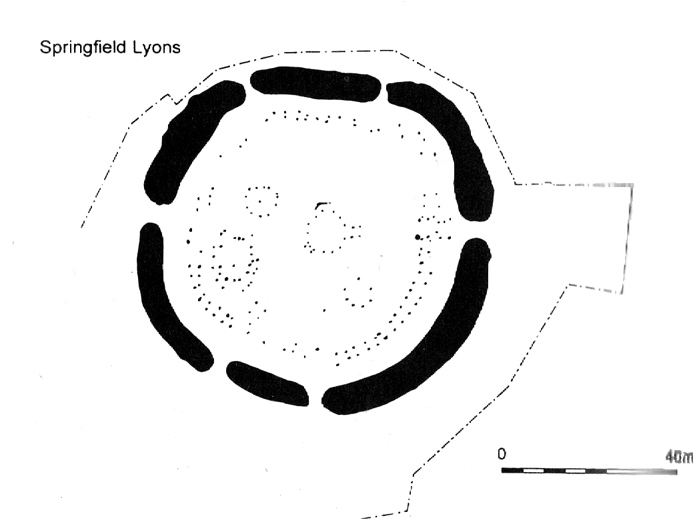
Springfield Lyons enclosure (after Brown, 2001)

We’ve known that there was an excessive number of prehistoric archaeological sites in and around the Chelmsford region for quite a long time now, but defining precisely the age and nature of the finds takes some doing! (as you’d expect)  It hasn’t helped, of course, with the housing estates and other ecologically destructive building operations in and around the area, screwing up a more accurate and patient assessment of the material there.  And this predicament was exemplified with the Springfield Lyons neolithic causewayed enclosure just as much as at the Springfield Cursus and other sites nearby.

Although excavations here found a large, deep ditch with impressive ramparts and entrance, in Oswald, Dyer & Barber’s (2001) survey of these giant monuments, they defined the remains here as “probable,” pending further investigations.  But the site was primarily defined by the large deep ditch, broken in several places round its edges with the ’causeways’ built leading onto the site.  The enclosure gave good views over the small valley from here and had streams running either side of it.

Adjacent to the site were the remains of a “small circular enclosure with multiple entrances,” saying that excavation here,

“has proved that it is of late Bronze Age date and might be interepreted variously as a defended settlement, or a ritual monument.”

This external small enclosure site was then conjectured, quite spuriously it’s gotta be said, to be a mini-version of the great causewayed enclosure monument, saying:

“Its siting and form both hint that it could have been a conscious imitation of, or re-invention of, the perceived form of the earthworks of the neolithic enclosure.”

I like the idea, it’s gotta be said — but without direct evidence we’ve gotta take this idea with a large pinch of salt!

…to be continued…

References:

  1. Brown, N., ‘The Archaeology of Essex 1500 – 500 BC,’ in Bedwin, O. (ed.), The Archaeology of Essex, ECC: Chelmsford 1996.
  2. Brown, N., “The Late Bronze Age Enclosure at Springfield Lyons in its Landscape Context,” in Essex Archaeology & History, volume 32, 2001.
  3. Oswald, Alastair, Dyer, Caroline & Barber, Martyn, The Creation of Monuments: Neolithic Causewayed Enclosures in the British Isles, EH: Swindon 2001.
  4. Priddy, D., ‘Excavations in Essex, 1987,’ in Essex Archaeology & History, 19, 1988.

© Paul Bennett, The Northern Antiquarian

Split Rock, Rivock, Keighley, West Yorkshire

Cup-and-Ring Stone:  OS Grid Reference – SE 07989 44208

Also Known as:

  1. Carving no.39 (Hedges)
  2. Carving no.80 (Boughey & Vickerman)

Getting Here

Split Rock, Rivock
Split Rock, Rivock

Head up to Rivock’s Wondjina Stone carving, then keep going east to the Long Rock.  Wander 100 or more further east till you see the fence, and about 50 yards before this check out the large rocks which you’ll notice near to each other.  One of them is this Split Rock!

Archaeology & History

First described in Hedges’ (1986) survey, this is a large flattish boulder, split across one side, with two distinct cup-marks on its eastern side and a number of other ‘possibles’ scattering the surface.  The most intriguing bit to this rock is on its lower eastern side.  Here’s what Boughey & Vickerman (2003) described as,

CR80-2
Deep cup-and-half-ring

“one clear cup (doubtful) discovered under turf…at extreme lower SE corner, with possible attempt at pecked partial ring.”

This cup they describe as “doubtful” is quite deep, but the half-ring on its northern side has definite artificial peck-marks.  I’m more of the opinion that this cup-and-half-ring is man-made — though whether it was done in more recent years is the more debatable aspect here.  I’ll try getting some better images (and a drawing) of this stone when we’re next up here.

References:

  1. Boughey, Keith & Vickerman, E.A., Prehistoric Rock Art of the West Riding, West Yorkshire Archaeology Service 2003.
  2. Hedges, John, The Carved Rocks on Rombalds Moor, WYMCC: Wakefield 1986.

© Paul Bennett, The Northern Antiquarian


Long Stone, Rivock, Keighley, West Yorkshire

Cup-Marked Stone:  OS Grid Reference – SE 07833 44313

Also Known as:

  1. Carving no.78 (Boughey & Vickerman)

Getting Here

Head up to the lovely Wondjina Stone carving, then walk east towards the triangulation pillar. Keep going, over the wall – and keep going straight on, over the next wall (no footpaths up here at all).  You’re now into rough heathland, but if you’re a real cup-and-ring freak, keep heading another 150 yards east, zigzagging slightly.  You’ll eventually find it!

Archaeology & History

CR78
Long Rock carving, Rivock

A quite large, smooth earthfast rock, but nowt much to look at unless you’re one of the crazy bunch!  This is just another one of our basic cup-marked rocks with very little modern archaeo-history attached.  There are perhaps as many as four cup-markings etched onto the stone: two at the northern end, one a little further down (not mentioned in Boughey & Vickerman’s survey) and another one cited towards the south end of the stone.  Gotta be honest though: a couple of them are slightly dubious and may be natural — but hopefully not! (soz about the crap photo of this poor carving; but the light was shit & our camera packed-up!)

References:

  1. Boughey, Keith & Vickerman, E.A., Prehistoric Rock Art of the West Riding, West Yorkshire Archaeology Service 2003.

© Paul Bennett, The Northern Antiquarian