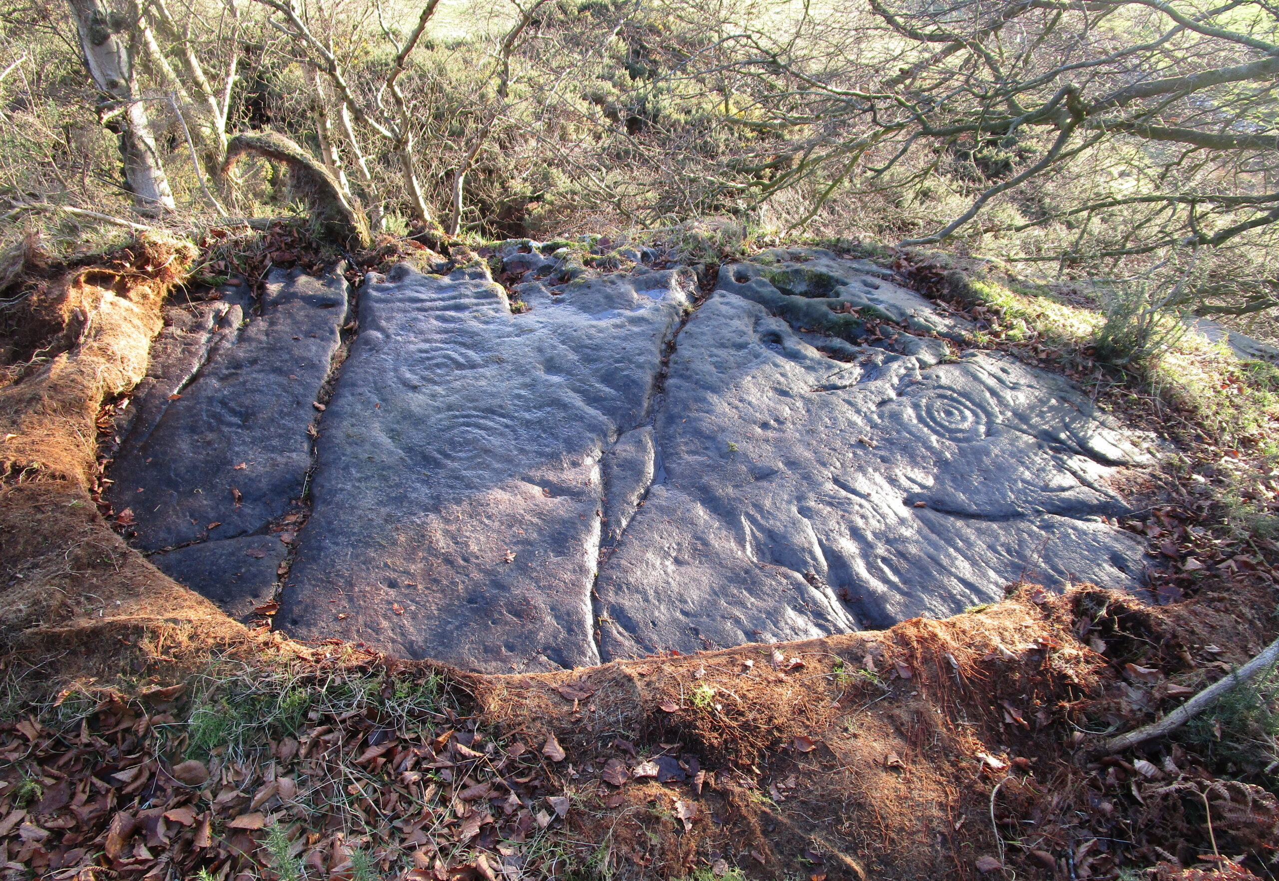
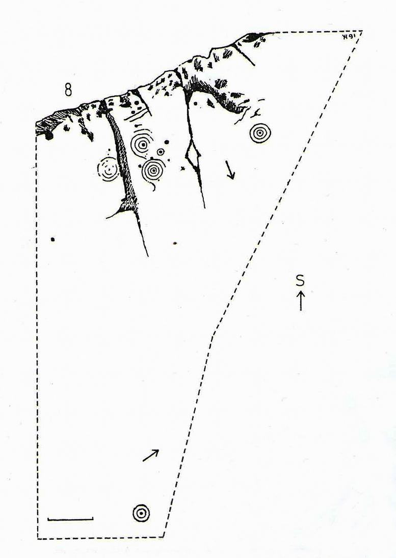
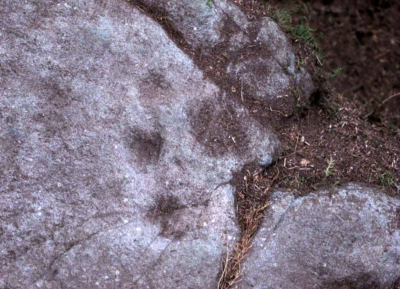
Located near the top of one of Castleton’s rocky island outcrops and overlooking extensive flatlands many miles to the south, this impressive multi-ringed carving was rediscovered in May 1985 by the Ordnance Survey lads and, I believe, was first described in an article by Maarten van Hoek (1996), whose description we’ll get to shortly. It’s a design that incorporates some of Nature’s own cup-marks alongside the marks of men.
The overall design here is captured within three sections of the rock: between three large natural cracks running roughly north-south, as clearly shown in the accompanying photos. It’s a multi-period carving, executed over what seems to be a considerable period of time—probably several centuries. I base this on the differing degrees of erosion between the respective multiple rings — a factor found several of the Castleton carvings.
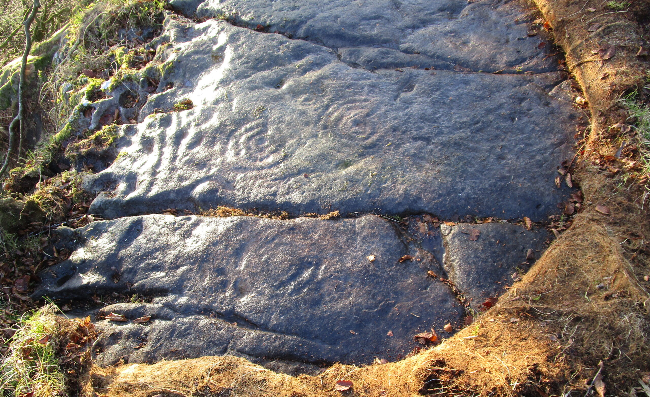
Eastern & central cup ring symbolsCloseup of central rings
One of the most eroded sections can be seen on the eastern side of the rock, where a very faded cup-and-three-rings was carved. Initially it looked as if there was no central cup to this, but as I looked across this towards the falling sun, what seemed to be a possible ‘dot’ was noticed in the centre, very faint indeed. There are several single cup-marks just a few inches east of this triple-ring, which look more recent than its eroded companion.
On the other side of the long natural crack we see two quite distinct multiple cup-and-rings: one with three rings and another with four, both of which have short carved lines running from their centres westwards. Between these, a smaller single cup-and-ring nestles quietly, almost innocuously, minding its own business! But below these two large multiple-ringers there’s a very faint cup-and-double ring, only visible when the light conditions are just right. In numerous attempts I made to catch this element in my photos, none were successful. (I’m a crap photographer, which doesn’t help!) Due to the erosion on this element, this is possibly the earliest section of the carving. Above these rings, close to the edge of the small cliff, one or two carved lines can be seen that run into natural ‘bowls’ which, in all probability, were of some significance to those who made this design. In cultures outside the UK, such elements have sometimes been afforded mythic importance.
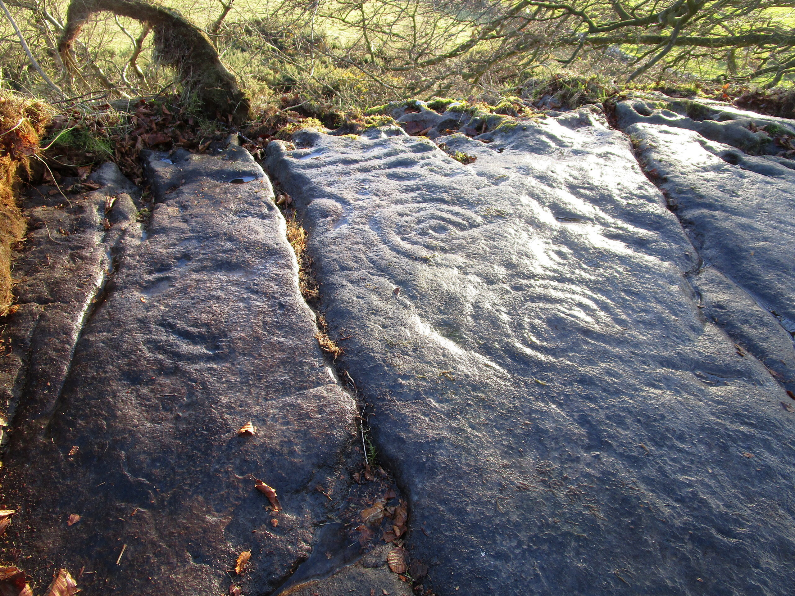
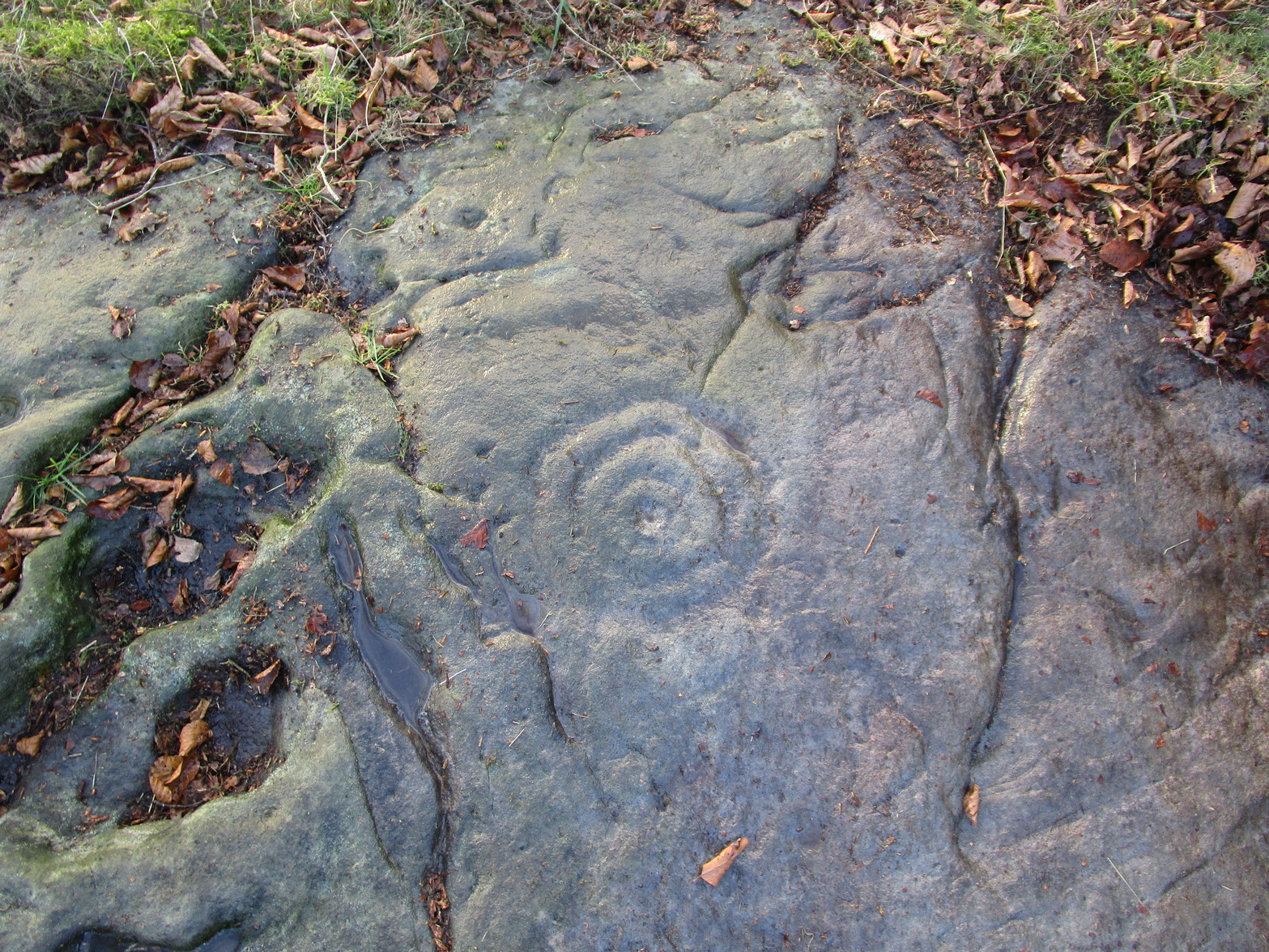
Several other natural small ‘bowls’ exist above the most blatant of the cup-and-rings here, on the west side of the rock, which consists of a cup-and-triple-ring no less. Erosion levels on this would seem to suggest that it was the most recent element of this petroglyph.
When Maarten van Hoek (1996) wrote his report, there was much less vegetation covering the stone and another cup-and-ring could be seen on the northernmost section of the rock – as his sketch here shows. He wrote:
Westernmost elementvan Hoek’s 1996 sketch
“Near the edge are five cup-and-rings and possibly up to four single cups, all on rock sloping about 6″ to 12″ NW. The easternmost set consists of the worn remains of three rings (the innermost hardly visible) without a distinct central cup. Across a crack is a cup with four rings, the outer incomplete and curving away; another cup with four rings, mostly incomplete. A small cup-and-one-ring sits in between. South of this group may be some grooves and a single cup, all doubtful being very near the cliff-edge which is heavily pitted by erosion. The westernmost cup with three ovalish rings is the best preserved set of the group. Further away from the scarp is one single cup on a horizontal part and even further N is a cup-and-two-rings on a part sloping 6″ SW.”
It would be good to completely clear this rock and make it all visible again, as it was long long ago…
References:
Morris, Ronald W.B., The Prehistoric Rock Art of Southern Scotland, BAR: Oxford 1981.
van Hoek, M.A.M.,”Prehistoric Rock Art around Castleton Farm, Airth,” in Forth Naturalist & Historian, volume 19, 1996.
Amidst the cluster of at least twenty petroglyphs found at Castleton, this example close to the fence 60 yards southeast of the farmhouse, wasn’t included in the earlier surveys by Morris (1981) and van Hoek. (1996) At this spot there a large smooth sloping rock broken into separate parts with natural cracks running over it at different angles, partially covered in soil. The stone faces north. On the easternmost side there exists a number of carved symbols, most notable of which is a large double cup-and-ring. You can’t really miss it! The other elements however, can be a little more troublesome to see…
Cup, rings & crossCastleton 11 carving
A curious motif is the quite notable ‘cross’ that’s been pecked onto the stone, above the primary cup-and-ring. This cross is probably a later addition to the petroglyph, perhaps added to christianize the original mythic function. From the cross, it looks as if a curved line has been carved down towards the double-ring, nearly linking them together, which could also be viewed as a movement from the pre-christian to the new christian meaning conferred upon the stone. …Just an idea…
It should be noted that a faint cross was also cut into natural cracks in the Castleton 2 carving, 380 yards northwest of here.
There are two more cup-and-rings on the stone, both on the right-hand side of the cross. These were carved quite separately over large periods of time, as evidenced by their degrees of erosion. One cup-and-ring (if you can call it that) is a somewhat erratically executed series of peck-marks that strives to join up with each other, almost failing miserably, creating a somewhat disjointed cup-and-ring. Next to this, but much much fainter, is a cup-and-half-ring that was obviously carved decades, if not centuries earlier. You can just make them out in the two photos here, to the right of the cross.
Carving in negative
Another very faint cup-and-half-ring also exists to the left of the primary motif that was only visible from one or two angles when we visited the place the other day, but barely shows up on any of the photos we took. There are a number of single cup-marks, mainly between the double-ring and the smaller cup-and-rings, some of which are probably natural, but several seem to have been worked upon by human hands.
A now-hidden petroglyph—known as “Castleton-3” in the Morris and van Hoek surveys—consisting of multiple cup-and-rings, exists beneath the mass or gorse bushes about forty years to the southwest. We could do with cutting this back so we can see the carving again.
References:
Morris, Ronald W.B., The Prehistoric Rock Art of Southern Scotland, BAR: Oxford 1981.
van Hoek, M.A.M.,”Prehistoric Rock Art around Castleton Farm, Airth,” in Forth Naturalist & Historian, volume 19, 1996.
A small and seemingly prehistoric grave, or cist, destroyed sometime around 1840, once existed on the top of a large hillock close to the River Carron where the bridge leads from Dunipace to Denny. Thankfully, memory of its existence was preserved by Robert Watson (1845) in his short description of Dunipace parish. He first began by talking of some large natural mounds on the eastern side of the township which, folklore told, gave rise to the place-name Dunipace; but from those mounds,
“About two miles to the westward of these hills, there was a very beautiful one about forty feet in height, and covering nearly three roods of ground, said also to be artificial. This hill was mutilated, from time to time, for the purpose of repairing roads and other purposes. It was entirely removed about six years ago, to form an embankment on the turnpike road near Denny bridge. The strata of which this hill was composed, were carefully observed during its removal. These were so regular, and as if rising out of, and gradually returning again to similar strata in the circumjacent level ground, as to afford conclusive evidence that the hill was not the work of man. On the top of this hill, and about three feet below the surface, was found a coffin or tomb, composed of five large un wrought stones, in which were the bones of a human body, scull and teeth not much decayed. Along with these, was a vase of coarse unglazed earthenware, containing a small quantity of material resembling the lining of a wasp’s nest, probably decayed paper or parchment, which in the lapse of ages had assumed that appearance. No conjecture could be formed about the individual here interred, tradition being entirely silent on the subject ; but this circumstance corroborates the opinion of some writers, that the hills of Dunipace might have been used as burying-places for ancient chiefs.”
The site was included in the Royal Commission’s (1963:1) Inventory, but they found no additional data about it.
References:
Royal Commission on the Ancient & Historical Monuments Scotland, Stirling – volume 1, HMSO: Edinburgh 1963.
Royal Commission on the Ancient & Historical Monuments of Scotland, Archaeological Sites and Monuments of Stirling District, Central Region, Society of Antiquaries of Scotland 1979.
Watson, Robert, “Parish of Dunipace,” in New Statistical Account of Scotland – volume 8, William Blackwood: Edinburgh 1845.
Healing Well (lost): OS Rid Reference – NS 579 884
Archaeology & History
One-and-a-half miles east of Balfron, this curiously-named well could once be seen – and indeed may still be there. Mentioned just once in D.S. Buchanan’s (1903) Guide as a well-known place, I’ve been unable to locate it and can find no other accounts of the place. He wrote:
“A little beyond Dailfoil there is a road to the right, down which, about 200 yards, there is a stile over the fence, only a few feet from the famous Gerchew Well, on the banks of the Endrick. Here the visitor can repose for a time under the shade of the trees, and quench his thirst in its pure, cool, and bubbling waters.”
His directions seem to indicate it as being just off the small road that runs to the ruins of Easter Gerchew, but there is nothing of note hereby. A half-mile away was Wester Gerchew house, which seems contrary to his directions —and there’s nothing in evidence there either. And so I enter it here in the hope that someone might be able to relocate this healing well. (the grid reference is an approximation based on Buchanan’s description)
References:
Buchanan, D.S., Buchanan’s Popular Illustrated Guide to Strathendrick, Aberfoyle and District, J. & C. Buchanan: Balfron 1903.
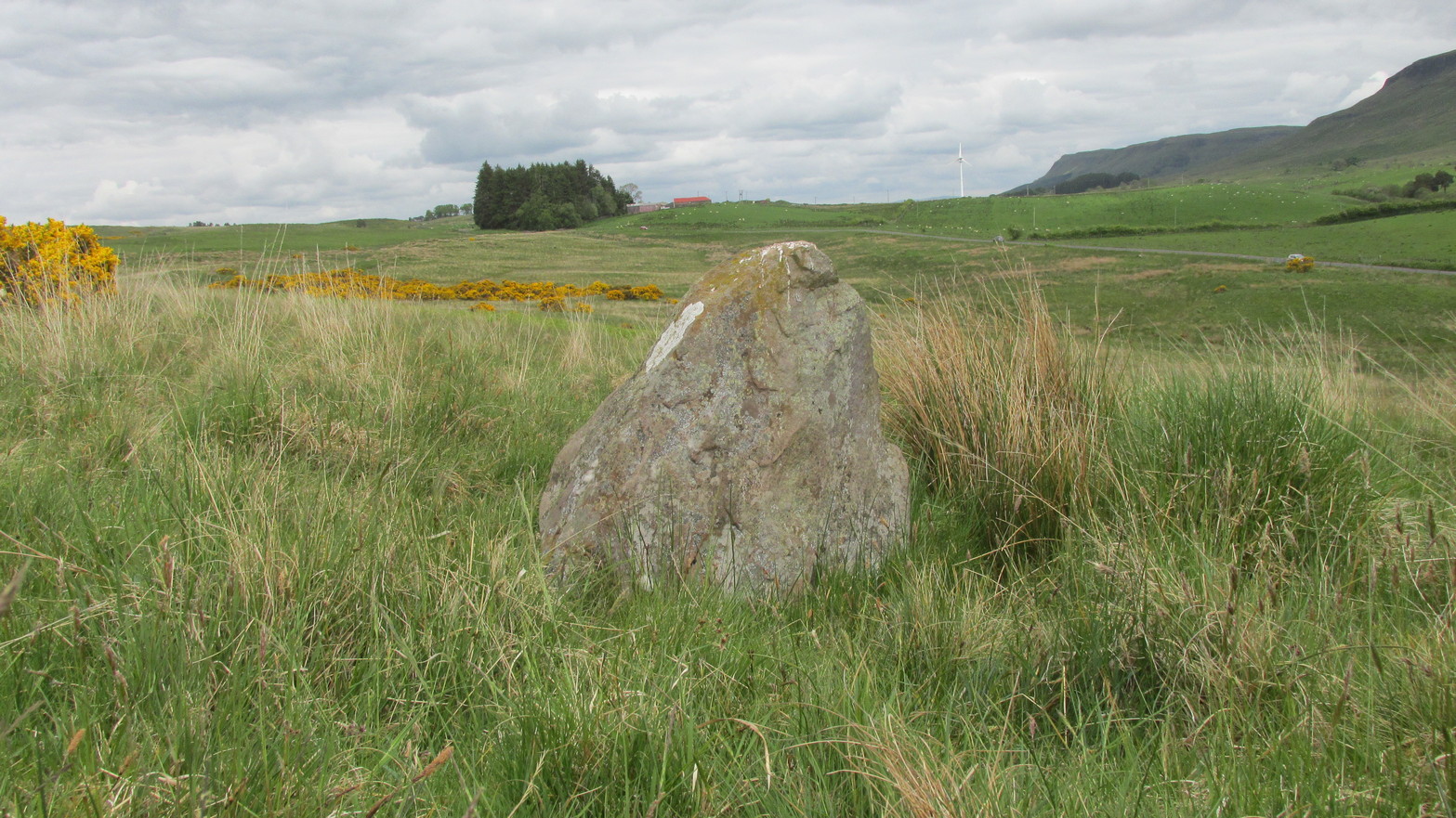
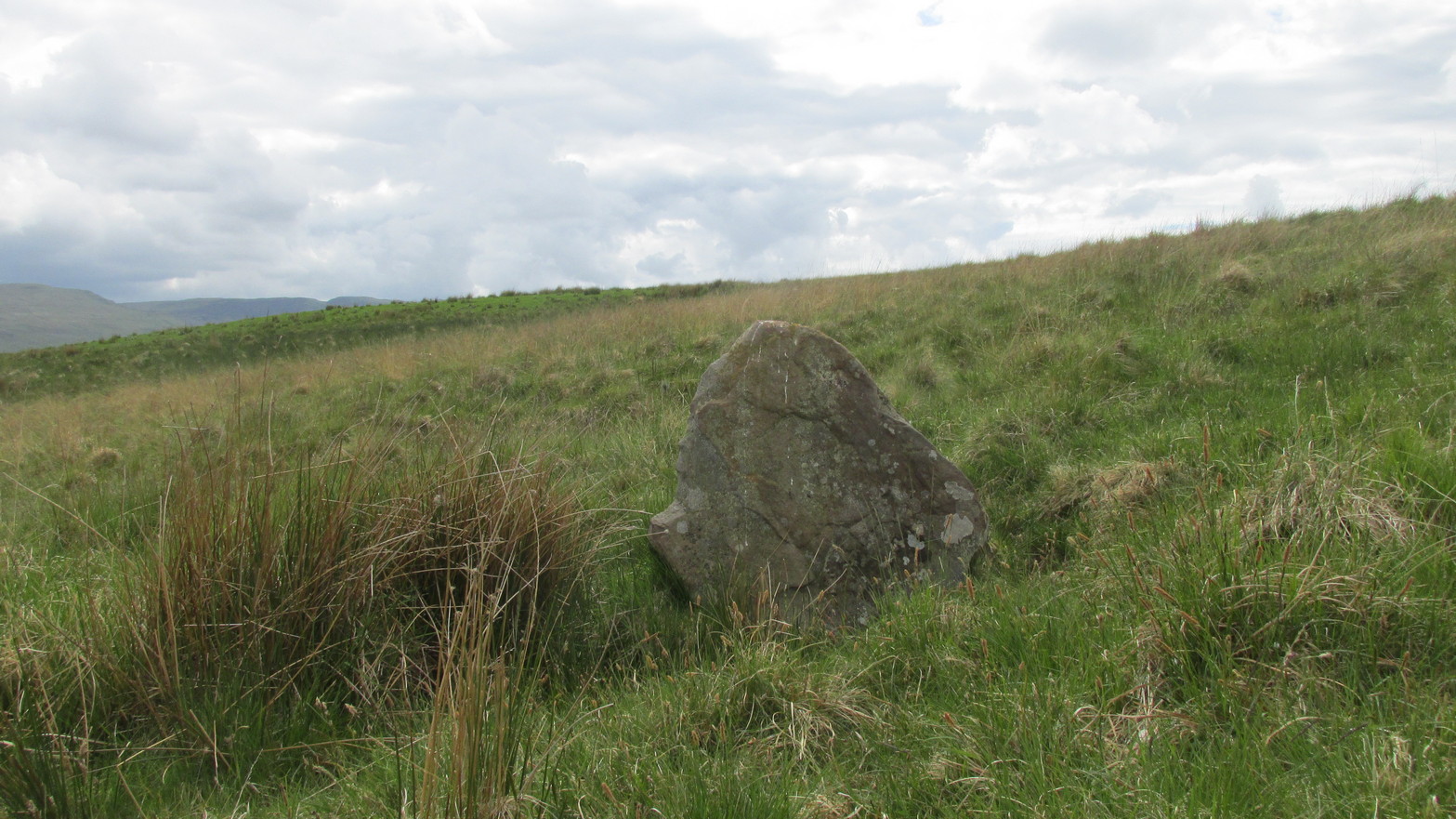
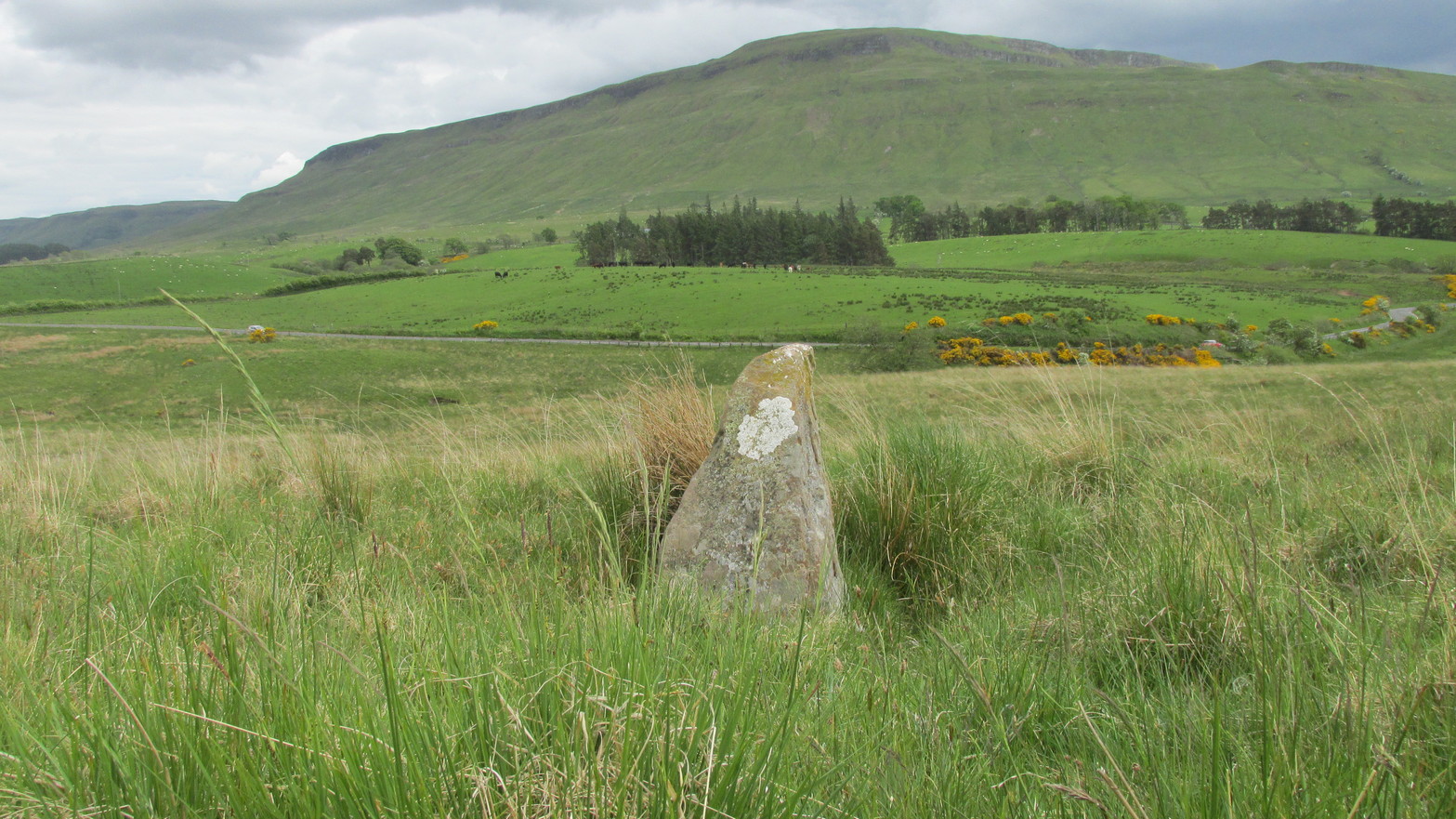
Go up the B822 road from Fintry for literally 2.5 miles (about 500 yards below the small copse of trees that almost hide Balafark Farm above you) and at a very small ‘parking’ spot are 2 farm-gates. Go through the lower of the two and head downhill, crossing the small burn and up the other side for just over 100 yards where you’ll meet a very low, old and very overgrown wall. Keep your eyes peeled for it! Walk left along this wall, uphill, for another 100 yards till you meet a a dried-up dyke that runs downhill. 10-15 yards down this, a small stone greets you…
Archaeology & History
It’s difficult to call this a ‘standing stone’ and, as far as I’m concerned, is even more troublesome to cite it as a legitimate prehistoric monument. Nevertheless it is shown on the modern OS-maps as such and was listed by the Royal Commission (1963:1) lads in their standing stones inventory. But it’s really pushing it to be honest! They told us:
“This stone stands about 180 yds NW of a gate which opens off the Fintry-Kippen road, 340 yds N of its crossing of the Lernock Burn. It is triangular in profile and wedge-shaped in section, measuring 3’3″ both in height and breadth along its base, by 1’7″ in greatest thickness. It may well have been a boundary stone as it is near the corner of some ground which is enclosed by a turf dyke and has been cultivated.”
Looking southwestLooking up to the ancient cairn of Stronend
In truth, if we call this a standing stone, then there are hundreds of others that I’ve come across over the years—frobbling off-path across huge swathes of moorland—that must also be added to our prehistoric inventories, as the height of this isolated rock is echoed in countless others which are off the archaeological listings. One such stone ‘stands’ 100 yards northeast of here—although there are many others with much greater potential. …I think the only thing that may sway this as being a possible prehistoric upright is the fact that the top of the stone appears to have been broken off, albeit a few hundred years ago if the weathering is owt to go by. But a cursory look for any broken top-piece found nothing.
References:
Royal Commission on the Ancient & Historical Monuments Scotland, Stirling – volume 1, HMSO: Edinburgh 1963.
Healing Well (lost): OS Grid Reference – NS 910 790
Also Known as:
Tammy Milns Well
Archaeology & History
This all-but-forgotten site situated somewhere on the north side of Lauriston was mentioned in Falkirk’s Notes & Queries (1906) journal, but its whereabouts is somewhat of a mystery (to me at least!). In a series of question and answers about the site, the editor of the journal, James Love, told us:
“Mr Charles Brown, factor to the Marquis of Zetland, kindly informs us that on a late occasion there passed through his hands a copy of a feu contract by the Right Honorable Francis Lord Napier in favour of Alexander Cowie, brewer, at New Merchiston (now Laurieston), of a piece of ground lying to the north of Mary Street. This is dated 7 August, 1762 and contains the following clause: ‘Providing also that the said Alexr Cowie and his foresaid have the Liberty of the water of Tammy Milns Well in common with the said Lord Napier’s other vassals ay New Merchiston.'”
The well was mentioned again in 1781 with similar historical information. As to the name of the well, Mr Love wrote,
“it would appear, from the circumstance, that an old infirm man belonging to the village, called Thomas Mills or Milns, used to sit with his wooden cup at the spring which flowed from the face of the hill, over which the present structure now stands, and served out to the weary passers-by the cooling and refreshing draught for any small pittance they in their generosity might think proper to give him. After the lands of Lauriston passed into the hands of Sir Laurence Dundas, he took the advantage of such a copious supply of what then was pure water, and built the present reservoir over the spring, and had it conveyed to Kerse House by means of leaden pipes.”
But he fails to tell us what “the present structure” was that covered the well, nor the whereabouts of the “reservoir over the spring”; and as there’s no such feature on any of the Ordnance Survey maps at the time he wrote his article, nor beforehand, I remain puzzled as to its exact position. This situation isn’t helped by the earlier description, which said it was found on “a piece of ground lying to the north of Mary Street”. There are two wells literlly on the other side of Mary Street, but Kerse House meanwhile—whose water supply came from the well—is about 1½ miles to the north! All in all there are more questions than answers here. Added to this, in John Reid’s (2009) magnum opus on local place-names, the site is mentioned, albeit in passing, where he gives us the vague grid-reference of just NS 91 79, but this may just be educated guesswork on his part. It would be good to know exactly where it was…
References:
Love, James (ed.), “Tammy Mills (or Milns) Well, Laurieston”, in Local Antiquarian Notes & Queries, Falkirk – volume 1, 1906.
Reid, John, The Place-Names of Falkirk and East Stirlingshire, Falkirk Local History Society 2009.
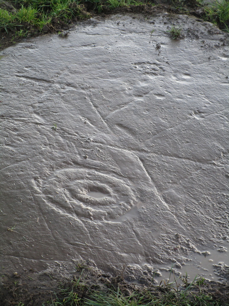
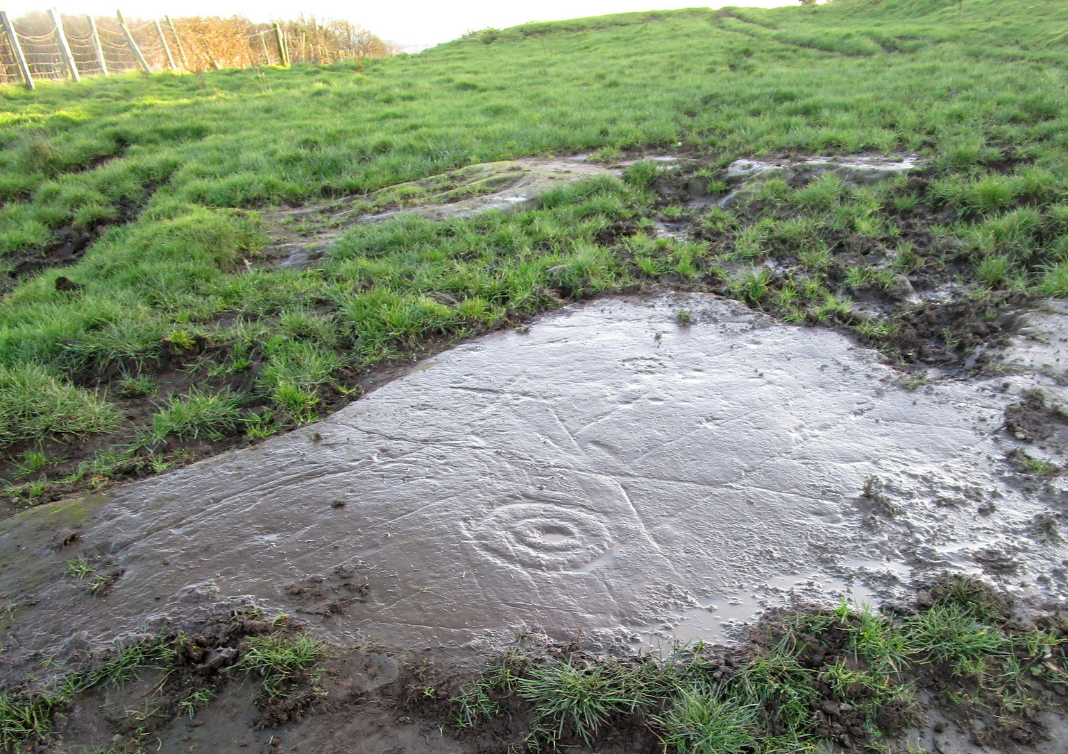
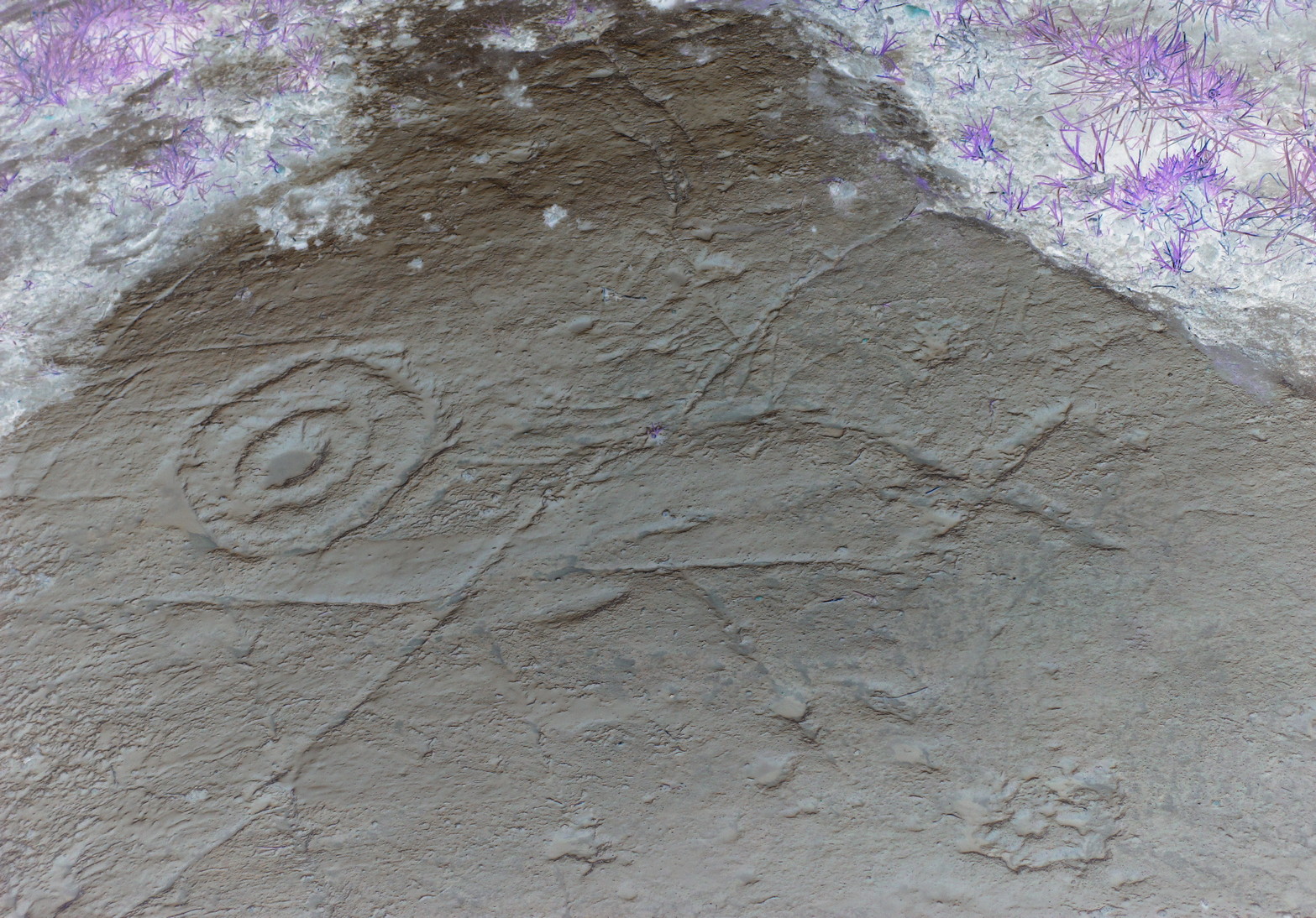
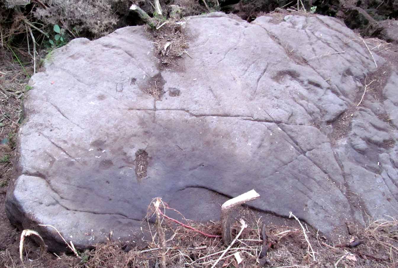
Cup-and-Ring Stone: OS Grid Reference – NS 8551 8819
Archaeology & History
Looking down on C-7c
Near the northwestern end of the small geological ridge that runs to the west of Castleton farmhouse, close to an awesome nine-ringed carving, we find this more simplified triple-ringed petroglyph. And although the carving is easy enough to describe, its labelling (as ‘Castleton 7c’) is rather troublesome. As with other carvings in this locale, the name of the stone is based on a survey done by Maarten van Hoek in the mid-1990s. But van Hoek’s sketch of Castleton 7c and the one shown in our photos, whilst very similar, possess attributes that aren’t on van Hoek’s drawing. Now this isn’t too odd, as many petroglyphs look different when lighting conditions change; to the point where some features you can see one day are almost invisible the next. But this carving has attributes that are very difficult to miss – and van Hoek’s detailing tended to be good. But, all this aside: until we can verify with certainty one way or the other and despite my suspicions that this isn’t what van Hoek described, I’m still entering this carving as Castleton 7c. So – now that bit’s out of the way…!
When we visited the site two years ago the day was dark and overcast, so we didn’t really have good conditions for seeing any faint carvings. But this wasn’t faint, thankfully. It was completely buried beneath soil and gorse bushes, but thankfully Paul Hornby managed to unearth the one you can see in the photos. If it is the Castleton 7c petroglyph, it was rediscovered by van Hoek on one of his ventures here in 1985.
Carving showing wavy lines on right…and from another angle
When we visited the site we only managed to uncover a small section of the stone, as the roots of the surrounding gorse prevented us from seeing more. (it’s tough stuff unless you’ve got the right gardening equipment!) The section we uncovered consisted of a cup-and-triple-ring. This is consistent with van Hoek’s sketch and description; but we also found there were two very notable ‘arcs’ on the outer edge of the rings—nearly opposite each other—as if another, fourth ring had been started. You can’t really miss these elements – and even in the poor lighting conditions we had, these outer arcs are very evident on a number of photos – especially when they are expanded to full-scale. However, as I mentioned, we were unable to uncover all the rock; but when van Hoek was here there was far less herbage. What he saw on this carving was as follows:
“Deturfing part of this ridge revealed a fine cup with three rings with a broadly pecked tail; one solo cup; one large oval ring with small central cup; and a faint cup with two rings, the outer one incomplete. The rock slopes 12º ENE.”
Crap drawing done in crap lightingvan Hoek’s 1996 sketch
The “broadly pecked tail” he mentions is also not really clear in any of the 60 photos we took. There is a faint line that runs through the three rings, into the central cup and out the other side: a single curving line no less. It’s certainly visible, but it’s far from broad. But there are a number of other lines coming out of the rings. These maybe just natural scratch marks, or even scratches acquired from farming activity. It’s difficult to say. In the poor light that we had, there as looked to be a single cupmark a few inches away from the rings, but this isn’t consistent with the position of the cupmark on van Hoek’s sketch.
There’s a simple solution to all this: we need to revisit the site and expose more of the rock. At least that will tell us once and for all whether this is the same as van Hoek’s stone, or whether we’ve found yet another new carving. Watch this space, as they say! 😉
References:
van Hoek, Martin A.M., “Prehistoric Rock Art around Castleton Farm, Airth, Central Scotland,” in Forth Naturalist & Historian, volume 19, 1996.
As with other carvings in this locale, the name of the stone is based on a survey done by Maarten van Hoek. (1996) It’s a pretty simplistic design within the impressive Castleton complex, found at the southeastern end of the gorse-covered rocky ridge, about 70-80 yards west of the farmhouse. It was uncovered on a visit here by Nina Harris, Paul Hornby, Frank Mercer and Lisa Samson on Sunday 19 November, 2018.
The cup-marked stoneLarge cup & arc of 3
Unlike the others in the Castleton complex, this carving is probably of interest only to the hardcore petroglyph hunters. The design consists of at least ten cup-marks on the uncovered section of the rock, one of which appears to have a broken circle with two ‘entrances’ either side of it, so to speak. The most notable element in the design is close to the edge, where an arc of three cups almost corners a larger cup right at the edge. There may be more carved elements to be found on the westerly side of the stone, which was covered in deep vegetation when we came here.
References:
van Hoek, Martin A.M., “Prehistoric Rock Art around Castleton Farm, Airth, Central Scotland,” in Forth Naturalist & Historian, volume 19, 1996.
This takes some finding! From the village of Doune take the A84 road towards Stirling and, just over the bridge barely 100 yards along, on your left, walk down the track past the old lodge house. 350 yards along, up the slope on your right where young trees and an excess of boscage prevails, walk up through it until, about 10 yards below an overgrown path at the top, beneath a raised section of old stonework, an old pipe protrudes from the undergrowth. The small spring of water that emerges 10 yards beneath this, amidst the brambles and reeds, is what you’re looking for.
Archaeology & History
Wells named ‘Ellen’ usually have a long and sacred history behind them, but this one seems unusually silent. Apart from being shown on the 1866 OS-map—simply as a ‘Well’—it is only mentioned briefly in Mr Mackay’s (1953) survey of Doune, being not far from the Clans Well, and in his day it was “still in use.” But not anymore! The water is barely running, but the trickle that still exists is nice and clear and it tastes good. It’s seen much better days though….
‘Ellen’s Wells’ tend to have one of three origins, being either 1) dedicated to St Helen, whose festival date is August 18; (2) named after or dedicated to the Elder tree (Sambucus niger); or, (3) named after a local person of this name. At some wells it may be two of these elements with their relative mythologies complimenting each other, overlapping between heathen peasant lore and early christian folklore. This has been the case at a number of St Helen’s Wells I’ve surveyed in Yorkshire and Lancashire. At this site however, there are no remaining Elder trees, meaning that its name relates to one of the two other options; but without any extant historical references to St. Helen hereby, we must conclude that at some point in the dim and distant past, a local lady called Ellen found her name immortalized in this all-but-forgotten sweet spring.
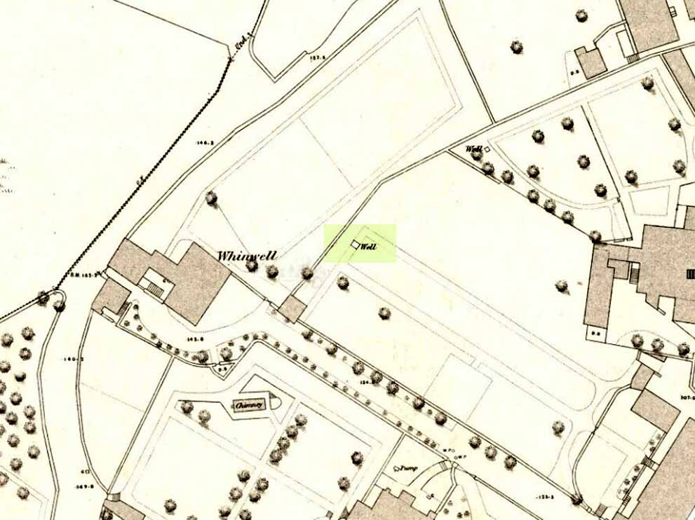
Healing Well (lost): OS Grid Reference – NS 7934 9412
Whin Well on 1858 map
Archaeology & History
Shown on the 1858 map of the city, this ‘Well of the Gorse’ (from the old folk-name ‘whin’, or Ulex Europareus) on the northern side of the old town, about 300 yards east of Stirling Castle, has long since gone. An old cottage of the same name was once to be found at the end of the appropriately named Whinwell Road, which also preserves its memory. Although the folklore of the site has seemingly been forgotten, it may be that the waters here had medicinal qualities akin to those given by the plant – i.e., jaundice, intestinal problems and to strengthen the heart. (see Mrs Grieve’s Modern Herbal)