Denoon Law, Glamis, Angus

Hill Fort: OS Grid Reference – NO 35464 44395

Also Known as:

  1. Canmore ID 32139
  2. Law of Denoon

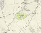
Denoon Law on 1865 map

Getting Here

Travelling north through Balkeerie on the Newtyle/Glamis road, turn right onto the Denoon road and follow it to the T-junction.  Turn right and, a few hundred yards on to your left, the large hillfort of Denoon Law rises up to your left.  You can’t really miss it!

Archaeology & History

Denoon Law from Murleywell

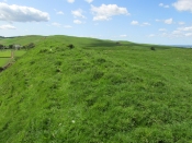
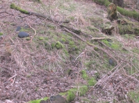
Denoon Law is an impressively lush and green hill fort hidden away in the Sidlaw Hills, in the Denoon Glen, parallel to the Vale of Strathmore. It can be entered froma gap in the ramparts on the north side. Be careful of the precipitous drop from the south east side!

In the County Angus survey by the Royal Commission on the Ancient & Historical Monuments of Scotland (1983), they describes it thus:

This fort crowns the summit of Denoon Law, a steep-sided volcanic plug on the NW side of Denoon Glen, a narrow valley at the N end of the Sidlaw Hills. The fort is roughly D-shaped on plan with the chord of the D formed by a long straight rampart that stands above the precipitous SE flank of the hill. It measures 105m from NE to SW by 55m transversely within a rampart that measures up to 17m in thickness and over 5m in external height but is clearly of more than one phase. Where the differentiation is clear, the latest phase of rampart measures about 6m in thickness and overlies the remains of a much thicker earlier rampart. Intermittently visible at the SW end of the fort is an outer face to the later rampart, comprising drystone walling that has, in places, been displaced downslope by the weight of core material behind. This outer face comprises no more than four or five courses of thin sandstone slabs and, although what is currently visible will only be the top of the surviving wall-face, a wall constructed of such material cannot have stoodto  any great height and what we see today is likely to be the remains of some form of comparatively low revetment. In both the earlier and later ramparts there is very little evidence of stone within the core and it appears that the material (boulder clay) for both has largely been derived from several large quarries within the interior of the fort. At the SW corner of the fort most of the rampart has been removed, leaving only the lower part of the outer talus. The fort, or at least its latest phase, had two entrances, one on the NE and another on the NW, both of which are crossed by the remains of a narrow, later, wall that runs around the entire circuit of the fort and may be associated with at least some of the buildings within the interior.

Outwith the main rampart there is a series of three outer ramparts, again with very little evidence for the use of stone in their construction, which run from the edge of the very steep slope at the NE end of the fort, around the N side to the entrance on the NW. All three lines of defence have been reduced to little more than terraces, though there is no evidence for them ever having been cultivated. At the entrance on the NW, the terminals of these ramparts (on both sides of the entrance) are obscured below outwash deposits from the slope above. To the SW of the entrance it is not at all clear what the relationship is between the defences of the fort and the enclosure that occupies the rocky and extremely uneven SW flank of the hill. This enclosure, which has an entrance on the W, could be some form of annexe or it could represent the SW end of an enclosure that once took in both this area and the rest of the summit.

Within the interior of the fort there are the remains of at least nine rectangular buildings, two of them large and open-ended and each overlain by a smaller, later structure. The freestanding buildings are represented by the footings of walls with inner and outer stone faces; close to the entrance on the NE, however, there are two buildings represented by simple rectangular platforms cut into the rear scarp of one of the prehistoric quarries in one case and the hollow of the entrance passage in another. On the N flank of the hill, overlying the outer defences, there are a number of structures, either taking the form of subrectangular structures with walls (and in one case an entrance) or simple scoops into the slope.’

Entrance from the NW

David Dorward’s definition of the name Denoon is from the Gaelic:

‘dun obhainn (+ Scots law) – [hill of the] fort of the streamlet.’

The streamlet is the Ewnie Burn flowing south-east of the Law.

The lush green centre

Folklore

James Cargill Guthrie, in his The Vale of Strathmore: Its Scenes And Legends, gives the following story from an,

early time, weird-like, a legend’s muffled chime ‘.

The Hill of Denoon was at that remote period accounted sacred or haunted ground. It was the mythical abode of the elfins and fairies, and formerly a fitting haunt for their midnight revelries.

When the silvery moonbeams lovingly slept in dreamy beauty on the green slopes of the enchanted Hill, and the blue bells and the purple heather were wet with the dew of angels’ tears, arrayed in gossamer robes of bespangled gold, with wands of dazzling sheen and lances of magical bright-ness, would the troops of elfins flauntingly dance to the music of the zephyrs, until the shrill cry of the chanticleer put an end for the time to their mystical enchantments.

Suddenly, as in blue clouds of vapour, they noiselessly vanished away, no sound remaining to break the oppressive stillness, save that of the mountain rivulet, as it fretfully leapt from crag to crag, as if piteously regretting the mysterious departure of its ethereal visitors.

South-east rampart

Having forsworn the presence and companionship of the terrestrial inhabitants of earth, it was a sacred dictum in the code of the fairies that no habitation for human beings should be permitted to be built within the hallowed precincts of the enchanted ground. Unable of themselves to guard against such sacrilegious encroachment, they had recourse to the aid of, and formed a secret compact with the demons, or evil spirits, whose sole avocation consisted in doing mischief, and bringing trouble and misfortune on those under the ban of their displeasure. By this compact these evil spirits became solemnly bound to prevent any human habitation whatever from being erected on the hill, and to blast in the bud any attempts whensoever and by whomsoever made to break this implacable, unalterable decree.

It was about this time the alarm-note was sounded, as the Queen of the Fairies, who, with an eye more observant than the rest of her compeers, observed one evening in the moon-light, certain indications of the commencement of a human habitation. Horror and dismay were instantly pictured on the fair countenances of the masquerading troops of merry dancers as the awful truth was ominously revealed to them by the recent workmanship of human hands.

The sheer slope to the south-east

A council of war was immediately held, when it was determined to summon at once the guardian spirits to their aid and protection.

“By our sacred compact,” cried the Queen, “I command the immediate attendance of all the demons and evil spirits of the air, to avenge the insult now offered to the legions of Fairyland, and to punish the sacrilegious usurpers who dare infringe the sanctity of their mystical domains.”

These demons instantly obeyed the haughty summons, and, in the presence of those they had sworn to protect, they in a twinkling demolished the structure, hurling the well-proportioned foundations over the steep rock into the vale beneath !

The builder, doubtless very much surprised and chagrined when he returned to his work in the early dawn of the following morning, was sorely puzzled to account for the entire disappearance of the solid foundations of the great castle he intended to be erected on the Hill. He did not, however, waste much time, or use much philosophic argument, on the matter, and gave orders to prepare new foundation of even a more durable character.

The demons, to show their invincible power, and for the sake of more effect, allowed the new foundations to rise a degree higher than the former, before they gave out their fiat of destruction. In an instant, however, they were again demolished, and the builder this time gravely assigning some fatal shock of Nature as the cause of the catastrophe quietly resolved to repair the damage by instantly preparing new and still more solid foundations.

Additional and more highly skilled workmen were engaged, and everything for a time went favourably on, the walls of the castle rising grandly to view in all the solidity and beauty of the favourite architecture of the period.

Biding their time, the demons again ruthlessly swept away as with a whirlwind every vestige of the spacious halls, razing the solid massy foundations so effectually that not one stone was left upon another !

Things were now assuming a rather serious aspect for the poor builder, who, thinking that he had at last hit upon the true cause of these successive disasters, attributed his misfortunes to the influence of evil spirits. A man of courage and a match, as he imagined, for all the evil spirits of Pandemonium, supposing they were let loose at once against him by the Prince of Darkness, he unhesitatingly resolved to keep watch and ward on the following night, and to defy all the hosts of hell to prevent him rebuilding the projected edifice. The night expected came ; but, alas, alas !

His courage failed when on the blast
A demon swift came howling past,
Loud screeching wild and fearfully,
This ominous, dark, prophetic cry
“Build not on this enchanted ground !
‘Tis sacred all these hills around ;
Go build the castle in a bog,
Where it will neither shake nor shog !”‘

So, if you are planning to visit Denoon Law – remember: RESPECT THE FAERIES!

References:

  1. Guthrie, James Cargill, The Vale of Strathmore: Its Scenes And Legends, Edinburgh, William Patterson, 1875.
  2. Royal Commission on the Ancient and Historical Monuments of Scotland. The archaeological sites and monuments of Central Angus, Angus District, Tayside Region, The archaeological sites and monuments of Scotland series no 18. Edinburgh, 1983.
  3. Dorward, David, The Sidlaw Hills, Forfar, The Pinkfoot Press, 2004.

©Paul T Hornby 2018

Culhawk Hill, Kirriemuir, Angus

Stone Circle:  OS Grid Reference – NO 3530 5620

Also Known as:

  1. Canmore ID 32209

Getting Here

The largest stone in the ring

From Kirriemuir central, head up the Kinnordy road, going straight across the main road and continuing past the Kinnordy turn-off for just over a mile towards Mearns, stopping where a small copse of trees appears on your left.  From here, walk along the track to the west. It goes gradually uphill, cutting through a small cleft with a hillfort on the north and a cairn circle on the south until, ⅔-mile along, you reach the moorland.  Keep going on the same path for another ½-mile west where the grasslands level out.  Here, on the flat bit between the two hills, a small incomplete ring of stones lives, with one stone sticking out.  You’ll find it!

Archaeology & History

This is a curious site on several levels—not least, that its definition as a ‘stone circle’ is a fragile one; although to be honest, we do find here a large unfinished arc of stones in what looks like either an unfinished ring, or a deliberately constructed large arc.  But you won’t find it in the standard megalithic gazetteers of Burl, Barnatt or Thom as it was only relocated in the 1980s by local researchers Sherriff and MacKnight. (1985)  They didn’t have much to say about it either, simply telling that they’d found,

“A stone setting representing the remains of either a denuded cairn or a stone circle lies in the saddle between Culhawk Hill and Castle Hill. One erect and 4 prone boulders describe a portion of a roughly circular site some 10m in diameter.”

Arc of fallen stones, looking NE

Faint low ring, looking W

This is roughly the gist of it, with the largest and most prominent of the stones—barely three feet tall—standing on the western side (this is the stone which draws your attention – otherwise you’d never even notice it).  The rest of the stones seem to have been knocked down some time ago.  A barely discernible embankment constructed around the edge of the ring can be seen around the northern side.  It seems unlikely that it was a cairn, as no inner piles of stones were in evidence when we visited the site.  It may be a large hut circle.  But in truth it could do with an excavation so that we can suss out its exact nature.  Beneath the grasses we found an additional stone to those counted by Sherriff & MacKnight; but more intriguing is what Frank Mercer and I found before we even reached the small circle….

Trackway leading to the circle

More visibly distinct than the ring itself were two artificial raised embankments, running parallel with each other 3-4 yards apart.  The raised edges of these embankments were about a yard across, on both sides, with the inner area slightly lower than the outlying natural background.  These distinct linear earthworks are, quite simply, an early medieval or prehistoric trackway—and it leads directly into the circle!  It’s quite unmistakable and is clearly visible as it drops down the slope to the south and away into the fields below.  Sadly when we found it last week, darkness was falling and so we didn’t trace the trackway any further.  But the most notable thing was that it stopped at the circle and did not continue on its northern side, implying that it was constructed with the circle as its deliberate focal point.  The trackway and its embankments are roughly the same size as other recognized prehistoric routes, such as Elkington’s Track on Ilkley Moor and the other ancient causeway that runs past the prehistoric ring known as Roms Law.

Regarding the ring of stones: unless you’re a real megalith fanatic, you’ll probably be disappointed by what you see here.  It’s a bittova long wander to something that may once have been just a hut circle, but the avenue leading up to it is something else – and much more intriguing!

References:

  1. Sherriff, John R. & MacKnight, O., “Culhawk Hill (Kirriemuir p): Stone Setting,” in Discovery & Excavation Scotland, 1985.

Acknowledgements:  Thanks as always to Nina Harris and Frank Mercer; and to Paul Hornby for use of his photos.

© Paul BennettThe Northern Antiquarian


St. Murdoch’s Well, Brechin, Angus

Holy Well:  OS Grid Reference – NO 5840 5682

Also Known as:

  1. Canmore ID 34760

Location of the Well

Location of the Well

Getting Here

The well is situated at the roadside on a grassed area at West Drum Cottages, to the east of the minor road from Hillhead of Burghill to Westerton of Aldbar, south of Brechin. The spring issues into a small circular pool, which drains as a burn southwards.

Archaeology & History

James Murray Mackinlay wrote in 1904:

“Murdoch – probably the St Mordouch invoked among the martyrs of the Dunkeld Litany……if we may believe Dempster [Thomas Dempster, 1579-1625 – Historia Ecclesiastica Gentis Scotarum, “Ecclesiastical History of the Scottish Nation.” Bologna 1627], who says that he was a hermit, and had a humble cell near a certain lake in Argyll, his cell being called Kilmurdah. Dempster further says that there was a life of the saint in nine lections, and that the events narrated in it were depicted on the walls of his cell. He is described as the last of the bards, and is said to have lived about 800 a.d.”

Dom Michael Barrett described Murdoch as a bishop, and wrote further in 1919 :

“No very reliable particulars can be ascertained as to the life of this saint. Traces of the honour shown to him are to be found in Forfarshire, the district which seems to have been the scene of his missionary labours. At Ethie, in the parish of Inverkeilor, in that county, are the remains of an ancient church and burial-ground which bear his name.”

Near Ethiebeaton, in the parish of Monifieth, are traces of an old church which goes by the name of ‘Chapel Dockie’. This is believed to be another dedication in honour of St. Murdoch.”

Murdoch may be an anglicisation of either Muireadhach, now Murray, or Muircheartach, which is now Murtough.  Murdoch’s Saint’s day is 2nd September, but 5th October and 23rd December have also been given. And Barrett also writes of a Saint Moroc, who, if what Mackinlay writes is correct, may be the same person as St Murdoch.

Looking into the waters

Looking into the waters

The small run-off from the well

The clear waters of the well

The spring was flowing strongly on the sunny February day of my visit, but its neat appearance gives no idea of it being a Saint’s Well to the passing traveller, who would probably think it to be just a pleasant water feature of the garden of the adjacent house. Perhaps there should be some representations made to the local tourist office for a sign to be placed by the well.

A mile or so to the north, hiding at the edge of a small copse of trees, is the little known holy well of St. Ouret.

References:

  1. Barrett, Dom Michael, A Calendar of Scottish Saints, Abbey Press, Fort Augustus 1919.
  2. Forbes, Alexander Penrose, Kalendars of Scottish Saints, Edmonston and Douglas, Edinburgh 1872.
  3. Mackinlay, James Murray, Influence of the Pre-Reformation Church on Scottish Place-Names, William Blackwood and Sons, Edinburgh & London 1904.

© Paul T. Hornby, The Northern Antiquarian 2016


St. Mary’s Well, Lethnot, Edzell, Angus

Holy Well:  OS Grid Reference — NO 5425 6814

Also Known as:

  1. Canmore ID 35005

Getting Here

General view of the site

Turn left in Kirkton of Menmuir towards Bridgend past the giant hillfort and rock art of White Caterthun, cross the Bridge of Lethnot, and continue to the holiday caravan park at Drumcairn, where you can park up.  Walk along the farm track on the south side of the caravan park and enter the field through the steel gate, and keep walking along the edge of the field  until you come to the spring below the old manse.

Archaeology and History

In the Ordnance Survey’s Name Book of 1857, the well is described as:

 ‘…a spring emitting from the foot of a natural bank. There is no built-up well about it.’

Andrew Jervise (1882) writes in his History and Traditions of the Land of the Lindsays,

…the Blessed Virgin was patron of Lethnot, and, during the incumbency of the late Mr Symers, several votive offerings, consisting of pieces of silver money, were found in the fountain near the church, which still bears the name of St.Mary’s Well…”

W.J Watson in his classic The Celtic Place Names of Scotland:

“..in Forfarshire is Navar, now Lethnot and Navar (the parish in which the Well stands)..the first part is doubtless nemed…”

Watson defines ‘nemed‘ as a derivative of nemeton – “a sacred place”, or “an institution originally pagan, taken over by the Church.”

C.P. Will, writes of the parish of Lethnot and Navar, in which the well stands:

Heifers drinking the holy waters
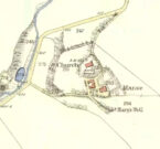
Site on the 1865 map

“..they record the existence here of an early settlement of the Celtic Christian church…Lethnot means Half-churchland, one portion of it, or as we might now say, one of two glebes…while Navar is Churchland-head, the top or extreme part of it, or Glebe-land. The two are complementary as to situation… Ultimately each had its parish church, the buildings being less than a mile apart and in full view one from the other, The “nemet” appearing in both names was a pagan shrine and, as such spots were commonly taken over by the Church on the advent of Christianity, the subsequent Gaelic neimheadh and neimhead came to mean a church site with the lands belonging to the church, latterly accepted as equivalent to glebe.”

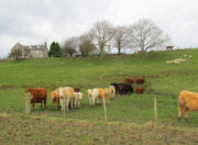
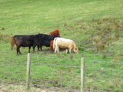
On the day of my field visit, the field in which the spring flows was occupied by skittish cattle who spent their time drinking, so I didn’t get close up to it, but it appears that any housing to the spring has been removed.

Visible to the south are the hillforts of White and Brown Caterthun; and 1¾ miles south east of St Mary’s Well, on the southern slope of the Brown Caterthun is the site of the Hermitage Notre Domine Maria de Kilgery, while its sub chapel and adjoining Lady Well of Chapelton in Menmuir are 2¾ miles away to the south-east, which may suggest a pre-Christian ritual landscape dedicated to one of the Earth goddesses.

References:

  1. Jervise, Andrew,  The History and Traditions of the Land of The Lindsays in Angus and Mearns, David Douglas: Edinburgh 1882
  2. Jervise, Andrew, “Notices of the Localities of the Sculptured Stone Monuments at St Vigeans, Inchbrayoch, Pitmuies, and Menmuir, in Angus and of Fordoun in the Mearns – part IV,” in Proceedings Society of Antiquaries of Scotland, volume 2, 1855-56.
  3. Watson, William J., The History of the Celtic Place Names of Scotland, Birlinn: Edinburgh 2004.
  4. Will, C.P., Place Names of Northeast Angus, privately printed: Edzell 1963.

© Paul T. Hornby 2016, The Northern Antiquarian


St. Aidan’s Well, Kirkton in Menmuir, Angus

Holy Well:  OS Grid Reference — NO 5339 6413

Also Known as:

  1. St. Iten’s Well 
  2. Canmore ID 35137

Getting Here

The spring seems to be on a modern property boundary

The spring seems to be on a modern property boundary

Just before entering Kirkton from Fearn, turn right down the minor road to Lochty. Park up just beyond the southern boundary of the woodland on the left and enter the field on the left, and follow the line of woodland on your left until you come to a break in the barbed wire protected by a tube of sponge rubber. Cross here into the old woodland and keep walking until you reach the top of a slope. Turn 45° to your left and walk down the slope among recently planted trees, and the spring will be seen at the bottom, bubbling into a pond.

 Archaeology and History

The Well shown on the 1865 6" OS Map

The Well shown on the 1865 6″ OS Map

The well was named after St. Aidan, the first Bishop of Lindisfarne, who died in 651, and whose Saint’s Day is 31st August. It was possibly named by his successor, St. Colman of Lindisfarne, who is believed to have sojourned in the area following the Synod of Whitby in 664

According to Jervise’s Land of the Lindsays, quoted on the Scotland’s Places website:

A fountain near the church, now lost by drainage, long preserved his (St. Aidan’s) name in the metamorphosed form of St. Iten, and was believed to perform miraculous cures on such as were afflicted with asthma and cutaneous diseases’.

The OS Name Book notes;

The spring was bubbling vigorously on the day of my visit

The spring was bubbling vigorously on the day of my visit

‘The place where the well was can be seen in the hollow which it has left. The water issues from a spout at the roadside, of which some care seems to have been taken as it is built around’.

Since that was written in the mid nineteenth century, the topography of the vicinity of the well has changed, and no trace of any previous building was visible to me. Prior to my locating the well, I enquired about it from a local who said it had ‘gone’ and no-one knew where it had been.

The spring now issues into a recently constructed pond

The spring now issues into a recently constructed pond

On my late winter field visit, the spring was bubbling away strongly, and was deliciously clean tasting.  I felt it had a spirit of its own, which of course it did before the Christian times.  I noticed that the barbed wire surrounding the area of the well had been broken down in a couple of places, and sponge rubber protection put over it. Maybe it is not just Northern Antiquaries who visit, and there are local people who still celebrate the old well….

References:

  1. Forbes, Alexander Penrose, Kalendars of Scottish Saints, Edmonston and Douglas, Edinburgh 1872.
  2. Cardinal Patrick Moran, Irish Saints in Great Britain, M.H.Gill and Son & Browne and Nolan, Dublin, 1879
  3. http://www.scotlandsplaces.gov.uk

© Paul T. Hornby 2016 The Northern Antiquarian


St. Ouret’s Well, Brechin, Angus

Holy Well:  OS Grid Reference – NO 5869 5904

Getting Here

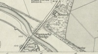
‘Spring’ shown on 1865 map

Travel north towards Brechin on the B9134, and cross the River South Esk at Stannochy Bridge.  Immediately after crossing the bridge, go through the double tubular steel gates to your right, descend the steep slope and walk along the boundary fence dividing the riverside field from the sloping woodland until you reach a tubular steel pedestrian gate. Go through this gate, over the burn and keep walking 150 yards or so to the right and St. Ouret’s Well is seen near the top of the slope.

Archaeology & History

Alexander Penrose Forbes, Bishop of Brechin wrote in 1872 :

Ouret – Close to Brechin, on the north bank of the Esk, near the Stannochy Bridge, is S.Ouret’s Well.”

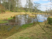
The spring flows south into a burn then into the river South Esk

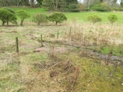
Perusal of the 25″ OS map of 1865 shows an enclosure marked ‘spring’ with a short pathway to the north-east, as the only water feature answering the written description. My field visit just over a century and a half later found a spring issuing at that point from the embankment, with the remains of old rough stone walling on either side of the spring. There was no sign of the pathway. The walling around an otherwise unremarkable spring located away from habitation would imply to me that this is the Saint’s Well.

As the good Bishop mentions the Well as the last entry in the Auctaria of his 1872 book—an afterthought as you will—it seems reasonable that the knowledge of St. Ouret and his well may have been at that time on the point of oblivion. The well is not noted as such by the earlier Ordnance Survey map,  nor can I find his name in any other of the hagiographies at my disposal.

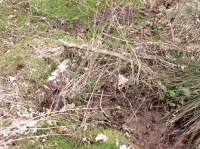
Old walling still visible low down

Intriguingly, ‘Ouret’ is a modern Basque surname, and while it is tempting to think of a Basque Holy Man walking the Pictland, the name is more likely a transliteration into Scots from a now lost Pictish or Gaelic name.  There is a mysterious ‘Uoret’ named in the inscription (as interpreted by Elisabeth Okasha) ‘DROSTEN : IRE UORET [E]TT FORCUS’  on the Drosten Stone at St Vigeans, who may be our saint, but this Uoret has been interpreted by Thomas Clancy as the Pictish King Uurad, son of Bargoit, who ruled from 839 to 842.  I know of no reference as to where Forbes obtained his information on Ouret or his well, but is it reasonable to hypothesise that the information was passed to him orally and what he wrote down as ‘Ouret’ may have been meant to be the very similar sounding ‘Uoret’? Or alternately was King Uurad  subjected to local canonisation as St Uoret/Ouret after his death? Can anyone add more?

A mile or so south of here is the holy well of St. Murdoch.

References:

  1. Forbes, Alexander Penrose, Kalendars of Scottish Saints, Edmonston and Douglas: Edinburgh 1872.
  2. Dwelly, Edward, Gaelic – English Dictionary, Garmin Publications: Glasgow 1988

© Paul T. Hornby,  The Northern Antiquarian 2016


Templelands, Auchterhouse, Angus

Stone Circle (destroyed):  OS Grid Reference – NO 355 360

Also Known as:

  1. Canmore ID 31855

Archaeology & History

In Mason Inglis’ (1888) fascinating history of the village of Auchterhouse, he describes a number of prehistoric antiquarian remains—some destroyed, others still in place.  But this old ring of stones is another of our ancient monuments that has fallen in the wake of the Industrialists with their ‘progress’ and ecocide.  Mr Inglis told,

“South of the Templelands another group of these mysterious circular stone relics of pagan times at one time stood, and was also held in much regard, and recognized as an ancient place of worship.  This group, however, unfortunately was demolished during excavations for railway purposes.”

He goes on to describe the finding of other prehistoric tombs and “unhewn slabs…in regular rows and at equal distances apart” in the same area.  It seems that many of these have also been destroyed.

References:

  1. Inglis, W. Mason, Annals of an Angus Parish, John Leng: Dundee 1888.

© Paul BennettThe Northern Antiquarian

Tods Stone, Monifieth, Angus

Standing Stone (destroyed):  OS Grid Reference – NO 486 339?

Archaeology & History

The only reference I can find about this site is in A.J. Warden’s (1880) massive survey of the county of Angus—previously called ‘Forfarshire’—where, in his discussion of the hillforts of the area, he told us that,

“About a quarter of a mile distant from The Laws is the Gallow Hill of Ethiebeaton.  In a field, a little to the south, there formerly stood a large upright stone called Tods Stone.”

All trace of it disappeared when quarrying operations were undertaken there, also destroying a number of prehistoric tombs close by.  The monolith may have had some association with the tombs, but we cannot be certain.

The name of the stone, tods, probably derives from the word ‘foxes’, although we cannot be certain of this either, as there are a variety of other Scottish dialect words relating to ‘tod’that may have had bearing on the name.

If anyone has any further information about this long lost site, we would gladly welcome it.

References:

  1. Grant, William (ed.), The Scottish National Dictionary – volume 9, SNDA: Edinburgh 1973.
  2. Warden, Alex J., Angus or Forfarshire – volume 1, Charles Alexander: Dundee 1880.

© Paul BennettThe Northern Antiquarian


West Mains (02), Turin Hill, Aberlemno, Angus

Cup-Marked Stone:  OS Grid Reference – NO 52150 53695

Getting Here

West Mains cup-marked stone

West Mains cup-marked stone

Follow the same directions as if you’re looking for the Doo’cot Woods carving; but, in the field that you have to cross before entering the trees, about 50 yards down from the top of the field, a geological ridge of stone runs along into the trees themselves.  The carving is along this ridge in the field.  Walk along and you’ll find it!

Archaeology & History

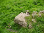
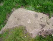
Not described in earlier surveys, this is one of two cup-marked stones close to each other along this long ridge of stone reaching across the field.  The carving has just two distinct cups, as illustrated, between 2-3 inches across and half-an-inch deep. As with the adjacent carving, no other features seem to visible.

Close-up of cup-marks

Close-up of cup-marks

We must, however, be cautious with this and other ‘cup-markings’ nearby, as a lot of the stone in this area is conglomerate with nodules of differing forms of rock (visible on nearby stones) falling away to leave cup-like impressions where the softer stone has eroded. Some of the cup-markings listed in John Sherriff’s (1995) survey of this region seem to be purely geological in nature and not man-made.

References:

  1. Sherriff, John, “Prehistoric rock-carving in Angus,” in Tayside & Fife Archaeological Journal, volume 1, 1995.

© Paul BennettThe Northern Antiquarian


White Caterthun Carving, Menmuir, Angus

Cup-Marked Stone:  OS Grid Reference – NO 54671 66022

Also Known as:

  1. Canmore ID 35007

Getting Here

White CaterthunCR01

The carving below the walling

Many ways here, but from the nearest town of Brechin, take the minor north road out of town (not the B966) to Little Brechin, heading roughly north to the renowned hillforts of White and Brown Cathertun (ask a local if needs be).  Park up and walk up the slope to White Cathertun, following the immense walling around to the right.  Near where you reach the opposite side of the hillfort, look down the rocky slopes for a large boulder, just on the edge of the walling.  You’ll find it!

Archaeology & History

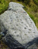
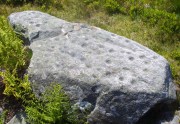
Although Canmore include this cup-marked stone in the site-profile of the incredible White Caterthun hillfort, it should really have an entry of its own, as it’s age and nature very probably pre-date the construction of the giant fortress.  But, this aside, if you’re visiting the hillfort (an incredible place!), at least give this heavily cup-marked stone your attention too.

Looking across the carving

Looking across the carving

Close-up of the main cups

Close-up of the main cups

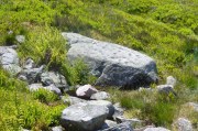
Probably neolithic in origin, there was a small portable cup-marked companion found 30 yards away, suggesting perhaps that a cairn might once have stood on this hilltop—but tradition is silent on the matter.  No other petroglyphs of any note have been located nearby, which is unusual.  In all probability other carvings remain undiscovered, particularly in the hills immediately to the north.

Consisting of around 80 cup-marks, several of which appear linked by carved lines, the stone has been bound together with concrete and metal bolts after some idiot damaged it in the 19th century.  It was first described by Miss Christian Maclagan (1875) in her stunning megalithic survey of the period.  She wrote:

“To Sir James Simpson’s list of cup-markings we are able to add the one at the Caterthun, on a large block 6 feet long, which is quite covered with very distinctly cut cup-markings.  It is a block of basalt…and the cups are so very clear and sharp in their lines that their freshness can only be accounted for by the stone having lain with the markings buried in the ground.  This curious stone has been quite recently broken in two.  It is a pity to see it so destroyed, because it is valuable to the antiquary in helping to establish a very remote antiquity for the fortification.  It lies on the north side of the fort, among a chaos of stones, having probably once formed the side of a gateway.”

A few years later the late great J. Romilly Allen (1882) visited the site and gave us his description, telling:

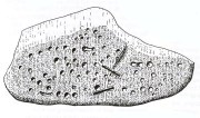
“On the west side (of the hillfort), 10 yards north of the boundary of the fir plantation that covers one-half of the hill is a cup-marked boulder… The stone has been broken in two, and one portion of it lies at the foot of the stone rampart just above the first outer ditch, whilst the other half has been rolled down the hill by some mischievous person with more muscles than brains, and is to be found immediately below, where its further progress was arrested by coming in contact with the outermost wall.  The two fragments when placed together measure 6 feet 9 inches long by 3 feet wide, and 1 foot 9 inches thick.  The stone is greenish quartzose slate, and on its upper surface are carved eighty cups, varying from 1½ to 2½ inches diameter.  In two cases two cups are united into one by a connecting groove.”

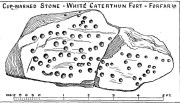
J. Sherriff's 1995 drawing

J. Sherriff’s 1995 drawing

J.R. Allen's 1882 drawing

J.R. Allen’s 1882 drawing

The most recent description and illustration of the stone is in John Sherriff’s (1995) survey. When we visited the carving recently we noticed three cup-marks etched onto the side of the stone, with a possible carved line running above one of them—but due to the bright sunlight on of the day of our visit, it was difficult to say whether this was a geological in nature or not (bright daylight can hamper good visibility of many carvings).  Check it out!

References:

  1. Allen, J. Romilly, “Notes on some Undescribed Stones with Cup Markings in Scotland,” in Proceedings of the Society of Antiquaries Scotland, volume 16, 1882.
  2. Kenworthy, J., “White Caterthun: Cup-Marked Stone”, in Discovery & Excavation, Scotland, 1980.
  3. MacLagan, Christian, The Hill Forts, Stone Circles and other Structural Remains of Ancient Scotland, Edmonston & Douglas: Edinburgh 1875.
  4. Sherriff, John, “Prehistoric Rock-Carvings in Angus,” in Tayside & Fife Archaeological Journal, volume 1, 1995.

© Paul BennettThe Northern Antiquarian