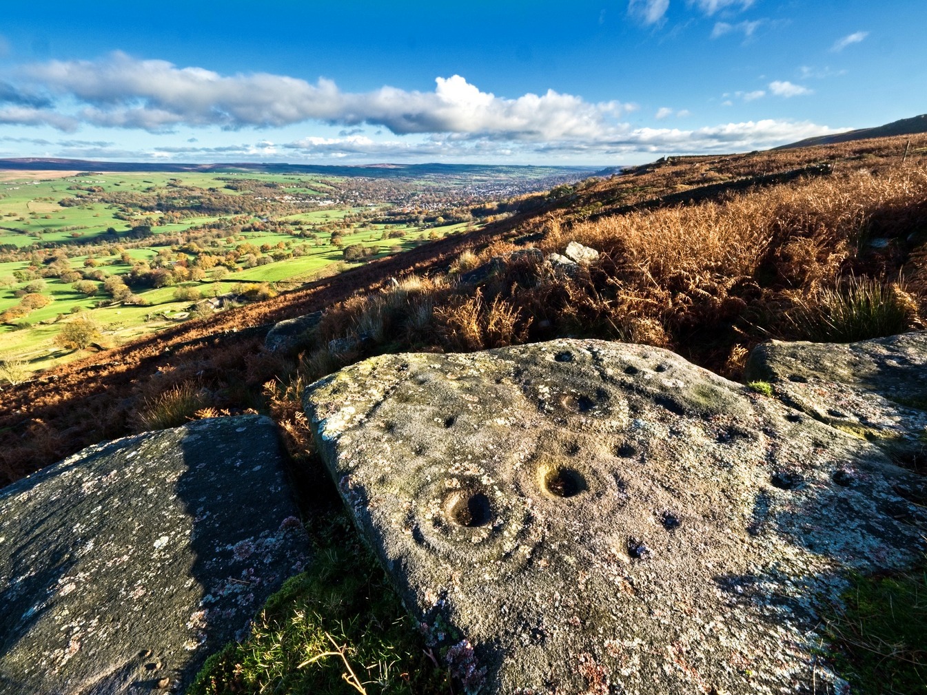
Ostensibly non-linear carved designs, generally assumed to be Bronze Age in date, but many originate in the neolithic period (some may indeed date back to 5000 BCE). Their central features are small rounded cup-markings, circles, semi-circles, curved lines (short, mid-length, and long), straight-ish lines, double- and multiple-rings, all in usually abstract design-forms. Their almost complete non-linear nature relate to non-egoic structuralisms, making them difficult to ‘intellectually’ grasp. Added to this is that no two carvings are the same. Although no direct ‘meaning’ can be ascribed to the carvings, many of them have a relationship with ancient notions of death and/or burial. In animistic terms, they relate to the spirit of rocks and other features of the natural landscape. They have very little relationship with alignment features (though exceptions in some megalithic rings have been found). Some modern writers allege positive relationships with water, but this ingredient (if tenable) cannot yet be said with any certainty: the idea should be forged onto animistic relationships with the land itself.
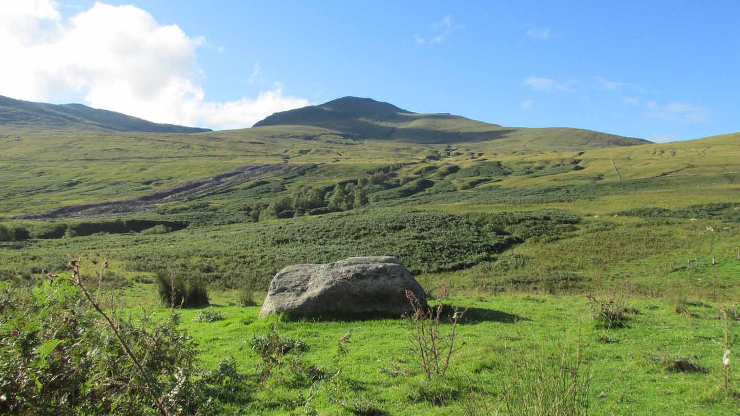
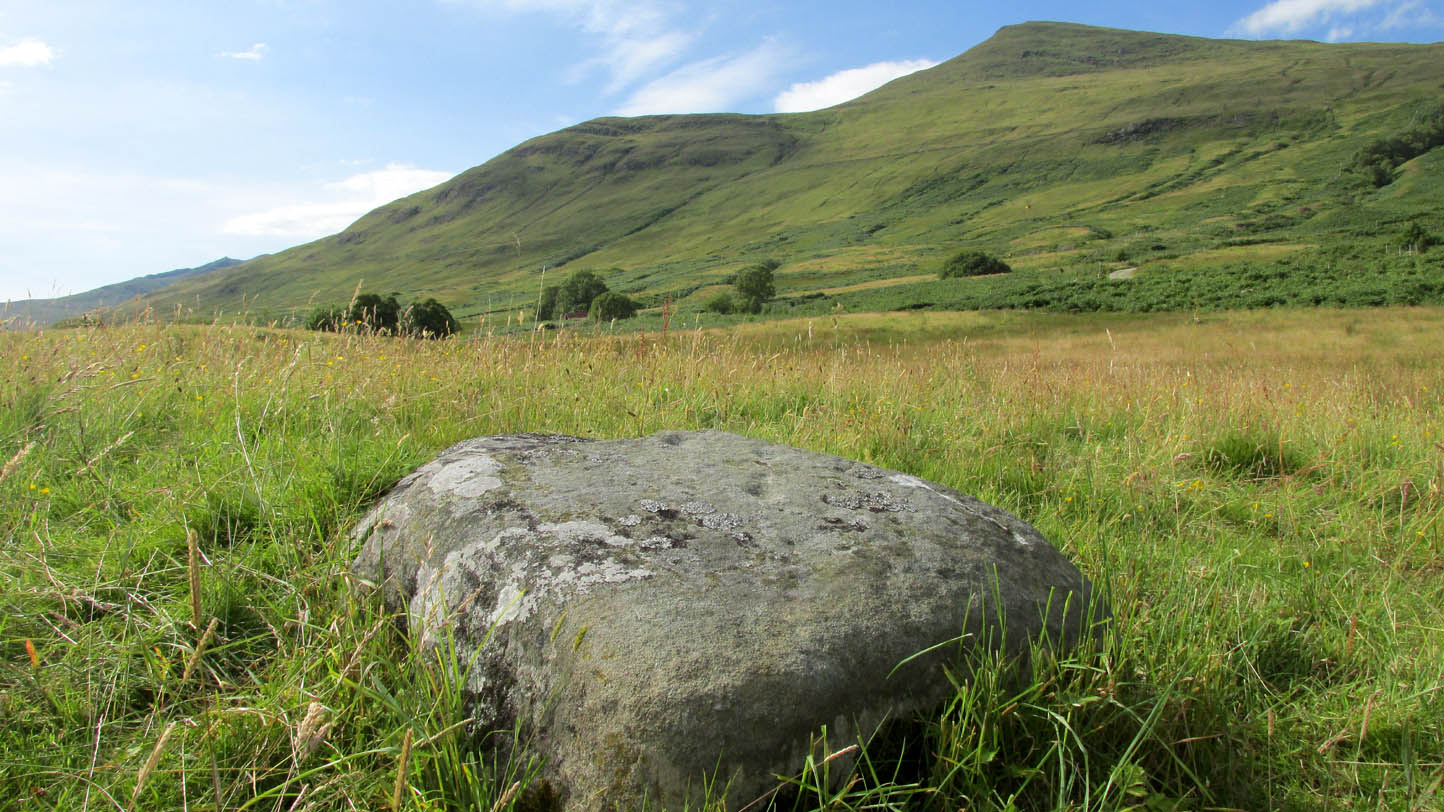
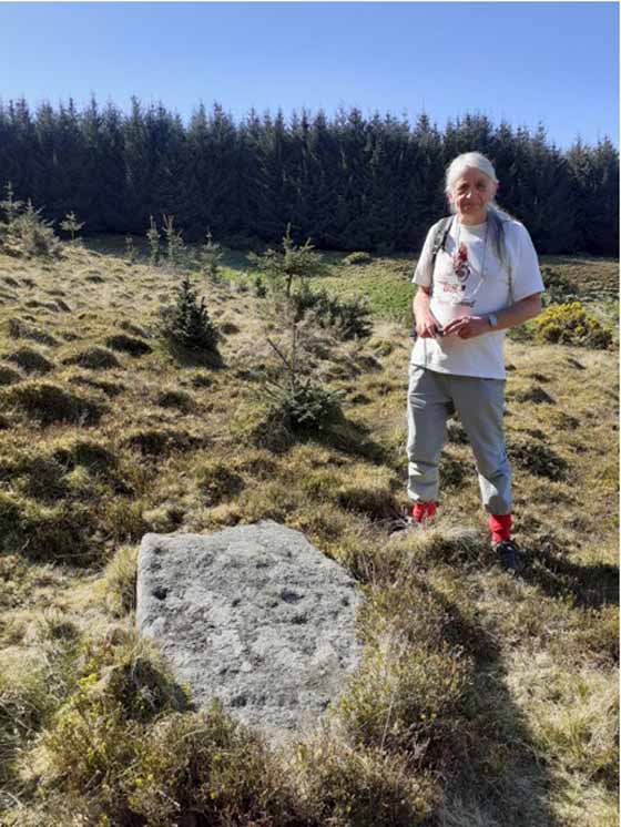
From Killin, take the A827 road to Kenmore. 6 miles along, on your right, is the track down to the Big Shed at Tombreck. Keep on the A827 for exactly ⅓-mile (0.53km), and opposite the driveway to Craggantoul is a small parking spot. A few yards on the road, over the burn, go thru the gate on your left. Follow the straight line of walling up for 7-800 yards and then walk to your right, into the field. About 300 yards into the overgrown meadowland you’ll see a rounded knoll with a very notable boulder on its crown. Y’ can’t really miss it!
Archaeology & History
It’s the setting of this carving that captures you way more than the carving itself—which is probably somewhat of a disappointment to most folk, unless you’re a petroglyph fanatic like myself.
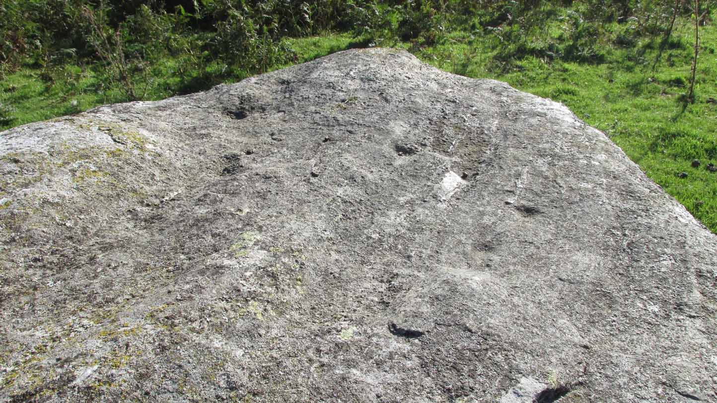
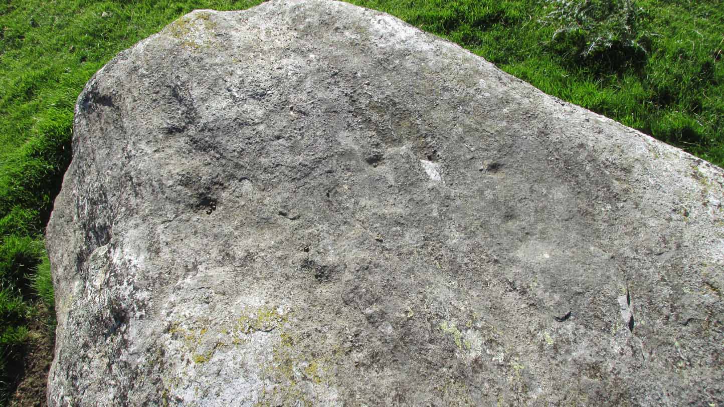
The five cup-marks…and from another angle
Found relatively close to other carvings, this reasonably large boulder has, upon its roughly smooth top, just five simple cup-marks with varying degrees of weathering, from the very noticeable to the somewhat faint—hinting at the unlikely possibility that it might have been carved at different times. A possible sixth cup can be seen in certain daylight conditions on the southwest section of the stone. That’s it!
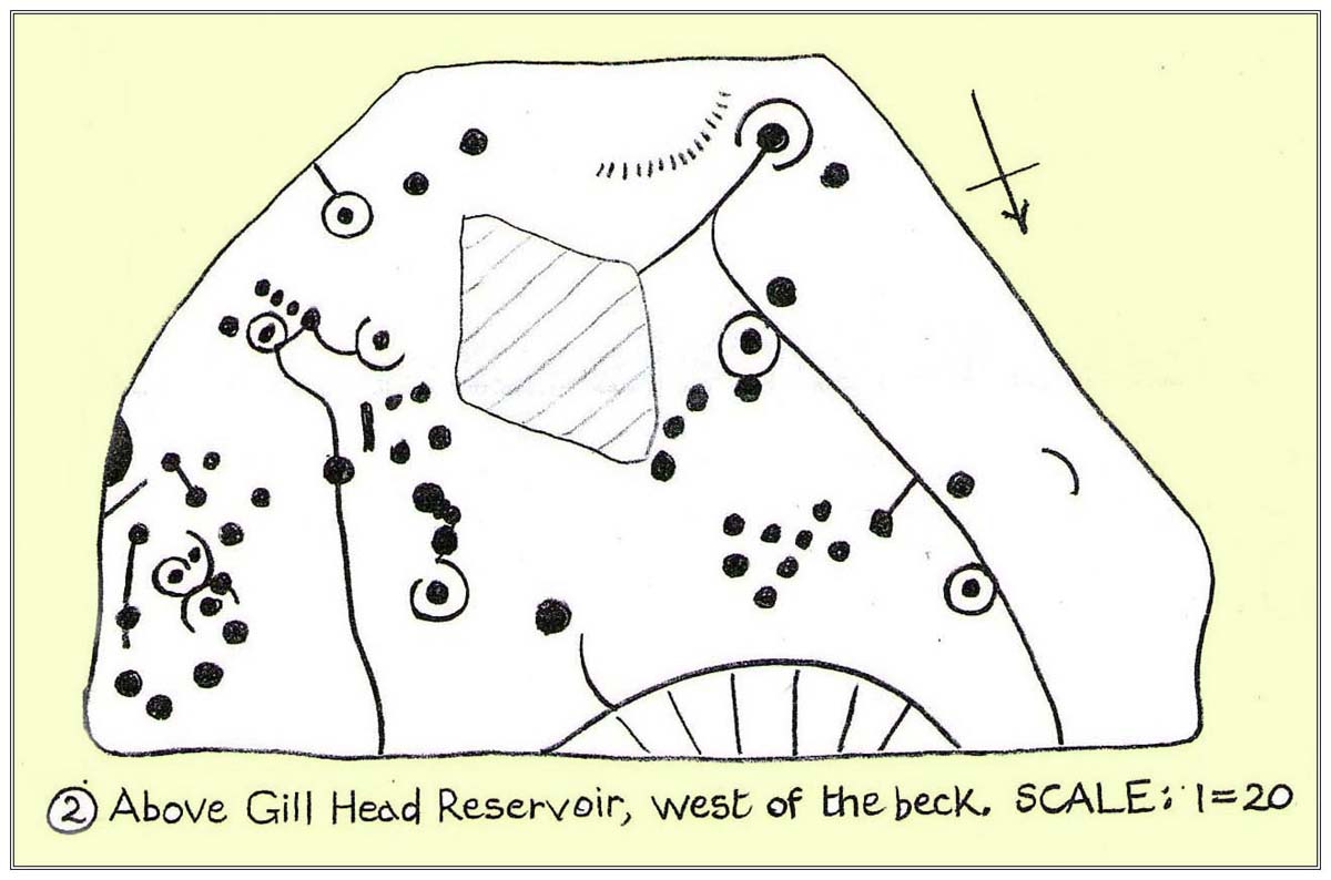
From Ilkley town centre take the road up to White Wells (ask any local if y’ can’t find it), but instead of heading up the track to the wells, keep on the road and, after just over 200 yards, turn left up the Keighley Road. Half-a-mile up there’s a dirt-track on your right which leads to Silver Well Farm. Walk along here for about 150 yards, keeping your eyes peeled for a large rock in the heather about 50 yards up onto the moor. You’ll find it.
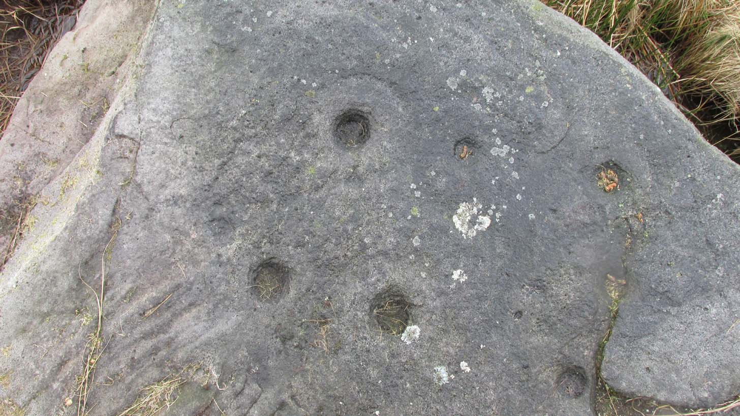
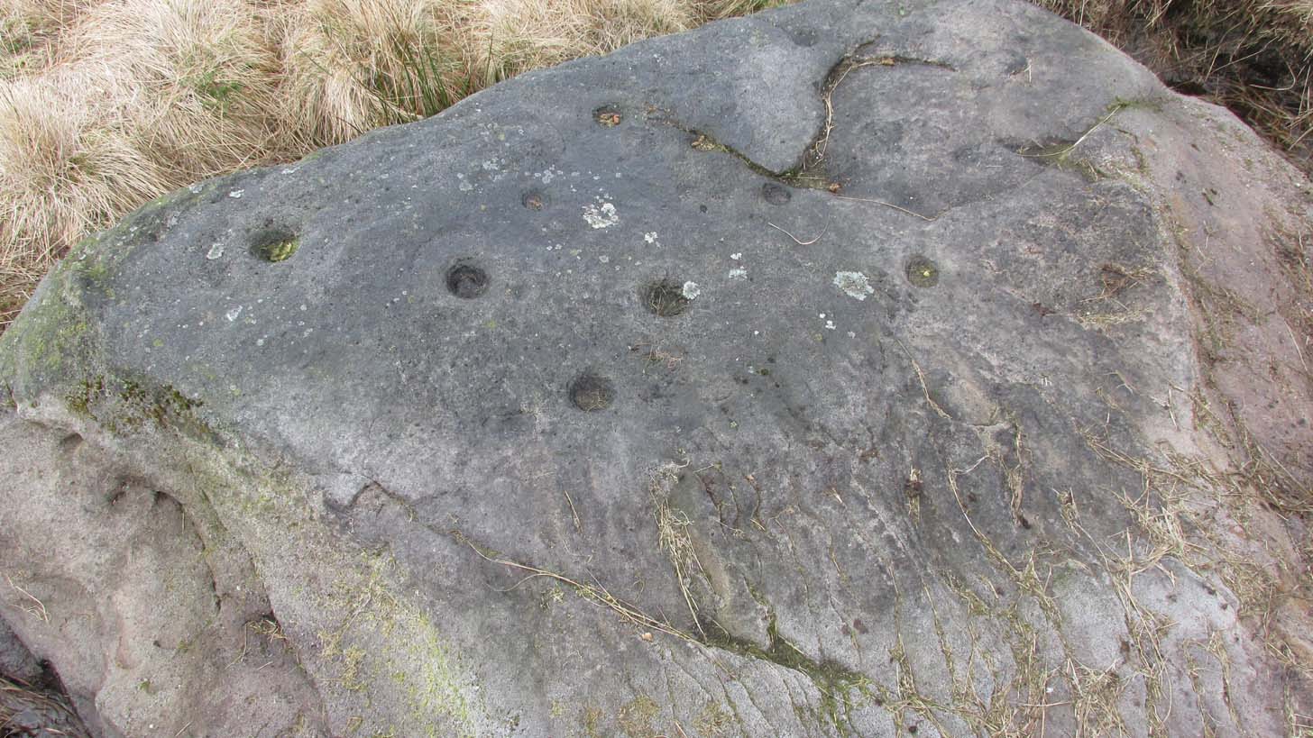
Archaeology & History
Located just 100 yards west of the old Roman road that effectively runs north-south through the middle of Rombalds Moor and which, when this carving was executed, was a prehistoric trackway, this is an impressive carving, all but unknown by many. On my last visit to this stone—maybe 10 years ago or more—it was a cloudy day. I know this from the fact that the design on the stone was difficult to see in its entirety. But not anymore! When the northern antiquarian Dave Whittaker came a-wandering this way a few years back, the stone so overgrown in vegetation that the design was very difficult to appreciate and, like any healthy curious antiquarian, he wanted to know what the full carving would look like. He enquired whether or not it was OK to uncover the stone from beneath its mass of heather to see the full image and, as far as we were concerned the idea was a good one. And so, following in the footsteps of Beckensall, Currie, Chappell, me and a few others, he got stuck in!
Cup-and-rings from above (photo by Dave Whittaker)Looking across the stone (photo by Dave Whittaker)
As you can see in Dave’s fine photos, the petroglyph is indeed a fine one. It comprises mainly of four cup-and-rings, two of which are incomplete The rings, as you can see, are very faint, whilst the cups, both in the rings and those outside of them, are notably deep; perhaps indicating that they were carved into many times over a long period.
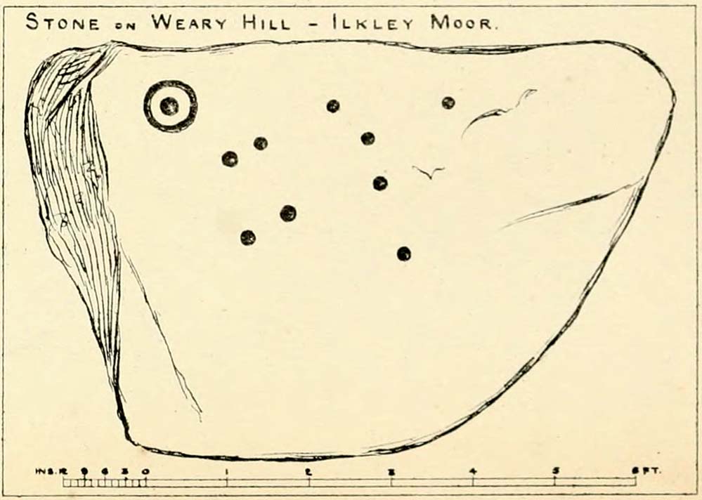
One of the great petroglyphic pioneers, J.Romilly Allen (1882) seems to have been the earliest to record this carving. Allen’s early sketch (below) was obviously drawn on a shady day, as it misses several of of the rings that are clear to see when the the daylight is just right. It’s an easy mistake to make. He wrote:
J.R. Allen’s 1882 sketchHedge’s 1986 sketch
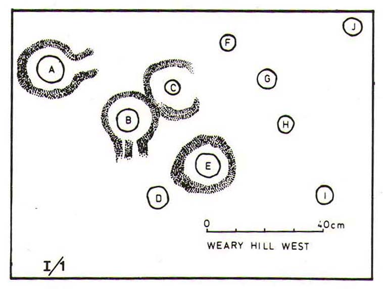
“One mile south-west of Ilkley is a road leading over the top of the Moor…very appropriately as Weary Hill. To the west of the road, and between it and the boundary-wall of Silver Well Farm, is a small boulder of gritstone with cup-markings on it. It lies at a level of 900 ft. above the sea, and it measures 8ft by 5ft. On its upper surface, which is nearly level, are carved ten cups, varying in diameter from 2 to 3 ins., one of them being surrounded by a single ring.”
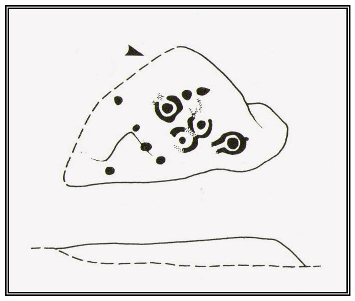
The pseudonymous “A. Reader” (1891) also included the stone in his international overview of prehistoric carvings, but merely copied the notes of his predecessors. Nearly a hundred years later when archaeologist John Hedges (1986) did his survey of these moors, he described this carving simply as:
“Medium seized rock…in grass, heather and crowberry with c.ten cups, four with rings, two with grooves from rings, three depressions and series of probably natural lines running down to bottom edge.”
And as with the pseudonymous A. Reader (1891), Boughey & Vickerman’s (2003) also just copied Hedges’ earlier description.
Seeking numeracy in Alan Davis 1988 sketchAnd from another angle (photo by Dave Whittaker)
The greatest analysis of this carving to date is by physicist and mathematician Alan Davis. He set out in 1983 to explore the possibility of there being a universal measurement used in neolithic times that was coded into our cup-and-rings—a theory first espoused by the great archaeo-astronomer Alexander Thom. (1968) He selected carvings from Rombalds Moor and Northumberland, including this one at Weary Hill (calling it the I/1 carving) to see if a ‘megalithic inch’ (MI) that was propounded by Thom had any foundation in fact. As a mathematician he was ideally qualified to examine this proposition. His 1983 paper found there to be “substantial support” for this prehistoric megalithic inch. However, in a subsequent 30-page analysis of the same carvings Davis (1988) found that some criteria in his initial investigation needed re-examining. In his updated report he told that “many of these deficiencies have now been remedied.”
His initial 1983 report concluded the Weary Hill carving possessed a deliberate mathematical code in accordance with Thom’s MI. However in the subsequent 1988 report, Davis found that the measurements were based on 5MI and 3 MI, but only in the cup-and-rings and not the single cups. Despite this, there remained an overall scepticism in terms of any deliberate universal use of the MI. My own take on this is a simple one: there was no deliberate use of any MI at carvings. Where we do find precise MIs, this is due simply to the average size of human hands, meaning that some obvious figurative correspondences will occur upon investigation. The more you think about it, the more obvious it becomes.
Anyhow, all this intriguing geometry aside: to those of you who take the time to check this out, have a bimble in the heather barely 100 yards west and you’ll find a few other carvings sleeping quietly, whose site profiles I’ve yet to do…
References:
Allen, J. Romilly, “Notice of Sculptured Rocks near Ilkley,” in Journal of the British Archaeological Association, volume 38, 1882.
Anonymous, Walks Around Cup and Ring Stones, ITIC: Bradford n.d. (1995)
Boughey, K.J.S. & Vickerman, E.A., Prehistoric Rock Art of the West Riding, WYAS: Leeds 2003.
Collyer, Robert & Turner, J. Horsfall, Ilkley, Ancient and Modern, William Walker: Otley 1885.
Davis, Alan, ‘The Metrology of Cup and Ring Carvings near Ilkley in Yorkshire,’ in Science and Archaeology, 25, 1983.
Davies, Alan, ‘The Metrology of Cup and Ring Carvings,’ in Ruggles, C., Records in Stone, Cambridge 1988.
Hedges, John (ed.), The Carved Rocks of Rombald’s Moor, WYMCC: Wakefield 1986.
Reader, A., Archaic Rock Inscriptions, privately printed: London 1891.
Thom, Alexander, “The Metrology and Geometry of Cup and Ring Marks,” in Systematics, volume 6, 1968.
Turner, J. Horsfall, Historical Notices of Shipley, Saltaire, Idle, Windhill, Wrose, Baildon, Hawksworth, Eccleshill, Calverley, Rawdon and Horsforth, Shipley Express: Idle 1901.
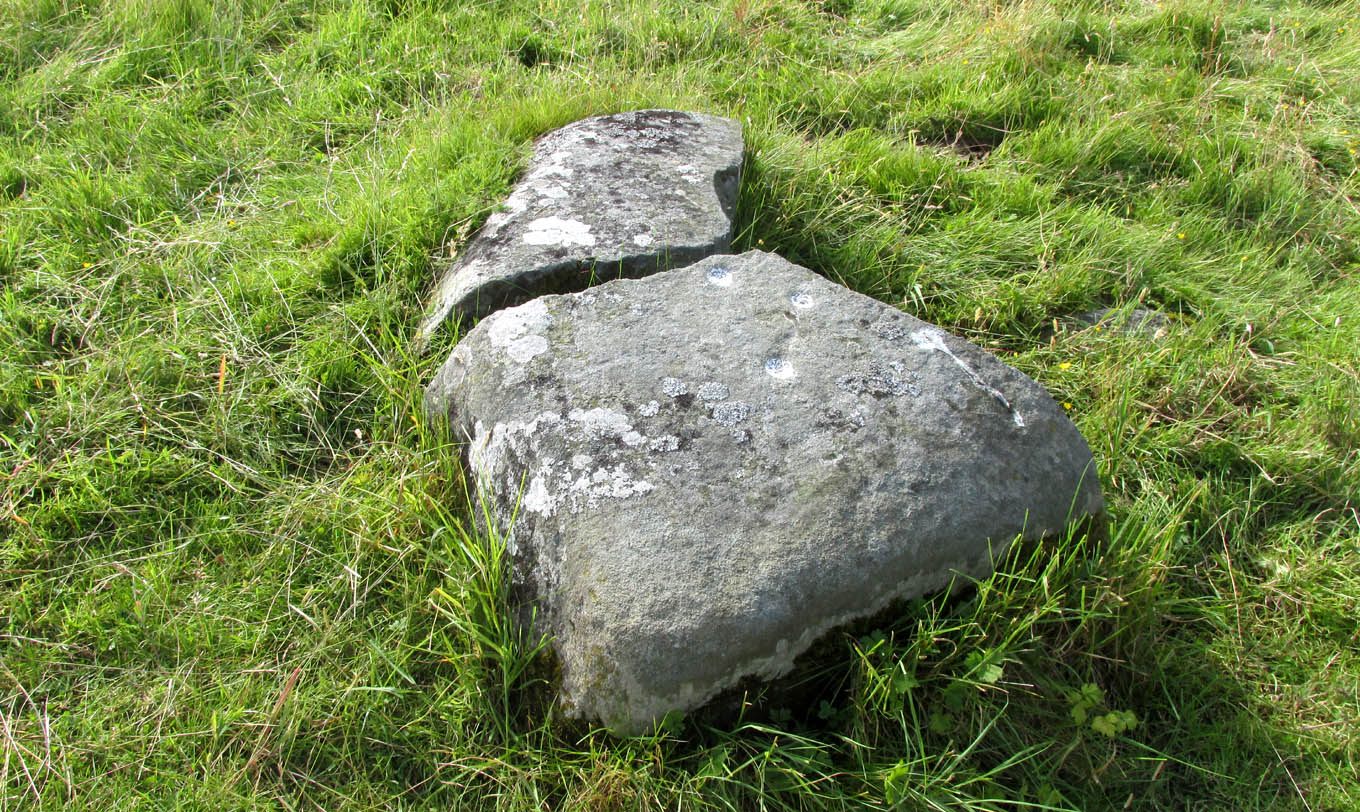
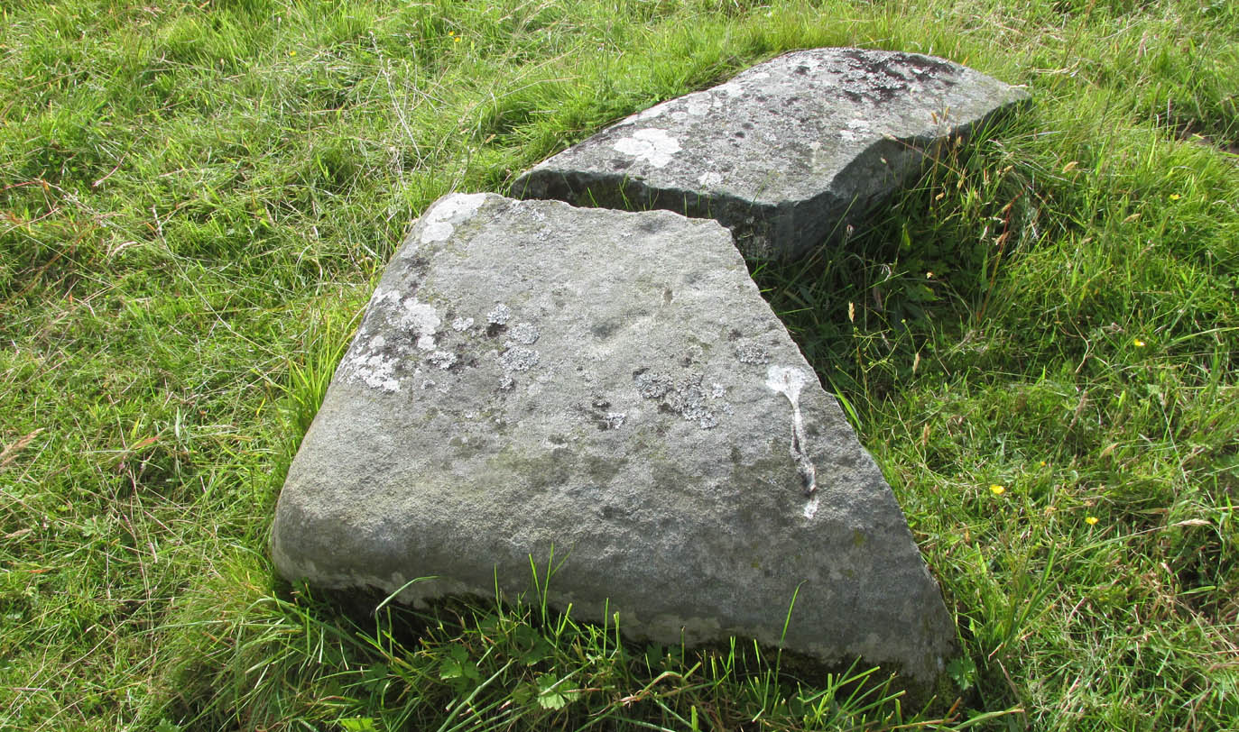
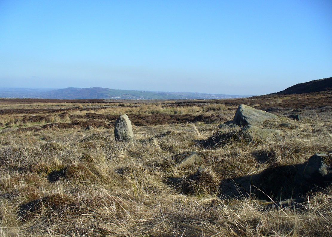
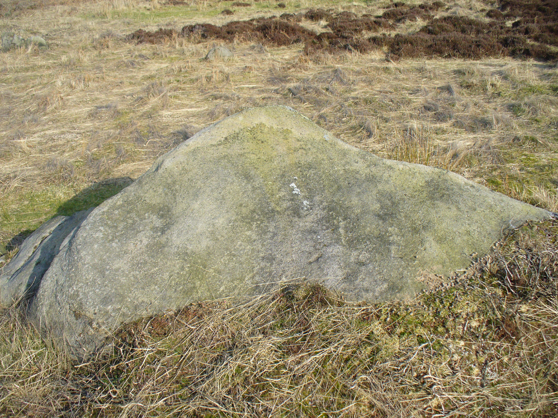
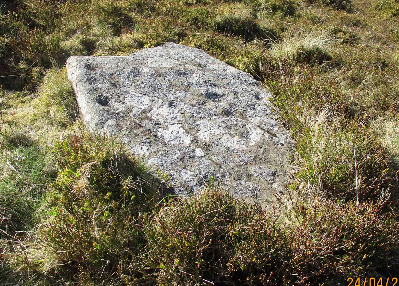
Along the A827 Loch Tay road between Morenish and Lawers, take the track uphill where Carie farmhouse and Tombreck are either side of the road. Walk up this track 2-300 yards till you go through the gate just past the sheep-folds on your left. Ahead of you is a small grassy hillock on your right upon which you’ll find the unimpressive Tombreck-1 carving. Walk down the grassy-slope to the boggy stream and then up the rounded knoll on the other side, where you’ll find a stone that’s been split in two. You’re here!
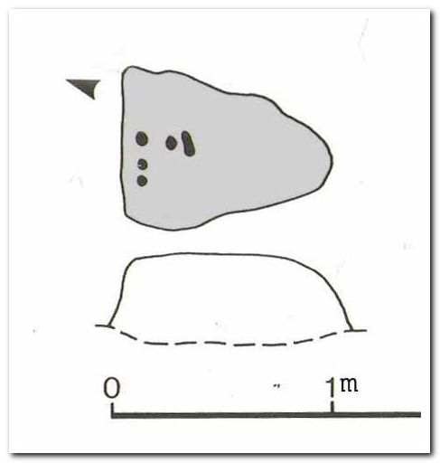
Archaeology & History
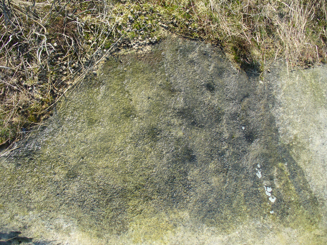
This is another unrecorded carving, found amidst this already large petroglyphic cluster on August 9, 2020. Carved on a stone that’s been spilt in half, three simple cup-marks can be seen on the larger easternmost section, with the lowest of them having a possible short line running towards the cup on the right. It seems that the right-hand (north) side of the stone has also been cut, but there is no trace of this part of the stone on the ground. Additionally, there is the possibility that this stone once stood upright, as evidenced by its very worn rounded top and the larger bottom end of the stone being distinctly lower compared to the ground all round it. But this is speculative.
The 3 cups, highlighted3 cups on the lower stone
Although the rock is close to being on the top of a rounded knoll, giving good visibility both east and west for a few miles along the extensive grassy ridge (where many other petroglyphs exist), the grandeur of Loch Tay in the glen below is not and could never have been visible from this, or indeed many other carvings on this ridge. I mention this due to the fact that some students are positing that the existence of so many carvings along here may relate to some sort of deification of Loch Tay. But here and at many others along this ridge, the idea simply aint valid, unfortunately.
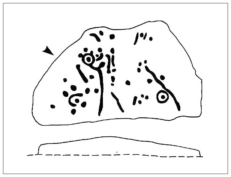
Various ways to get here, but probably the easiest is to start from Cow & Calf Rocks, walking up the steep slope onto the moor-edge. Paths veer left and right once you’re on the level, but you wanna head straight forward, west(-ish), for about 350 yards till you reach the stream. Cross over and then take the path that runs parallel with the stream, uphill. Nearly 200 yards up, where the moor begins to level out, you cross a path running east-west; keep going past this for about another 50 yards (as if you’re heading to the Backstone Circle) and you’ll notice some small sheep-paths leading you into the heather to your right and, some 40-50 yards into the heath you’ll see this large flat stone!
Archaeology & History
This carving seems to have been rediscovered in the 1950s by Michael Walker and Stuart Feather. They were amongst a small group of people who visited this and some other carvings in June 1956, when the first (known) sketch of the carving was done by Mr Walker. His sketch of the stone is somewhat more elaborate than the one in John Hedges’ (1986) later archaeological survey. Indeed, in some ways the two drawings seem to show little resemblance to each other. (not uncommon with these things!)
Walker’s 1956 sketchHedges’ 1986 sketch
Walker shows nine cup-and-rings in various states of completion, with several clusters of singular cups at different places on the rock—more than forty in all, some of which are connected to each other by short lines. This is in contrast with the later archaeological description, which saw far fewer of the primary symbols. When John Hedges (1986) described the carving in his inventory, he informed the reader:
“Fairly smooth, medium sized grit rock standing up in heather, crowberry and grass, sloping SW to NE with the hill, its almost triangular flat top covered with carvings, some very clear, interesting patterns. About thirty-five cups, seven surrounding a small ring with cups on the circumference and at centre. Two long grooves with a cup at one end, running down to the edge of the rock. ‘Peck’ marks noticeable in one groove and in one ring round a cup. Three other grooves going half round cups, or leading from a cup. Slice of rock apparently removed.”
Boughey & Vickerman (2003) added nothing new in their later survey.
Although we have an uninterrupted open view of the landscape to the north and west from here, it might not have been like this when the carving was done 4-5000 years ago. The scattered woodland covering these heaths may have impeded the views. However, immediately west of this carving are the broken remains of a small Bronze Age settlement, some of whose walling is traceable some 100-150 yards away and any tree cover that may have been here may have been cut back. We may never know for sure…
References:
Boughey, K.J.S. & Vickerman, E.A., Prehistoric Rock Art of the West Riding, WYAS: Leeds 2003.
Hedges, John (ed.), The Carved Rocks of Rombald’s Moor, WYMCC: Wakefield 1986.
Jackson, S. & Walker, Michael J., “Ilkley Boulders Tour,” in Cartwright Hall Archaeology Group Bulletin, 2:1, 1956.
Follow the directions to reach our superb Swastika Stone from Ilkley, visible due to the iron railing that surround and protect the carving on the cliff edge. From here, keep walking west along the Millenium Way footpath, over the stile of the first wall, then the second wall—six in all—for ⅔-mile (1km), where you’ll see another small crag of rocks on your right, just yards from the footpath. You’re damn close!
Archaeology & History
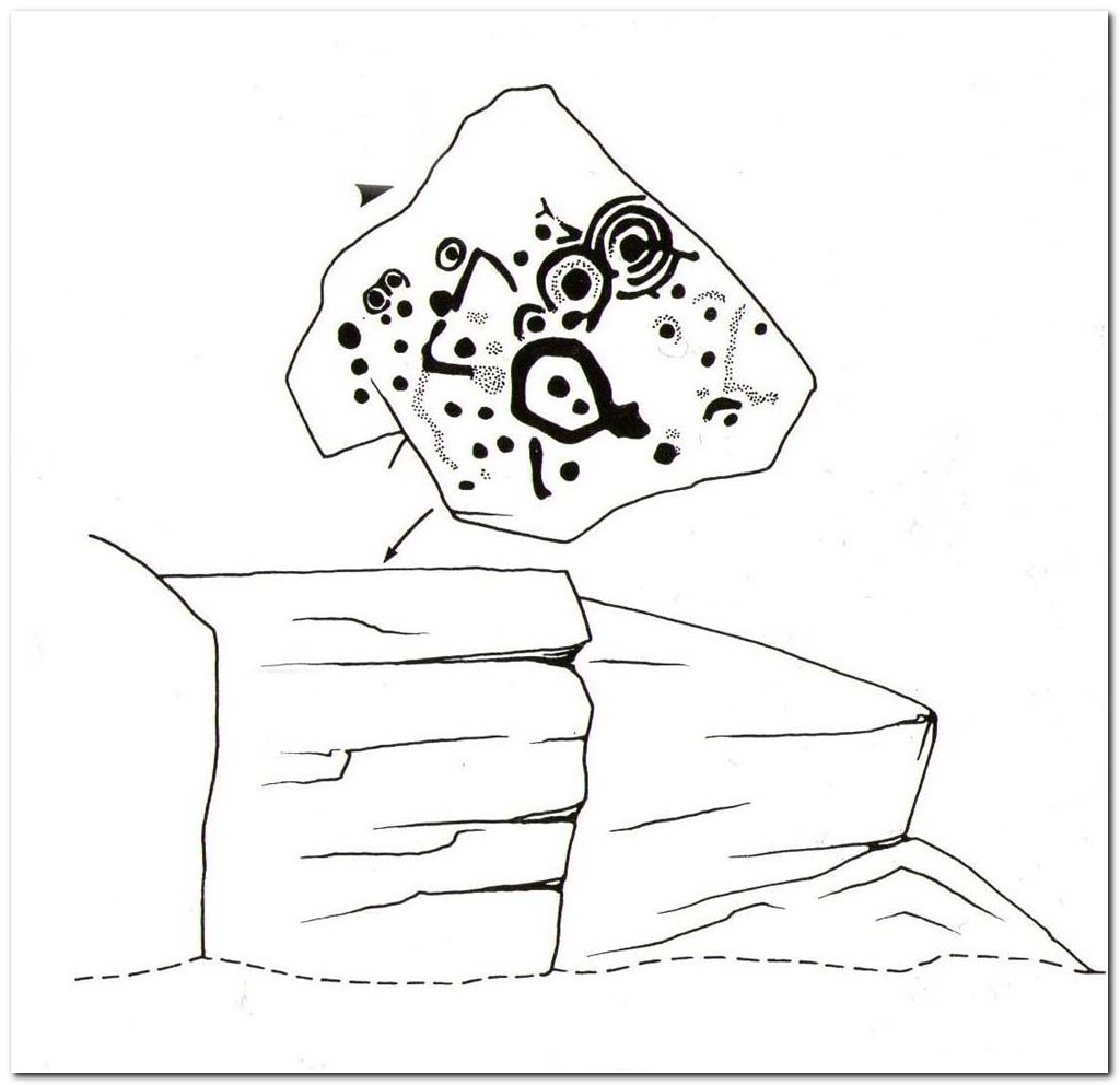
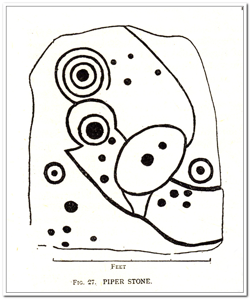
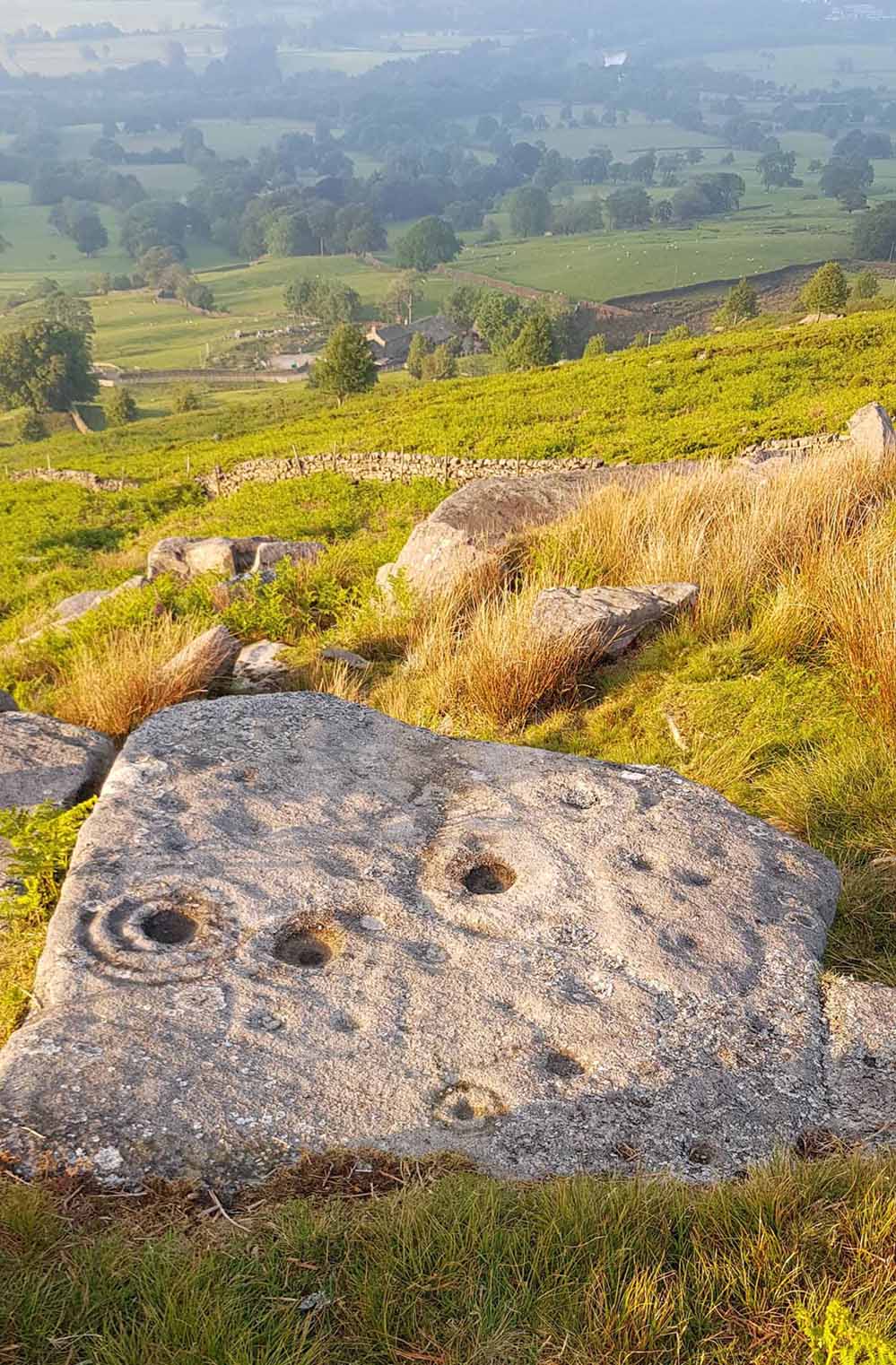
When the great J. Romilly Allen (1882) visited the Ilkley petroglyphs in 1878, the Piper Stone was one that he wandered over to see—and he had this to say of it:
“At the edge of Piper’s Crag is a horizontal rock-surface, and on a portion of it, measuring 5ft by 7ft, are carved a series of fifteen cups varying in diameter from 2 to 3 ins. Of these, one is surrounded by a single ring, four by a double ring, and one by a triple ring.”
Hedges 1986 sketchCowling’s 1940 sketch
This type of description, whilst accurate on the whole, rarely does justice to the carving. It was echoed more than 100 years later in John Hedges’ (1986) survey, when he described the large rock jutting out to possess merely, “a complicated design of cups, rings and grooves.” When Boughey & Vickerman (2003) did their follow-up survey, they added nothing more.
In an attempt to give some sort of meaning to the carving (and many others), the late great Eric Cowling (1940; 1946) placed it within Henri Breuil’s (1934) classification system, which assigns all carvings different degrees of complexity and form, from Classes 1-4. The Piper Stone entered Breuil’s Class 3A, being one “with deeply cut and smoothed down grooves.” Whilst this may sound good on the surface, in truth such classifications are utterly meaningless outside of the tables and graphs of statisticians and the boring. They give the appearance of quantitative research, but they have as much bearing on the nature of the carvings as an energy dowser healing the place with crystals.
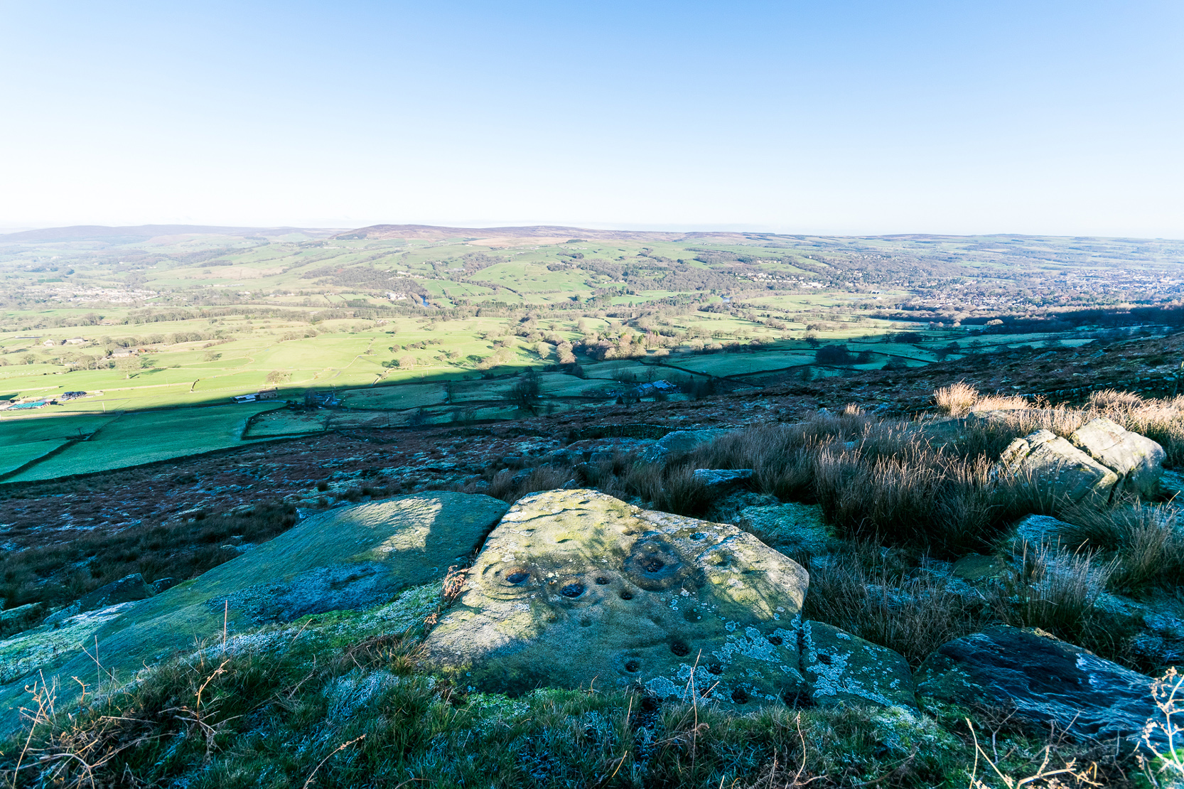
In the flesh, in the real world—so to speak—from the Piper Stone we are looking, not just at the carving, but its place in the landscape: an ingredient that more and more emerging archaeologists are recognizing has a synergistic relationship with some petroglyphs. And here we have an impressive landscape that reaches out ahead of us for many miles. We look primarily to the north: the Land of the Dead in many traditional northern cultures. But our panorama here is 180º, with east and west horizons having the potential for measuring equinoctial periods in the cycle of the year. But in truth this is sheer speculation.
It’s a worthwhile carving to see, both for its views and its excess of non-linearity. In its form, Rorscharch impressions of early humans emerge; the usual solar and lunar symbols can be seen; star systems seem apparent; maps or settlement ground-plans could be there. We know that somewhere within it is the animistic ‘spirit’ of the rock itself, but the forms it exalts are, once again, all but lost on us modern folk…
References:
Allen, J. Romilly, “Notice of Sculptured Rocks near Ilkley,” in Journal of the British Archaeological Association, volume 38, 1882.
Allen, J. Romilly, “Cup and Ring Sculptures on Ilkley Moor,” in The Reliquary and Illustrated Archaeologist, volume 2, 1896.
Anonymous, Walks around Cup and Ring Stones, TIC: Ilkley n.d. (c.1990).
Baildon, W. Paley, “Cup and Ring Carvings: Some Remarks on their Classification and a New Suggestion as to their Origin and Meaning,” in Archaeologia, volume 61, 1909.
Bennett, Paul, “Cup-and-Ring Art”, in Towards 2012, volume 4, 1998.
Bennett, Paul, The Old Stones of Elmet, Capall Bann: Milverton 2001.
Boughey, Keith & Vickerman, E.A., Prehistoric Rock Art of the West Riding, WYAS: Wakefield 2003.
Breuil, Henri, “Presidential Address for 1934,” in Proceedings Prehistoric Society East Anglia, 7:3, 1934.
Collyer, Robert & Turner, J.H., Ilkley: Ancient and Modern, William Walker: Otley 1885.
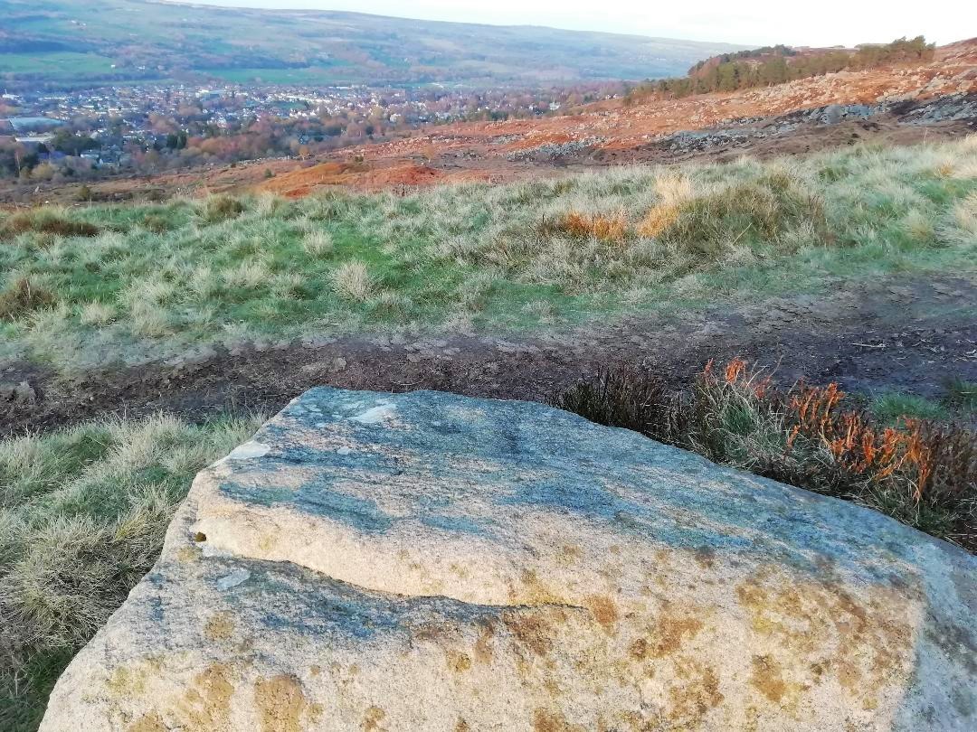
Follow the directions to reach the impressive Woofa Bank prehistoric enclosure. You need to find the walling that constitutes the enclosure itself and walk along to its eastern side where you’ll reach an ‘opening’, as if it may once have been an entrance at that side of the enclosure. A reasonably large sloping rock is on one side of this ‘entrance’. You can’t really miss it!
Archaeology & History
Unlike many of the other petroglyphs found within the Woofa Bank enclosure, the design on this one is faint — very faint indeed (much like the recently uncovered triple-ring petroglyph by the Thimble Stones). Comprising simply of a small cluster of cup-marks, you’ll struggle to see this one — unlike its compatriot on the western wall of the enclosure.
Looking down on the rockSome very faint cupmarks
It consists of a single cup-mark on the northern edge of the stone, whilst on the sloping southern part of the rock are a number of very faint cups, eroded by them there millenia of Nature’s wind and weathering. One or two of the cups are just visible in good lighting, but what are almost certainly a few more can be seen when the rock is wet and in low daylight hours. It’s a design that’s probably only of interest to the hardcore petroglyph fanatics, but without doubt this is yet another carving within this obviously important prehistoric enclosure.
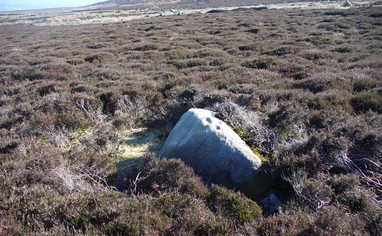
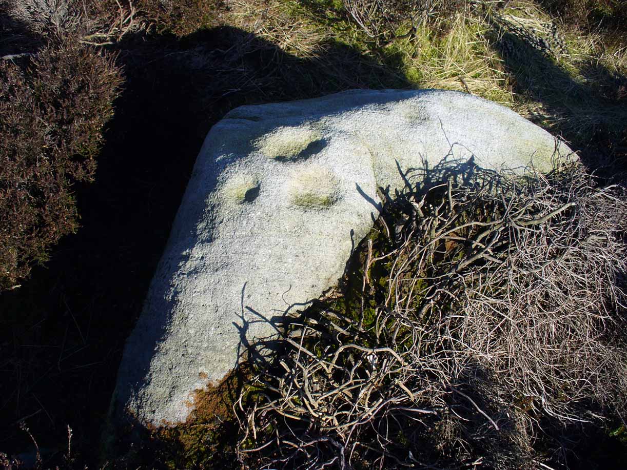
The easiest way to find this is to take the same directions to reach the Woofa Bank settlement. Get your compass out and make sure that you’re at the northern edge of the settlement walling. From here, walk about 60 yards northwest and keep your eyes peeled for a rock about 2 feet high, curved and elongated with its top surface above the heather. You’ll find it.
Archaeology & History
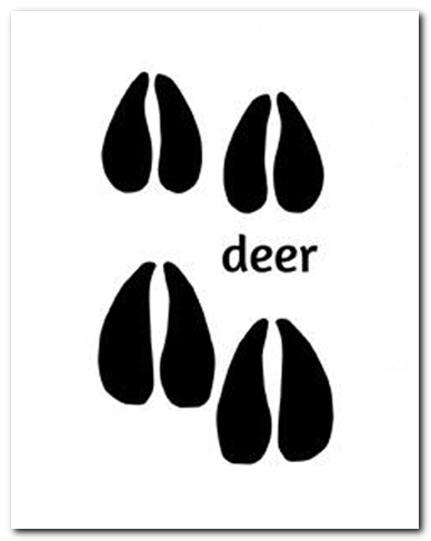
The name I’ve given to this stone is a conjectural one based entirely on comparative petroglyph designs elsewhere in the world. Or to put it more simply: elsewhere in the world we find examples of prehistoric rock art showing animal tracks and rituals relating to hunting animals, and in the design of this petroglyph on Ilkley Moor I wondered if we might be looking at something similar. Internationally respected anthropologists, archaeologists, geologists and rock art specialists such as Lawrence Loendorf (2008), Polly Schaafsma (1980), Dennis Slifer (1998) and many others show examples of animal tracks in the US and Mexico (examples exist throughout the world), and it’s not unlikely that some of the petroglyphs in the UK represent such things. But, like I say, this particular carving may have nowt to do with such a thing and the idea is entirely conjectural on my part and is probably way off the mark.
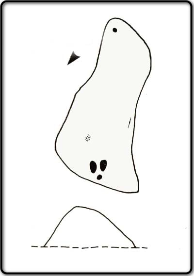
Deer-print motif & cup
Located less than 60 yards (54m) northwest of the impressive Woof Bank enclosure, it’s possible that the first literary note of this was by Stuart Feather (1968) when he made note of five cup-and-ring marked rocks (which) have been revealed by erosion in 1968,” telling us that some of the motifs on the rocks included cups with and without rings, channels and eye-shaped marks (occuli)— the latter of which may relate to this stone.
A more definite description of the stone was made in John Hedges (1986) survey where he described it in that usual simplistic form, telling us: “Long rock, its surface on two levels, sloping N to S in heather. Two large oval cups and one cup at N end. One clear cup at S end.”
Hedges’ 1986 sketch
It is these two elongated cups that have the distinct appearance of deer tracks. (another animal with a similar footprint is the goat) The cup-mark in front of them and the one at the back of the rock may be something relative to the animal. But more important than this is to recognise that, in lots of cultures, animal tracks are represented in some petroglyphs. That’s more important to think about when you look at British rock art, than the improbability of this design being such a thing…
References:
Boughey, Keith & Vickerman, E.A., Prehistoric Rock Art of the West Riding, WYAS: Wakefield 2003.
Feather, Stuart, “West Yorkshire Archaeological Register – Ilkley (WR) Green Crag Slack,” in Yorkshire Archaeology Journal, volume 42, 1968.
Hedges, John, The Carved Rocks on Rombalds Moor, WYMCC: Wakefield 1986.
Loendorf, Lawrence L., Thunder and Herds – Rock Art of the High Plains, Left Coast: Walnut Creek 2008.
Schaafsma, Polly, Indian Rock Art of the Southwest, University of New Mexico Press 1980.
Slifer, Dennis, Signs of Life – Rock Art of the Upper Rio Grande, Ancient City: New Mexico 1998.
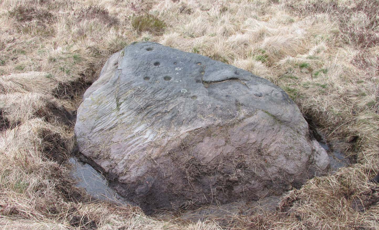
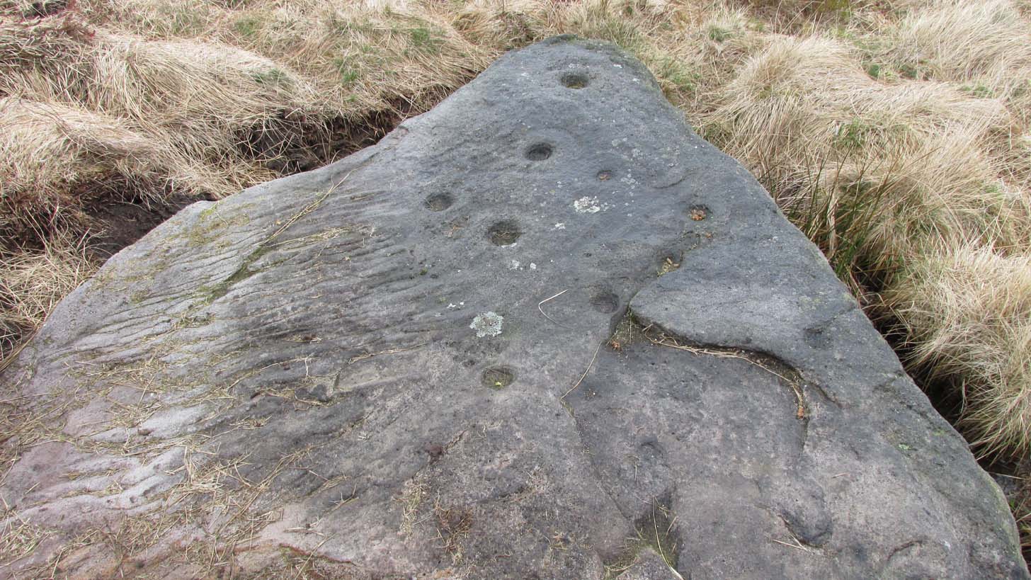
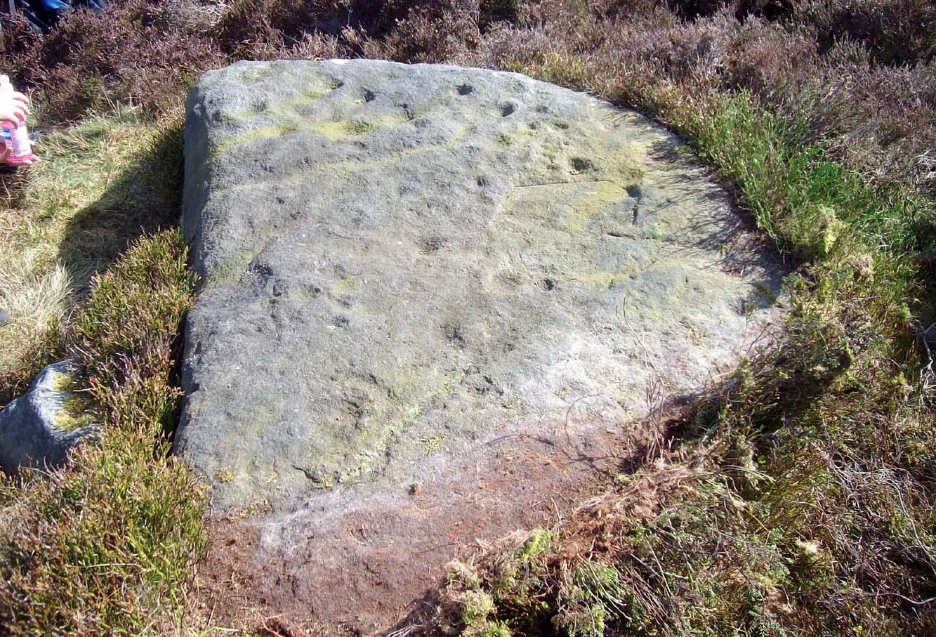
In the middle of Bridge of Earn village, take the Heughfield Road until, ⅓-mile on you hit the T-junction. Turn left along Forgandenny Road and go along the curvaceous road for just over a mile where you need to keep your eyes peeled for the small left turn that takes you up the dead straight road. At the top, turn left at the junction and go ⅔-mile, turning right at the next junction until after 400 yards you reach the houses on your right. Go up the footpath opposite the houses (south) until, after nearly 400 yards, it splits. Bear right and zigzag up the track for nearly a mile till you reach a large opening in the forest. 40 yards up the slope to your left is the stone—at last!
Archaeology & History
After the trail to get here, you might not be overly impressed by what you see – and it’s nothing special to look at to be honest. But its location is a good one: reasonably high up on a sloping plateau which would have given good views were it not for the surrounding forestry plantations. The only literary description of the site was the brief one in Discovery & Excavation Scotland, shortly after being rediscovered. Mrs Johnson (1960) wrote:
Close-up of the carving
“A cup-marked stone was found by Mr. J. R. Morrison on the N side of West Dron hill. The stone measures approx. 4ft long by 1ft 9in broad.
There are 17 cup-marks: five of which have channels, and two of which are joined in the form of a dumb-bell. The stone lies with its longer axis NE-SW, and its broad face uppermost.”
Its seeming isolation is a peculiarity that I don’t buy. Other carvings are going to be in the locale, probably on the same north- or north-east facing ridges – but due to the dense forestry, any other petroglyphs will remain hidden for quite some time…
References:
Johnson, M., “Dron, Perthshire,” in Discovery & Excavation Scotland, SRG 1960.
Acknowledgements: Huge thanks to Theresa Hughes for the use of her photos of this carving.
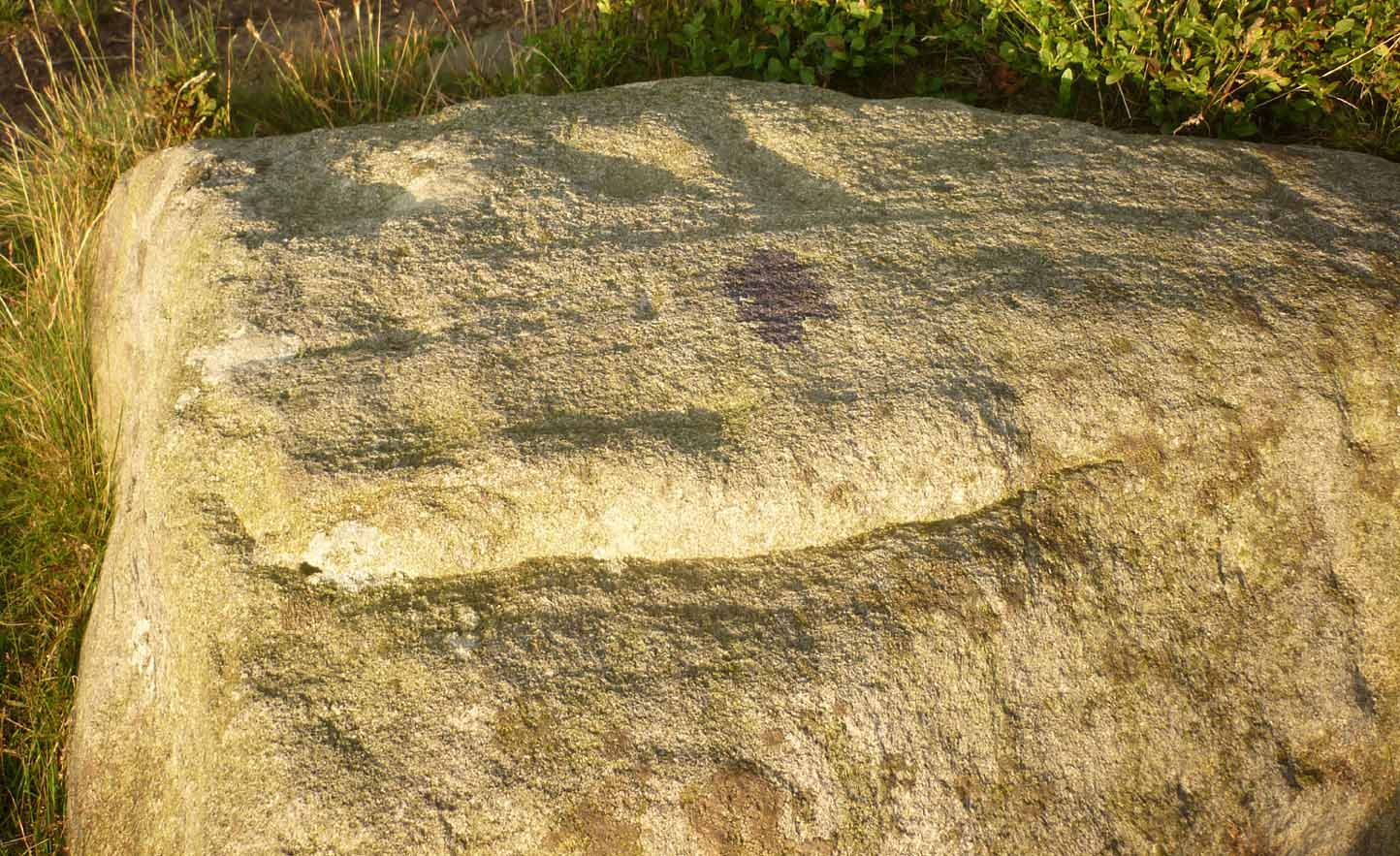
From Ilkley, go up to White Wells (ask a local if y’ get stuck) and walk round the back of the building. Walk to the trees and then follow the footpath up onto the moors; but after 70 yards a small footpath on your right goes up the slope. Take this and after about 90 yards it veers round to your left, following the contours up towards the copse of trees. Another 100 yards up it meets with another path and once here, just yards in front of you, right by the side of the footpath, is the stone in question.
Archaeology & History
First described in John Hedges (1986) survey, this simple cup-marked stone typifies many petroglyphs on these moors: a barely visible design much eroded by centuries of wind and water, with markings perhaps only of interest to the devoted student and explorer. But at least it’s a good place to sit, rest and watch the valley below.
Looking down at the cupsHedges 1986 sketch
This old fella looks to have only five cupmarks on its supper surface, one of which is elongated, as shown in Hedge’s drawing. However, when he saw this, he thought the elongated ‘cup’ consisted of three of them in a line, all linked up. He saw a “medium sized smooth grit rock standing in grass, its surface triangular in shape, with flat top sloping slightly N to S. Three cups connected by a groove, c. four other cups, all shallow and worn.”
This description was echoed in Boughey & Vickerman’s survey (2003), where they thought that the “triangular top surface has about seven worn cups, three connected by a short groove.” But if the light isn’t quite right, this can be very difficult to see.
References:
Boughey, Keith & Vickerman, E.A., Prehistoric Rock Art of the West Riding, WYAS: Wakefield 2003.
Hedges, John (ed.), The Carved Rocks on Rombalds Moor, WYMCC: Wakefield 1986.
Cup-and-Ring Stone: OS Grid Reference – NS 8551 8819
Archaeology & History
Looking down on C-7c
Near the northwestern end of the small geological ridge that runs to the west of Castleton farmhouse, close to an awesome nine-ringed carving, we find this more simplified triple-ringed petroglyph. And although the carving is easy enough to describe, its labelling (as ‘Castleton 7c’) is rather troublesome. As with other carvings in this locale, the name of the stone is based on a survey done by Maarten van Hoek in the mid-1990s. But van Hoek’s sketch of Castleton 7c and the one shown in our photos, whilst very similar, possess attributes that aren’t on van Hoek’s drawing. Now this isn’t too odd, as many petroglyphs look different when lighting conditions change; to the point where some features you can see one day are almost invisible the next. But this carving has attributes that are very difficult to miss – and van Hoek’s detailing tended to be good. But, all this aside: until we can verify with certainty one way or the other and despite my suspicions that this isn’t what van Hoek described, I’m still entering this carving as Castleton 7c. So – now that bit’s out of the way…!
When we visited the site two years ago the day was dark and overcast, so we didn’t really have good conditions for seeing any faint carvings. But this wasn’t faint, thankfully. It was completely buried beneath soil and gorse bushes, but thankfully Paul Hornby managed to unearth the one you can see in the photos. If it is the Castleton 7c petroglyph, it was rediscovered by van Hoek on one of his ventures here in 1985.
Carving showing wavy lines on right…and from another angle
When we visited the site we only managed to uncover a small section of the stone, as the roots of the surrounding gorse prevented us from seeing more. (it’s tough stuff unless you’ve got the right gardening equipment!) The section we uncovered consisted of a cup-and-triple-ring. This is consistent with van Hoek’s sketch and description; but we also found there were two very notable ‘arcs’ on the outer edge of the rings—nearly opposite each other—as if another, fourth ring had been started. You can’t really miss these elements – and even in the poor lighting conditions we had, these outer arcs are very evident on a number of photos – especially when they are expanded to full-scale. However, as I mentioned, we were unable to uncover all the rock; but when van Hoek was here there was far less herbage. What he saw on this carving was as follows:
“Deturfing part of this ridge revealed a fine cup with three rings with a broadly pecked tail; one solo cup; one large oval ring with small central cup; and a faint cup with two rings, the outer one incomplete. The rock slopes 12º ENE.”
Crap drawing done in crap lightingvan Hoek’s 1996 sketch
The “broadly pecked tail” he mentions is also not really clear in any of the 60 photos we took. There is a faint line that runs through the three rings, into the central cup and out the other side: a single curving line no less. It’s certainly visible, but it’s far from broad. But there are a number of other lines coming out of the rings. These maybe just natural scratch marks, or even scratches acquired from farming activity. It’s difficult to say. In the poor light that we had, there as looked to be a single cupmark a few inches away from the rings, but this isn’t consistent with the position of the cupmark on van Hoek’s sketch.
There’s a simple solution to all this: we need to revisit the site and expose more of the rock. At least that will tell us once and for all whether this is the same as van Hoek’s stone, or whether we’ve found yet another new carving. Watch this space, as they say! 😉
References:
van Hoek, Martin A.M., “Prehistoric Rock Art around Castleton Farm, Airth, Central Scotland,” in Forth Naturalist & Historian, volume 19, 1996.