For those who may not know, the terms ‘cairns’ and ‘tumuli’ are just prehistoric tombs. Another word we find as we move further north into Scotland is ‘cist’, which has a similar affiliation. A cairn is a pile of loose rocks and stones, which tends to be erected over a single or multiple burial or cremation – though without excavation we can never be sure which one it’s gonna be! A tumulus meanwhile (‘tumuli’ is the plural) is a heap of earth piled up over a burial or cremation. Small cairns and tumuli tend to cover single graves; whilst larger ones can have multiple burials therein. However we sometimes find that huge tombs have only one or two burials/ cremations inside. In such cases it’s likely that the people entombed there were of considerable importance: perhaps a tribal chief, a king, a queen, or powerful shaman. In many places across northern Britain, where there’s a profusion of cairns/tumuli we tend to find a good examples of prehistoric rock art, or cup-and-ring stones.
Along the A820 road between Dunblane and Doune, from the Dunblane-side, take the very first minor road on your right a few hundred yards after you’ve come off (or over) the A9 dual-carriageway. Go all the way to the very top of this long and winding road for several miles, until you reach the gate which prevents you going any further. Walk up the slope on your left (west) and you’ll see the large grassy mound a coupla hundred yards ahead of you. That’s it!
Archaeology & History
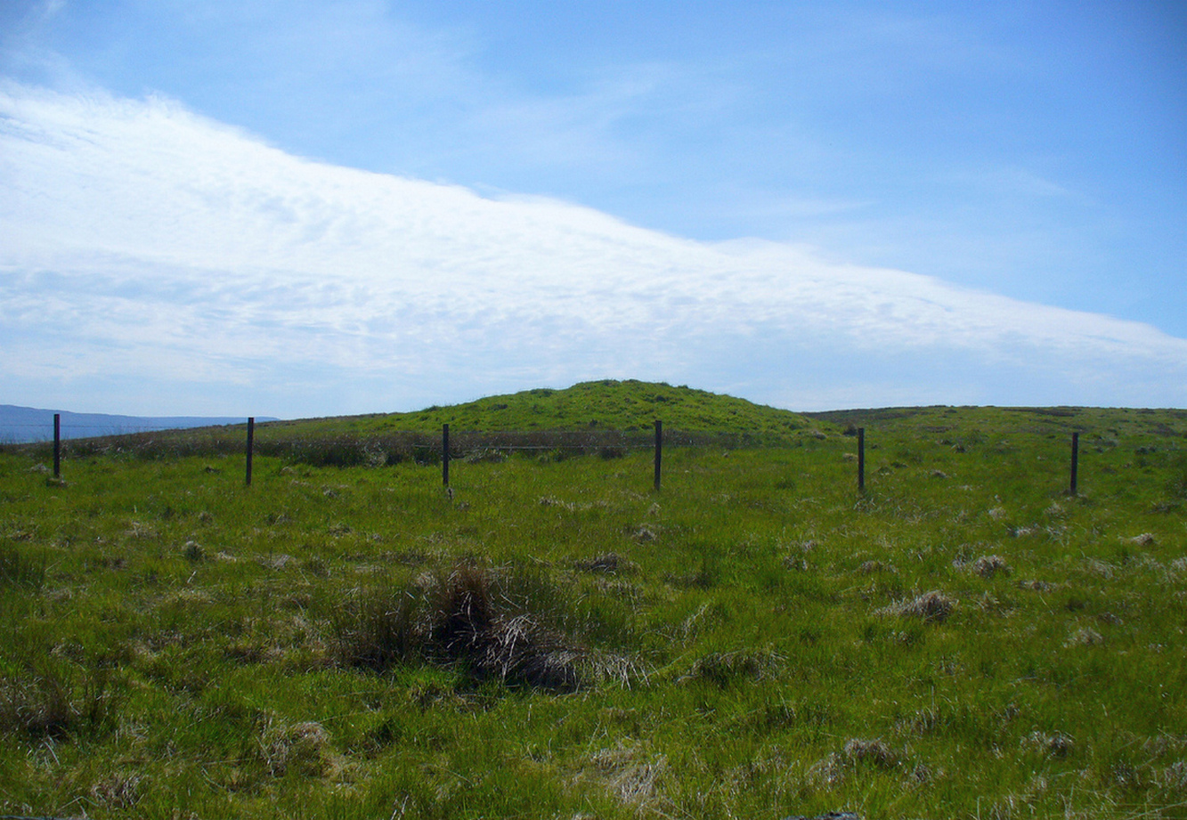
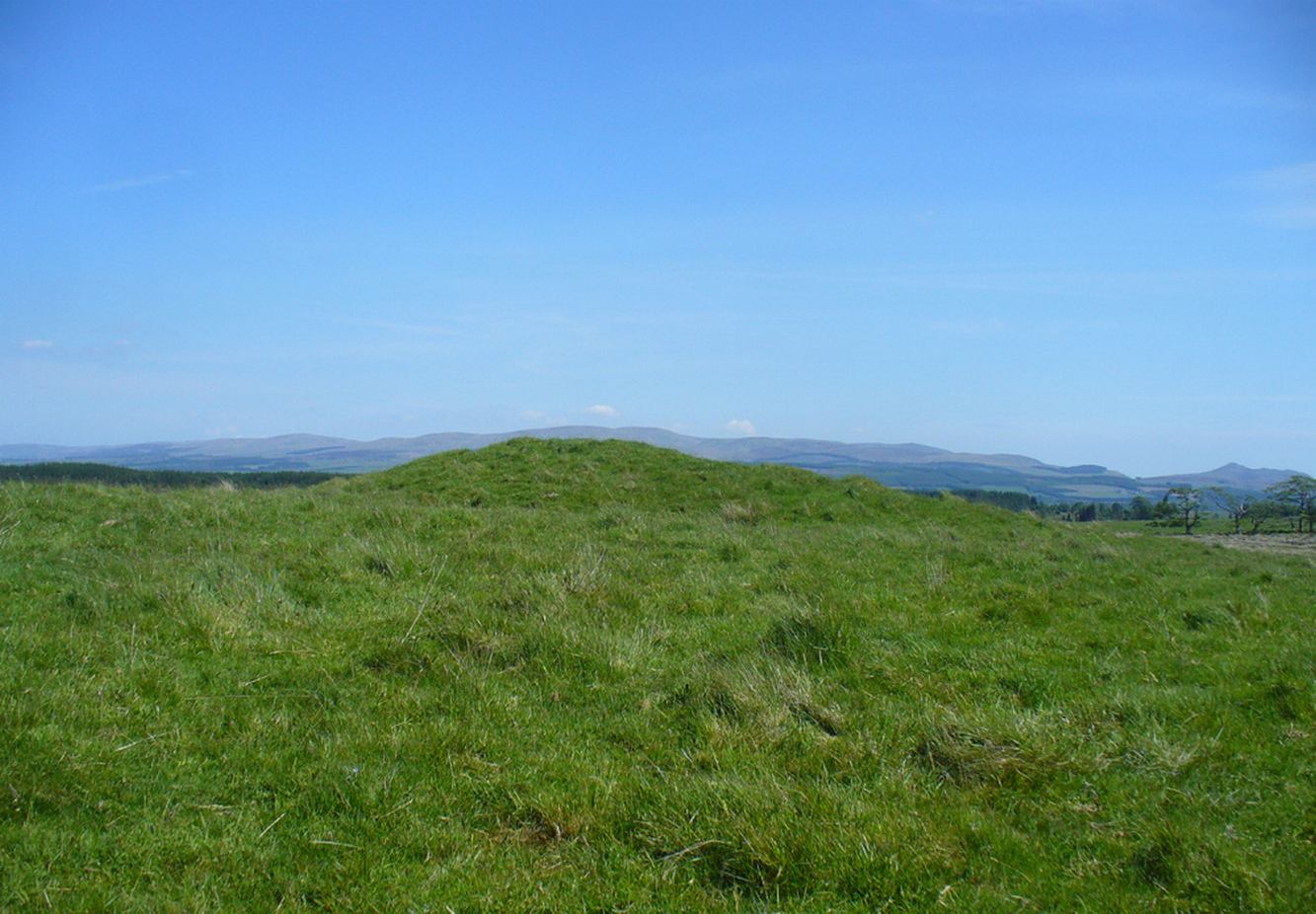
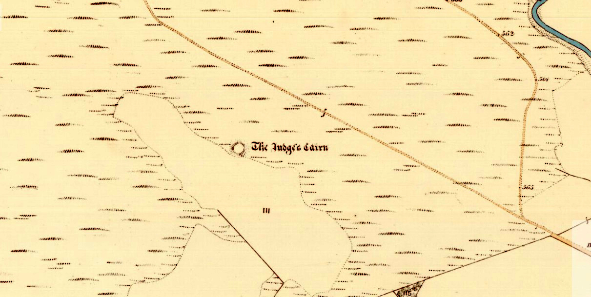
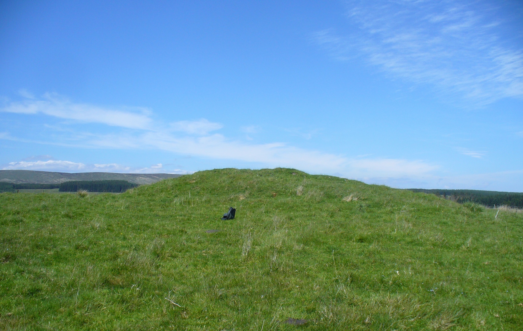
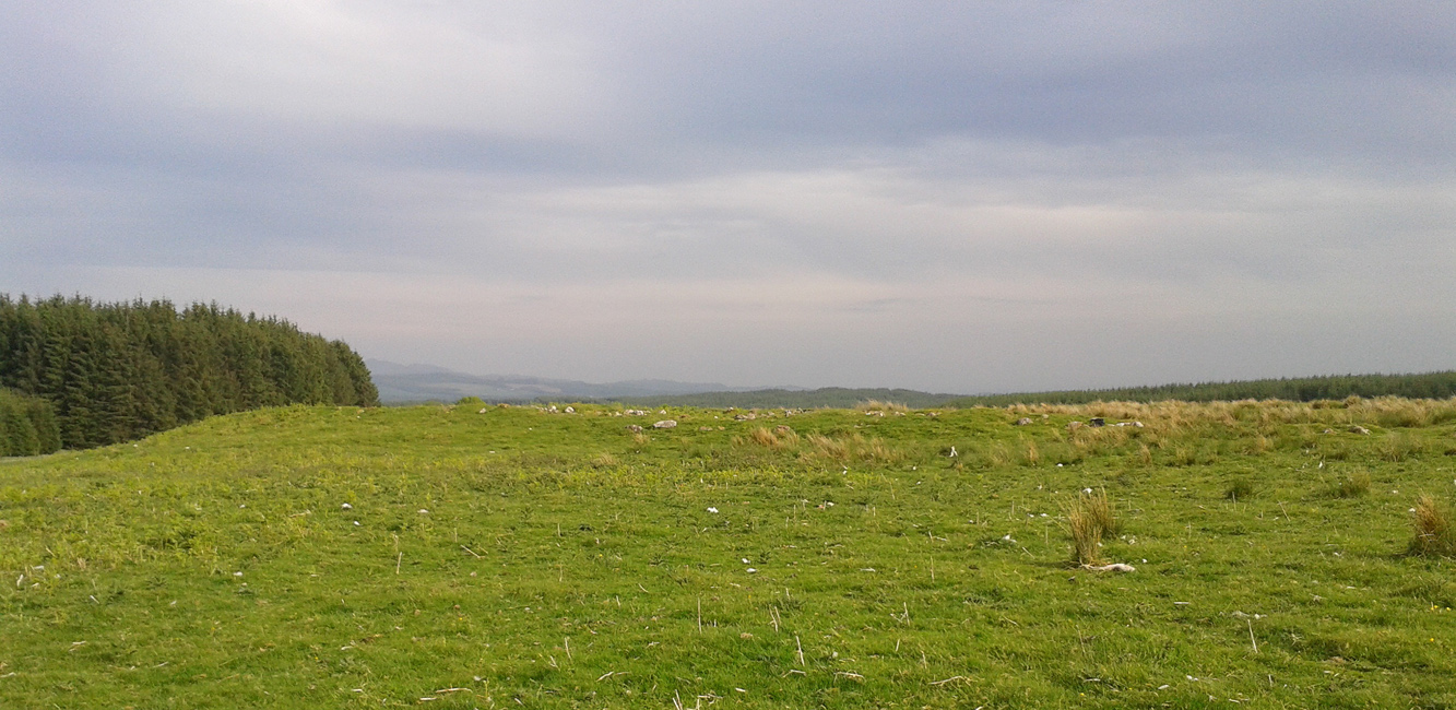
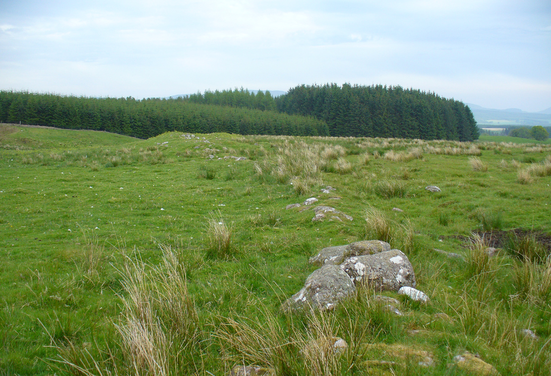
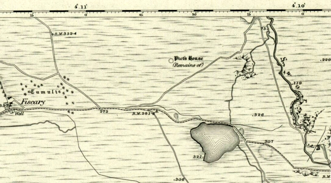
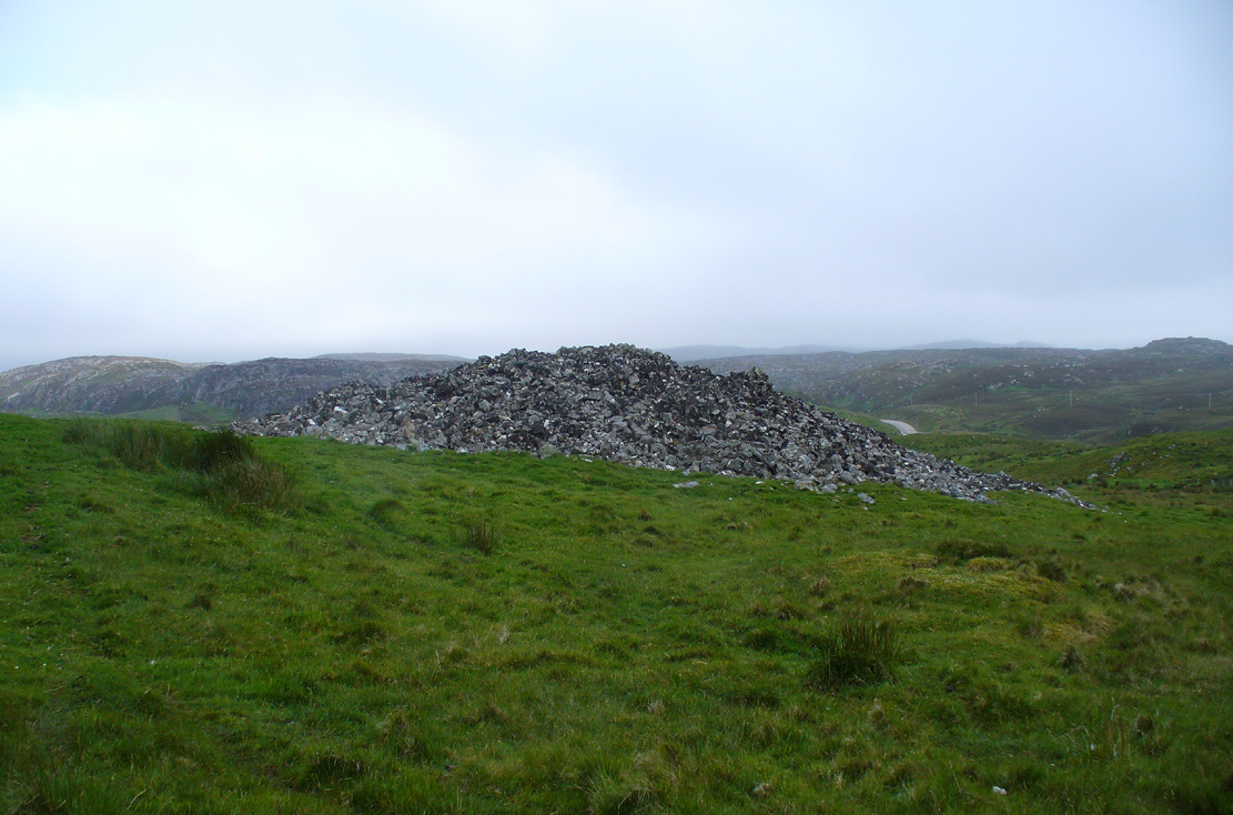
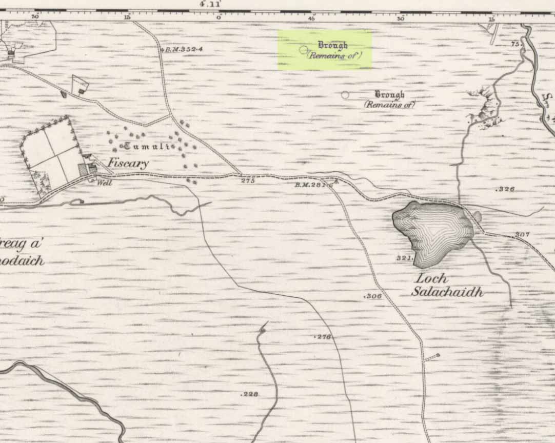
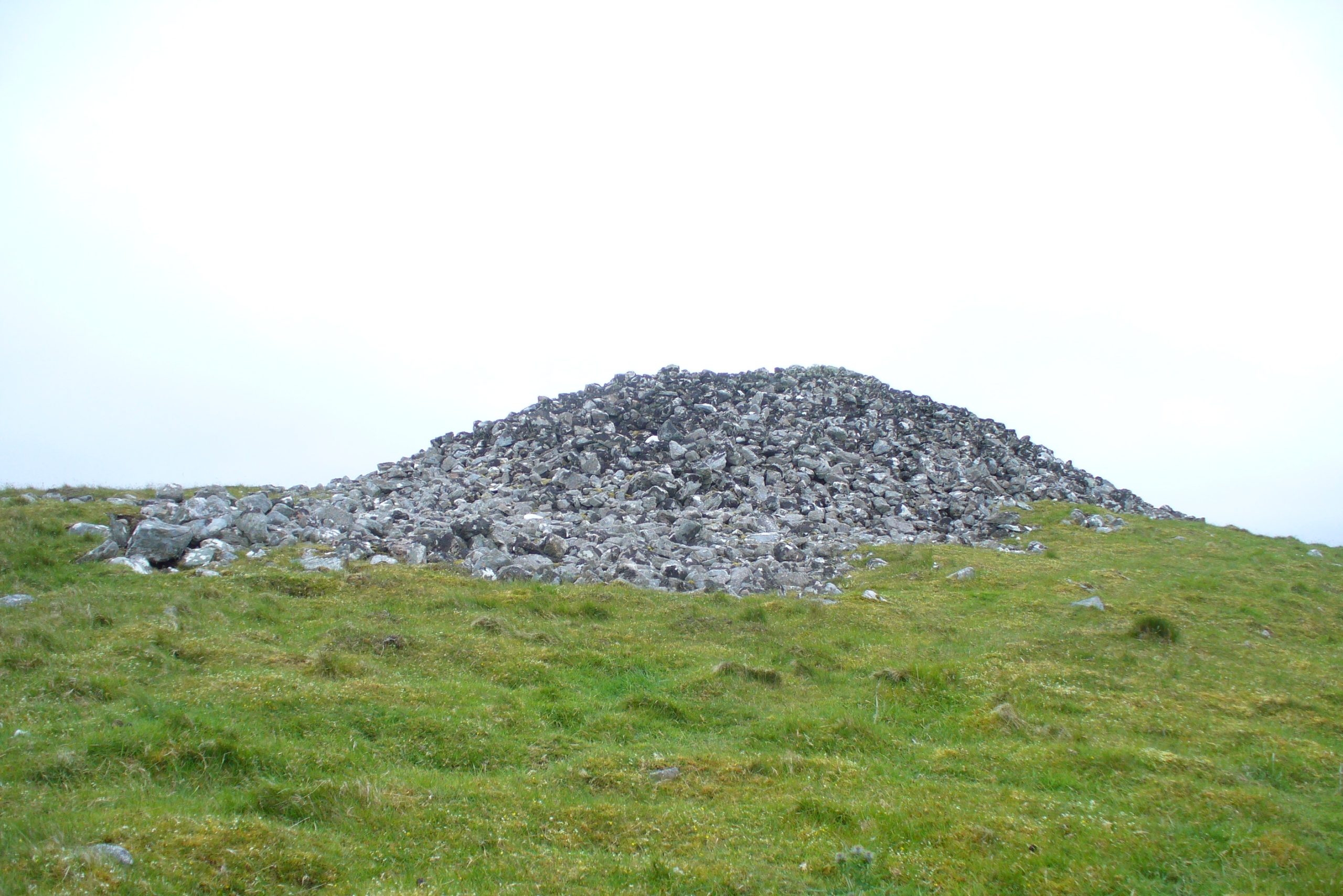
Highlighted on the first Ordnance Survey map of the area in 1862, this is a large rounded prehistoric cairn of some considerable size, whose position in the landscape allows for an impressive 360° view way into the distance in several directions—a deliberate ingredient, no doubt, when it came to building this probable tomb. I say “probable”, as there has never been a dig (not an ‘official’ one anyway) into the heart of this overgrown rocky mound.
Looking SE into the OchilsJudges Cairn on 1862 map
More than 60 feet in diameter at its greatest and 6 feet high, with a circumference of 67 yards (61m), the top of the mound has been disturbed and, clearly, has been dug into at some time in the distant past—but archaeohistorical accounts are silent on this matter. The first description of the Judge’s Cairn seems to have been in Peter Stewart’s (1839) notes on the local antiquities of Dunblane, where he described it most simply as:
“The Judges Cairn, yet undispersed, a circular heap of rough mountains stones covered with furze, on the farm of Bowie, barony of Kilbride.”
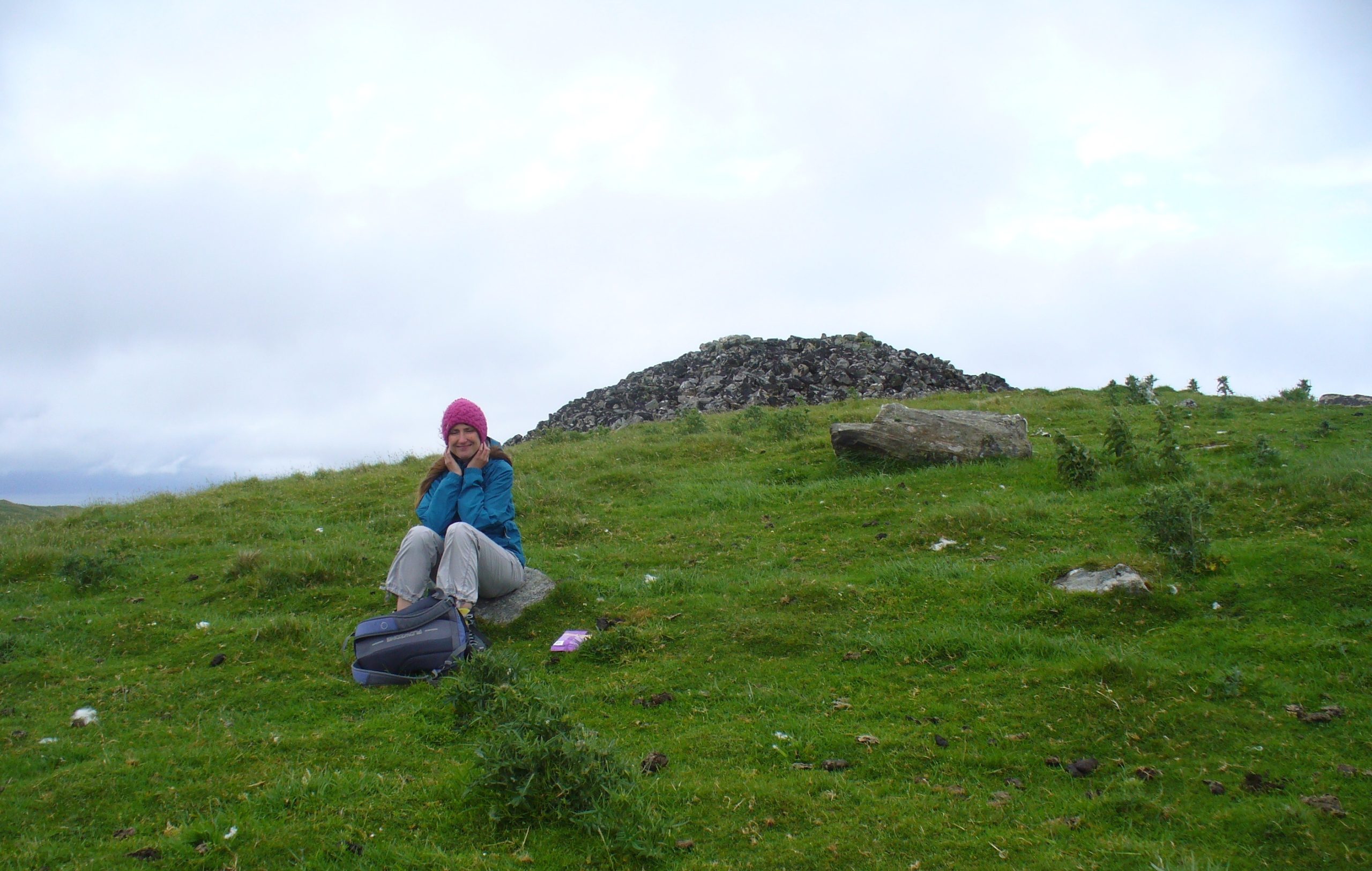
Along with the Ordnance Survey lads who came here in 1862, all subsequent visits gave rise to only short notes about the place. Odd, considering its size and distinct vantage point. And yet it remains hidden from view unless you come from the north, from whence that archetype of a fairy mound raises itself above Nature’s fair body into the eyes of any ambling wanderer…. A wonderful place to sit and dream for a while…
Folklore
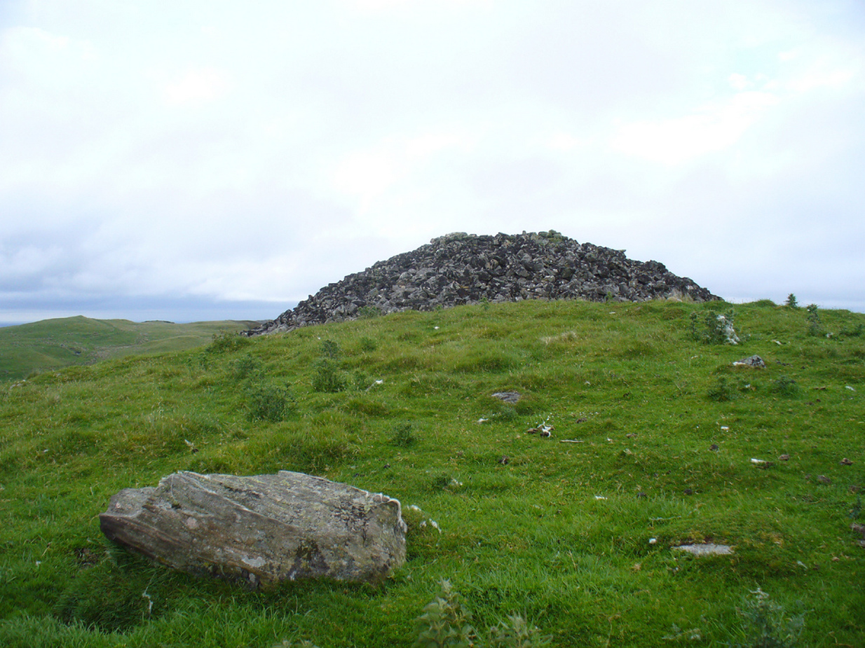
Judges Cairn, looking NE
We enquired with a local whose family had been resident here since the mid-18th century about the name and folklore of the site, but he said he knew of nothing. However, in earlier times it was said to be a place where the local sheriff held court and dispensed justice. Mr Mackay (1984) told that the site “has been connected with the Judge’s Seat at Severie” nearby. It seems possible that, as “it is just outside the parish boundary” between Doune and Dunblane, this may have been a moot site in ancient times, from whence laws were dispensed. Old perambulation records may, perhaps, prove fruitful…
References:
Barty, Alexander, The History of Dunblane, Eneas MacKay: Stirling 1944.
Royal Commission on the Ancient & Historical Monuments of Scotland, Archaeological Sites and Monuments of Stirling District, Central Region, Society of Antiquaries of Scotland 1979.
Take the B8033 north out of Dunblane and, immediately out the other side of Kinbuck, as you cross the river, take the first track on your left to Cromlix. Keep right along here to Cullings and beyond, till you reach the edge of the forestry plantation. Go left instead of going into the trees and, instead, follow the edge of the woodland for about 750 yards. You’ll see the land rise up on the other side of the stream and the huge length of stones thereby. That’s it!
Archaeology & History
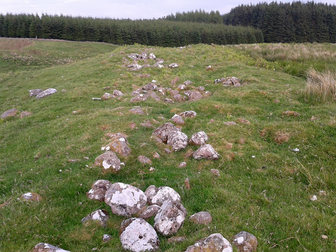
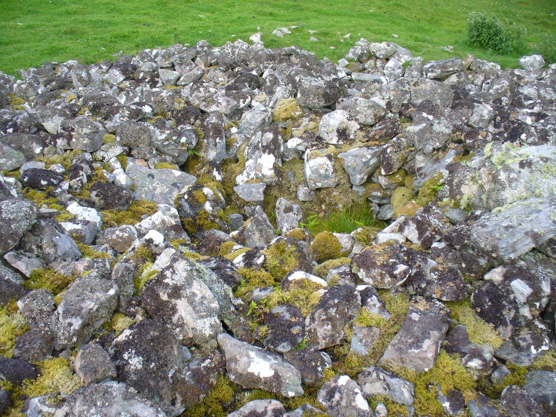
Main axis of the cairn
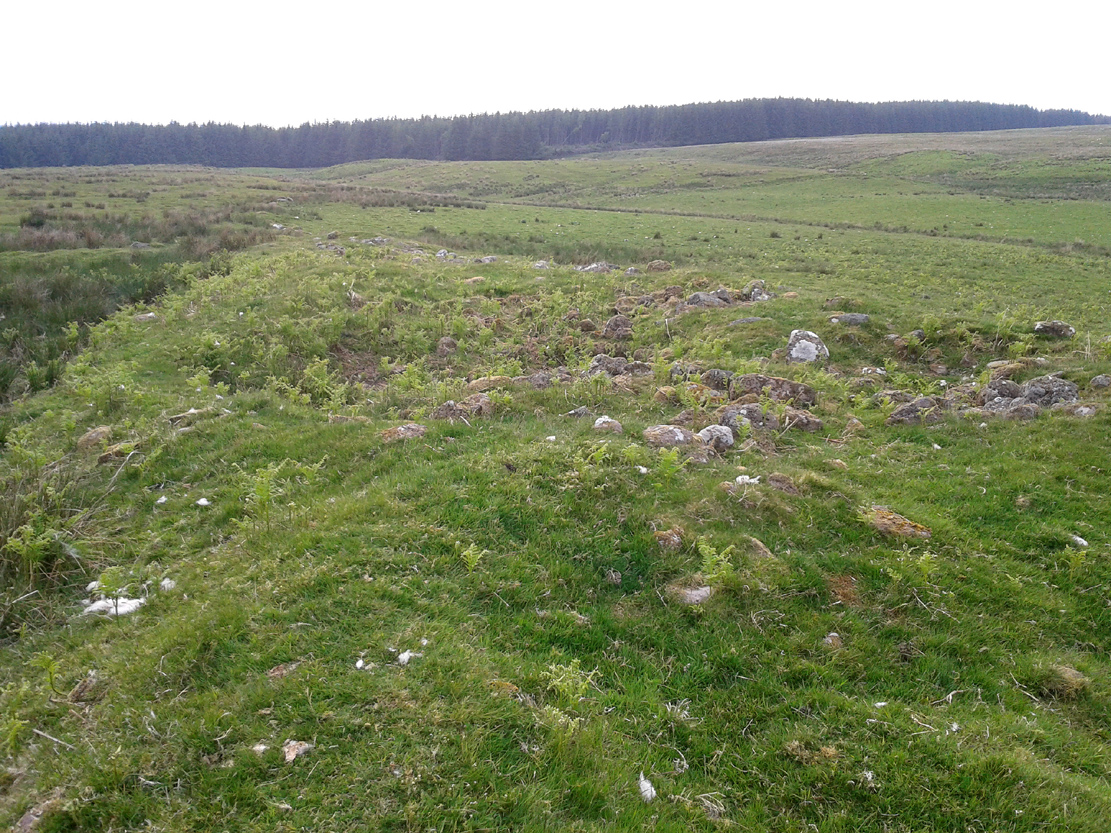
Not included in any major archaeology tomes, this giant long prehistoric pile of rocks—probably constructed in neolithic times—sits along the edge of a natural ridge, out of sight of all but the lone wanderer and the birds. Aligned ESE to WNW, this huge monument measures more than 61 yards (56m) in length and is 12 yards across at its present widest section. Much of the tomb has been severely robbed for stone in making the local walling: two of which emerge out of the structure itself—one running directly downhill from its larger eastern edge, and a more extensive wide line of walling running west and northwest for quite some distance. This western section of walling has the hallmarks of being constructed as far back as the Iron Age, which may be when the initial destruction of the chambered cairn first started. But, until we get an excavation here, we won’t know for sure.
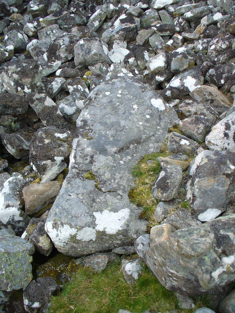
Portion of the central mass of stones
Western wall leads to the cairn
The next closest tomb of any great size is the Judge’s Cairn, 1½ miles (2.4km) to the southwest. Clusters of smaller single cairns exist about nearly a mile northwest, with prehistoric settlement traces accompanying them—but nothing seems in immediate attendance to this Cromlix giant.
Other sites, obviously, await discovery in this area. We know that a spring of water roughly 50 yards east of here was used by so-called ‘witches’ in earlier centuries, for both healing and sympathetic magick. Whether this tradition ever had any relationship with the cairn is difficult to say.
References:
Royal Commission Ancient & Historical Monuments of Scotland, Braes of Doune: An Archaeological Survey, Edinburgh 1994.
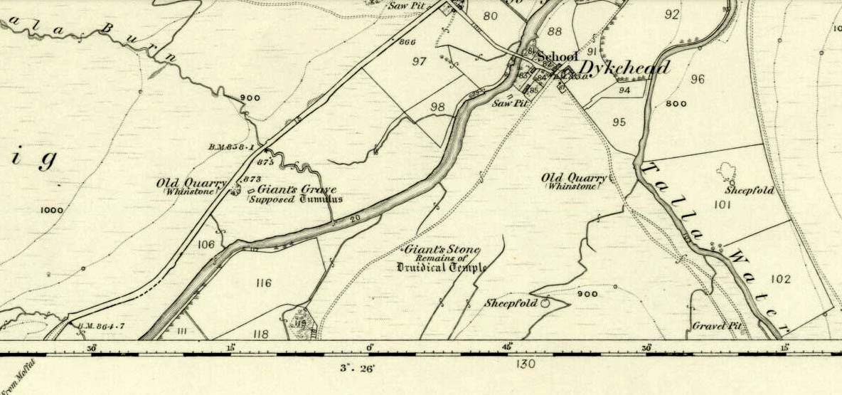
Marked on the 1865 OS-map as a “tumulus”, it was destroyed by some idiot in 1818 due to some basic lacking; but we can see from the old map how close it was to the Giant’s Stone on the south-side of the River Tweed, to which it may have had an archaeological connection with. When it was destroyed, the New Statistical Account in 1845 described there being a six-foot long stone coffin (cist) beneath the tumulus, containing the usual burial urn.
Folklore
When the 18th century writer Alexander Pennecuik (1715) wrote about this old tomb, he narrated the tradition of the site as told him by the local people, telling:
“….upon the head of a burn on the south side of Tweed, stands the old-house of Hawkshaw, belonging (to) Porteous, from a numerous race of Ancestor’s Chiefs of that surname. Over against the foot of Hawkshaw-Burn in a Kairn beside the High road is the Giants Grave, so called from a huge and mighty Fellow, that robbed all on the way, but was at length from a Mount in the over side of the River supprised and shor to Death as Tradition goes.”
Tumulus (destroyed): OS Grid Reference – NT 3076 7177
Archaeology & History
Long since gone, this little-known burial mound could once be seen not far from the old mansion of Niddrie House. The only reference I’ve found of it is in Thomas Whyte’s (1792) early essay on the parish of Liberton, where he told:
“East from the house and plantations, and on the north side of the public road, is a rising ground, or tumulus, called the Law Know, where, in more early times, judgment was dispensed, and where, probably, certain acknowledgments were made, by those who held of the baron or family. It is of a circular form. And this is the cafe with all places of the same kind. For they were considered as emblems of the sun, that great object of Druidical worship.”
The site appears to have been destroyed when the Industrialists blasted their quarry here and, as historians well know, quarrymen are dreadful when it comes to making notes of anything! Any additional info on this place would be good….
From Broadford town, head northwest outta town up the A87 for a mile, turning left and stopping by the electricity station just 100 yards along. Follow the line of cables down, SE, through the trees, dead straight for about 600 yards (crossing the large stream about halfway) till you notice an open gap through the trees on your right where, 40 yards in, there’s a large circular arena which has been kept aside amidst which a scattered mound is clearly visible. In this opening in the trees…this is where the tomb/s rest…
Archaeology & History
Sited a mile east on lowlands beneath the shadow of Beinn na Cailleach mountain, with its host of heathen legends and lore, is reputed to be the prehistoric remains of an important ancestral burial site, under dominion of the cailleach’s eye. In Audrey Henshall’s (1972-2) magnum opus she describes the remains of what may be two separate tombs here as “difficult to interpret”; even “questioning whether they do in fact represent the ruins of a chambered cairn” as has been ascribed. The site is still included in the Canmore survey, where they cite the same reference as I do here, but add no additional data to Henshall’s query. There is obviously something to be seen here, but until excavation of the site has been done, the exact nature of what lies here cannot be clarified. Miss Henshall wrote:
“There is a setting of stones forming about a third of the west side of a circle which would have a diameter of about 30ft if complete; its greatest N to S measurement is 23ft. The stones are thin slabs 4 to 5in thick, up to 3ft 6in long, set on their long sides and projecting up to 2ft above the turf. The stones have probably been reduced in size due to natural fracturing as the stone readily flakes away. Within this setting, which might be interpreted as the kerb of a cairn, there is a rise of about 1ft above ground level and the grass grows greener, but except for this and a number of boulders lying about the site, there is no sign of cairn material. This is curious as there is no obvious reason for removing it.
“Inside the ‘kerb’ there is a horse-shoe setting of five similar slabs, just visible except for two on the S side which project 1ft 2in due to some peat on their N side having been removed. The enclosed area is 7ft wide by 7ft 6in long, open on the E end. On this side, 14ft from the W end of the setting, is a larger stone, set on end, 2ft 8in high. This might be regarded as a portal stone except that it is set opposite the centre of the open end of the horse-shoe setting, and there is a low thin slab projecting westwards from the middle of its W face. E of this there lie a number of flat slabs and boulders, the larger (some measuring 3ft 8in by 3ft and 4 by 2ft) marked on the plan, but they do not suggest the form of the original structure.
“A stone is set radially to the kerb, 15ft 8in to the N. It is on its long edge, 4ft 11in long and 2ft 2in high. Twenty eight feet S of the kerb there is a circular setting of small boulders, 6ft 6in across inside, and part of another concentric setting can be traced 6ft outside these.”
References:
Henshall, Audrey, The Chambered Tombs of Scotland – volume 2, Edinburgh University Press 1972.
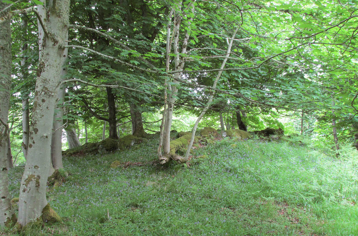
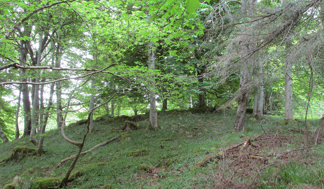
I approached this by walking along the B8438 road northwest out of Tongue village, towards the road-crossing over the Kyle of Tongue. There’s a small tiny road on the right (easily missed) nearly a mile out, just as the road starts to bend, which leads you down to Tongue House. Go along here for about 325 yards (300m) and just as the road bends to the left, walk into the woods. Keep straight forward, following the low-level stream, and when you see the buildings ahead of you, veer diagonally upslope until you hit the large Tongue Burn. Cross this and walk uphill to the tree-covered knoll ahead. You’re there!
Archaeology & History
…and again, looking north
From the descriptions I’d read of this site, I wasn’t expecting much at all—but it was much better than I anticipated, and in a beautiful woodland setting too. Admittedly the site is much overgrown, but the overall size, edges and outline of the tomb is easily discernible. In pacing across it, from outer-edge to outer-edge, it measured 18 yards by 19 yards across. All round the edges are many overgrown tumbles of smaller rocks which obviously had been part of the cairn in previous centuries; but it is primarily defined by the larger earthfast rocks at the very top of the natural knoll in the trees, all of them covered in deep mosses.
The site was first mentioned in James Horsburgh’s (1870) survey of the region. He explored a small section of the monument and, upon digging, found a chamber therein—defined by Audrey Henshall (1963) as “a single compartment chamber”—telling us:
“A little to the south of Tongue House, and near the fountain head that supplies it with water, there is the chamber of a cairn of the same description as that near Skelpick, but rather smaller; on clearing it out, I found that one of the large upright stones had two holes bored artificially a short way into each of its sides, but not quite opposite, the holes were about 3 inches diameter.”
However, these internal structures have not been seen since and in Henshall & Ritchie’s (1995) catalogue of Sutherland’s giant tombs, there is some confusion over the definition of the structure itself, questioning whether or not it was indeed a chambered tomb.
“The ‘chambered cairn’ is a circular stone structure overgrown with small trees and covered in leaf-litter and moss. A kerb about 15m in diameter can be traced for much of the circuit. The kerb is of unusually substantial and closely-set boulders which have the appearance of the base of a massive wall such as is inappropriate for a dun or a broch rather than a cairn. The interior is filled with loose stones including some quite large boulders, roughly to the level of the top of the kerb. There is no indication that these boulders have formed part of a neolithic chamber or that the structure was a cairn. There seem to be three possibilities: that the structure is not Horsburgh’s cairn; that the structure is that which he investigated but that he was mistaken in regarding it as a chambered cairn; that the writers are mistaken in identifying the structure as a ruined broch or dun.”
Despite this, the general consensus today is that the monument is indeed a chambered cairn.
References:
Henshall, Audrey S., The Chambered Tombs of Scotland – 2 volumes, Edinburgh University Press 1963 & 1972.
Henshall, Audrey S. & Ritchie, J.N.G, The Chambered Cairns of Sutherland, Edinburgh University Press 1995.
Royal Commission on Ancient & Historical Monuments, Scotland, Second report and inventory of monuments and constructions in the county of Sutherland. HMSO: Edinburgh 1911.
2 cairns in line of 3, Manse Bridge (photo Sarah Maclean)
Along the A836 road between Durness and Tongue, take the minor road north to Melness and Talmine. 400 yards or so past Talmine Stores shop, walk left up the track onto the moor. Follow the track along as if you’re visiting the Talmine West settlement, but walk uphill onto the moor a hundred yards or so after the sheep-folds on your right. Before the top of the hill, keep your eyes peeled for the heather-covered rocky mounds in the moorland scattered about. You’ll find them!
Archaeology & History
A cluster of prehistoric cairns—or a cairnfield as it’s known— is found on the moorland scattering the south and eastern edges of the unnamed hill immediately west of Talmine. They can be pretty difficult to see when buried in heather, but they’re there! When Sarah Maclean took us up to see them, three in particular stood out: seemingly along a deliberate line, perhaps parallel with either an old trackway or old walling on the south slope of the hill.
Central cairn in line of 3 (photo by Sarah Maclean)
Central cairn hollowed out (photo by Sarah Maclean)
The main three that we visited were pretty easy to locate, with many loose stones comprising the respective piles, standing about 3 feet high and some 3-4 yards across. One of them (left) had been dug into, leaving a deep hollow in its centre, leaving it more exposed and visible than the others. There are other cairns on the slopes to the east, but none seemed to be as well-defined as the three here described.
In the same area are also a number of hut circles, much overgrown but still visible amongst the heather.
References:
Welsh, T.C., ‘Manse Bridge – Small Cairns, Hut Circles’, in Discovery & Excavation Scotland, 1973.
Acknowledgements: Huge thanks to Donna Murray of Borgie for putting me up (or should that be, putting up with me?!) and equally massive thanks to Sarah Maclean—also of Borgie—for guiding me up here and allowing us use of her photos to illustrate this site profile.
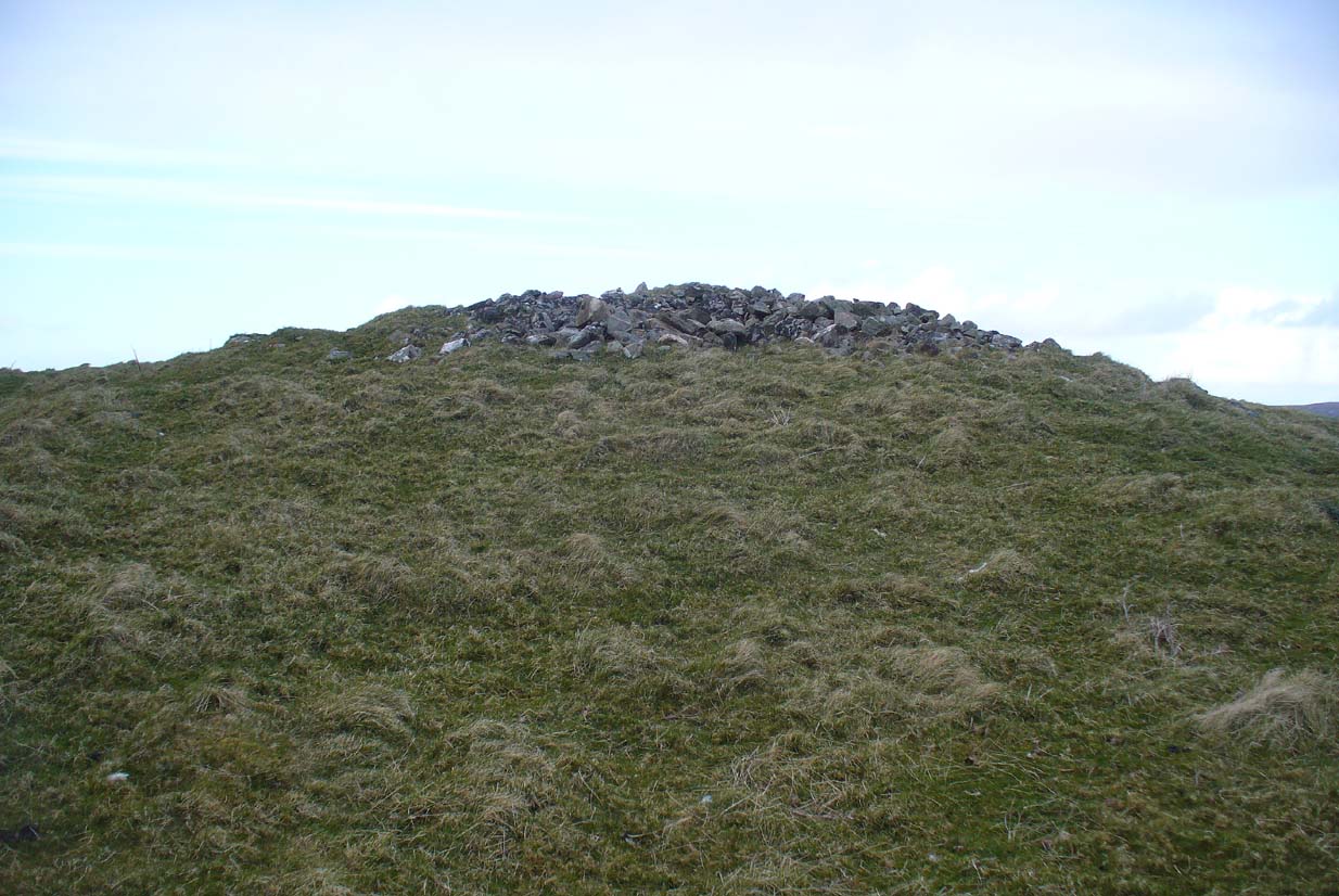
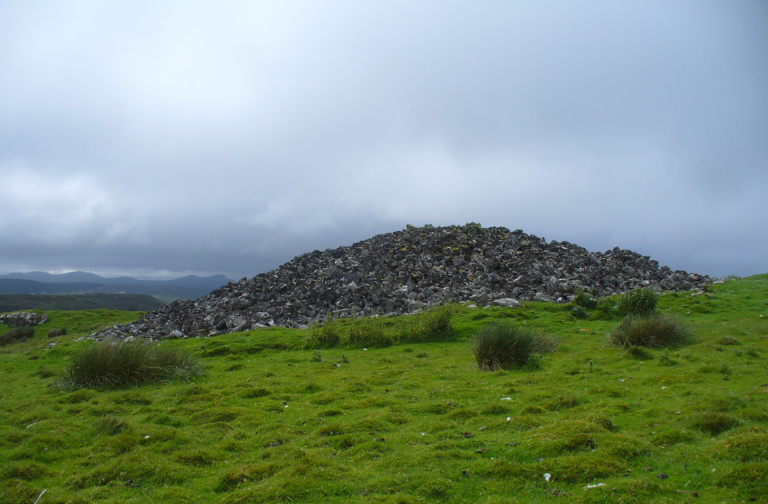
A mile east of Bettyhill on the A836 road, watch for the large piles of rocks up on the hill on your left (north). Turn left on the tiny road past the first house for 150 yards and then on the track past the sheep-fanks through the gate and up the small hill. The cairn is the smallest of the pile of rocks in front of you.
Archaeology & History
Of the four giant cairns clustered here at Fiscary, a mile east of Bettyhill, this one has received the least attention. It is found amidst a massive cluster of archaeological remains running from the 19th century all the way back into the neolithic period. Quite impressive!
Sitting on top of the cairn the view is impressive: looking 360º with the Orkney islands s to the northeast, Durness and the rising mountains west and southwest, and endless craggy moorlands peppered with lochans driving in all directions to the south countless miles away. This panorama of wilderness is something to behold…
Looking west out to sea
Looking southwest
The tomb itself, with the acceptable scatter of fallen rocks to the edges, is nearly 50 yards in circumference, measuring more than 12 yards east-west and nearly 14 yards north-south, with the Earth covering the older rocks to the edges with more and more vegetation as the years pass. It stands about 5-6 feet high with the typical internal mass of thousands of stones making up the cairn. No known excavations have ever been made here.
In the otherwise superb Royal Commission (1911) survey of Sutherland, they only had scant information to say about this tomb, telling that,
“The fourth cairn…measures 28′ to 30′ in diameter and is about 6′ high. There are no signs of chambers visible and the cairn has been a good deal dilapidated.”
Even when R.J. Mercer (1981) came to give this area greater attention, he passed by the Fiscary 4 cairn with equal brevity, noting simply its dimensions, elevation above sea level and the fact that it is a “circular cairn on crest of hill.”
The tombs of Fiscary 1, 2 and 3 are very close by some beginning some 257 yards (235m) to the east. I cannot recommend this entire complex highly enough!
References:
Henshall, Audrey S., The Chambered Cairns of Sutherland, Edinburgh University Press 1995.
Mercer, R.J. & Howell, J.M., Archaeological Field Survey in Northern Scotland – volume 2, University of Edinburgh 1981.
o’ Reilly, Kevin & Crockford, Ashley, What to See Around Bettyhill, privately printed 2009.
Royal Commission on Ancient & Historical Monuments, Scotland, Second report and inventory of monuments and constructions in the county of Sutherland. HMSO: Edinburgh 1911.
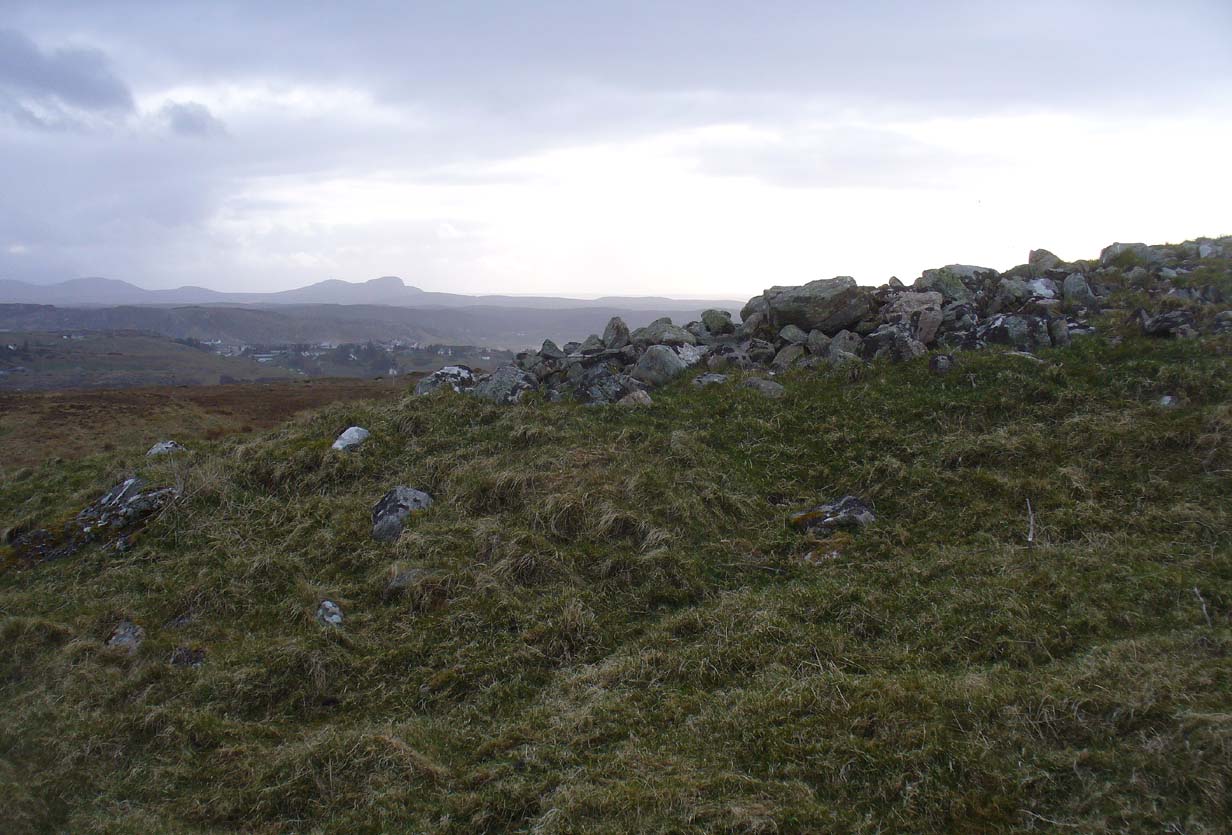
Along the A836 road from Bettyhill to Thurso, a mile east of the village keep your eyes peeled to your left (or to the right if you’re coming the other way!), looking north, and you’ll see some very large piles of stones a few hundred yards away. Go through the gate onto the rough grasslands and the first one you reach is the cairn in question. Y’ can’t miss it!
Archaeology & History
On 1878 OS-map as Picts House
Close to the Fiscary 1 and Fiscary 2 tombs, this is the third and southernmost of the three giant cairns on this moorland hillside and is the second largest of the trio. Curiously it was the only one highlighted by the Ordnance Survey lads in their cartographic analysis here in 1873—they somehow missed the others—when they told it to be a ‘Pictish House’, or broch. A few years later when the Royal Commission (1911) fellas got their noses up here, they said that this,
“which is the most easterly, is circular in form, is about 68ft in diameter, and 15ft 6in to the apex, on which a small pile of stones has recently been erected. The cairn does not appear to have been excavated, but the stones in several places have been pulled out, probably in attempts to discover the chambers or in pursuit of rabbits.”
Looking into its centre
Long stone at southern edge
Considering the size of this giant cairn and its close association with is neighbours 150 yards northwest, I’m surprised at the lack of attention it’s been given. Within the collapse of stones on its southern-side we find an elongated stone which seems to have stood upright at some point in the past, either at the very edge of the cairn, or just inside it. It may even have been a covering stone to a collapsed entrance, but without an excavation we’re not gonna know for certain.
The fact that this cairn is on the slopes south of the crowning cairns of Fiscary 1 and Fiscary 2 implies that this was built some centuries later than them. Also notable here is that the view to the north is blocked and we are instead only looking across a panorama east, south and west.
Folklore
Looking across into the east
Local tradition told that this was a Pict’s house, or broch (it may well have been) and is shown as such on the first Ordnance Survey account of the region in 1878. Otta Swire (1963) told that this landscape was once peopled by giants who made the land and played a part in the creation of some of the giant tombs around here. One time local school-teacher at Bettyhill, Alan Temperley (1977) also told us how the fairy folk lived close to the giant tombs of Fiscary.
References:
Gourley, Robert, Sutherland: An Archaeological Guide, Birlinn: Edinburgh 1996.
Henshall, Audrey S., The Chambered Tombs of Scotland – volume 1, Edinburgh University Press 1963.
Henshall, Audrey S., “The Distant Past,” in The Sutherland Book (edited by Donald Omand), Northern Times: Golspie 1991.
Henshall, Audrey S., The Chambered Cairns of Sutherland, Edinburgh University Press 1995.
o’ Reilly, Kevin & Crockford, Ashley, What to See Around Bettyhill, privately printed 2009.
Royal Commission on Ancient & Historical Monuments, Scotland, Second report and inventory of monuments and constructions in the county of Sutherland. HMSO: Edinburgh 1911.
Sutherland, George, Folk-lore Gleanings and Character Sketches from the Far North, John o’ Groats Journal: Wick 1937.
Temperley, Alan, Tales of the North Coast, Research Publishing Company: London 1977.
Acknowledgments: HUGE thanks to Aisha Domleo and for getting me up here.
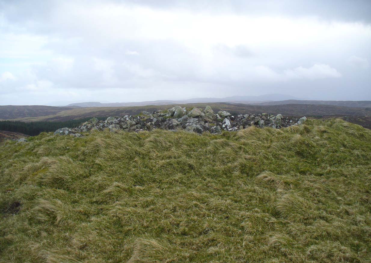
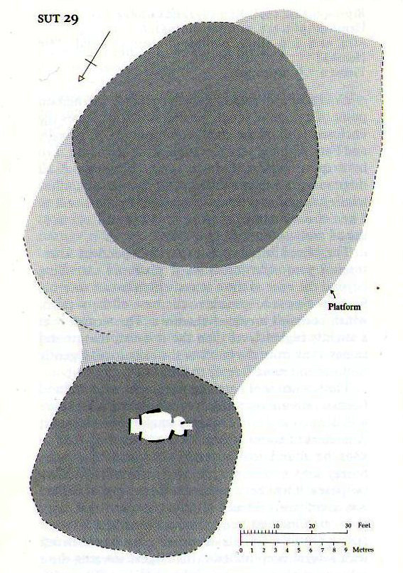
A mile east of Bettyhill along the A836 road, watch out for the large piles of rocks up on the hill on your left (north). Go through the gate, past the Fiscary 3 cairn and 150 yards northwest you’ll reach the crowning cairn on the hilltop itself – the Fiscary 2 cairn.
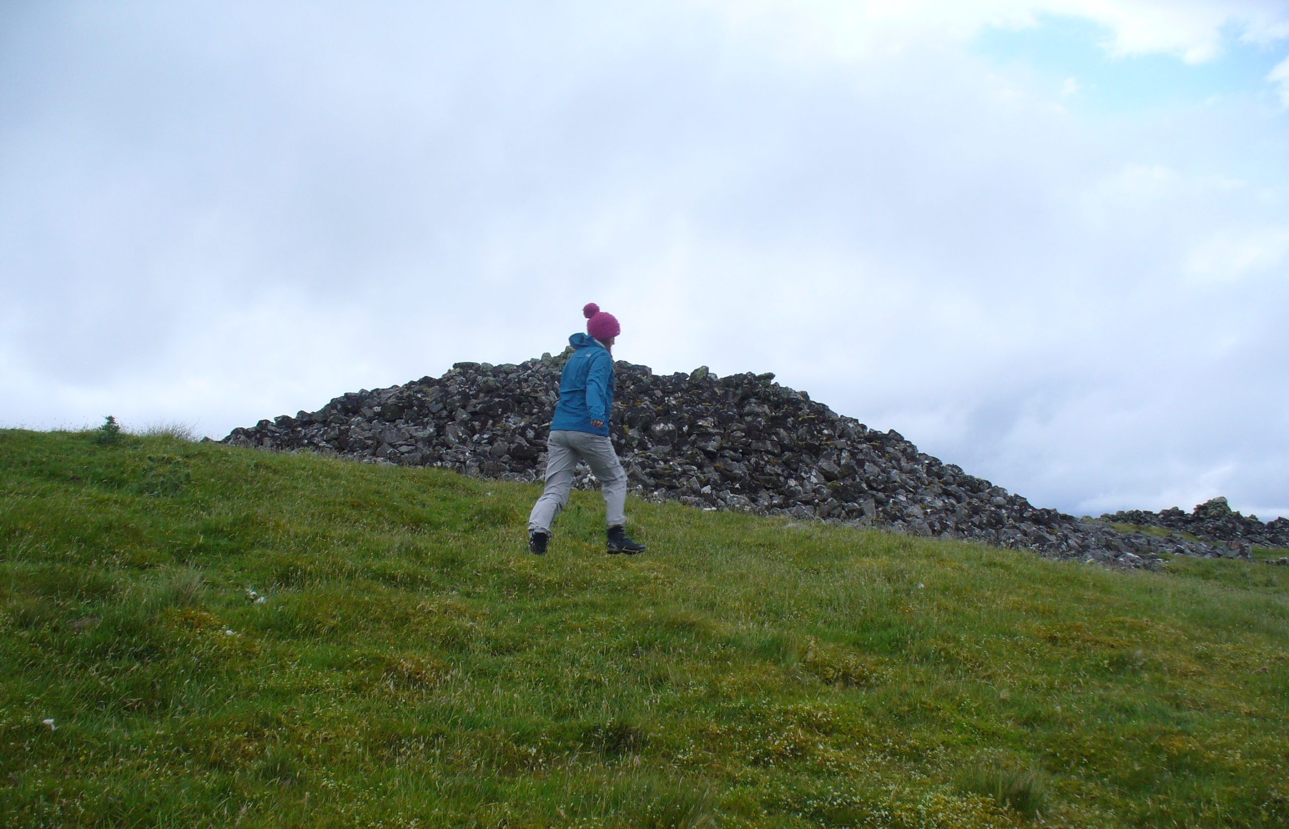
Archaeology & History
Fiscary 2 cairn, looking NW
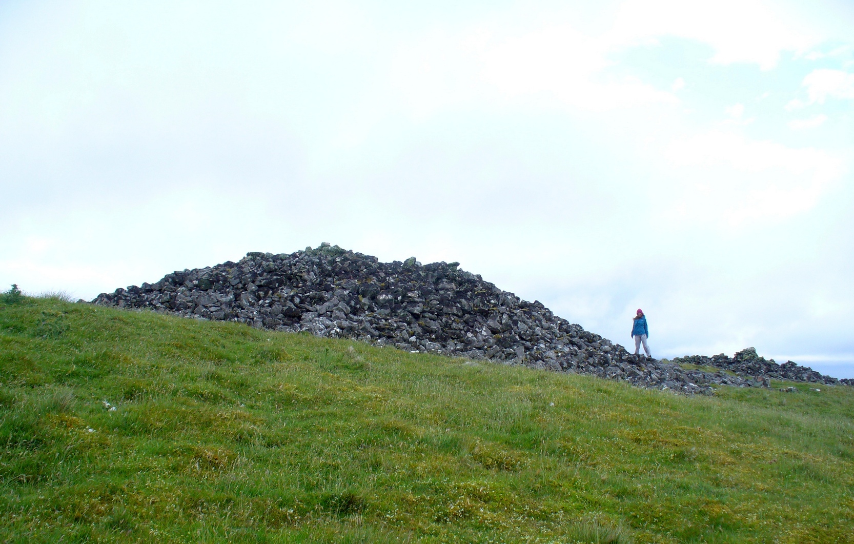
The second of the three giant chambered cairns on this moorland hillside is the largest (only just!) of them all. Positioned right on top of the small hill, this great mass of rocks stands out from the roadside a quarter-mile to the south quite blatantly, yet it somehow evaded the eyes of the early Ordnance Survey lads in their visit here in 1873 (though the nearby Fiscary 3 cairn was plotted). Odd…
Aish by the side o’ the cairn
When I came here with Aisha and her clan a few weeks ago Nature was blasting us with full gales and so half her bunch returned after a short while, leaving us to get thrown about in the winds! Even just trying to stand upright on this and its associated tomb proved difficult. But despite this and the low grey clouds—typical of northern Scottish weather—it was obvious that the views from here would be superb, seeing far into the distance with a 360º view. I have little doubt that other important prehistoric sites would be speaking with this giant neolithic cairn, but there is nothing in the archaeology accounts to help us on such matters.
The giant tomb is almost linked to its companion—Fiscary 1—by a low scatter of rocks running between them, with only a yard or two separating their disturbed masses. Several archaeology students have posited that the two seemingly separate sites were, many thousands of years ago, perhaps one elongated chambered tomb, just like the ones found nearby at the Coille na borgie and Long Skelpick cairns; but it seems unlikely in this case…
Fiscary (2) on 1908 mapFiscary (2), looking SE
Although Adam Gunn (1893) mentioned the “four large cairns” at Fiscally (the fourth and smallest is 262 yards to the west), the first real description I can find of the place comes from an article by a local man called Cathel Kerr (1892) who told us it was “about 220 feet in circumference, and 15 or 16 in height”; but most of his article dealt with his excavation into the adjacent Fiscary 1 tomb, which he noticed was connected by a stone platform that ran between the two sites. This was the first mention of such a connecting platform—and a curious feature it is indeed. When the Royal Commission lads came here in May 1909 they also noted this connecting platform. They found that the cairn itself,
“does not appear to have been excavated. It is circular with a diameter of about 52ft and is some 10ft high to the top of the modern pile of stones on its apex. It presents a peculiar feature. At the north end is clearly visible a broad platform of stones extending to a distance of 25ft from the base of the cairn and, though largely overgrown with turf, traceable by the outline of stones almost entirely around it. This platform has been described as a neck connecting the two cairns (Fiscary 1 and 2, PB), but in reality it stops 7ft distant from the adjacent cairn.”
In strong gales at Fiscary 2Henshall’s plan of Fiscary 1 & 2
Indeed, this “platform” seems to have been either deliberately constructed with the hilltop cairn positioned on top of it, or has been set around the tomb. It’s difficult to say with any certainty without further excavation.
The great Audrey Henshall (1963; 1995) wrote extensively about this ancient monument in her works, finalizing her site entry in The Chambered Cairns of Sutherland (1995). After describing in some detail the obvious archaeological association this site has with Fiscary 1, she gave us a detailed description on this one and wrote:
“The larger south cairn (Fiscary 2, PB) is bare, steep-sided, and has been little disturbed. The diameters are between 19.5 to 21.5m, and the height is 5.5m measured from the NW. The edge is clear for about half of the circuit. The surrounding platform is quite low and is partly covered with peat and deep heather which in places obscure the edge. The platform varies in width from 4.8 to 7.3m. On the SE side the cairn edge is clear and there is no sign of the platform. It appears on the NE side where it is largely free of heather, and the cairn material merges into its stones. This part of the platform is edged by a rough kerb which fades away westwards into the spread of stones which links the two cairns. In the area between the cairns the stones are mainly covered by peat on which grow turf and heather. The spread of stones appears to be thin, but on the NW side of the cairn, where there is evidently a drop in ground level, breaks in the peat cover show that here the stone spread has considerable depth. Round the W side the platform is heather-covered, and along the SW part, where the hill drops away steeply, there is a rough kerb at a lower level than elsewhere, within which the surface of the platform rises to the base of the cairn. The S end of the platform, which here is bare stones, seems to turn sharply towards the S edge of the cairn, though the actual edge of the platform is indefinite.”
The likelihood is that this cairn is the oldest of the cluster of three found here, most likely constructed in the neolithic period. Its position in the landscape would indicate that the site would have been built to commemorate the spirit of a local tribal elder, a King or Queen. It’s a superb site and I’ll be visiting it again very soon indeed!
Folklore
Bouncy elven sprite flies by
The folklorist Otta Swire (1963) told that this region was once peopled by giants who created the landscape itself around here (a common attribute of giants the world over), and they also played a part in the creation of this and other giant tombs in the area. The one time local school-teacher at Bettyhill, Alan Temperley (1977), also told us that the fairy folk lived close to the giant tombs of Fiscary.
References:
Gourley, Robert, Sutherland: An Archaeological Guide, Birlinn: Edinburgh 1996.
Gunn, Adam & Mackay, John, Sutherland and the Reay Country, John Mackay: Glasgow 1893.
Henshall, Audrey S., The Chambered Tombs of Scotland – volume 1, Edinburgh University Press 1963.
Henshall, Audrey S., “The Distant Past,” in The Sutherland Book (edited by Donald Omand), Northern Times: Golspie 1991.
Henshall, Audrey S., The Chambered Cairns of Sutherland, Edinburgh University Press 1995.
o’ Reilly, Kevin & Crockford, Ashley, What to See Around Bettyhill, privately printed 2009.
Sutherland, George, Folk-lore Gleanings and Character Sketches from the Far North, John o’ Groats Journal: Wick 1937.
Temperley, Alan, Tales of the North Coast, Research Publishing Company: London 1977.
Acknowledgments: To the beautiful Aisha Domleo, for her images, bounce, spirit and madness – as well as getting me up to see this cluster of sites. And a Huge thanks for use of the Ordnance Survey map in this site profile, reproduced with the kind permission of theNational Library of Scotland.