Stone Circle (destroyed): OS Grid Reference – NO 220 416
Archaeology & History
In the first volume of the Royal Society’s Committee on Boulders (yes, there was such a thing!) that was read in April 1872, a megalithic ring was described that stood on the north side of the River Isla, above Coupar Angus. It was told that the minister of Bendochy, Dr Barty, reported to the committee, that
“on the rising ground behind his manse, there was a circle of large stones, boulders, standing on their ends (Druidical); but some years ago they were removed. The place is yet called ‘The Nine Stanes.'”
Despite its destruction, in recent times aerial photography has identified a number of features in the field above the manse, including what seems to be an enclosure and some disc-shaped cropmarks. One of these may be the shadow marks of the circle.
References:
Home, David Milne, First Report by the Committee on Boulders, Royal Society Edinburgh 1872.
Cup-Marked Stone (lost): OS Grid reference – NN 918 524
Archaeology & History
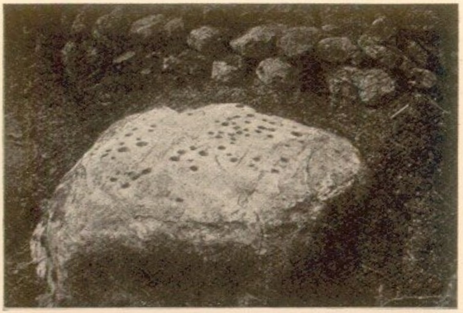
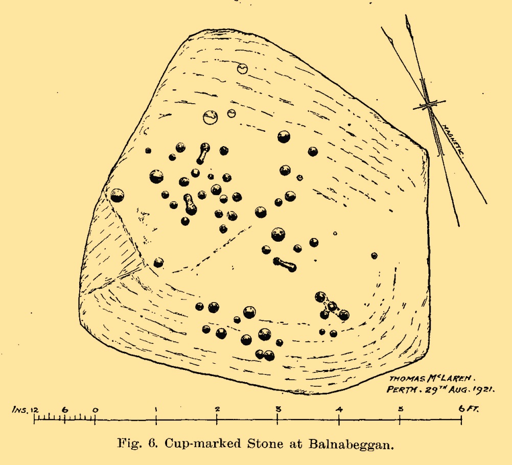
On the hillside a short distance (probably) south of old Balnabeggan farmhouse, up against some walling at the edge of some natural birch wood, could once be seen—some fifty or sixty years ago—a large, ornately inscribed, quartz-enriched cup-marked stone. And, although seemingly lost, it shouldn’t be too hard to uncover with a little bit of bimbling and dedication. It was described in some considerable detail in John Dixon’s (1922) survey of the Strathtay petroglyphs as being,
Balnabeggan stone, c.19201921 sketch of the stone
“roughly hexagonal in shape, but one side is partly hidden by an old dry-stone wall built above it. The greatest width is 7 feet, whilst a diameter at right angles measures 6 feet. The thickness or depth of the stone is at least 2 feet, but it may be more underneath, as the stone stands in a wet place in which it may have settled down.
“On the upper surface of the stone are fifty-nine cups of various sizes, the largest measuring 2½ inches in diameter, and from 1 inch to ½ inch, or less, in depth. A special feature is that four equidistant cups (three in a row and the fourth at a right angle to the centre of the row) are connected by grooves slightly less broad and deep than the cups. Three pairs of cups are also similarly connected. The cups connected as described are discernible, but the group of four cups on the low left side of the stone does not appear in the photograph to have its fourth cup (the lowest) connected, as it really is, with the central cup of the group.”
Mr Dixon’s additional clue as to its whereabouts is that it’s “about 500 feet above sea level.” So what, pray, has become of it…?
References:
Dixon, John H., “Cup-Marked Stones in Strathtay, Perthshire,” in Proceedings Society Antiquaries, Scotland, volume 56, 1922.
Kennedy, James, Folklore and Reminiscences of Strathtay and Grandtully, Munro Press: Perth 1927.
Cup-Marked Stone (lost): OS Grid reference – NN 8866 5320
Also Known as:
Sunday Well
Tobar an Donich
Archaeology & History
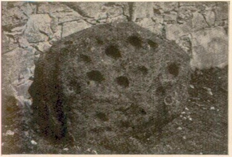
Tobairandonaich stone, c.1920
Located some 30 yards south of a holy well known (in English language) as the Sunday Well, this carving was rediscovered shortly before John Dixon (1922) wrote his survey of petroglyphs in the Strathtay region. It would seem to have been a large “portable” cup-marked stone that had been placed, face-downward, into an old doorstep at the stable at Easter Tobairandonaich and forgotten about, long long ago. Then, at the beginning of the 20th century when the people living here had to clear a drain beneath the stable, the stone was moved and the cup-markings were noticed. The carving was a pretty simplistic design, as you can see, which was described by Mr Dixon as follows:
“The stone…has nineteen cups all on the same face. The largest cup is 3¾ inches in diameter and 2 inches deep. The next largest has the same diameter, but is 1½ inch deep. Other five of the cups are very nearly the same size. The smallest cup is 1¾ inch in diameter and ½ inch deep, but weathering has effected much towards almost obliterating some of the smaller cups. The stone is of whinstone with slight veins of quartz. It is oval in form and varies in thickness from 2½ inches to 4 inches. Its greatest diameter is 3 feet 2 inches, and its least diameter 2 feet 8 inches.”
Tom MacLaren’s 1921 sketch
The stone would seem to have disappeared as no one has seen it for fifty years or more. It may (hopefully) be in one of the walls, or perhaps buried somewhere under the soil. Or maybe, tragically, some fuckwit has destroyed it. Twouldst be good to find out one way or the other. The photograph above, taken by Mr Dixon sometime around 1920, is the only thing that remains of the carving.
In this small part of Strathtay we are fortunate in finding a cluster of petroglyphs with folklore about them relating to our faerie and witch folk. Some larger man-made stone “bowls” in the area were also used as “praying stones.” I have little doubt that the people who originally used this carving as a doorstep were fully aware of the cup-marks—and I’d suggest that they even put it here on purpose, probably as a form of protection from the fairies who might have stolen or caused sickness to the horses.
References:
Dixon, John H., “Cup-Marked Stones in Strathtay, Perthshire,” in Proceedings Society Antiquaries, Scotland, volume 56, 1922.
Kennedy, James, Folklore and Reminiscences of Strathtay and Grandtully, Munro Press: Perth 1927.
Yellowlees, Walter, Cupmarked Stones in Strathtay, Scotland Magazine: Edinburgh 2004.
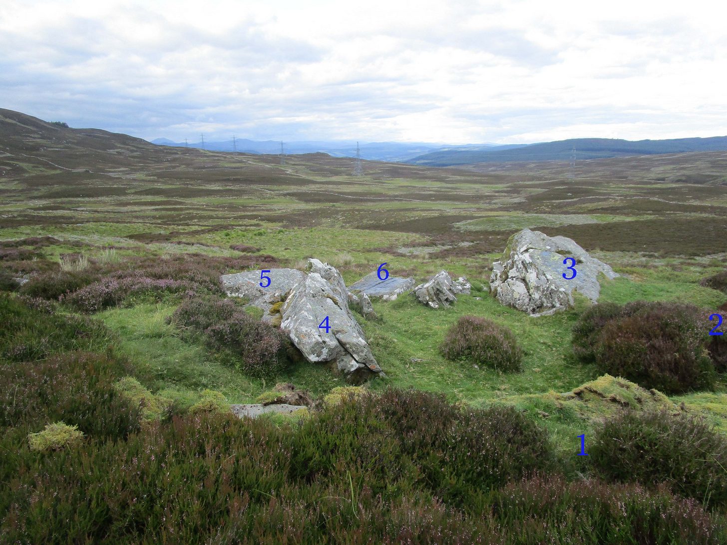
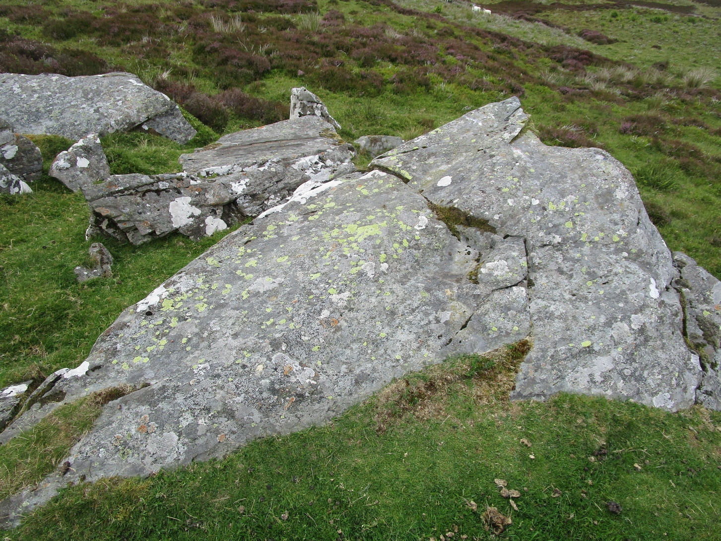
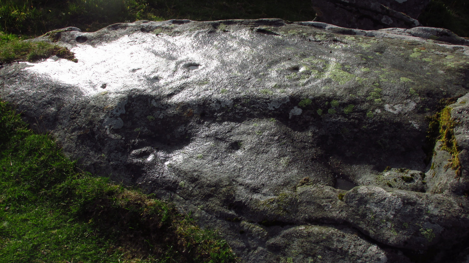
From Kenmore go east up the steep mountain road towards Glen Quaich, or if you’re coming from Amulree, go west along the same glen. After 2½ miles (4km) up the Kenmore route (nearly 9 miles on the Amulree route) you’ll reach a small lochan on your left (you’ve got a very small parking spot a coupla hundred yards before the loch). A gate and stile past the loch takes you east along a track into the moors. More than a mile on, the track splits, but you need to keep to the left and follow the track along the wall-side for another 400 yards or so, where you’ll see a small crag of rocks 100 yards down the slope on your right. Once here, the deformed triangle-shaped stone to the left-side of the cluster is the one you’re looking for.
Archaeology & History
About four yards west of the Craig Hill cluster (3) carving, this gently smooth sloping rock was initially noted to have between six and seven cup-marks on it. Under the grey skies it was difficult to see any of this clearly, and so we wet the surface when Nature gave us some short bursts of light through the clouds which then enabled us to get a much better look at the design—but it’s still far from clear.
Curious eye motifCentral elements of carving
We found at least eight cups on here, two of which had single rings: the one near the top of the stone seems to be complete, whilst the other nearest the bottom of the stone looks to be incomplete. Another cup had a curious double ring; whilst the one nearest the middle of the stone has what may be three rings, with what could be a carved line running from its centre—but it’s very difficult to say with certainty until we’ve made another visit. I have little doubt that there’s more to this petroglyph than we could make out beneath the grey skies. On the west-side of the stone, the “curious” double-ring has, as its outer surround, an “eye” motif, or lozenge, which is also found on the Craig Hill cluster (3) stone a few steps away. The eye motif on both stones have the same levels of erosion and, I would suggest, were carved within a century or two of each other; perhaps even around the same time.
This one’s well worth checking out!
Acknowledgements: Huge thanks to Prof Paul Hornby for use of his photos in this site profile; and to Myrna Hurley for getting us up there. Cheers doods. 😉
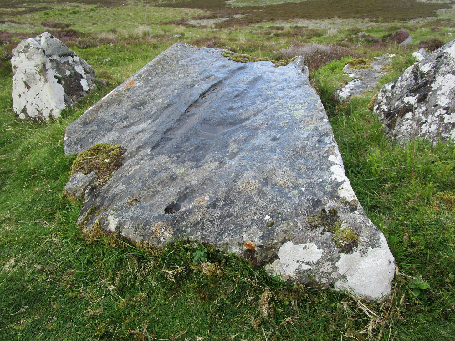
From Kenmore go east up the steep mountain road towards Glen Quaich, or if you’re coming from Amulree, go west along the same glen. After 2½ miles (4km) up the Kenmore route (nearly 9 miles on the Amulree route) you’ll reach a small lochan on your left (you’ve got a very small parking spot a coupla hundred yards before the loch). A gate and stile past the loch takes you east along a track into the moors. More than a mile on, the track splits, but you need to keep to the left and follow the track along the wallside for another 400 yards or so, where you’ll see a small crag of rocks 100 yards down the slope on your right. That’s your target!
Archaeology & History
The stone in question
One of at least six rocks next to each other that possess cup-and-rings, this is the most notable of the bunch inasmuch as it’s the one that stands out above all the others. At first sight it doesn’t look impressive: a shallow scatter of nine or ten cup-marks can be seen when the light’s alright, but that’s about it. This is what George Currie (2005) noticed when he first came across it in 2004, describing it simply as “a boulder with 10 cups” a few yards away from one of it’s fellow petroglyphs (CR19, or the Craig Hill cluster-2 carving). But there’s much more to it than that. Unfortunately when we visited here, we weren’t blessed with good daylight, so were unable to get a decent appraisal of the entire design and have most probably missed some elements.
Curious double-ringed eyeGeneral overview of design
On the top sloping surface are six or seven cup-marks; another two or three are on a secondary lower level of the stone. Of those on the top, at least two of them have surrounding rings: one with a carved line coming out to the south-east; the other having a more extravagant appearance, surrounded by what looks like a secondary outer “oval”, or eye-shaped design. It’s unusual. Other lines intersect these cup-and-rings, but it was difficult to say with any certainty whether they were Nature’s handiwork, or had been modified by humans. Below these on a slightly lower level are two or three single cup-marks, one of which, close to the edge of the rock, appears to have an incomplete ring round it—but this might have just been a trick of the light. Another visit is required for a better appraisal…
Acknowledgements: Huge thanks to Prof Paul Hornby for use of his photos in this site profile; and to Myrna Hurley for getting us up there. Cheers doods. 😉
Cup-Marked Stone (lost): OS Grid Reference – NO 3975 3340
Also Known as:
Magdalen’s Kirkton Stone
Archaeology & History
In the mid-1890s, workmen ploughing one of the fields near the steading at Magdalen’s Kirkton farm hit a large stone beneath the soil. It turned out to be the covering stone of a prehistoric burial, or cist, that was aligned east-west. Whilst the remains in the cist had all but turned to dust, the covering stone had a number of cupmarks on it. It was described only briefly by R.N. Kerr (1896), who told that,
“The stone forming the lid of the cist is cup-marked. It weighs 5 cwt., 1 qr., 21½ lbs., and its thickness varies from 9 to 12 inches. There are 40 or more cup-markings on it, varying from 1 to 3 inches in diameter.”
It would seem that no sketches were made of this carving and I’ve been unable to find any more details about it. Help!
Stone Circle (destroyed): OS Grid Reference – NN 9424 5871
Archaeology & History
Missing from the primary surveys of Burl (2000) and Barnatt (1989), a mention of this long lost site was made by local historian Hugh Mitchell (1923) in his survey of the area. He told that,
“On the east side of the Moulin road beyond the Hydro Hotel a knoll and a clump of trees will be noticed on the right, inside the Hydropathic grounds; this knoll is known as the Cnoc Dubh, or “Black Knoll” and still bears an uncanny reputation as being an old site of Pagan worship. There was at one time a stone circle on it, but the stones are said to have been broken up, fully 100 years ago, to build the old farmhouse of Balnadrum.”
Something ancient was there, obviously, as it was mentioned in another earlier account—albeit just a tourist guide of Atholl—which said that, on
“the knoll known as Knock-Dhu, within the (Pitlochry Hydro) grounds, are the remains of a pre-historic fort, now overgrown with pine trees.”
References:
Anon., Atholl Illustrated, L. Mackay: Pitlochry c.1910.
Dixon, John H., Pitlochry Past and Present, L. Mackay: Pitlochry 1925.
Mitchell, H., Pitlochry and District: Its Topography, Archaeology and History, L. Mackay: Pitlochry 1923.
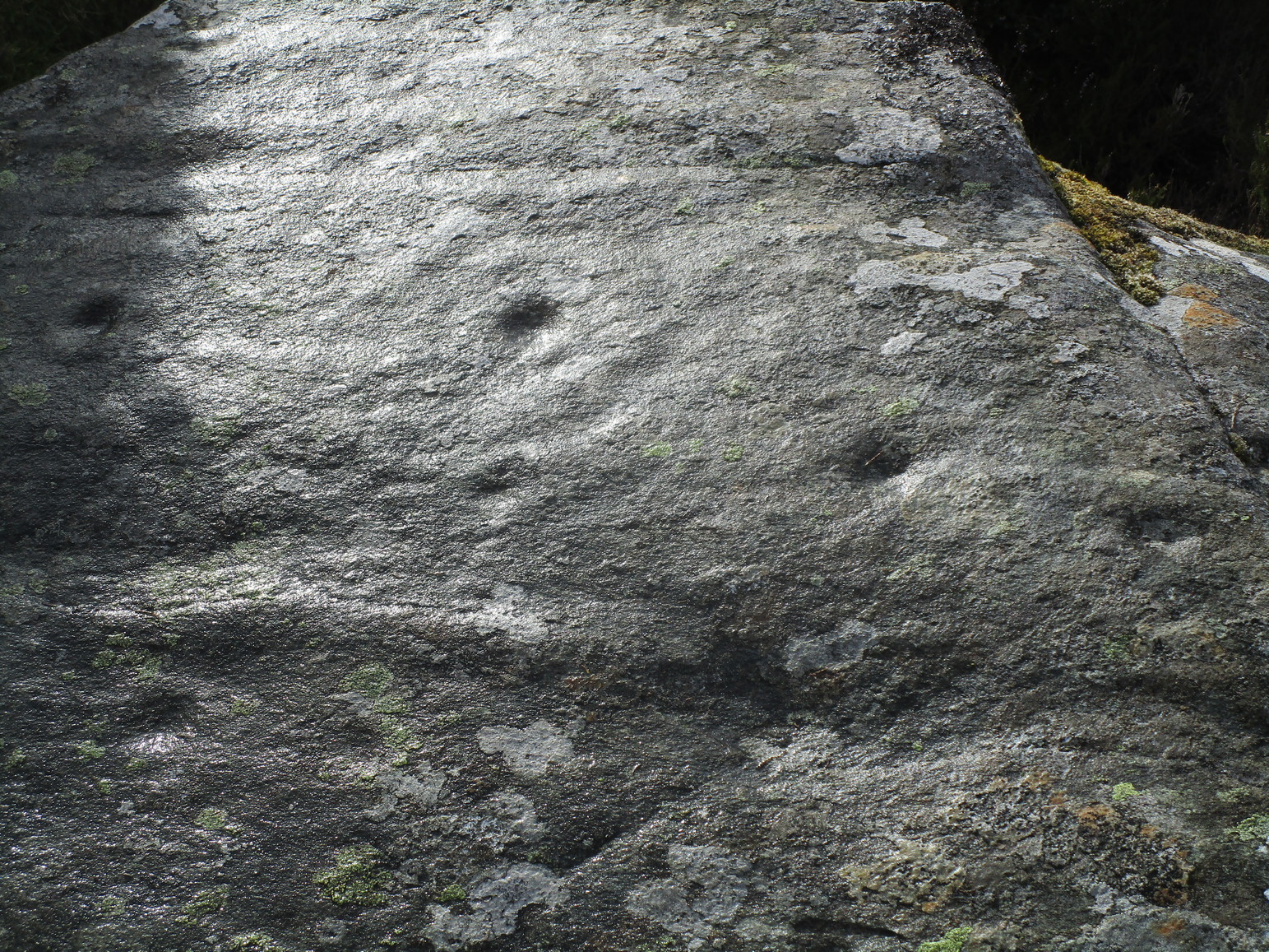
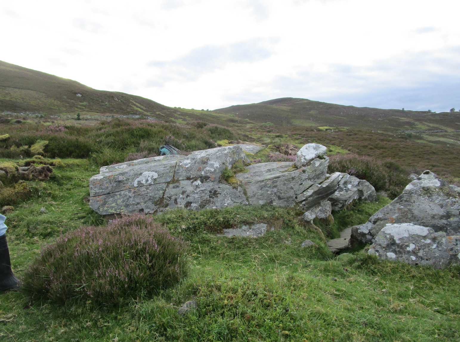
Follow the same directions to reach either the Craig Hill cluster (3), no.4 or no.5 carvings. Once here, looking at the sloping moorland ahead of you, the elongated stone that’s closest to where the moorland slopes downhill is the one you’re after. Y’ can’t really miss it!
Archaeology & History
The sixth carving in this small close-knit cluster and, design-wise, the least impressive of the bunch. There are three distinct cup-marks on the rock: two on its more southern side and one near the middle of the stone. There may be another two cups, but these may have been part of the curious long, naturally-eroded line running along the length of the stone. Other man-made elements may have been cut into the stone, but it needs to be seen in perfect low light to tell us one way or the other.
Healing Well (destroyed): OS Grid Reference – NO 4032 3025
Archaeology & History
This old water supply had no direct ‘holy’ nature, despite its proximity to the cathedral, the old market cross and St Clement’s Well some fifty yards away! Most odd. A much more mundane story lies behind this long lost water source. The Dundee historian William Kidd (1901) told us,
“When the public wells were erected, about the year 1749, to supply the town with water from the Lady-well reservoir at foot of Hilltown, one was placed on the High Street, on the east side of the Cross, and was called the Cross Well.”
It didn’t have too long a life either—much like the old Market Cross, for,
“In the year 1777 that quaint structure was demolished. The platform and octagonal tower were carted away as rubbish, the least decayed stones being selected to be used in other buildings. The stone shaft, also, was preserved, and placed beside the Old Steeple. With the demolition of the Cross, the Cross Well was cleared away from the High Street, but, as water was an essential to the people, the well was re-erected behind the Town House in St. Clement’s Lane. In that situation it remained for nearly one hundred years, when, being rendered unnecessary by the introduction of the Lintrathen water supply, it was also demolished, along with the old buildings in the Vault and St. Clement’s Lane, to make room for the additions to the Town House.”
References:
Colville, A., Dundee Delineated, A. Colville: Dundee 1822.
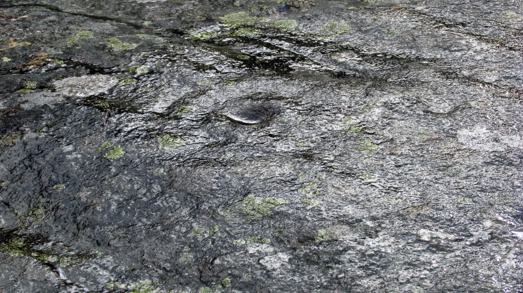
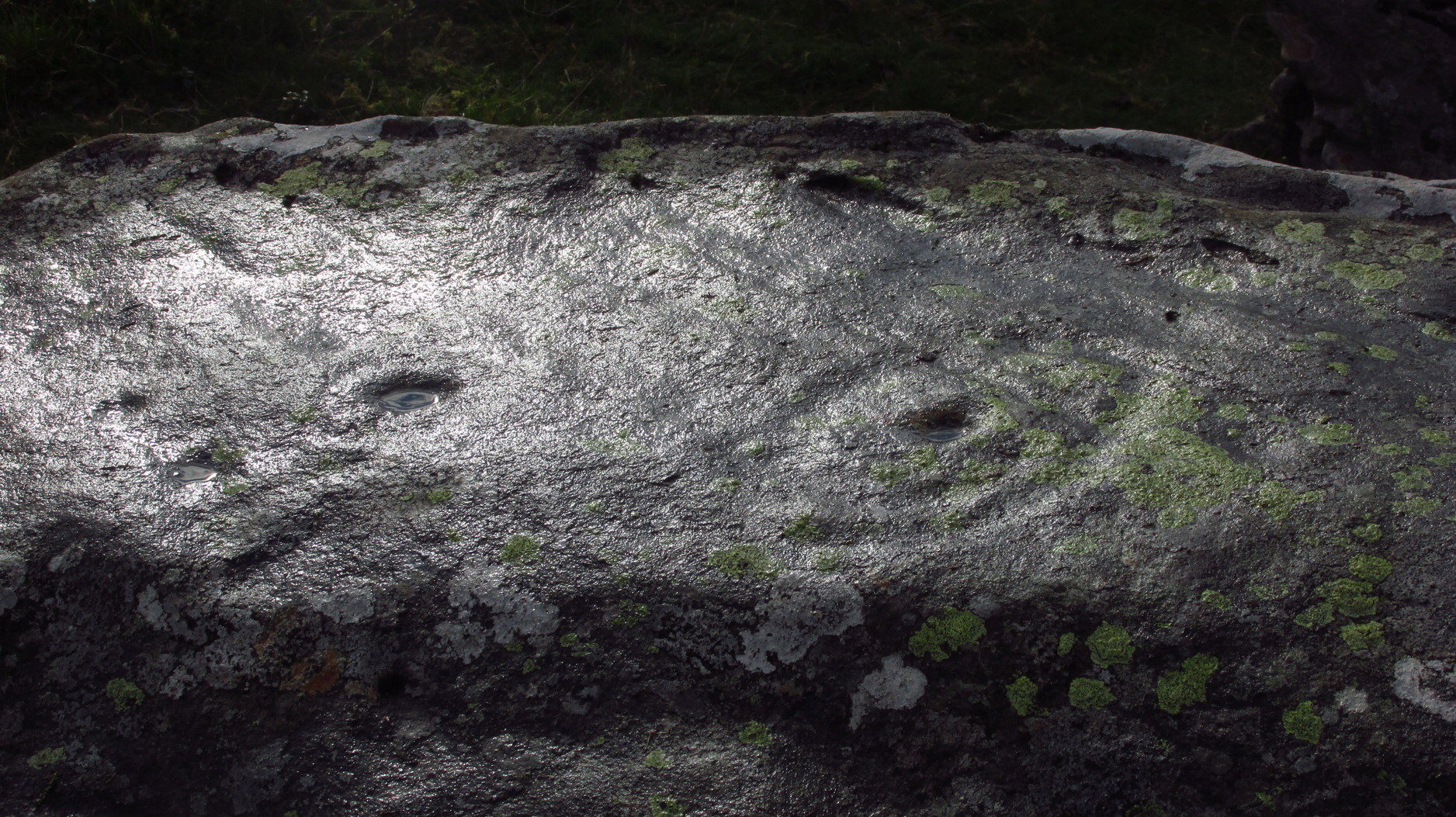
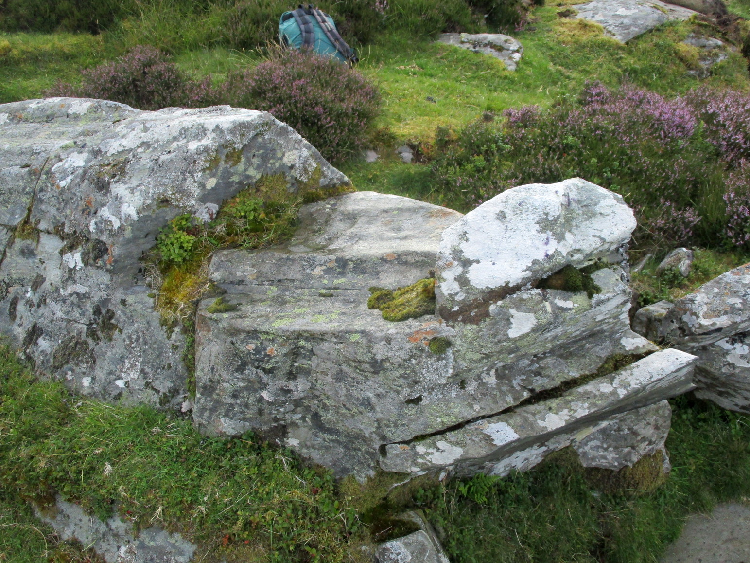
From Kenmore go east up the steep mountain road towards Glen Quaich, or if you’re coming from Amulree, go west along the same glen. After 2½ miles (4km) up the Kenmore route (nearly 9 miles on the Amulree route) you’ll reach a small lochan on your left (you’ve got a very small parking spot a coupla hundred yards before the loch). A gate and stile past the loch takes you east along a track into the moors. More than a mile on, the track splits, but you need to keep to the left and follow the track along the wall-side for another 400 yards or so, where you’ll see a small crag of rocks 100 yards down the slope on your right. Once here, the elongated rock with a “seat” that you can sit in is the stone in question.
Archaeology & History
At first sight this stone doesn’t seem to have anything petroglyphic about it, and—as when we visited the other carvings in this Craig Hill cluster—the weather was grey and overcast, so it was difficult to discern anything at first. But as we walked round and round inspecting the Craig Hill cluster-5 carving, a glance at this adjacent stone seemed to indicate one or two cup-marks within the curious chair-like aspect of the rock, but we couldn’t initially work out whether they were simple geophysical elements or not.
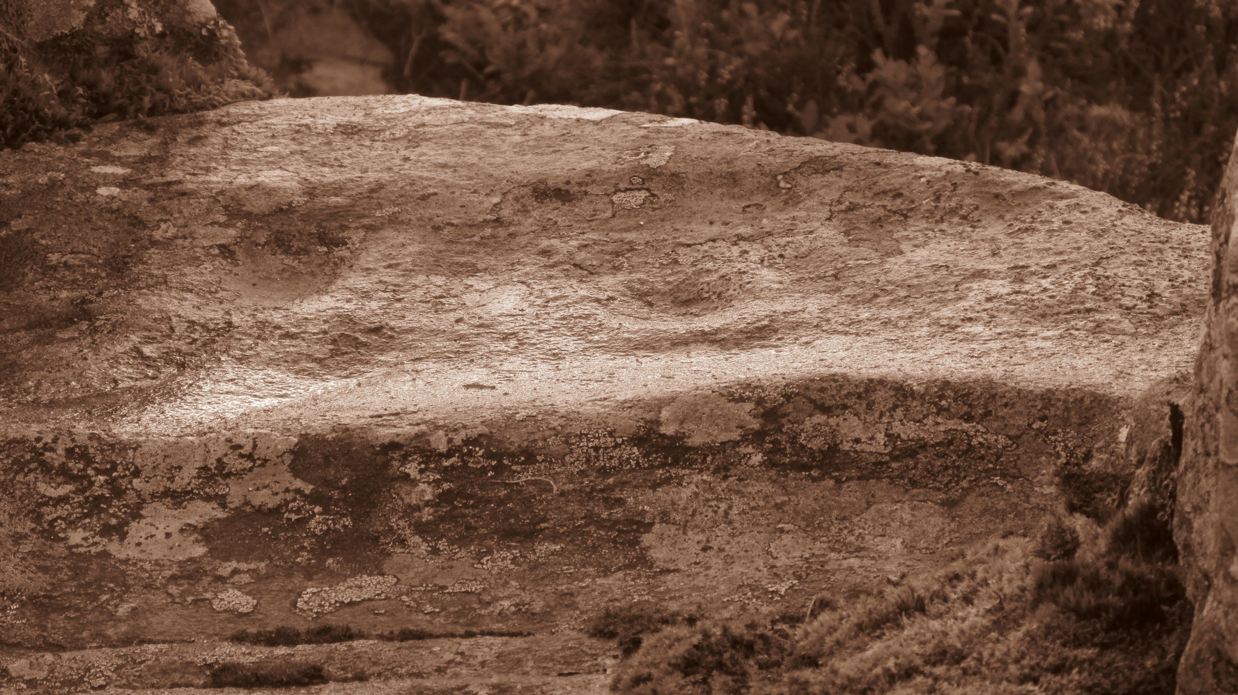
Very faint cup-&-half ring near the centreClose-up of the C&R
So we poured water onto the stone in the hope that something might show up. And the more we walked round and round, bending down, looking from as many angles as possible, not only did we see what looked like several cups, but one of them had a half-ring that curved round what may or may not be a natural cupmark. You can see it pretty clearly in the attached photos. In other photos that we took, the faint cup-and-half-ring seems to plays its part in a line of three or four other cups; although in order to ascertain whether these elements are man-made or not, we could do with the help of a good geomorphologist.
Acknowledgements: Huge thanks to Prof Paul Hornby for use of his photos in this site profile; and to Myrna Hurley for getting us up there. Cheers doods. 😉