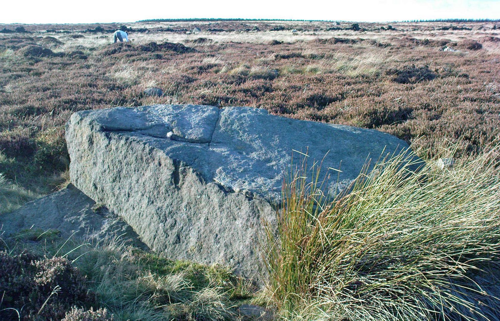
From East Morton, head up the winding Street Lane for just over a mile until, on your right-hand side, you hit the long straight Roman Road, or Ilkley Road as it’s known. Literally 690 yards (0.63km) up, on your left a footpath is signposted. Take the path alongside the wall, through the first gate (note the pile of stones at this gate, which are the remains of the destroyed Bradup stone circle) then keeping on for ⅓-mile till you reach another gate, then 200 yards to the next one where you reach the moorland proper. From here you need to walk through the heather, just over 300 yards southwest where you’ll reach this large rock. Y’ can’t miss it!
Archaeology & History
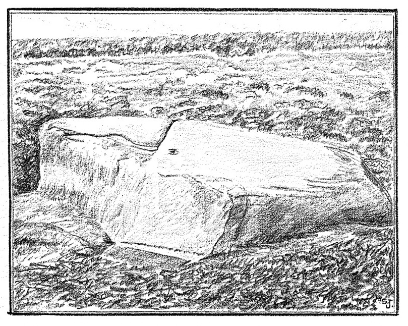
Looking down at the CnR
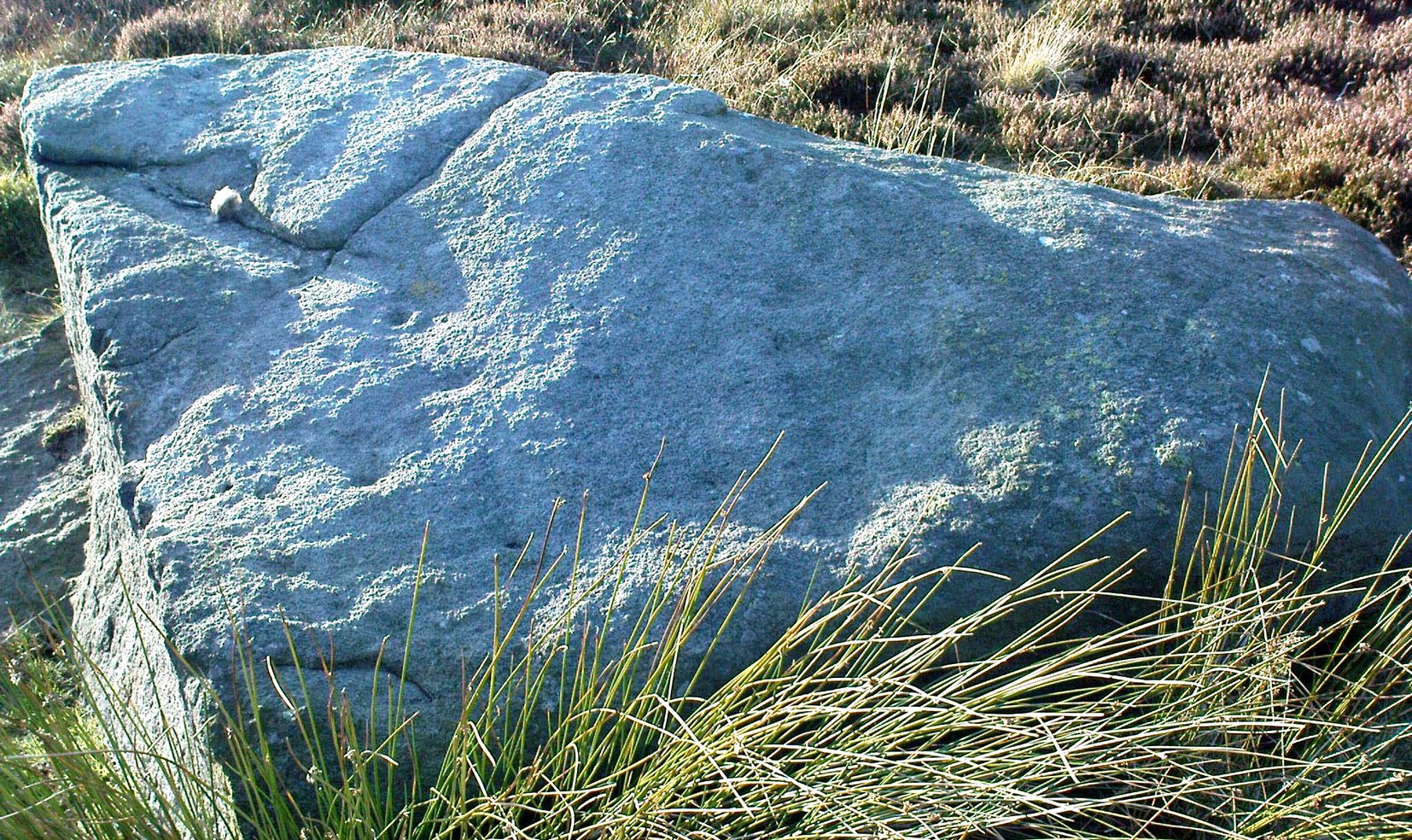
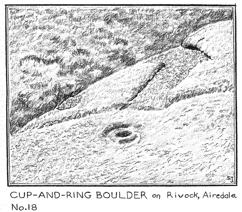
Considering the size of this stone, visitors might expect there to be more on it than there actually is; although a large section of it has been quarried off and there might have been more to it in earlier times. A basic cup-and-ring with one or two single cup-marks elsewhere on its surface, the carving was first described by Stuart Feather (1964) following one of his many rambles hereby, when he was checking out the Rivock carvings a short distance to the west (calling it the Rivock 18 stone). He wrote:
S. Feather’s 1964 sketch
“On the eastern edge of the Rivock plateau, about half-a-mile west of the stone circle at Bradup Bridge, is a cup-and-ring marked rock of a pronounced triangular shape. This at present measures 10ft by 8ft and is 3ft high at its western side… At some time in the past it has been quarried, probably to build part of the adjacent gritstone walls. The 8ft side of the rock has quite distinct drill marks visible…
Close-up of the CnR
The rock has…on its sloping surface a very fine cup-and-ring mark, the ring 6in in diameter around a cup 2in deep, all finely executed and well preserved. Running south from this cup-and-ring mark is a level area 3ft long and 5in wide, which ends alongside the ring at one end and at the quarried edge of the rock at the other. This is probably the former position of a fossil which has weathered out and its alignment onto the cup-and-ring may be due to the carving having been deliberately sited in juxtaposition to this very distinct natural feature. Only one other 2in deep cup remains on the surviving original portion of the rock; others may have been quarried away.”
References:
Boughey, Keith & Vickerman, E.A., Prehistoric Rock Art of the West Riding, WYAS: Wakefield 2003.
Feather, Stuart, “Mid-Wharfedale Cup-and-Ring Markings – no.18, Rivock”, in Bradford Cartwright Hall Archaeology Bulletin, 9:2, 1964.
Hedges, John (ed.), The Carved Rocks on Rombalds Moor, WYMCC: Wakefield 1986.