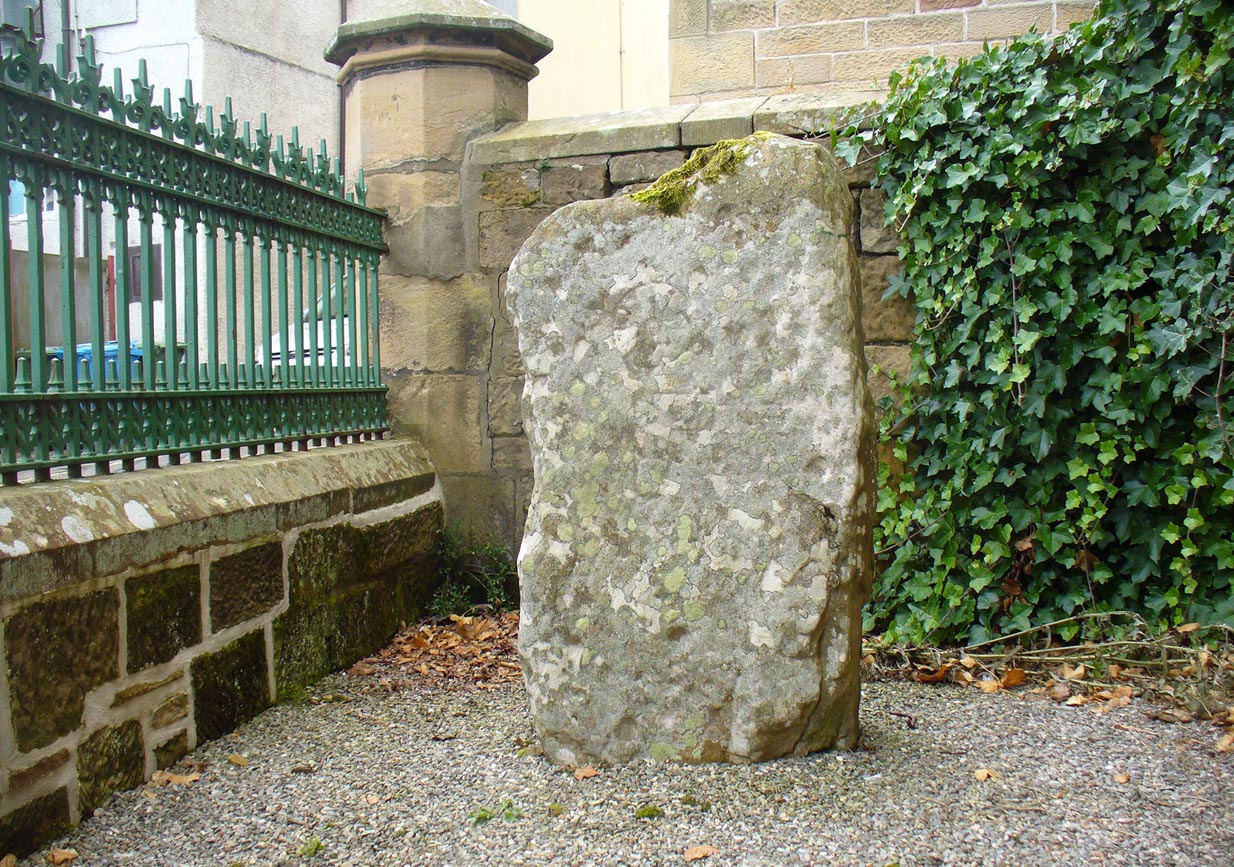
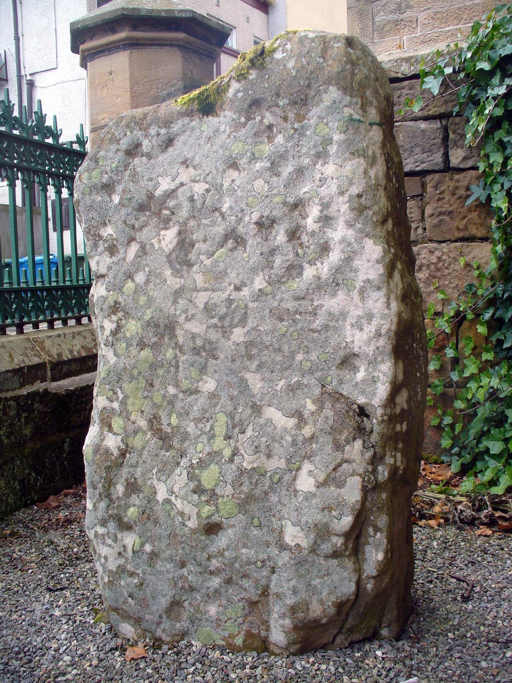
The stone is no longer in its original position (a few miles away), but can now be found if you visit the Tain & District Museum, just off Tower Street, in towards St Duthus’ Church. The stone is upright around the side of the adjacent buildings. It’s probably easier to access if you walk down Castle Brae, keeping your eyes peeled to your left. Otherwise, just ask the helpful people at the Museum and they’ll point you to the spot.
Archaeology & History
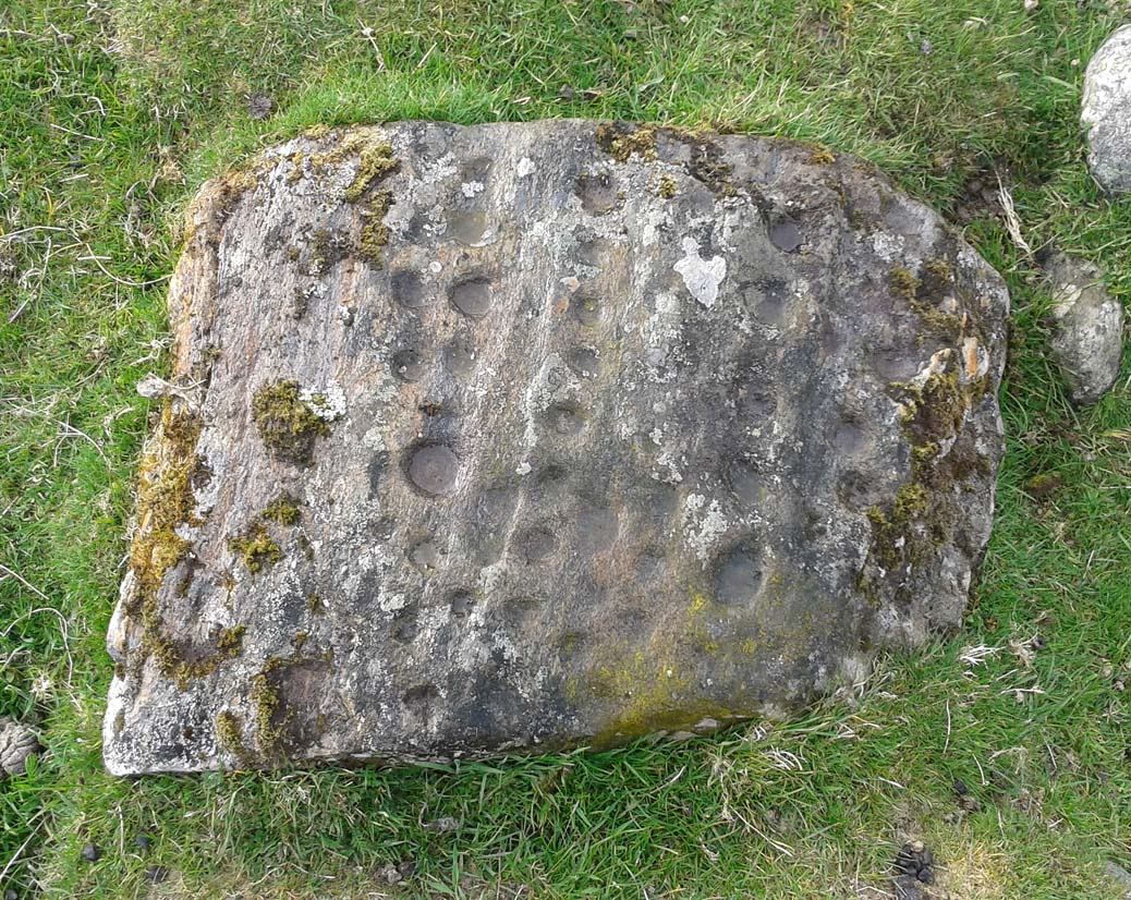
An intriguing stone with what may be a long and fascinating history behind it… It was only rediscovered in the 1960s, when the farmer at Ardjachie (2½ miles northwest of Tain town centre) came across it in one of his fields. It’s not large or notable in any way, other than it possessing a couple of really peculiar symbols etched amongst a mass of otherwise standard neolithic and Bronze Age cup-marks. These other symbols are (as seen in Mark Taylor’s drawing, right) a very distinct ‘spoked wheel’ and what looks like a right-angled ‘tool’ or set-square of some sort. These symbols have brought with them notions from academics who are claim it has Pictish provenance. However, we must be very cautious of this idea….
The first written account of the stone was by Ellis Macnamara (1971) who gave a detailed description of the carving:
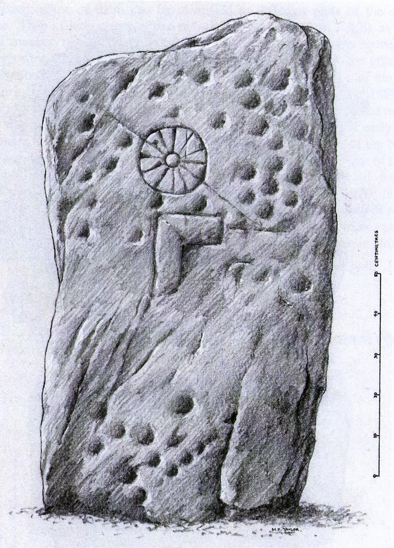
Ardjachie Carving (after Mark Taylor 2004)
“Boulder found on Ardjachie Farm, now in Tain Museum. The boulder, of probably local old red sandstone, is uncut and very irregular in shape but has two principal faces; the maximum length is 1.7m; maximum width is 0.65m and on the maximum thickness is some 0.35m. The carvings are all on one face, which is much weathered; the opposing face is conspicuously less smooth so that it is possible that this stone was never set upright. The weathered face is covered with at least 30 ill-defined cup markings scattered over nearly the whole surface, though grouped towards one end; the average diameter of these cup markings is about 3 to 4cm, depth about 1.5cm. There are several indistinct lines among the cup markings and there is among the thickest cluster of cup markings a symbol like a ‘wheel’, with the outer ‘rim’ drawn as a fairly perfect circle, with a diameter at the outer edge of some 17cm. The ‘wheel’ has twelve ‘spokes’ and a single inner circle, or ‘hub’, with a diameter at the outer edges of about 4 or 5cm.”
Subsequent to Macnamara’s description, it’s been suggested that there are cup markings on both sides of the stone; but the ones on the other side are a little less certain. The stone itself almost typifies the cup-marked cist covers we find scattered all over the country—yet no burial or other structure was noted upon its discovery in the fields. It’s an oddity on various levels…
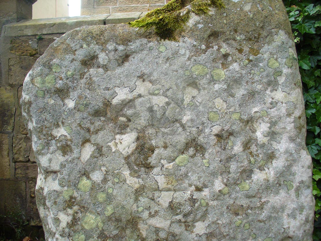
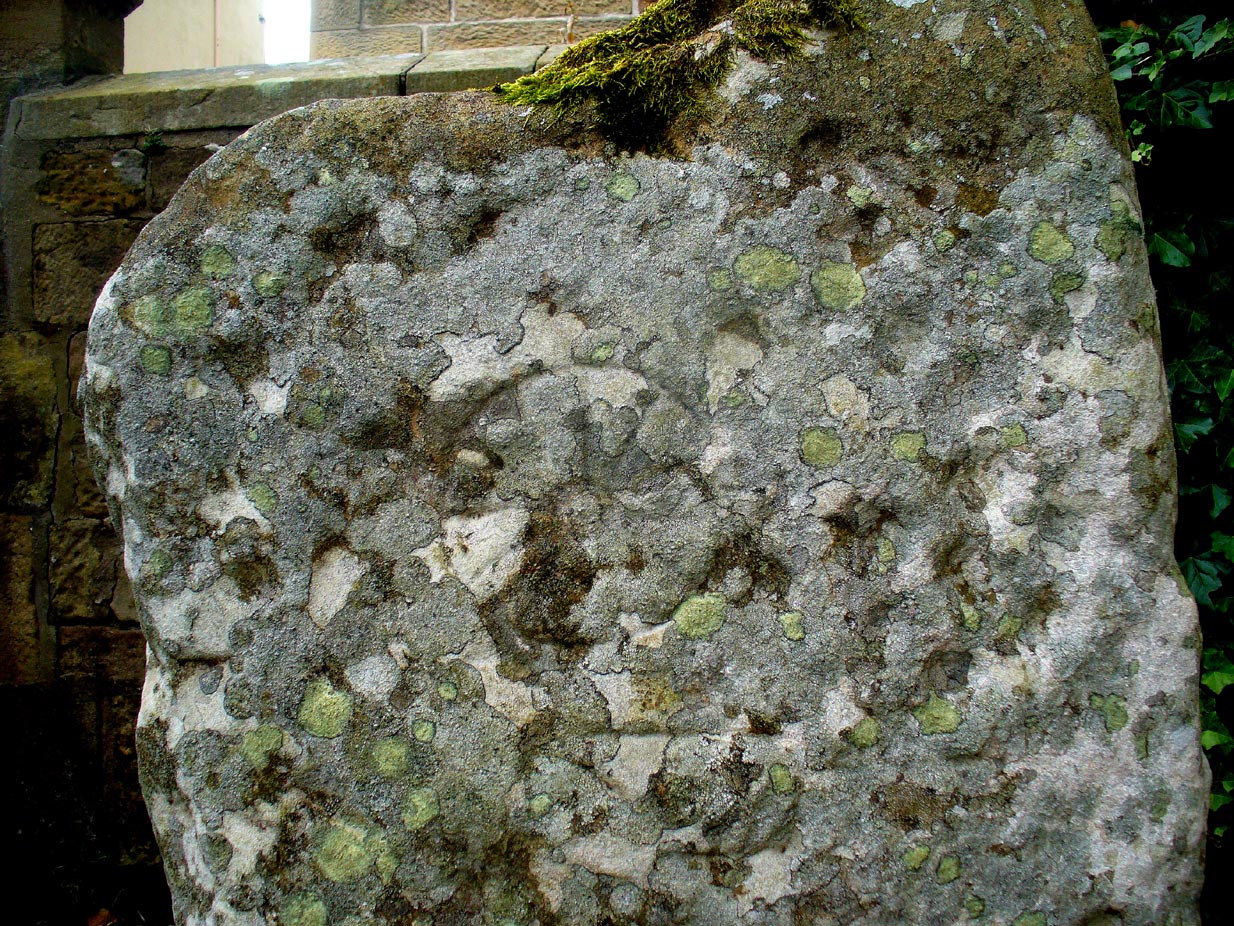
Close-up of spoked-wheelClose-up of spoked-wheel
The spoked-wheel symbol and, moreso, the right-angled element, have led some to speculate that the symbol was carved in Pictish times; but there are problems with this on two levels at least. The cup-marks we know are neolithic or Bronze Age in origin, and their design always inclines to abstract non-linear forms, screwing egocentric analysis. But the ‘spoked wheel’ is more linear in nature. But as acclaimed petroglyph researchers from George Coffey (1912) to Martin Brennan (1983) show, this spoked wheel occurs in neolithic Ireland; and the identical symbol occurs in prehistoric carvings at Petit Mont in France (Twohig 1981), at Cairnbaan in Argyll (Royal Commission 2008) and there’s even a partial spoked-ring on the Badger Stone on Ilkley Moor! We have no need to jump into Pictish times to account for its origin and unless we have direct archaeological evidence to prove this, the academic Pictish association must be treated with a pinch of salt. It is nevertheless scarce amongst neolithic and Bronze Age carvings in Britain. Maarten van Hoek (1990) suggested it to be a variant on the ‘rosette’ design, also neolithic in origin. On the whole the symbol is interpreted as being the sun—which it may well be.
If you look carefully at the images above you can see, to the right of the ‘wheel’, a cup-marking surrounded by a ring of six-cups. It is possible that this may be an older variant of the spiked-wheel solar symbol. All speculation of course. The other peculiar element here is the curious right-angled design, below the ‘sun’. This symbol in particular is quite different from the early cup-marks and may have been carved at a much later date. In which case, this raises the potential for a continuity of tradition here… which mightjust bring in the Picts!
A bittova closer look
But the general problem with a Pictish assignment is that of the Picts themselves. If we ascribe the current anglocentric belief that the Picts only existed between the 3rd and 9th centuries (because we only have written records of them during that period), we are assuming the rather naive philosophy that anything before written history did not exist: a sort of blind-man’s Schrodinger’s Cat ideology, only really accepted by pseudo-historians. But if the Picts didhave something to do with this carving, we may indeed be talking about a continuity of tradition from the ancient past into the written period. Such an idea would be no problem in developed tribal cultures with an animistic cosmology—and that’s assuming that this stone was deemed as ‘special’ in some form or another to the local people. But all these are uncertainty principles in themselves and we may never know for sure…
There are no adjacent monuments to where Ardjachie’s stone came from, and apart from a scatter of flints found a hundred yards or so closer to the beach, other archaeological remains are down to a minimal. Its isolation is peculiar. There are however, a number of springs of water a few hundred yards away, just across the main A9 road, two of which have left their old names with us as the Cambuscurrie Well and the Fuaran nan Slainte, or fountain/spring of Healing (the modern Glenmorangie whisky gets it waters hereby!). Although we must be careful not to assign every example of prehistoric rock art with the same material, the mythic association between petroglyphs and water cannot be understated, and although such an association at Ardjachie is conjectural, it cannot go unnoticed.
References:
Brennan, Martin, The Stars and the Stones: Ancient Art and Astronomy in Ireland, Thames & Hudson: London 1983.
Coffey, George, New Grange and other Incised Tumuli in Ireland, Hodges Figgis: Dublin 1912.
McHardy, Stuart, A New History of the Picts, Luath: Edinburgh 2012.
Mack, Alastair, Symbols and Pictures: The Pictish Legacy in Stone, Pinkfoot Press: Brechin 2007.
Macnamara, Ellen, “Tain, Ardjachie Farm: Cup Markings and Incised Symbol”, inDiscovery & Excavation Scotland, 1971.
This was an astonishing-sounding place, little-known beyond the pages of specialist historians. It has been described in modern terms as simply “subterranean structures”, “weems”, or “prehistoric underground houses”; but were this site still in evidence it would be a huge attraction! From the literary descriptions we possess, the extensive remains found and destroyed sound very much like the much-visited fogous found throughout Cornwall, or more commonly known as ‘souterrains’ in Scotland—although there’s no mention of the place in Wainwright’s (1963) singular study on such monuments. Despite this, here, on the south-side of modern Clarkston, it seems we once had a Renfrewshire equivalent to the prehistoric Cornish village and fogous known as Carn Euny.
The first known account of this site was written by James Smith (1845) in the survey for the New Statistical Account, who thankfully gave us a reasonably lengthy account of what was once here. He told:
“About thirty years ago, on the farm of Overlee, which lies on the north bank of the river Cart, in the south-west angle of the parish, Mr Watson, the proprietor, on removing the earth from a quarry which he wished to open, discovered a great many subterraneous houses ranged round the slope of a small swelling hill. Each house consisted of one apartment, from eight to twelve feet square. The sides, which were from four to five feet high, were faced with rough undressed stone, and the floors were neatly paved with thin flag stones which are found in the neighbourhood. In the centre of each floor was a hole scooped out as a fire-place, in which coal-ashes still remained, and seemed to indicate that their occupiers had left the place on a sudden. That coal and not wood or peat had been employed as fuel, seemed at first an argument against the antiquity of the houses, until it was remembered that many seams of coal crop out on the steep banks of the river in the immediate vicinity, which may have been picked out for firing by the aboriginal inhabitants, as is still done to a limited extent by a few of the poorer classes in the neighbourhood. Near the fire-places were found small heaps of water-worn pebbles, from two to three inches in diameter, the use of which it is difficult to conjecture. They may have been used as missiles for attack or defence in the rude warfare of ancient days, or more probably they served the purposes of an equally rude system of cookery, by which meat was prepared for being eaten by heated stones placed round it, as is still done in many of the South Sea islands. The floors of the houses were covered to the depth of about a foot with a rich black vegetable mould, which was in all likelihood the decayed remains of the roofs mixed with soil filtered from the surface. As was gathered from the different appearances of the soil, in and over them, the houses were partly excavated from the hill and partly built above ground, and a level approach to the entrances was dug out of the slope. The number discovered amounted to forty-two, of which thirty-six formed the arc of a lower and larger circle, and the remaining six, also circularly ranged, stood a little higher up the hill. The writer is informed that the ruins of villages of a similar description have been discovered in several parts of Scotland; and there is an account of one very much the same as the above, recorded in the third volume of the Transactions of the Antiquarian Society of Scotland. About twelve querns or small hand-mills were found near the site of these houses, and a grave lined with stone containing a rude urn filled with ashes. These latter relics, however, may have belonged to a still distant but less remote antiquity. The old castle of Lee or Williamwood was erected near the place, and it is not improbable that, in procuring materials for the building from the freestone, of which the hill consists, the soil, which for so many centuries concealed the remains of the village, was thrown down upon it. Several years ago, the proprietor, in clearing away the old foundations of the castle, which interfered with the rectilineal operations of the plough, found within the square which they enclosed many human bones, which he avers were of almost superhuman magnitude.
“If the natives of the village, described above, deserted their homes hastily, as may be conjectured from the fact of the fuel remaining on their hearths, it may have been in terror of the Romans—one division of whose invading army must have passed not far from the place. In a direct north-east line from this hill, without any intervening eminence, and at the distance of about two miles, there are still very distinct traces of a small Roman encampment on the summit of a hill, the name of which, from the circumstance, is Camp Hill…”
Although the modern official description of these remains is simply that of “a settlement”, the idea that some of the remains here were souterrains seems beyond doubt. The comparison James Smith makes with remains that were found shortly afterwards that were “very much the same”, unearthed at Cairnconon—or the West Grange of Conon, as Canmore call it—northwest of Arbroath, confirms this idea.
Just over a decade after Mr Smith’s initial account, the Glaswegian historian James Pagan (1856), in his huge History of Glasgow, included another description of the place from the pseudonymous 19th century writer “J.B.” In what were called Desultory Sketches, much of what he wrote merely echoed the original notes by Smith, but they are still worth repeating:
“Specimens of the winter houses, or weems, were to be seen, till recently, in our own district, at Cartland Craigs, near Stonebyres, on the Clyde; and one very interesting example of the pit-houses was revealed in 1808, on the farm of Overlee, near Busby, in the vicinity of Glasgow. The following particulars regarding these were communicated to the writer of this sketch, by the parish minister of Cathcart, who had his information from an eye-witness.
“While the farmer was removing soil to get at freestone, for building a new steading, he came on a cluster of subterranean aboriginal huts. They were forty in number, and ranged round the face of the hill on which the farm-house of Overlee now stands. These huts were of the most primitive kind. They were mere semicircular pits, cut out of the hillside, with a passage to the door, also dug out of the slope, on a level with the floor, as indicated by the different colour of the soil. Each consisted of one small apartment, about twelve feet square, five feet high, and faced with stone. The floors were neatly paved with thin flag-stones, found in the neighbourhood. In the centre of each was a hole for a fireplace, in which ashes were still visible. Near the fireplace were small piles of water-worn stones, two or three inches in diameter, probably for cooking food, by placing heated stones round it, as is yet done by some of the islanders in the Pacific Twelve hand-querns of stone for grinding grain were found in the houses. At a short distance, a grave was discovered, lined with stone, and containing rude urns filled with ashes, thus indicating that the inhabitants of this primitive cluster, near what is now Glasgow, burned their dead. Unfortunately, the whole of these curious pit-houses were ruthlessly destroyed.
“In some of the weems and pit-houses, small groups of pretty oyster-shells have been found, perforated with small holes, as if they had been strung together, and formed an ornamental necklace—shall we say for the lady-savage of that distant epoch? In others were discovered bodkins and skewers, made of horn, probably to hold together the folds of the wild beasts’ skins forming the savages’ winter covering; the bones of oxen, neatly notched, as if for ornament; bowls made of stone, the hollow having been drilled out by the circular action of another stone, sharper and harder, aided by the grit of sand (one of which is now before me); arrow-heads and lances formed of flint or bone, some of the former of which I happen to possess; —nay, swords have been found, fashioned from the bone of a large fish! Heavy oaken war-clubs, too, must not be omitted from this curious catalogue.”
Although highly unlikely, there is the remote possibility that some remains of these underground ‘houses’, or souterrains, could possibly still be unearthed hereby. In recent years we’ve encountered a number of good farmers and land-owners who’ve told us about souterrains beneath their fields that are not in any record-books. Intriguingly, each one asked us, “who are you working for?” – and when we’ve assured them that we have nothing to do with the ‘official’ bodies, they’ve opened up and showed us. In one instance, a land-owner in Angus told us how he was farming the field as he’d always done, “when my tractor fell into a huge hole in the ground – and there was another souterrain!”
Why am I telling you this? Well, if you’re a local, maybe get round to Overlee and ask around some of the olde local people. You never know what you might find! And we could perhaps try find more about the other souterrain which the pseudonymous ‘J.B.’ said was “at Cartland Craigs, near Stonebyres, on the Clyde.”
References:
McBeath, H.D., Walks by Busby and Thorntonhall, with Historical Notes on the Area, EKDC: East Kilbride 1980.
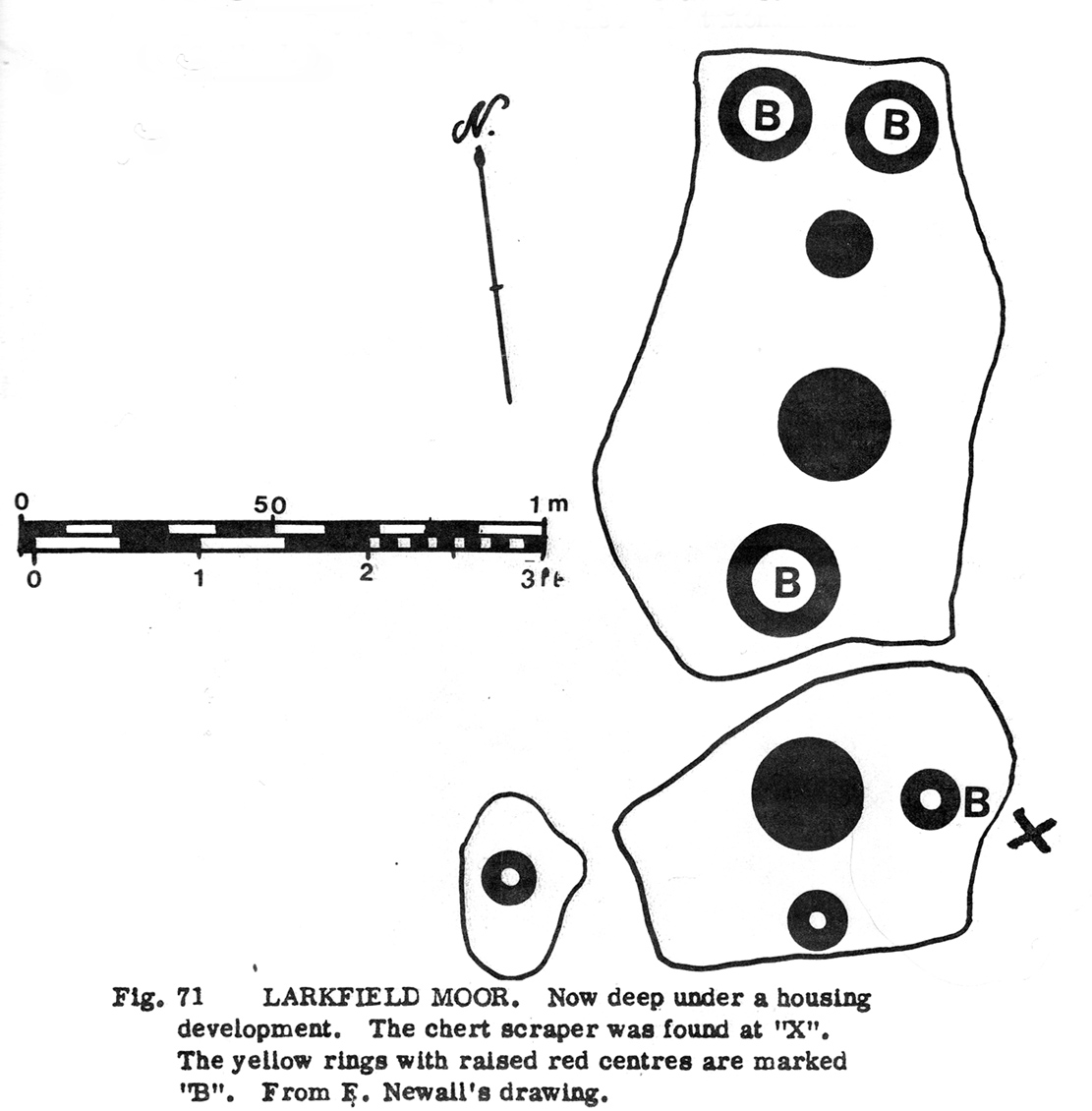
When the moorland here was still free from the dodgy factory workings of Texas Instruments (UK) Ltd, a Mr F. Newall (1960) came across this curious example of ancient rock art—now long gone. He described the find as,
“A series of cup marks and one ring, worked in laminated sandstone (that) has been located on Larkfield Moor by Mr H.M. Sinclair. In several cases the outer edge of the cup has been deeply incised through yellow sandstone to leave a slightly raised boss of red sandstone at the centre. From the side of the outcrop bearing the cups was recovered a chert scraper, doubly notched on one edge.”
Morris’ 1981 sketch
The “chert scraper” is marked on the adjacent diagram with an “X”.
Although this carving is described on the latest Canmore survey as being “possibly a freak geological formation”, we are best erring on the side of caution regarding their note. The cup-marks on this stone were—as the illustration (right) shows—quite large, which is the reason for the geophysical suggestion. However, the site was deemed to be authentic by the rock art authority R.W.B. Morris. (1981) In his account of this petroglyph, Morris told of there being,
“6 rings up to 20cm (8in) diameters, cut so that they penetrated the next lower yellow sandstone layer; but in 4 cases having a ‘boss’ of red sandstone slightly raised in the middle, and also 3 cups. Greatest carving depth 1cm (½ in).”
References:
Morris, Ronald W.B., “The Cup-and-Ring Marks and Similar Sculptures of South-West Scotland,” in Transactions of the Ancient Monuments Society, volume 14, 1967.
Morris, Ronald W.B., The Prehistoric Rock Art of Southern Scotland, BAR: Oxford 1981.
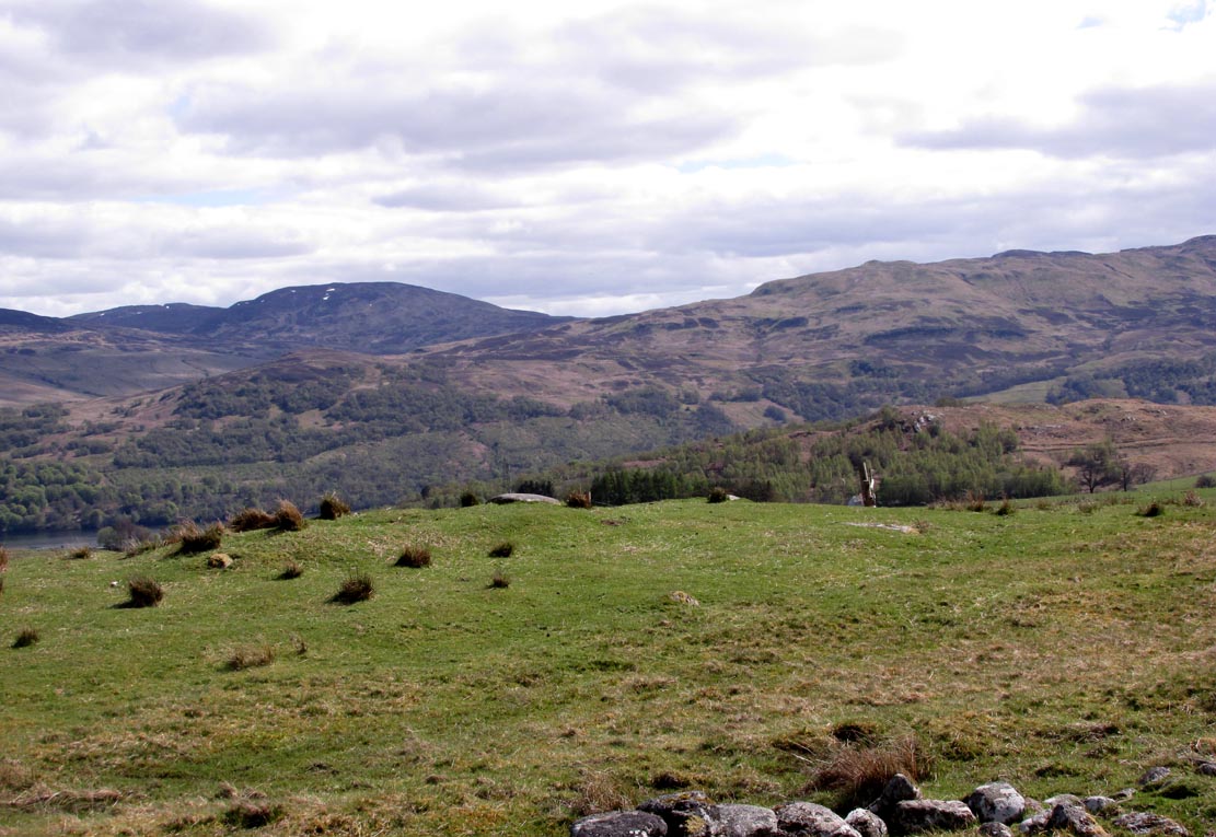
Along the A827 north road around Loch Tay, between Killin and Kenmore, a few hundred yards east of Carie—and on the same side of the road—there’s a dirt-track down to the Tombreck community. Go into it and just past The Big Shed you’ll see the small caravan where the helpful and friendly Gabriela lives. The stone just in front of her caravan is the one you’re looking for!
Archaeology & History
Close-up of the cups
Although this cup-marked rock has been known about for sometime by local people, it is one of many that are not in the archaeological record. It’s nothing like as impressive as some of its petroglyphic neighbours on the slopes of Ben Lawers, as this simple carving comprises of two well-defined simple cup-marks, and another two that appear to have been worked slightly into natural cracks in the rock. These two remain incomplete. It’s nothing too special to look at and is, once again, only gonna be of interest to the petroglyphic purists amongst you.
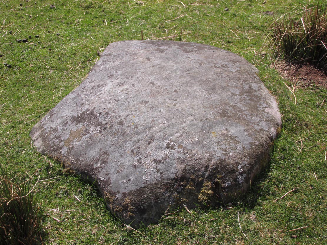
Along the A827 road between Killin and Kenmore, park at the entrance to the Tombreck track and cross the road, walking up the track heading up Ben Lawers. Pass the sheep pens, through the gate and keep going for a few hundred yards until you hit the old straight line of walling which runs off east into the pine trees a few hundred yards away. Walk along here, keeping to the south side, for less than 100 yards, watching out for a small stone on a small rise on a small hillock – and make sure your eyes are in good condition!
Archaeology & History
The stone in question
This is a seemingly unrecorded cup-marked stone, with very faint petroglyphic evidences just visible on the surface. Set within the wider surrounds of more recent enclosure walling, this is a small slightly raised female (rounded, smooth) stone, roughly three feet in diameter, which has at least five cup-markings on its surface—mainly near the middle of the stone. The rock itself is next to the western edge of a raised man-made feature, reminiscent of a collapsed denuded cairn or hut circle, which itself has not been archaeologically assessed. It is one of a number of petroglyphs in relative proximity to each other on the geological ridge above Loch Tay (not visible from here).
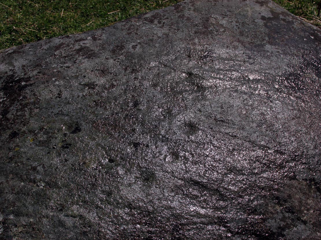
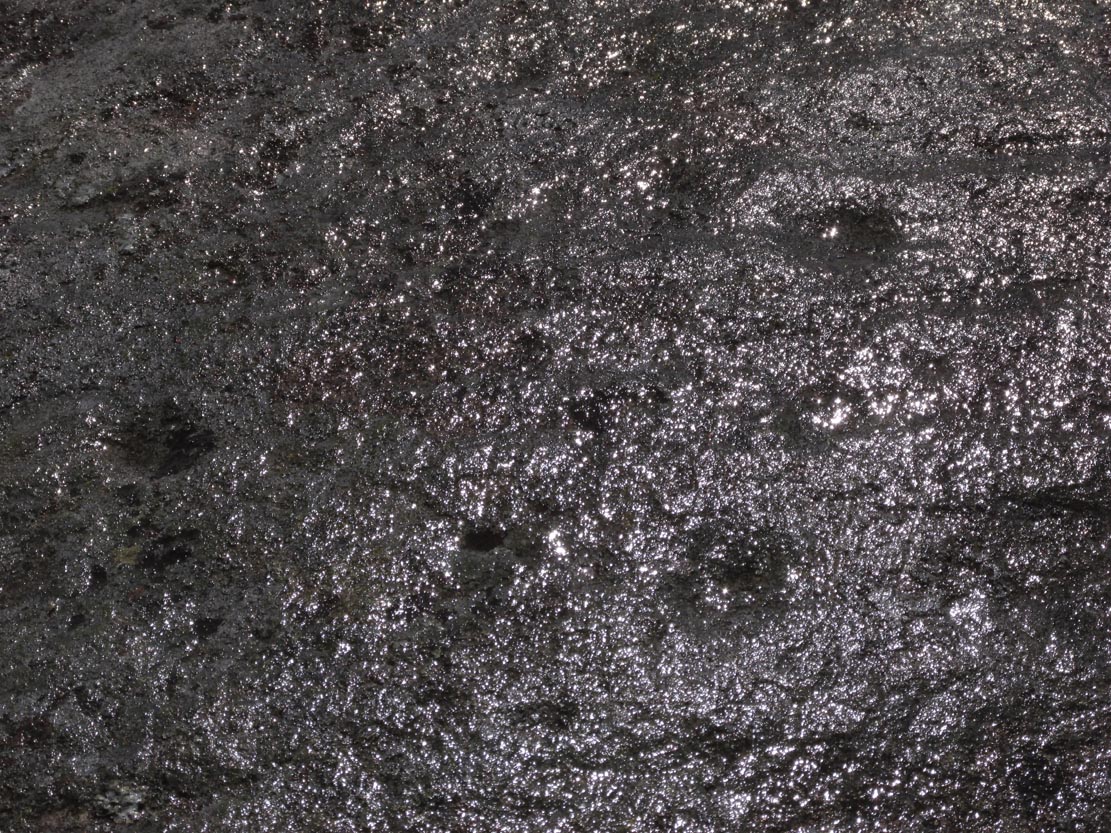
Close-up of faint cupsCloser-up of faint cups
As you can see in the photos left and right, the cups are only truly visible when the stone has been wet. Initially I thought that this carving may have been one that was mentioned briefly in George Currie’s (2009) notes—at NN 64736 38647, 62 (57m) yards to the east—but it doesn’t seem to be the case as the grid reference he cited differs from this. There are going to be a number of other unrecorded carvings scattered about beneath the great shadow of Ben Lawers…
Acknowledgements: Huge thanks to Paul Hornby for the use of his photos in this site profile; and to Lisa Samson, for her landscape detective work at the site.
Take the A827 road that runs alongside Loch Tay between Killin and Kenmore, and about 6 miles from Killin watch out for the signposts for The Big Shed. Stop and walk NW up the track across the road from there, up toward Ben Lawers. Several hundred yards up, past the sheep-fold on the left-side of the track, a line of ruinous walling runs straight over the grasslands. Walk along here until it meets with the next walling that runs uphill. Look down into where the wall has collapsed. It’s under your nose!
Archaeology & History
This is a fascinating and pretty impressive example of a simple cup-marked stone. It’s the design that does it I suppose – similar in some ways to the well-known Idol Stone carving on my old playground of Ilkley Moor (that’s what this one reminded me of when I first clapped eyes on it)—but much better!
Lines of cups from above
The carving from the east
Its similarity lies in the series of parallel rows of cup-marks running very close together along the line of the low-lying rock, found at the base of some ancient walling that runs up the mountain for several hundred yards. Not only that, but the line of walling itself also has a parallel line of walling running adjacent for the same distance up the mountainside — more than half-a-mile from start to finish. This “parallel” feature of walling and cup-markings is a curious coincidence, perhaps. But certainly the linearity of the cup-marks was itself a very deliberate feature by the person who carved it, representing something ‘structural’, in whatever mythic form that may have been!
The carving in its walling
Of the rows of cups constituting this petroglyph, four of them run completely from one side of the stone to the other, rough north to south; with four other shorter rows running only halfway across the rock surface. Altogether there are perhaps seventy cups etched onto the rock. No rings or semi-circles of any form were visible in our visit here—although the skies were grey and overcast, making any decent visual analysis more difficult.
A damn good carving and well worth checking out by anyone into prehistoric rock art!
Take the B954 north out of the Alyth, up through the hills. After just over 2 miles (3km), take the left turn up to Bamff. Go along here and past the copse of trees on your right for literally three-quarters of a mile (1.2km), where a gate takes you into the overgrown meadows on your right. Walk back on yourself for about 100 yards or more, across the boggy stream and up the slope. The embankments of this enclosure are right under nose!
Archaeology & History
Some 70 yards west of the little four-poster ‘stone circle’ of Shealwalls, is this previously unrecorded enclosure. Oval in shape and well-defined at ground level, the great majority of the inside of this enclosure is relatively even and flat. Around its perimeter there are, at intervals, a number of small stones defining its edges along its internal embankment, but these are intermittent and seem to have no deliberate architectural regularity: they may simply be elements of an internal raised platform that have become visible due to erosion processes.
Northwest section of ditch
At its greatest width from the edges of the outer ditch to outer ditch, the enclosure measures more than 22 yards (20.3m) east-west, and at its longest it is 30 yards (27.3m) north-south. The circumference of the enclosure is between 88-89 yards (80m). The average width of the surrounding or enclosing ‘ditch’ is between 2 and 2½ yards (2m) and it has a depth of no more than 2 feet all round. All along the southern side, very little remains of the ditch and in sections it has been eaten into by foraging rabbits and cattle. The most conspicuous section of the surrounding ditch and embankment is along the eastern length (where it gives the impression of being hengi-form in nature); the more rounded northern section of the ditch is very distinct, but is overgrown in Juncus reeds; whilst the western section of the ditch is clear until reaching its southernmost part, where its outer edges become less visible.
SW edge of enclosure
NE arc of ditch, looking west
There seemed to be no visible structures within the enclosure itself, which added to my thoughts that the site was hengi-form in nature, as defined in the surveys by A.F. Harding (1987) and Jan Harding (2006). However, it is best to maintain a simple description regarding the nature of the site until archaeological evaluation can give us a more accurate assessment. Without excavation it is obviously impossible to give an accurate idea of its age, but its architectural form and similarity with other enclosures would seem to place its construction in the late Bronze Age to early Iron Age period.
The monument proved very difficult to photograph with any success as it is much overgrown and the bright sun was in the wrong place! (serious) So, another visit is needed in the hope that we can get better images. A fascinating little site!
References:
Harding, A.F., Henge Monuments and Related Sites of Great Britain, BAR 175: Oxford 1987.
Harding, Jan, The Henge Monuments of the British Isles, Tempus: Stroud 2006.
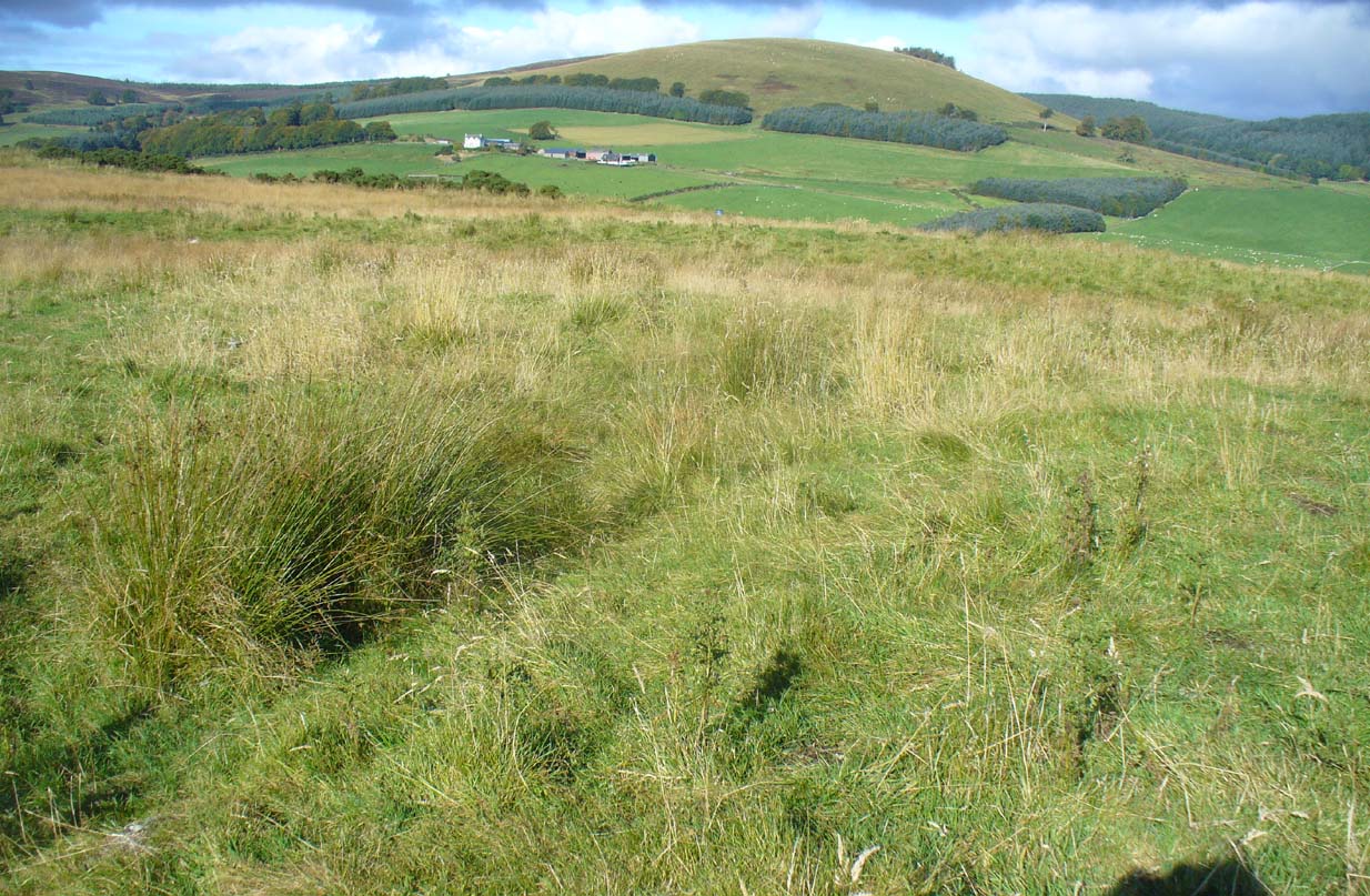
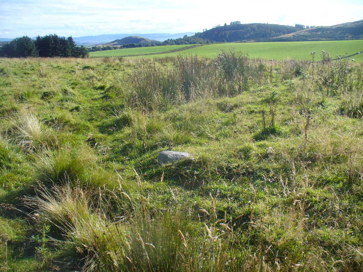
A little-known, but once important site in the mythic history of Scotland, this Long Man’s Grave was said to be the spot where MacBeth—described by Aitchison (1999) as “Scotland’s foremost King”—died. It would seem that any remains of the stone which once stood here has gone. When Robert Chambers (1827) told of the site, he said that
“At the bottom of Dunsinnan Hill, on the east side, and near the west end of a drystone wall which runs along the side of the road from Baledgarno, is a large stone about eight feet in length, beneath which MacBeth is said to have been interred. It is usually called the Lang Man’s Graff, probably from a supposition that the stone was made to suit the length of the deceased.”
More than fifty years later when the Scottish historian Thomas Hunter (1883) wrote about the site, he thought that it had probably been a prehistoric one, telling that
“The tumulus, on being examined, proved to be a druidical stone that had toppled over, and no relic was discovered that could throw light on the tradition.”
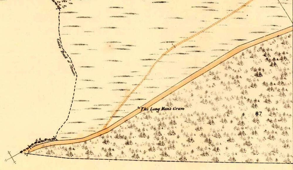
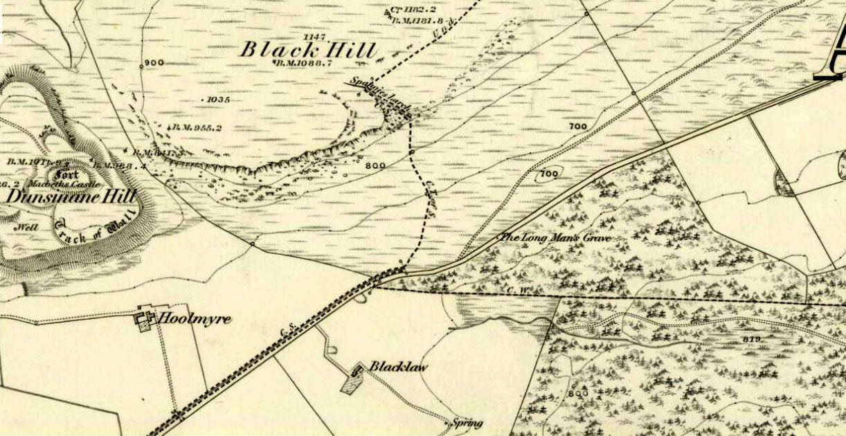
Long Man’s Grave on 1867 6-inch map
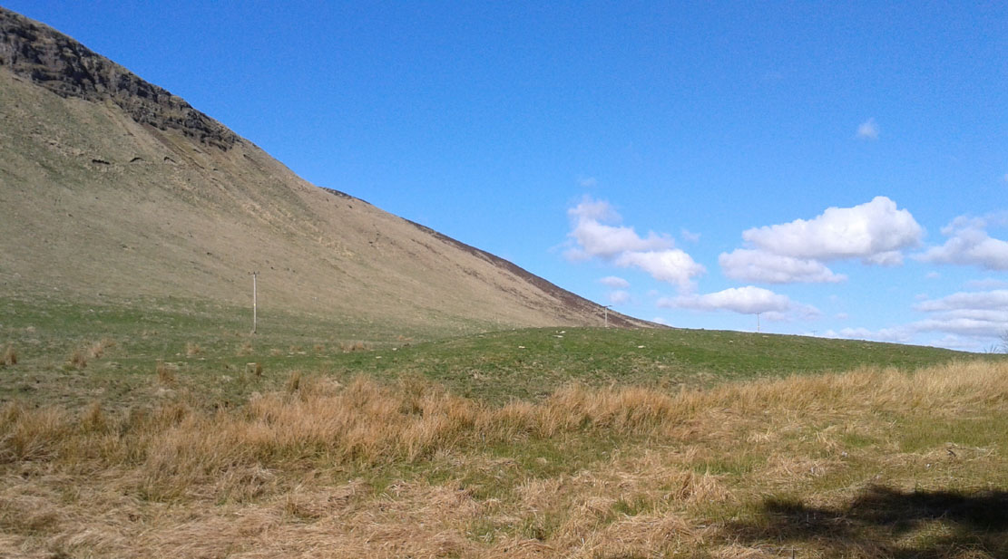
Site of the Long Mans Grave
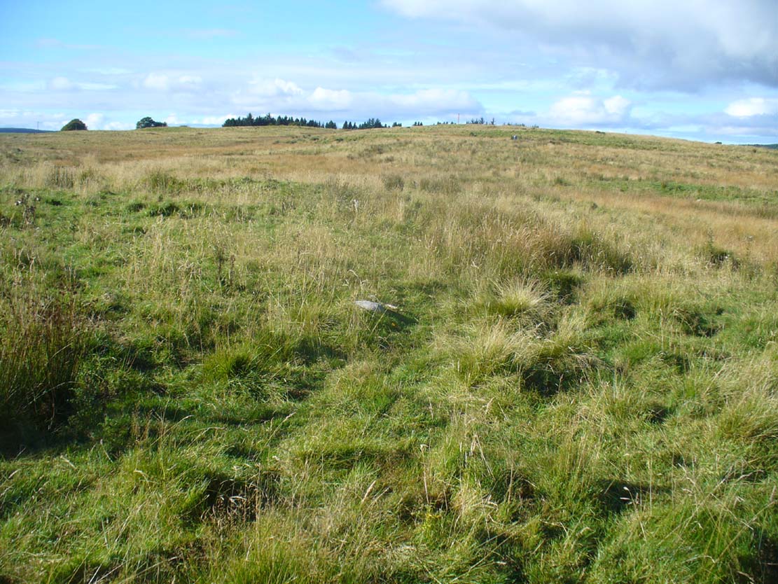
The site was shown on the earliest OS-maps of the region (as highlighted here), but we don’t know for certain about the exact nature of the site. Although a bunch of lads from the Royal Commission popped along to see the place in 1969 and proclaimed (without excavation) that the stone was “probably a ‘grave slab’ and not a “standing stone” which has toppled over”, we have to treat their words with caution. Close by are the remains of Bronze Age stone circles; above us we have the prehistoric hillfort of Dunsinane, with even older neolithic remains being found within it; and we also have neolithic rock art remains nearby; other prehistoric tombs, and plenty more besides…
Folklore
Echoing the early folklore of the site as narrated by local people, Hunter (1883) told that,
“the tradition of the district is that MacBeth, finding it impossible to escape from MacDuff, threw himself from the top of the (Dunsinane) Hill, was killed upon the rocks, and buried at the ‘Lang Man’s Grave’.”
References:
Aitchison, Nick, MacBeth – Man and Myth, Sutton: Stroud 1999.
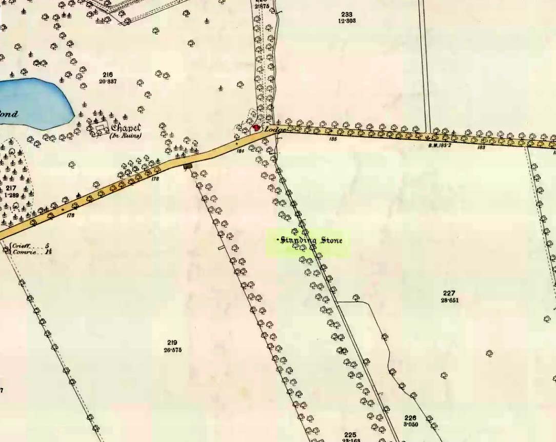
Take the A85 road between Comrie and Crieff. Nearly 1.7 miles (2.7km) east out of Comrie—or 4 miles (6.44km) west out of Crieff—keep your eyes peeled on the fields to the south-side of the road, below and across the mansion of Lawers House. Alongside a long but small plantation of trees you’ll see a large upright stone. You can walk along the track adjacent to the field and through the gate.
Archaeology & History
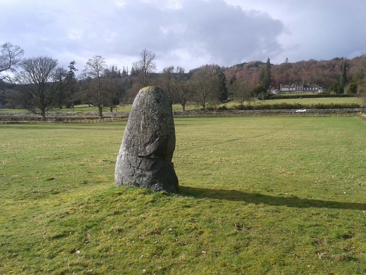
The stone on 1886 OS-map
Shown on the early Ordnance Survey maps of the area, this probably neolithic monolith was suggested by Fred Coles (1911) to have once been part of a larger megalithic circle—although Aubrey Burl (2000) didn’t consider it as a good enough contender to be listed as such in his gazetteer; and unless we can have some positive affirmation, either through folklore or excavation, we should maintain its status as a singular monolith. There is the possibility that it stood as an outlier or had some relationship with a nearby prehistoric tomb—but even this is contentious. Nevertheless, the stone itself is an impressive one!
Mr Coles curiously got the size of the old stone wrong too (although, we have to give him credit, as he did all of his work without electricity or any of our modern ‘stuff’). He wrote that:
“This massive boulder of whinstone is rounded at the base, where it girths 10 feet 3 inches, but tapers upwards to its apex of 5 feet 10 inches, with the eastern edge somewhat jagged and broken. Near its base on the west is a small slab-like fragment of stone, quite earthfast. The north and south surfaces are smooth and nearly vertical, and the longer axis is ESE 75º by WNW 75º.”
Fred Coles’ 1911 sketch
Lawers monolith, looking SE
The stone is actually larger than Coles described, being more than 6 feet 6 inches tall. His sketch (right) “shows the stone from the east”, and is pretty much as we find it today. A notable crack in the stone along the southern face, about a third of the way up, suggests that the stone was broken at some time in the past.
Local architect Andrew Finlayson (2010) included the stone in his local megalith guide and noted how the axes of the stone, east-west, lines it up with Ben Halton to the west and The Knock to the east.
References:
Burl, Aubrey, The Stone Circles of Britain, Ireland and Brittany, Yale University Press 2000.
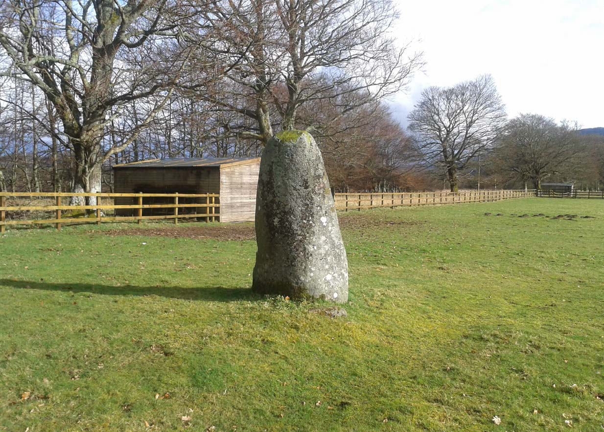
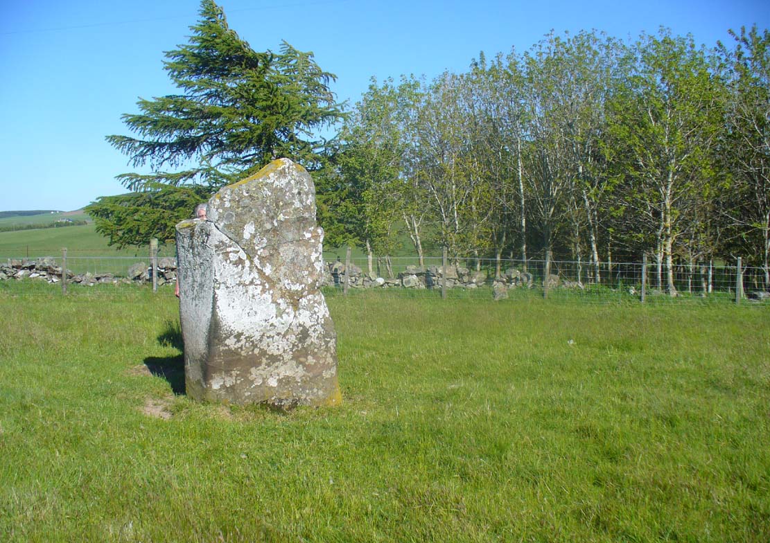
Take the B934 road south, uphill, out of Dunning, for 2.1 miles (3.4km), past Kippen, past Pitmeadow and past Quilts. It’s the track to Knowes that you’re after! Along this track, keep to the field-side on your right, following the edge of the fencing until you reach the small copse of trees. At the far side of the trees a gate takes you into the field with the standing stone, which is just over 100 yards to the north. You can’t miss it!
Archaeology & History
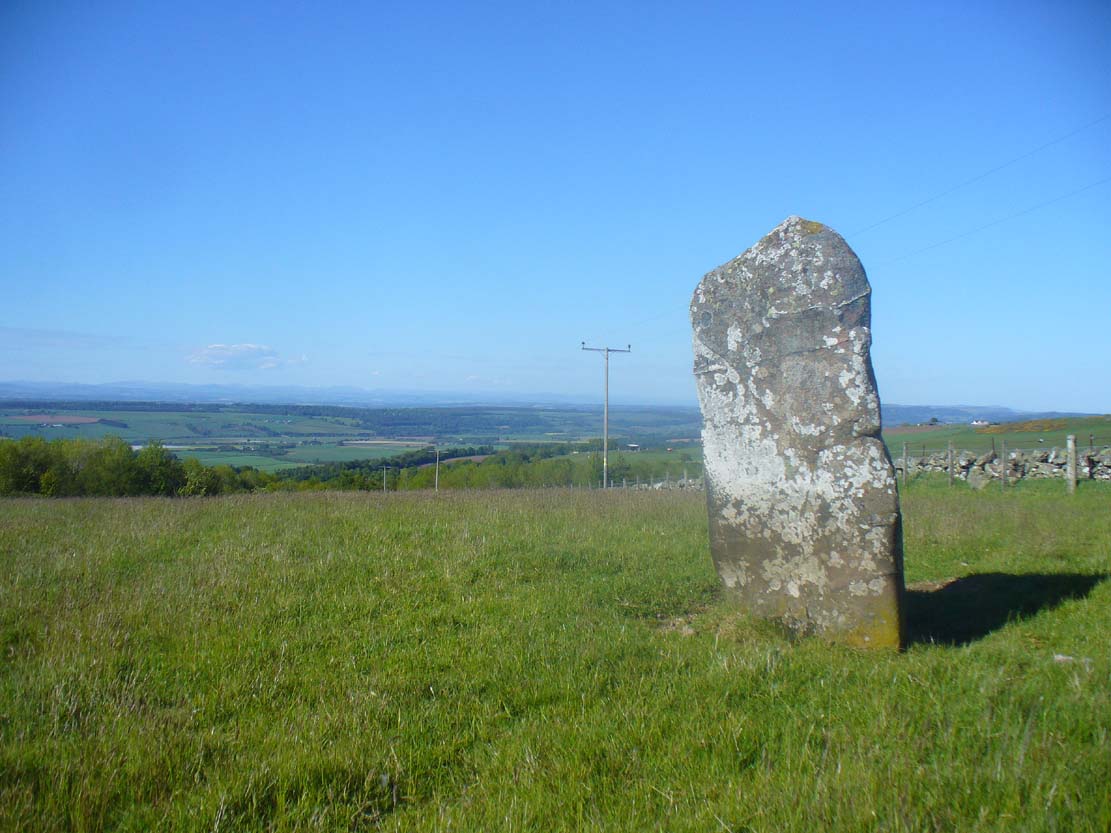
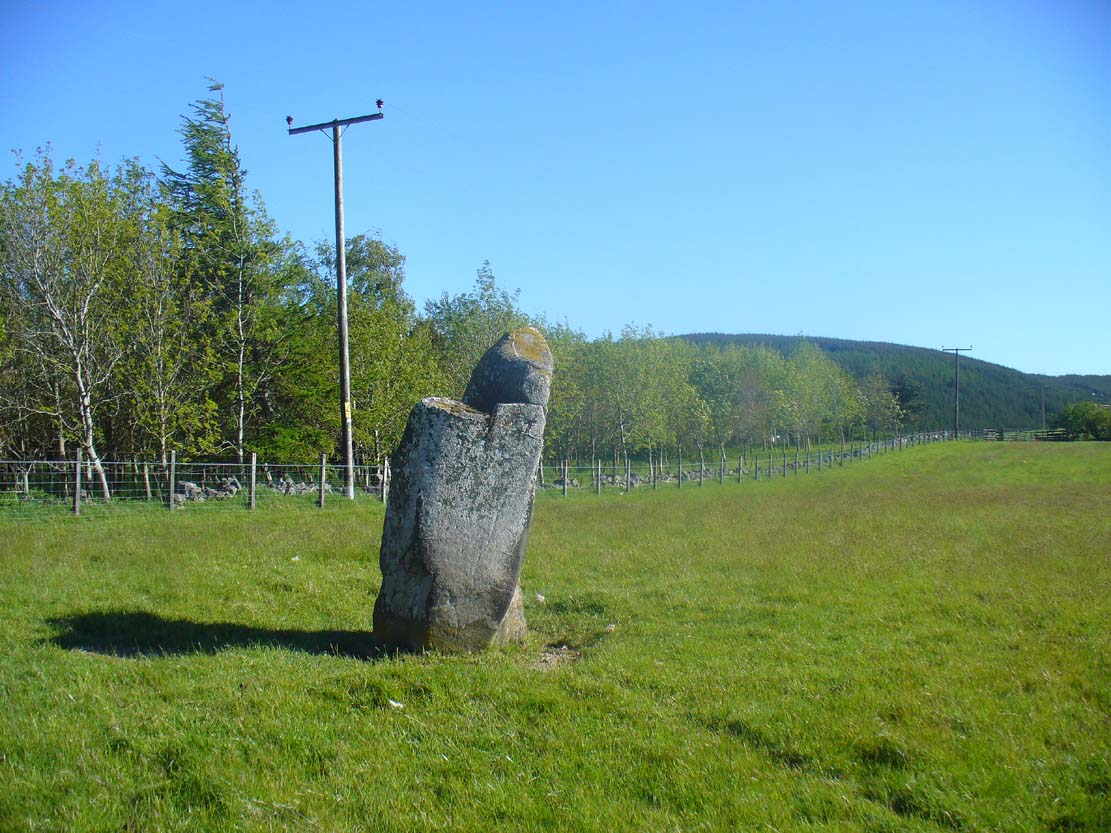
Although mentioned in several folklore works and just a couple of archaeology tomes, almost nothing has been written about this large upright standing stone. A very bulky stone nearly seven feet tall, it has been broken into pieces at sometime in the recent past but, thankfully, good locals put the stone back together and placed it upright once again. Its position in the landscape is quite superb, overlooking the lowlands of Tayside below and then far into the rising mountains of Perthshire and beyond, easy fifty miles or more.
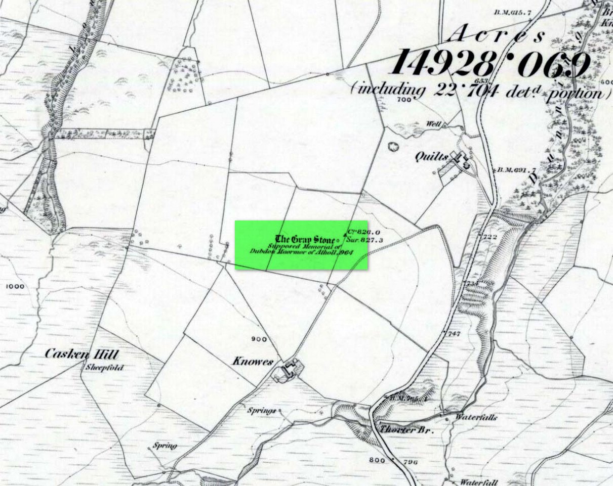
Grey Stone, looking southGray Stone on 1866 map
Shown on the earliest Ordnance Survey map of the area, the name of the stone is somewhat of a puzzle, for in a lot of cases ‘gray’ stones are found on local boundary lines—indeed, the name gray stone and boundary stone are interchangeable in many cases—yet the nearest boundary from here is some distance to the east. It may simply relate to the colour of the rock (although this is unlikely). Whatever its reason, it’s an impressive stone and is well worth checking out!
Folklore
Gray Stone, looking east
The local farmer told that the field where the Grey Stone lives was known as the Big Stane Field. Makes sense! Legend has it that the Gray Stone was the burial place of Maormor, the Steward of Atholl in the Battle of Duncrub, after dying in Thanes Field (Watson 1995), on land to the north of Dunning village in 964-5 CE.
References:
Holder, Geoff, The Guide to Mysterious Perthshire, History Press 2006.
McKerracher, Archie, Perthshire in History and Legend, John Donald: Edinburgh 1988.
Swarbrick, Olaf, A Gazetteer of Prehistoric Standing Stones in Great Britain, BAR: Oxford 2012.
Watson, Angus, The Ochils: Placenames, History, Tradition, PKDC: Perth 1995.