Standing Stone (destroyed?): OS Grid Reference – HY 3347 0450
Archaeology & History
Very little seems to be known of this long lost standing stone, that appears to have been described just once in 19th century notebooks of the Orcadian lawyer and antiquarian, George Petrie. Therein he told how,
“Mr Balfour of Balfour and Trenabie described to me a ball of freestone found close to a Standing Stone on the farm of the Bu of Orphir and near to the churchyard.”
Despite being reported as “destroyed” by the Royal Commission (1946) lads, recently a local man claims to have found what he thinks might be the missing stone, about 400 yards to the southwest, very close to the coast and standing some six feet tall. We await a secondary local report on this.
References:
Royal Commission Ancient & Historical Monuments, Scotland, Inventory of the Ancient Monuments of Orkney and Shetland – volume 2, HMSO: Edinburgh 1946.
Standing Stone (destroyed): OS Grid Reference – HY 3035 1136
Archaeology & History
Very little is known of this standing stone that existed just a half-mile south of the major Stones of Stenness (to which it may have had some archaeo-linear relationship; or perhaps with the Brodgar circle a further half-mile away). It was destroyed sometime around 1860, with no description of its dimensions or appearance. When it was mentioned briefly by J. Fraser (1926), he told us that the position of the stone had subsequently been marked “by a wooden stake in the boggy land close to and north-east of Kethesgeo.”
References:
Fraser, J. “Antiquities of Stenness Parish”, in Proceedings Orkney Antiquarian Society, volume 4, 1926.
Royal Commission Ancient & Historical Monuments, Scotland, Inventory of the Ancient Monuments of Orkney and Shetland – volume 2, HMSO: Edinburgh 1946.
Standing Stone (destroyed): OS Grid Reference – HP 5378 0425
Also Known as:
The Brough
Archaeology & History
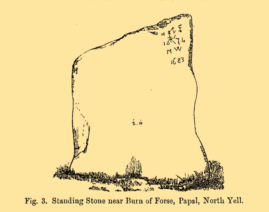
This standing stone formerly stood close to the Burn of Forse, otherwise known as the Garth of Papal in the far north of the island. Described briefly in J.T. Irving’s (1887) essay on the prehistoric remains of the area, the upright was obviously of local stone being,
Papil stone (PSAS 1887)
“a broad flat slab, slightly lower at one side than the other and measuring 4 feet 2 inches in greatest height by 2 feet 10 inches in width, and varying from 18 inches to 6 inches in thickness. In one corner were the initials H I 1674 and M W 1683, with an old merchant’s mark, or something of that description… The late Dr Hunt of the Anthropological Society, dug under it in 1865, with the result that it was left to fall down, and be eventually broken up for building material to be used in the walls of a new school-house.”
Folklore
Irving (1887) told us that, “there is a tradition that a queen who came in a ship to Papal died there, and was buried beneath this stone.”
References:
Irving, J.T., “Notes on some Prehistoric Burial-places and Standing Stones in the Island of Yell, Shetland”, in Proceedings Society Antiquaries, Scotland, volume 21, 1887.
Royal Commission Ancient & Historical Monuments, Scotland, Inventory of the Ancient Monuments of Orkney and Shetland – volume 3, HMSO: Edinburgh 1946.
Standing Stone (destroyed): OS Grid Reference – NY 546 889
Archaeology & History
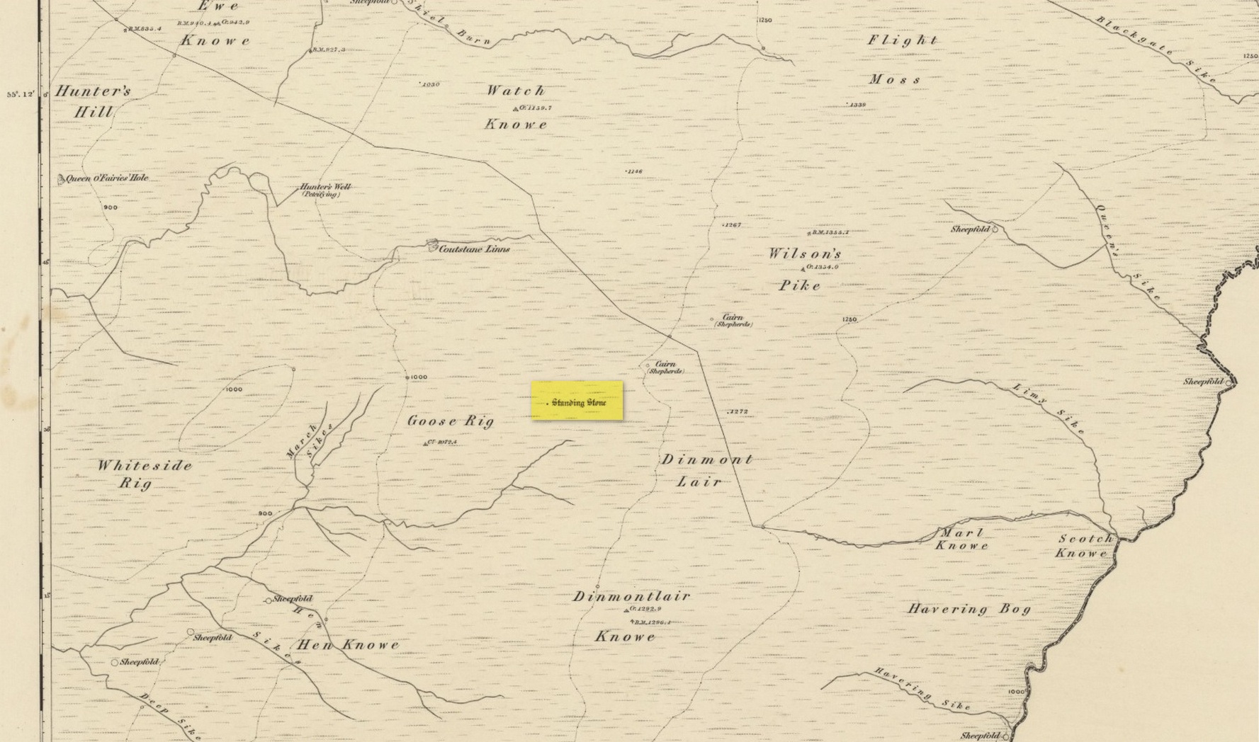
Stone shown on 1863 map
Once found living on the high moors four miles to the east of Newcastleton, close to the English border, all trace of the stone has gone. Highlighted on the 1863 OS-map, the stone was three feet high and was located at the highest end of Goose Rig. It was deemed by local people “to be of ancient origin,” but we know little else about it. A place immediately to the northwest is known as the Queen o’ Fairies Hole, whose history and folklore has also been forgotten…
References:
Royal Commission on the Ancient & Historical Monuments of Scotland, Roxburghshire – volume 1, HMSO: Edinburgh 1956, p.95
I add this brief site profile in the hope that we can clarify, one way or the other, whether the report of a stone circle described in a letter by G.W. Zealand to the Ordnance Survey in November, 1978, has any basis in fact. Zealand said that the structure comprised of “red stone, not very large” at Millden in Glen Esk. Perhaps local people or megalithic explorers who may visit this area could try locating it so we can confirm it as real, or strike it from the listings. It is included in the Canmore catalogues. I must point out that there were a large number of prehistoric sites in this area destroyed in recent centuries, meaning that this report may be authentic.
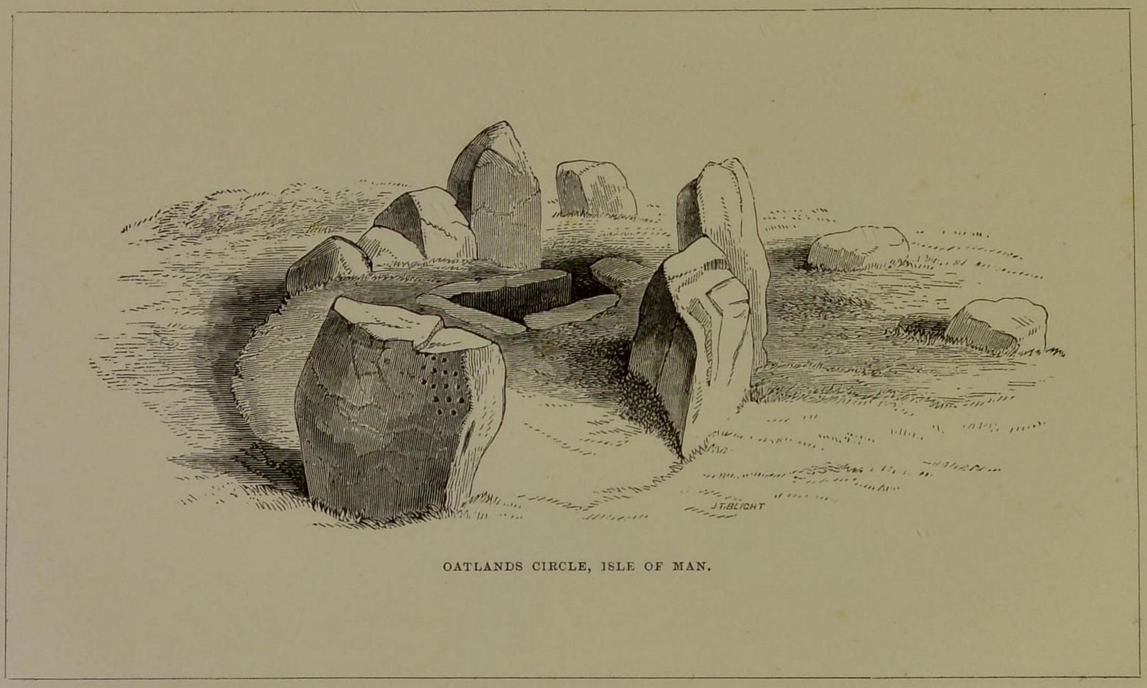
This carving is one that was found inside the remains of a chambered cairn and so, as with all things petroglyphic, it deserves its very own site profile. It’s been mentioned before—in fact many times before, from the legendary J.T. Blight (1868) to our modern researchers—although it was curiously absent in Ron Morris’ (1989) otherwise excellent survey. When Mr Blight described the tomb, he told us that,
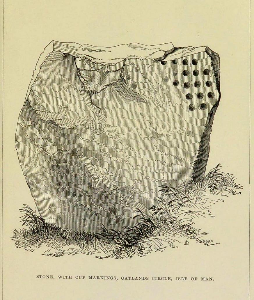
“Its outer ring, of which but three or four stones are left, was about 45 feet in diameter; the inner one 15 feet, with a kistvaen in its midst. As on the external face of one of the uprights of the inner circle there are rows of cup carvings … it may be presumed that this was always exposed to view.”
Position of cups in the tombE.L. Barnwell’s 1868 sketch
The same year, Barnwell (1868) mentioned the same carvings—albeit briefly—telling us “that one of the stones has several rows of the curious cups.” The design faced to the north, which is the traditional direction relating to Death in most northern hemisphere cultures.
As you can see, this design is similar to other petroglyphs that some students have suggested have a numeric nature (see the Idol Stone on Ilkley Moor for example). You can understand why! The basic linearity of the cups, in rows, certainly gives that impression and indeed it’s not unreasonable to make such an assumption—but, as always, we simply don’t know. A similar design was found on a stone at Ballagawne in the parish of Kirk Arbory, but the cups were much deeper and deemed as being a medieval game played on stone, known as Nine Man’s Morris. The original function of the game may have been divinatory.
References:
Barnwell, E.L., “Notes on the Stone Monuments in the Isle of Man,” in J.G.,Cumming (ed.) Antiquitates Manniae, London 1868.
Blight, J.T., “Stone Circles and Megalithic Remains,” in Gentleman’s Magazine 1868.
Cubbon, A. M., Prehistoric Sites in the Isle of Man, Manx Museum: Douglas 1971.
Gale, J. & Darvill, T., “A Survey of the Ballakelly Chambered Tomb,” in Darvill, & T. Billown (eds.), Neolithic Landscape Project, Isle of Man, 1997, Bournemouth University 1998.
Henshall, A. S., “Manx Megaliths Again: An Attempt at Structural Analysis,” in P. Davey (ed.), Man and Environment in the Isle of Man, BAR: Oxford 1978.
Kermode, P.M.C., “The Ancient Monuments of the Isle of Man,” in Archaeologia Cambrensis, volume 84, 1929.
Kermode, P.M.C. & Herdman, W.A., Manks Antiquities, University of Liverpool 1914.
Simpson, James, Archaic Sculpturings of Cups, Circles, etc., Upon Stones and Rocks in Scotland, England and other Countries, Edmonston & Douglas: Edinburgh 1867.
This is a site that requires the attention of some local antiquarians, as there are conflicting reports as to whether or not it still lives in its old haunt. Very little has been written about it and its whereabouts seems to have been completely missed in the radars of all megalithic guides. The Langholm historians—John and Robert Hyslop (1912)—who wrote about the place in their gigantic history work more than a hundred years ago, would no doubt be shaking their heads at such lackings.
They told:
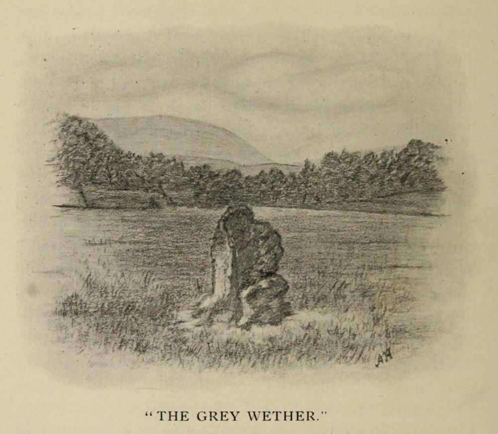
“The best example of the standing stones in the Eskdale district is that at Meikledale in Ewes, locally known as ” The Grey Wether,” a print of which is here given. It is about 5 feet in height and its girth is 8 feet 7 inches, and it would probably weigh about two tons. The stone is the common greywacke, or whinstone of the Silurian series, rough and unhewn. It stands in the centre of a field in front of Meikledale House, and can be seen from the highway. The field is surrounded by hills on every side,”
which the writers thought might have been the reason for its erection here, although having more to do with the natural beauty of the landscape than any archaeocentric or geomantic factor.
Shortly after this had been written, Alexander Curle of the Royal Commission visited the area and made note of this “standing stone known as the Grey Wether…situated on the haughland some 250 yds SSE of Meikledale”, but added nothing more. It was several years later before a Royal Commission (1920) team came here and told that,
“A standing-stone, known as the “Grey Wether,” is situated on the haugh-land, some 250 yards south-south-east of Meikledale. It is a large whinstone slab, measuring in greatest height 4 feet 8 inches, in breadth 3 feet 5 inches, and in thickness 1 foot, and faces west-south-west and east-north-east.”
Stone shown on 1857 map
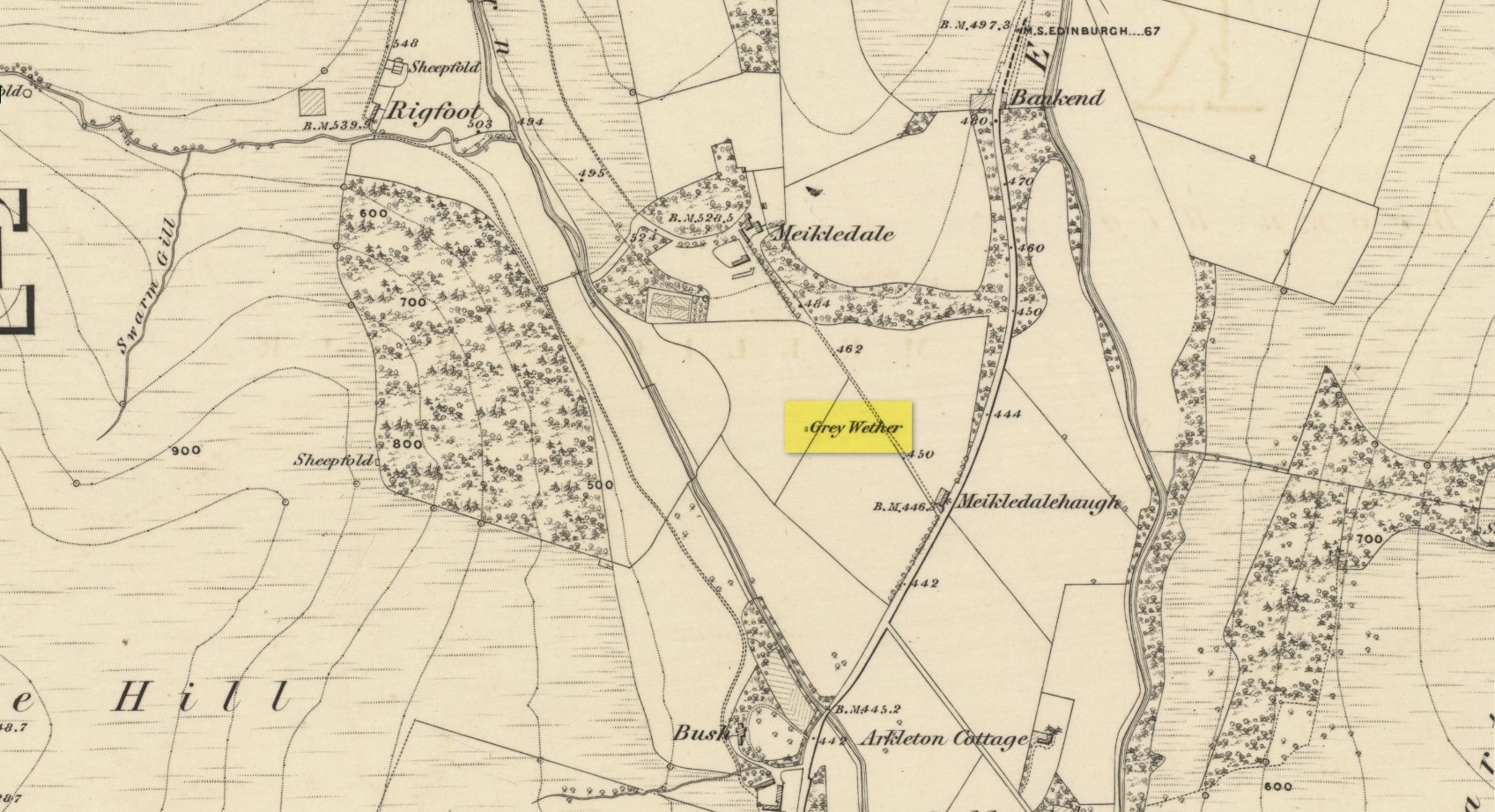
But they subsequently reported that, prior to World War 2, some complete dickhead knocked it down, broke it up and dumped it in a nearby stream! However, in 1980 some more lads from the Scottish Royal Commission revisited the area and alleged that a stone laid in the field 250 yards below of Meikledale farmhouse was our old Grey Wether. The position they describe is the same spot as the one shown on the 1857 OS-map; and at this very spot on GoogleEarth it seems that a stone there lies… Are there are any local folk in that neck o’ the woods who could find out…?
Folklore
The Greywethers stone circle on Dartmoor has a veritable mass of folklore attached to it, but its namesake here at Langholm has very little. The origin of its name has been forgotten. All we have left is what the Ordnance Name Book in 1857 recorded, telling that “it is supposed to have been erected in memory of some Hero, but no further account of it can be obtained.”
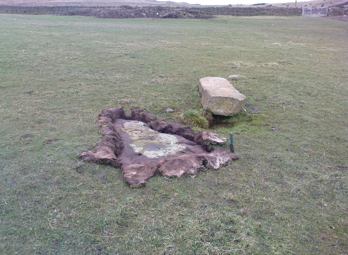
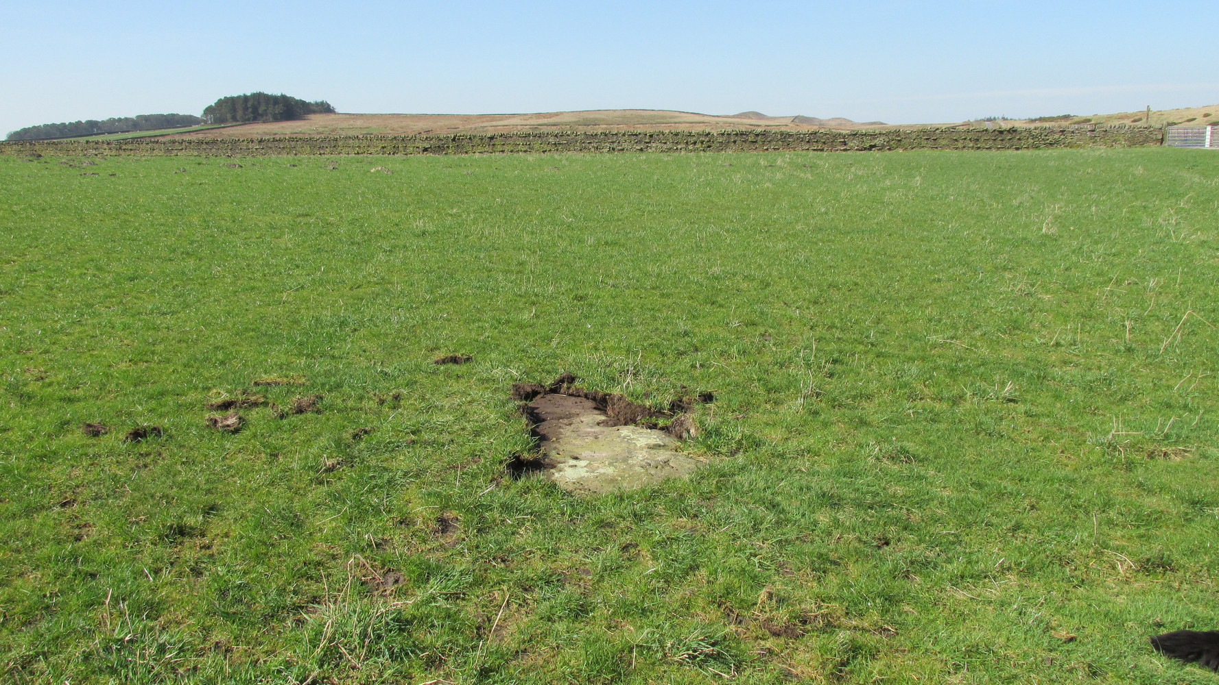
Probably the easiest way here is to take the well-trodden Dales High Way track westwards, under the bypass from Addingham, and along the old Roman Road. After 1.7 miles (2.7km) you’ll reach the Heights Lane country road. Stop here! Walk back on yourself along the track for maybe 50 yards and look in the field to your right (south) between 10-20 yards in the short grass and there, somewhere under your feet next to a modern stone, you’ll see peeking up at you (probably somewhat covered on the whole by the soil) a long flat stone. That’s what you’re looking for.
Archaeology & History
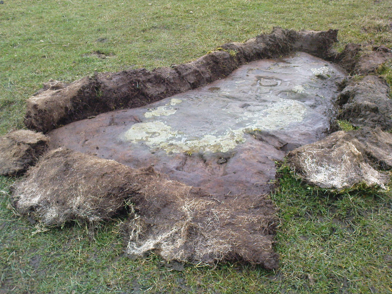
This old stone had been sought after by various groups and people for many years and I was fortunate to relocate it about thirty years ago, laid down and all-but-hidden beneath the grasses. The stone appears to have been buried nearly 100 years earlier, because when Harry Speight (1900) wrote about it in 1900 he described it as still upright. In more recent years, it seems that the farmer has put a replacement stone next to its position with the letters “JC” cut into it. You can see it in the above photo.
Thief Thorne uncoveredThief Thorne, looking W
First mentioned in the 16th century and included in boundary perambulation records of 1709, and again in 1781, someone during that period turned it into a milestone, etching the words “To Skipton 3 m. To Addingham 2 m.” It stood by the old Roman road, but its considerable erosion and shape is decidedly prehistoric. Nearly 6 feet long, it is now laid in the earth and almost completely covered over. A sure case for resurrection.
References:
Bennett, Paul, The Old Stones of Elmet, Capall Bann: Milverton 2001.
Speight, Harry, Upper Wharfedale, Elliott Stock: London 1900.
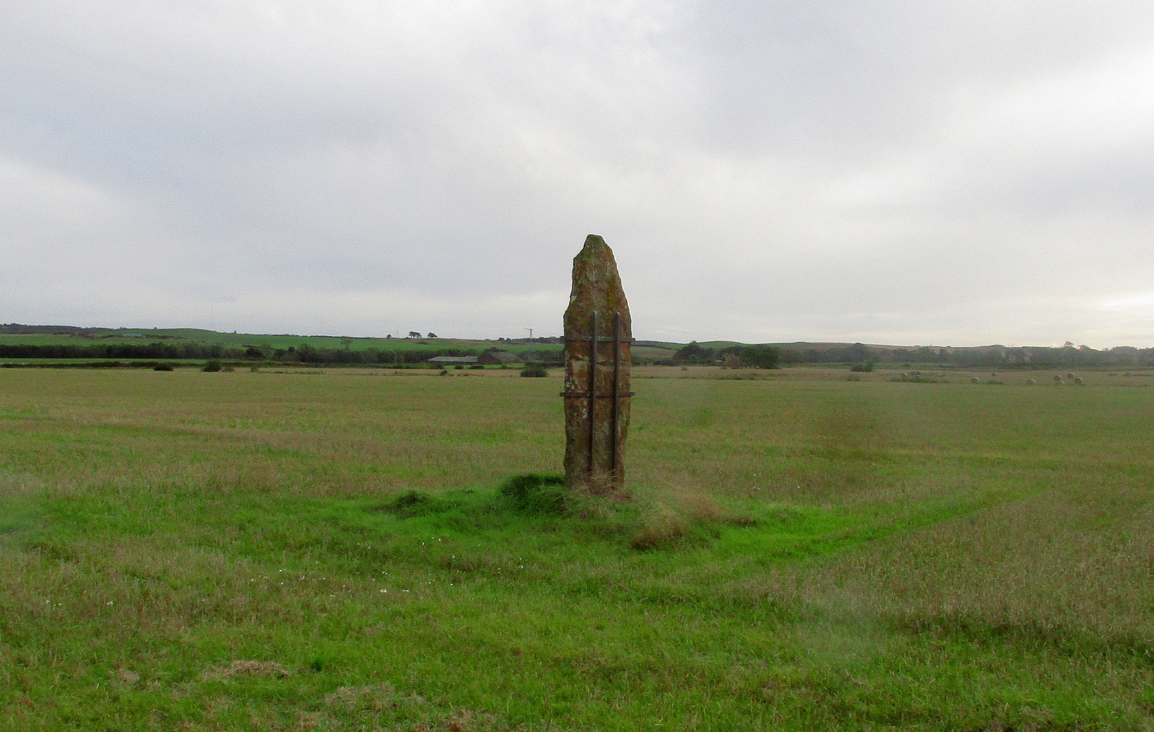
Take the A917 road southeast out of St Andrews, heading towards the hamlet of Boarhills about 4 miles away. However, about a half-mile before you get to Boarhills, keep your eyes peeled for a small minor road on your right, signposted to Dunino, 3 miles. Go along here for about 350 yards where you’ll reach a track cutting across the road. Walk up the gently sloping field here on your right and you’ll see, 400 yards from the road whence you’ve parked, a tall thin upright stone standing alone…
Archaeology & History
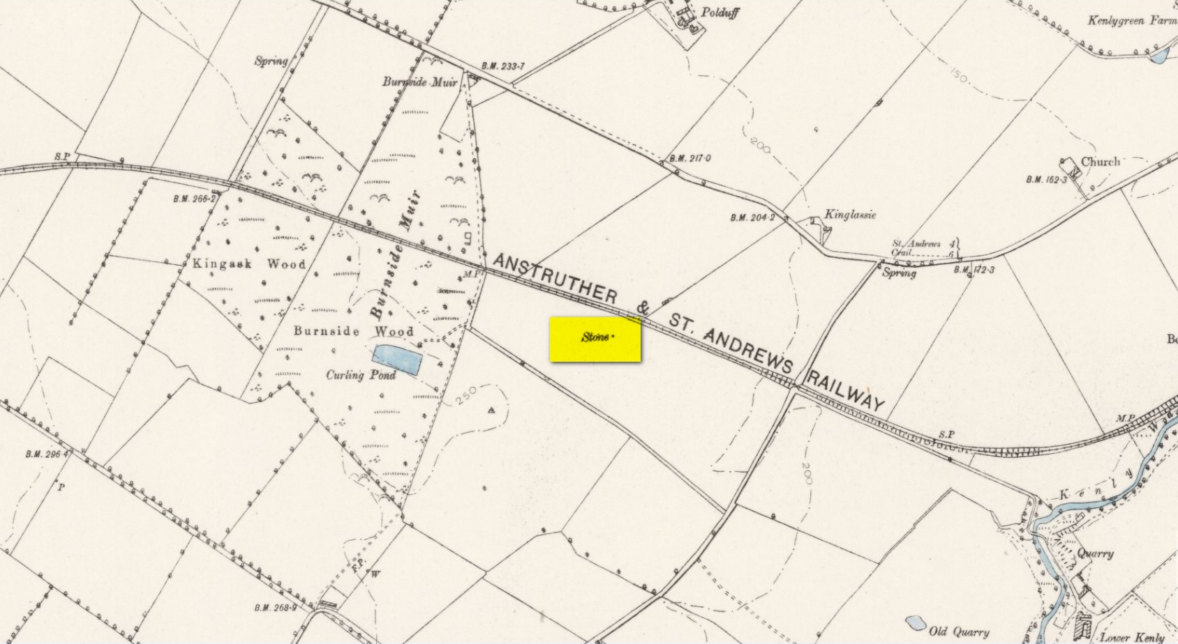
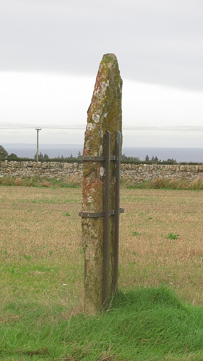
Highlighted on the 1893 and 1896 OS-maps (as merely a “Stone”), this tall and incredibly skinny standing stone has seen better days. After many-a-millenia, the god of storms cut the stone to the ground not too many years ago, leaving it broken in the middle o’ the field where once it stood. Thankfully however, local folk ensured that it was eventually resurrected and fixed into position once more, albeit in a somewhat ugly cage—or corset as Mr Hornby called it!
The Royal Commission (1933) lads checked the stone out for inclusion in one of their damn good surveys, they told us the following:
“About midway between the farms of Polduff and Peekie, and on the south side of the Anstruther and St Andrews Railway, 200 feet above sea level, there is a fine block of red sandstone, which rises to a height of just over 9 above ground. It averages 4¼ inches in thickness and measures 2 feet 4 inches wide across the broad faces. The stone has been set up with the major axis north-east and south-west and has been well packed round the base with smaller stones.”
Interestingly—to me anyhow—when the monolith was recently stood back in its upright position, the archaeo’s found a spring of water beneath it. Many dowsers (and I don’t mean the ones who fallaciously reckon they’re finding ‘energy lines’ all over the place) have found the crossing of underwater streams and water sources to be a common feature beneath megalithic sites.
Folklore
In Richard Batchelor’s (1997) short work on the ancient sites of this area, he calls attention to what a Mr N. Dow thought was a ley-line passing from the cairn on top of Kellie Hill 4¾ miles (7.64km) away, northeast to the Peekie Stone, and which Mr Batchelor points out is close to the major lunar standstill.
References:
Batchelor, Richard A., Origin of St Andrews, Shieling: St Andrews 1997.
Royal Commission on the Ancient & Historical Monuments, Scotland, Inventory of Monuments and Constructions in the Counties of Fife, Kinross and Clackmannan, HMSO: Edinburgh 1933.
Acknowledgements: Huge thanks to Paul Hornby for use of his photos.
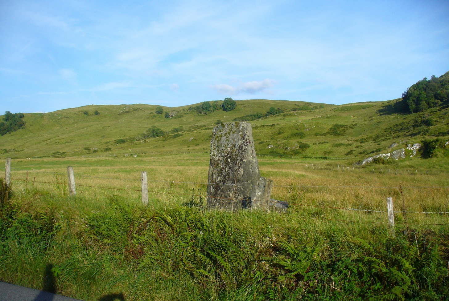
From Kilmartin go north on the A816 Oban road, and after 1½ miles watch out for the small B840 road on your right, to Ford and Loch Awe. Less than a mile along the winding road, just after the track to the farmhouse on your left, keep your eyes peeled for the standing stone on your right, whose top is peeking over the old walling. If you’re not careful you’ll miss it!
Archaeology & History
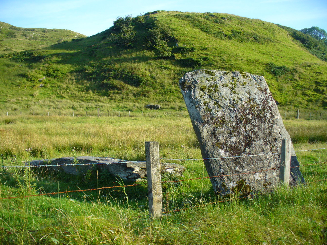
From the roadside this looks like just a reasonably small standing stone, but closer inspection shows it’s been snapped halfway up—apparently in a great storm in December 1879. If you look over the wall, just a couple of yards behind the upright you’ll see the larger section of stone that was attached to the 6-foot upright before its calamitous fall. Originally it was said to have been 16 feet tall!
Broken bit laid flatFrom the roadside
The first description of the stone is thought to be by the great J. Romilly Allen (1880) in his brief visit to Ford, saying simply that the stone “is close to the road on the east side, 1 mile from Ford. It is 14 feet high and 3 feet by 4 feet at the base. The material is slate. It inclines considerably from the perpendicular”—meaning, that he saw it before the stone had been broken. Lucky bugger!
More than twenty years later David Christison (1904) visited the site and wrote his of his finds in an essay for the Society of Antiquaries, although in truth he said little more than anyone before and after has been able to say:
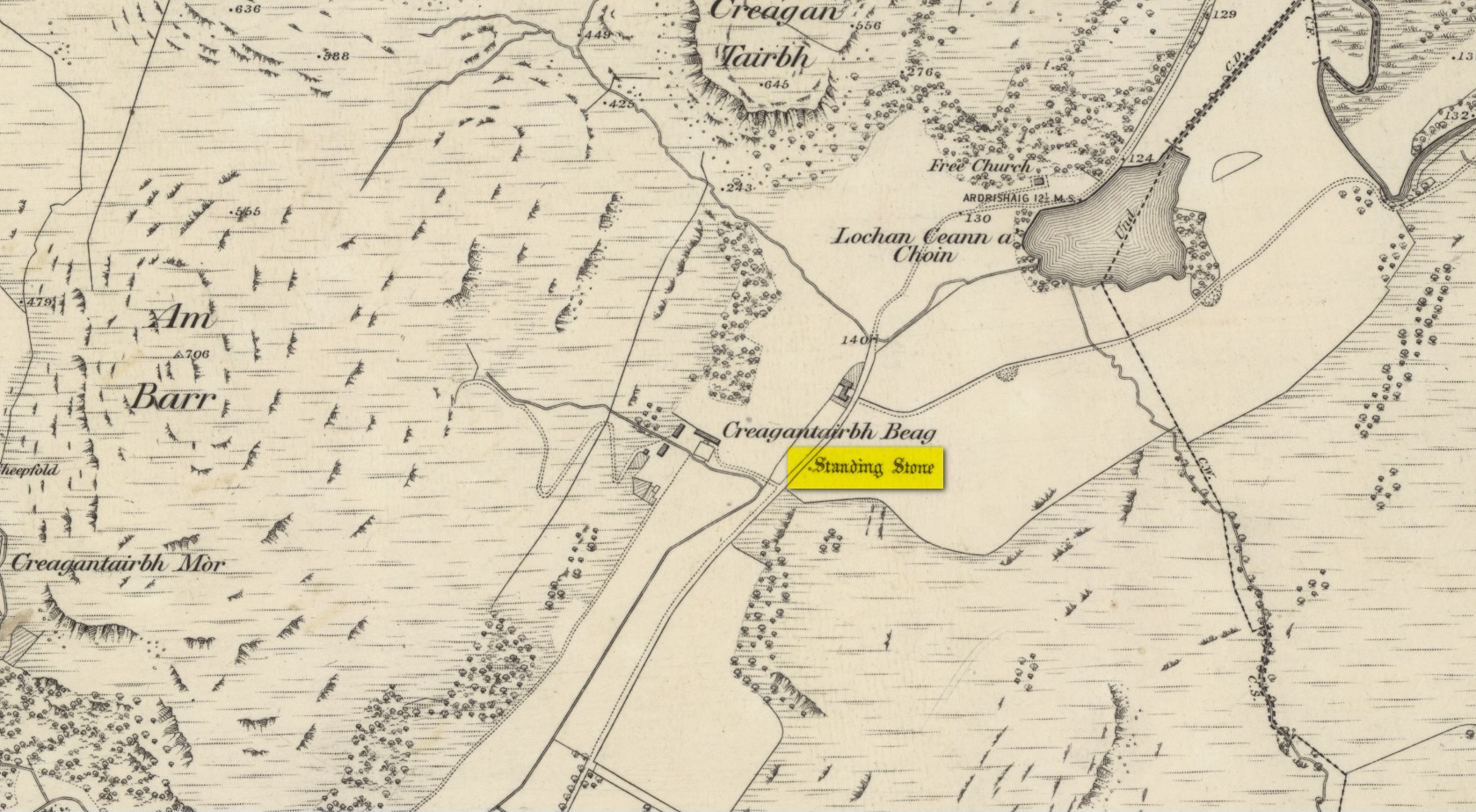
“A mile and a quarter south-south-west of Ford Church, 130 yards east by south of Creagantairbh Beag farmhouse, close to the west side of the highway, stands the base of an obelisk, at the foot of which the shaft lies prostrate. The base is 5 feet 6 inches high,’and has an oblique ledge, half way up on to which the shaft would accurately fit. If restored, the height of the stone would be 16 feet 2 inches above ground, and it must have had a very handsome appearance, tapering in width as it gradually does from 2 feet 6 inches to 2 feet. It is 18 inches thick at the base and 10 inches to 12 inches at the top.”
Christison’s 1904 sketch
The name Creagantairbh derives from the Crag of the Bull, which is the sharp hill immediately in front of you to the north; and its geological consort, the Creag a’ Chapuill (or Crag of the Horse) rises to its immediate northwest. A few hundred yards further along the road towards Ford is the large Auchinellan standing stone.
Folklore
When I lived in Ford many years ago, the olde folk told me how, in bygone centuries, bulls were sacrificed on the Creagantairbh above.