Standing Stone (destroyed): OS Grid Reference – NY 546 889
Archaeology & History
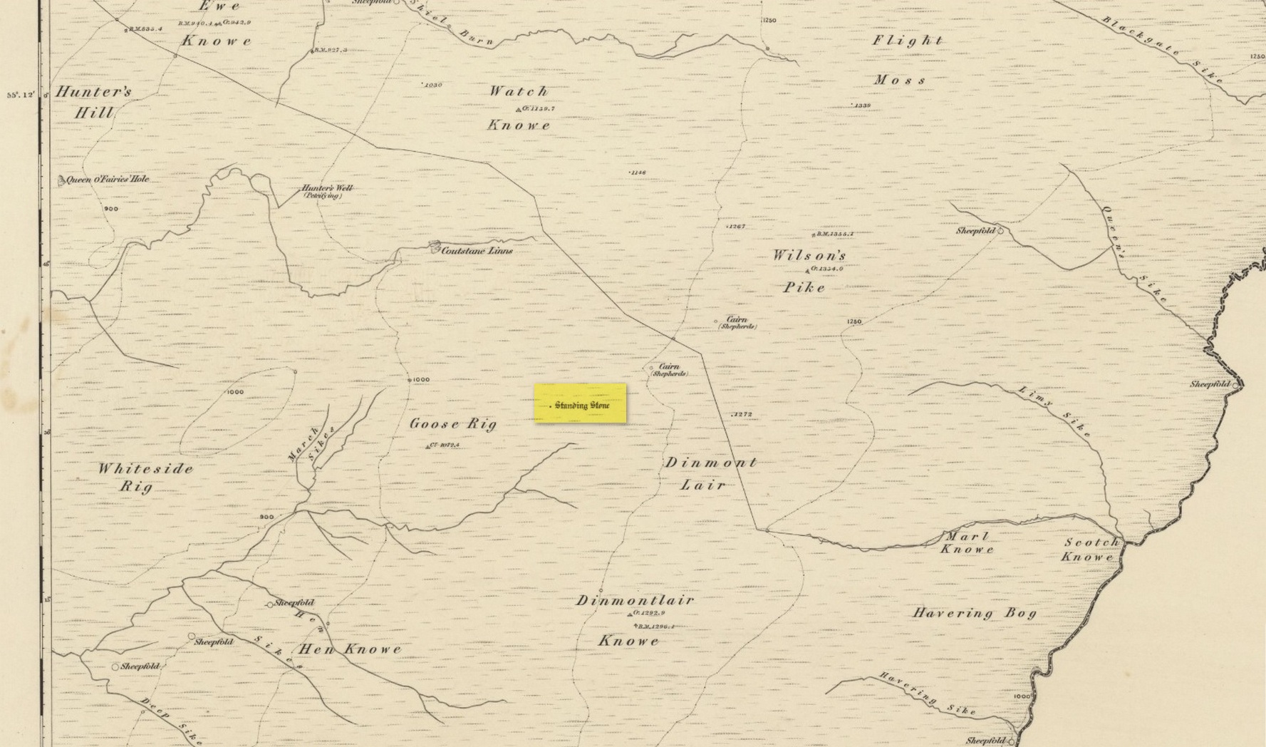
Once found living on the high moors four miles to the east of Newcastleton, close to the English border, all trace of the stone has gone. Highlighted on the 1863 OS-map, the stone was three feet high and was located at the highest end of Goose Rig. It was deemed by local people “to be of ancient origin,” but we know little else about it. A place immediately to the northwest is known as the Queen o’ Fairies Hole, whose history and folklore has also been forgotten…
References:
- Royal Commission on the Ancient & Historical Monuments of Scotland, Roxburghshire – volume 1, HMSO: Edinburgh 1956, p.95
© Paul Bennett, The Northern Antiquarian