Stone Circle (destroyed): OS Grid Reference – NO 5225 6924
Archaeology & History
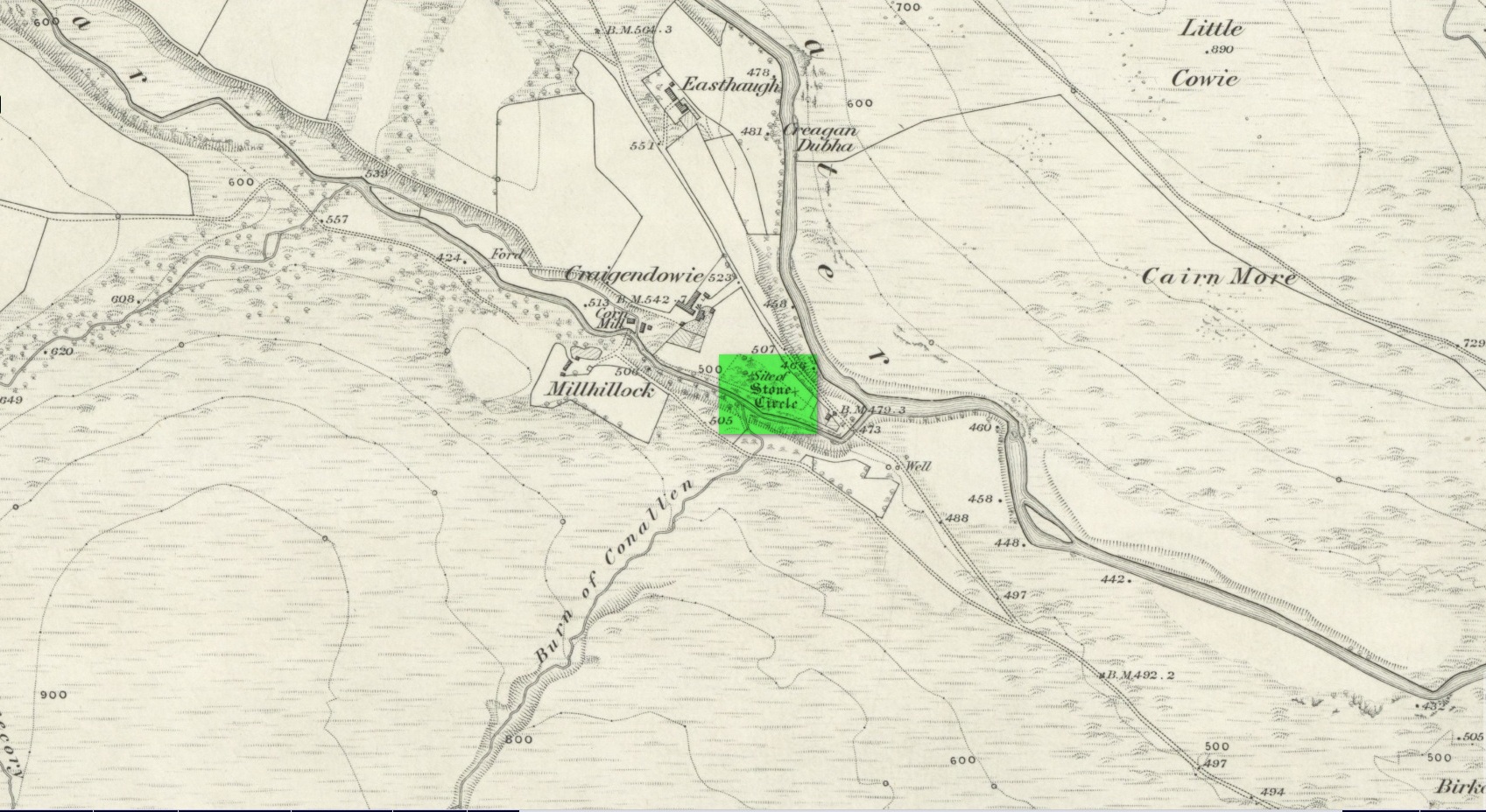
Site shown on 1865 map
All remains of this stone circle have long since bitten the dust. It was already described in the past tense when Alexander Gardner wrote his summary of the parish in the New Statistical Account in 1843 where he told that, “there are the remains of two or three small Druidical temples, one at Newbigging, one at Blairno, and one said to have been at Craigendowie, but now demolished.”
A few years later Andrew Jervise (1853), in his classic tome on the Mearns, gave us the best description of the place, based either on his own personal visit here, or one given to him by a local when he was surveying the history of the area. He wrote:
“In the vicinity of Craigendowie … among the mass of artificial-looking cairns (which are said to be the graves of warriors), there was a small circle, composed of a quantity of stones about the same size, and ranged in the same manner, as those at Fernybank…. Unlike the latter, this circle was never thoroughly explored, even at the time of its removal more than forty years ago, and if as old as prehistoric times, it cannot now be said in how far it may have been a place of sepulture. Craigendowie has, perhaps, its true etymon in the Gaelic Craigandubh, or “the black rock,” for the craig is an immense black rock close by the river-side; but, according to a truer etymology, as well as popular story, it implies the “rock of the funeral cairn,” or perhaps the “craig of battle or mischief;” and, if any reliance can be placed on the tales regarding the malicious actions of the kelpie in the dark pool beside it, or in the story of warriors having fallen in the neighbourhood, the latter rendering may not be altogether inept!”
When the Ordnance Survey lads wrote about it their Name Book (1861) they told simply of its memory, saying,
“There is now nothing remaining to mark the site except a portion of the ground being still uncultivated, nor is there any person who recollects seeing any remains. It is supposed to have been demolished in making an old road through it, the track of which is still plain.”
And, later still in Cruikshank’s (1899) major work on Lethnot township he added little extra information other than saying that “it was situated in the field in front of the farmhouse (but) is entirely destroyed.”
References:
Cruikshank, F., Navar and Lethnot: The History of a Glen Parish in the North-east of Forfarshire, Black & Johnston: Brechin 1899.
Jervise, Andrew, The History and Traditions of the Land of the Lindsays in Angus and Mearns, Sutherland and Knox: Edinburgh 1853.
Royal Commission on the Ancient and Historical Monuments of Scotland, The Archaeological Sites & Monuments of Central Angus, Angus District, Tayside Region, HMSO: Edinburgh 1983.
Warden, Alex J., Angus or Forfarshire: The Land and People – Descriptive and Historical – volume 4, Charles Alexander: Dundee 1884.
Acknowledgements: Huge thanks for use of the Ordnance Survey map in this site profile, reproduced with the kind permission of the National Library of Scotland.
Cup-Marked Stone (lost): OS Grid Reference – NN 4808 0140
Archaeology & History
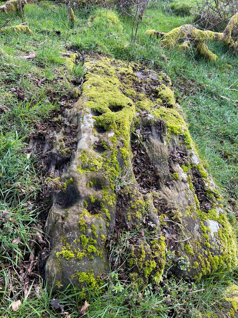
On the south-side of Loch Ard, just a few yards from the entrance to Rob Roy’s Cave (one of several), right by the water’s edge are the natural upstanding pillars known locally as Gog and Magog. In Peter Joynson’s (1996) work on Aberfoyle, this site is listed as one in a number of unrecorded cup-and-ring stones in the area. Discovered by a local lady—”the late Mrs Maitland”—here we have,
“two huge stones about 30ft high known as Gog and Magog situated at the mouth of Blan Ross Bay. They have numerous cup marks, but sadly have disappeared from view as they have been covered by forestry planting.”
This is an increasingly annoying problem that many rock art students are having to contend with! When we visited the site, the tops of these huge stones were, indeed, covered in depths of mosses and pine needles and the carving is hidden from sight. When the trees are felled, let’s hope someone can find it!
Folklore
These natural rocks were said to have been two giants that were turned to stone, the story of which seems to have been forgotten…
References:
Joynson, Peter, Local Past, privately printed: Aberfoyle 1996.
Stone Circle (destroyed): OS Grid Reference – NX 693 709
Archaeology & History
In March 1844, Rev. W.G. Crosbie in his survey of the parish of Parton, mentioned the mediaeval earthworks, or motte, above the west side of the Borland Glen:
“At a short distance from this,” he wrote, “are the remains of a small Druidical circle.”
This “Druidical circle” was subsequently described in Fred Coles’ (1895) megalithic survey of Kirkcudbrightshire, where he added that the circle was “some two hundred yards distant” from the motte—but it had already been destroyed when he wrote about it and its exact location seems to have been forgotten. Logic suggests that the circle would have been on the lands immediately west of the motte, where the land is relatively level and possesses several small hillocks, which would be perfect for megalithic siting. (the grid-reference cited above is an approximation)
References:
Burl, Aubrey, The Stone Circles of Britain, Ireland and Brittany, Yale University Press 2000.
Coles, Fred, “The Stone Circles of the Stewartry of Kirkcudbright”, in Proceedings Society Antiquaries, Scotland, volume 29, 1895.
Crosbie, W.G., “Parish of Parton,” in New Statistical Account of Scotland – volume 4, William Blackwood: Edinburgh 1845.
On the A81 road from Aberfoyle to Strathblane, about a mile south of Aberfoyle take the tiny right turn (keep your eyes peeled!) to Gartmore. Along the tiny curving road for exactly 1km (0.61 miles), where the road has straightened out there’s a small dirt-track with a parking spot along it. A few hundred yards along there’s a crossroads of dirt-tracks: walk to your left (SW) for nearly a mile (or exactly 1.5km) keeping your eyes peeled for a small distinct footpath leading down-slope on your left. Walk along this undulating path for just over 200 yards till you go through the gate, then walk immediately to your right down the side of the fence in the field for about 20 yards. Y’ can’t miss it!
Archaeology & History
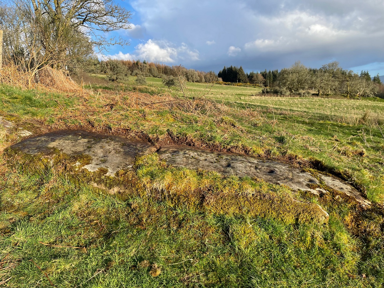
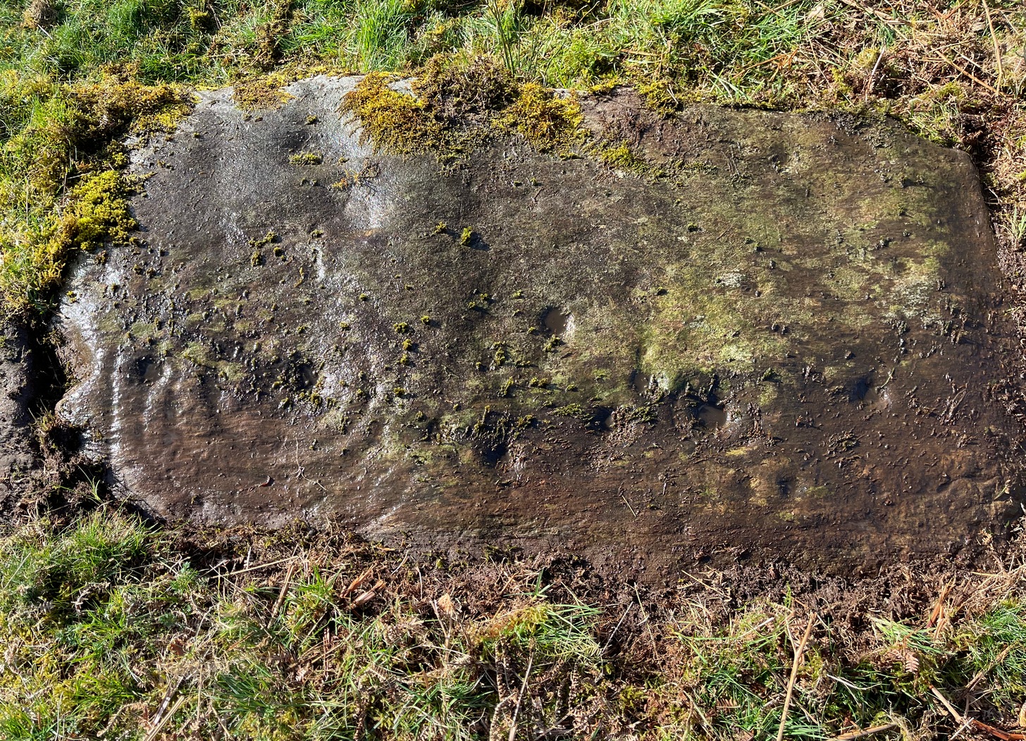
Blarnaboard (3), NE-SW
Located on the land of the early bards of Gartmore, we could speculate that those early orators told tales of, and from this old stone—but that’s all it would be: dreamy speculation. Instead, passing that aside, the petroglyph itself brings us a feast to drool over!
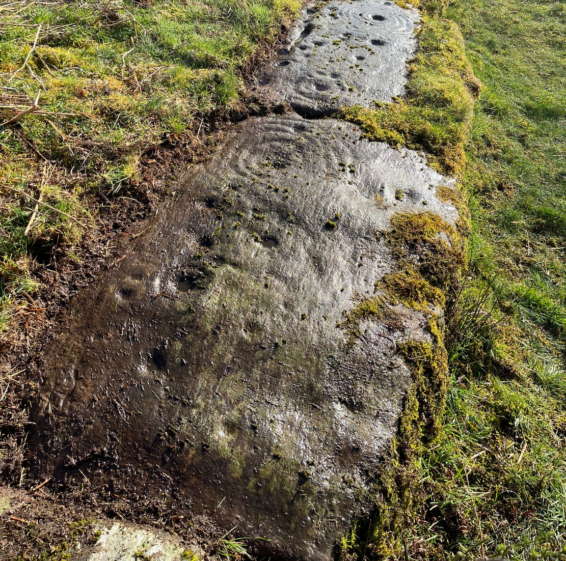
Made up of four distinct carved sections of almost interconnecting rock, this flat thin line of stone is covered with an impressive array of cups and multiple rings. Running downhill in a northeast to southwest line, it would appear to have been written about for the first time by Lorna Main (1988) who subsequently described it in the usual archaeological shorthand, simply telling that,
“There are at last 28 cups, 3 cup and one ring, 4 cup and two rings, 2 cup and three rings, 1 cup and five rings and 1 cup and seven rings.”
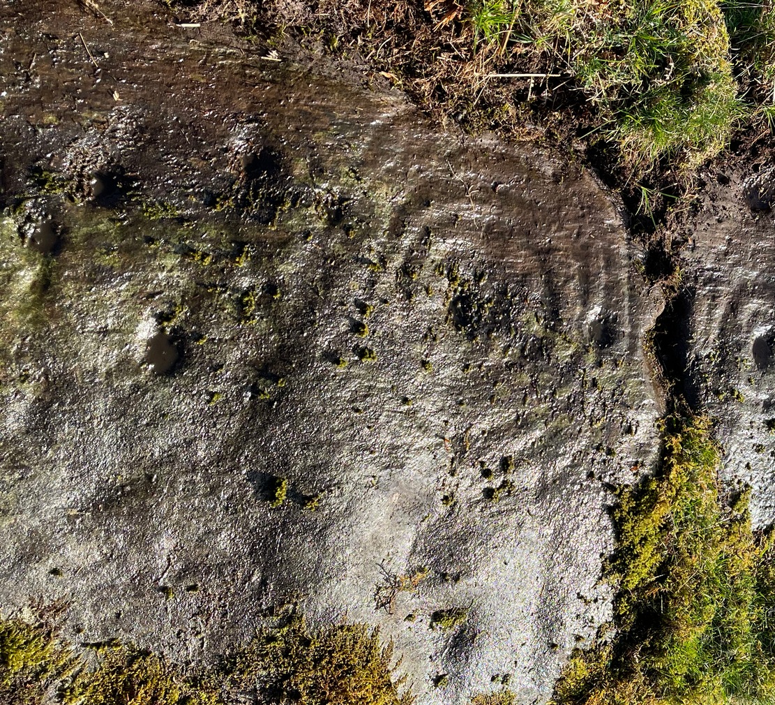
Multiple ringed elementSection 1 overview
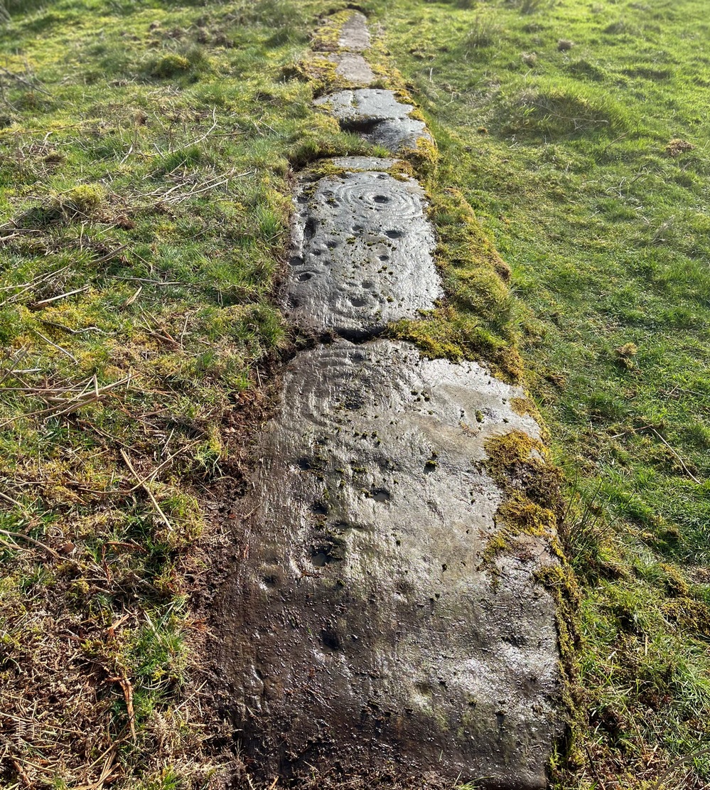
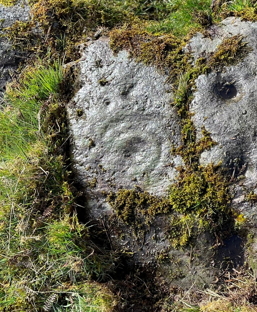
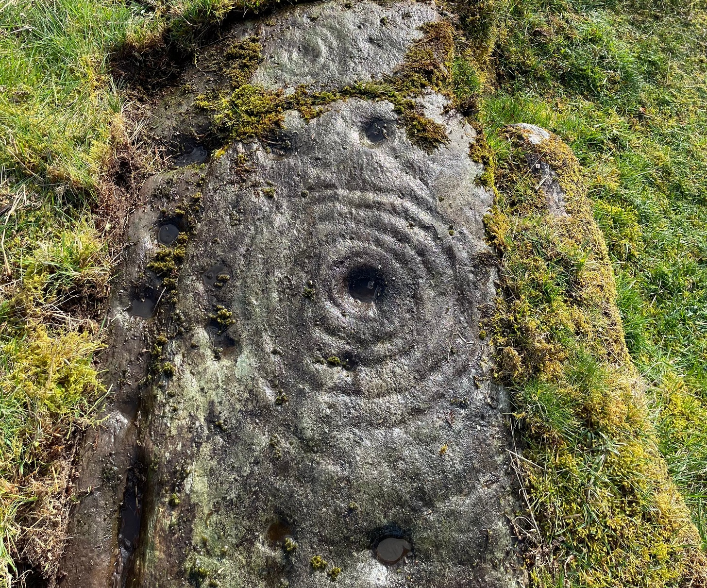
…But, as usual, there’s much more to be said of it than that. Of the four sections, we’ll start at the uppermost northeastern section and work down the sloping ridge, looking at the respective symbols as we go. Section 1 has the largest surface area, but isn’t the most decorated of the bunch. Nonetheless, what we find here is impressive. About a dozen single cup-marks of various ages are scattered over the surface in what initially seems to be no recognizable order; these are accompanied by two single cup-and-rings: one of which could be said to be of standard size and form, whilst the other has a much larger and broken ring, near the middle of the rock, about 12 inches across. This larger ring has two or three of the cup-marks incorporated into its outer edges. The most impressive element of Section 1 is the large multiple-ringed design, five in all, radiating outwards or funneling inwards (depending on what was intended) around a central cup. The outer ring of this is incomplete.
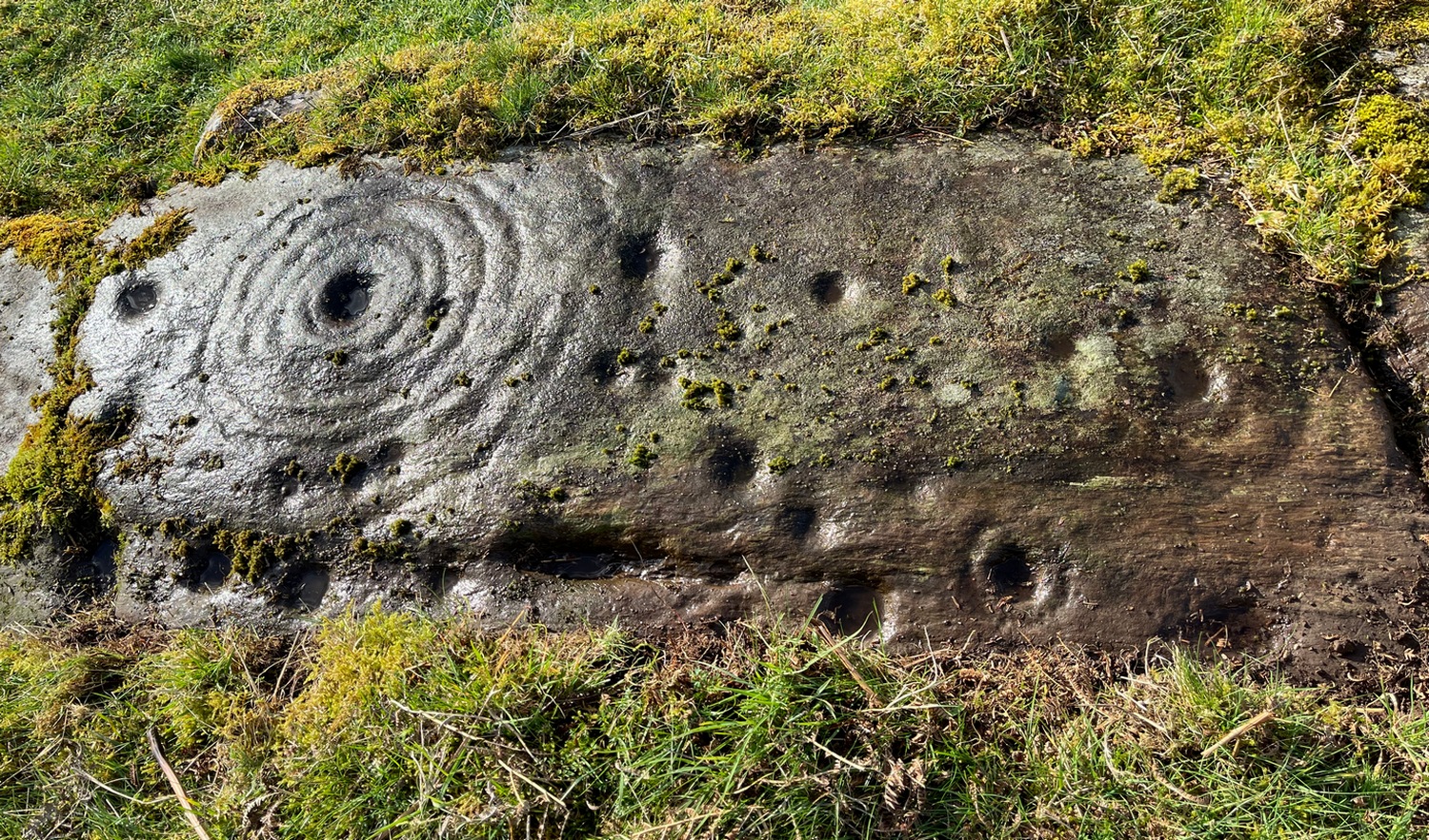
Impressive cup & 7 ringsScatter of cups & rings
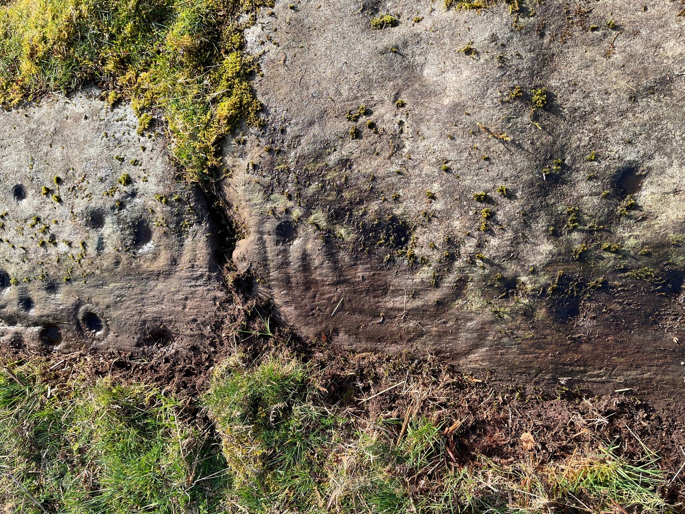
Section 2 is the most visually impressive of all the Blarnaboard (3) carvings: almost an evolutionary development of what we see on the first part. A 2-dimensional panorama shows off a distinct cup-and-ring close to the edge of the soil, and there’s a somewhat wonky incomplete cup with double-ring below it. A very clear cup-mark to the right of this has another faint incomplete double-ring round it—but this is hard to see. The same cannot be said of the cup with seven concentric rings surrounding it! (the outer two of these are incomplete) As I walked round and round this section, drooling somewhat, it became obvious that a number of well-defined cup-marks had been carved around the outer edges of the rings, deliberately creating an eighth ring comprised purely of cup-marks. It gave me the impression of it representing heavenly bodies revolving around the central Pole Star; but also of it defining the movement of the Moon through the heavens during a calendar year. (the astronomy of my youth still comes through at times!)
Section 3 carvingFaint double cup-and-ring
By comparison, the third and smallest section of Blarnaboard (3) almost pales into insignificance, possessing a mere cup-and-double-ring—and a very faint one at that. From a certain angle it looked like it possessed a third ring, but this was probably more to do with me wanting to see more than there is! Just below this double-ring, a single cup has what might have once been another incomplete ring round it—but we’d need the computer graphic students among you to suss that bit out! You can’t make it out on the photos here, sadly…
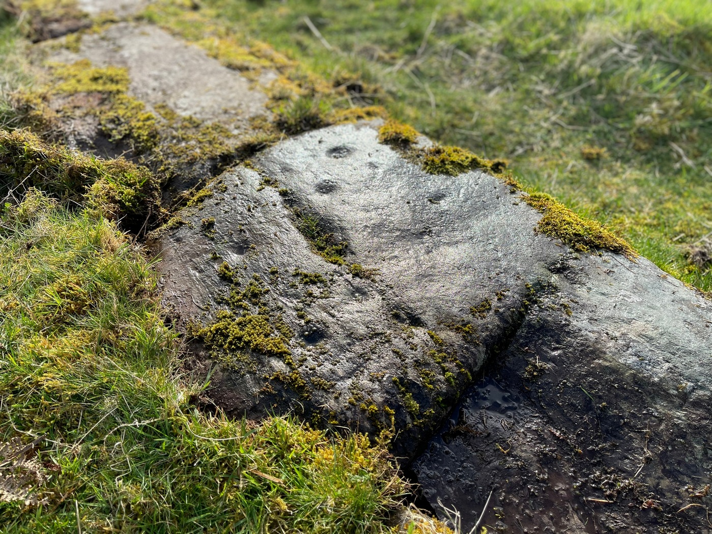
Section 4 carvingFaint double-arc, lower cup
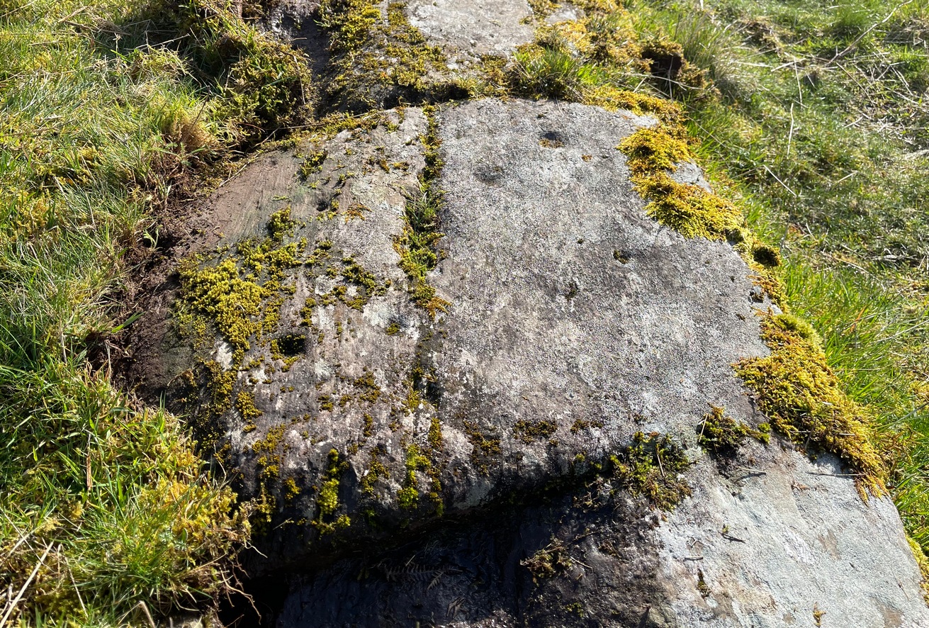
The fourth section is the most visually unimpressive of the entire cluster and was probably carved much later than the rest. The poor little fella has just five single cup-marks, with a sixth at the top-corner or northeastern part with what seems to be a small carved double-arc, or partial lozenge, that was started and never finished.
A couple of other exposed sections of stone running a few more yards further down the same line have no carvings on them—but there may well be more to this petroglyph hiding beneath the turf, which covers quite a large area. I have no doubt that other unrecorded carvings exist in close by, but due to excessive forestry plantations all around here, they’ll either be covered over or will have been destroyed. Don’t let this put you off looking for others though!
Cup-and-five-ringsCup-and-seven rings
An interesting feature of this long line of stone is its potential alignment. When we were photographing the site, a local man came over and got chatting with us. He knew of the carving and had been here many times and told us that his wife had looked at this one and found it aligned with another cup-and-ring on the south-side of Blarnaboard farm and another one (officially unrecorded) even further along. I checked this when I got home and found that this long line of petroglyphs did indeed line up with the Blarnaboard farm carving, perfectly. Whether this was intentional and/or possesses an astronomical function, we might never know. The third carving along the line has yet to be located. I must emphasize however, that the relationship between earthfast petroglyphs and alignments is very rare and, where found, is little more than fortuitous. But when we find cup-markings on alignments of standing stones and other prehistoric monuments, the relationship seems to be much more intentional and would have had a specific mythic function.
If y’ follow the fence-line from this carving down to the small burn, on the other side is the much less impressive Blarnaboard (2) cup-marked stone.
Folklore
Prior to Lorna Main’s (1988) short note on this petroglyph, local people had long known about the carving. As late as the 20th century, people with fevers were brought to this stone in the early morning to be cured of the illness. The idea was that medicinal herbs were collected and placed in some of the cup-marks, which were used like a mortar and pestle to prepare the plants. This healing magick, spoken of by some of the old folk in Aberfoyle, was known to them as children, who’d been told of this by their elders and, of course, by the elders before them.
There is also a tradition that some of the stone that makes up the curious moondial (not sundial) that can be seen at the back of the church in Gartmore village nearly a mile to the southeast, originally came from here.
References:
Main, L., “Blarnaboard (Aberfoyle parish), Cup and Ring Marked Outcrop,” in Discovery & Excavation Scotland, 1988.
Acknowledgements:Huge thanks for use of the Ordnance Survey map in this site profile, reproduced with the kind permission of the National Library of Scotland.
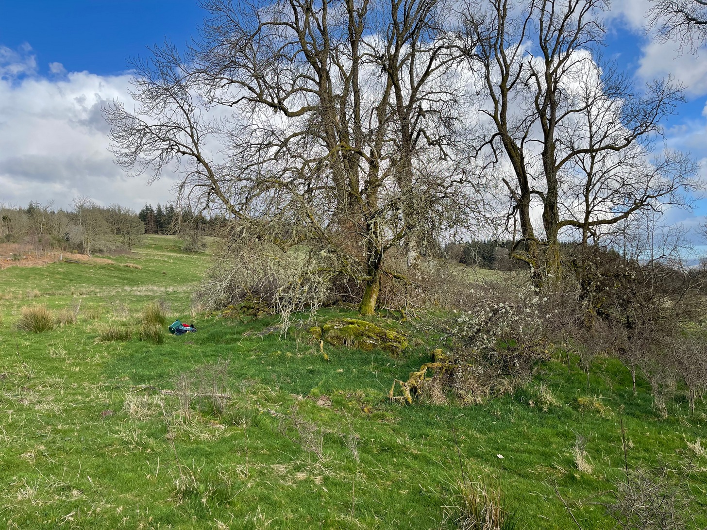
Anyone who’s going to visit this carving will be doing so as a result of visiting the impressive Blarnaboard (3) cup-and-ring stone, 115 yards (105m) away. From Blarnaboard (3), walk down the slope on your right (west), cross the tiny burn and go round to the other side of the small rocky hawthorn-topped hillock just a few yards in front of you. Fumble about and you’ll find what you’re looking for!
Archaeology & History
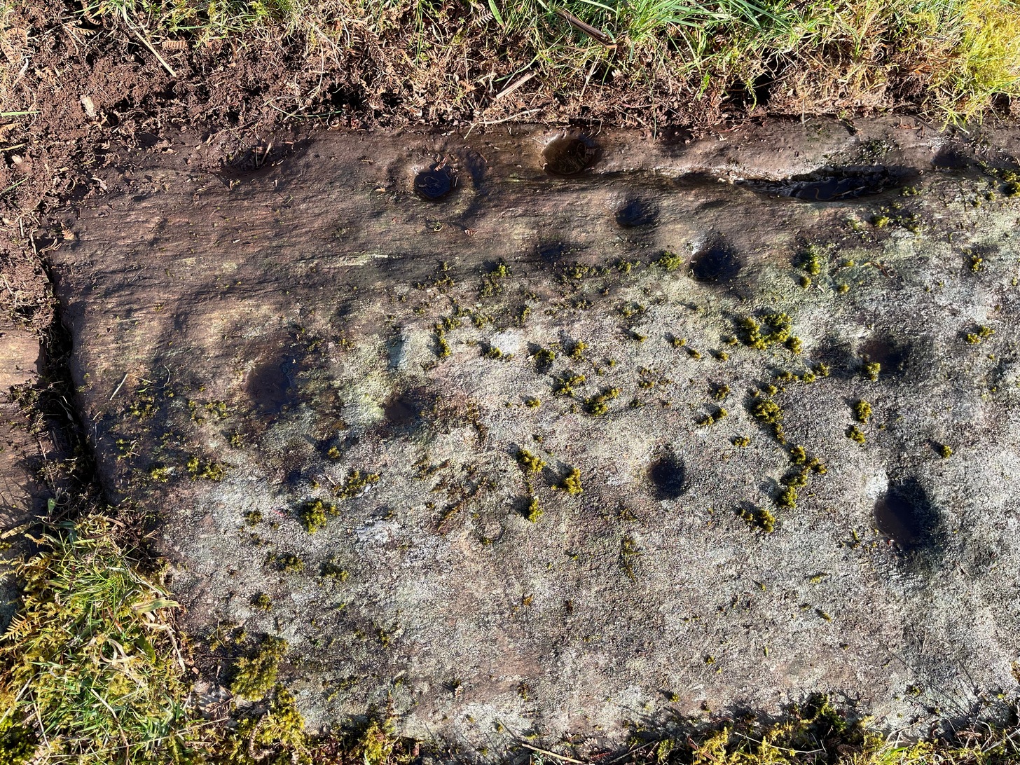
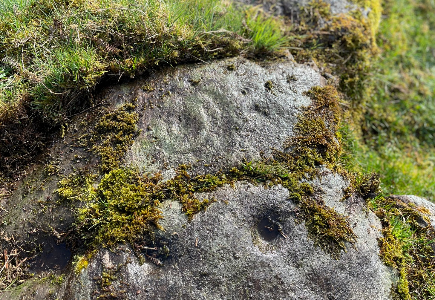
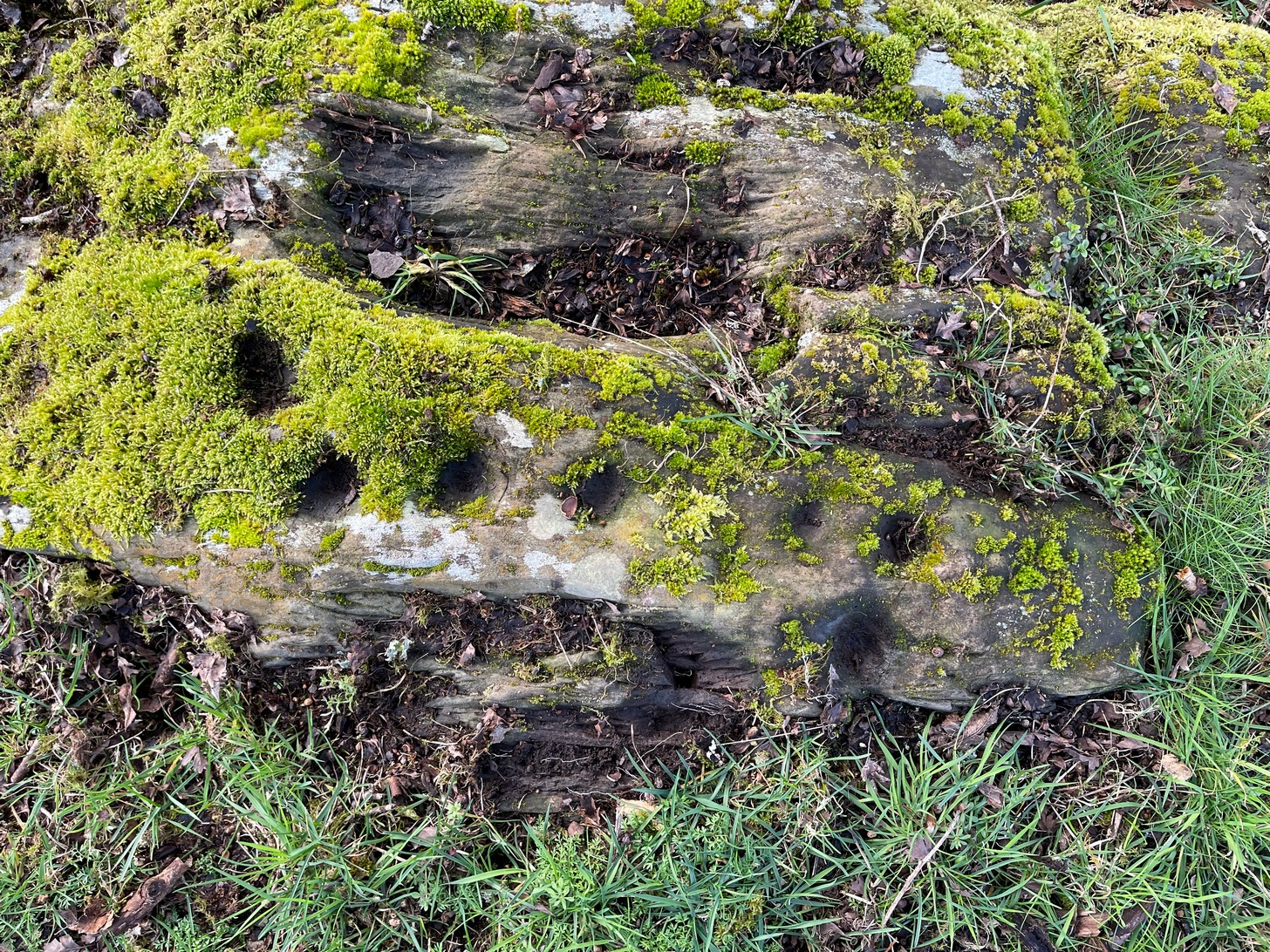
It’s possible that there’s more to this carving than meets the eye. On the west-side of this small rocky rise, along a thin elongated raised section in the stone, a gently meandering line of nine deep cups runs roughly northeast to southwest. You can’t really miss them as they average some 2 inches across and 1 inch deep, strongly suggesting that they were cut and reworked over and over for a long period of time.
Line of cups, from aboveRough NE-SW alignment
It was first described in distinct brevity by Lorna Main (1988) who told that, “over a length of 60cm on a north-east facing outcrop are 9 cup marks.” And, whilst all of the cups are clearly visible, one of them at the edge of the stone has been cut or worked into a natural curved hollow. You’ll see what I mean when you visit the site (it’s pretty clear in the photos).
Beneath the roots and soil there may well be other cup-markings that are still hiding away on this rocky dome. I have no doubt that other unrecorded carvings exist in this area, but due to the excessive forestry plantations all around here, they will be covered over or have been destroyed.
References:
Main, L., “Blarnaboard (Drymen parish), Cup Marked Rock,” in Discovery & Excavation Scotland, 1988.
From Comrie take the B827 road (towards Braco) out of town and where the fields open up on both sides of you, 400 yards along the straight road you’ll see a large bulky stone right by the roadside (it’s the standing stone known as the Roman Stone). Stop here and look on the ground just a couple of yards past the monolith where, amidst the grasses and mosses, you’ll see this small smooth stone (you might have to roll some of the mosses back to see it properly).
Archaeology & History
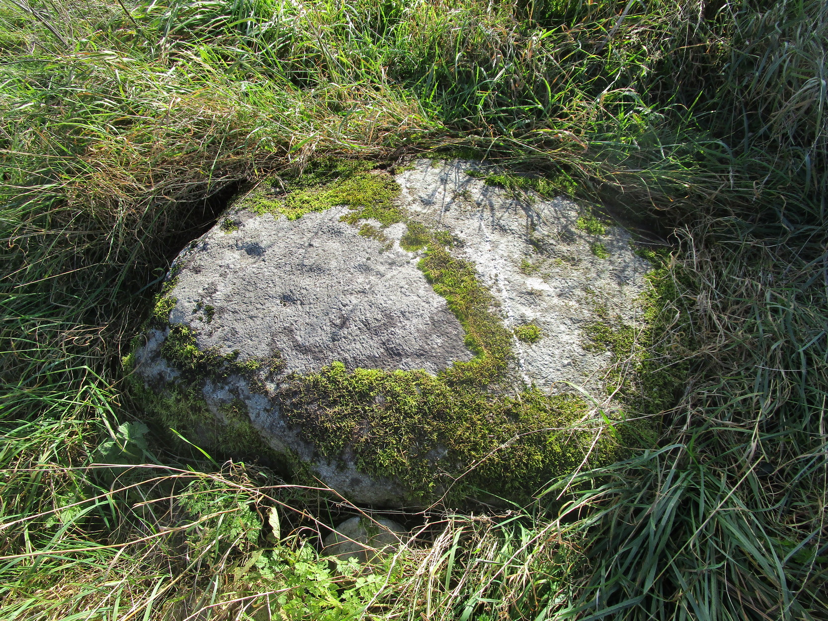
More than a hundred years ago when John MacPherson (1896) wrote his essay on the history of this area, he described there being “three large stones, supposed to be the remains of a Druidical temple.” He was talking about the Roman Stone here, with its two companions—although only the Roman Stone remains upright today. He noted that one of them, on the ground was “a round, flat boulder” which “bears upon its surface cup-marks arranged in irregular concentric circles.”
This seems to have been the first mention of the carving. Fifteen years later when the great Fred Coles (1911) looked at the same standing stones, he found the adjacent petroglyph to still be in situ, stating that,
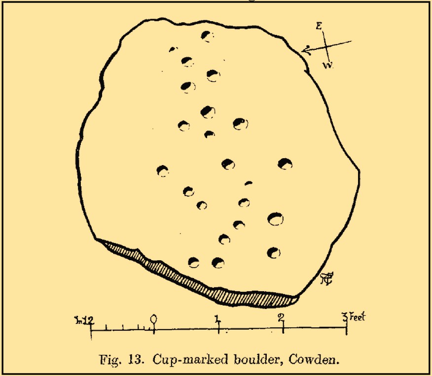
“The surface is covered with a group of twenty-two neatly made cups … the majority being about 2 inches in diameter, with a few much smaller. Two cups measure only 1 inch in diameter.”
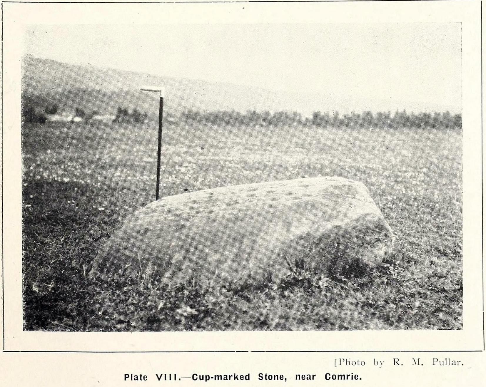
R.M. Pullar’s 1914 photoFred Coles’ 1911 sketch
A few years after this, members of the Perthshire Natural History Society on an excursion to Glen Artney in May 1914, stopped here to have a look at the same standing stones and they also pointed out that one of the stones “lying on the ground…is remarkable for the numerous cup-marks on its surface.” In truth, it’s not that remarkable compared to some of the other carvings, but it’s still worth checking out when visiting the other sites in the area. Many of the cups that were visible a hundred years back are difficult to make out unless the light is good; and it seems as if some of them have been chipped away, perhaps due to farming activity.
References:
Barclay, W., “Winter Session, 1914-1915,” in Transactions & Proceedings Perthshire Society Natural Science, volume 6, 1919.
Coles, Fred, “Report on Stone Circles in Perthshire, Principally Strathearn,” in Proceedings Society Antiquaries, Scotland, volume 45, 1911.
Hunter, John, Chronicles of Strathearn, David Philips: Crieff 1896.
Mac Pherson, John, “At the Head of Strathearn,” in Hunter’s Chronicles of Strathearn (David Philips: Crieff 1896).
Standing Stone (destroyed): OS Grid Reference – NO 5404 6892
Archaeology & History
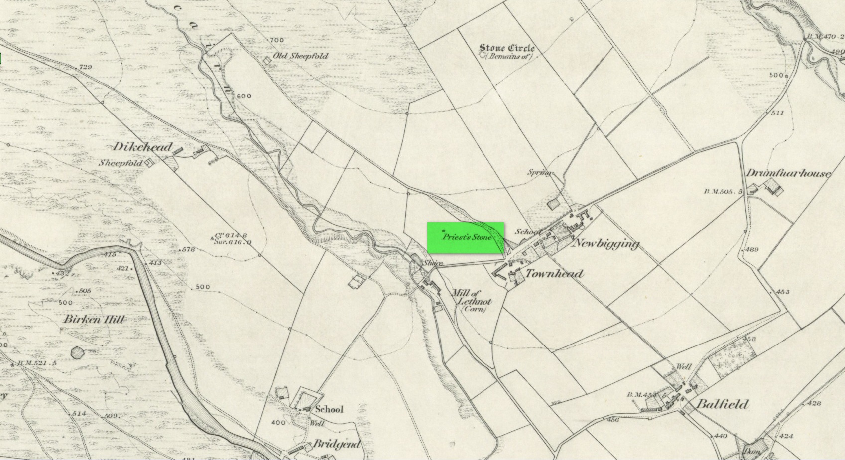
Priest’s Stone on 1865 map
Despite being shown on the early OS-maps of the area, I can find few references of this place. The Ordnance Survey lads themselves, when visiting here in 1863, merely told that this it was “a standing stone of which nothing is known except the name. It is 3 feet high, three feet in diameter at base, and a foot and a half at top.” Even in Cruikshank’s (1899) definitive survey of this township he could add little more, merely telling:
“About a quarter-of-a-mile north of Bellhill is a field known as “the Priest’s Field.” There is a large right stone in the middle of it, called “the Priest’s Stone,” and it is so given on the Ordnance Survey map. not simply because such is the local name, but also because the skilled surveyors after examining it concluded that it had been used for sacrifice. It stands just behind the site of the old farm steadying of Upper Argeith, or vulgarly, Townhead.”
Quite what he meant by saying that “it had been used for sacrifice,” god only knows! But the writer was the local minister and so would have been possessed by the usual delusions. Anyhow, the stone was uprooted and destroyed by the farmer at Newbigging, sometime prior to 1958. Idiot!
A half-mile north of this could once be seen a stunner of a site: a double-ringed giant tomb from where hundreds of cartloads of stone were taken. It too no longer exists!
References:
Cruikshank, F., Navar and Lethnot: The History of a Glen Parish in the North-east of Forfarshire, Black & Johnston: Brechin 1899.
Royal Commission on the Ancient and Historical Monuments of Scotland, The Archaeological Sites & Monuments of Central Angus, Angus District, Tayside Region, HMSO: Edinburgh 1983.
Acknowledgements:Huge thanks for use of the Ordnance Survey map in this site profile, reproduced with the kind permission of the National Library of Scotland.
Standing Stone (destroyed): OS Grid Reference – NO 483 603(approximation)
Archaeology & History
In an area once teeming with megaliths, this is but one that lost its life in the 19th century. It would seem that the only reference of its existence—and demise—comes from the pen of the great regional historian Andrew Jervise (1853) who, in a description of the nearby holy well of St Ninian, in a field near Wellford,
“within the last half century there were two or three large rude boulders nearby, which were called Druidical stones.”
References:
Jervise, Andrew, The History and Traditions of the Land of the Lindsays in Angus and Mearns, Sutherland & Knox: Edinburgh 1853.
Standing Stone (destroyed): OS Grid Reference – NT 074 698
Archaeology & History
A few hundred yards west of the commemorative Wallace Stone monolith could once be seen a standing stone of considerable size. It was described by James Primrose (1898) in his description of the standing stones of the Strathbrock region; but even in his day, remains of it were fragmentary. He wrote:
“On Drumshoreland Moor, within the grounds of Pumpherston Oil Company, there is a stone, popularly styled Bucksides — its correct designation being Backsides — from its position at the backside of Pumpherston. This stone, a huge whinstone boulder about 12 feet long and 8 feet broad, was blasted in 1888, to make room for the site of a bench of retorts; a few fragments of the stone, however, yet remain by the roadside. The ancient name of this stone was Ballengeich — apparently the Gaelic for “the township towards the wind”, — as if a croft once stood here, near Pumpherston Mains, in an exposed and windy situation.”
A visit to the local history department of the local library might prove fruitful in giving us more information about this place—that’s assuming the filthy tory central government’s theft of taxpayer’s money doesn’t close it! (does that sound a bit harsh? 😁 )
Folklore
The same historian told of a “tradition…that round this stone in days gone by the Broxburn folks, along with their neighbours, used to assemble at Fair time, in the month of August, in order to witness their favourite sport of horse-racing; but whether there was any more ancient custom associated with it, we have never learned.”
References:
Primrose, James, Strathbrock; or, the History and Antiquities of the Parish of Uphall, Andrew Elliot: Edinburgh 1898.
Make a day out of this one, visiting several old places on the way. From Comrie take the B827 road to Braco, turning right at the tiny Glen Artney road a half-mile along (easy to miss). 3 miles along, pass the derelict Dalness cottage, you can follow the directions to get to the Mailer Fuar (2) cup-and-ring stone; and from here go up the field past the Mailer Fuar (1) carving, through the gate and follow the fence to your right. Keep going till your reach the Allt na Drochaide cup-and-ring stone. From here you’re heading (south) towards the rounded crags of Cnoc Brannan. It’s boggy as fuck in parts so cautiously zigzag through this section up towards the small grassy rise about 350 yards from the cup-and-ring stone. You’ll find it!
Archaeology & History
From the old stone, gazing S
On one of the gentle rises below the northern slope of Cnoc Brannan we find this sturdy old fella, 3-4 feet tall (I didn’t measure it), looking across the stunning landscapes north, east and west along Glen Artney. Not previously recorded and seemingly isolated from other prehistoric remains, he looks all alone at first sight, but laid down in the grassy rushes (Juncus conglomeratus) to his side, is a slender seven-foot long stone which may have stood upright in the not-too-distant past, giving us another double stone setting in this area (at least two others existed in this area—the closest being at Craggish, 3.7 miles northeast). I have little doubt that other undiscovered prehistoric remains are hiding in the area. (there are a number of single cup-marked stones in the locale, although I tend to leave such examples off the catalogues as they can be somewhat dubious [and many are]. I mention this just in case any rock art students want to forage the area.)