Becket’s Well, Otford, Kent

Holy Well:  OS Grid Reference – TQ 531 592

Getting Here

Becket's Well, Kent
Becket’s Well, Otford

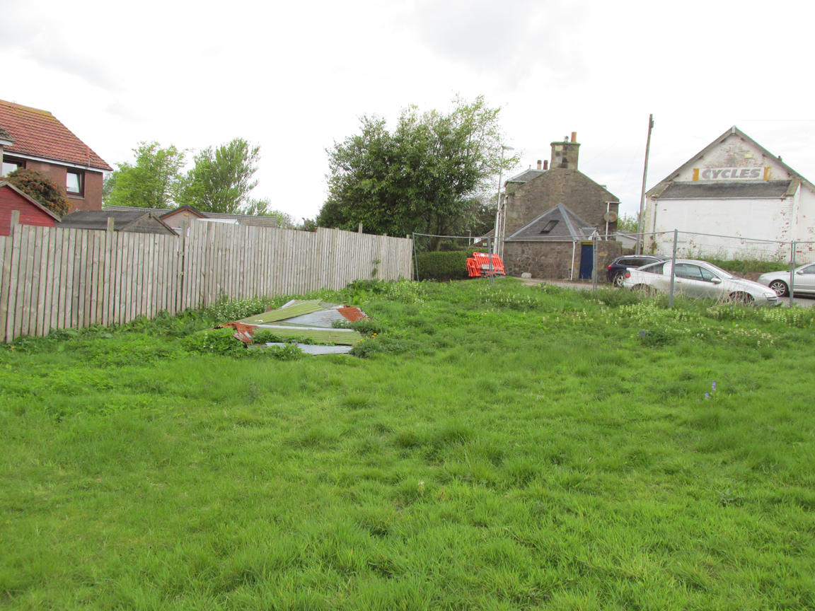
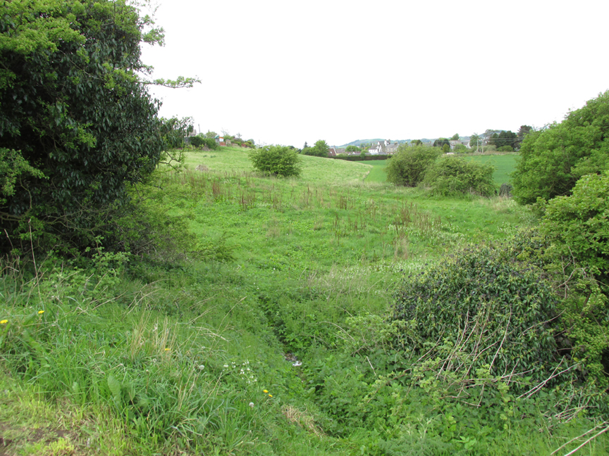
The well now lies on private land and feds a trout farm (Beckets Well Trout Farm at The Castle House, Sevenoaks Rd, Otford in Sevenoaks). To find Becket’s Well go along the A225 to the centre of Otford, park in the car park ( in front of the row of terraced shops ) near the Bishop’s Palace. Take a small private road to Castle farm, now as said, a trout farm. Inquire here, if you are able to visit the well, which lies  within a complex of fish pools to the east of the farm house.

Archaeology & History

The site has been well recorded in recent centuries, for example an account of 1876, describes the site as, “endorsed within a wall, forming a chamber 15 ft across and 10 ft  deep.”  Both the chamber’s appearance and shape suggests that is would be ideal for immersions, of which Harper and Kershaw (1923) notes that bath and steps are defied annually by the hop pickers.  It is interesting to note that Thorne (1876), with no apparent reference, gives another connection with the saint, suggesting that, “to have used by the saint as a bath.”  No subsequent or previous work draws notice to this, so it is likely to be antiquarian fancy.  Another more plausible possibility is that it was used by the leper hospital found on this site around 1228.  They would have clearly made use of the pure water for medicinal purposes and perhaps indeed used it as a bath.

Kirkham (1948) notes it was suffering from neglect being “now said to be choked up and half full of tins.”  This decline would appear to have started a long time ago, as a folly tower, now demolished, was built on Otford Mount (a nearby earthwork), from the well’s stone work.  Consequently, this degraded condition prompted excavation in the 1950s by the Otford and District Historical Society; of which the following details of their findings are briefly described.

The report noted that the well consisted of two chambers, with water emerging from two arched outlets into the first of these. This chamber is surrounded on three sides by walls, thirty-five feet by thirteen feet (east end), the walls are eight feet high, and at the same level of the ground.  Six steps at the south-east end give access to the well chamber.  The sluice wall is five feet high, eight feet wide, and is substantially buttressed on the western front.  Water runs through this sluice wall, between steep banks westward, through a lower chamber, twenty-seven feet (north sides), and thirty-five feet (west side).  The water then flowed through watercress and finally through an underground, probably Tudor conduit.  This conduit then passes through the site of the Palace. This stream once fed a moat, but now discharges into the Bubblestone Brook, a Darenth tributary.

Local common thought was that the well is the remains of a Roman bath house, a belief echoed by its present owner; and a view endorsed by both Ward (1932) and Harper and Kershaw (1923), who note that it “is really a Roman Bath.”  This view is further supported by the two surrounding Roman villas, and hence one aim of the excavation was to evaluate this long held claim. Yet, although they showed that the well had gone through considerable renovation and rebuilding over the centuries, no remains could be positively be dated to this period.  This renovation, of course, resulted in a rarity of deposits, and hence with a lack of artefacts, the subsequent interpretation was thus difficult.

The excavation was further handicapped by the waterlogged conditions. Both may have influenced the results.  Consequently, there are still doubts, and the concept of a Roman origin has not been satisfactorily disproved.  The earliest written record is from Otford Ministers accounts of 1440-1, indicating that by then a stone structure existed here, but how old that was again is not clear. It states:

“To a carpenter for two days to make 2 gutters to bring water from the pool of the garden to the moat and for working on and laying another gutter beyond the water course and coming from the fountain of St. Thomas to old garden, 12d; and to a carpenter for one day covering a gutter with timber and cresting it, 6d.  And for two masons for 2 days for placing and laying and making a new stone wall of the fountain of St. Thomas, broken for the pipe of the water conduit, 3s, taking between them daily 12d.  To five labourers 10 days digging the soil between the said fountain and moat to lay in the leaden pipe of said conduit16s 8d taking each daily 4d.”

The present floor may be ascribed to that period; although it would seem to cover an earlier lower flint floor (again possibly Roman). Between 1520-1520, Archbishop Warkham, pulled down the then existing Manor house and built the Palace, covering four acres. This consequently required a better water supply, and hence the well was improved: the original lower chamber is said to originate from this period. The full purpose of the lower chamber is not clear, but it is believed that it may have housed cisterns giving a greater flow of water. When Henry VIII acquired the Palace from Archbishop Crammer in 1537, he spent money on improvements to the estate, and probably the well.  The sluice gate, strengthened by Warham, was now supported by buttresses.  These may have supported a conduit house. This was recorded in 1573:

“The condiyte house or well conteyning in length XXXVI foote and in breadth XIX fote to be taken downe and newe sett upp will coste XXX pounds. The pypes conveyinge the water from hence to the offyces and small sesterns to be amended will coste Xiii.”

By the 1600s, the Palace was in disrepair and the well was only used for private consumption by Castle farm.  Despite this, restoration still continued and the north, east and south wall saw upper improvements by the 1700s.  In the lower chamber a stone west wall was erected on Warham’s brick foundations. By this time, the south wall was beginning to collapse and was rebuilt in the 1800s.

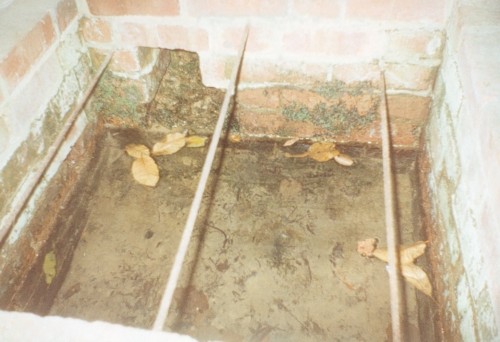
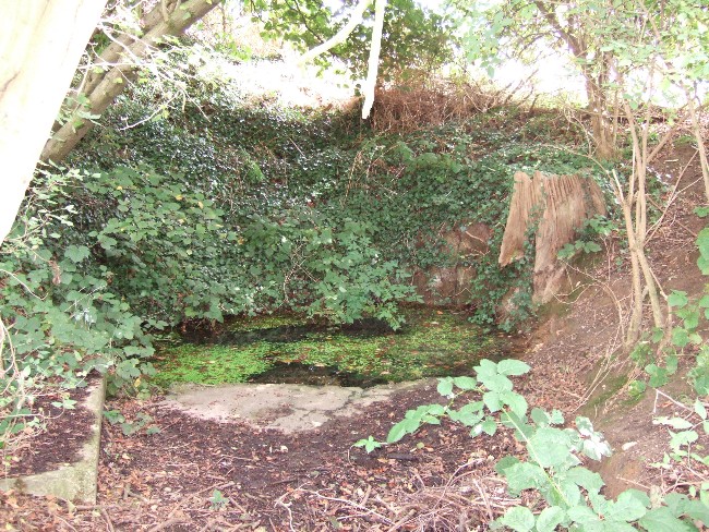
By 1954 repairs were again needed, as the north wall was collapsing.  Goodsall (1968) reported that even after its excavation in the late 1950s, the site then enclosed in railings was forlorn and overgrown with weeds.  Forty years on, the present condition is similar to that illustrated in the contemporary photo, taken during the excavation: the intervening decades have seen the inevitable degradation, through time, of its infrastructure. Fortunately, the hideous railings have been removed, obviously to erect the trout farm infrastructure, whose water is supplied by the well.  The walls appear now comparably greatly overgrown, which has probably preserved them, and the sluice wall, north, south and west walls appear the most ruinous, with the walling falling away towards the sluice wall.  The walling was best preserved at the east end.

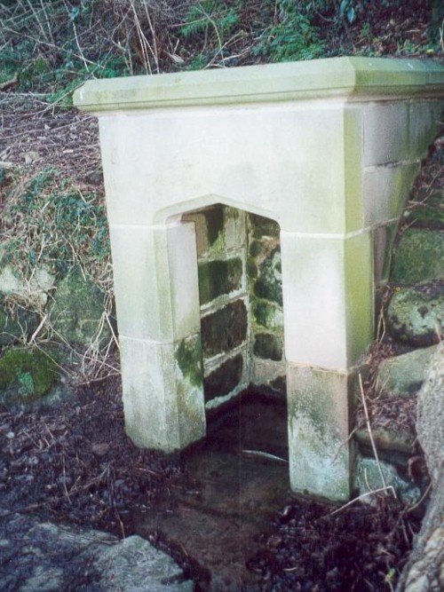
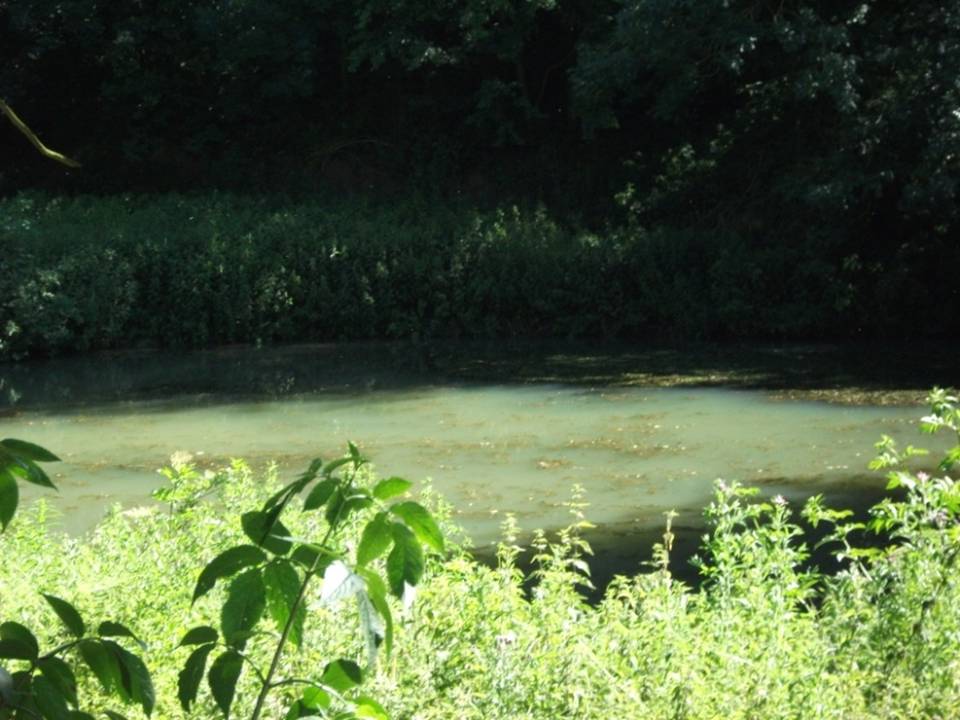
The clear spring appears to flow rapidly from its source, and has the appearance of being deeper.  As stated, it now has now a commercial function, providing good quality water for the raising of trout flowing through a series of fish ponds replacing the cress beds.  The owner in the 1990s, a Mrs. Burrows, believed that the well was originally roofed.  The results of the excavation did not indicate this although it may be a mix-up with the possibility of a conduit house over the well.  She also stated the water stayed the same temperature through the winter and summer, a constant 500 C, certainly beneficial to bathers.

Folklore

One of the best known holy wells among Kent antiquarians no doubt due to the colourful legend associated with it. This tells that whilst living here in the old manor—the ruins of which called the Bishop’s Palace still stand—St. Thomas bemoaned the lack of good water. As a remedy he struck his staff into the ground and clear water gushed forth.  This is a familiar folklore motif and we shall see it again referred to at other Kent sites.  Perhaps it recalls the saint ordering well digging to provide fresh water and marked the position with his staff!  The legends earliest reference  is made by Lambard (1571):

“..stake his staffe into the drie ground ( in a place thereof now called Sainte Thomas Well) and immediately the same water appeared, which running plentifully, serveth the offices of the new house to the present day.”

The well was said to be curative, but the exact nature of its curative powers are unknown, and although belief in them was waning by 1800s, rumours of its use continued to the last world war.  The Gentlemen’s Magazine of June 1820 gives the only recorded account of a cure and states that:

“an old man, who, crippled by rheumatism, was completely renovated by this bath to health and action of circumstance witnessed by the late Lord Stanhope and several of the neighbouring gentry.”

(Extracted and amended from original blog page, which includes and addition holy well – Colet’s Well –
http://insearchofholywellsandhealingsprings.wordpress.com/2012/01/12/the-holy-wells-of-otford-kent/ – and from the forthcoming Holy Wells and Healing Springs of Kent – references quoted in the piece can be found therein.)


Douky Bottom, Arncliffe, North Yorkshire

Settlement:  OS Grid Reference – SD 95203 69067

Getting Here

Aerial view of settlement

Go up the B6160 road, heading for Kilnsey Crag.  A few hundred yards past the famous crags, take the little road to Arncliffe.  About a mile up, where you reach the second building on the left-side of the road, walk up behind here, up the steep fields and towards the craggy heights above.  Keep right uphill till you see the cluster of cairns on the peak above; but before reaching them, walk over the rocky landscape to your left (southeast) and you’ll eventually see an excess of straight walling a coupla hundred yards away. That’s it!

Archaeology & History

A bittova climb to get here – but well worth it in the end.  On a spur of land amidst the outstanding limestone plateaux less than a mile south of Arncliffe village, rising near the silent ghostly cairns upon Knotts ridge above it, we come across an extensive prehistoric settlement complex.  It is one of many in this upland region.

Looking south at the settlement
Knott cairns above the settlement

Poorly described (if at all) by official archaeology websites, this place is big!  All that we can see today at ground level are lines of very extensive lines of enclosure walling, between one and three feet high, intersecting each other and forming very large rectangles growing further and further out from each other towards the western scree.  Much of the walled structures are in good condition if they are prehistoric, as presumed by archaeologists; but it seems obvious that the site was in continuous use by local people for domestic and agricultural purposes all through medieval and later periods.

One of the settlement hut circles
Raised lines of ancient walling

The longest stretch of visible walling runs from northeast to southwest and measures 175 yards long (160m), with several stretches of parallel walling splitting the settlement into different sections of large enclosures all attached to each other.  These parallel walls measure a maximum of 54 yards (49.5m) and run northwest to southeast.  The aerial image of the site shows the structures very clearly in some parts.  Others are more vague and some are difficult to see at ground level.  But the settlement as a whole cannot be missed.  Several hut circles have been built inside the main rectangular enclosures, with two others faintly visible on the outer edges.

As far as I’m aware, no excavations have taken place here, so we are still grasping at periodic straws when it comes to dating the place.  When Arthur Raistrick (1929) wrote his article about the associated enclosures like that at Blue Scar, a short distance to the east, he thought them to be Iron Age in origin.  He may well right.  A singular enclosure circle can be found a few hundred yards to the south.

References:

  1. Elgee, Frank & Harriet, The Archaeology of Yorkshire, Methuen: London 1933.
  2. Raistrick, Arthur & Chapman, S.E., ‘The Lynchet Groups of Upper Wharfedale, Yorkshire,’ in Antiquity, volume 3, 1929.

© Paul Bennett, The Northern Antiquarian


Adam’s Well, Speldhurst, Kent

Holy Well:  OS Grid Reference – TQ 556 382

Getting Here

Adam's Well, Speldhurst
Adam’s Well, Speldhurst

To find Adam’s Well take the footpath from near the High Rocks Inn, leading up under the railway, continuing along the edge of a copse and into open area. Where the path turns sharp right one can see, looking ahead at this junction, a large pond and above this the black and white cottage.  Beside this an arch where the spring arises. To gain access, go through the gate ahead and turn into the drive of the house called Adam’s Well and ask permission to see the well as it lives on private land.

Archaeology & History

The earliest reference to the site is found in Thomas Burr’s (1766) History of Tunbridge Wells:

“on forest a little beyond the Rocks, a spring of water was discovered, which was palled in and called Adam’s well. For what particular reason this spring was taken such notice of, it is not now very easy to determine.”

Burr (1766)  perhaps implies that the well was discovered within living memory, and its fame being established before that of Tunbridge.

MacKinnon (1934) in his History of Speldhurst, perhaps drawing upon an earlier source as well as describing it in greater detail, clearly indicates it origins as a holy well, in the use of the words holy water below:

“Adam’s Well is situated in this Manor, it was famous long before the Tunbridge Wells waters were discovered, and issue from high ground at Langton. In much repute in ancient times, it is impregnated with no mineral, saline, nitrous or earthy matter, whatever, it is quite free of sediment, and was called in old times a ‘holy water.’ In 1765, the owner of this well, on digging into the rock to enlarge the pool or bath came upon an ancient stone arch, whose date could but mere matter of conjecture. This arch can be seen at the present day.”

Combined with the traces of medieval stonework, the medieval origin is supported by its name: Adam, being taken from a local fourteenth century landowner, John Adam.  Fortunately, Adam’s Well still exists, much as MacKinnon (1934) describes, now enclosed in the private grounds of Adam’s Well House: a bungalow, built in the nineteenth century, after a bout of vandalism, to house a caretaker for the well. The well itself arises in a shallow, square brick-lined chamber.  Enclosing this is a large stone alcove, built to allow a sheltered access to the well during inclement weather. The back wall of this shelter is of a crude nature, indicating that it may indeed be of considerable age. A stone set in its arch notes: ‘ADAMS WELL 1868.’

The waters of the Well

This date presumably refers to when the well was repaired, and the house built.  In front of this is a much larger and deeper rectangular stone chamber. I was informed by the then owner in the mid-1990s, Mrs Wolf, that dogs and horses were washed within this.  Over this chamber is an iron grill with the letters ‘AW’ in its centre.  Mrs Wolf also told me that the quality of the water was so good that it was bottled and stored on ships for long periods. Much of the popularity of the water came from the fact that it lay along the busy old road from Peacehaven to London.

Folklore

Burr (1766) implies that its powers, to cure human ailments, were largely forgotten and:

 “…at present it is only famous for the cure of mangy dogs, in which case it is esteemed an infallible remedy.”

Yet, John Britton (1836) in the Descriptive sketches of Tunbridge Wells and the Calverley estate; with brief notices of the picturesque scenery, seats, and antiquities in the vicinity describes it as being noted for:

“its transparency of its waters, and for its efficacy in some cutaneous disorders.”

Recent analysis showed that the water contains copper, which perhaps explains its lower popularity compared to Tunbridge, as copper salts were not as efficacious as iron salts. This is supported by Mrs. Wolf who noted that it had not cured her rheumatism!

Extracted from the forthcoming Holy wells and healing springs of Kent

References:

  1. Britton, John, (1836) Descriptive sketches of Tunbridge Wells and the Calverley estate; with brief notices of the picturesque scenery, seats, and antiquities in the vicinity
  2. Burr, T., (1766) History of Tunbridge Wells
  3. MacKinnon, Donald D., (1934) History of Speldhurst 

© R.B. Parish, The Northern Antiquarian


Holy Well, King’s Newton, Derbyshire

Holy Well:  OS Grid Reference – SK 386 262

Getting Here

The well depicted in Hope’s (1893) Legendary lore of holy wells, sadly he says nothing about it!

The Holy Well is signposted off the road to Castle Donington on the left hand side as you near a small brook, past new bridge and it will be seen down the track. It can be muddy, so bring some boots!

Archaeology & History

It is first noted in 1366 as ‘Halywalsiche.’  The purchase of the lands of St Catherine’s Chantry, lately dissolved, in 1564, refers to lands here at ‘Holy well hedge’ and ‘Hollywell siche.’  A carved inscription over the well read:

Fons sacer hic strvitvr Roberto Nominus Hardinge 16xx

translating as:

this Holy well was built by Robert named Hardinge 16xx“.

Briggs suggested the date of 1660, which is quite likely, as it coincides with the Restoration of Charles II as the family at the nearby hall.  The aforementioned Hardinge, were staunch Royalists, and of course puritans disliked holy wells as many other so called ‘popish’ things. However, its restoration may have been for little more than to maintain a good water supply. Later depictions such as pre-war postcards show the date to be quite clearly 1662.

The restored holy well today, original stonework to rear with newer stone at the front

The present condition of the well is tribute to its local community.  The arch survived for nearly 300 years but a combination of vandals and the roots of the nearby ash tree caused the arch fall down and it lay in pieces in the 1950s. Sadly the original inscription appears to have been stolen or entirely broken to pieces. However, unlike many similar sites, this was not the final fate of the well. In the 1980s it was restored using as many of the old stones as possible. The landowner was happy to sell the land and Melbourne Civic Society donated money for its restoration. No artifacts were found, apart from 17th century Ticknall ware pottery, later tiles, and drainpipes fragments. Most of the original stones were recovered, but the job of reconstructing them appeared to be a large task and new stone was required. The arch over the well was left blank as it was thought misleading to re-inscribe it. Usher (1985) notes that on the first Sunday after Ascension Day, May 19th 1985, over a hundred people gathered for the opening ceremony when the plaque was unveiled by the Society’s President, the Marquees of Lothian, of Melbourne Hall. It is delightful to see it restored and celebrated by the community.

Folklore

There appears to be no records regarding its properties baring its ‘superior excellence of its waters‘, and being noted as a mineral spring. Interestingly, its waters are said to flow towards the rising sun.

Extracted from R.B.Parish’s (2011) Holy wells and healing springs of Derbyshire

References:

  1. Usher, H., (1984) The Holy Well at King’s Newton, Derbyshire. Old Series Source

© R.B. Parish, The Northern Antiquarian


St. Mungo’s Well, Glasgow Cathedral, Lanarkshire

Holy Well:  OS Grid Reference – NS 6025 6558

Archaeology & History

St Mungos Well, Glasgow cathedral

Not to be confused with the sacred well of the same name found along Gallowgate a short distance to the south, the waters of this ancient well have sadly fallen back to Earth.  The structure built above it, however, is thankfully still preserved inside the Cathedral, as visitors will see.

Folklore and history accounts tell its dedication to be very early – and the tale behind the erection of the cathedral is closely associated with the waters themselves.  Indeed, if the folklore is accepted, we find merely a transference of early animistic ideas about the death of an ancestor placed onto this early Saint, with a simple association in the formula of:  tomb, holy site and architectural form.  It could almost be Bronze Age in nature!

The lengthiest (and best) description of St Mungo’s Well was by Mr Brotchie (1920) in a lecture he gave on the city’s holy wells in April 1920, which was thankfully transcribed by the local history society.  He told us:

“It seems to me that Glasgow in a very particular degree is a case that illustrates emphatically the existence of the early cult of the sacred fountain (sketch attached)… How came it to be there? In itself it represents the very beginning of Glasgow.  It was to the little spring on the hillside overlooking the Molendinar that there came the earliest of christian missionaries, Ninian. All that we know of Ninian is from the account of Jocelin, the monk of Furness, who tells us that “ane holy man Ninian cam to Gleschu or Glasgow in the third century”, and made his cell on the banks of the Molendinar. When Kentigern or Mungo came to Glasgow in the sixth century, he made his settlement near a certain cemetery, which had long before been consecrated by St. Ninian, and which at the time when Jocelin wrote (twelfth century), was “encircled by a delicious density of overshadowing trees.”  The crypt of the Cathedral—in reality an under church of extraordinary beauty of design and magnificence of mason work—is the shrine of St. Mungo, who is buried there, and the whole design of the lower church shows that the architect who in 1230 planned the building…built his scheme up with the idea of providing a shrine for the saint’s tomb and his holy well.

“The well is in the lower eastern corner of the church just opposite to the chapter house.  John Hardying, the chronicler, who visited Scotland in 1413, states that St. Mungo’s shrine was then the centre of the life of Glasgow.  In 1475 James III, on account of his great devotion to St. Kentigern, granted three stones of wax yearly for the lights at the tomb of the saint in the cathedral, near his holy well.

“St. Mungo adopted this well from the pagans of the district and changed its purpose from evil to good.  Beside it he erected in 560 his little wattle hut where he died.  He was buried inside it, and when the great cathedral was built the holy well was included within its walls…

“St. Mungo’s Well was a place of pilgrimage to the early christian fathers, and we find it described as “an idolatrous well” in 1614.  In 1579 we have a public statute prohibiting pilgrimages to wells, and in 1629 the Privy Council denounced these pilgrimages in the strongest terms, it being declared that for the purpose of “restraining the superstitious resort of pilgrimage to chapels and wells, which is so frequent and common in this kingdom, to the great offence of God, scandall of the kirk, and disgrace of his majesties government,” that commissioners cause diligent search in “all such pairts and places where this idolatrous superstition is used, and to take and apprehend all such persons of whatever rank and qualitie whom thay sall apprehend going on pilgrimage to chapels and wells.”  That decree was issued under the Dora of 1629.  But all in vain.  The custom of visiting chapels and wells had become a habit – and habits, as we all know, though easily formed are difficult to break.  The wells continued to be visited by stealth if need be.”

References:

  1. Bennett, Paul, Ancient and Holy Wells of Glasgow, TNA 2017.
  2. Brotchie, T.C.F., “Holy Wells in and Around Glasgow,” in Old Glasgow Club Transactions, volume 4, 1920.
  3. Davidson, Nevile, The Cathedral Church of St. Mungo, Bell & Bain: Glasgow 1957.
  4. Walker, J.R., ‘”Holy Wells” in Scotland”, in Proceedings of the Society of Antiquaries, Scotland, volume17, 1883.

© Paul Bennett, The Northern Antiquarian


Lady Well, Ancaster, Lincolnshire

Holy well:  OS Grid Reference – SK 9840 4332

Getting Here

Lady Well, Ancaster
Lady Well, Ancaster

Park by the church, which has a Sheela Na Gig and some roman stones. Walk back to the A153 (Ancaster Cross roads), turn left and cross the road. Take the footpath which is on the south side of the A153 and bear right into the nature reserve. The well – a large pool – is on private land, but it can be seen to the right of the entrance to the reserve.

Archaeology & History

This spring was possibly known in Roman and pre-Roman times, as there is a Roman station settlement hereby.  Roman credentials have been strengthened since Time Team’s research which found that the site was the focus of a cult. There was an inscribed stone, found in the church and originally part of an archway, which says:

DEO VIRIDIO TRENICO ARCVM FECIT DE SVO DON

Translated to:

‘For the god Viridius, Trenico made this arch, donated from his own funds.”

The Time team archaeologists found a late Roman or early Dark Age burial with a similar inscription ‘DEO VRIDI SANCTO – ‘To the holy god Viridius.”  The show thought that the God was associated with agriculture, but with the proximity of the spring nearby, perhaps they missed an obvious connection.    It seems very likely that the Romans would have known of the spring as the valley beside it is thought to be a Roman raceway and the town was only a few yards away.

The spring is not mentioned historically; for example Leland (1535-43) notes a chapel and hermitage, but no well:

“The area wher the castelle stoode is large, and the dikes. In the highest ground of the area is now an old chapel dedicate to S. Marie, and there a her(em)ite.” 

Lady Well on 1858 map

In Victorian times the water was tapped as a source of water for the village and a large cistern and pipe system established.  According to Thompson (1999) in his work on Lincolnshire springs and wells, this was later removed and the well had become a boggy area, before finally being restored and clay-lined to be stocked with fish and prevent water loss.  Its water now appears to be a light greeny-blue as a result. One cannot directly reach the edge of the water as it is enclosed in fencing but it can clearly be seen from the footpath.

Folklore

No tradition appears recorded regarding it properties.  However, it appears likely that this is the spring Rudkin (1936) notes as St. Helen’s Well or Mucky Pool in the legend of Byard’s Leap, the famed story associated with a local witch as the story has association with Ancaster – although this could record another site.

References:

  1. Parish, R. B., (2012) Holy wells and healing springs of Lincolnshire
  2. Rudkin, Ethel, Lincolnshire Folklore, Gainsborough 1936.
  3. Thompson, Ian, Lincolnshire Springs and Wells, Bluestone: Scunthorpe 1999.
  4. Thompson, Ian, Saints, Churches, Holy Wells, Bluestone: Scunthorpe 2009.

Links:

  1. Holy and Healing Wells

© R.B. Parish, The Northern Antiquarian 


St. Thenew’s Well, Glasgow, Lanarkshire

Holy Well (destroyed):  OS Grid Reference – NS 589 648

Also Known as:

  1. Canmore ID 44288
  2. St. Tenew’s Well
  3. St. Theneu’s Well

Archaeology & History

St Thenew’s on early map

Whilst I’m in Glasgow (big thanks to Aisha!) I thought I’d check out any remaining heathen sites that might still be visible.  Many have perished of course, beneath the weight of religious industrialism—this one included.  Even when the Ordnance Survey lads came here in 1858, it had already been destroyed.  All that we now know of it comes from the writings of the earlier historians like Walker (1883), Renwick (1921) and co.

Known in early records as St. Theneu (mother of the legendary St. Mungo, who also had sacred wells dedicated to him in Glasgow, Gleneagles and much further afield), trackways and burns hereby were also named after this curious character, and a chapel was also commemorated to her, which fell into ruin several centuries ago.  Its position was highlighted on a late-16th century sketch of Glasgow village—as it was then—immediately south of the chapel, just north of the River Clyde.  The best description we have of it comes from a detailed paper on the holy wells of Glasgow by a Mr Brotchie (1920), who told:

“Where the subway station of St. Enoch’s Square stands…there was at one time the well of St. Tenew, the mother of St. Kentigern or Mungo.  It is thus described by a writer in 1750, “The ruins of a small chapel stood beside the well whose waters were sheltered by a bush, on which were to be seen, especially in early summer, bits of rags of all kinds and colours, while in the well itself enterprising boys were wont to get small coins.  The rags and the coins were the offerings of people, principally women, who came to drink of the waters of St. Tenew’s Well, and left these trifles as thank offerings.”

“This ancient well of St. Tenew stood near a chapel erected over the tomb of St. Tenew, and the ground in its vicinity remained sacred in the eyes of the faithful as the last resting place of the holy woman who had watched the infant steps of the great apostle of the Cambrian Britons, St. Mungo, the patron saint of Glasgow.  The Trongate and Argyle Street, which now stretch westwards from the cross, were in old times a country road leading to St. Tenew’s chapel, kirkyard and holy well.  In a deed of 1498 mention is made of “the blessed chapel where the bones of the beloved Tenew, mother of the blessed confessor, Kentigern, rest.”  When M’Ure wrote his History of Glasgow in  1736, the remains of this old chapel and kirkyard were described as standing “in a solitary spot in the country surrounded by cornfields.”  Looking westwards from St. Tenew’s Well in 1750, a writer describes the scene as “open country, pastures and cornfields, rude-looking country homesteads, barns and other farm buildings, and enclosed kailyards,” where now stand the busy arteries of Jamaica Street, the Caledonian Railway Station, and the miles of tenements that stretch westward to Anderston, Finnieston and Partick.

“We have a comparatively recent record of the holy well of St. Tenew in the statement of the late Mr Robert Hart, who told M’George that he had been informed by an old man, a Mr Thomson, who had resided in the neighbourhood of St. Enoch’s Square, that in the beginning of the last century, say 1800, he recollected the well being cleaned out, and of seeing picked from the debris at the bottom many old coins and votive offerings.  St. Tenew’s Well was a holy well.  For centuries it was a place of pilgrimage and was much resorted to for cures, especially in pre-Reformation days.  In 1586, James VI, addressed a letter to Mr Andrew Hay, commissioner for the west of Scotland, condemning the practice of people making pilgrimages to wells and chapels, but the royal edict was powerless to stop the practice and St. Tenew’s Well was resorted to by people in trouble as long as it was in existence.  The road that led to it was known up to the 15th century as St. Tenew’s Gait or path.  Indeed, it was so named till 1540, when the name of Trongate begins to make its appearance in old city deeds.  This name, of course, owes its origin to the granting in 1490 by James IV, to the Bishop of Glasgow of the privileges of a free tron in the city—hence our Trongate of today.”

References:

  1. Bennett, Paul, Ancient and Holy Wells of Glasgow, TNA 2017.
  2. Brotchie, T.C.F., “Holy Wells in and Around Glasgow,” in Old Glasgow Club Transactions, volume 4, 1920.
  3. Eyre-Todd, George, History of Glasgow – volume 2, Jackson Wylie: Glasgow 1931
  4. MacGeorge, Andrew, Old Glasgow, Blackie & Son: Glasgow 1880.
  5. Renwick, Robert & Lindsay, John, History of Glasgow – volume 1, Maclehose Jackson: Glasgow 1921.
  6. Walker, J.R., ‘”Holy Wells” in Scotland”, in Proceedings of the Society of Antiquaries, Scotland, volume17, 1883.

© Paul Bennett, The Northern Antiquarian


Our Lady’s Well, Runwell, Essex

Holy Well:  OS Grid Reference — TQ 7510 9658

Also Known as:

  1. Running Well

Getting Here

The runwell. copyright with permission http://www.spiritrealms.co.uk/gallery.htm
The Runwell (copyright with permission http://www.spiritrealms.co.uk/gallery.htm )

It can be found by taking a road off the A132 (Wickford Road) which leads to Stock (directly opposite the Parish Church), continuing until you reach another minor road to Rettendon. A short way up this road it forks. Take the road to the right & continue until one reaches a minor drive to Poplars Farm (distinctive with its trees each side of the drive). Continue up here until one passes the house to a small piece of tarmac. Here a footpath continues directly in front, continue until one reaches on the left a gate. Enter through here, and head across the field towards a notable tree, and a gap in the hedge. To the left, follow the edge of the field, until one sees another opening into the well. The approach from the south is the only route worth considering as northerly access is blocked by a fence. It can be extremely muddy, so good footwear is advisable.

Archaeology & History

Philip Morant (1763-8) is the first to mention it, suggesting that the settlement is named:

“..from a considerable Running well in the Parish.”

Again, Chandler (1896)—noted in Collins (1986)—emphasises:

“a remarkable spring of water on Poplars Farm, which is always running and has never been known to fail.”

Despite this obvious assumption, Ekwall (1936) suggested that the prefix originates from O.E rune for ‘mystery’ or implying a well possessing a secret of some religious observance. This is suggestive of the strange legends and traditions involved with the site.  Alternatively it could derive from hruna referring to the tree trunk—and it does arise in a copse. A roman road runs by here.

The only reference to a religious site appears to be in 1602 when the parish register records ‘Shrine of the Bl. Virgin of RunnyngeWelle’.  However, stone remains found over the years around the well may support the idea of a well chapel; these remains were two pieces of limestone window mullion and a piece which appears to be part of a step as well as pieces of Kentish ragstone.

Folklore

According to Bazille-Corbin (1940), Runwell is steeped in lore and legend. One must take these stories as possible antiquarian fancy as there does not appear to be any concrete evidence for them.  Doubtless some of it is true, other bits not. He states that in the Sixth Century AD, Christian missionaries Lucus and Lucilus visited Essex and found a scene of paganism here, built a chapel, and rededicated the well to “Our Lady St Mary.”  The floor of this chapel had a unique designed cross, with black flint and red strawberry stone, to show the teachings of the tenets of the Christian Faith.

To protect this and collect subsequent devotional gifts, a nunnery, of six members, was developed around the site. They tended to the shrine, well head and the statue of Our Lady, to which many miracles were attributed. Little evidence exists concerning this foundation, but it is believed to have been dissolved in the 16th Century. Locally it is said parts of the nunnery were incorporated into the nearby farm-house ‘The Poplars’. In the 1980s, Andrew Collins, searched for records of this local priory, but found none.

Another legend connected with the well accords that a young nun, Sister Lucy, after renouncing her vows, found the outside world not to her liking and returned in repentance, one snowy night, to the chapel for forgiveness. Yet, upon reaching the chapel steps, she slipped and fell into the icy waters of the well. (cf. The Single or St. Thomas’ Well at Ifield, Kent)

Her ghost is said to haunt the area, preserving perhaps the memories of these past water deities. This is enforced by the belief by some authorities that the well’s dedication indicates a Christianisation of the Iceni goddess Epona. This is supported by these horseshoe-shaped motifs, and that the approach to the well being haunted by a horse.

Andy Collins (1986) was informed that a concrete water tank was installed over the spring.  This proved to be inaccurate, but the well was defined by a concrete chamber.  Collins thought that this may be the remains of some adaptation for a spa bath, but no hard evidence was forthcoming regarding this.

It certainly had passed through considerable years of neglect, as noted by the Runwell Rector John Edward Bazille-Corbin (1942), who said it was “in much need of dredging and cleaning out.”

The photo shown in Collins’s (1986) work shows a concrete lined rectangular pond, defined by corrugated iron. He was thus responsible for its repair and clearing away the years of neglect, also revealing the concrete rectangular pond, which was reached by a series of steps from its north side. A flight of steps appear to enter the well itself from the front. The body of water is of considerable size and depth and one could easily immerse oneself in it. When I last visited here, the water appeared murky but a sample revealed (apart from the pond fauna) a remarkable clarity.

Within recent years the well appears to have attracted a ‘cult following’, clearly manifesting itself in two ways. One is a seasonal Boxing Day walk to the well started in 1975, which is still undertaken (see link, below). The other more traditionally is the attachment of rags or cloutties to the surrounding shrubbery. Such activity, although probably done by those ‘in the know’ rather than any continuation of any local tradition, is the only such example I have come across in East Anglia—although recent photographs fail to show this and it appears that the tree has been cut down where these have been placed and the area opened up.

References:

  1. Bazille-Corbin, J. E., Runwell St. Mary: A farrago of History, Archaeology, Legend and Folk-lore, 1940. 
  2. Collins, Andrew, “Devilish Mysteries at Runwell,” in Essex Countryside Vol. 33 no.431, p38-39, 1985.
  3. Collins, Andrew, The Running Well Mystery, 1986.
  4. Ekwall, Eilert, Studies in English Place and Personal Names, Lund 1931.
  5. Ekwall, Eilert, The Concise Oxford Dictionary of English Place-Names, Oxford 1936.
  6. Morant, Philip, The History and Antiquities of the County of Essex – 3 volumes, London 1763-8 (reprinted by EP: Wakefield 1978).
  7. Parish, R.B., Holy Wells and Healing Springs of Essex, Pixy Led Publications 2008.
  8. Reaney, Paul, The Place-Names of Essex, Cambridge University Press 1935.

Links:

  1. Runwell Boxing Day History Walk – Wickford History
  2. Runwell History Walk – Photo Guide

This site profile is an edited extract from the book Holy wells and healing springs of Essex

© R.B. Parish, The Northern Antiquarian


St Bunyan’s Well, Leuchars, Fife

Holy Well:  OS Grid Reference NO 45252 21483

Getting Here

St Bunyan's PlaceIf travelling from Dundee or Newport, turn right into Meadow Road, the last turning before the roundabout in the middle of the town. On the right is a large white-painted building where bicycles are sold. The site of St Bunyan’s Well is on the patch of empty land opposite, to the left nearest the road.

Archaeology & History

Site of St Bunyan's Well
Site of St Bunyan’s Well

The Well is named in conjunction with the ninth century Culdee chapel of St Bunyan on the nearby Temple Hill, now known as School Hill.  St Bunyan has been remembered by various alternative names:  Bunoc, Bonac, Bonoc, Bonnoch, Bunan, Bernard and Bennett, and W. Reid noted in 1909,

“A crown charter of 1539 refers to a yearly market on St. Bonoc’s Day, and a further reference to the Chapel of St Bonach occurs in the confirmation of a charter by James VI.”

Forbes’ Kalendars of Scottish Saints records, under the entry for Saint Bonoc that one of the Endowments of Saint Fergus at St Andrews was the jawbone of Saint Bonoc, given by Bishop David Rhynd.

The mid nineteenth century Ordnance Survey Name Book correspondents Messrs. Pillans and Keddie described the well: “In the village of Leuchars. A excellent Spring Well in the village of Leuchars it is built round with cut stones, and is Kept in good repair by the inhabitants. the date when it was first Constructed is not known but it said to have been before the reformation, dedicated to St. Bunyan hence its name.”

The Reverend Kettle in the Old Statistical Account for Leuchars adds: “There is a most excellent well flowing with an abundant Stream of Soft water near the west en of the village (for the village is now extending westward) called by the name of the saint to whom the Chapel was no doubt consecrated.”

An elderly couple whom I met remembered a small well-house, but I didn’t ask them when it was demolished.  The Saint is remembered in Leuchars by the road name of a modern development in St Bunyan’s Place.  St Bunyan’s Well probably dried up as a result of the increased water demand following the establishment of RAF Leuchars in 1920. The Saint now has his waters extracted by Scottish Water’s Meadow Road Pumping Station.

References:

  1. Reid, William., “Notice of the Discovery of a Group of Full-Length Stone Cists at the School Hill, or Temple Hill, Leuchars“, in Proceedings Society of Antiquaries, Scotland, volume 43, 1909.
  2. Forbes, Alexander Penrose, Kalendars of Scottish Saints, Edmonston and Douglas, Edinburgh, 1872
  3. http://stat-acc-scot.edina.ac.uk/link/1791-99/Fife/Leuchars/18/585/

Link:

  1. Canmore

© Paul T. Hornby, The Northern Antiquarian


Lady’s Well, Leuchars, Fife

Holy Well :  OS Grid Reference NO 45573 21645

Also Known as:

  1. Lady Well

Getting Here

Lady's Well at Leuchars
Lady’s Well at Leuchars

Entering Leuchars from Dundee or Newport go straight ahead through the roundabout; entering from Cupar or St.Andrews turn right at the roundabout, then up School Hill and bear left up the Pitlethie Road, then immediately past a long terrace of bungalows, turn left up an unmade road opposite the school, where you can park up.  Walk down the track, noting the Castle Knowe Motte across the fields ahead and follow the track to the right, and there at the bottom of the slope, below modern housing, is the site of the Lady’s Well.

Archaeology & History

There seems to be only minimal information about Lady’s Well. To the south lies the ancient church of St Athernase, described architecturally as the second finest Romanesque church in Britain (after Durham Cathedral) and apparently built by some of the same masons who built Durham.  Prior to the building of St Athernase, a ninth century Culdee church, dedicated to St Bonoc (also known as St. Bennet or St. Bonach or St.Bernard) stood on the School Hill which rises over Leuchars.  School Hill was anciently known as Temple Hill, perhaps indicating a connection with the Knights Templar.

Writing in the Old Statistical Account for Leuchars in the 1790s, the Reverend Kettle wrote:

“A little north of the east end of the village, to the convenience and comfort of the inhabitants, there is another well of equal excellence, called the Lady well, no doubt consecrated to the Blessed Virgin”

The mid nineteenth century Ordnance Survey name book has the following entry referring to the Lady’s Well, contributed by a Messrs Pillans and David Keddie:

“The site of a Spring Well in a small piece of open ground adjoining the Village of Leuchars. It ran dry before the year 1843 from some unaccountable reason. and in that year A New well was sunk and opened a short distance from it. which since supplys its place. This last was done by subscription by the inhabitants of the village the original well was sunk and opened for use by a Lady of the name of “Carnegie” who formerly Lived at “Leuchars Castle” hence the name “Lady’s Well” it was never resorted to as a holy Well.”

Despite this, we must bear in mind the Kirk’s powerful post Reformation antipathy to holy wells, which may be reflected in the story given by the above two correspondents.

While your writer was bimbling around Leuchars, a chance (?) meeting led to him being introduced to probably the oldest residents in the town (mid- to high-90s).  They only remember the Lady’s Well site being known as ‘The Well Green’ where the old Fife County Council waterworks were once situated, and there we may have the reason for the Well’s physical demise:  modern water extraction to serve Leuchars RAF Station and its ancillary barracks and housing has lowered the water table, leading to the spring drying up as it passes from living memory

Links:

  1. Canmore
  2. Leuchars St. Athernase, Church of Scotland
  3. http://www.scotlandsplaces.gov.uk/digital-volumes/ordnance-survey-name-books/fife-and-kinross-shire-os-name-books-1853-1855/fife-and-kinross-shire-volume-44/61
  4. http://stat-acc-scot.edina.ac.uk/link/1791-99/Fife/Leuchars/18/585/

© Paul T Hornby 2014-16, The Northern Antiquarian