Holy Well (destroyed): OS Grid Reference – NS 667 653
Archaeology & History
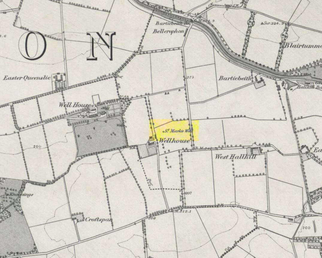
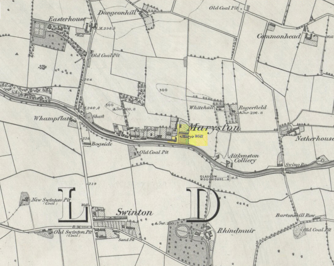
St Marks Well on 1864 map
Information on this long forgotten holy well that once flowed a few miles east of Glasgow city centre, beneath what is now Wellhouse estate, is all but lost. Local history works of the area tell us little (though there must surely be something somewhere?) and even the place-name surveyor of this area—Peter Drummond (2014)—could find nothing. Noted by the Ordnance Survey lads in 1858, when they came to re-survey the area again in 1899 its waters had, it seems, been covered and carried into the ‘Well house’ less about 50 yards to the southwest (another ‘Wellhouse’ found 150 yards further west is the site that gives the estate its present name). From thereon, this wellhouse and St. Mark’s Well fell into the forgotten pages of history and, sadly it seems, even its oral tradition has died…
The origin and nature of the ‘well house’ isn’t too troublesome, as Drummond (2014) explains:
“The name Wellhouse exists in several places in Scotland, and could indicate a ‘house beside wells’, or a protective ‘house over wells’; the early record here suggests the former, since the first Glasgow Water Company’s Act was obtained in 1806, many years later.”
However, the reasons behind the dedication to St. Mark at this probably heathen arena in times gone by, seems to be quite a mystery. Perhaps the folklore of the saint concerned may be of some help.
Customs practiced on St. Mark’s Eve and St. Mark’s Day (April 24-5) are replete with animistic elements throughout and are certainly not christian! Six months after the old New Year, we find rituals once more allowing, not for the passing of, but the emergence of the dead: bringing the spirits into the Spring and Summer. Divination rites were practiced with Cannabis sativa no less! Prophecy and wise-women were advisors to the young. Walking backwards around wells were known at some St. Mark’s wells; whilst others without his name—but on this saint’s day—were leapt across, symbolizing the crossing of danger and darkness in the ritual calendar. All around this period of time, up to and including Beltane, the end of the dark cold year has passed, and these plentiful rites are prequels to the lighter days, warm spring, summer and good autumn: all vital rites for the people in their myths of the eternal return…
St. Mark’s Well at Glasgow meanwhile, seems to have lost its old tales… Surely not?
References:
Banks, M. MacLeod, British Calendar Customs: Scotland – volume 2, Folk-lore Society: Glasgow 1939.
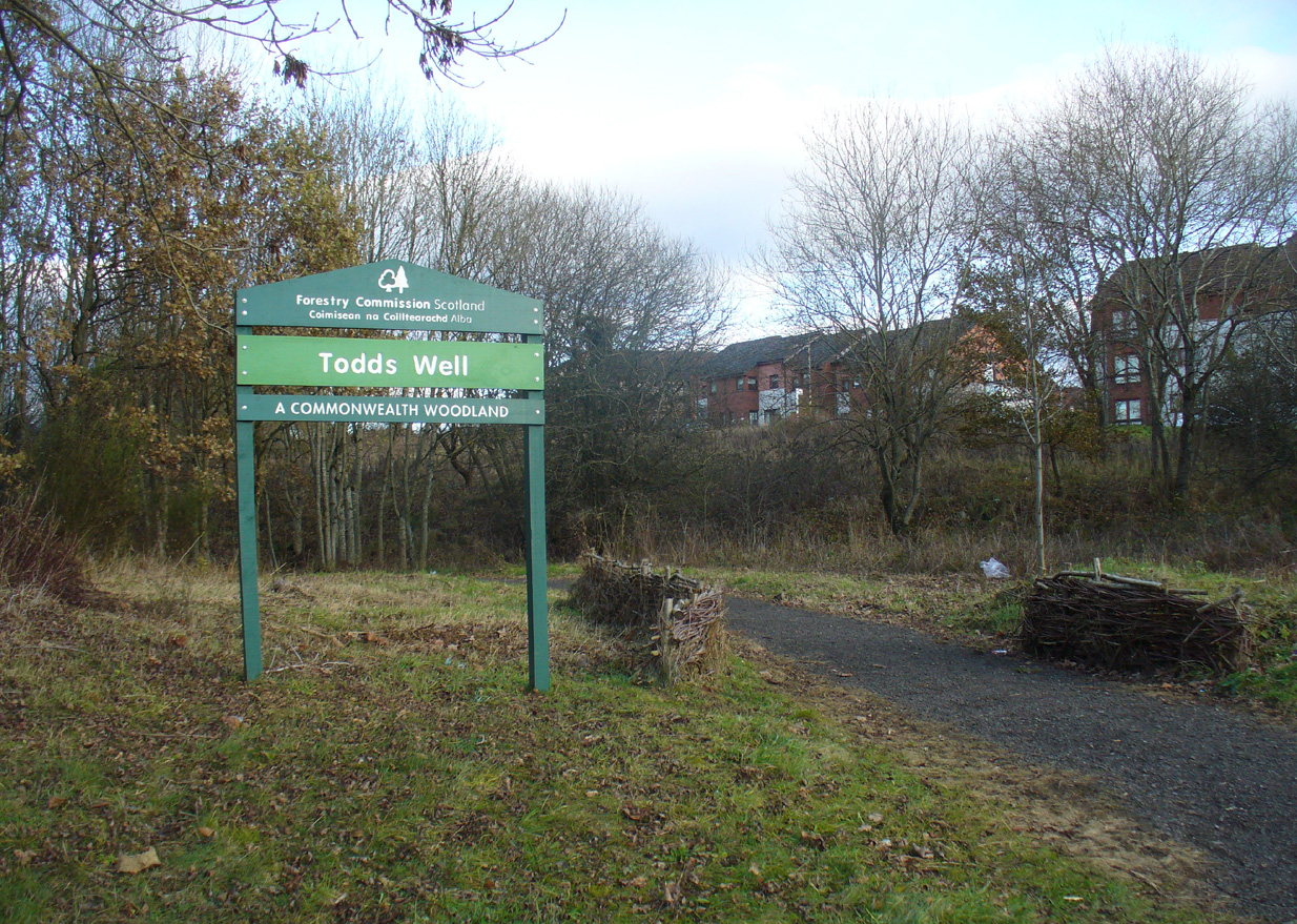
Many ways to get here, via the M8 or the B806. Just get to the Glasgow Fort shopping centre on the northern edge of Easterhouse, above Provan Hall. At the T-junction where the road from the Fort meets Auchinlea Road, note the sign saying ‘Todds Well’. Walk along the winding path, keeping to the lower side, and as you swing round the small hill, keep your eyes peeled for the small burn emerging from the shrubs 10-20 yards off the track. That’s the place.
Archaeology & History
Follow the track past the sign
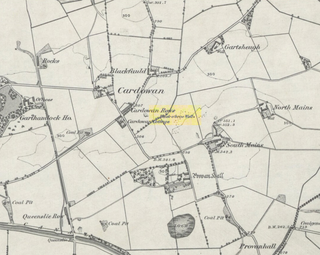
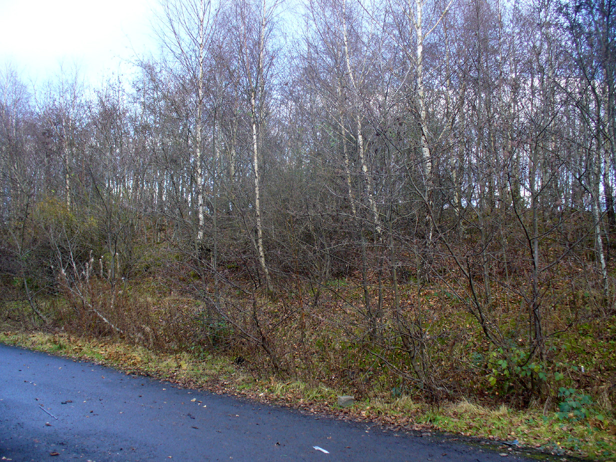
Thankfully this site still exists and the waters—slow though they flow—are quite drinkable (us lot drank here anyway!). It was illustrated on the early OS-map of the area as the ‘Back o’ Brae Well’—no doubt gaining its name from the surveyors who took the directions to the place as its title! At the point where the spring water emerges from the Earth, very overgrown remains of low walling marks the opening well-head, and a number of larger stones mark the course of the tiny burn as you walk towards the track (though these could be more recent).
Getting ready for a drink!The slow-flowing water source
Thought to derive its name from the old word todd, meaning ‘fox’ (Grant 1973), a variant on the word may have meant that children’s games were played here (but without a confirmation of this in local folklore, we should urge caution). As well as being used by local people, the water from Todds Well was one of the places used by them there ‘rich’ folk who lived at nearby Provan House.
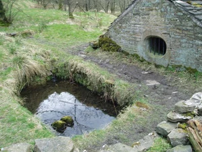
This old well, named after Queen Mary (one of at least three dedicated to her in Lanarkshire), was illustrated on the earliest Ordnance Survey map of the area in 1864. Local tradition tells us that the site gained its name when the great Mary Queen of Scots visited this old healing well, amidst a period when she stayed at Provan Hall 1½ mile away. Both she and her horse stopped and drank here for refreshment.
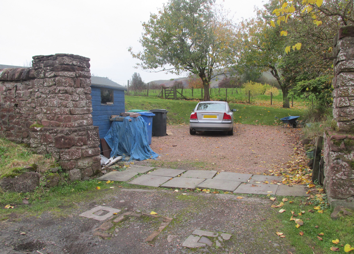
Site of Mary’s WellMary’s Well on 1864 OS-map
In the 19th and early 20th century, the well was converted into a pump and supplied the water to a row of cottages that used to be here. When we visited the site yesterday, no trace of the pump, nor any spring of water could be found. It seems that a huge pile of industrial crap has been piled on top of the well, then trees planted to give the impression that Nature has taken back the place. The well seems to have been completely destroyed (the photo here shows the spot where the well should be, just a few yards into the young trees). Due to this site being an important part of Scotland’s heritage, its ignorant destruction must be condemned.
Acknowledgements: Big thanks to the team – Nina Harris, Paul Hornby and Frank Mercer – for their work here. And to Dan Holdsworth and John Bestow for their additional input.
Travelling from Milnathort on the A91, in Gateside village, turn right down Old Town, and after the left bend in the road, park up. Access to the field where the Well is situated is through the gate on land next to the easternmost house on the south side of Old Town. Ask at the house first. Walk down the field towards the Chapel Den burn, and the ruins of the Well will be seen next to the burn just before the line of bushes that cross the field.
Archaeology and History
In his brief description of Strathmiglo parish, Hew Scott (1925) wrote:
“At Gateside…there was a chapel of St Mary, with Our Lady’s Well beside it.”
It was described in the nineteenth century Ordnance Survey Name Books by an informant:
“A small spring well on the north side of the Mill Dam. Supposed to have been used in the days of Popery as holy water and for other purposes when the building supposed to have been St Mary’s Chapel was in existence.”
Another informant wrote:
“…a Romish chapel is supposed to have been erected in this village and is borne out in a great measure by names of objects adjoining, namely Chapel Den, Chapel Well.”
And further:
“According to Doctor Small…it is stated, ‘The ancient name of this village called in old papers the Chapelton of the Virgin, changing its name at the Reformation.'”
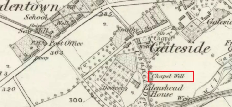
Shown as Chapel Well in 1856
This latter statement would seem to imply that the part of modern-day Gateside south of the main road (the north side was known as ‘Edentown’) was a pilgrimage centre of the Cult of the Virgin. The chapel was erected by the monks of Balmerino to whom it was known as ‘Sanct Mary’s of Dungaitsyde’. It was highlighted as the Chapel Well on the 1856 OS-map.
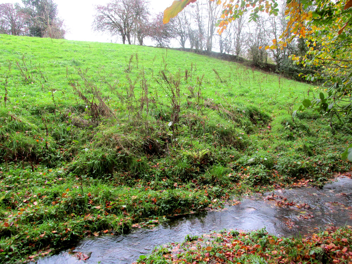
The ruined Well from across the burnNature takes back the ruined masonry at this magickal spot
While no trace of the chapel remains, the Well is evidenced by some low ruins of what had once been a red sandstone structure, and it was just possible to make out in the field the line of the pilgrim’s path to the well. But what a lovely serene place next to the burn! An ideal spot to meditate or daydream… The spring no longer flows, and a manhole in the field probably indicates the water supply has been diverted, perhaps to serve the long since closed Gateside Distillery?
References:
Scott, Hew, Fasti Ecclesiae Scoticanae – Volume V, Oliver & Boyd: Edinburgh 1925.
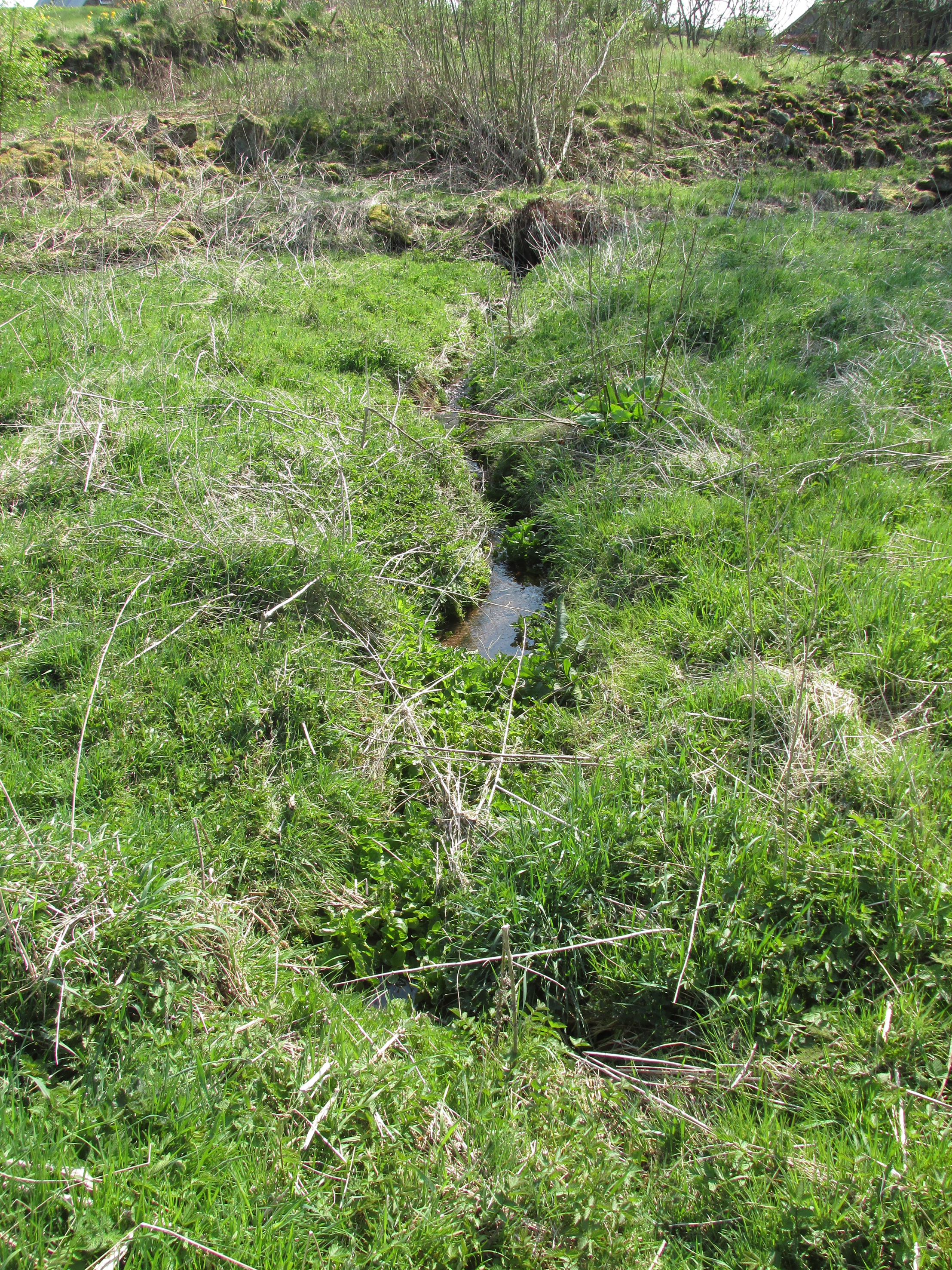
One of the present issues of St. Madden’s spring looking south.
At Kirkton of Airlie, park next to the church and walk north eastwards along the track, past the houses ‘Crabra’ and ‘Cleikheim’ and the spring that once supplied the Holy Well will be seen on the opposite side of the burn in a small fenced off enclosure. To the north east of the enclosure is a small hillock known as St Medan’s Knowe.
Archaeology & History
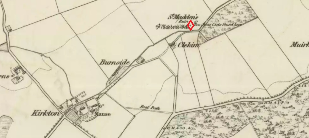
According to the Ordnance Survey Name Books, St Madden’s Well was located in a hamlet called St Maddens, which has since been almost entirely destroyed. In the mid nineteenth century a number of stone coffins and pottery were recovered from around the site, and the well was described as,
“filled up and defaced, the spring…still to be seen issuing into the mouth of a covered drain that was made some few years ago”.
There are now two issues of water from the spring, while nothing now remains of the original well housing. An adjoining resident informed me that the local landowner had gone to some trouble to try to find any evidence of the well housing, but had found nothing.
St. Madden’s Well on 1865 Map
As is often the case with these early mediaeval Scottish saints there is some confusion as to St Madden’s identity. To some writers his Saint’s day is accepted to be April 29th, and he has been identified as Saint Middanus, abbot of the monastery of Holywood, but Bishop Alexander Forbes considers he is more likely to have been a Bishop Medanach listed in the Dunkeld Litany.
To confuse things even more, J.M. MacKinlay (1904) wrote:
“The Hamlet of St Madden’s or St Medan’s in the parish of Airlie, where are also St Medan’s Well and St Medan’s Knowe, probably retains the name of St Modan, believed to have been a contemporary of St. Ronan. Skene says: ‘Modan appears in the Scotch calendars as an abbot on the fourth February, and as a bishop on the fourteenth November; but the dedications to him are so much mixed up together that it is probable that the same Modan is meant for both'”.
Andrew Jervise provides the following quote about St Medan:
“..bishop and confessor whose feast is held on 14th November was in great favour with King Conran c.503 – Coll. for Aberdeen and Banff.”
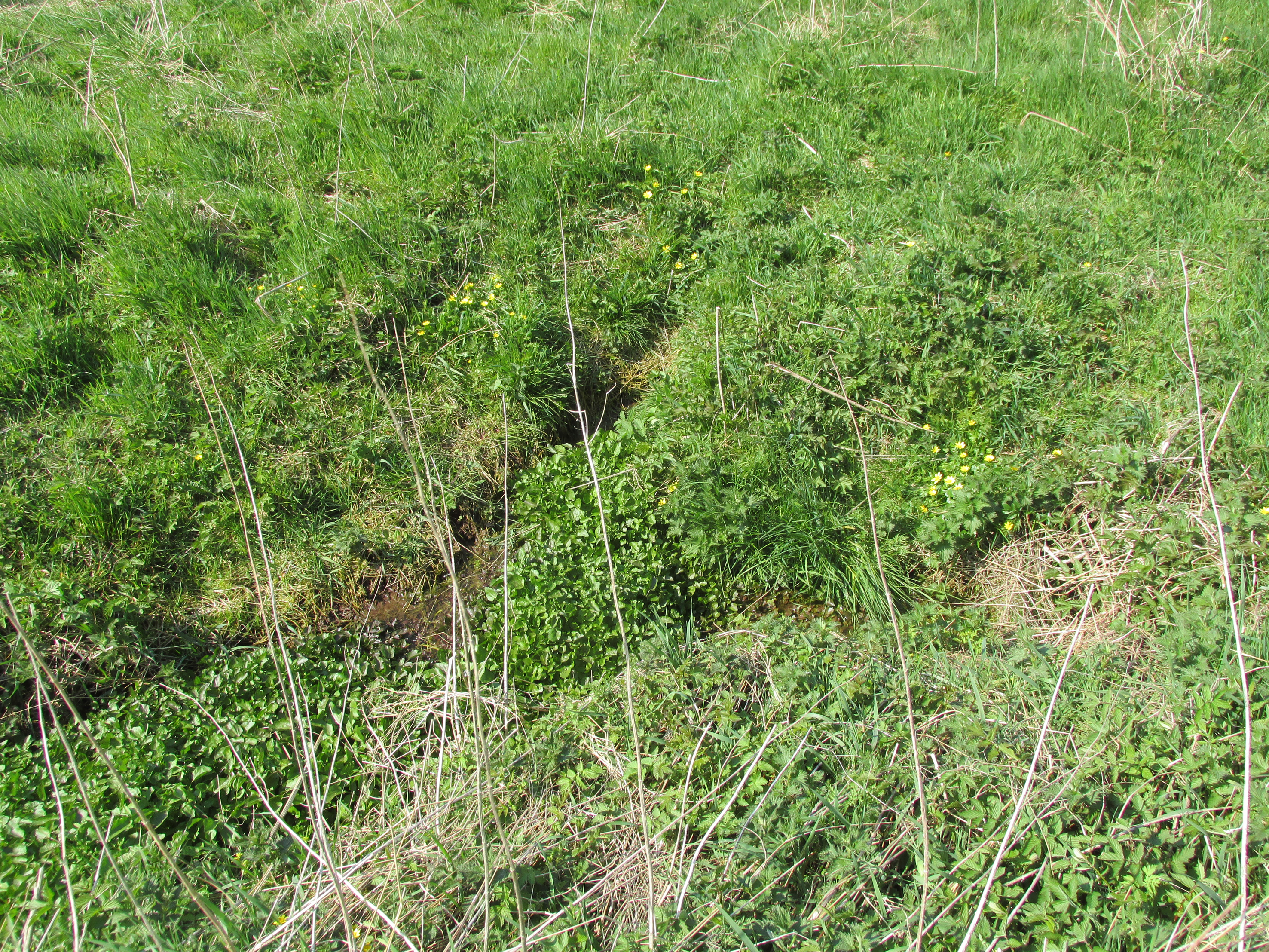
Another issue of the spring
Whosoever St Madden was, his quadrangular bell was the subject of an extant fifteenth century deed whereby the bell with its appurtenant parcel of land was granted to the Countess of Moray as dewar (hereditary keeper of a Holy Relic with appurtenant land), together with “the infeftment being completed by (the Countess) being shut up in a house and then receiving the feudal symbols of earth and stone.” On the death and subsequent disposal of the estate of the last dewar in the nineteenth century, the bell was sold along with a load of rubbish, its true identity and value not being realised at the time.
References:
Andrew Jervise, The History and Traditions of the Land of the Lindsays, Edinburgh, Sutherland & Knox 1853.
Andrew Jervise, Epitaphs and Inscriptions from Burial Grounds and Old Buildings inthe North East of Scotland, Edinburgh, Edmonston and Douglas 1875.
James Murray MacKinlay, Influence of the Pre-Reformation church on Scottish Place-Names, Edinburgh and London, William Blackwood and Sons 1904.
Dom Michael Barrett, A Calendar of Scottish Saints, Fort Augustus 1919.
Bishop Alexander Forbes, Kalendars of Scottish Saints, Edinburgh, Edmonston and Douglas 1872.
Scotland’s Place Names
Andrew Jervise, Notice of Antiquities in the Parish of Airlie, Forfarshire, in Proceedings of the Society of Antiquaries of Scotland, June 1864
Take the A675 road to Bolton from Abbey Village, going up the track opposite Piccadily farmhouse until you reach the ruins in the woods. The site can also be reached by going south down the Tockholes Road car park following the sign for Hollinshead Hall on your right.
Archaeology & History
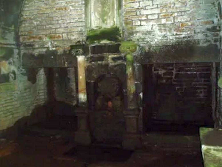
Hollinshead Hall
Associated with Hollinshead Hall, which is now a ruin, the well is made of the same sandstone rubble as the hall with a stone slate roof. The building a single cell is built into a slope from which the spring arises and is encapsulated by it. Either side a high walls creating a sort of forecourt with side benches with inward-facing chamfered piers with ball finials at the ends. The well house itself is quite an attractive building and is certainly not thrown up, having a symmetrical facade with chamfered unglazed widows which are fitted with spear-headed iron bars and clearly the building has never been glazed. The gable end has a large oval opening with a matching one at the rear. In the centre is a heavy board door with a chamfered doorway. This doorway unfortunately is locked baring any entrance to the well house.
Peering in through the windows one can see how strong the vaulted roof is, adorned by a pendent ball in its centre. The spring’s water flows from a crudely carved lion’s head, either side of a reredo of Ionic colonnettes, with a sunken stone tank beneath or each side a rectangular recess which enclose rectangular pools. There is a diamond-paved floor with a central gutter draining from this well or trough at centre of rear wall.
Local tradition accounts that there was a site here from Medieval times and indeed, that the name Hollinshead was derived from a version of holy well although O.E hol, for hollow is more likely although there is a Halliwell Fold Farm nearby being derived from O.E halig for healing. The pool with steps down above the well house may be the original well of course. The discovery of a hoard of medieval coins in 1970s would support the date and perhaps they were an offering.
Folklore
Abram’s Blackburn (1877) is perhaps the first to state that the water was curative. However, anonymous quote in Nightingales History of Tockholes describes the well as:
“Here no less than five different springs of water, after uniting together and passing through a very old carved stone representing a lion’s head, flow into a well. To this Well pilgrimages were formerly made and the water which is of a peculiar quality, is remarkable as an efficacious remedy for ophthalmic complaints.”
Another tradition is that the site was a resting place for pilgrims to Whalley Abbey and that the trough was used as baptistery, however, this would be more likely to be the spring above the well house. It is probably a spring house, a structure built over a natural source of water for the storage of dairy products and other foods that needed to be kept fresh.
Reculsancy was very prevalent in Lancashire and the well house does the bear the coat of arms of the Radcliffes. It would suggest why the structure is so ornate and suggest a 1600s date—although many authorities suggest an 18th century origin. The site would be a secret baptistery and its design as a dairy would also help as well as being still function, certainly the presence of benches suggest this functionality. It appears to be too close to the house to be a garden folly such as a grotto! The suggestion of stained glass in the windows suggests something more significant discovered during the present stone roof’s construction. Indeed, the choice of the lion’s head is possibly that of the ‘Lion of Judah’, meaning Jesus providing rich and valuable water, although this is a common motif on many drinking fountains of course! Interesting, Cramshaw (1994) tells us that the site was in the 1980s the site of a well dressing, although what type is unclear and no other author has mentioned it as far as I am aware. Perhaps we shall never know the real origin of this delightful building.
A stone’s throw from Ikea and found off the B600 main road. Travelling to Greasley from Watnall, take first turning on the left after Royal Oak Wood. Travel up Trough Road, past the woods where it is best to park, then walk up Trough Lane and the well can be found on the right hand side, opposite a house called The Springs.
Archaeology & History
I am of the opinion that the ‘holy’ element of this well is a romanticism of the 1800s, but there is a possible record in the ‘The Manor of Bevall in the County of Nottingham’ document, commissioned by the Honourable Dame Elizabeth Capell in 1653. Amongst the records it appears a number of times as:
‘Holy Well Furlong 2 lands bounded with John Richards west and William Hickton east’.
Plaque at the wellFront of the well
A 1724 Capps Survey of Watnall Cantelupe notes that Joseph Richards had some lands lying in a close called the Flatts or Holliwell, which understandably relates to ‘Holy Well’. There is also note of a Holwell Croft field name in the 1500s at Greasley, which again may describe this site or another and such suggests that it derives from O.E. hol, meaning ‘hollow’, a common misconception when identifying prospective holy wells. Jeremy Harte (2008) in his English Holy Wells suggests that those sites called ‘Holy Well’ are pre-Medieval in origin so perhaps this site is one of the most ancient in the county.
The sacred waters
On my first visit to this site I was told by an elderly man that he was baptised there (or water used from it used for his baptism), before attempting inexplicably in trying to discourage me from finding it (due to his wariness of me I failed to discover the nature of his baptism or of what denomination). According to locals in the lane the plaque and present state of the well dates from the 1980s and was done in partnership with the local council.
The house opposite is called ‘The Springs’ was this name of the well before the ‘present’ name and so it is ‘modern’ holy well per se, although I think the 18th century survey is significant.
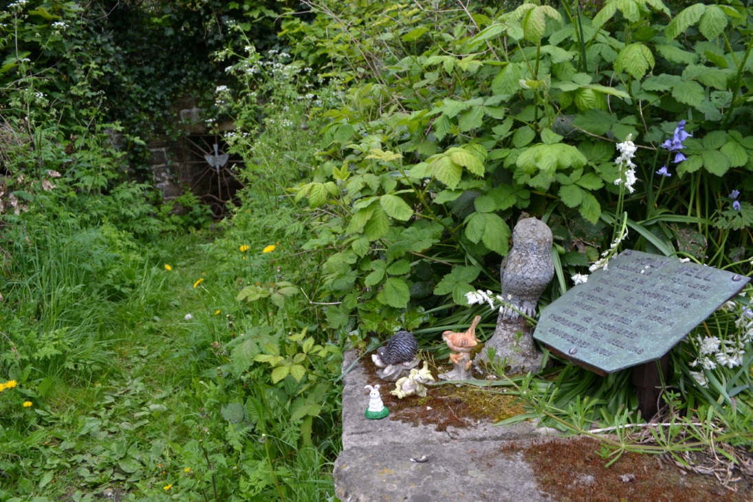
The well itself, is enclosed in a stone recess with a rusty iron gate with a dove affixed on it bearing the legend Holy Well. It is approached by a path walled along both sides which are adorned by a wide range of gnomes and garden ornaments..almost so you could be pixy led!
Folklore
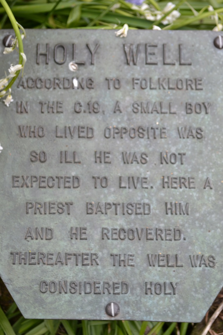
A plaque near the well’s entrance has a local piece of folklore recorded. This relates that a local boy who lived opposite was very ill and bedridden. A local priest called for water to be drawn for the boy from the well. This was done and the boy became well.
Interestingly it’s the only legend of this type—one which records a cure—in all the Nottinghamshire holy wells. It is a shame one cannot find a date or check its provenance, a fact supported by local history author Mr. John Lee. The use of priest is significant. Does the story may indicate the Catholic revival in holy wells in the 19th century? However, the only Catholic associations locally are that of Hilltop at Greasley for there was, and is, only a Methodist chapel in Watnall.
Extracted from Parish, R.B (2008) Holy Wells and healing springs of Nottinghamshire
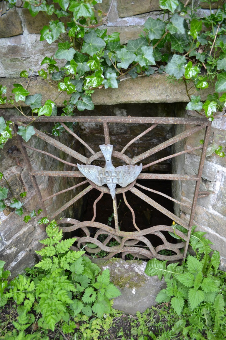
To find Nanny’s Well, take B5474 out of Chapel and take the right hand turning called Crossings road (which goes to Chinley) which is before Frith view on the left. Continue until the small wall surrounding the site can be seen on the right.
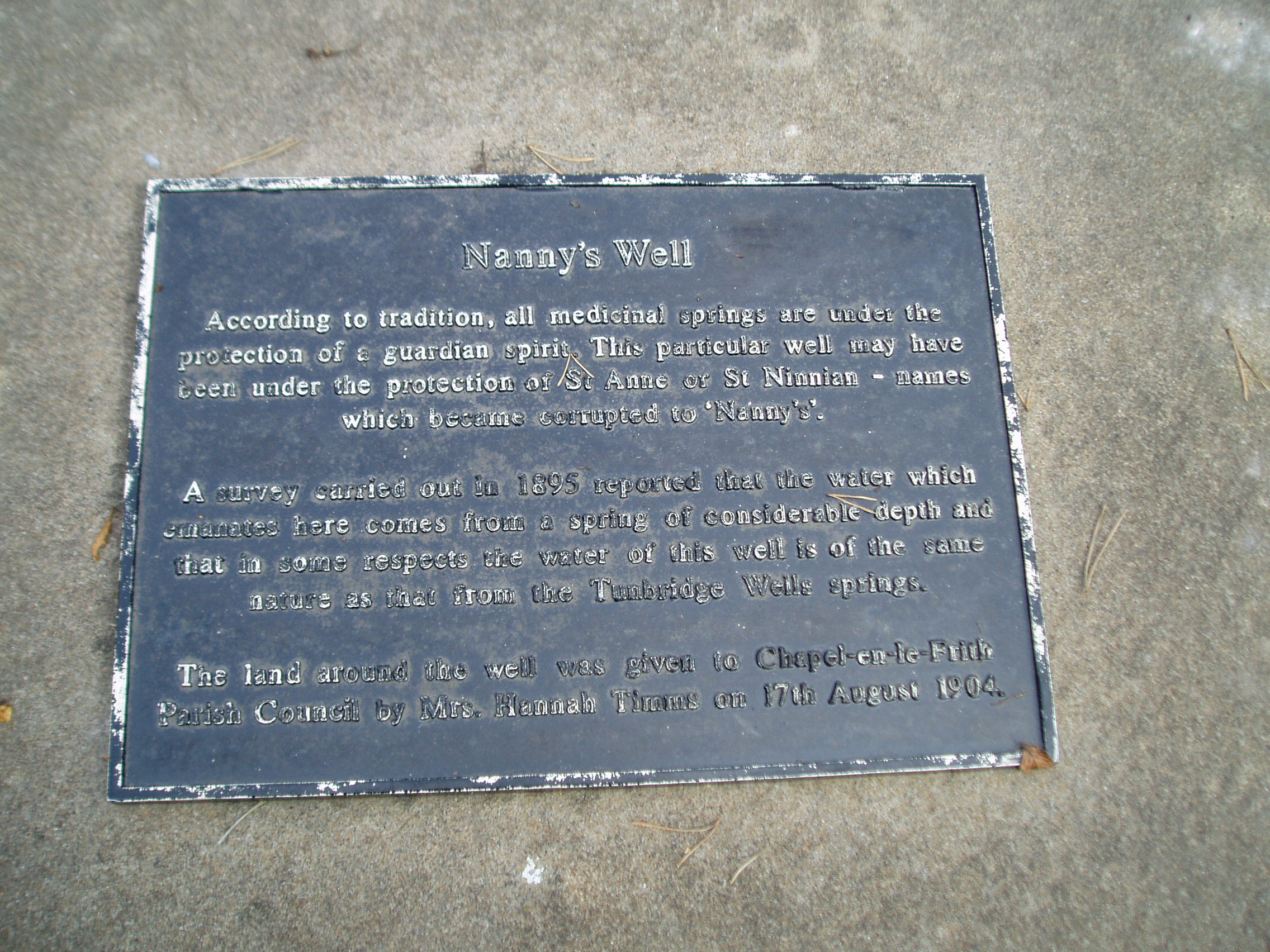
Archaeology & History
The name it is said to be either from St Ninian (less likely) or St Anne (more likely as she is also considered the mother of Mary and thus Grandmother of Jesus).
The Nanny well pump
It is described in M.J.B Baddeley’s Peak district of Derbyshire (1913) and the neighbourhood as:
“a valuable but neglected spring of chalybeate water.”
Yet in 1895, a Manchester firm of Grace, Calvert and Thompson analysed it and found it:
“not polluted to any extent with organic matter of animal or vegetable origin and comes from a spring of considerable depth and that no surface water has become mixed with it’…in same respects the water of this well is of the same nature as that from the Tunbridge Wells springs.”
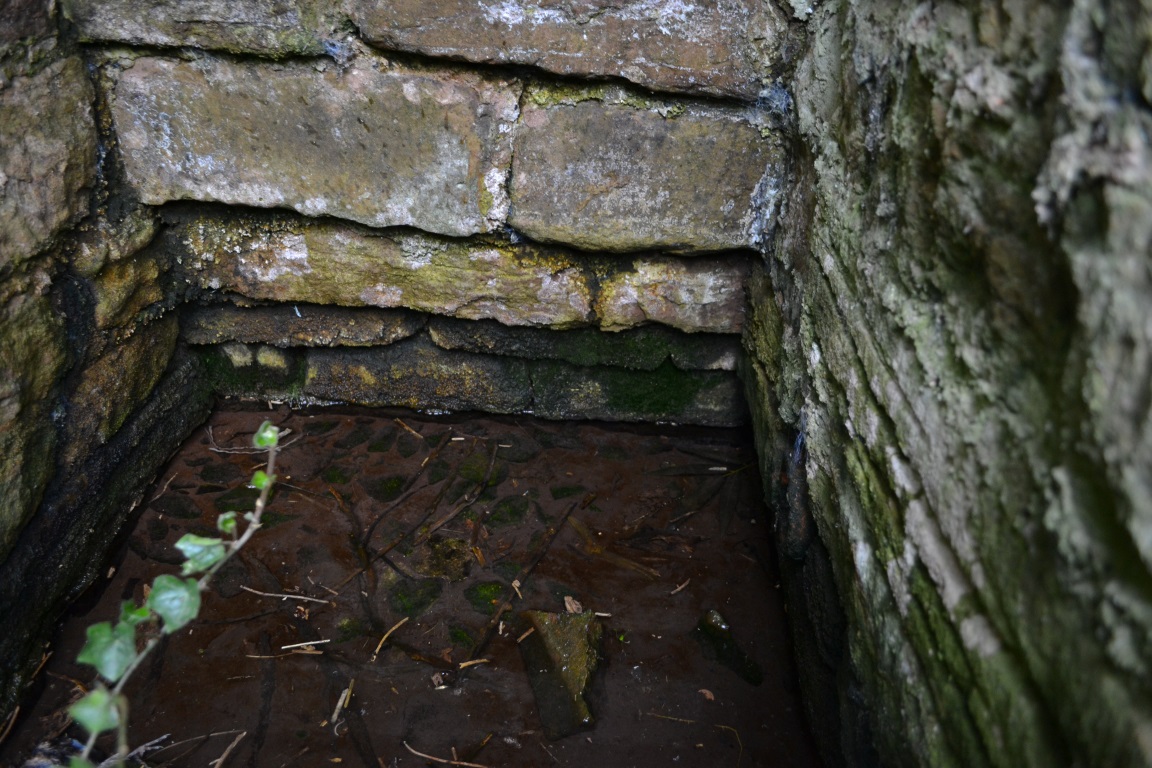
The site is now an iron pump by the side of Crossings Road, known as Nanny Well Road, enclosed in a low wall along which. The pump no longer works and the well capped but it can be heard and just about seen through a crack beneath.
A peer through the crack shows running water!
Folklore
Nanny well plaque
It was visited on Easter Morning, with sugar or licorice to make Spanish Water, and then the bottles were hung around their necks. The site is one of four wells dressed annually since the 1980s in July and the site is blessed.
Extracted from Parish, R. B., (2008) Holy Wells and Healing springs of Derbyshire
The genuine St. Bertram’s well is not easy to find and I recommend using the OS map carefully. It is reached by taking the footpath that leads off at the left passing the cross out of the village. Follow this until the end of the dry stone walling on the right and then divert from the footpath to the right where the well can be seen. The second well is easily found in the field between the church and the Hall.
Archaeology and History
Bertram is an interesting local saint, dating from around the 7th-8th century. Briefly, he is said to be of Royal Irish lineage but after making a princess pregnant, escaped to England where he sheltered in the woods around Ilam. The story is told by Alexander, a monk, in the 13th century who notes:
“They were in hiding in a dense forest when lo ! the time of her childbirth came upon them suddenly ; born of pain and river of sorrow! A pitiful child bed indeed! While Bertellinus went out to get the necessary help of a midwife the woman and her child breathed their last amid the fangs of wolves. Bertellinus on his return imagined that this calamity had befallen because of his own sin, and spent three days in mourning rites”.
As a result he became a hermit living in a cave in the valley near Ilam. Despite the earliest mention being Plot, the local geography is suggestive that this is the site of an early Christian hermitage site, although no mention of a well is noted in his legends it can be noted. Currently, the well is surrounded on four sides by varying low stone walling, about two feet or so at its highest (although it appears to have been built up and down over the time I have visited the well). The spring flows from a small, less than a foot square chamber, enclosed in stone and set into the bank through a channel in the rubble flow and out along the path towards it.
Since the 1990s, on the first Saturday in August, the Orthodox Church makes a pilgrimage to the site and blesses the well. Interestingly, literature available from the National Trust shop fails to mention this well, but notes a more substantial second St Bertram’s Well close by the church and surrounded by a rectangular stone wall with steps down, the water arises here at greater speed and flows into the nearby River Manifold. Visually it is more impressive and more accessible but whether there is any long tradition of this second well is unclear, but authors such as the Thompsons’s (2004) The Water of Life: Springs and Wells of Mainland Britain and Bord (2008) Holy Wells of Britain appear to have fostered its reputation.
Incidentally, the church boasts the remains of St Bertram’s shrine with foramina and the church yard has two Saxon crosses, making a visit to the village a must for those interested in early medieval history.
Folklore
“St Bertram’s Ash… grows over a spring which bears the name of the same Saint… The common people superstitiously believe, that tis very dangerous to break a bough from it: so great a care has St Bertram of his Ash to this very day. And yet they have not so much as a Legend amongst them, either of this Saint’s miracles, or what he was; onely that he was Founder of their Church”
Such notes Plot (1686) The Natural History of Stafford-Shire, the earliest reference of this fascinating site. By Browne (1888) in his An Account of the Three Ancient Cross Shafts, the Font, and St Bertram’s Shrine, at Ilam, noted that the ash had gone, but the water was still being used. He states that:
“The late Mrs Watts Russell always had her drinking water from it.”
Extracted and amended from the forthcoming Holy wells and healing springs of Staffordshire by R. B. Parish (2008)
The well now lies on private land and feds a trout farm (Beckets Well Trout Farm at The Castle House, Sevenoaks Rd, Otford in Sevenoaks). To find Becket’s Well go along the A225 to the centre of Otford, park in the car park ( in front of the row of terraced shops ) near the Bishop’s Palace. Take a small private road to Castle farm, now as said, a trout farm. Inquire here, if you are able to visit the well, which lies within a complex of fish pools to the east of the farm house.
Archaeology & History
The site has been well recorded in recent centuries, for example an account of 1876, describes the site as, “endorsed within a wall, forming a chamber 15 ft across and 10 ft deep.” Both the chamber’s appearance and shape suggests that is would be ideal for immersions, of which Harper and Kershaw (1923) notes that bath and steps are defied annually by the hop pickers. It is interesting to note that Thorne (1876), with no apparent reference, gives another connection with the saint, suggesting that, “to have used by the saint as a bath.” No subsequent or previous work draws notice to this, so it is likely to be antiquarian fancy. Another more plausible possibility is that it was used by the leper hospital found on this site around 1228. They would have clearly made use of the pure water for medicinal purposes and perhaps indeed used it as a bath.
Kirkham (1948) notes it was suffering from neglect being “now said to be choked up and half full of tins.” This decline would appear to have started a long time ago, as a folly tower, now demolished, was built on Otford Mount (a nearby earthwork), from the well’s stone work. Consequently, this degraded condition prompted excavation in the 1950s by the Otford and District Historical Society; of which the following details of their findings are briefly described.
The report noted that the well consisted of two chambers, with water emerging from two arched outlets into the first of these. This chamber is surrounded on three sides by walls, thirty-five feet by thirteen feet (east end), the walls are eight feet high, and at the same level of the ground. Six steps at the south-east end give access to the well chamber. The sluice wall is five feet high, eight feet wide, and is substantially buttressed on the western front. Water runs through this sluice wall, between steep banks westward, through a lower chamber, twenty-seven feet (north sides), and thirty-five feet (west side). The water then flowed through watercress and finally through an underground, probably Tudor conduit. This conduit then passes through the site of the Palace. This stream once fed a moat, but now discharges into the Bubblestone Brook, a Darenth tributary.
Local common thought was that the well is the remains of a Roman bath house, a belief echoed by its present owner; and a view endorsed by both Ward (1932) and Harper and Kershaw (1923), who note that it “is really a Roman Bath.” This view is further supported by the two surrounding Roman villas, and hence one aim of the excavation was to evaluate this long held claim. Yet, although they showed that the well had gone through considerable renovation and rebuilding over the centuries, no remains could be positively be dated to this period. This renovation, of course, resulted in a rarity of deposits, and hence with a lack of artefacts, the subsequent interpretation was thus difficult.
The excavation was further handicapped by the waterlogged conditions. Both may have influenced the results. Consequently, there are still doubts, and the concept of a Roman origin has not been satisfactorily disproved. The earliest written record is from Otford Ministers accounts of 1440-1, indicating that by then a stone structure existed here, but how old that was again is not clear. It states:
“To a carpenter for two days to make 2 gutters to bring water from the pool of the garden to the moat and for working on and laying another gutter beyond the water course and coming from the fountain of St. Thomas to old garden, 12d; and to a carpenter for one day covering a gutter with timber and cresting it, 6d. And for two masons for 2 days for placing and laying and making a new stone wall of the fountain of St. Thomas, broken for the pipe of the water conduit, 3s, taking between them daily 12d. To five labourers 10 days digging the soil between the said fountain and moat to lay in the leaden pipe of said conduit16s 8d taking each daily 4d.”
The present floor may be ascribed to that period; although it would seem to cover an earlier lower flint floor (again possibly Roman). Between 1520-1520, Archbishop Warkham, pulled down the then existing Manor house and built the Palace, covering four acres. This consequently required a better water supply, and hence the well was improved: the original lower chamber is said to originate from this period. The full purpose of the lower chamber is not clear, but it is believed that it may have housed cisterns giving a greater flow of water. When Henry VIII acquired the Palace from Archbishop Crammer in 1537, he spent money on improvements to the estate, and probably the well. The sluice gate, strengthened by Warham, was now supported by buttresses. These may have supported a conduit house. This was recorded in 1573:
“The condiyte house or well conteyning in length XXXVI foote and in breadth XIX fote to be taken downe and newe sett upp will coste XXX pounds. The pypes conveyinge the water from hence to the offyces and small sesterns to be amended will coste Xiii.”
By the 1600s, the Palace was in disrepair and the well was only used for private consumption by Castle farm. Despite this, restoration still continued and the north, east and south wall saw upper improvements by the 1700s. In the lower chamber a stone west wall was erected on Warham’s brick foundations. By this time, the south wall was beginning to collapse and was rebuilt in the 1800s.
By 1954 repairs were again needed, as the north wall was collapsing. Goodsall (1968) reported that even after its excavation in the late 1950s, the site then enclosed in railings was forlorn and overgrown with weeds. Forty years on, the present condition is similar to that illustrated in the contemporary photo, taken during the excavation: the intervening decades have seen the inevitable degradation, through time, of its infrastructure. Fortunately, the hideous railings have been removed, obviously to erect the trout farm infrastructure, whose water is supplied by the well. The walls appear now comparably greatly overgrown, which has probably preserved them, and the sluice wall, north, south and west walls appear the most ruinous, with the walling falling away towards the sluice wall. The walling was best preserved at the east end.
The clear spring appears to flow rapidly from its source, and has the appearance of being deeper. As stated, it now has now a commercial function, providing good quality water for the raising of trout flowing through a series of fish ponds replacing the cress beds. The owner in the 1990s, a Mrs. Burrows, believed that the well was originally roofed. The results of the excavation did not indicate this although it may be a mix-up with the possibility of a conduit house over the well. She also stated the water stayed the same temperature through the winter and summer, a constant 500 C, certainly beneficial to bathers.
Folklore
One of the best known holy wells among Kent antiquarians no doubt due to the colourful legend associated with it. This tells that whilst living here in the old manor—the ruins of which called the Bishop’s Palace still stand—St. Thomas bemoaned the lack of good water. As a remedy he struck his staff into the ground and clear water gushed forth. This is a familiar folklore motif and we shall see it again referred to at other Kent sites. Perhaps it recalls the saint ordering well digging to provide fresh water and marked the position with his staff! The legends earliest reference is made by Lambard (1571):
“..stake his staffe into the drie ground ( in a place thereof now called Sainte Thomas Well) and immediately the same water appeared, which running plentifully, serveth the offices of the new house to the present day.”
The well was said to be curative, but the exact nature of its curative powers are unknown, and although belief in them was waning by 1800s, rumours of its use continued to the last world war. The Gentlemen’s Magazine of June 1820 gives the only recorded account of a cure and states that:
“an old man, who, crippled by rheumatism, was completely renovated by this bath to health and action of circumstance witnessed by the late Lord Stanhope and several of the neighbouring gentry.”
(Extracted and amended from original blog page, which includes and addition holy well – Colet’s Well –
http://insearchofholywellsandhealingsprings.wordpress.com/2012/01/12/the-holy-wells-of-otford-kent/ – and from the forthcoming Holy Wells and Healing Springs of Kent – references quoted in the piece can be found therein.)