Cup-Marked Stone (lost): OS Grid Reference – Q 6014 0226
Archaeology & History
A cup-marked stone that was reported at this position in the 1940s by the Kerry Archaeological Survey (KAS) had disappeared by the time Judith Cuppage (1986) wrote her survey. She told that “there is no visible trace or local knowledge of the” carving. It may well have been destroyed. Seemingly KAS made no notes or sketches of the site. (WTF?!?!?)
References:
Cuppage, Judith, Archaeological Survey of the Dingle Peninsula, Oidhreacht Chorca Dhuibhne: Ballyferriter 1986.
Cup-and-Ring Stone (lost): OS Grid Reference – Q 46 00
Archaeology & History
This lost carving probably still exists, but in all likelihood is well overgrown by vegetation. It was in that state of affairs when Rev. Orpen (1908) wrote about it more than a hundred years ago in his essay on the petroglyphs between Lispole and Dingle. After describing and illustrating several carvings in the area, he told:
“I may mention here that further west, near Ballintaggart, at Ballywoonig, there is another single cup and circle which I found on a rock, the last of which was covered with clay and grass. I had these removed, hut nothing further was disclosed.”
Sadly, he left us with no sketch. His wording suggests that the carving is close to the southern boundary of Ballinvownig, pehaps near the souterrains near Ballintaggart house…? Perhaps some local antiquarian explorers might be able to find out where it’s hiding—although it will doubtless be covered in vegetation.
References:
Cuppage, Judith, Archaeological Survey of the Dingle Peninsula, Oidhreacht Chorca Dhuibhne: Ballyferriter 1986.
Orpen, R., “Antiquities near Lispole, Co. Kerry,” in Kerry Archaeological Magazine, volume 1, 1908.
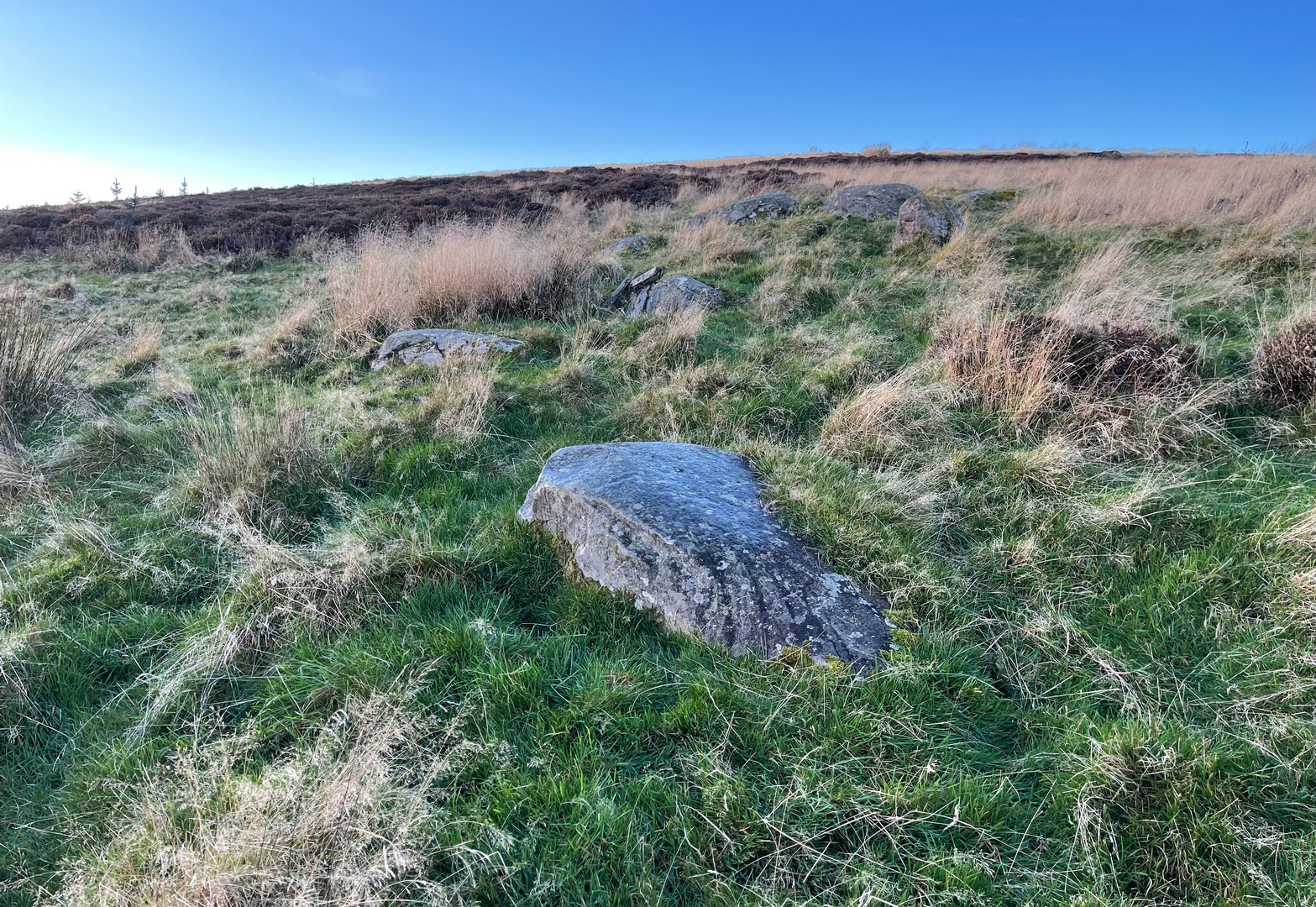
Cup-and-Ring Stone (removed): OS Grid Reference – NT 12364 32627
Also Known as:
Drumelzier Carving
Archaeology & History
Position of stone in cairn
A carving that was located at the edge of a cairn on a knoll on the east-side of the River Tweed, this is an odd design that now lives in Edinburgh’s central museum: odd, inasmuch as the design looks as if it’s a typical cup-and-ring carving, yet none of the cups on this stone were ever hollowed or pecked out, and so the “cups”, so to speak, are actually small rings (if that makes sense!). There are a number of similar unhollowed “cups” on other carvings that are found associated with prehistoric tombs, so perhaps this aspect was something of a burial trend—amongst a very small tribal group, perhaps… It’s an element that was remarked upon in Simpson & Thawley’s (1972) examination of petroglyphs in neolithic tombs that were called “passage grave style” carvings: a sort of dyslexic cup-and-ring design no less! The intriguing thing about this carving is that it’s one in a small cluster of dyslexic cup-and-rings that are found in this part of Scotland—in an area where rock art itself is pretty scarce. Which begs the question: was it a local tribal style? Anyhow…
The carving was first uncovered when J.H. Craw (1930) excavated the aforementioned cairn, finding therein a number of cists. There’s speculation that the petroglyph might originally have been a covering stone for one of the cists, but we don’t know for sure. Craw described the carving as follows:
Craw’s 1930 sketchRon Morris’ 1981 sketch
“The ring-marked slab…measures 3 feet by 2 feet by 6 inches. It lay at the north side of the cairn (highlighted in sketch, PB), outside the encircling ring, but may originally have been the cover of cist No.2. On the upper side are five shallow ring-markings, four being double and one single. The former measure 3 inches to 4 inches in diameter, and the latter 1¾ inch. The figures are thus much smaller than in typical cup-and-ring-marked stones, and the lines are only ¼ inch in width. The only similar markings known to me are on a slab which I found a number of years ago near the site of several former cairns, and forts at Harelawside near Grant’s House, Berwickshire. The stone is now in our Museum.”
The “museum” in question being Edinburgh’s National Museum (I don’t know if it’s in a box somewhere or on public display, which is where it needs to be). If anyone can get a good photo of this carving, please send it to us or add it on on our Facebook group.
Morris, Ronald W.B., “The Cup-and-Ring and Similar Early Sculptures of Scotland; Part 2 – The Rest of Scotland except Kintyre,” in Transactions of the Ancient Monuments Society, volume 16, 1969.
Morris, Ronald W.B., The Prehistoric Rock Art of Southern Scotland, BAR: Oxford 1981.
Ritchie, Graham & Anna, Edinburgh and South-East Scotland, Heinnemann: London 1972.
Royal Commission on the Ancient & Historical Monuments, Scotland, Peeblesshire – volume 1, Aberdeen University Press 1967.
Simpson, D.D.A. & Thawley, J.E., “Single Grave Art in Britain,” in Scottish Archaeological Forum, no.4, 1972.
Acknowledgements:Huge thanks for use of the Ordnance Survey map in this site profile, reproduced with the kind permission of the National Library of Scotland.
Cup-and-Ring Stone (lost): OS Grid Reference – Q 43 11
Archaeology & History
Judith Cuppage (1986) recounted that in the unpublished Minutes of the County Kerry Field Club for 1944, mention was made of a multiple-ringed petroglyph that hasn’t been seen since. It sounds quite impressive. She told how they’d,
“discovered a stone bearing a cup-and-gapped circle and a cup-and-3 gapped circles, “on the fence opposite the church” at Camp. Mortar still adhering to the stone as if it had been removed from a building.” Adding that, “neither its original provenance nor present whereabouts are known.”
Surely some good wise local still knows where this olde stone lives? In a garden perhaps…? It would be good to know that it’s still alive and well.
References:
Cuppage, Judith, Archaeological Survey of the Dingle Peninsula, Oidhreacht Chorca Dhuibhne: Ballyferriter 1986.
Acknowledgements:Huge thanks for use of the Ordnance Survey map in this site profile, reproduced with the kind permission of the National Library of Scotland.
Less than a mile east of Callander on the main A84 road, nearly 300 yards just past the entrance into the Keltie Bridge caravan park, take the tiny road on your left (north) and barely 100 yards along where a small crossroads can be said to exist, go straight forward up the tiny single-track road ahead of you. Literally 0.62 miles, or 1km up, park on the right-side of the road where a small grassy track runs up the slope. From here, you need to keep walking up the road itself, bearing right just past the small bridge and, about 350 yards along you’ll see a notable rise in the field on your right less than 100 yards in. Head straight for it!
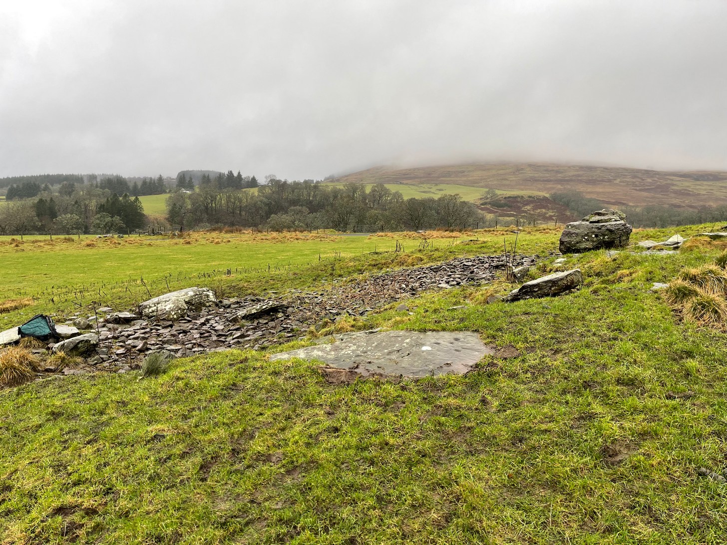
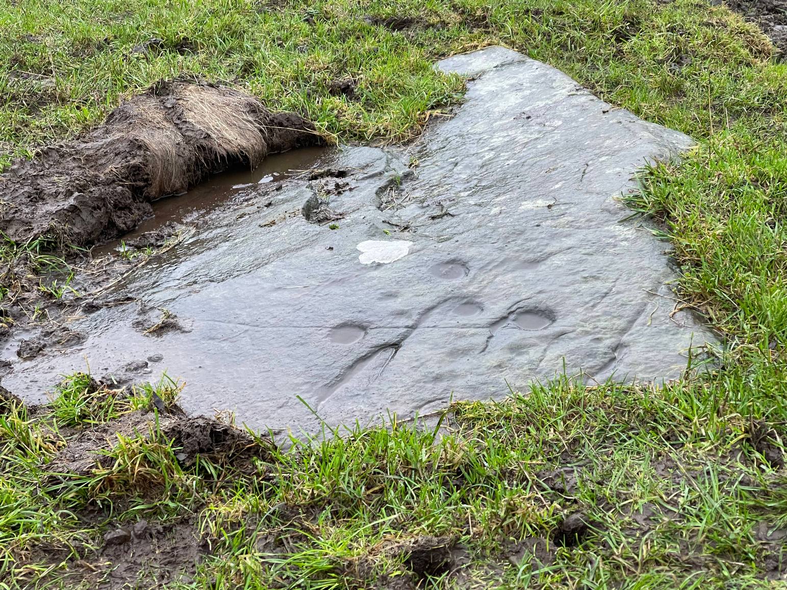
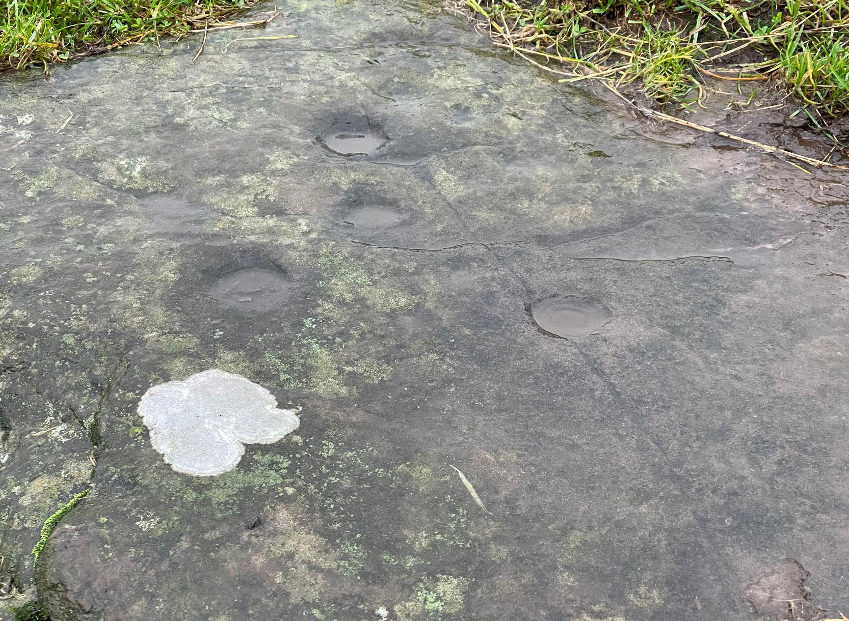
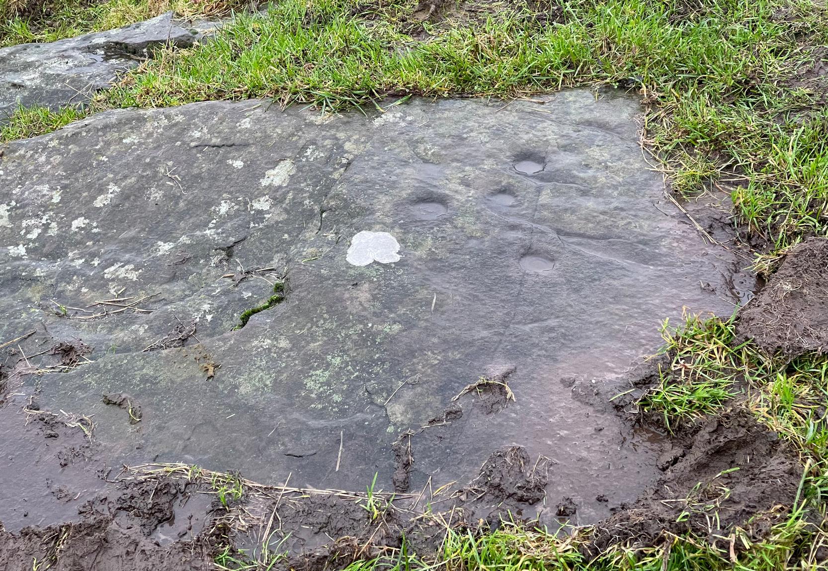
Archaeology & History
Despite this being a very basic simplistic design, I’m somewhat disappointed in myself as when we visited here, She was pouring with rain and for some reason or other I didn’t indulge myself in the soaking muddy ground and peel back the dung-infested turf to see the entire surface of this stone—and so, as a result, didn’t see the carving in its entirety. I’d have got soaked and been covered in shit! 🙂 But later this day we were visiting an antique centre and book-dealer straight afterwards, so for once I couldn’t play in the mud. Damn those neat and tidy folk!
It’s nowt special to look at in all honesty, but it’s in a good state of preservation as it was seemingly uncovered in pretty recent times beneath the curious large mass of loose stones right next to it. The stone mass gives the impression of it being a ruined cairn, but seems more likely to be a clearance cairn that was piled up, quite fortuitously, next to the cup-marked rock.
The carving consists of eight cup-marks (not all shown in these photos): five large and prominent, one not so prominent, and two that are small and very shallow. The more distinct cups would seem to have been worked and re-worked many times, obviously possessing a practical nature of some sort. As we can see in the photos, four of the larger cups stand out, whilst the small ones can be difficult to see. If there are any petroglyphic locals who fancy getting up here to clear the rest of the stone to see if there are more cup-marks underneath the soil, please let us know! Perhaps check it out when you’re looking at the nearby cairns at Ballachraggan and beyond.
References:
Main, Lorna & Page, R., “Easter Brackland, Stirling,” in Discovery & Excavation Scotland, volume 2, 2001.
A little-known multiple ringed carving was discovered a few years ago during the excavation of a prehistoric cairn just immediately east of the A701 roadside, several miles south of Broughton. The cairn itself had been recognised many years prior to the recent excavation, when one of two cists inside it was noted by R.B.K. Stevenson (1940), and which was subsequently described in slightly more detail in the Royal Commission Inventory (1967). But when the modern investigation was undertaken by the Biggar Archaeology Group in 2008, a damaged but impressive carving was uncovered that somehow hadn’t been noticed before. It was described in Tam Ward’s (2008) excavation report where he told that,
Carving in situ (photo courtesy Jim Ness)Carving looking N: courtesy Jim Ness
“lying almost immediately on the east side of Cist 1 is an angular rock…measuring 1m long and over 0.3m wide on the uppermost face, itself lying at an angle facing SW and away from the cist. The rock has fractured due to weathering in post deposition times, as indeed several other surface stones had, but on the widest part of the upper surface are at least seven concentric lines faintly pecked into the smooth flat surface of the stone. The lines are up to 10mm wide and appear to have been intended to form semi ovals on the edge of the rock. The outer ring forms an arc of c270mm on the long axis by c140mm on the short one (the former measurement being straight between the ends of the lines and the latter being a radius across the design). The terminals of the inner curved line are about 80mm apart. The lines are slightly irregular in distance from one another. Although it is far from certain, it does not appear that the rock has been part of a larger one with a more complete design on it, rather the pecking appears not to have been finished since the surface of the rock is similar in appearance overall while the abrasion of the carving varies.”
Fractured design (photo courtesy Jim Ness)
The carving remains in place with the cist, which was covered back over when the excavation had been finished.
Carvings such as this are uncommon in this neck o’ the woods; although less than a mile downstream from here, on the other side of the river, another petroglyph—known as the Drumelzier carving—accompanied another prehistoric tomb. Apart from this, there’s a great scarcity of carvings scattering the Lowlands—although it’s likely that there are others hiding away, waiting to be found on these hills…
References:
Royal Commission on the Ancient & Historical Monuments, Scotland, Peeblesshire – volume 1, Aberdeen University Press 1967.
Stevenson, R.B.K., “Cists near Tweedsmuir,” in Proceedings Society Antiquaries, Scotland, volume 74, 1940.
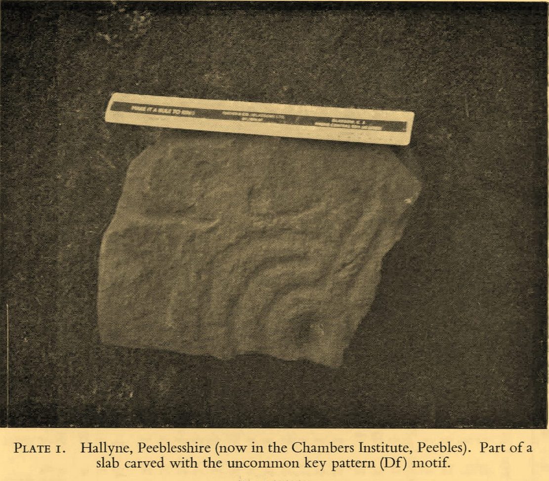
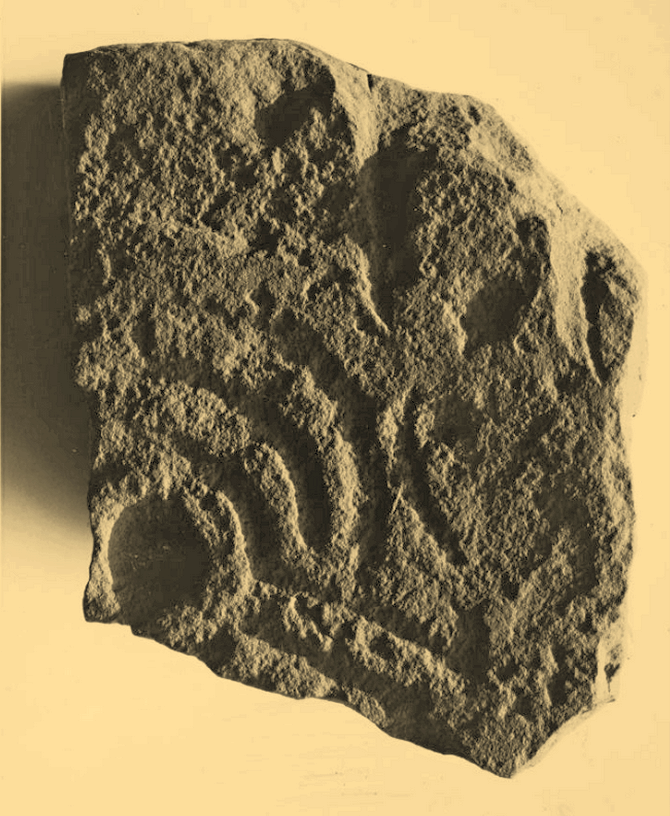
Cup-and-Ring Stone (removed): OS Grid Reference – NT 1872 4072
Archaeology & History
Included in the standard catalogues by Ronald Morris (1967; 1969), this carving was brought to light fortuitously by the local farmer who, thankfully, recognized its archaeological importance. Etched into a small flat broken block of stone, he noticed a cup-marking and the remains of a triple-ring around it, with grooves running out from the central cup. It was described in detail by the Royal Commission (1967) lads in their county survey where they told:
R.W.B. Morris’ 1967 photoHallyne carving in Peebles Museum
“During the excavations at the Roman fort at Lyne…in June 1959, a stone bearing cup-and-ring markings was found lying beside the fence that crosses the North Annexe. According to local information it was found while ploughing in the field on the NE side of the fence. It is a sandstone block, measuring 1ft 5in by one foot, and with an average thickness of 8in. It is clearly a mere fragment of what must have been a larger slab, but it is impossible to estimate its original dimensions. The markings consist of a single well-formed cup, 2in in diameter and three-quarters of an inch in depth, now partly surrounded by the broken arcs of three rings, which, if complete, would measures about 4in, 7in and 10in in diameter respectively. The rings are all half an inch in width and one eighth of an inch in depth. From the innermost ring two radial grooves, set one inch apart, extend outwards for a maximum distance of 4in. They interrupt the two outer rings, which stop short on either side of them, leaving a gap of about half an inch. The grooves are slightly narrower and shallower than the rings. The whole symbol has been formed by the pecking technique and punchmarks are still remarkably fresh. Outside the outermost ring there is a very shallow depression, one inch in diameter, which may be another cup-mark; in addition there are several recent scars caused by the plough.”
It was moved to the museum in Peebles shortly after being found and remains there to this day, apparently. I’ve not seen it.
References:
Morris, Ronald W.B., “The Cup-and-Ring Marks and Similar Sculptures of South-West Scotland,” in Transactions of the Ancient Monuments Society, volume 14, 1967.
Morris, Ronald W.B., “The Cup-and-Ring and Similar Early Sculptures of Scotland; Part 2 – The Rest of Scotland except Kintyre,” in Transactions of the Ancient Monuments Society, volume 16, 1969.
Morris, Ronald W.B., The Prehistoric Rock Art of Southern Scotland, BAR: Oxford 1981.
Royal Commission on the Ancient & Historical Monuments of Scotland, Peeblesshire – volume 1, HMSO: Edinburgh 1967.
If you can make your way to the Stroness (2) carving, then walk down the slope for less than 50 yards past quite a few other earthfast stones, you’ll eventually run into the stone shown here in the photos. You’ll find it easily enough.
Archaeology & History
This carving was found when I was heading down the hillside to meet up with my antiquarian colleague 500 yards lower down. The sun was just setting, so visibility wasn’t good, but as I rushed from stone to stone feeling each one in the hope of finding a carving, this one gave my fingers that distinct feedback of a cup-marking; then another; and what seemed like another. I had a small amount of water left in a bottle and quickly sprayed it over the surface of the stone and saw that there were indeed a number of cups on it. Two or three certainly – but possibly as many as five. I laid on the wet ground and looked across its even surface from several angles and caught what seemed to be a very faint semi-circle around one of the cups. But I wasn’t sure it was real. However, on a number of quick photos I took, several of them do appear to show such an arc around one of the cups. But I’m very cautious about it. Only when we (or you) go back up and have a look at it in good light will we be able to affirm or discount it.
One additional feature that needs mentioning is a small low arc of walling just above this stone. It’s man-made, it’s very old, but I couldn’t work out what it might be: hut circle, cairn (there’s one further up the hill), enclosure walling. I’m not sure, but it needs to be looked at when we have a full day.
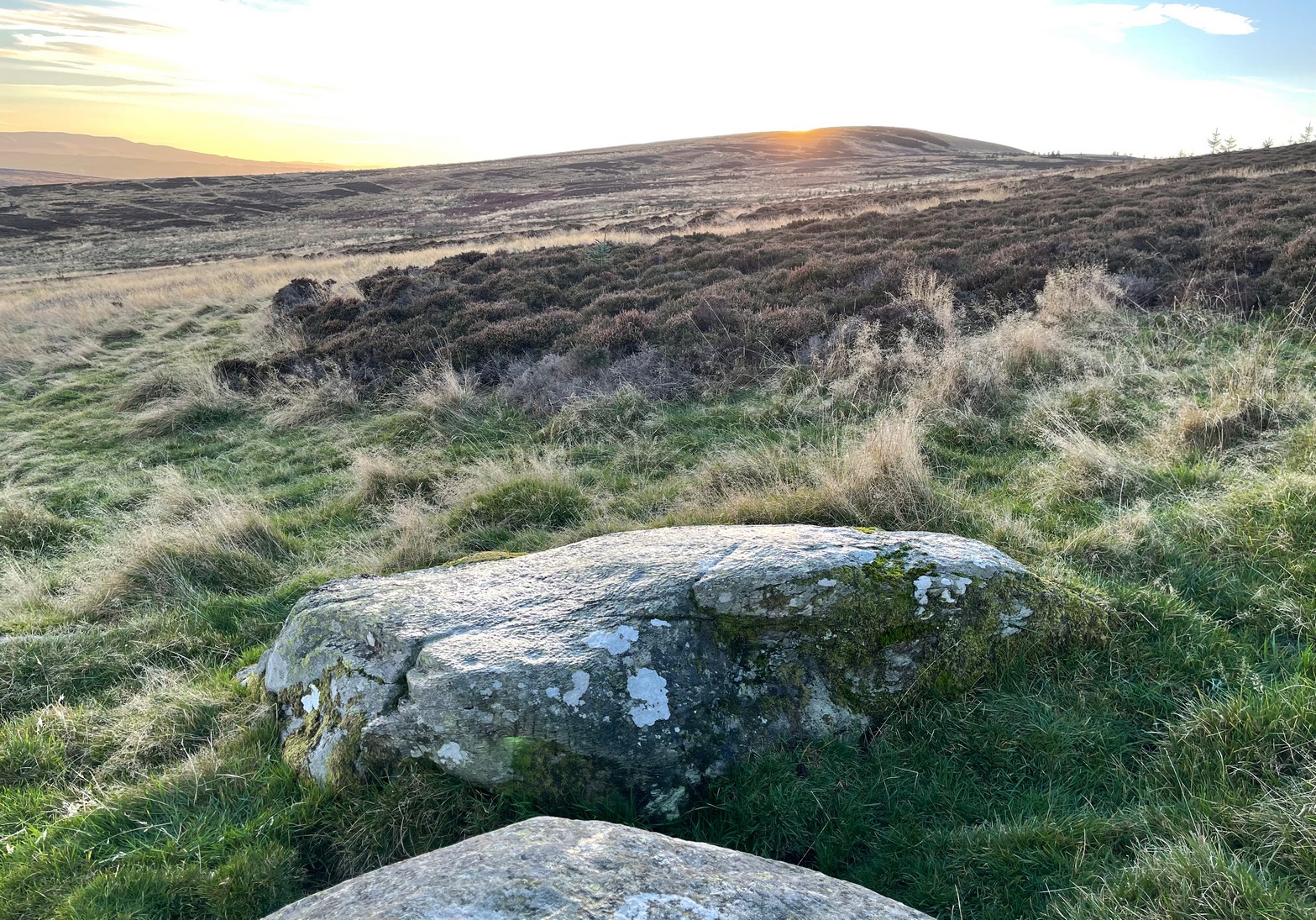
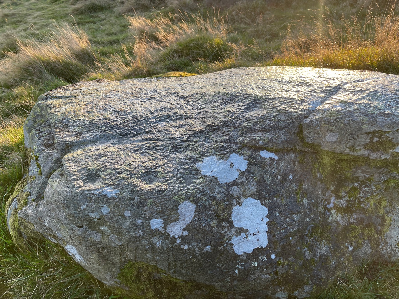
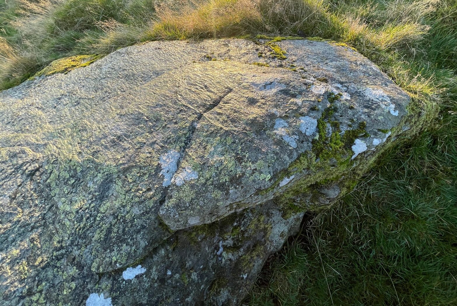
The minor road that runs roughly north-south between the hamlets of Fowlis Wester and Buchanty is probably your best bet. Nearly 2 miles north of the village up the tiny winding lane, where the moorland at the roadside finishes and the fields begin – is where to take the track, left, up onto the hillside. But after just 75 yards, go left over the rickety-gate and follow the walling until your reach the burn. Follow this up all the way to its source (it’s boggy as hell) and, once you’re there, walk due north for 250 yards until you reach a cluster of rocks. Look around!
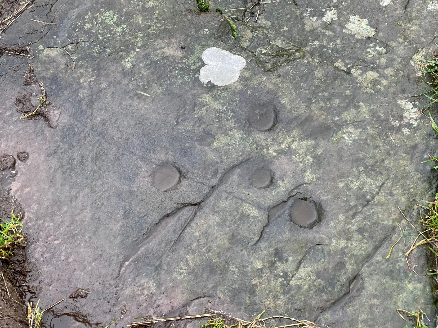
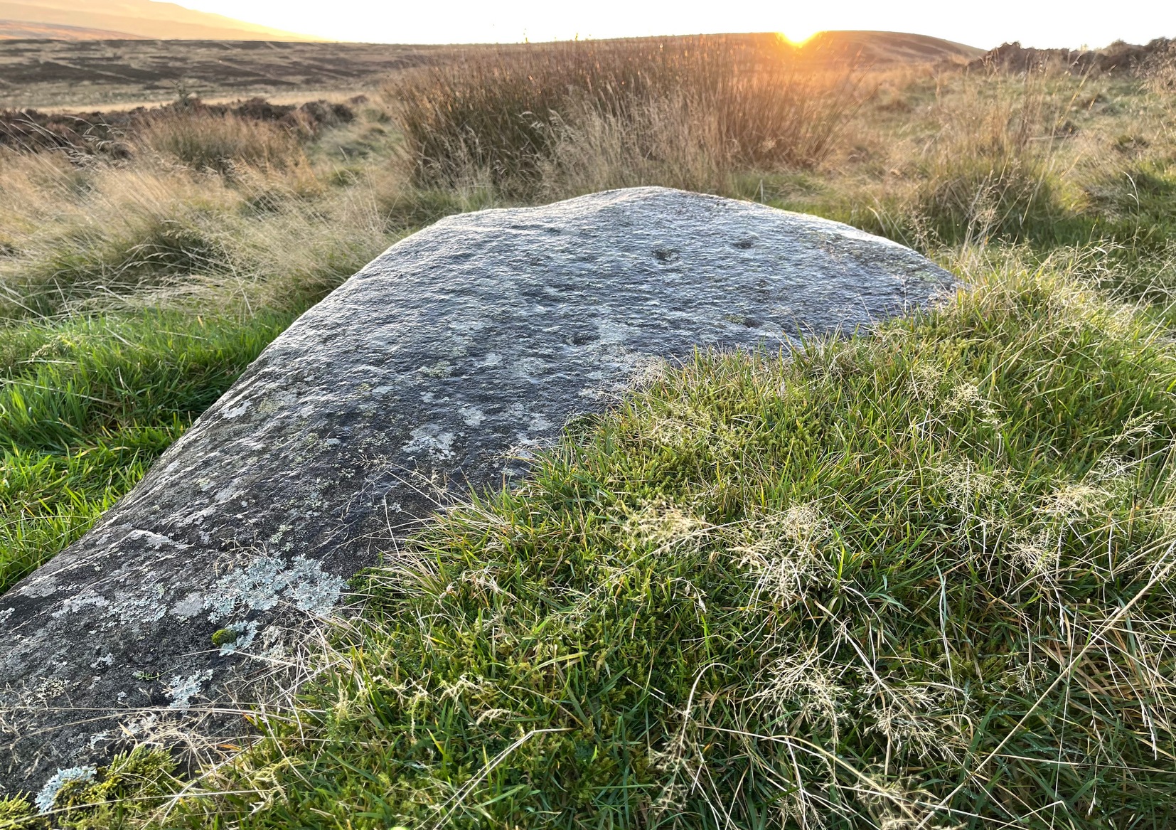
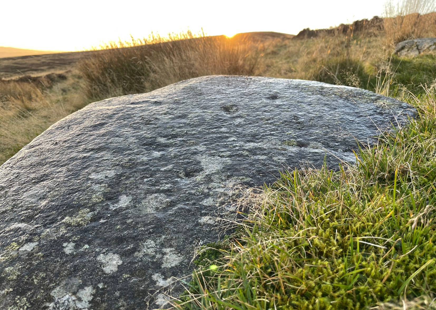
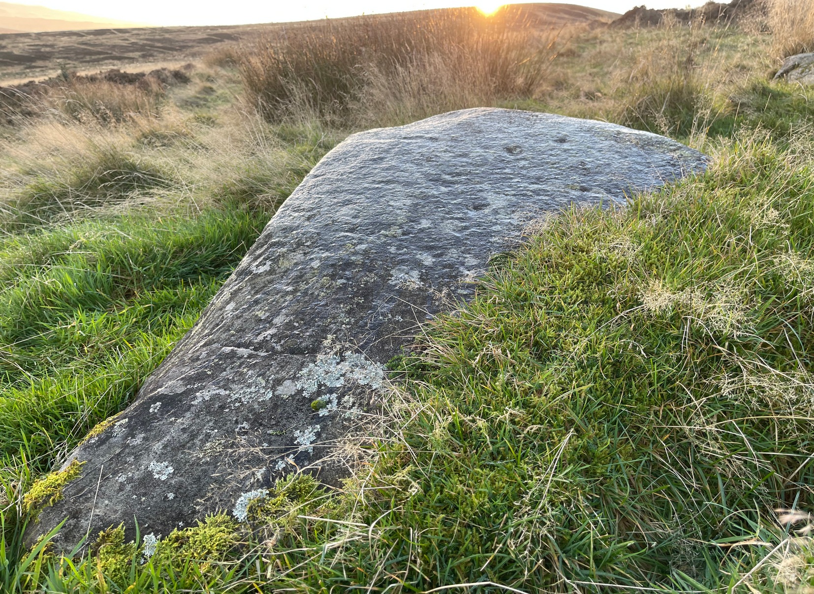
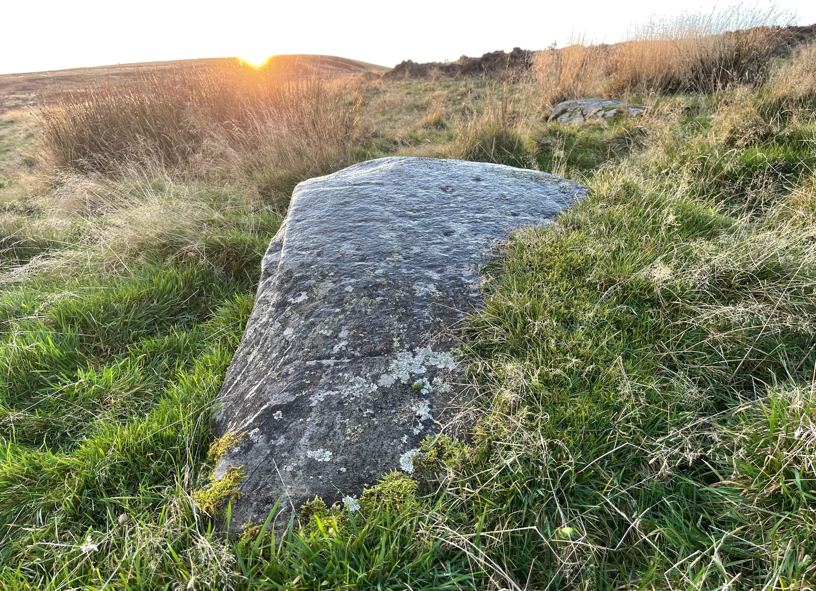
Archaeology & History
It’s a long way to come to see such a simplistic design —but for the real petroglyph researchers among you, it’s worth it the trek. It’s had scant attention. George Currie (2004) seems to have been the only person to mention this stone, giving the standard bland description typifying archaeology. He wrote:
“SE-facing slope, 1.2m long pointed rock aligned E-W; three shallow cups, 30-40 x 6-10mm.”
Inspiring stuff, ey?! Anyhow… As usual, there’s more to it than that. If we assume that the carving described above is the same one I visited yesterday (Mr Currie’s grid-ref is slightly different), even despite the poor daylight, it was obvious there was more than three cup-marks on this.
Lower cups & upper cups
Cups on top
When I got to this stone, the evening sun was literally touching the horizon and so the light cutting across half the rock highlighted very little indeed. I was rushing, trying to fondle and see as much as I could before the darkening sky clouded everything, and as I almost frenetically sprayed showers of water across its surface, the two or three cups that I could see near the crown of the stone suddenly doubled in number. Two cups along one edge became three; whilst the sloping surface above these that had one cup suddenly seemed to have a companion. On the highest part of this gently sloping stone, the form of one of the two distinct cup-marks that first caught my eye seemed to slowly morph into one of the carved “footprint” designs, akin to those clustered on the Ardoch (2) carving 1½ miles south-west of here. However, this element needs looking at again, as it may have been a curious playful trick between stone and light showing me something that wasn’t there! Things like that happen with stones.
Altogether there are at least six cup-marks on here, but perhaps as many as eight. Obviously, if we (or you) visit the site when the light is much better, an even larger design might emerge from this old rock.
I spent perhaps just five minutes here, before heading back down to meet my companion 500 yards below in the midst of the boggy moorland. Usually a carving gets my fondles for a an hour or two, but conditions weren’t good for us to form a healthy relationship. And so, as I headed downhill, another unrecorded cup-marked stone appeared beneath my rushing feet (Stroness [3] carving)— and I spoke with that for only a couple of minutes. We need to come back up here and zigzag to find other companions that lay sleeping, forgotten for countless centuries…
References:
Currie, George, ‘Buchanty Hill (Fowlis Wester parish): Cup-marked Rocks’, in Discovery & Excavation Scotland, volume 5, 2004.