Cup-and-Ring Stone: OS Grid Reference – NN 5513 2987
Also Known as:
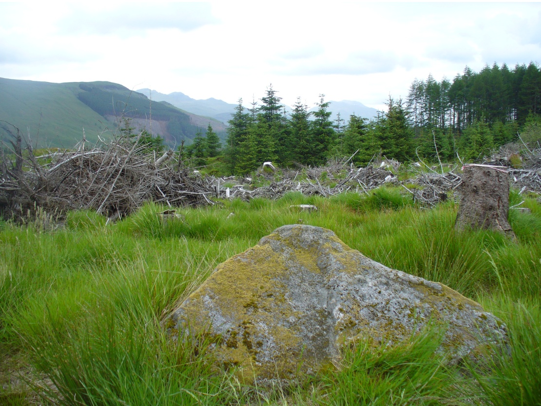
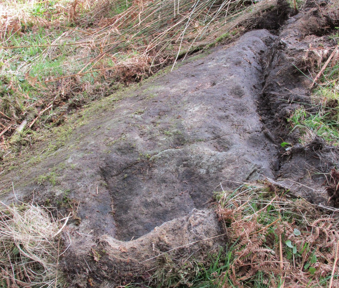
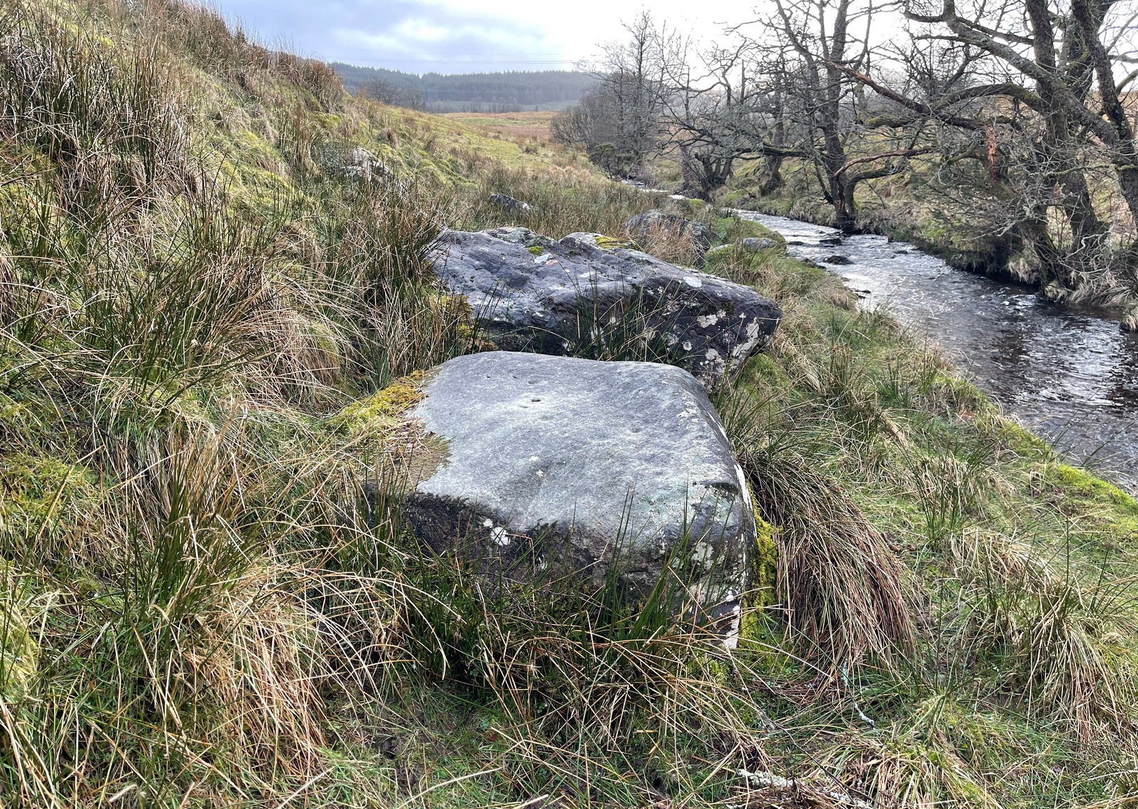
As you go along the road between Lochearnhead and Crianlarich, about 200 yards before reaching the turning to Killin, stop at the Mid Lix dirt-track. Cross the road and walk back uphill for about 75 yards, then walk into the denuded remains of the forest. There are several notable rocks peeking up from the wood, one of which has many well-formed cup-markings on, about 25 yards from the roadside. If you look around here, you’ll find it.
Archaeology & History
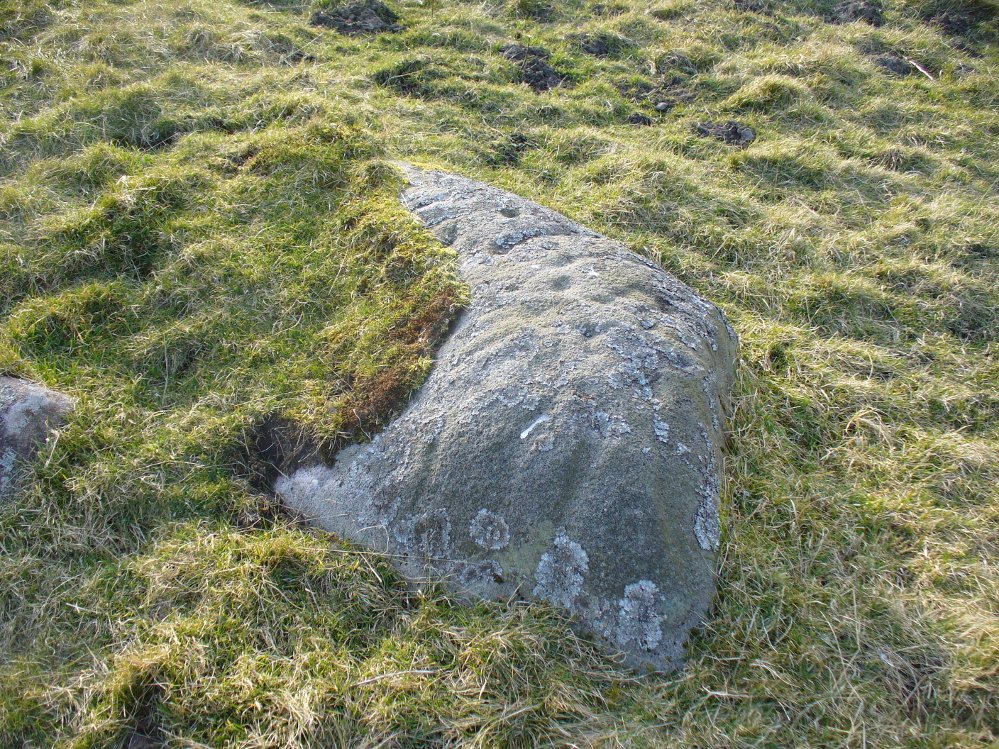
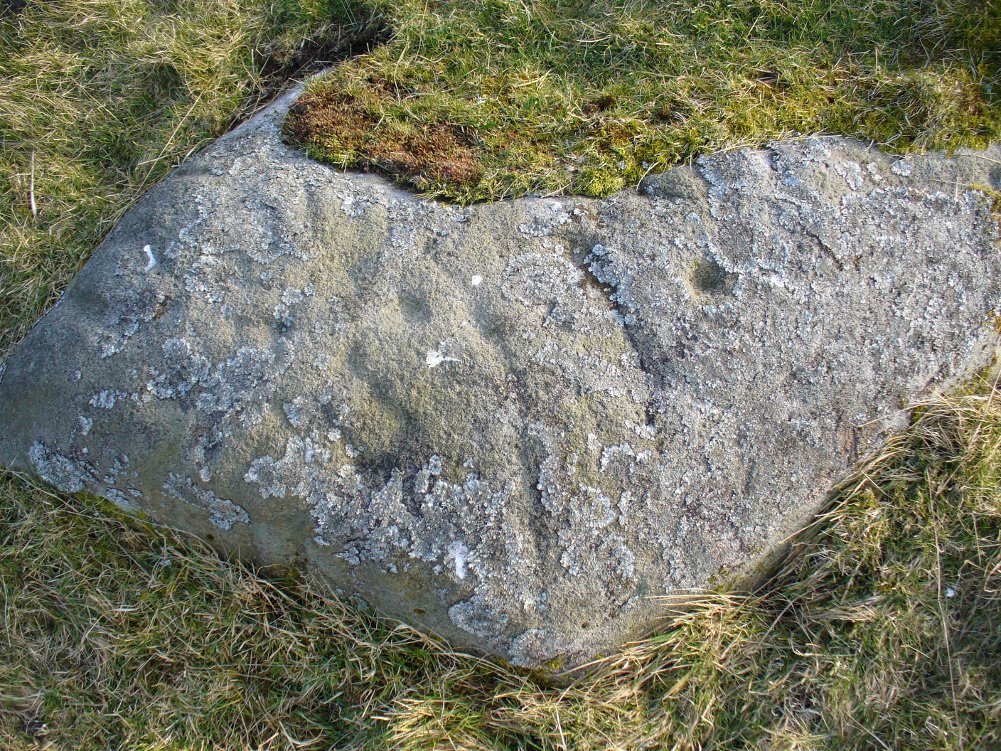
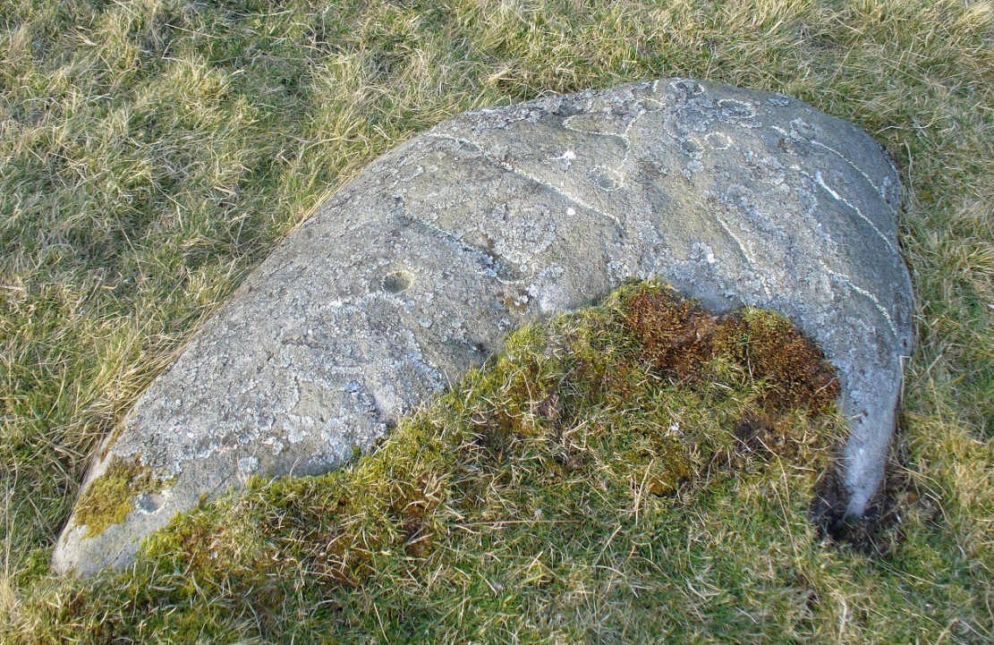
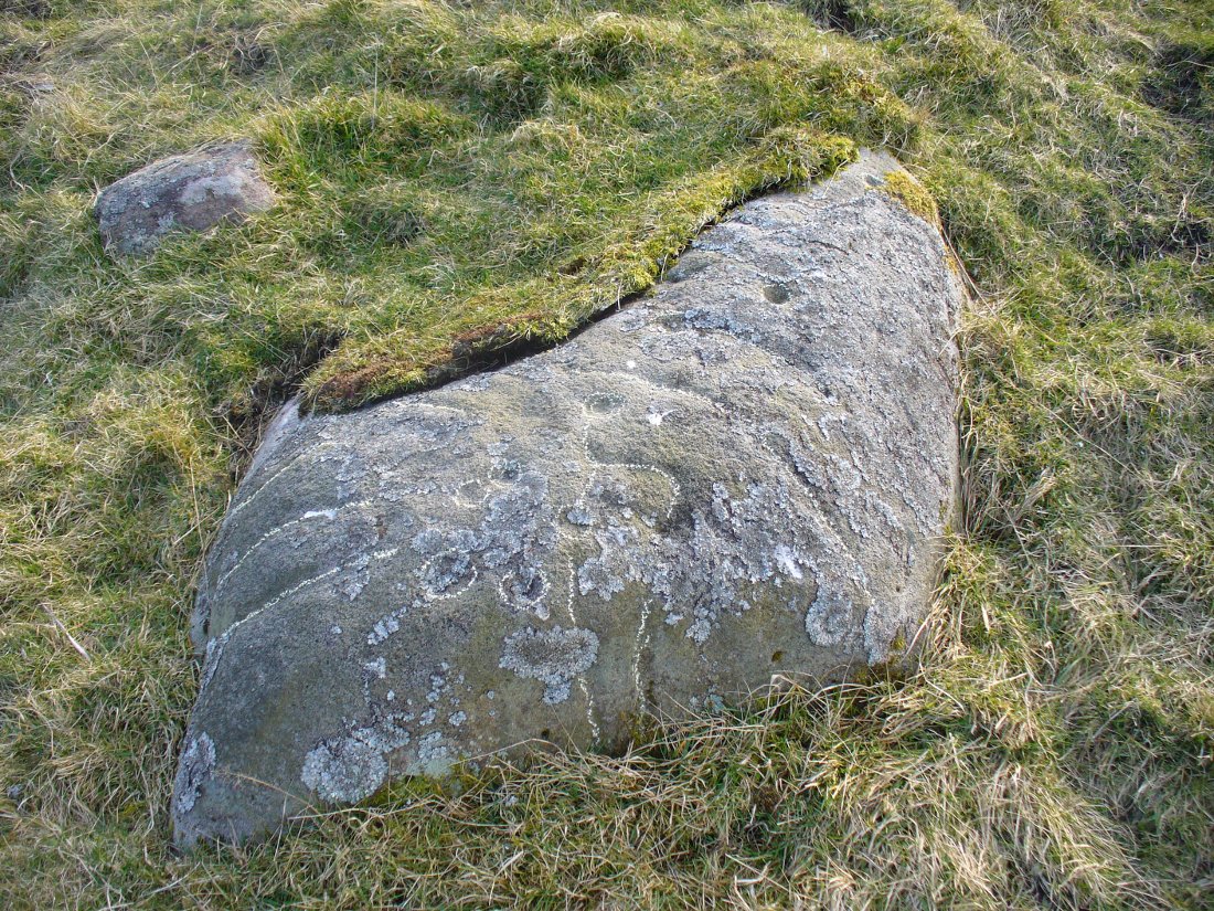
This seemingly isolated petroglyph, still in a very good state of preservation, was first reported in the 19th century by a Mr Haggart (1883), who described it in a letter to the late great J. Romilly Allen. He wrote:
“I have also, since you last wrote to me, discovered another cup-marked stone at the farm of Mid Lix, near Killin. It is a very good specimen, with between sixteen and twenty marks, well cut and distinct. I was passing the farm three weeks ago, and I thought, from the name Lix — which is a Gaelic word corrupted from Lie, the plural of Leac, a tomb-stone or flagstone — that it was very likely to have stones with marks, and I asked John Little, farmer, to keep a look out for such. He did so, and found the one mentioned within twenty yards or so of the road leading to Killin Railway Station, and between the farm and the roadway, due west of the farm-house.”
Subsequently, thirty years later Mr Cash (1912) visited and described the petroglyph in more detail in his survey of sites around Killin. He told that,
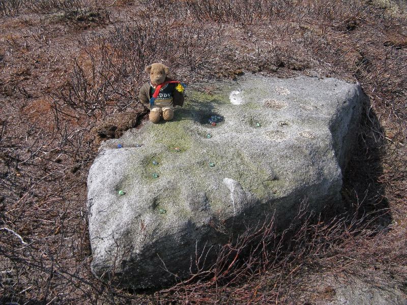
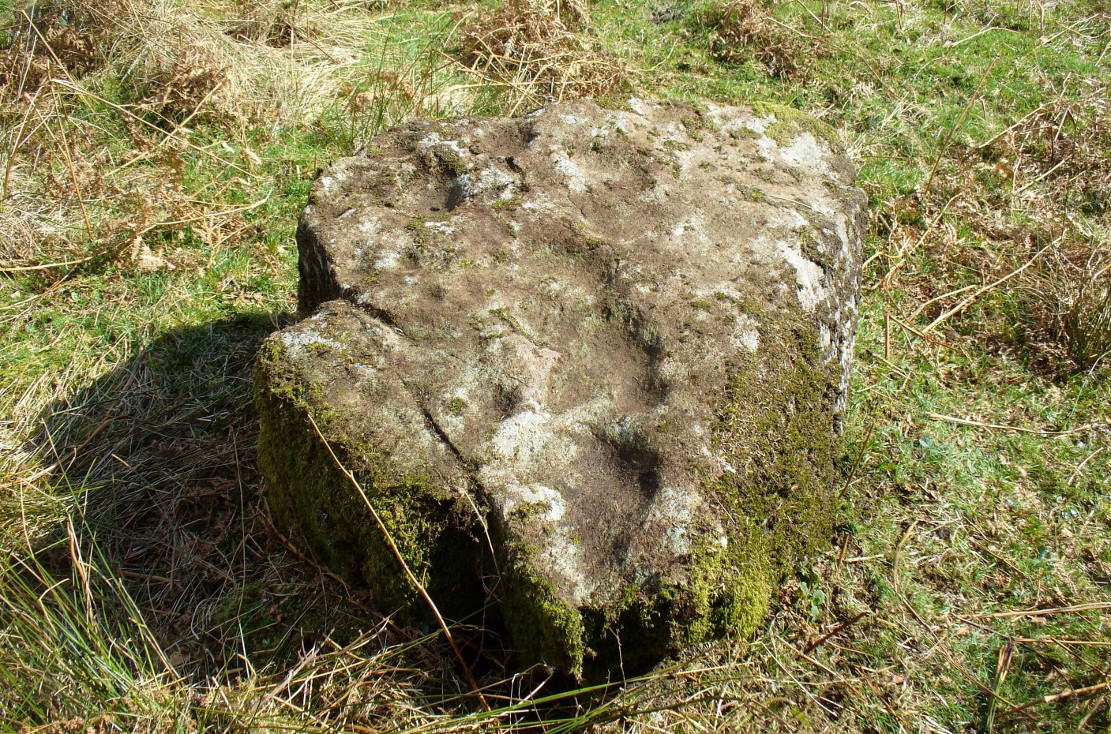
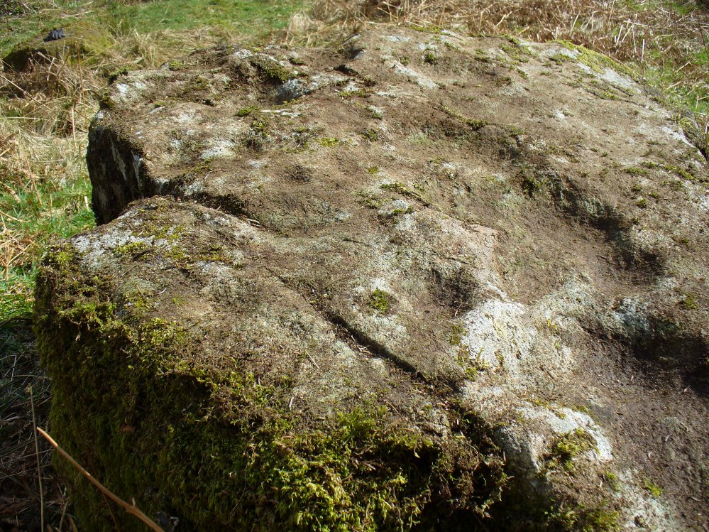
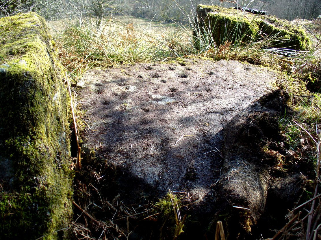
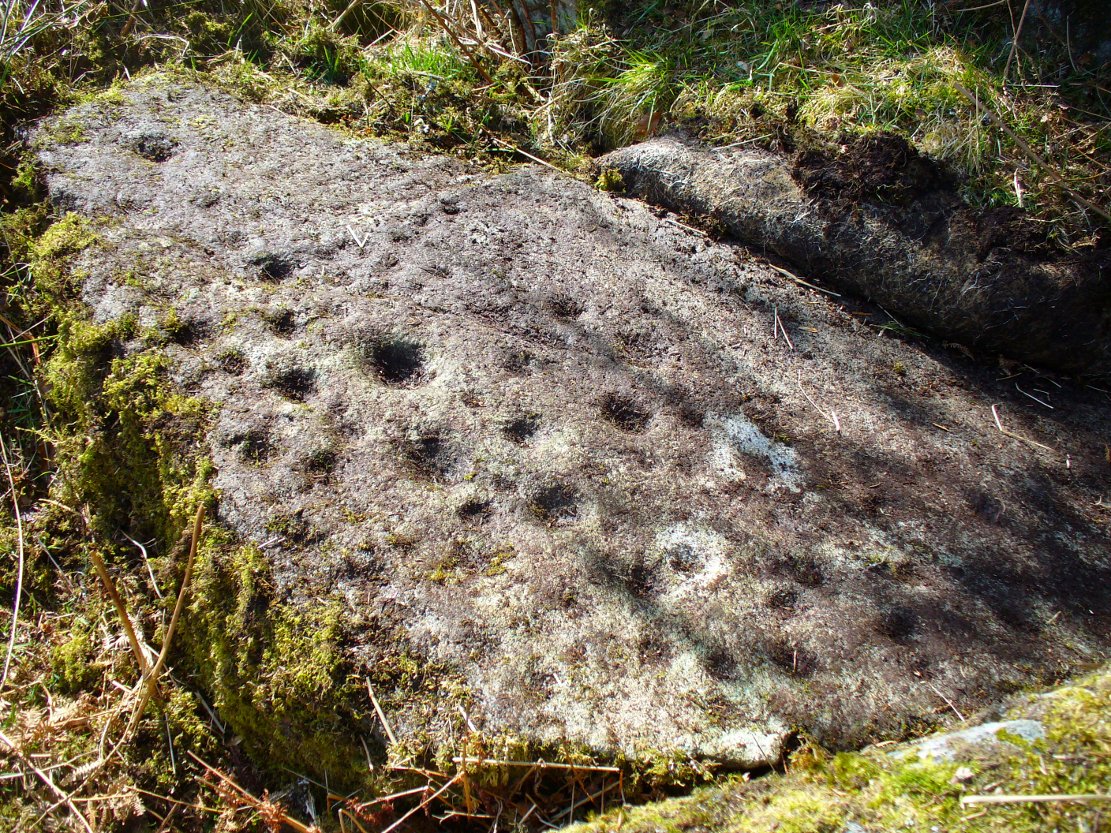
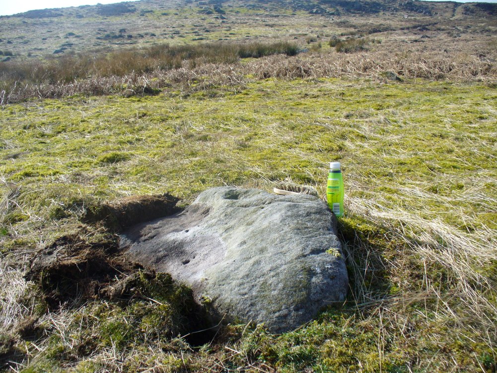
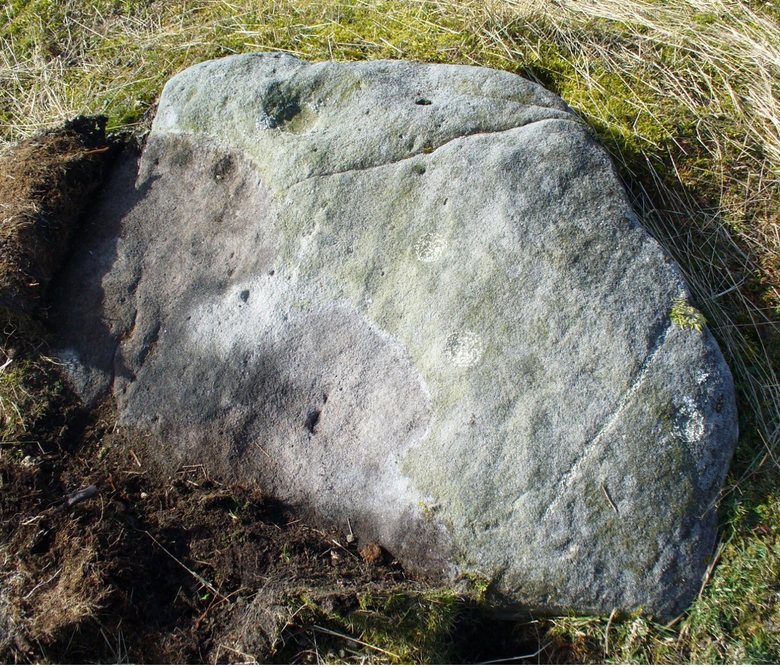
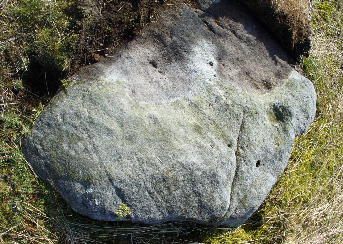
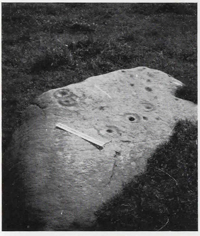
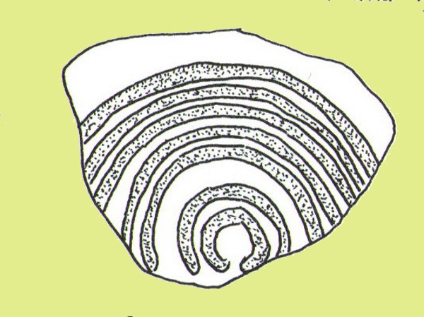
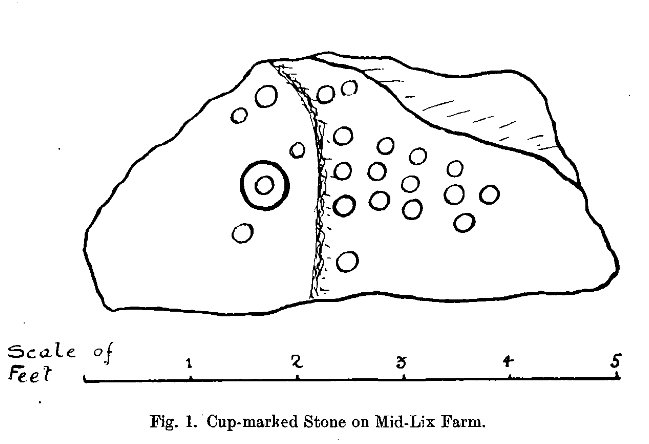
“In 1882 or 1883 this was reported to Mr Allen by Mr Haggart; it was shown to me by Mr Haggart. It lies about 100 yards south of the railway, and 20 yards east of the Glen Ogle road. It is a low triangular pyramid; the cups are on the west face, which lies at an angle of about 35°, and measures 5 feet across its base, and just over 3 feet along its median line. It carries twenty-one cups, as shown in the figure. One cup has round it a ring 6½ inches in diameter. The cups vary in diameter from 2¼ to 3 inches, and in depth from ¼ to ¾ inch. In his paper on “Cup-marked Stones near Aberfeldy,” read in 1884, Dr Macmillan said that he did not know a single example of a concentric ring round a cup on the stones found on the shores of Loch Tay or in Glendochart or Glen Lochay.”
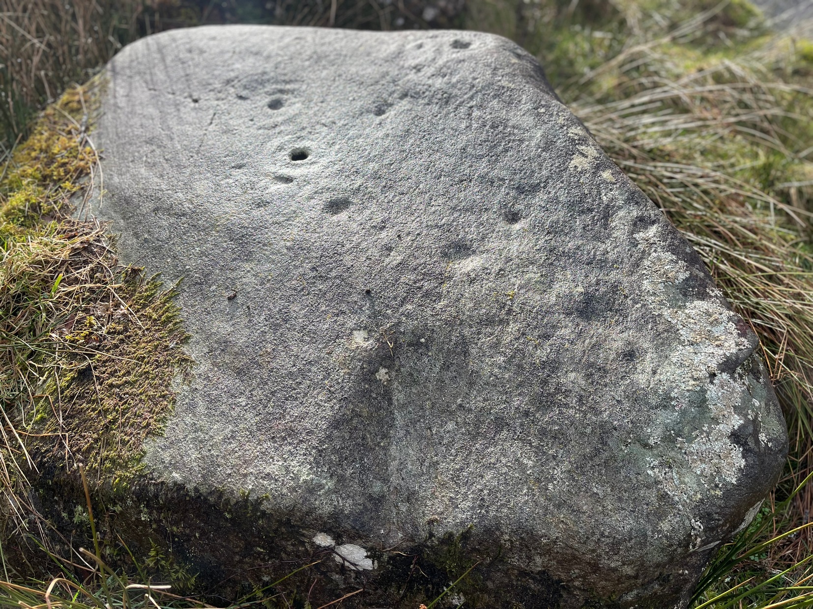
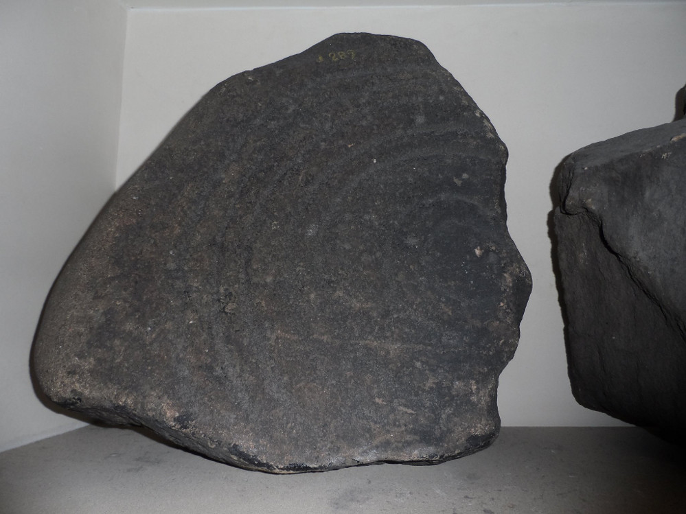
When we visited the site earlier, the grey clouds prevented us getting good images of the carving and made visibility of the design more troublesome (typical rock art dilemma!); but we counted a minimum of 23 cup-marks on the stone. There is a small cluster of small rounded stones around the west and north-western base of the stone, but whether these are collected rubble or the denuded remains of a cairn could not be discerned upon our visit.
References:
- Cash, C.G., “Archaeological Gleanings from Killin,” in Proceedings of the Society of Antiquaries of Scotland, volume 46, 1912.
- Gillies, William A., In Famed Breadalbane, Munro Press: Perth 1938.
- Haggart, D, ‘Notice of the Discovery of Cup-Marked Stones near Killin, Perthshire‘, in Proceedings of the Society of Antiquaries of Scotland, volume 17, 1883.
- Morris, Ronald W.B., The Prehistoric Rock Art of Southern Scotland, BAR 86: Oxford 1981.
- Royal Commission on the Ancient and Historical Monuments of Scotland, The Archaeological Sites and Monuments of Stirling District, Central Region, HMSO: Edinburgh 1979.
© Paul Bennett, The Northern Antiquarian