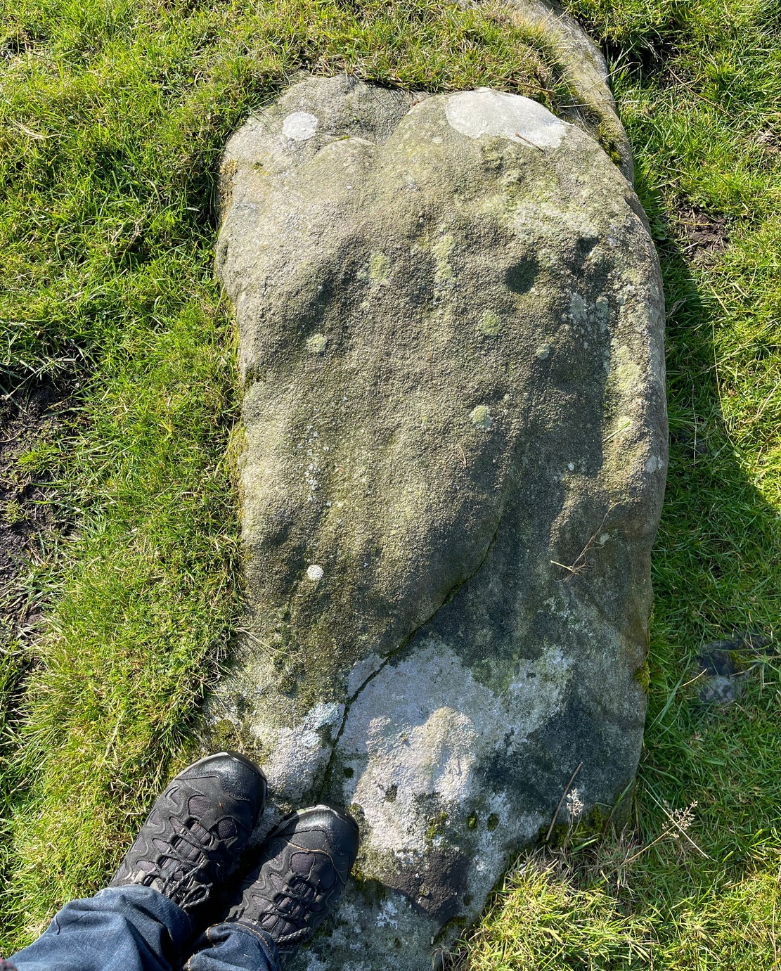
Cup-and-Ring Stone: OS Grid Reference – NN 66412 24837
Getting Here
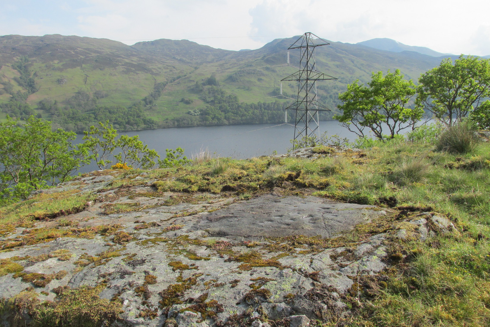
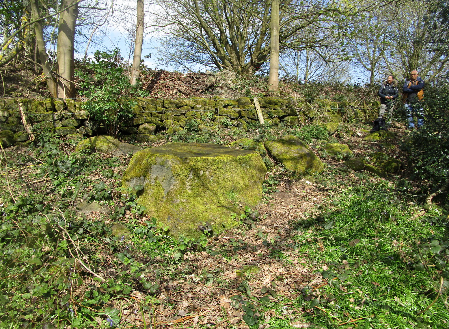
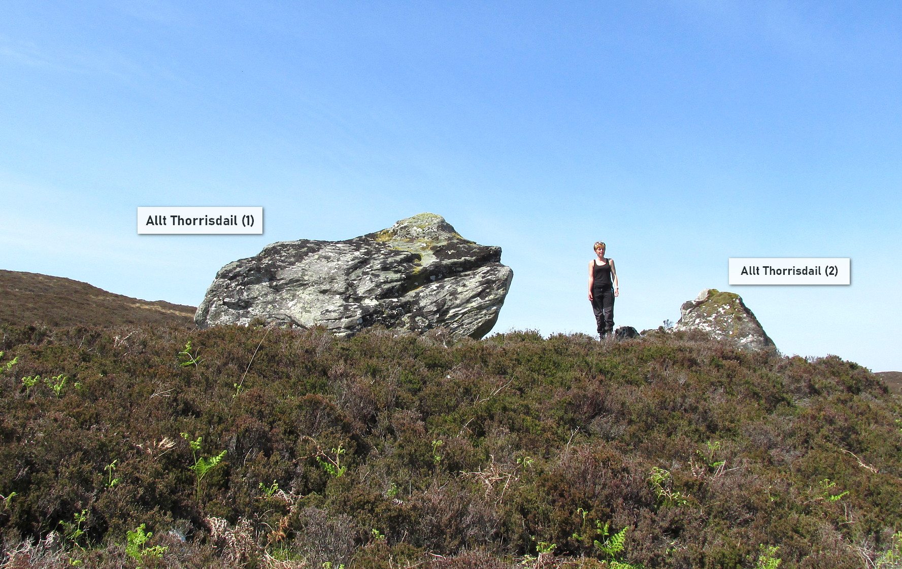
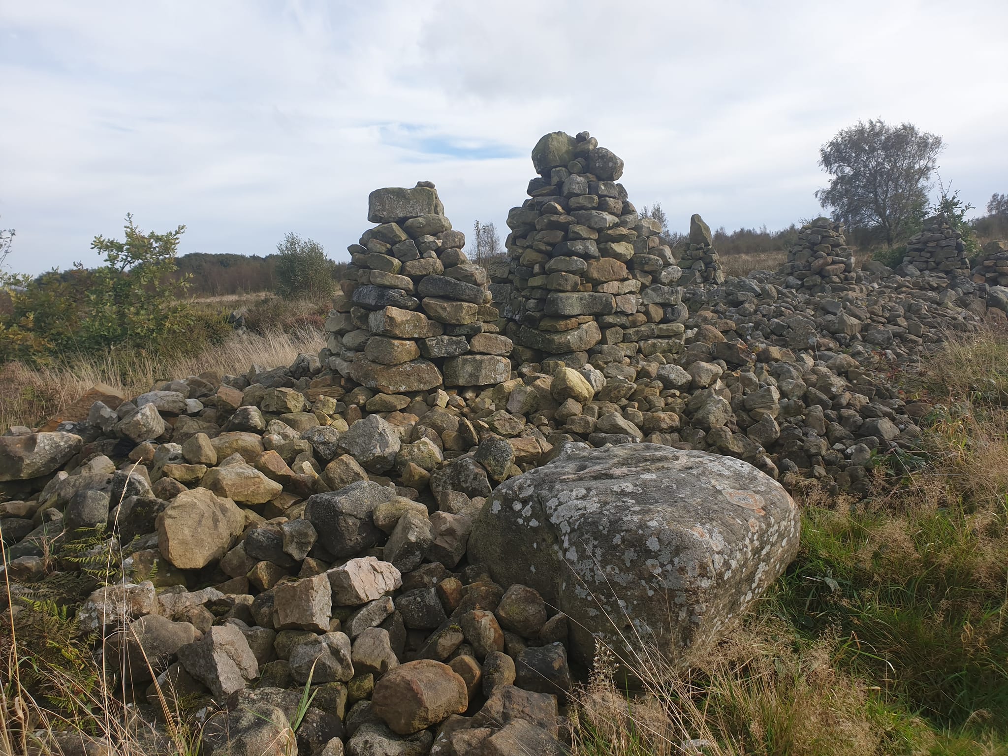
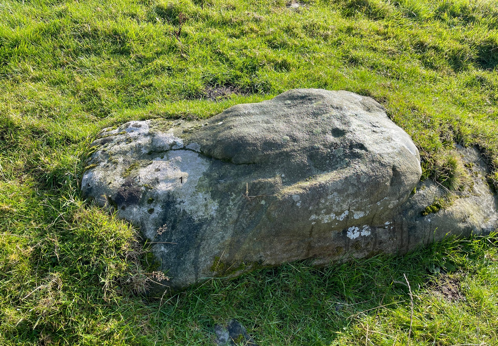
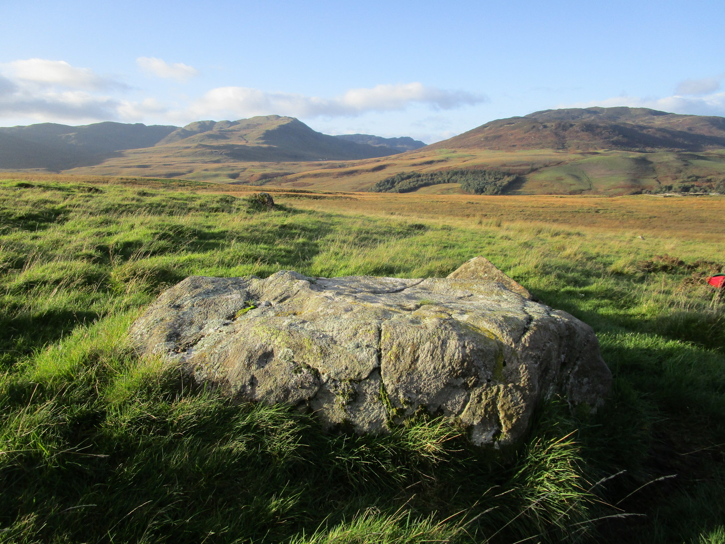
1½ miles out of St Fillans on the A85 road towards Lochearnhead you reach the boating marina by the lochside. 100 yards or so past this, park up. Cross the road and walk 50 yards to your right then follow the dirt-track up into the trees. After ⅓-Mile (0.5km) turn left to the old house on your left and follow the green path around it, then around the right-side of the rocky knoll to the Wester Glentarken (1) and (2) carvings. From here walk straight uphill, direct north, past the pylon and onto the rocky outcrop behind the gorse shrubs. You’re here!
Archaeology & History
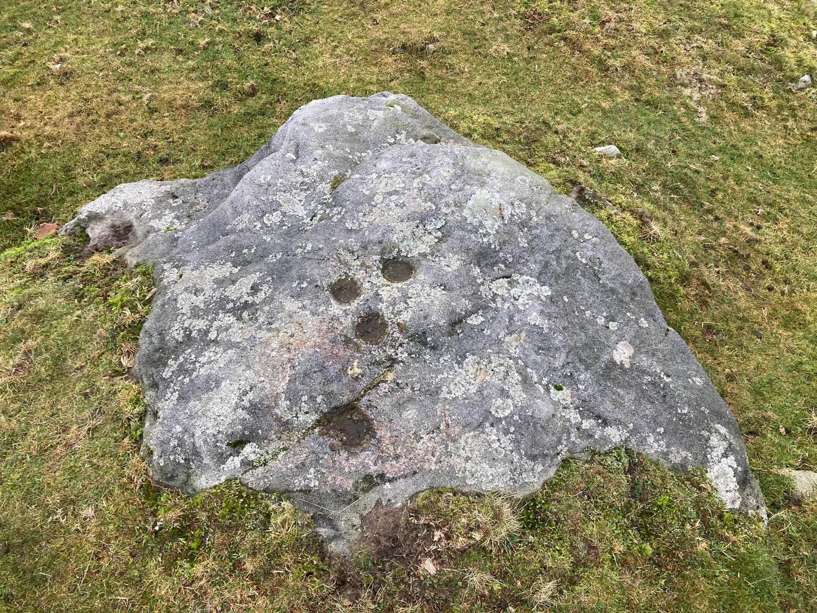
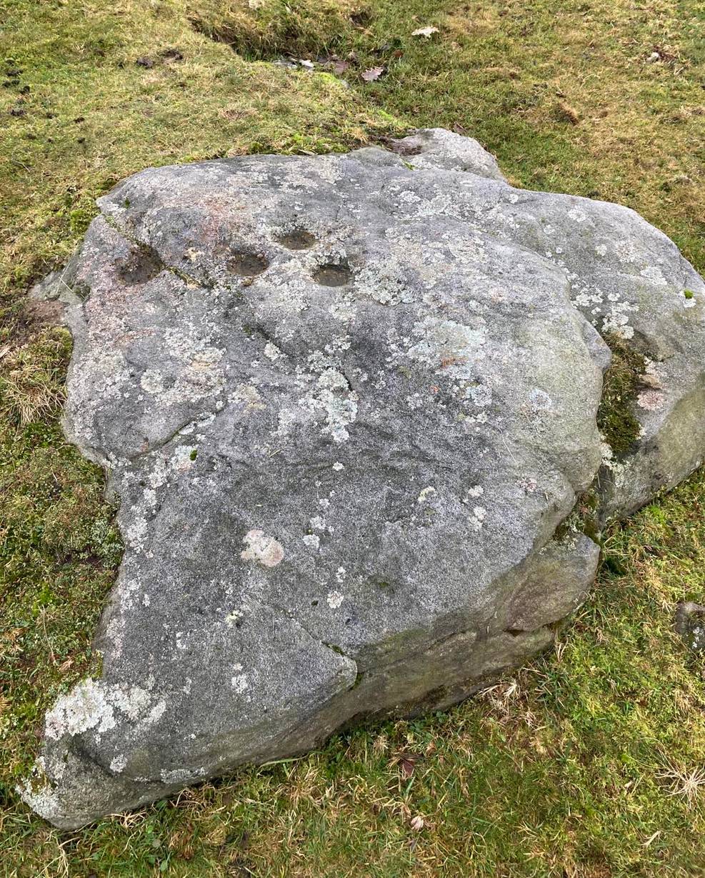
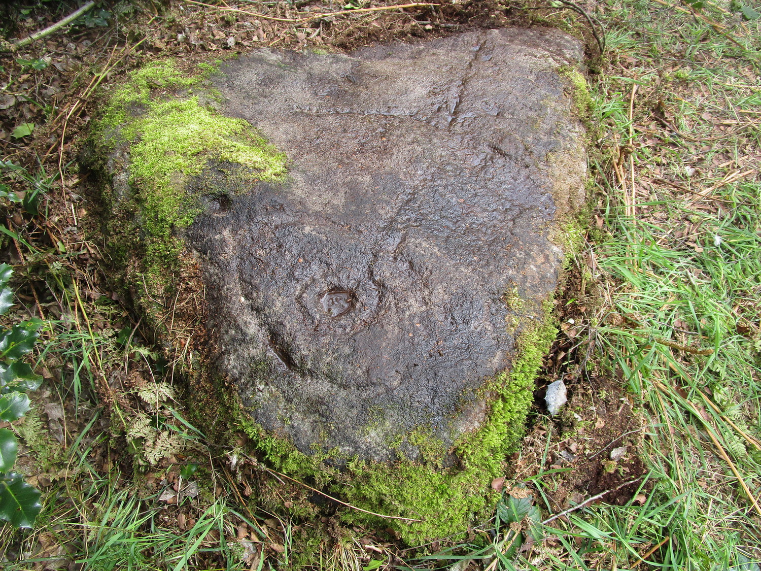
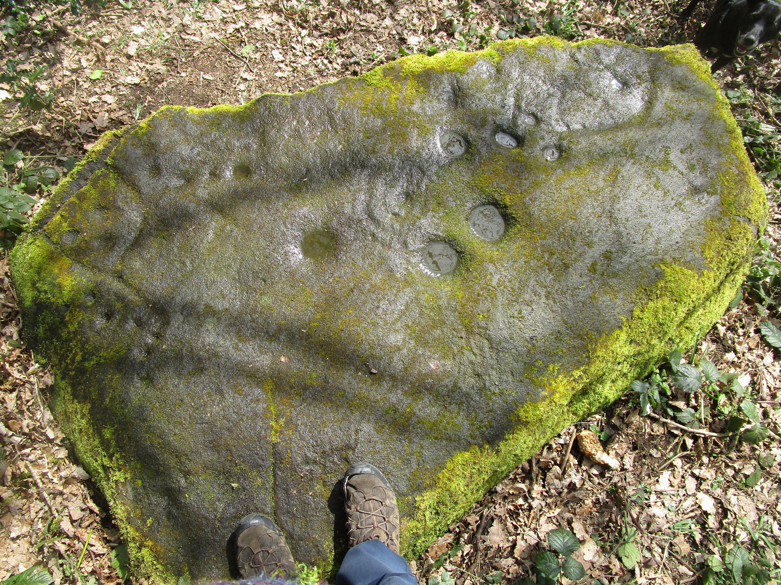
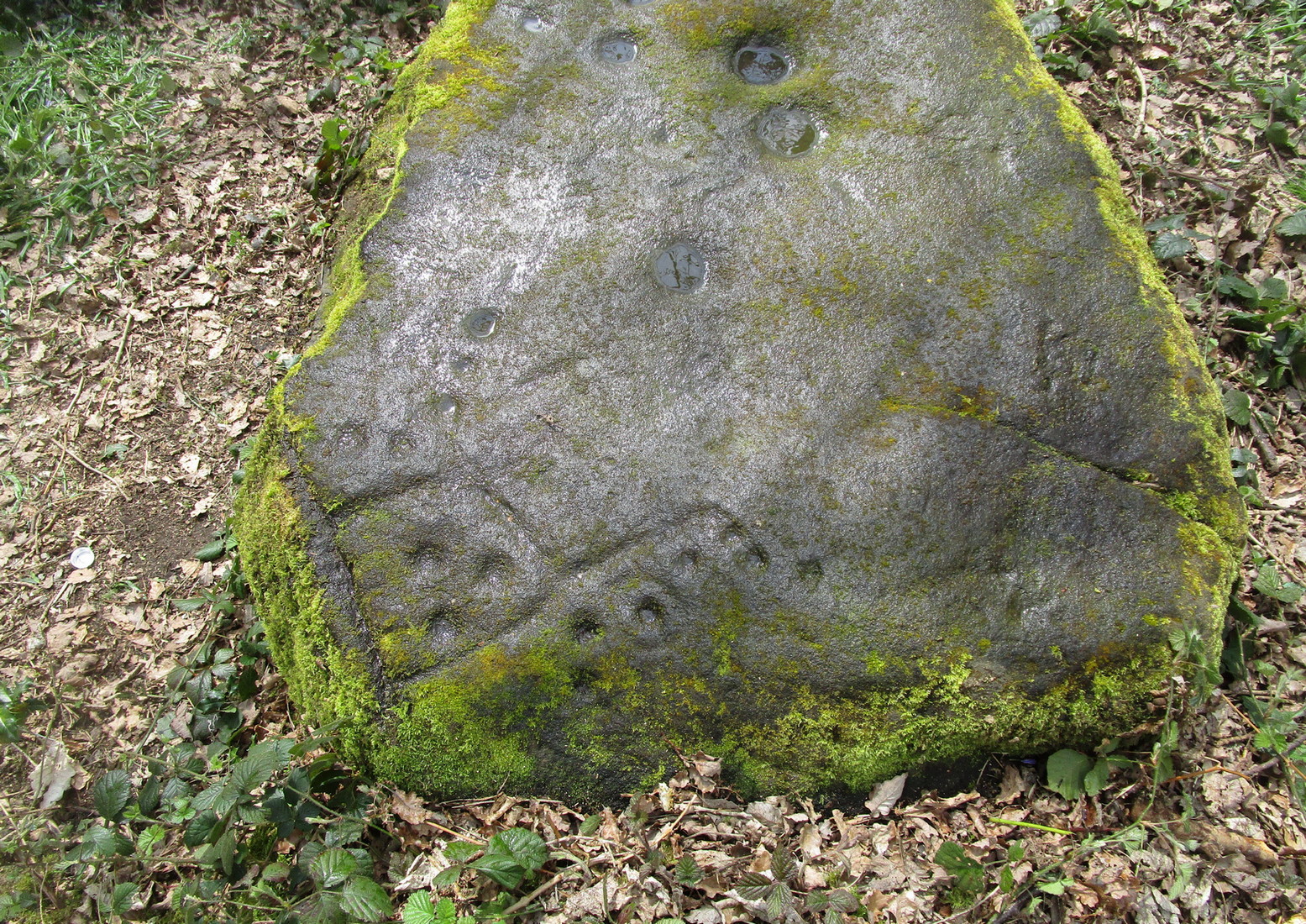
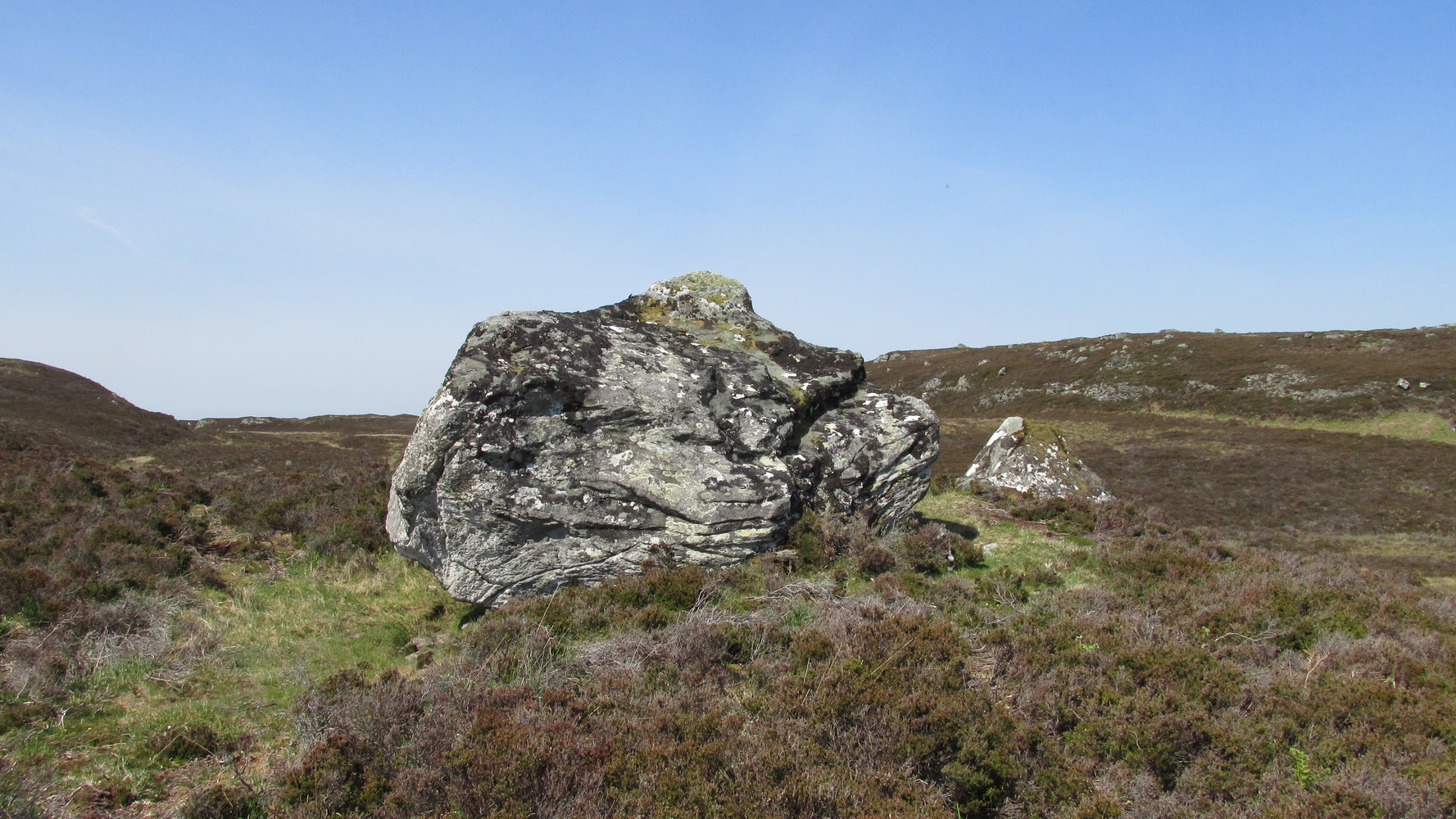
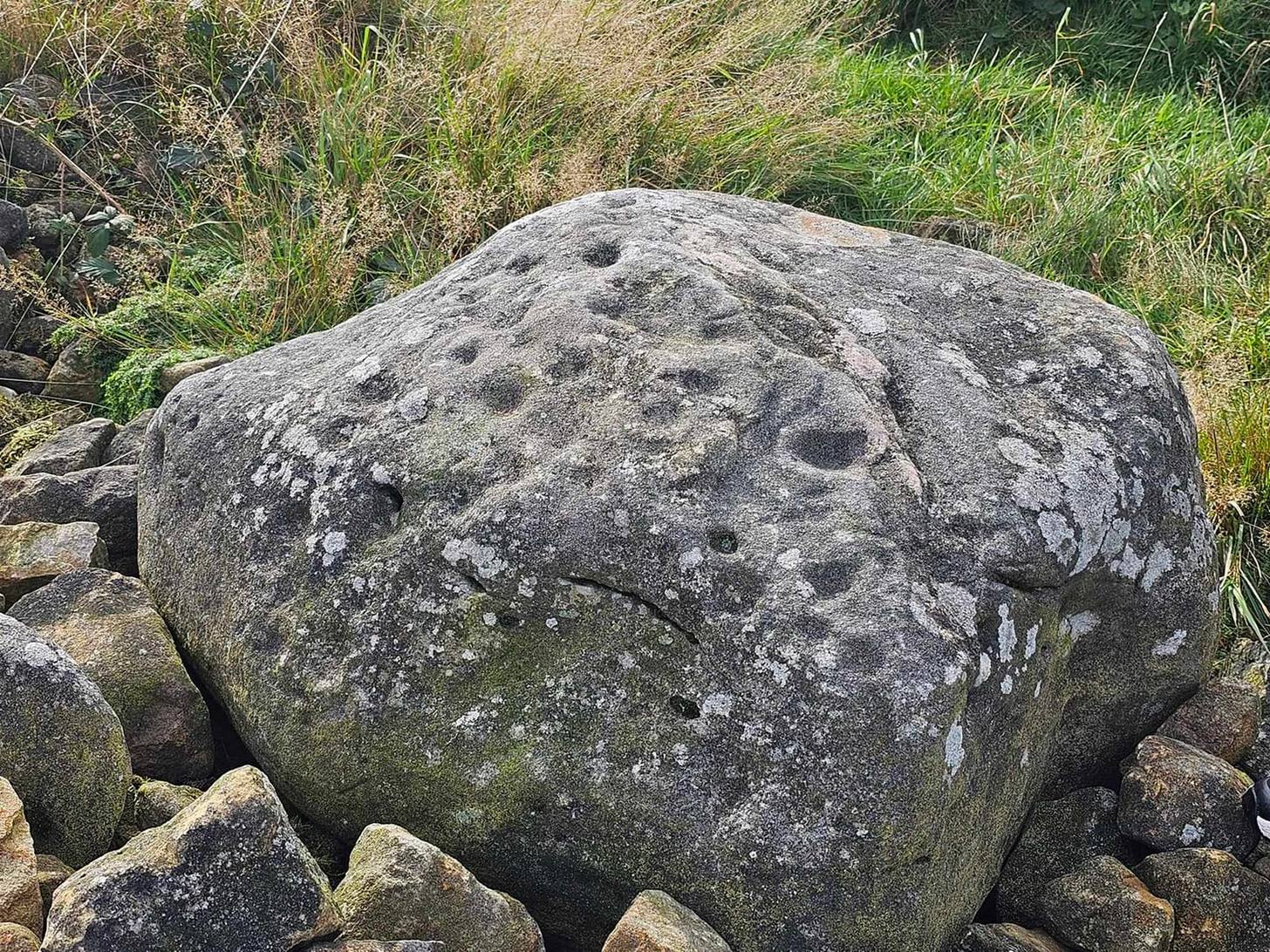
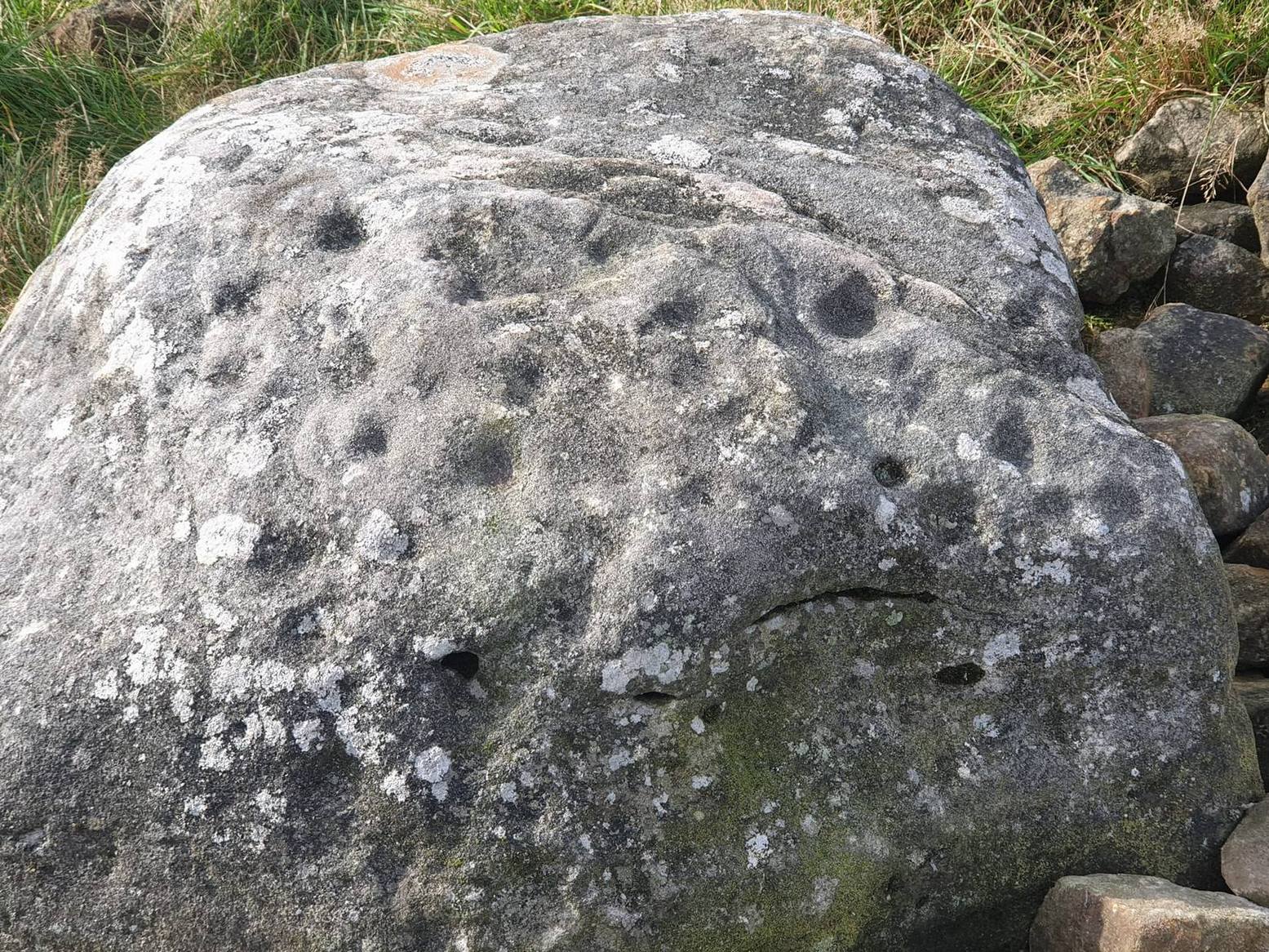
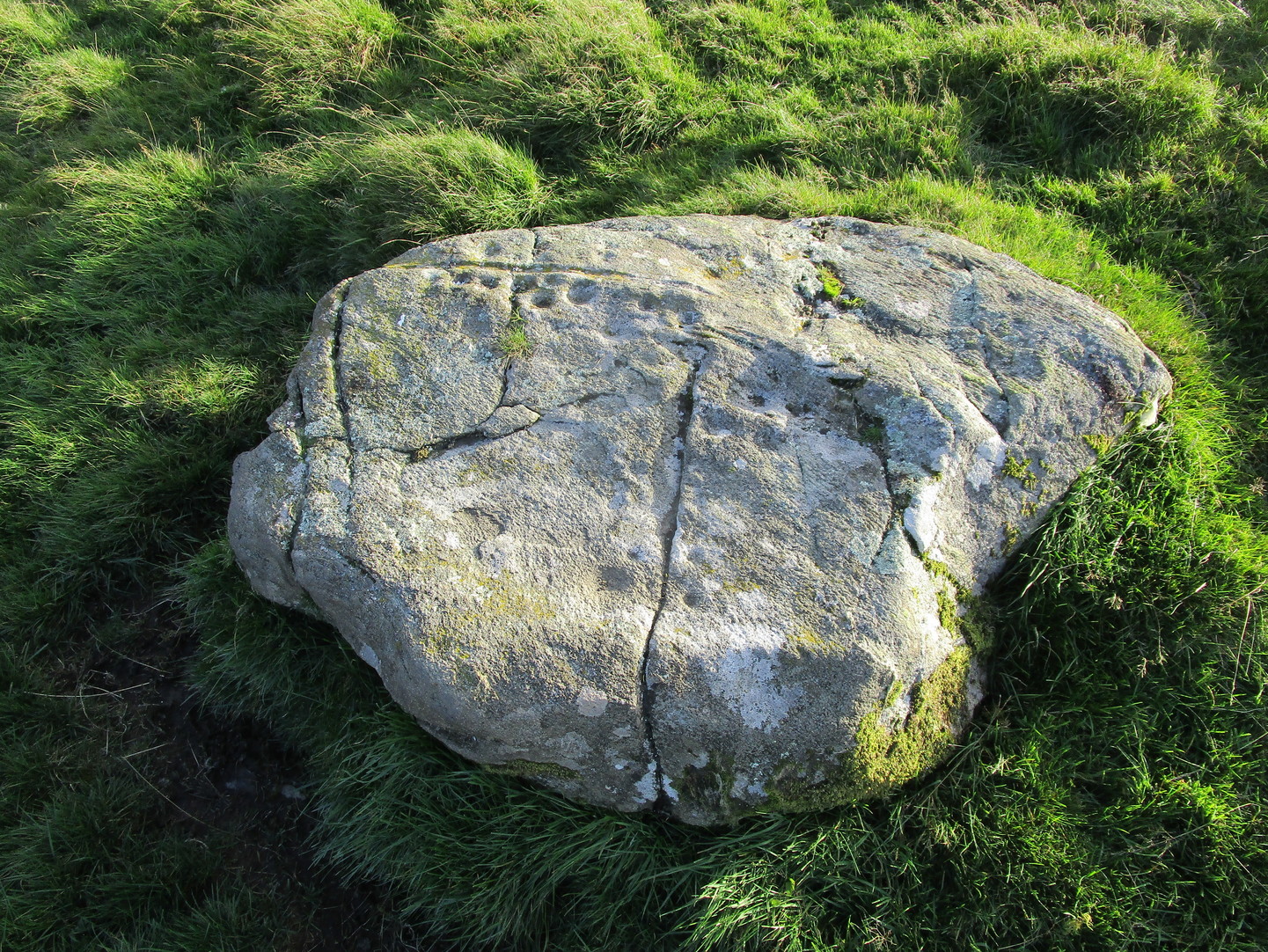
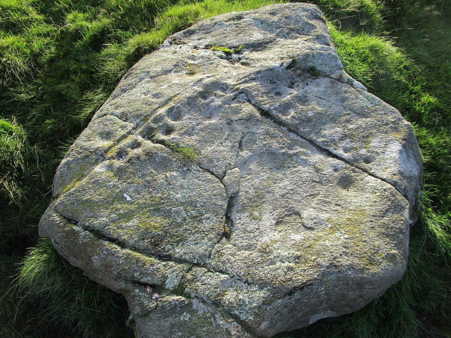
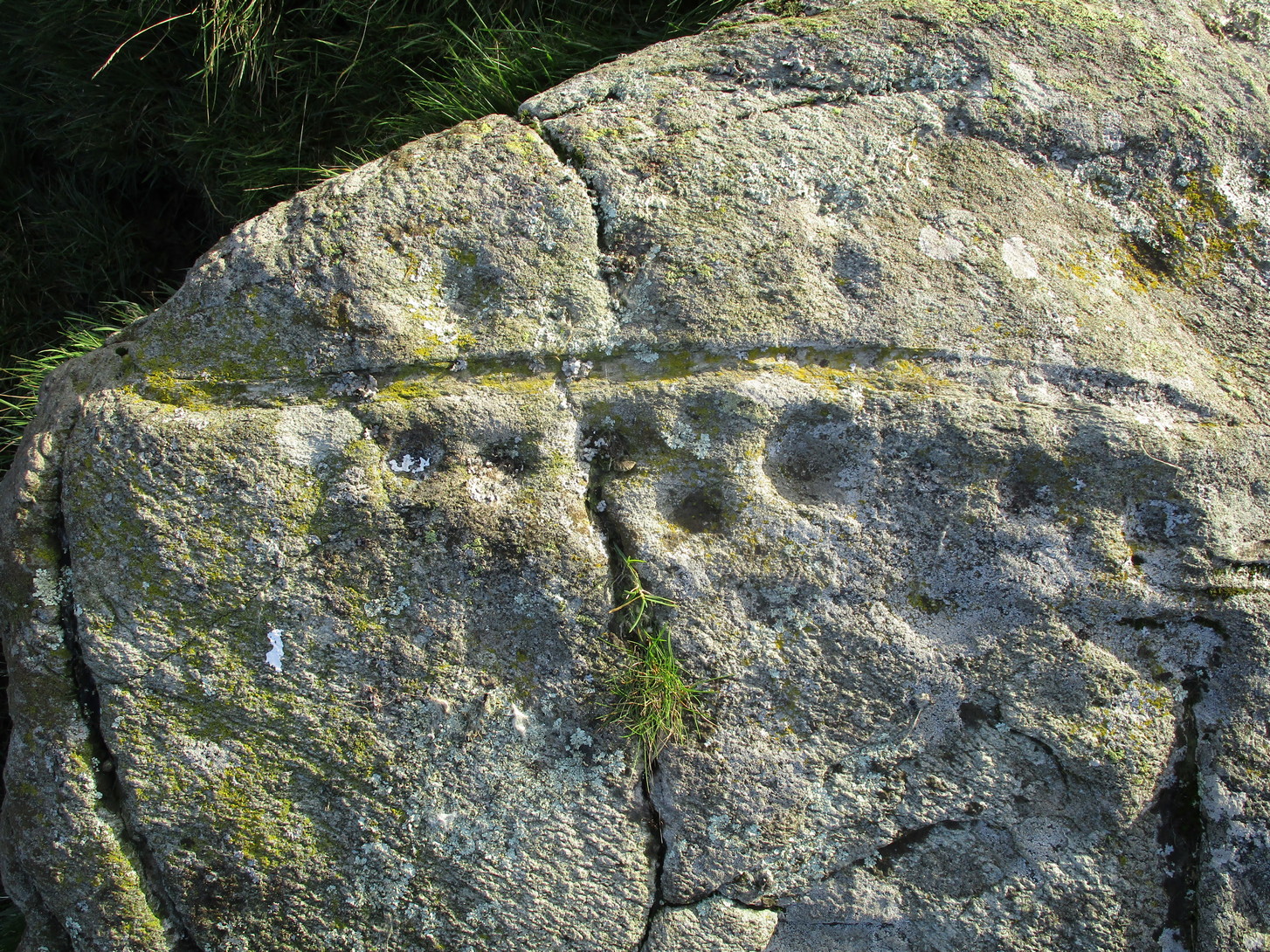
Away from the edge of this relatively flat rock surface, hemmed in between three geological scars, this decent petroglyph shows its memory to prying eyes. It was first described by George Currie (2005) as being just “17 cups (and) one pair of cups are linked”, but there are, as usual, more elements to it than that.
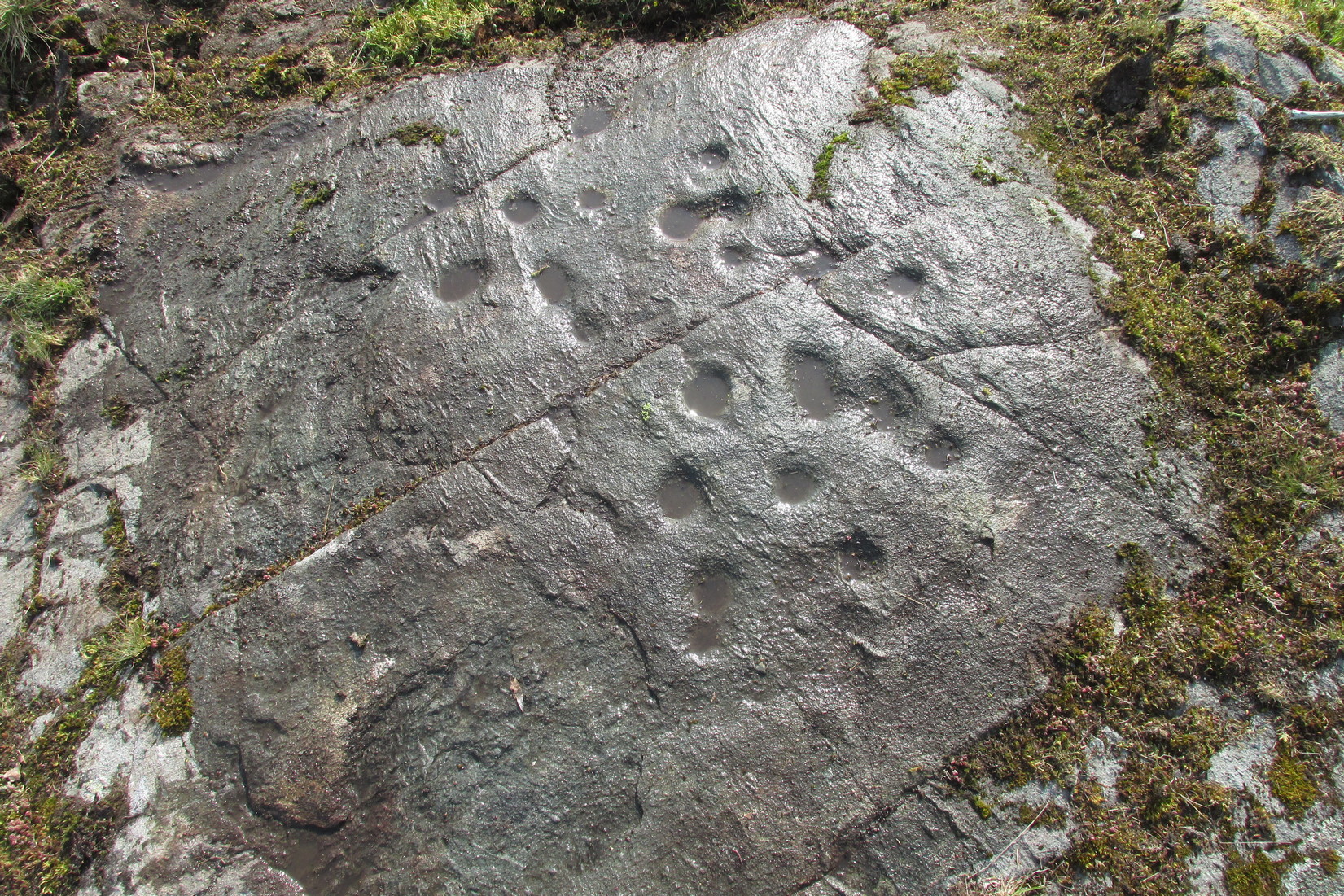
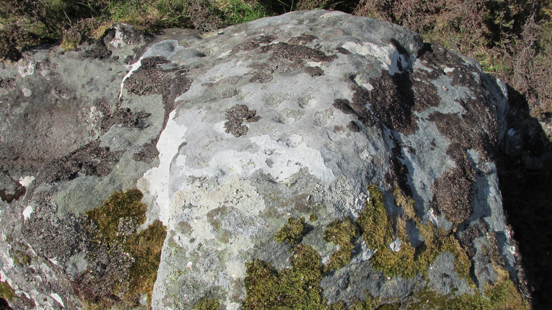
As we can see quite clearly in the photos here, two of the cups possess rings around them. One of the cup-and-rings near the middle of the mass of cups is complete, with a short line running out of it and into the longest of the natural cracks that frame the design and that runs all the way across the surface of the stone. This cup-and-ring plays a part in a rough circle of cup-marks surrounding a central cup, with one of the outer cups possessing a companion just outside the ring. Two cups in this circle are elongated. There is a possibility that the cup-and-ring I’ve mentioned has another line running from it into the cupmark at the centre of the circle.
On the same side of the long natural crack, outside the circle of cups, is another cup with a faint ring around it. Tis difficult to say whether or not this was originally complete, but when we zoom in it’s pretty damn close!
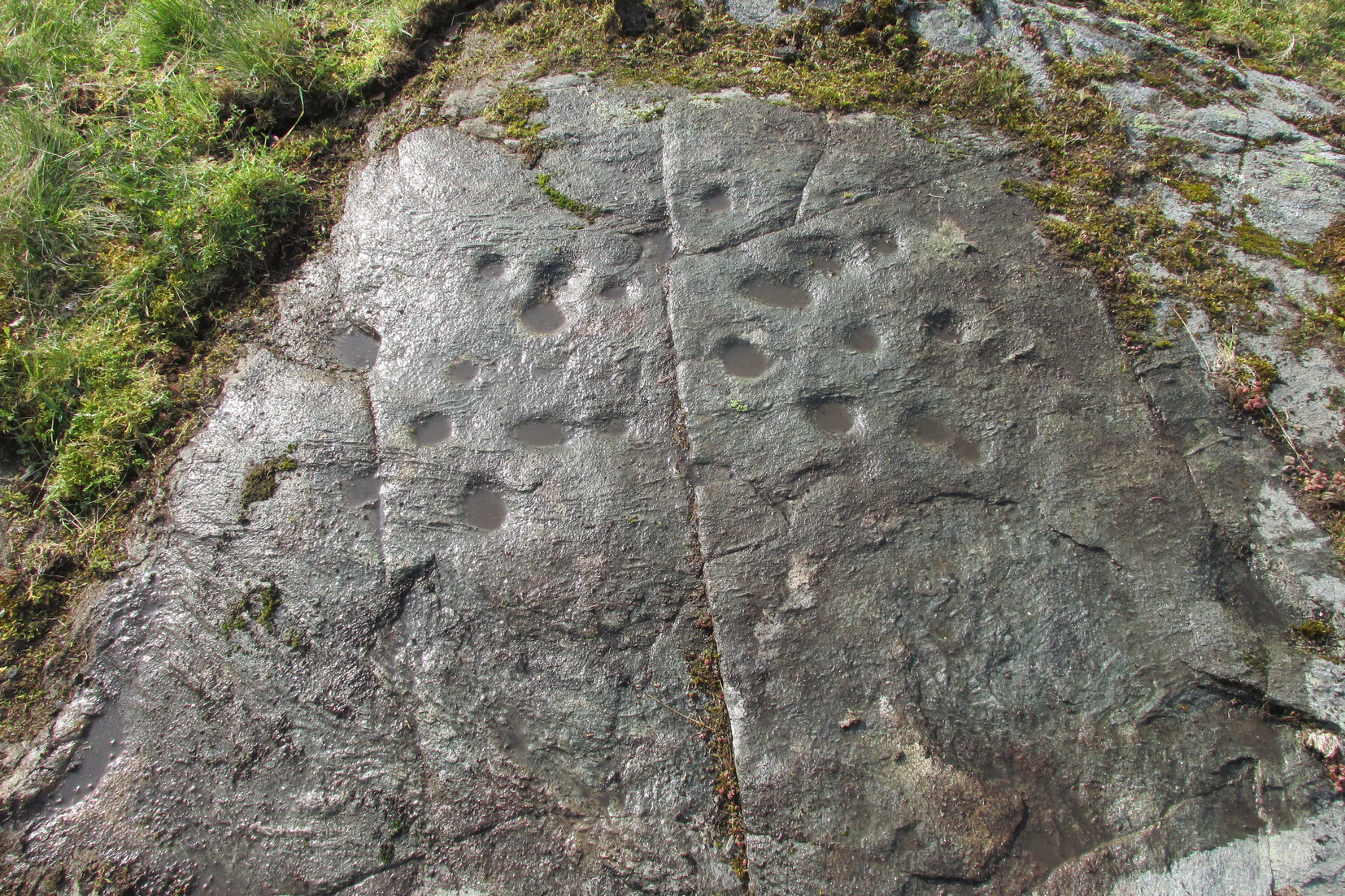
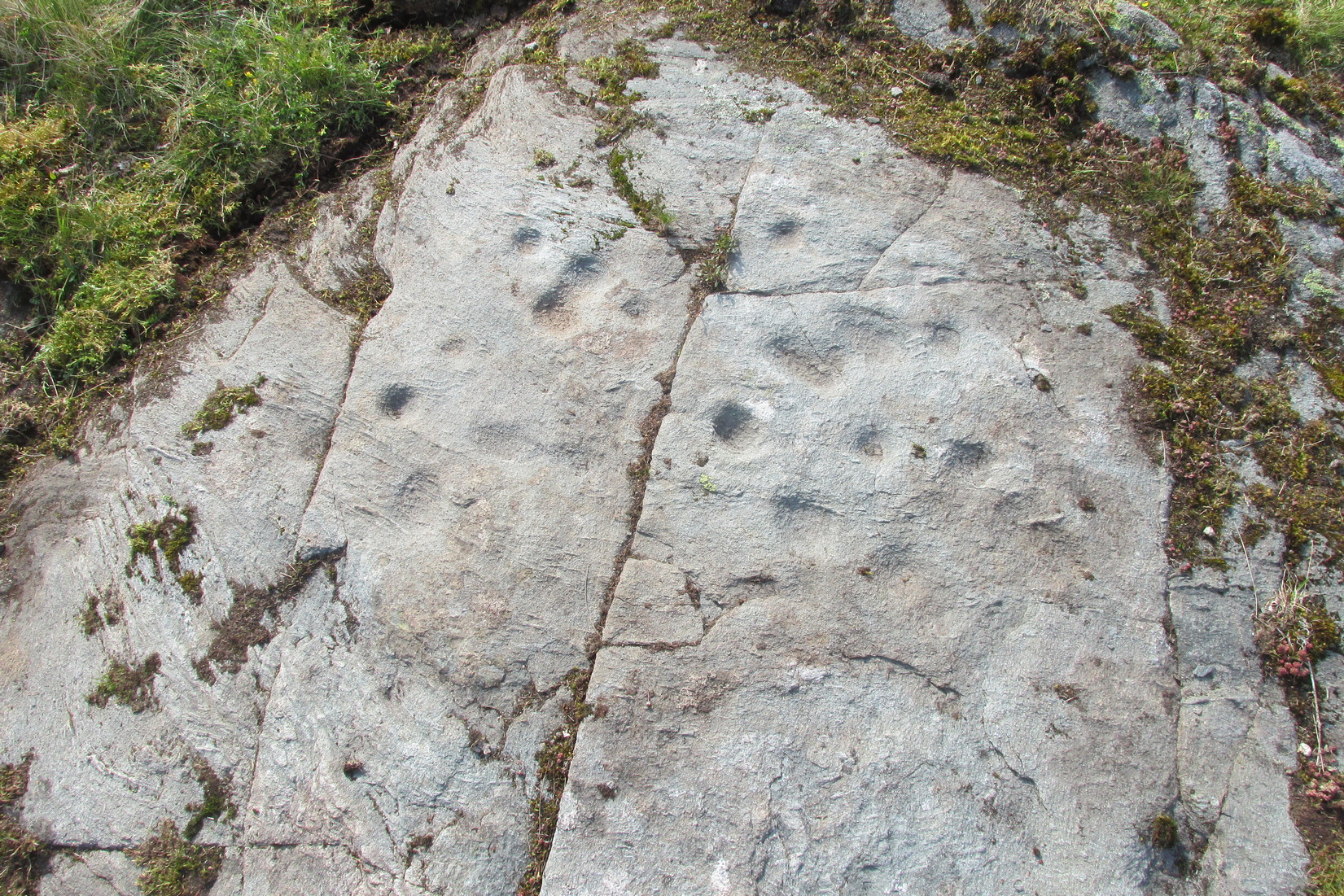
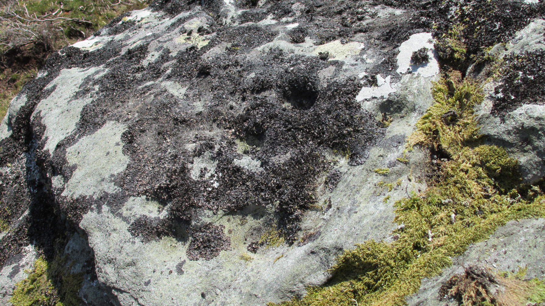
On the other side of the long natural crack is a haphazard spread of nine more cup-marks, with at least one of them seeming to possess a very faint incomplete ring around it. You can just make it out in one of the attached photos. From some angles it seems that two other cups may possess fragments of carved rings around them, but more visits are needed in better light before we can say this with any certainty. One of the cups in this cluster is elongated, whilst two other cups in this bunch are conjoined. Another crack to the side of this secondary cluster has one or two more cups cut into it. Altogether we have between 19 and 21 cups on this petroglyph, with rings around several of them. Worth checking out when you visit this neck o’ the woods. And, of course, if you’re a serious rock art researcher, scan the slopes hereby as other carvings yet remain hidden. You can almost feel them breathing…..
References:
- Currie, George, “Wester Glentarken, Perth and Kinross (Comrie parish), Cup-marked Rocks,” in Discovery & Excavation Scotland, volume 6, 2005.
© Paul Bennett, The Northern Antiquarian