Tale the A85 road between Comrie and Crieff and, roughly halfway between the two towns, take the minor road south to Strowan (it’s easily missed, so be aware!). A few hundred yards along, stop where the trees begin and walk into the fields immediately east. Keep walking, below the line of the trees, and you’ll get to it within five minutes.
Archaeology & History
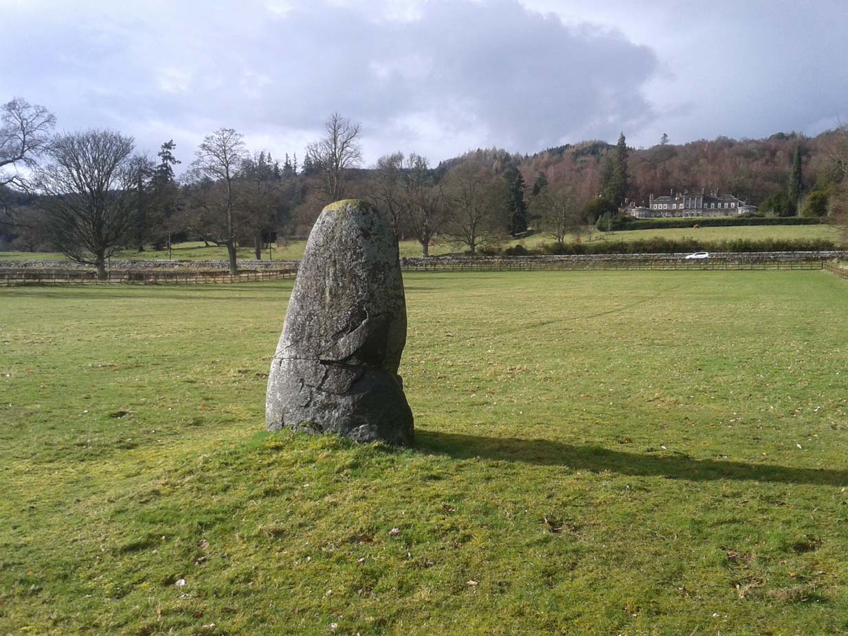
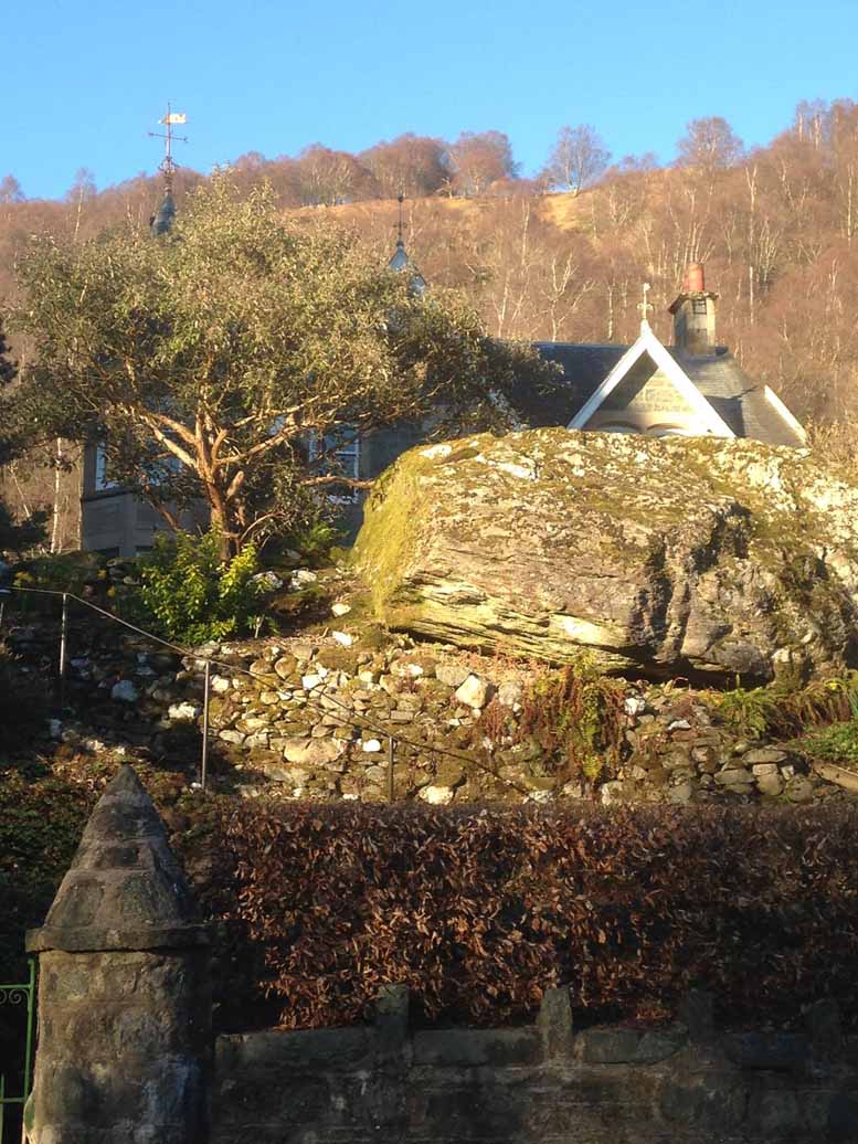
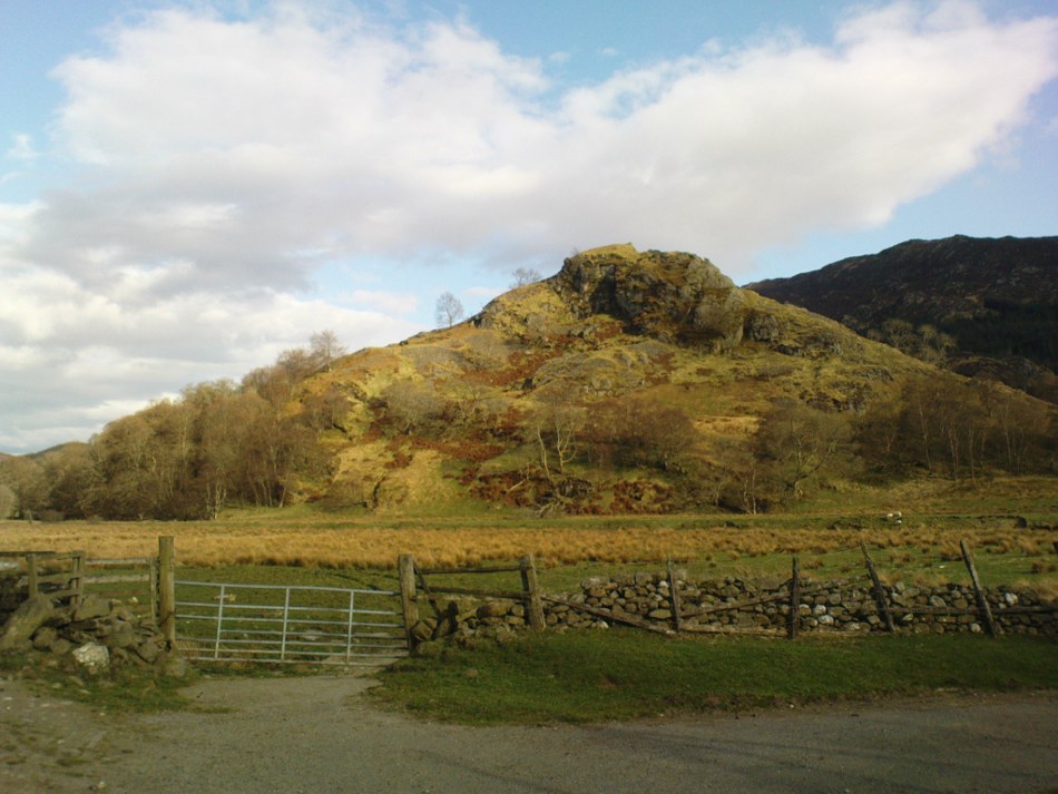
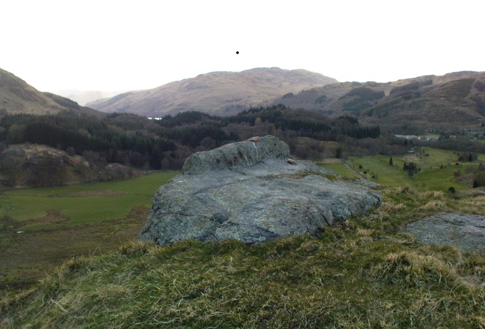
Samson’s Stone, looking east
Mistakenly cited by some as a standing stone, the large boulder which rests here on the hillside just below the woodland is a glacial erratic. Highlighted on the 1866 OS-map of the region, I hoped that we might find some rock art on the stone, but cup-and-rings there were none. However, there is a curious ‘footprint’ on top of it, similar to the ones found at Dunnad, at Murlaganmore and other places (see Bord 2004); but I can find no previous reference to this carved footprint.
‘Footprint’ on top of stone
In 1863 the site was described in the local Name Book, where it was reported to be “a large oblong shaped stone lying on the surface, eight feet long, four wide, and three thick”; but, much like today, it was also reported that “There is no tradition respecting it in the neighbourhood. Supposed to have received the name in consequence of its great size.”
Most peculiar…..
References:
Bord, Janet, Footprints in Stone, Heart of Albion Press 2004.
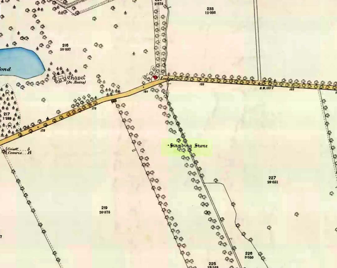
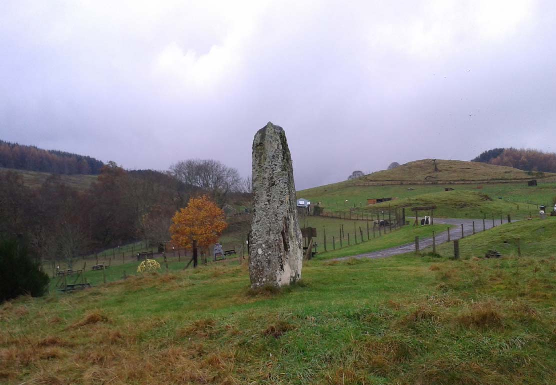
Take the A85 road between Comrie and Crieff. Nearly 1.7 miles (2.7km) east out of Comrie—or 4 miles (6.44km) west out of Crieff—keep your eyes peeled on the fields to the south-side of the road, below and across the mansion of Lawers House. Alongside a long but small plantation of trees you’ll see a large upright stone. You can walk along the track adjacent to the field and through the gate.
Archaeology & History
The stone on 1886 OS-map
Shown on the early Ordnance Survey maps of the area, this probably neolithic monolith was suggested by Fred Coles (1911) to have once been part of a larger megalithic circle—although Aubrey Burl (2000) didn’t consider it as a good enough contender to be listed as such in his gazetteer; and unless we can have some positive affirmation, either through folklore or excavation, we should maintain its status as a singular monolith. There is the possibility that it stood as an outlier or had some relationship with a nearby prehistoric tomb—but even this is contentious. Nevertheless, the stone itself is an impressive one!
Mr Coles curiously got the size of the old stone wrong too (although, we have to give him credit, as he did all of his work without electricity or any of our modern ‘stuff’). He wrote that:
“This massive boulder of whinstone is rounded at the base, where it girths 10 feet 3 inches, but tapers upwards to its apex of 5 feet 10 inches, with the eastern edge somewhat jagged and broken. Near its base on the west is a small slab-like fragment of stone, quite earthfast. The north and south surfaces are smooth and nearly vertical, and the longer axis is ESE 75º by WNW 75º.”
Fred Coles’ 1911 sketch
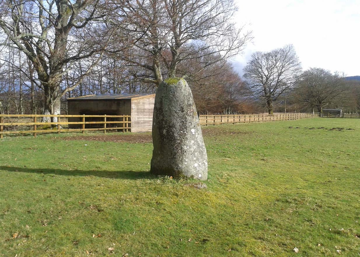
Lawers monolith, looking SE
The stone is actually larger than Coles described, being more than 6 feet 6 inches tall. His sketch (right) “shows the stone from the east”, and is pretty much as we find it today. A notable crack in the stone along the southern face, about a third of the way up, suggests that the stone was broken at some time in the past.
Local architect Andrew Finlayson (2010) included the stone in his local megalith guide and noted how the axes of the stone, east-west, lines it up with Ben Halton to the west and The Knock to the east.
References:
Burl, Aubrey, The Stone Circles of Britain, Ireland and Brittany, Yale University Press 2000.
Legendary Trees (lost): OS Grid Reference – NN 693 242
Folklore
A fascinating story of this forgotten site is detailed in Alex Porteous’ (1912) history book on this tiny parish at the eastern end of Loch Earn. It’s a peculiar tale—and unless the story was little more than the local people ripping the piss out of the patronising incomers, its nature remains a mystery. Porteous wrote:
“What were known as the Goose Oaks grew by the loch-side about two or three hundred yards west from the hotel. The story is told of a celebrated goose which attained to the great age of 160 years and finally gave up this life in 1818. It is solemnly averred by Mr (John) Brown that the history of this goose was well authenticated and that the families and individuals who successively were owners of the goose were highly respectable, and that its history was preserved entire for the period back to 1658, while he naively adds—”How long it was in being prior to that date is uncertain.” The goose was buried at the spot indicated, and the oaks trees, two in number, of which only one remains now, planted over its grave; but the story, as regards the age, must be looked upon as apocryphal.”
One wonders what on Earth Sir James Frazer might have made of this tale!
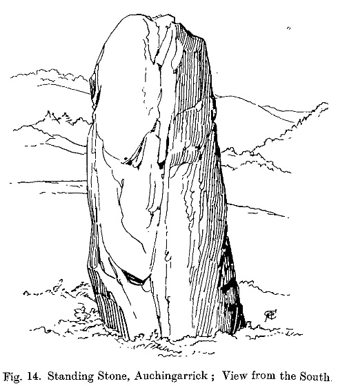
Take the B827 road south out of Comrie as if you’re heading towards Braco, and after a mile or so, as you start going uphill, turn left to go to the Wildlife Centre. Go along the track and park up at the buildings. The monolith is round the back of the first building (ask at the Centre, where the people there are very helpful).
Archaeology & History
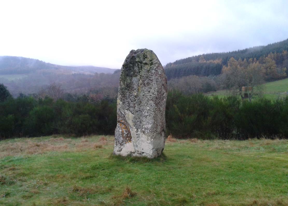
F. Coles 19l1 sketch
Shown on the earliest Ordnance Survey map of the region as one of several ‘Roman Stone’ sites, this prehistoric upright is similar in size and feel to the other standing stones in the highly impressive Dunruchan complex close by. The big fella stands on a raised piece of ground more than 8½ feet tall and, said Fred Coles (1911) has “a basal girth of 12ft 8ins.” Quite a big stone! A dubious large cup-mark is visible on the thin western face and three faint ones on its east.
The monolith is surrounded all along the southern landscape arc with forested moorland and low mountains, with the primary extended views reaching mainly into the north and western arc. Although a rounded hillock immediately southwest of the stone looks promising, no calendrical or astronomical alignments have been found here.
Folklore
Auchingarroch, looking SW
As with the other standing stones in this region, legend ascribes it as marking the resting place of a Roman soldier who fell in a great battle close by with our local heathens, in what was known as “battle of Mons Grampius.”
Hunter, John, Chronicles of Strathearn, David Phillips: Crieff 1896.
Acknowledgements: Thanks to Paul Hornby for the journey here; and more especially a different sorta thanks to Linzi Mitchell for her influence whilst the site profile of this megalithic erection was being written. Who sez that men can’t do two things at the same time?!
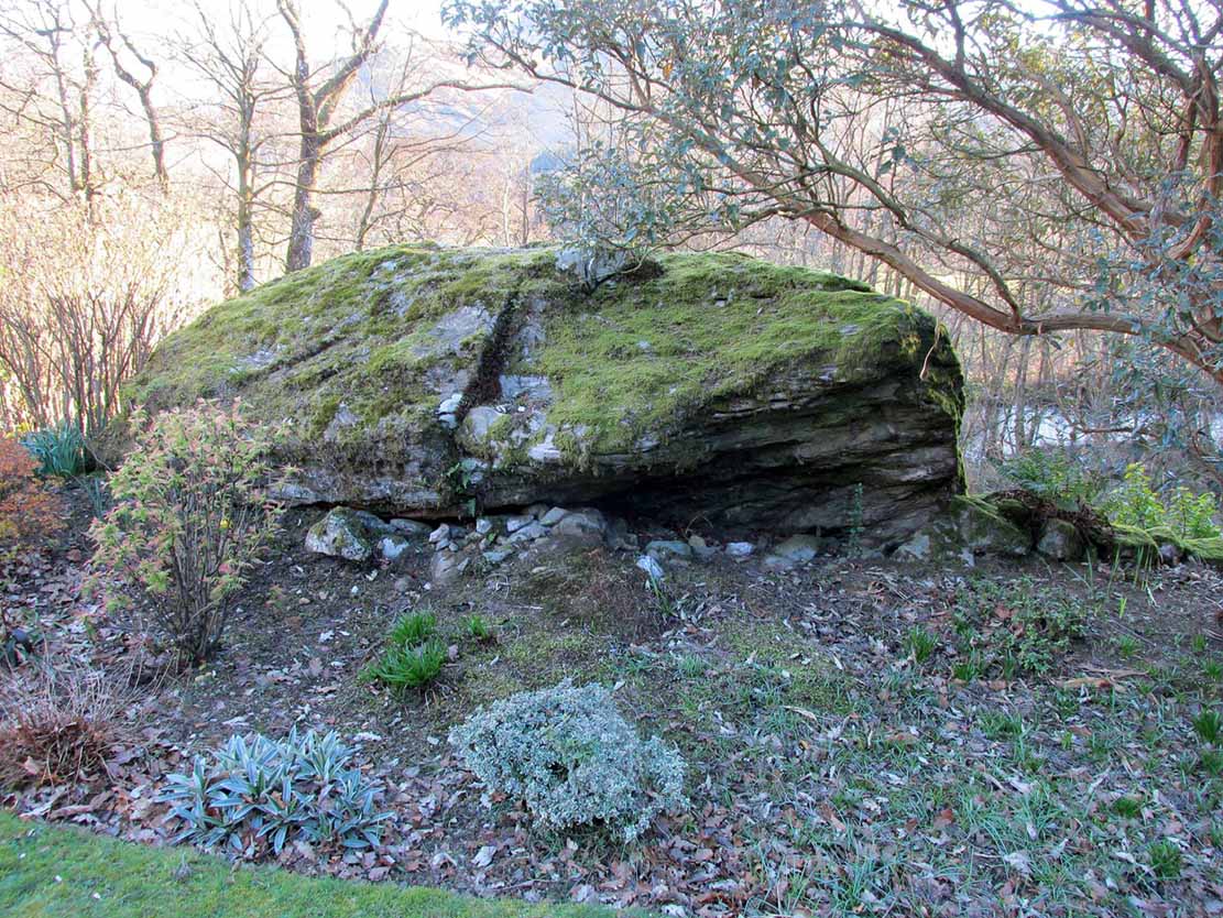
Along the A85 road at the east-end of Lochearnhead, head out of the village east towards Comrie. Just above the main-road, maybe 50 yards after passing the small road to St Fillan’s Golf Club, on the north side of the road you’ll see a huge boulder resting in the edge of the garden of the large detached house that was known as The Oaks. That’s the fella!
Archaeology & History
Clach na Ba, from the rear
Almost fallen out of history, oral tradition has thankfully kept the name and brief history of this huge boulder alive. Found in association with the prehistoric standing stones just yards away, the Clach na Ba lives beside the ancient drover’s road (and probable prehistoric route before that) just yards east of the old cottage known as Casetta. This occupies a site where an old toll-house stood, and the drovers would have to stop and pay a toll before continuing onwards past the Clach na Ba, or Stone of the Cattle.
Folklore
When the drovers passed their highland cattle here, the animals rubbed themselves against the stone to ensure good health and fertility (as well as just having a good scratch, no doubt).
References:
Porteous, Alexander, Annals of St Fillans, David Philips: Crieff 1912.
Acknowledgements: With huge thanks to Nina Harris and Paul Hornby for the day out and for use of their photos in this site-profile; and to the lovely couple (we didn’t get their names – soz) who live in the house behind the Clach na Ba, for their help with the fascinating local history .
Take the directions to the hugely impressive Dunruchan A standing stone. Walk directly south, over the gate and follow the fence straight down the fields, crossing the burn at the very bottom. Walk over the boggy grassland and start veering uphill, southeast. You’ll notice the land goes up in geological ‘steps’ and, a few hundred yards up, a small standing stone pokes up on the near skyline ahead of you. Head straight for it!
Archaeology & History
This small standing stone was first noted after a quick visit to the major Dunruchan megalithic complex in the summer of 2016. Photographer James Elkington was taking images of the landscape and the standing stones when he noticed a stone on the horizon a half-mile away. As we were in a rush, he took a couple of photos from different angles on the way back to the car—both of which looked promising. And so, several months later, we revisited the site again. Lisa, Paul and Mr Fukner and I meandered up the geological steps of the hillside until we reached the site in question.
Looking northwestLooking northeast
Standing just over four-feet tall, this solitary stone overlooks the megalithic Dunruchan complex a half-mile or so to the north and northwest. Like the Dunruchan C monolith, this smaller upright is conglomerate stone. Paul Hornby noted what may be a single cup-marked stone roughly 100 yards east along the same ridge. (Please note that the grid-ref may be slightly out by perhaps 50 yards or so at the most. If anyone visits and can rectify my ineptitude on this matter, please let me know.)
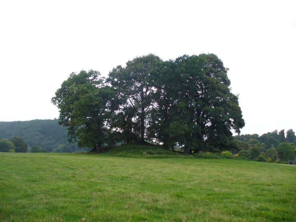
If you’re coming southwest out of Crieff on the A822, as you cross the river take the right-turn just before leaving the town along the country lane onto Strowan and Dalginross. Nearly 2½ miles along there’s the small junction on your right to Strowan House and church. Just past this turning, the next field on by the roadside, has a large rounded tree-covered mound living quietly. That’s the fella!
Archaeology & Folklore
Found halfway between Crieff and Comrie in the field on the north-side of the road, this large oak-covered tumulus was, seemingly, first described in notes made by the old archaeologist O.G.S. Crawford following a quick visit he made here in 1936. The place has, since then, never been excavated to find out exactly what might be hiding therein! It’s quite a big fella too: about 10 feet high and 40 yards across (east-west)—similar in size and design to the prehistoric burial mounds at Tulloch and Kinpurnie. Some large rocks make up the sides and edges of the mound, with smaller ones scattered here and there, giving the distinct impression of a very overgrown cairn of sorts.
Tis a quiet and tranquil arena, amidst fervent colours of meadows and old trees. Another 2 miles further down the same road is the equally tranquil (though ruined) megalithic ring of Dunmoid…
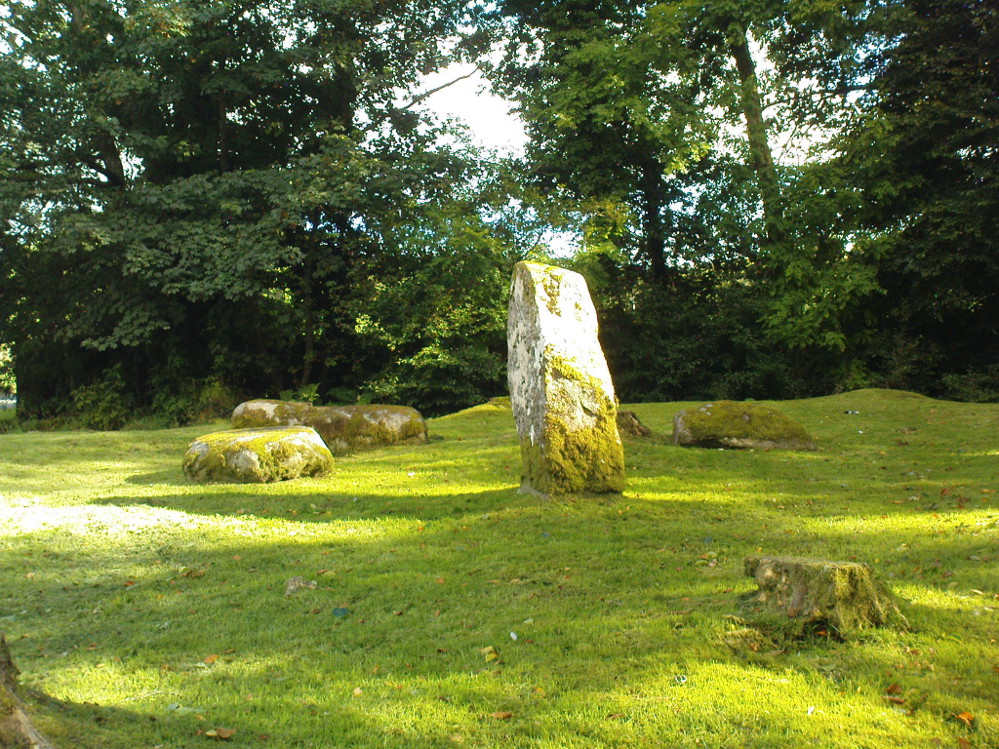
From the main road running through lovely Comrie, take the south B827 road over the old river bridge. Go dead straight for several hundred yards until the road bends right; but take the left turn here. 100 yards or so along note the trees on your right, and the road begins to swerve round here. Just round the corner in the trees, the stones are in the clearing right by the roadside. You can’t miss them! (if you hit the graveyard, you’ve gone past them)
Archaeology & History
This is a truly lovely, almost warming enclosed megalithic site—albeit damaged by the ruin of centuries; but on the occasions I’ve been here it feels quite nurturing and elicits a quite natural meditative state. Whether or not this is due to the surround of trees, or the natural electromagnetic field, or just me, I dunno….
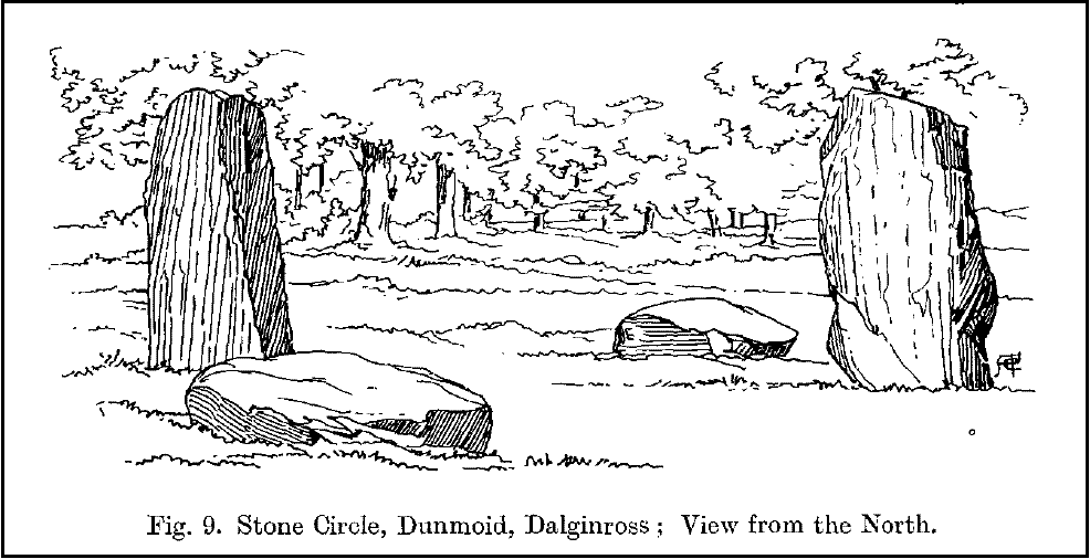
Dunmoid Circle, looking SEDunmoid from the North (Coles 1911)
The ‘circle’ is constructed upon a flat rounded section of ground, surrounded by a ditch on two-thirds of its edges, very reminiscent of a typical henge monument—but there is no mention of this in modern surveys. One of the earliest accounts of Dunmoid was written by John MacPherson (1896) who gave us as much of the known history of the site as is still known by any modern academic. He wrote:
“At the west side of the new cemetery, close to the public road, there is a curious round knoll, which at one time must have been used as a place for the burial of the dead. The attention of the writer of this was drawn to it about twenty years ago. There were three large slabs of stone lying upon the ground, which apparently had been at some former period placed erect by some loving hands to mark the last resting-place of some departed friend or hero. By the aid of some of the Comrie masons the stones were placed in a standing position. Curious to know what lay beneath the surface, we dug up the earth in front of the largest slab, and came upon a stone cist placed north and south, 7 inches long, 1 foot 8 inches broad, and 1 foot 3 inches deep. The only remains discovered was a thigh-bone, but whether it at one time formed a part of the leg of a Celt, a Roman, or a Saxon we could not tell. An old man who then lived in the village of Comrie told us that in his young days the same mound was dug up, when an urn filled with ashes was discovered. This, perhaps, would indicate that it formed a place of burial for Romans rather than for Caledonians. The spot is called Dunmoid, or ‘hill of judgment.'”
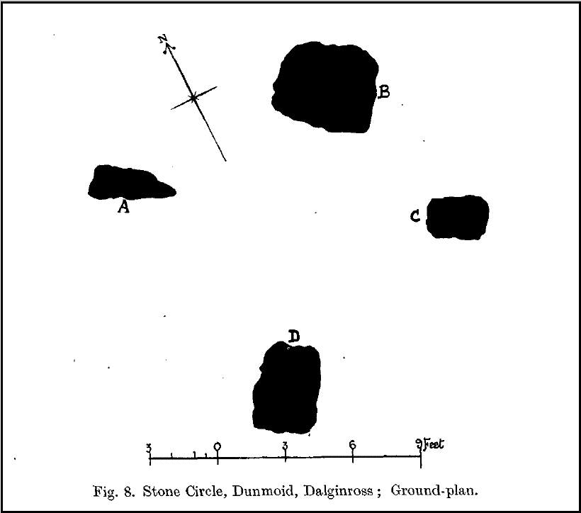
Fred Coles 1991 planDunmoid from SE (Coles 1911)
The circle gained the attention of the prolific Fred Coles (1911) in his Perthshire surveys, whose drawings and measurements are still repeated in the modern textbooks more than a century later. When he visited the site, two of the stones were still upright, but today only one still stands. In Aubrey Burl’s (1988) survey on ‘four-poster’ stone circles, he reiterated Coles’ words, telling:
“Originally four stone stood at the corners of a rectangle on a mound some 75ft (23m) across and 2ft (60cm) high. Coles’ plan showed the NW stone standing 5ft 4ins (1.6m) high and the SE, opposite, 5ft 2ins (1.6m), with the thick NW stone prostrate, 4ft 6ins (1.4m) long, with the more slender SW pillar also supine and 4ft (1.2m) long. The longer SE and NW sides of the oblong were roughly 9ft 6ins (2.9m) long and the others 9ft (2.7m) in length. The circle on which the stones had been placed had a diameter 13ft 2ins (4m), of which the Megalithic Yard is not an integer.”
The circle is included in Andrew Finlayson’s (2010) modern survey of the region.
References:
Burl, Aubrey, Four Posters: Bronze Age Stone Circles of Western Europe, BAR 195: Oxford 1988.
Finlayson, Andrew, The Stones of Strathearn, One Tree Island: Comrie 2010.
Hunter, John (Ed.), Chronicles of Strathearn, David Philips: Crieff 1896.
Hutchison, A.F., “The Standing Stones of Stirling District,” in The Stirling Antiquary, volume 1, 1893.
MacPherson, John, “At the Head of Strathearn,” in Chronicles of Strathearn, Crieff 1896.
Not hard to find. Between the small towns of Comrie and St. Fillans along the A85 road, keep your eyes peeled for the small but rocky crags that rise in front of the background of dramatic mountains not far from the roadside to the south. It looks truly majestic even on a dull day. Just as you reach the eastern edge of St. Fillans village, take the small road over the river-bridge and go to the golf club. Walk past the golf club itself, keeping along the track that leads you to Dundurn hill. It’s easy enough. Then climb to the very top of the hill where you’ll find this curious, large, flat bed-like rock right in front of you!
Archaeology & History
St Fillan’s rocky bed or ‘chair’
The archaeological data for St. Fillan’s Chair relates more to the folklore practices of the people upon Dundurn hill than anything else and ostensibly little can be said by such students. The place is more satisfying for geologists than archaeologists, who would adore the rocky fluctuations and geophysical propensities with greater verve than any archaeologist could muster! For this rocky bed-shaped feature is a fascinating structure whose only potential interest to archaeologists are what may be a couple of reduced cup-marks on the top of the stone (and even then, such potential rock art is more the province of religious historians and anthropologists than archaeologists).
Small quartz offerings left on St Fillan’s Chair at BeltaneView of the Chair from below
But this ‘bed’ or ‘chair’, as it was locally known, was – and it seems, still is – important in the social history of the area, as its folklore clearly tells. The ‘chair’ plays an important part in the holistic role of Dundurn as a hill, a fort, a healing centre, an inauguration site, and very probably an omphalos: a sacred centre whereupon the ordination of shamans, kings and the cosmos as a whole was brought to bear here… (these features will be explored in greater depth when I write a singular profile of Dundurn as a ‘fort’).
Folklore
Looking west over St Fillan’s Chair
The character of St. Fillan was described by James Cockburn (1954) as “an Irish Pict” and the “son of a King – his father being Angus mac Nadfraich who died in battle in 490 AD.” Quite an important dood in his day! The relationship this early christian figure had with this Chair was in its supposedly curative properties. Yeah…you read it right: curative properties! As with countless rocks all over the world, some of Nature’s outcrop boulders were imbued with a spirit of their own and, when conditions and/or the cycle of the spirit ‘awoke’, healing attributes could be gained from the place. And such was the case at St. Fillan’s Chair, especially on Beltane morning (May 1). And some element of this traditional pilgrimage is still done; for when the author Marion Woolley and I visited the site on Mayday 2013, it was obvious that some people had been up earlier that Beltane morning and left some offerings of quartz stones on the top end of the bed.
The earliest written reference of this medicinal virtue was told in the Old Statistical Account of Perthshire (1791):
The rock on the summit of the hill, formed, of itself, a chair for the saint, which still remains. Those who complain of rheumatism in the back, must ascend the hill, sit in this chair, then lie down on their back, and be pulled by the legs to the bottom of the hill. This operation is still performed, and reckoned very efficacious.
More than a hundred years later, the sites was still being used and was described in similar vein in MacKinlay’s (1893) excellent study:
“On the top of green Dunfillan, in the parish of Comrie, is a rocky seat known in the district as Fillan’s Chair. Here, according to tradition, the saint sat and gave his blessing to the country around. Towards the end of last century, and doubtless even later, this chair was associated with a superstitious remedy for rheumatism in the back. The person to be cured sat in the chair, and then, lying on his back, was dragged down the hill by the legs. The influence of the saint lingering about the spot was believed to ensure recovery.”
The origins of this dramatic rite were probably pre-christian in nature and we should have little doubt that St. Fillan replaced the figure of a shaman or local medicine woman of some sort. The ritual “dragging down the hill” may be some faint remnant of initiation rites…
References:
Cockburn, James H., The Celtic Church in Dunblane, Friends of Dunblane Cathedral 1954.
Eliade, Mircea, Rites and Symbols of Initiation, Spring: Woodstock 1995.
Landscape of Giants Knowe (photo by Marion Woolley)
Amidst the colourful and nurturing landscape close to the gigantic Dunruchan standing stones and just along the road from the solitary Craigneich stone, in the field across the road above Straid farmhouse could once be seen a fascinating-sounding prehistoric site that has sadly been destroyed. Some of the remains of this old monument can be found in the field-clearance of stones just over the fence, above the top of the field (many fields round here have scatterings of large stone clearings at the field edges), but we have no detailed accounts of the site. It was mentioned in early notes by the Ordnance Survey to have been,
“A large circular heap of small stone and gravel entirely removed in 1831. An urn filled with ashes and several stone coffins were found under it.”
The local historian John Shearer (1883) later told us that,
“A small mound of earth on the farm of Strayd, called Crock-nafion or the Giant’s Knowe, or the Fingalian’s Knowe, was cleared away several years ago. An urn containing burnt bones was discovered.”
Any additional information about this site and its folklore, would be greatly appreciated.
Folklore
To the west along Glen Artney whence our view takes us from here, old legend told that the valley was once the abode of a great giant who lived in a cave in one of the mountains thereby. In mythic lore, giants were the creation deities of hills, mountains and other geological forms, whose narratives were overturned and demonized by the incoming christian cult many centuries ago. It is likely that this once great tomb was deemed as the burial-place of our local giant – which would make this prehistoric site neolithic in age. But — logical though it is — this idea is pure speculation…
References:
Hunter, John, Chronicles of Strathearn, David Philips: Crieff 1896.
Shearer, John, Antiquities of Strathearn, David Philips: Crieff, 1883.